Part Square Plantation

Wood, Forest in Dorset

England

Part Square Plantation

Old Milestone, North Trigon Carved stone post by the UC road, in parish of Wareham St Martin (Purbeck
 District), long straight opposite small pull-in; 1m back from road in scrub and small trees, on East-northeast side of road. Dorset 3 (limestone), erected by the Wareham (North, South & West Branches) Turnpike Trust in the 19th century.

Inscription reads:-
: WAREHAM / 3 : : BERE / 4 : 
Carved benchmark on bottom of right face. 

Milestone Society National ID: DO_WABE03
Old Milestone, North Trigon Credit: Wendy Halliday

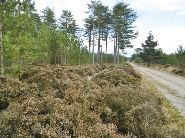
Part Square Plantation is a picturesque woodland located in the county of Dorset, England. Spread across an area of approximately 50 acres, this plantation boasts an impressive variety of trees and is a popular destination for nature lovers and outdoor enthusiasts.

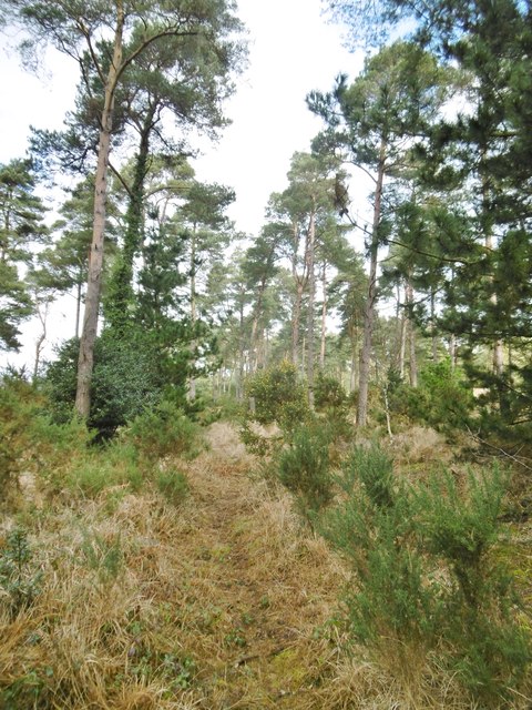
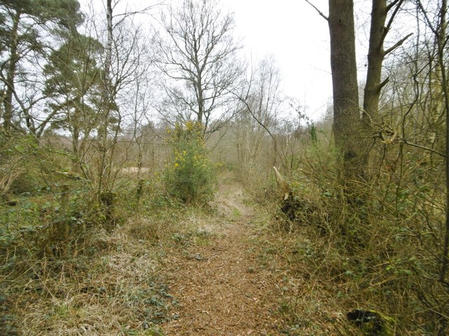
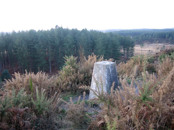
The woodland is primarily made up of dense coniferous trees, including Scots pine, Douglas fir, and Norway spruce. The towering trees create a serene and peaceful atmosphere, making it an ideal spot for relaxation and leisurely walks. The forest floor is covered with a thick carpet of moss and ferns, adding to the enchanting beauty of the area.

Part Square Plantation is home to a diverse range of wildlife, providing a haven for various bird species, such as woodpeckers, owls, and finches. Visitors may also spot squirrels, rabbits, and deer as they explore the plantation's winding pathways.

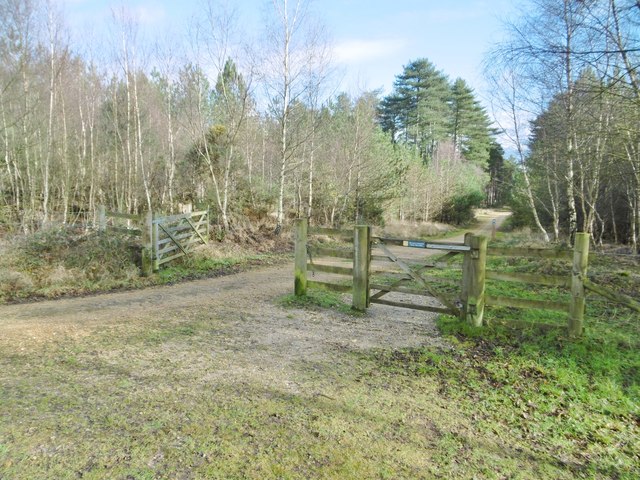
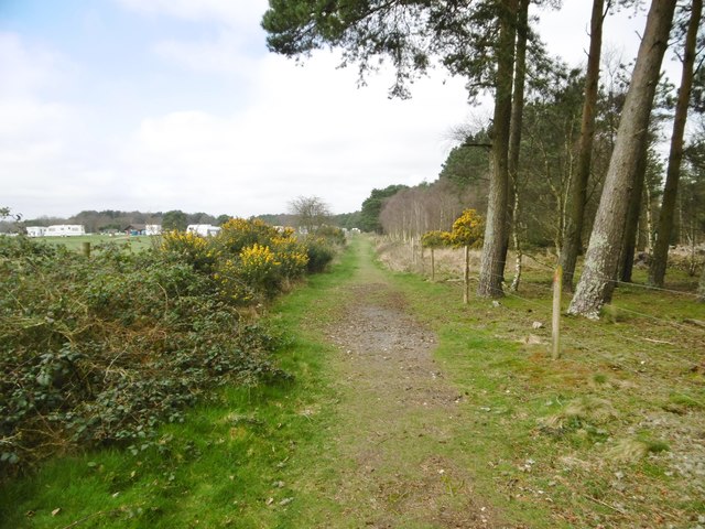
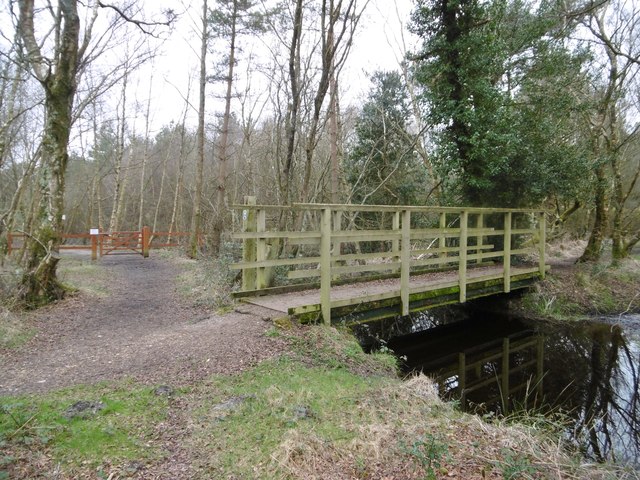
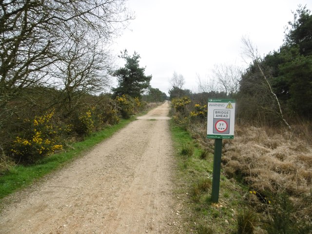
The woodland is well-maintained, with designated walking trails that guide visitors through the different sections of the plantation. These trails cater to different fitness levels and offer opportunities for both leisurely strolls and more challenging hikes. Along the way, informative signs provide details about the flora and fauna, enhancing the educational aspect of the visit.

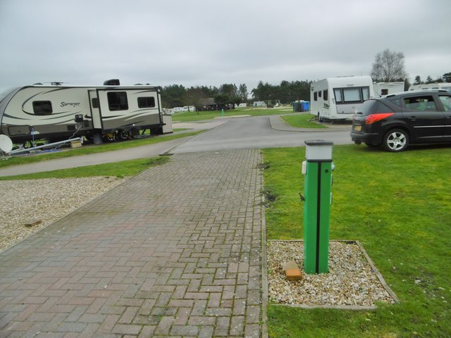
Part Square Plantation is easily accessible, with ample parking facilities and well-marked entrances. It is a popular destination for families, nature enthusiasts, and photographers, who are drawn to the plantation's natural beauty and tranquil atmosphere. Whether it's a leisurely walk, birdwatching, or simply enjoying the serenity of nature, Part Square Plantation offers a delightful experience for all.

If you have any feedback on the listing, please let us know in the comments section below.

Part Square Plantation Images

Images are sourced within 2km of 50.707495/-2.1575416 or Grid Reference SY8889. Thanks to Geograph Open Source API. All images are credited.

Old Milestone, North Trigon Carved stone post by the UC road, in parish of Wareham St Martin (Purbeck
 District), long straight opposite small pull-in; 1m back from road in scrub and small trees, on East-northeast side of road. Dorset 3 (limestone), erected by the Wareham (North, South & West Branches) Turnpike Trust in the 19th century.

Inscription reads:-
: WAREHAM / 3 : : BERE / 4 : 
Carved benchmark on bottom of right face. 

Milestone Society National ID: DO_WABE03
Old Milestone, North Trigon
Carved stone post by the UC road, in parish of Wareham St Martin (Purbeck District), long straight opposite small pull-in; 1m back from road in scrub and small trees, on East-northeast side of road. Dorset 3 (limestone), erected by the Wareham (North, South & West Branches) Turnpike Trust in the 19th century. Inscription reads:- : WAREHAM / 3 : : BERE / 4 : Carved benchmark on bottom of right face. Milestone Society National ID: DO_WABE03
Old Boundary Marker on Lower Hyde Heath Boundary Marker on Lower Hyde Heath, southwest of Stroud Bridge. On the boundary of Bere Regis and Wareham St Martin parishes.

Milestone Society National ID: DO_BERWSM01bm
Old Boundary Marker on Lower Hyde Heath
Boundary Marker on Lower Hyde Heath, southwest of Stroud Bridge. On the boundary of Bere Regis and Wareham St Martin parishes. Milestone Society National ID: DO_BERWSM01bm
Wareham Forest, gates At the start of a forestry road/traffic-free cycle route through the forest.
Wareham Forest, gates
At the start of a forestry road/traffic-free cycle route through the forest.
Wareham Forest, woodland Scattered conifers, with seedlings and bracken in the under-storey.
Wareham Forest, woodland
Scattered conifers, with seedlings and bracken in the under-storey.
Wareham Forest, heather Banks of ling - a drab sight in winter.
Wareham Forest, heather
Banks of ling - a drab sight in winter.
Wareham Forest, forestry crossroads
Coldharbour, unclassified road From Wareham to Dorchester Road (A35), passing in this square farm- and heathland, caravan, reclamation and travellers' sites.
Coldharbour, unclassified road
From Wareham to Dorchester Road (A35), passing in this square farm- and heathland, caravan, reclamation and travellers' sites.
Coldharbour, marker Showing the route of Wareham Forest Way (here, a bridleway); left, woodland; right, a tourist park. <span class="nowrap"><a title="https://www.dorsetforyou.gov.uk/article/396516/Wareham-Forest-Way" rel="nofollow ugc noopener" href="https://www.dorsetforyou.gov.uk/article/396516/Wareham-Forest-Way">Link</a><img style="margin-left:2px;" alt="External link" title="External link - shift click to open in new window" src="https://s1.geograph.org.uk/img/external.png" width="10" height="10"/></span>
Coldharbour, marker
Showing the route of Wareham Forest Way (here, a bridleway); left, woodland; right, a tourist park. LinkExternal link
Coldharbour, gate On Wareham Forest Way, entering Birchwood Touring Park. <span class="nowrap"><a title="https://www.dorsetforyou.gov.uk/article/396516/Wareham-Forest-Way" rel="nofollow ugc noopener" href="https://www.dorsetforyou.gov.uk/article/396516/Wareham-Forest-Way">Link</a><img style="margin-left:2px;" alt="External link" title="External link - shift click to open in new window" src="https://s1.geograph.org.uk/img/external.png" width="10" height="10"/></span>
Coldharbour, gate
On Wareham Forest Way, entering Birchwood Touring Park. LinkExternal link
Coldharbour, tourist park Birchwood Tourist Park, seen from the neighbouring Wareham Forest Way: <span class="nowrap"><a title="http://www.birchwoodtouristpark.co.uk/" rel="nofollow ugc noopener" href="http://www.birchwoodtouristpark.co.uk/">Link</a><img style="margin-left:2px;" alt="External link" title="External link - shift click to open in new window" src="https://s1.geograph.org.uk/img/external.png" width="10" height="10"/></span>
Coldharbour, tourist park
Birchwood Tourist Park, seen from the neighbouring Wareham Forest Way: LinkExternal link
Coldharbour, path Between paddocks (left) and heathland (right).
Coldharbour, path
Between paddocks (left) and heathland (right).
Wareham Forest Way Route from Wareham to Sturminster Marshall: <span class="nowrap"><a title="https://www.dorsetforyou.gov.uk/article/396516/Wareham-Forest-Way" rel="nofollow ugc noopener" href="https://www.dorsetforyou.gov.uk/article/396516/Wareham-Forest-Way">Link</a><img style="margin-left:2px;" alt="External link" title="External link - shift click to open in new window" src="https://s1.geograph.org.uk/img/external.png" width="10" height="10"/></span>
Wareham Forest Way
Route from Wareham to Sturminster Marshall: LinkExternal link
Wareham Forest, footbridge Over a ditch, on the Wareham Forest Way: <span class="nowrap"><a title="https://www.dorsetforyou.gov.uk/article/396516/Wareham-Forest-Way" rel="nofollow ugc noopener" href="https://www.dorsetforyou.gov.uk/article/396516/Wareham-Forest-Way">Link</a><img style="margin-left:2px;" alt="External link" title="External link - shift click to open in new window" src="https://s1.geograph.org.uk/img/external.png" width="10" height="10"/></span>
Wareham Forest, footbridge
Over a ditch, on the Wareham Forest Way: LinkExternal link
Wareham Forest, bridleway junction At Old Ram; from camera and ahead, Wareham Forest Way; left, to Stroud Bridge. <span class="nowrap"><a title="https://www.dorsetforyou.gov.uk/article/396516/Wareham-Forest-Way" rel="nofollow ugc noopener" href="https://www.dorsetforyou.gov.uk/article/396516/Wareham-Forest-Way">Link</a><img style="margin-left:2px;" alt="External link" title="External link - shift click to open in new window" src="https://s1.geograph.org.uk/img/external.png" width="10" height="10"/></span>
Wareham Forest, bridleway junction
At Old Ram; from camera and ahead, Wareham Forest Way; left, to Stroud Bridge. LinkExternal link
Wareham Forest, traffic sign Weight limit of 7T at the imminent bridge; on the Sika Cycle Trail: <span class="nowrap"><a title="https://www.dorsetforyou.gov.uk/article/396577/Northport-Greenway-and-Sika-Cycle-Trail" rel="nofollow ugc noopener" href="https://www.dorsetforyou.gov.uk/article/396577/Northport-Greenway-and-Sika-Cycle-Trail">Link</a><img style="margin-left:2px;" alt="External link" title="External link - shift click to open in new window" src="https://s1.geograph.org.uk/img/external.png" width="10" height="10"/></span>
Wareham Forest, traffic sign
Weight limit of 7T at the imminent bridge; on the Sika Cycle Trail: LinkExternal link
Wareham Forest, ditch Draining an area of wet heathland.
Wareham Forest, ditch
Draining an area of wet heathland.
Wareham Forest, Sika Trail Cycle trail through Forestry Commission heath- and woodland: <span class="nowrap"><a title="https://www.dorsetforyou.gov.uk/article/396577/Northport-Greenway-and-Sika-Cycle-Trail" rel="nofollow ugc noopener" href="https://www.dorsetforyou.gov.uk/article/396577/Northport-Greenway-and-Sika-Cycle-Trail">Link</a><img style="margin-left:2px;" alt="External link" title="External link - shift click to open in new window" src="https://s1.geograph.org.uk/img/external.png" width="10" height="10"/></span>
Wareham Forest, Sika Trail
Cycle trail through Forestry Commission heath- and woodland: LinkExternal link
Coldharbour, paddocks
Show me another place!

Part Square Plantation is located at Grid Ref: SY8889 (Lat: 50.707495, Lng: -2.1575416)

Unitary Authority: Dorset

Police Authority: Dorset

What 3 Words

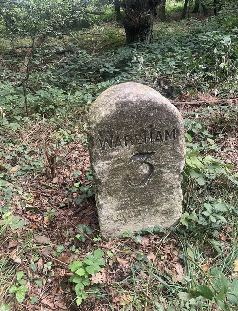
///ended.overhear.squirts. Near Wareham, Dorset

Related Wikis

Trigon Hill

Trigon Hill is a hill on the edge of a clay pit near Cold Harbour, Dorset, on the Dorset Heaths. It rises about 3 kilometres northwest of the centre of...

Wareham Forest

Wareham Forest is an area of countryside in Dorset, England, consisting of open heathland, including Decoy Heath and Gore Heath, and plantations of conifers...

Woolsbarrow Hillfort

Woolsbarrow Hillfort is a hillfort on Bloxworth Heath in the district of Purbeck in the county of Dorset, England. It dates to the period from the Late...

Worgret Heath

Worgret Heath SSSI, Dorset (grid reference SY895871) is an 8.4 hectare biological Site of Special Scientific Interest in Dorset, notified in 1987.The site...

Decoy Heath

Decoy Heath is an area of open heathland and bog forming part of Wareham Forest west of the Poole-Bournemouth conurbation in south Dorset, England. It...

Worgret

Worgret is a hamlet in the English county of Dorset. It is situated immediately to the west of the town of Wareham. Worgret forms part of the civil parish...

Wareham railway station

Wareham railway station serves the historic market town of Wareham in Dorset, England. It is situated about 0.6 miles (1 km) north of the town centre....

Purbeck miniature railway

Purbeck Miniature Railway was a 7+1⁄4 in (184 mm) gauge miniature railway, located at The Purbeck School near Wareham, Dorset, England. Construction started...

Nearby Amenities

Located within 500m of 50.707495,-2.1575416
Power: tower
Source: bing
Lat/Long: 50.7055263/-2.1632135
Power: tower
Source: bing
Lat/Long: 50.7057527/-2.1586144
Power: tower
Source: bing
Lat/Long: 50.7041433/-2.1562656
Material: wood
Power: pole
Source: bing
Lat/Long: 50.7053596/-2.1631223
Material: wood
Power: pole
Source: bing
Lat/Long: 50.7055006/-2.1603001
Material: wood
Power: pole
Source: bing
Lat/Long: 50.7055513/-2.15894
Material: wood
Power: pole
Source: bing
Lat/Long: 50.7056108/-2.1589824
The data included in this document is from www.openstreetmap.org. The data is made available under ODbL.

Have you been to Part Square Plantation?

Leave your review of Part Square Plantation below (or comments, questions and feedback).