Horsepools Coppice

Wood, Forest in Wiltshire

England

Horsepools Coppice

Old Milepost by the B3414, Warminster Road, Norton Bavant Cast iron post by the B3414, in parish of Norton Bavant (West Wiltshire District), Warminster Road; 800m East of entrance to Bishopstrow Farm, by the road, on Southwest side of road. C&M Classical iron casting, erected by the Warminster turnpike trust in the 19th century. 

Inscription reads:-
SALISBURY
19
WARMINSTER
2

Grade II listed.  
List Entry Number: 1364340 <span class="nowrap"><a title="https://historicengland.org.uk/listing/the-list/list-entry/1364340" rel="nofollow ugc noopener" href="https://historicengland.org.uk/listing/the-list/list-entry/1364340">Link</a><img style="margin-left:2px;" alt="External link" title="External link - shift click to open in new window" src="https://s1.geograph.org.uk/img/external.png" width="10" height="10"/></span>

Milestone Society National ID: WI_SAWM19
Old Milepost by the B3414, Warminster Road, Norton Bavant Credit: M Faherty

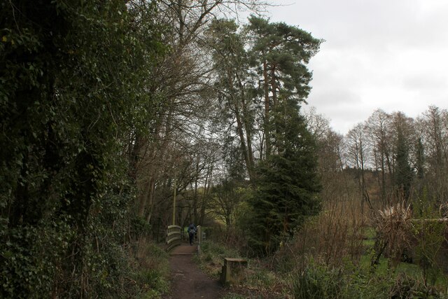
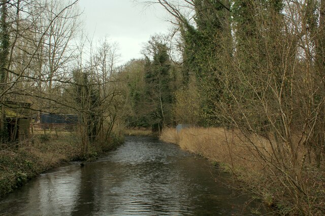
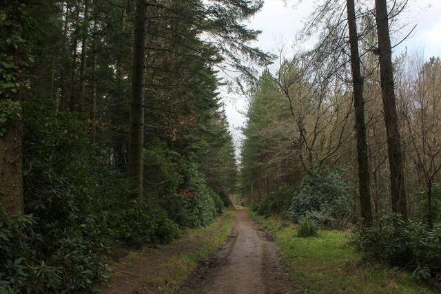
Horsepools Coppice is a picturesque woodland located in the county of Wiltshire, England. Covering an area of approximately 50 acres, it is nestled in the heart of the beautiful countryside, offering a serene and tranquil escape from the hustle and bustle of urban life.

The coppice is predominantly composed of native broadleaf trees, such as oak, ash, and beech, which create a dense canopy and provide a habitat for a diverse range of flora and fauna. The woodland floor is adorned with carpets of bluebells in the spring and a variety of wildflowers throughout the year.

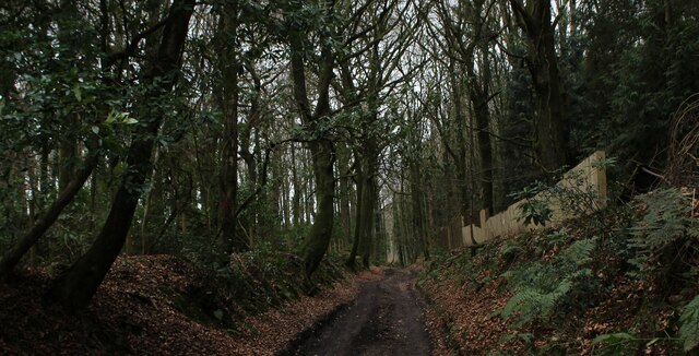
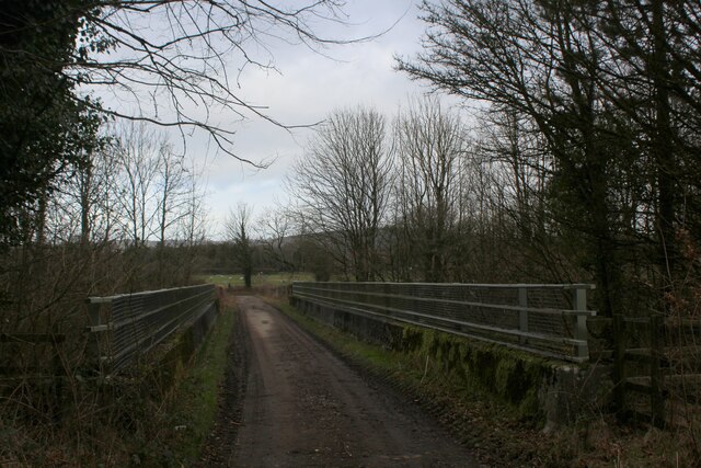
Visitors to Horsepools Coppice can enjoy a network of well-maintained footpaths and trails that weave their way through the woods, offering opportunities for leisurely walks, birdwatching, and nature photography. The peaceful atmosphere and natural beauty of the woodland make it a popular destination for both locals and tourists.

The coppice is also home to a number of wildlife species, including deer, foxes, badgers, and a wide array of bird species. Nature enthusiasts can spot woodpeckers, owls, and various songbirds, making it a haven for birdwatching enthusiasts.

Managed by a local conservation trust, Horsepools Coppice is dedicated to preserving the natural heritage of the area and promoting sustainable forestry practices. Regular conservation work is carried out to maintain the health and diversity of the woodland ecosystem.

Overall, Horsepools Coppice offers a peaceful retreat for nature lovers and provides a valuable habitat for wildlife, making it a cherished natural asset in Wiltshire.

If you have any feedback on the listing, please let us know in the comments section below.

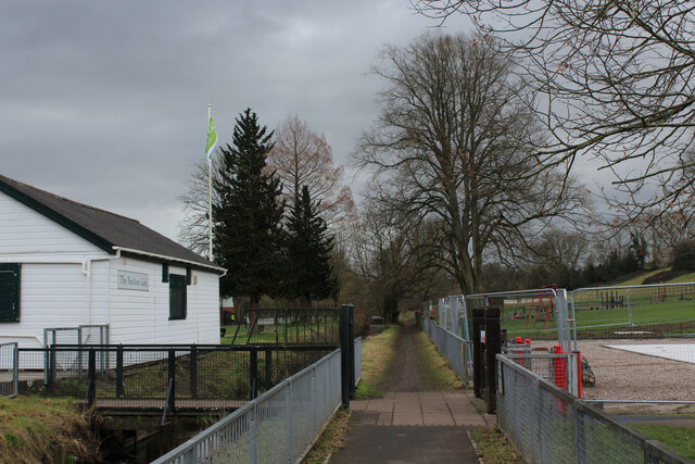
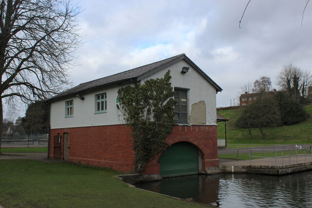
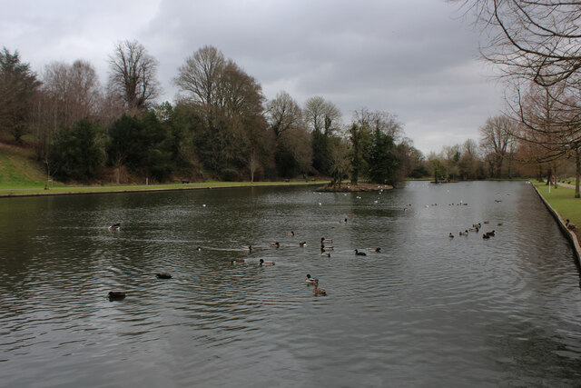
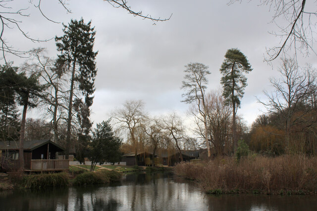
Horsepools Coppice Images

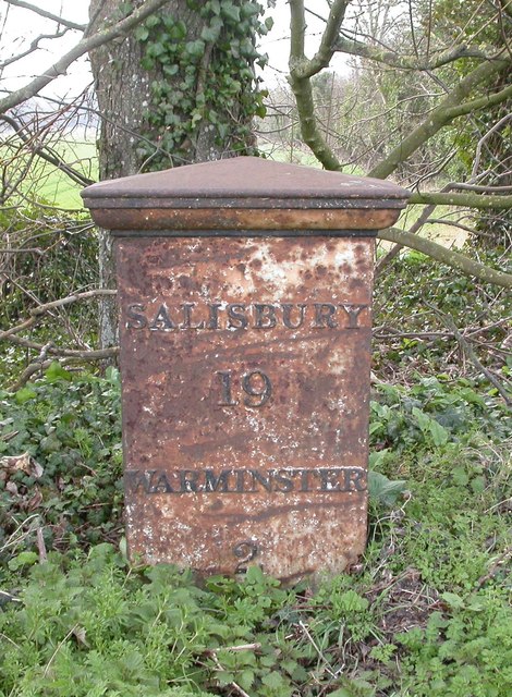
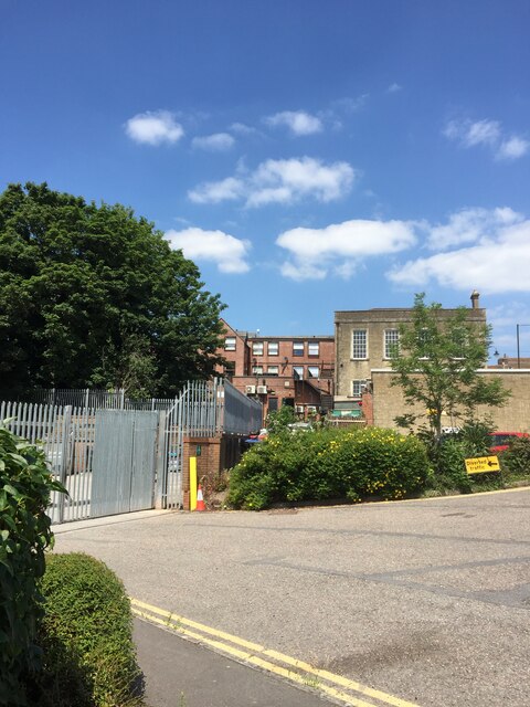
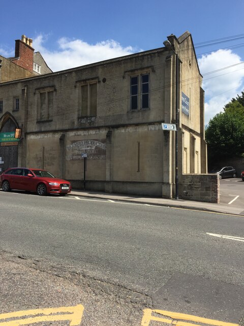
Images are sourced within 2km of 51.194787/-2.1652824 or Grid Reference ST8843. Thanks to Geograph Open Source API. All images are credited.

Old Milepost by the B3414, Warminster Road, Norton Bavant Cast iron post by the B3414, in parish of Norton Bavant (West Wiltshire District), Warminster Road; 800m East of entrance to Bishopstrow Farm, by the road, on Southwest side of road. C&M Classical iron casting, erected by the Warminster turnpike trust in the 19th century. 

Inscription reads:-
SALISBURY
19
WARMINSTER
2

Grade II listed.  
List Entry Number: 1364340 <span class="nowrap"><a title="https://historicengland.org.uk/listing/the-list/list-entry/1364340" rel="nofollow ugc noopener" href="https://historicengland.org.uk/listing/the-list/list-entry/1364340">Link</a><img style="margin-left:2px;" alt="External link" title="External link - shift click to open in new window" src="https://s1.geograph.org.uk/img/external.png" width="10" height="10"/></span>

Milestone Society National ID: WI_SAWM19
Old Milepost by the B3414, Warminster Road, Norton Bavant
Cast iron post by the B3414, in parish of Norton Bavant (West Wiltshire District), Warminster Road; 800m East of entrance to Bishopstrow Farm, by the road, on Southwest side of road. C&M Classical iron casting, erected by the Warminster turnpike trust in the 19th century. Inscription reads:- SALISBURY 19 WARMINSTER 2 Grade II listed. List Entry Number: 1364340 LinkExternal link Milestone Society National ID: WI_SAWM19
View from Middle Hill View from the chalk escarpment on the southern edge of Salisbury Plain, looking over Warminster towards the double hump of Cley Hill on the horizon
View from Middle Hill
View from the chalk escarpment on the southern edge of Salisbury Plain, looking over Warminster towards the double hump of Cley Hill on the horizon
B3414 towards Warminster The old route of the A36 before a bypass was built.
B3414 towards Warminster
The old route of the A36 before a bypass was built.
Entrance to Morrisons loading bay Warminster
Number 13 Weymouth Road, Warminster
OS Cut Mark - Warminster,  Number 13 Weymouth Road <span class="nowrap"><a title="https://www.bench-marks.org.uk/bm35446" rel="nofollow ugc noopener" href="https://www.bench-marks.org.uk/bm35446">Link</a><img style="margin-left:2px;" alt="External link" title="External link - shift click to open in new window" src="https://s1.geograph.org.uk/img/external.png" width="10" height="10"/></span>
OS Cut Mark - Warminster, Number 13 Weymouth Road
Beside The Were Following a footpath beside The Were or Swan River, a tributary of the Wylye. The white wooden building is the Pavilion Cafe, part of the Warminster Pleasure Grounds.
Beside The Were
Following a footpath beside The Were or Swan River, a tributary of the Wylye. The white wooden building is the Pavilion Cafe, part of the Warminster Pleasure Grounds.
The Boathouse in Warminster Pleasure Grounds The building appears to have a double purpose as a boathouse, and public conveniences.
The Boathouse in Warminster Pleasure Grounds
The building appears to have a double purpose as a boathouse, and public conveniences.
The Boating Lake, Warminster Part of the Lake Pleasure Grounds in Warminster
The Boating Lake, Warminster
Part of the Lake Pleasure Grounds in Warminster
Hunters Moon Lodges A holiday park in Henfords Marsh beside the River Wylye, near Warminster
Hunters Moon Lodges
A holiday park in Henfords Marsh beside the River Wylye, near Warminster
Footpath in Henfords Marsh The path crosses the River Wylye near Warminster
Footpath in Henfords Marsh
The path crosses the River Wylye near Warminster
River Wylye near Warminster The river slowly makes its way through Henfords Marsh
River Wylye near Warminster
The river slowly makes its way through Henfords Marsh
Track in Woodcroft Wood Bridleway heading southwards to Southleigh Woods
Track in Woodcroft Wood
Bridleway heading southwards to Southleigh Woods
Bridge over the A36 Bridleway crossing the A36 from Southleigh Wood
Bridge over the A36
Bridleway crossing the A36 from Southleigh Wood
Southleigh Wood Track heading southwards to the village of Longbridge Deverill
Southleigh Wood
Track heading southwards to the village of Longbridge Deverill
The River Were (aka Swan River), Warminster Warminster = 'Church on the River Were' (were = old English for 'winding') <span class="nowrap"><a title="https://www.oxfordreference.com/view/10.1093/acref/9780199609086.001.0001/acref-9780199609086" rel="nofollow ugc noopener" href="https://www.oxfordreference.com/view/10.1093/acref/9780199609086.001.0001/acref-9780199609086">Link</a><img style="margin-left:2px;" alt="External link" title="External link - shift click to open in new window" src="https://s1.geograph.org.uk/img/external.png" width="10" height="10"/></span>
The River Were (aka Swan River), Warminster
Warminster = 'Church on the River Were' (were = old English for 'winding') LinkExternal link
Public convenience, Warminster Town Park Occupying a boathouse. The park was built in the 1920s on the site of the town's Old Refuse Tip and, as a labour-intensive scheme, helped alleviate the high unemployment after the First World War <span class="nowrap"><a title="https://wshc.org.uk/blog/item/warminster-lake-pleasure-grounds.html" rel="nofollow ugc noopener" href="https://wshc.org.uk/blog/item/warminster-lake-pleasure-grounds.html">Link</a><img style="margin-left:2px;" alt="External link" title="External link - shift click to open in new window" src="https://s1.geograph.org.uk/img/external.png" width="10" height="10"/></span>
Public convenience, Warminster Town Park
Occupying a boathouse. The park was built in the 1920s on the site of the town's Old Refuse Tip and, as a labour-intensive scheme, helped alleviate the high unemployment after the First World War LinkExternal link
Footbridge over the River Wylye, Henfords Marsh Leading from the southern edge of Warminster to Eastleigh and Southleigh woods
Footbridge over the River Wylye, Henfords Marsh
Leading from the southern edge of Warminster to Eastleigh and Southleigh woods
Show me another place!

Horsepools Coppice is located at Grid Ref: ST8843 (Lat: 51.194787, Lng: -2.1652824)

Unitary Authority: Wiltshire

Police Authority: Wiltshire

What 3 Words

///cakes.makeup.closed. Near Boreham, Wiltshire

Related Wikis

St John's Church, Warminster

St John's Church, in full the Church of St John the Evangelist, is a Church of England church in the Boreham area in the south-east of the town of Warminster...

Bishopstrow

Bishopstrow is a small village and civil parish in Wiltshire, England, on the southeastern edge of the town of Warminster. The village is about 1.5 miles...

Kingdown School

Kingdown School is a mixed secondary school and sixth form in Warminster, Wiltshire, England for students aged 11 to 18. Since 1 August 2011, the school...

Battlesbury Barracks

Battlesbury Barracks is a British Army installation in Warminster, Wiltshire, England. It is the permanent base of the Royal Dragoon Guards, serving as...

Nearby Amenities

Located within 500m of 51.194787,-2.1652824
Crossing
Crossing: unmarked
Crossing Markings: no
Kerb: lowered
Lat/Long: 51.1984225/-2.1612362
Crossing
Crossing: unmarked
Crossing Markings: no
Kerb: lowered
Lat/Long: 51.1990632/-2.163539
Yeates Meadow
Tourism: attraction
Lat/Long: 51.1985797/-2.1643803
The data included in this document is from www.openstreetmap.org. The data is made available under ODbL.

Have you been to Horsepools Coppice?

Leave your review of Horsepools Coppice below (or comments, questions and feedback).