Foulhoggers Plantation

Wood, Forest in Northumberland

England

Foulhoggers Plantation

Old road over the moor Between New Dotland Farm <a href="https://www.geograph.org.uk/gridref/NY9160">NY9160</a> and Jingling Gate <a href="https://www.geograph.org.uk/gridref/NY8959">NY8959</a>. This appears to be an old road between Hexham and Allendale; tarmac roads follow the same alignment at either end.
Old road over the moor Credit: Oliver Dixon

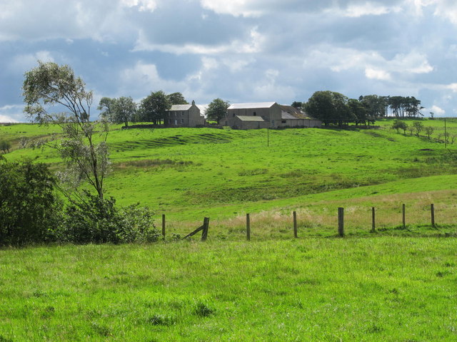
Foulhoggers Plantation is a woodland area located in Northumberland, England. Nestled in the heart of the county, this plantation spans over a vast expanse of land and is renowned for its picturesque beauty and rich biodiversity.

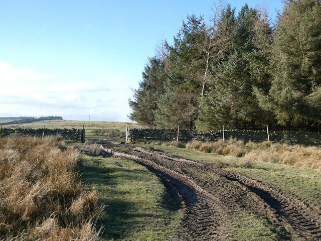
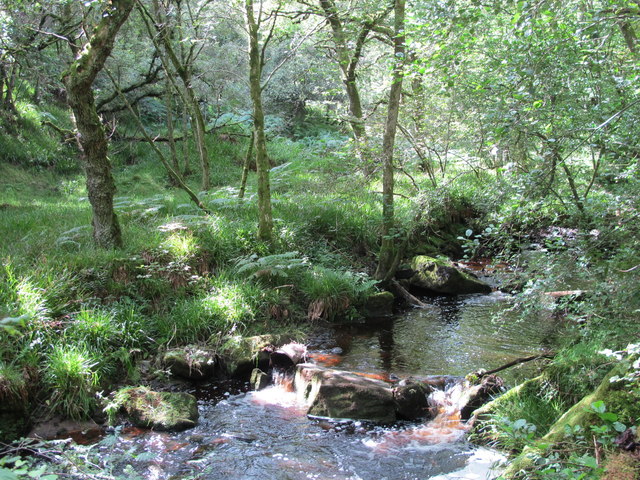
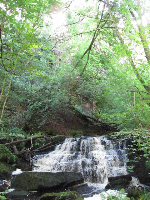
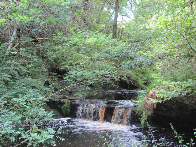
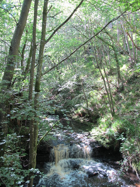
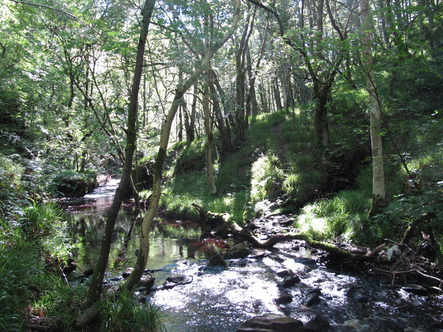
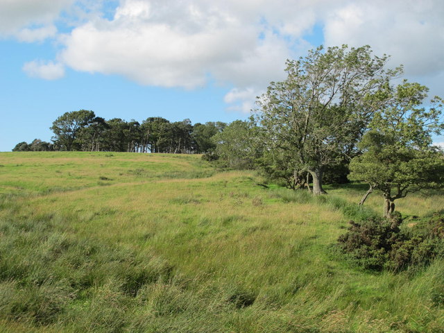
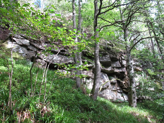
The plantation is predominantly covered by dense forest, featuring a variety of tree species including oak, beech, and birch, among others. These towering trees create a thick canopy, providing shade and shelter for the diverse range of flora and fauna that inhabit the area. The forest floor is covered in a lush carpet of moss, ferns, and wildflowers, adding to the enchanting ambiance of the plantation.

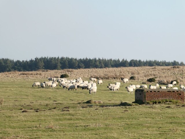
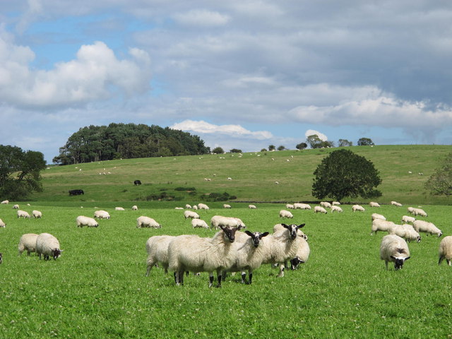
In addition to its natural beauty, Foulhoggers Plantation is home to an abundance of wildlife. Visitors may spot various species of birds, such as woodpeckers, finches, and owls, as well as small mammals like squirrels, rabbits, and foxes. The plantation is also known for its population of deer, which can often be seen grazing peacefully in the meadows surrounding the woodland.

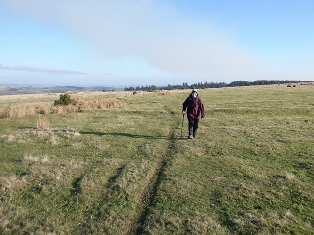
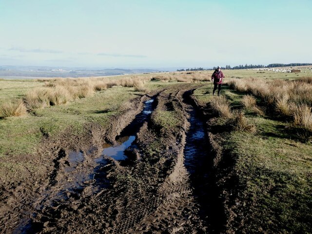
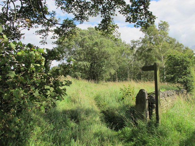
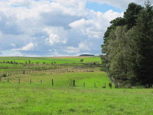
The plantation is a popular destination for nature enthusiasts and hikers, offering a network of well-maintained trails that wind through the forest. These paths provide opportunities for visitors to explore the plantation's natural wonders, offering scenic views and tranquility.

Foulhoggers Plantation is not only a haven for wildlife and a recreational space for visitors, but it also plays a vital role in preserving Northumberland's natural heritage. Its ancient woodlands and diverse ecosystems contribute to the region's ecological balance and serve as a vital habitat for many endangered and protected species.

If you have any feedback on the listing, please let us know in the comments section below.

Foulhoggers Plantation Images

Images are sourced within 2km of 54.947685/-2.1815673 or Grid Reference NY8861. Thanks to Geograph Open Source API. All images are credited.
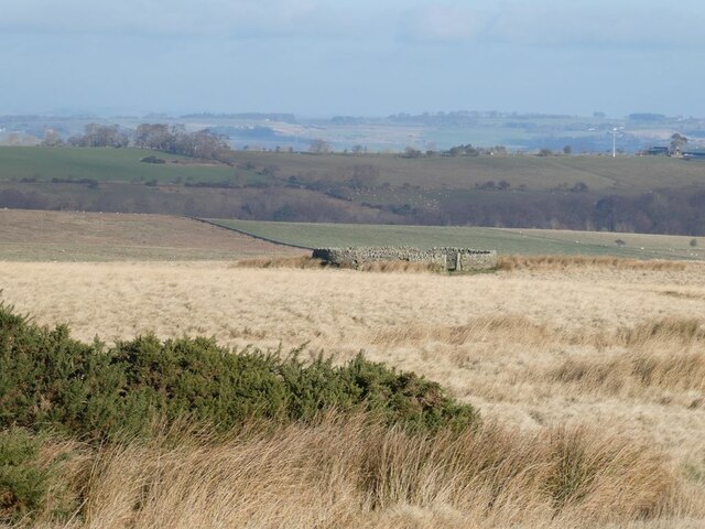
Old road over the moor Between New Dotland Farm <a href="https://www.geograph.org.uk/gridref/NY9160">NY9160</a> and Jingling Gate <a href="https://www.geograph.org.uk/gridref/NY8959">NY8959</a>. This appears to be an old road between Hexham and Allendale; tarmac roads follow the same alignment at either end.
Old road over the moor
Between New Dotland Farm NY9160 and Jingling Gate NY8959. This appears to be an old road between Hexham and Allendale; tarmac roads follow the same alignment at either end.
Muddy track near Jingling Gate Between New Dotland Farm <a href="https://www.geograph.org.uk/gridref/NY9160">NY9160</a> and Jingling Gate <a href="https://www.geograph.org.uk/gridref/NY8959">NY8959</a>. This appears to be an old road between Hexham and Allendale; tarmac roads follow the same alignment at either end.
Muddy track near Jingling Gate
Between New Dotland Farm NY9160 and Jingling Gate NY8959. This appears to be an old road between Hexham and Allendale; tarmac roads follow the same alignment at either end.
Muddy track and plantation near Jingling Gate Between New Dotland Farm <a href="https://www.geograph.org.uk/gridref/NY9160">NY9160</a> and Jingling Gate <a href="https://www.geograph.org.uk/gridref/NY8959">NY8959</a>. This appears to be an old road between Hexham and Allendale; tarmac roads follow the same alignment at either end.
Muddy track and plantation near Jingling Gate
Between New Dotland Farm NY9160 and Jingling Gate NY8959. This appears to be an old road between Hexham and Allendale; tarmac roads follow the same alignment at either end.
Sheep on moor near Jingling Gate Didn't stop to check on the brick structure - drinking trough?
Sheep on moor near Jingling Gate
Didn't stop to check on the brick structure - drinking trough?
Sheepfold above Green Ridge The valley of the West Dipton Burn in the middle distance, with Tynedale beyond.
Sheepfold above Green Ridge
The valley of the West Dipton Burn in the middle distance, with Tynedale beyond.
Sheepfold above Green Ridge The valley of the West Dipton Burn in the middle distance, with Tynedale beyond. In the far distance, it is just possible to make out the turbines of the Green Rigg Windfarm [[NY9182].
Sheepfold above Green Ridge
The valley of the West Dipton Burn in the middle distance, with Tynedale beyond. In the far distance, it is just possible to make out the turbines of the Green Rigg Windfarm [[NY9182].
Farmland northeast of The Paise
If you go down to the woods today ... ... you'd better be well prepared.

If you’re thinking of using this innocuous looking footpath to walk eastwards alongside West Dipton Burn towards Windy Hill, note that the branch “path” that doubles back down to the burn, at around NY 8906 6164, is not easy to find.

The “path” along the burn is not recommended after rain, as it crosses the burn several times. There are in fact more than twice the number of “fords” as are marked on the 1:25000 map - which is absolutely useless for indicating which side of the burn you should be on. I recommend magicmap at a scale of 1:2500 (takes 5 A4 sheets, landscape).

The “fords” are simply places where you have to cross the burn in order to avoid crags; a possible line to take may (or may not) be indicated by traces of a “path” on the opposite bank - see <a href="https://www.geograph.org.uk/photo/2556132">NY8961 : Ford on West Dipton Burn</a> and <a href="https://www.geograph.org.uk/photo/2556160">NY9061 : Ford on West Dipton Burn</a>. Wear fishermen's thigh-length waders.

Also wear thick long trousers, a thick long-sleeved shirt and gardening gloves to combat the brambles, the head high nettles, and the head high bracken full of ticks carrying Lyme disease <span class="nowrap"><a title="http://www.ncbi.nlm.nih.gov/pubmedhealth/PMH0002296/" rel="nofollow ugc noopener" href="http://www.ncbi.nlm.nih.gov/pubmedhealth/PMH0002296/">Link</a><img style="margin-left:2px;" alt="External link" title="External link - shift click to open in new window" src="https://s1.geograph.org.uk/img/external.png" width="10" height="10"/></span> . A fencer’s mask might also be useful. Put on lashings of insect repellent (at least 50% DEET <span class="nowrap"><a title="http://en.wikipedia.org/wiki/DEET" rel="nofollow ugc noopener" href="http://en.wikipedia.org/wiki/DEET">Link</a><img style="margin-left:2px;" alt="External link" title="External link - shift click to open in new window" src="https://s1.geograph.org.uk/img/external.png" width="10" height="10"/></span> ). Take long handled secateurs/small flame thrower/machete for clearing a way through the jungle-like undergrowth, and a chainsaw for cutting through the trunks of the numerous fallen trees blocking the “path”.

And then there’s the terrifying trolls who live in the deep dark wood and enjoy nothing more than hurling unsuspecting passers-by into the raging waterfalls <a href="https://www.geograph.org.uk/photo/2556097">NY8961 : Waterfall on West Dipton Burn</a>.
If you go down to the woods today ...
... you'd better be well prepared. If you’re thinking of using this innocuous looking footpath to walk eastwards alongside West Dipton Burn towards Windy Hill, note that the branch “path” that doubles back down to the burn, at around NY 8906 6164, is not easy to find. The “path” along the burn is not recommended after rain, as it crosses the burn several times. There are in fact more than twice the number of “fords” as are marked on the 1:25000 map - which is absolutely useless for indicating which side of the burn you should be on. I recommend magicmap at a scale of 1:2500 (takes 5 A4 sheets, landscape). The “fords” are simply places where you have to cross the burn in order to avoid crags; a possible line to take may (or may not) be indicated by traces of a “path” on the opposite bank - see NY8961 : Ford on West Dipton Burn and NY9061 : Ford on West Dipton Burn. Wear fishermen's thigh-length waders. Also wear thick long trousers, a thick long-sleeved shirt and gardening gloves to combat the brambles, the head high nettles, and the head high bracken full of ticks carrying Lyme disease LinkExternal link . A fencer’s mask might also be useful. Put on lashings of insect repellent (at least 50% DEET LinkExternal link ). Take long handled secateurs/small flame thrower/machete for clearing a way through the jungle-like undergrowth, and a chainsaw for cutting through the trunks of the numerous fallen trees blocking the “path”. And then there’s the terrifying trolls who live in the deep dark wood and enjoy nothing more than hurling unsuspecting passers-by into the raging waterfalls NY8961 : Waterfall on West Dipton Burn.
West Dipton Burn
West Dipton Burn
Waterfall on West Dipton Burn This is the second, and largest, of the three falls on the burn in this grid square (heading east).
Waterfall on West Dipton Burn
This is the second, and largest, of the three falls on the burn in this grid square (heading east).
Waterfall on West Dipton Burn This is the first waterfall on the burn in this grid square (heading east).
Waterfall on West Dipton Burn
This is the first waterfall on the burn in this grid square (heading east).
Waterfall on West Dipton Burn This is the third waterfall on the burn in this grid square (heading east).
Waterfall on West Dipton Burn
This is the third waterfall on the burn in this grid square (heading east).
Ford on West Dipton Burn
Farmland south of Watch Currock Farm <a href="https://www.geograph.org.uk/photo/611143">NY8962 : Watch Currock Farm</a> itself is hidden behind the trees in the distance and by the lie of the land.
Farmland south of Watch Currock Farm
NY8962 : Watch Currock Farm itself is hidden behind the trees in the distance and by the lie of the land.
Winnowty Crags Above West Dipton Burn (north side).
Winnowty Crags
Above West Dipton Burn (north side).
Farmland east of Nubbock Lodge Wood
Farmland north of The Paise On the horizon (centre) is the square plantation shown in <a href="https://www.geograph.org.uk/photo/818808">NY8561 : Rough pastures and plantation on Stublick Hill</a>.
Farmland north of The Paise
On the horizon (centre) is the square plantation shown in NY8561 : Rough pastures and plantation on Stublick Hill.
Allendale to Hexham Road The B6305. Paise Wood to the right.
Allendale to Hexham Road
The B6305. Paise Wood to the right.
Show me another place!

Foulhoggers Plantation is located at Grid Ref: NY8861 (Lat: 54.947685, Lng: -2.1815673)

Unitary Authority: Northumberland

Police Authority: Northumbria

What 3 Words

///sailors.albatross.tutored. Near Warden, Northumberland

Related Wikis

Elrington Halt railway station

Elrington Halt station is a closed stone-built railway station situated on a single-track branch railway line in Northumberland, England, that runs from...

St Joseph's Roman Catholic Middle School

St Joseph's Roman Catholic Middle School is one of the two middle schools in Hexham, Northumberland, England, the other being Hexham Middle School. The...

Queen Elizabeth High School, Hexham

Queen Elizabeth High School (QEHS) is a coeducational high school and sixth form located in Hexham, Northumberland, England. == History == The school was...
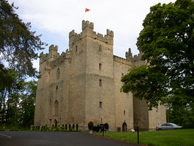
Langley Castle

Langley Castle is a restored medieval tower house, now operated as a hotel, situated in the village of Langley in the valley of the River South Tyne some...

Have you been to Foulhoggers Plantation?

Leave your review of Foulhoggers Plantation below (or comments, questions and feedback).