Boycott Wood

Wood, Forest in Worcestershire Wychavon

England

Boycott Wood

Diamond Coffee Bar, at the crossroads Droitwich Many businesses have tried to flourish at this location which is subject to flooding.
Diamond Coffee Bar, at the crossroads Droitwich Credit: Jeff Gogarty

Boycott Wood is a picturesque forest located in Worcestershire, England. Spanning approximately 200 acres, this woodland is known for its serene beauty and diverse flora and fauna. It is situated in close proximity to the popular village of Wood, making it a popular destination for nature enthusiasts and locals alike.

The forest is predominantly composed of broadleaf trees such as oak, beech, and birch, which provide a stunning backdrop throughout the year. During the spring and summer months, the woodland flourishes with a vibrant array of wildflowers, adding bursts of color to the landscape.

Boycott Wood boasts several well-maintained walking trails, allowing visitors to explore its natural wonders at their own pace. These trails meander through the forest, providing opportunities for wildlife spotting and birdwatching. The area is home to various bird species, including woodpeckers, owls, and numerous songbirds.

In addition to its natural beauty, Boycott Wood also holds historical significance. It is rumored to have been a hiding place for local villagers during the English Civil War in the 17th century. Remnants of ancient earthworks and defensive structures can still be seen within the forest, serving as a reminder of its past.

Thanks to its tranquil atmosphere and natural charm, Boycott Wood offers a peaceful retreat for those seeking solace in nature. Whether it's a leisurely stroll, a picnic among the trees, or an opportunity to immerse oneself in the region's history, this woodland is a must-visit destination for nature lovers and history enthusiasts visiting Worcestershire.

If you have any feedback on the listing, please let us know in the comments section below.
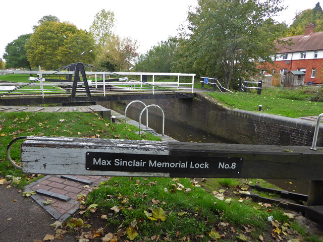
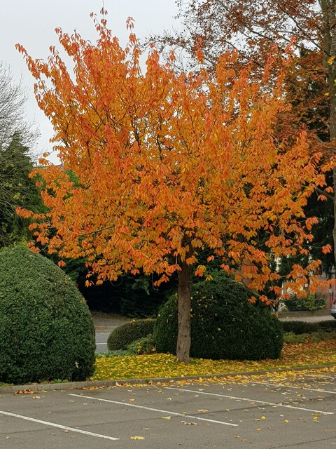
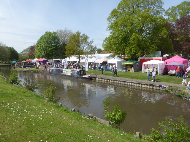
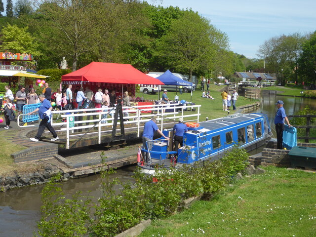
Boycott Wood Images

Images are sourced within 2km of 52.272022/-2.1710828 or Grid Reference SO8863. Thanks to Geograph Open Source API. All images are credited.

Diamond Coffee Bar, at the crossroads Droitwich Many businesses have tried to flourish at this location which is subject to flooding.
Diamond Coffee Bar, at the crossroads Droitwich
Many businesses have tried to flourish at this location which is subject to flooding.
2, The Holloway, Droitwich Spa
5 The Holloway, Droitwich Spa This used to be a general store at least up to 2001 when the owner complained of too many roadworks in the road.
5 The Holloway, Droitwich Spa
This used to be a general store at least up to 2001 when the owner complained of too many roadworks in the road.
7 The Holloway, Droitwich Spa Presently a semi-detached house this was formally the Ring O'Bells <a href="https://www.geograph.org.uk/photo/5196358">SO9063 : Ring O' Bells, Droitwich</a> which is still marked in the glass above the door.
7 The Holloway, Droitwich Spa
Presently a semi-detached house this was formally the Ring O'Bells SO9063 : Ring O' Bells, Droitwich which is still marked in the glass above the door.
Coventry Almshouses, The Holloway, Droitwich Spa This is one of the original wings which has recently been repointed with lime mortar. Said to have been founded as a result of a horse race between Henry Coventry and Sir John Pakington of Westwood <a href="https://www.geograph.org.uk/photo/4583125">SO8763 : Westwood House from the drive</a>. The loser was to pay for the building of the property named after the winner. Henry Coventry horse won but John Pakington had no cash spare so promised the income of two farms for the upkeep and Henry Coventry left money the building of the houses in his will.
Coventry Almshouses, The Holloway, Droitwich Spa
This is one of the original wings which has recently been repointed with lime mortar. Said to have been founded as a result of a horse race between Henry Coventry and Sir John Pakington of Westwood SO8763 : Westwood House from the drive. The loser was to pay for the building of the property named after the winner. Henry Coventry horse won but John Pakington had no cash spare so promised the income of two farms for the upkeep and Henry Coventry left money the building of the houses in his will.
1, The Holloway, Droitwich Spa
Largely buried lintel by the Droitwich Junction Canal I believe this is the remains of the bridge that crossed the remnant of the original lock linking the Droitwich Junction Canal to the River Salwarpe. The newly restored canal joins the river further upstream. An earlier view is seen here - <a href="https://www.geograph.org.uk/photo/761976">SO9063 : Droitwich Junction Canal - beginning or end</a>.
Largely buried lintel by the Droitwich Junction Canal
I believe this is the remains of the bridge that crossed the remnant of the original lock linking the Droitwich Junction Canal to the River Salwarpe. The newly restored canal joins the river further upstream. An earlier view is seen here - SO9063 : Droitwich Junction Canal - beginning or end.
The canalised River Salwarpe in Droitwich Approaching bridge No. 8 and the barge lock at the entrance to Vines Park.
The canalised River Salwarpe in Droitwich
Approaching bridge No. 8 and the barge lock at the entrance to Vines Park.
The barge lock, Vines Park, Droitwich Now renamed the Max Sinclair Memorial Lock and numbered in the same sequence as the Droitwich Junction Canal. This lock marks the junction of the Droitwich Barge Canal with the canalised River Salwarpe at the end of the Junction Canal. Although the Junction Canal is a narrow canal, the barge lock was designed to take the larger sailing trows so they could access a works upstream of here on the river.
The barge lock, Vines Park, Droitwich
Now renamed the Max Sinclair Memorial Lock and numbered in the same sequence as the Droitwich Junction Canal. This lock marks the junction of the Droitwich Barge Canal with the canalised River Salwarpe at the end of the Junction Canal. Although the Junction Canal is a narrow canal, the barge lock was designed to take the larger sailing trows so they could access a works upstream of here on the river.
Autumn tree, Lido car park, Droitwich
Winter trees and basketball court, Lido Park, Droitwich
St Richards Canal Festival, Droitwich To raise money for the hospice.
St Richards Canal Festival, Droitwich
To raise money for the hospice.
St Richards Canal Festival, Droitwich A trip boat passing through one of the swing bridges in Vines Park. The festival is to raise money for the hospice.
St Richards Canal Festival, Droitwich
A trip boat passing through one of the swing bridges in Vines Park. The festival is to raise money for the hospice.
St Richards Canal Festival, Droitwich St Augustine's church is on the hill in the background. The festival was to raise money for the hospice in Worcester and was getting quite crowded.
St Richards Canal Festival, Droitwich
St Augustine's church is on the hill in the background. The festival was to raise money for the hospice in Worcester and was getting quite crowded.
St Richards Canal Festival, Droitwich In Vines Park on the Droitwich Barge Canal. To raise money for the hospice.
St Richards Canal Festival, Droitwich
In Vines Park on the Droitwich Barge Canal. To raise money for the hospice.
St Richards Canal Festival, Droitwich
Stalls at St Richard's Canal Festival, Droitwich Spa
The Freemasons Arms, Droitwich I am not sure if I have ever been in this public house.
The Freemasons Arms, Droitwich
I am not sure if I have ever been in this public house.
Show me another place!

Boycott Wood is located at Grid Ref: SO8863 (Lat: 52.272022, Lng: -2.1710828)

Administrative County: Worcestershire

District: Wychavon

Police Authority: West Mercia

What 3 Words

///trap.waistcoat.mole. Near Droitwich, Worcestershire

Related Wikis

Westwood Priory

Westwood Priory (priory of St. Mary) was a priory of Benedictine nuns founded in 1153, near Droitwich, Worcestershire, England. It was a daughter house...

Droitwich Spa High School

Droitwich Spa High School is a secondary school and specialist Sports College with academy status in Droitwich Spa, Worcestershire, England. It serves...

Westwood House

Westwood House is a stately home, near Droitwich, Worcestershire, England. It has been subdivided into twelve self-contained apartments. The house has...

Droitwich Spa railway station

Droitwich Spa railway station serves the town of Droitwich Spa in Worcestershire, England. It is located just to the south-west of Droitwich Spa Junction...

Droitwich Spa

Droitwich Spa (often abbreviated to Droitwich ) is a historic spa town in the Wychavon district in northern Worcestershire, England, on the River Salwarpe...

Old Town Hall, Droitwich Spa

The Old Town Hall is a municipal building in St Andrews Street, Droitwich Spa, Worcestershire, England. The structure, which was the headquarters of Droitwich...

RGS Dodderhill

RGS Dodderhill is a private school on the outskirts of Droitwich Spa, Worcestershire, England. Girls & Boys are educated from 2–11 years of age - most...

Hampton Lovett

Hampton Lovett is a village and civil parish in the Wychavon district of the county of Worcestershire, England. It is just north of Droitwich. The church...

Nearby Amenities

Located within 500m of 52.272022,-2.1710828
Bus Stop
Farmers Way
Bus: yes
Naptan AtcoCode: 2000G003900
Naptan Bearing: NE
Naptan CommonName: Farmers Way
Naptan Crossing: Farmers Way
Naptan Indicator: Opp
Naptan NaptanCode: wocdptpw
Naptan PlusbusZoneRef: DRTWCHS
Naptan Street: Westwood Road
Naptan Verified: no
Public Transport: platform
Source: naptan_import
Lat/Long: 52.275726/-2.1687869
Bus Stop
Hunters Way
Bus: yes
Naptan AtcoCode: 2000G030999
Naptan Bearing: N
Naptan CommonName: Hunters Way
Naptan Crossing: Hunters Way
Naptan Indicator: opp
Naptan NaptanCode: wocdpwjt
Naptan PlusbusZoneRef: DRTWCHS
Naptan Street: Boycott Road
Naptan Verified: no
Public Transport: platform
Source: naptan_import
Lat/Long: 52.2718407/-2.1697394
Bus Stop
Woodmans Way
Bus: yes
Naptan AtcoCode: 2000G502734
Naptan Bearing: NE
Naptan CommonName: Woodmans Way
Naptan Crossing: Woodmans Way
Naptan Indicator: Opp
Naptan NaptanCode: wocdgdwd
Naptan PlusbusZoneRef: DRTWCHS
Naptan Street: Westwood Road
Naptan Verified: no
Public Transport: platform
Source: naptan_import
Lat/Long: 52.2743409/-2.1691627
Mini Roundabout
Direction: clockwise
Lat/Long: 52.2693058/-2.1682536
Turning Circle
Source: bing
Lat/Long: 52.2741628/-2.1697889
Turning Circle
Source: bing
Lat/Long: 52.2738997/-2.1650621
Post Box
Note: ref is conjectural; need to visit again
Operator: Royal Mail
Operator Wikidata: Q638098
Ref: WR9 507
Lat/Long: 52.2713347/-2.1675194
Power: pole
Lat/Long: 52.2763917/-2.1711836
Barrier: kissing_gate
Foot: yes
Lat/Long: 52.2704217/-2.1714394
Power: pole
Lat/Long: 52.269094/-2.1698316
Barrier: kissing_gate
Foot: yes
Lat/Long: 52.2709653/-2.1745553
Power: pole
Lat/Long: 52.2734064/-2.1706698
Power: pole
Lat/Long: 52.2747149/-2.1711648
Power: pole
Lat/Long: 52.2741469/-2.1709526
Barrier: sally_port
Lat/Long: 52.2687103/-2.1706701
Power: pole
Lat/Long: 52.2705545/-2.1699366
Post Box
Note: Not on Dracos list
Old Ref: D.187 Manor Oaks
Post Box Type: lamp
Ref: WR9 187
Royal Cypher: EIIR
Royal Cypher Wikidata: Q33102113
Source Old Ref: collection plate
Source Ref: conjecture
Lat/Long: 52.268668/-2.1700487
Power: pole
Lat/Long: 52.2754932/-2.1708409
Power: pole
Lat/Long: 52.2716077/-2.1699699
Power: pole
Lat/Long: 52.2725959/-2.1703629
Generator Method: photovoltaic
Generator Output Electricity: yes
Generator Source: solar
Generator Type: solar_photovoltaic_panel
Location: roof
Power: generator
Lat/Long: 52.270411/-2.1676272
Generator Method: photovoltaic
Generator Output Electricity: yes
Generator Source: solar
Generator Type: solar_photovoltaic_panel
Location: roof
Power: generator
Lat/Long: 52.2716732/-2.1659079
Generator Method: photovoltaic
Generator Output Electricity: yes
Generator Source: solar
Generator Type: solar_photovoltaic_panel
Location: roof
Power: generator
Lat/Long: 52.2716929/-2.1658167
Generator Method: photovoltaic
Generator Output Electricity: yes
Generator Source: solar
Generator Type: solar_photovoltaic_panel
Location: roof
Power: generator
Lat/Long: 52.2731766/-2.1652508
Generator Method: photovoltaic
Generator Output Electricity: yes
Generator Source: solar
Generator Type: solar_photovoltaic_panel
Location: roof
Power: generator
Lat/Long: 52.2731667/-2.1648994
Generator Method: photovoltaic
Generator Output Electricity: yes
Generator Source: solar
Generator Type: solar_photovoltaic_panel
Location: roof
Power: generator
Lat/Long: 52.2734211/-2.1651676
Generator Method: photovoltaic
Generator Output Electricity: yes
Generator Source: solar
Generator Type: solar_photovoltaic_panel
Location: roof
Power: generator
Lat/Long: 52.2743123/-2.1697113
Generator Method: photovoltaic
Generator Output Electricity: yes
Generator Source: solar
Generator Type: solar_photovoltaic_panel
Location: roof
Power: generator
Lat/Long: 52.2747078/-2.1707895
Generator Method: photovoltaic
Generator Output Electricity: yes
Generator Source: solar
Generator Type: solar_photovoltaic_panel
Location: roof
Power: generator
Lat/Long: 52.2745306/-2.1707922
Generator Method: photovoltaic
Generator Output Electricity: yes
Generator Source: solar
Generator Type: solar_photovoltaic_panel
Location: roof
Power: generator
Lat/Long: 52.2757491/-2.1704663
Generator Method: photovoltaic
Generator Output Electricity: yes
Generator Source: solar
Generator Type: solar_photovoltaic_panel
Location: roof
Power: generator
Lat/Long: 52.2757335/-2.1703899
Generator Method: photovoltaic
Generator Output Electricity: yes
Generator Source: solar
Generator Type: solar_photovoltaic_panel
Location: roof
Power: generator
Lat/Long: 52.2707409/-2.1665087
Generator Method: photovoltaic
Generator Output Electricity: yes
Generator Source: solar
Generator Type: solar_photovoltaic_panel
Location: roof
Power: generator
Lat/Long: 52.2707064/-2.1664524
Generator Method: photovoltaic
Generator Output Electricity: yes
Generator Source: solar
Generator Type: solar_photovoltaic_panel
Location: roof
Power: generator
Lat/Long: 52.2713301/-2.1655659
Parking
Parking: layby
Source: bing
Lat/Long: 52.2711192/-2.1651247
Generator Method: photovoltaic
Generator Output Electricity: yes
Generator Source: solar
Generator Type: solar_photovoltaic_panel
Location: roof
Power: generator
Lat/Long: 52.2734851/-2.1645749
Westwood Lodge
Power: pole
Ref: 761267
Source: wpd_opendata
Transformer: distribution
Voltage Primary: 11000
Lat/Long: 52.269601/-2.1702169
Power: pole
Source: bing
Lat/Long: 52.27031/-2.1701391
Power: pole
Source: bing
Lat/Long: 52.270777/-2.1706769
Location Transition: yes
Power: pole
Source: bing
Lat/Long: 52.2736632/-2.1778961
Power: pole
Source: bing
Lat/Long: 52.2735245/-2.1765389
Power: pole
Source: bing
Lat/Long: 52.273385/-2.175352
Power: pole
Source: bing
Lat/Long: 52.2730781/-2.1742697
Power: pole
Source: bing
Lat/Long: 52.2727556/-2.1731874
Power: pole
Source: bing
Lat/Long: 52.2722575/-2.1725222
Power: pole
Source: bing
Lat/Long: 52.271468/-2.1714842
Power: transformer
Source: bing
Lat/Long: 52.2736377/-2.1705723
Power: transformer
Source: bing
Lat/Long: 52.2739611/-2.1706769
The data included in this document is from www.openstreetmap.org. The data is made available under ODbL.

Have you been to Boycott Wood?

Leave your review of Boycott Wood below (or comments, questions and feedback).