Ridgehill Wood

Wood, Forest in Staffordshire South Staffordshire

England

Ridgehill Wood

Arizona Crossing, Kingswinford
Arizona Crossing, Kingswinford Credit: Chris Whippet

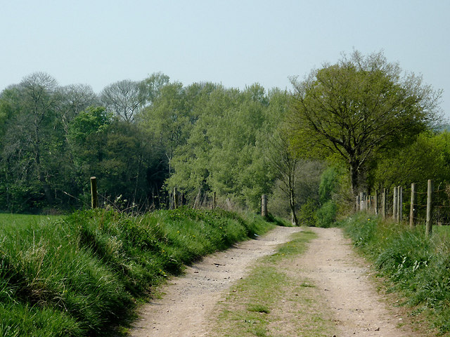
Ridgehill Wood, located in Staffordshire, England, is a picturesque woodland area known for its natural beauty and diverse ecosystem. Covering an area of approximately 230 acres, it is a popular destination for nature enthusiasts, hikers, and wildlife observers.

The wood is characterized by a mix of broadleaf and coniferous trees, including oak, beech, and pine, which create a stunning canopy overhead. The forest floor is adorned with a variety of plant species, such as bluebells, wood sorrel, and wild garlic, which add vibrant bursts of color throughout the seasons.

Ridgehill Wood boasts a rich wildlife population, with several species making it their home. Visitors may be fortunate enough to spot roe deer, foxes, badgers, and a wide range of bird species, including woodpeckers, owls, and warblers. The tranquil atmosphere of the wood makes it an ideal environment for these animals to thrive.

For outdoor enthusiasts, the woodland offers a network of well-maintained footpaths and trails, allowing visitors to explore its enchanting scenery at their own pace. These paths wind through ancient woodland areas, revealing breathtaking views and hidden gems around every corner.

Ridgehill Wood also holds historical significance, with remnants of old charcoal pits and iron smelting sites dating back centuries. These remnants provide insight into the area's industrial past and offer a glimpse into the lives of those who inhabited the region long ago.

Overall, Ridgehill Wood in Staffordshire is a captivating destination that combines natural beauty, diverse wildlife, and a rich history. Whether you seek tranquility, adventure, or an opportunity to reconnect with nature, this woodland is sure to provide an unforgettable experience.

If you have any feedback on the listing, please let us know in the comments section below.

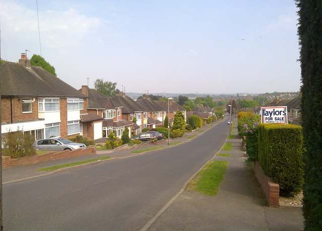
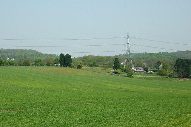
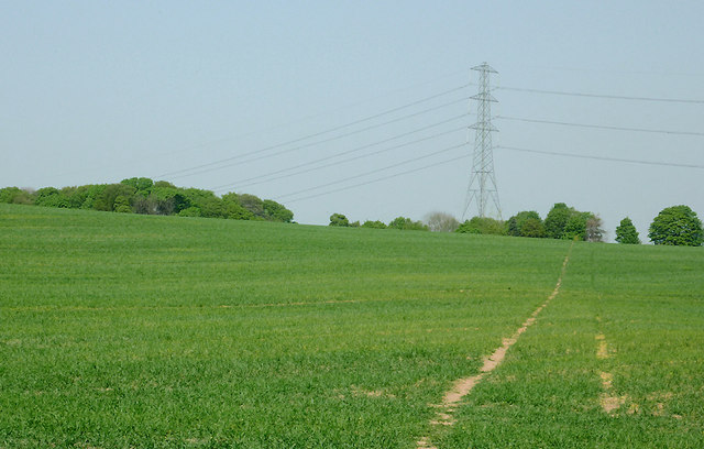
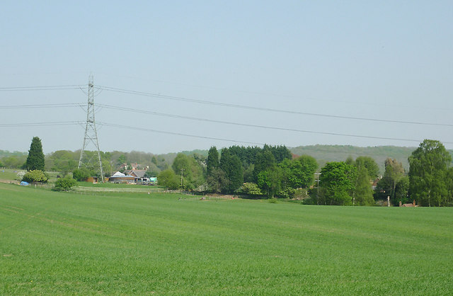
Ridgehill Wood Images

Images are sourced within 2km of 52.488444/-2.1812152 or Grid Reference SO8787. Thanks to Geograph Open Source API. All images are credited.

Arizona Crossing, Kingswinford
Ridge Road looking toward Dudley and the Black Country
Cave at Prestwood near Stourton, Staffordshire This cave in the Triassic sandstone is on land belonging to Prestwood Cave Nursery. The nursery grows a limited range of hardy shrubs and other plants. Quality is high, and the prices are very reasonable. The hard winter of 2010-2011 killed many plants in nurseries all over the West Midlands, but enough remains here to continue trading.
Cave at Prestwood near Stourton, Staffordshire
This cave in the Triassic sandstone is on land belonging to Prestwood Cave Nursery. The nursery grows a limited range of hardy shrubs and other plants. Quality is high, and the prices are very reasonable. The hard winter of 2010-2011 killed many plants in nurseries all over the West Midlands, but enough remains here to continue trading.
Prestwood Cave Nursery near Stourton, Staffordshire The nursery grows a limited range of hardy shrubs and other plants. Quality is high, and the prices are very reasonable. The hard winter of 2010-2011 killed many plants in nurseries all over the West Midlands, but enough remains here to continue trading.
Prestwood Cave Nursery near Stourton, Staffordshire
The nursery grows a limited range of hardy shrubs and other plants. Quality is high, and the prices are very reasonable. The hard winter of 2010-2011 killed many plants in nurseries all over the West Midlands, but enough remains here to continue trading.
Bridleway near Stourton, Staffordshire The bridleway links Wolverhampton Road (A449) at Prestwood with Greensforge Lane and Gothersley Farm.
Bridleway near Stourton, Staffordshire
The bridleway links Wolverhampton Road (A449) at Prestwood with Greensforge Lane and Gothersley Farm.
Bridleway near Stourton, Staffordshire The bridleway links Wolverhampton Road (A449) at Prestwood with Greensforge Lane and Gothersley Farm.
Bridleway near Stourton, Staffordshire
The bridleway links Wolverhampton Road (A449) at Prestwood with Greensforge Lane and Gothersley Farm.
Bridleway near Stourton, Staffordshire The bridleway links Wolverhampton Road (A449) at Prestwood with Greensforge Lane and Gothersley Farm.
Bridleway near Stourton, Staffordshire
The bridleway links Wolverhampton Road (A449) at Prestwood with Greensforge Lane and Gothersley Farm.
Public footpath and stile near Prestwood, Staffordshire The path across this crop field seems little used. The bridleway from the Coach House which is mapped as being behind the camera does not exist at all now.
Public footpath and stile near Prestwood, Staffordshire
The path across this crop field seems little used. The bridleway from the Coach House which is mapped as being behind the camera does not exist at all now.
Farmland near Prestwood, Staffordshire Seen from the bridleway near Prestwood Cave Nursery.
Farmland near Prestwood, Staffordshire
Seen from the bridleway near Prestwood Cave Nursery.
Farmland near Prestwood, Staffordshire Looking across the fields from the bridleway between Prestwood and Greensforge Lane.
Farmland near Prestwood, Staffordshire
Looking across the fields from the bridleway between Prestwood and Greensforge Lane.
Crop field near Prestwood, Staffordshire What appear to be tractor wheel tracks actually follow almost exactly the course of a public footpath across the field to Foley Lane.
Crop field near Prestwood, Staffordshire
What appear to be tractor wheel tracks actually follow almost exactly the course of a public footpath across the field to Foley Lane.
Arable Land near Prestwood, Staffordshire Looking across the fields from the bridleway between Prestwood and Greensforge Lane. The tall dark green conifers in the centre of the image are by the A449 near Yew Tree Farm.
Arable Land near Prestwood, Staffordshire
Looking across the fields from the bridleway between Prestwood and Greensforge Lane. The tall dark green conifers in the centre of the image are by the A449 near Yew Tree Farm.
Bridleway north of Stourton, Staffordshire The bridleway links Wolverhampton Road (A449) at Prestwood with Greensforge Lane and Gothersley Farm. The woodland ahead is on the slope down to the Smestow River. To the right of the bridleway there is Gothersley Rough, and to the left, Colbourn's Rough.
Bridleway north of Stourton, Staffordshire
The bridleway links Wolverhampton Road (A449) at Prestwood with Greensforge Lane and Gothersley Farm. The woodland ahead is on the slope down to the Smestow River. To the right of the bridleway there is Gothersley Rough, and to the left, Colbourn's Rough.
Bridleway north of Stourton, Staffordshire The bridleway links Gothersley Farm and Greensforge Lane with the Wolverhampton Road (A449) at Prestwood. On the skyline are Lousy Wood and Crabtree Rough.
Bridleway north of Stourton, Staffordshire
The bridleway links Gothersley Farm and Greensforge Lane with the Wolverhampton Road (A449) at Prestwood. On the skyline are Lousy Wood and Crabtree Rough.
Grazing near Gothersley, Staffordshire Seen from Greensforge Lane, many of the fields have been divided into paddocks so that horses can graze and have "their own space". Someone told me that horses can be cantankerous with others they do not know. These two beauties are definitely good friends, enjoying some early warm spring grazing. The Smestow River is behind the trees.
Grazing near Gothersley, Staffordshire
Seen from Greensforge Lane, many of the fields have been divided into paddocks so that horses can graze and have "their own space". Someone told me that horses can be cantankerous with others they do not know. These two beauties are definitely good friends, enjoying some early warm spring grazing. The Smestow River is behind the trees.
Horses grazing near Gothersley, Staffordshire Many of the fields in this area have been divided into paddocks for use by the horse riding community. These two beauties had been grazing separately, quite calmly, when the bay decided to communicate with her friend. <a href="https://www.geograph.org.uk/photo/2379017">SO8686 : Friendly horses near Gothersley, Staffordshire</a>
In this image they are separating to continue enjoying the warm dry conditions.

See also <a href="https://www.geograph.org.uk/photo/2378981">SO8686 : Grazing near Gothersley, Staffordshire</a>
Horses grazing near Gothersley, Staffordshire
Many of the fields in this area have been divided into paddocks for use by the horse riding community. These two beauties had been grazing separately, quite calmly, when the bay decided to communicate with her friend. SO8686 : Friendly horses near Gothersley, Staffordshire In this image they are separating to continue enjoying the warm dry conditions. See also SO8686 : Grazing near Gothersley, Staffordshire
Friendly horses near Gothersley, Staffordshire Many of the fields in this area have been divided into paddocks for use by the horse riding community. These two beauties had been grazing separately, quite calmly, when they decided on a bit of communication. Charming.

See <a href="https://www.geograph.org.uk/photo/2379006">SO8686 : Horses grazing near Gothersley, Staffordshire</a>
and <a href="https://www.geograph.org.uk/photo/2378981">SO8686 : Grazing near Gothersley, Staffordshire</a>
Friendly horses near Gothersley, Staffordshire
Many of the fields in this area have been divided into paddocks for use by the horse riding community. These two beauties had been grazing separately, quite calmly, when they decided on a bit of communication. Charming. See SO8686 : Horses grazing near Gothersley, Staffordshire and SO8686 : Grazing near Gothersley, Staffordshire
Show me another place!

Ridgehill Wood is located at Grid Ref: SO8787 (Lat: 52.488444, Lng: -2.1812152)

Administrative County: Staffordshire

District: South Staffordshire

Police Authority: Staffordshire

What 3 Words

///sectors.card.tiredness. Near Kingswinford, West Midlands

Nearby Locations

Ridgehill Wood Lawns Wood

Related Wikis

Summerhill School, Kingswinford

Summerhill School is a mixed community secondary school located in Kingswinford, West Midlands, England. == History == The school was built by Brierley...

Kingswinford Rural District

Kingswinford Rural District was a rural district in Staffordshire, England from 1894 to 1934. It was created by the Local Government Act 1894, and originally...

Ashwood, Staffordshire

Ashwood is a small area of Staffordshire, England. It is situated in the South Staffordshire district, approximately two miles west of the West Midlands...

Kingswinford

Kingswinford is a town of the Metropolitan Borough of Dudley in the English West Midlands, situated 5 miles (8.0 km) west-southwest of central Dudley....

Wordsley Hospital

Wordsley Hospital was an NHS hospital located in Wordsley, near Stourbridge, West Midlands, England. == History == The facility was built as part of the...

Kingswinford Academy

Kingswinford Academy is a coeducational secondary school with academy status, located in Kingswinford, West Midlands, England.The school is run by the...

Greensforge

Greensforge is a scattered hamlet on the boundary of Kinver and Swindon parishes, in South Staffordshire, England. It is noted for its Roman associations...

Wall Heath

Wall Heath is a suburban village in the Dudley Metropolitan Borough in the West Midlands of England. It is located on the A449 road, approximately 1.5...

Nearby Amenities

Located within 500m of 52.488444,-2.1812152
Ridge Hill
Ele: 141
Natural: peak
Lat/Long: 52.485631/-2.1790794
Generator Method: photovoltaic
Generator Output Electricity: yes
Generator Source: solar
Generator Type: solar_photovoltaic_panel
Location: roof
Power: generator
Lat/Long: 52.488038/-2.1744856
Generator Method: photovoltaic
Generator Output Electricity: yes
Generator Source: solar
Generator Type: solar_photovoltaic_panel
Location: roof
Power: generator
Lat/Long: 52.4901596/-2.1799386
Generator Method: photovoltaic
Generator Output Electricity: yes
Generator Source: solar
Generator Type: solar_photovoltaic_panel
Location: roof
Power: generator
Lat/Long: 52.4910921/-2.175875
Generator Method: photovoltaic
Generator Output Electricity: yes
Generator Source: solar
Generator Type: solar_photovoltaic_panel
Location: roof
Power: generator
Lat/Long: 52.4892581/-2.1740028
The data included in this document is from www.openstreetmap.org. The data is made available under ODbL.

Have you been to Ridgehill Wood?

Leave your review of Ridgehill Wood below (or comments, questions and feedback).