Nunnery Wood

Wood, Forest in Worcestershire Worcester

England

Nunnery Wood

M5 motorway M5 bank holiday monday, looks deserted but it was 5.30am!
M5 motorway Credit: Richard Dunn

Nunnery Wood is a large forested area located in Worcestershire, England. Covering approximately 50 hectares, it forms part of the wider Nunnery Wood Country Park. The wood is situated on the outskirts of Worcester, the county town, and is a popular destination for locals and visitors alike.

The woodland consists mainly of deciduous trees, including oak, beech, and birch, which provide a picturesque backdrop throughout the seasons. The forest floor is carpeted with wildflowers, creating a vibrant and diverse ecosystem. A network of well-maintained paths meanders through the wood, allowing visitors to explore and enjoy the natural beauty of the area.

Nunnery Wood is not only a haven for nature enthusiasts but also offers various recreational activities. There are designated picnic areas, perfect for family outings or relaxing with friends. Additionally, the wood features a well-equipped children's play area, ensuring that younger visitors are also entertained.

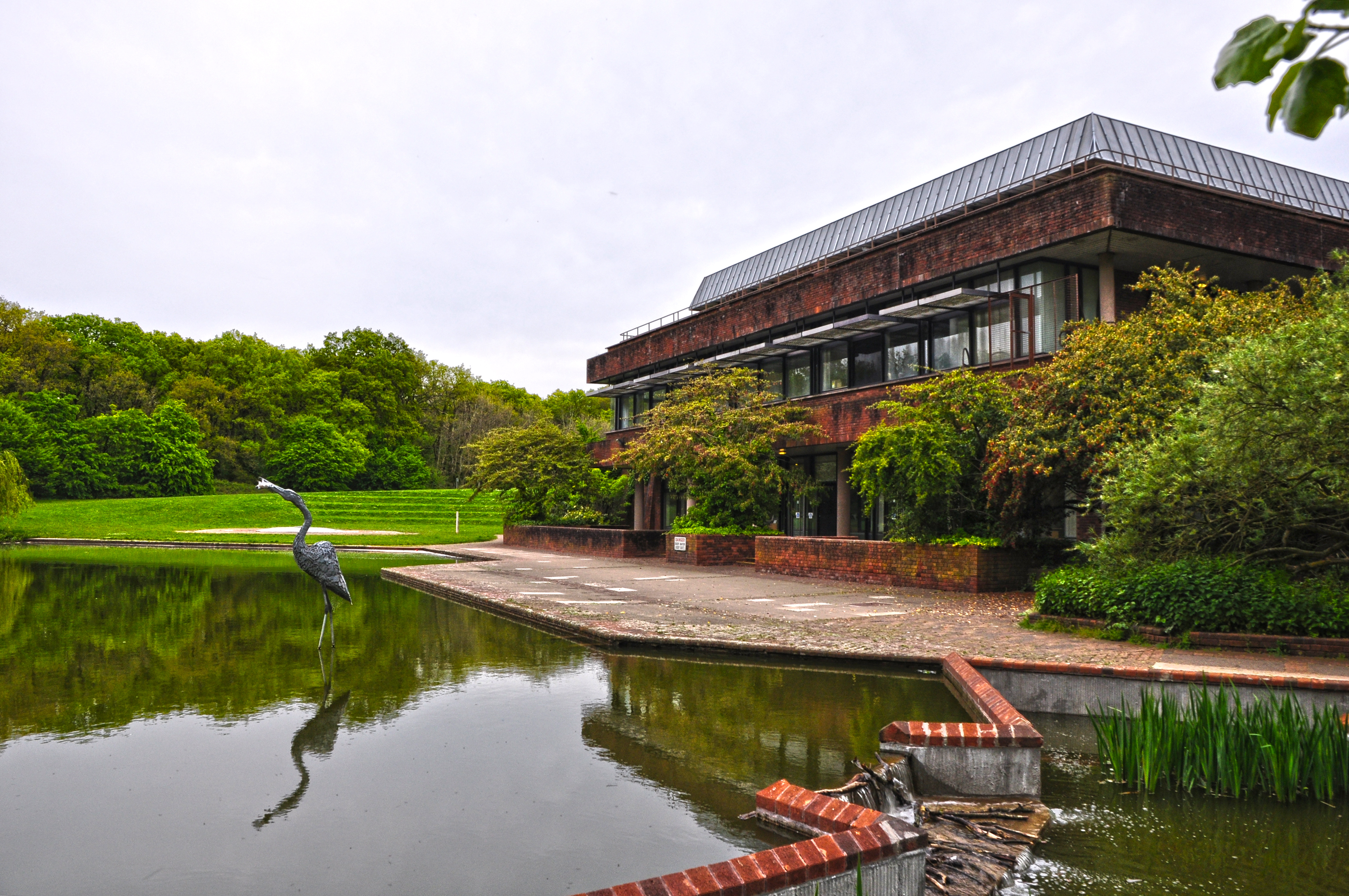
The forest is home to an abundance of wildlife, including squirrels, badgers, and a variety of bird species, making it a popular spot for birdwatching. Nature enthusiasts can also find several ponds within the wood, which attract waterfowl and other aquatic creatures.

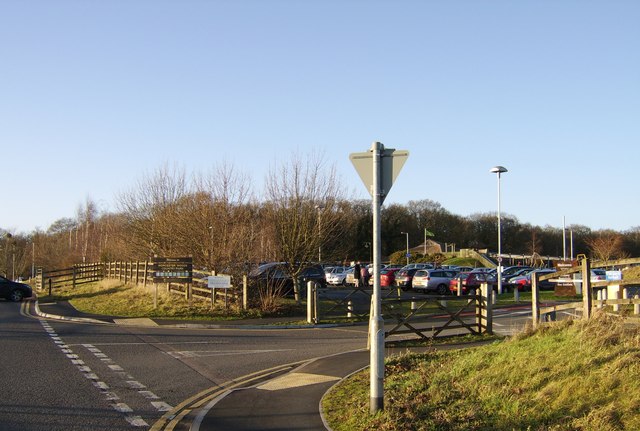
Nunnery Wood is easily accessible, with ample parking facilities available for visitors. The wood is managed by the local council, ensuring its preservation and protection for future generations to enjoy. Whether it's a leisurely stroll, a picnic in nature, or an opportunity to observe wildlife, Nunnery Wood offers a tranquil and idyllic escape from the urban bustle of Worcester.

If you have any feedback on the listing, please let us know in the comments section below.

Nunnery Wood Images

Images are sourced within 2km of 52.189139/-2.1837827 or Grid Reference SO8754. Thanks to Geograph Open Source API. All images are credited.

M5 motorway M5 bank holiday monday, looks deserted but it was 5.30am!
M5 motorway
M5 bank holiday monday, looks deserted but it was 5.30am!
Looking NNW from bridge over Perry Wood road towards Shrub Hill Station.
All that is left of the old Ronkswood hospital. Since the new Worcester Royal Hospital was built the old Ronkswood site has been levelled apart from this building which still carries communications antennae. Ronkswood was used during the 2nd world war for treating large numbers of injured soldiers.
All that is left of the old Ronkswood hospital.
Since the new Worcester Royal Hospital was built the old Ronkswood site has been levelled apart from this building which still carries communications antennae. Ronkswood was used during the 2nd world war for treating large numbers of injured soldiers.
Worcestershire County Council offices Built at great expense when Herefordshire and Worcestershire were amalgamated in the 1970s. they have now separated.
Worcestershire County Council offices
Built at great expense when Herefordshire and Worcestershire were amalgamated in the 1970s. they have now separated.
Lea & Perrins factory,  Worcester The home of "Worcestershire Sauce"
Lea & Perrins factory, Worcester
The home of "Worcestershire Sauce"
Ronkswood An open green space in Worcester.
Ronkswood
An open green space in Worcester.
St Mary's Convent St Mary's Convent is a school in Worcester on Battenhall Road.
St Mary's Convent
St Mary's Convent is a school in Worcester on Battenhall Road.
Nearly Redundant Roundabout At the junction of the Worcester to Evesham road and what was the Worcester to Stratford-upon-Avon road. The latter is now a cul-de-sac since the building of the Eastern Relief Road.
Nearly Redundant Roundabout
At the junction of the Worcester to Evesham road and what was the Worcester to Stratford-upon-Avon road. The latter is now a cul-de-sac since the building of the Eastern Relief Road.
DEFRA Offices, Whittington Road Worcester Department for the Environment, Food and Rural Affairs now occupy these "Government Offices" based on the old "temporary" war time single story spurred buildings.
DEFRA Offices, Whittington Road Worcester
Department for the Environment, Food and Rural Affairs now occupy these "Government Offices" based on the old "temporary" war time single story spurred buildings.
Trotshill Roundabout One of the many roundabouts along the eastern relief road opening up the land between the city of Worcester and the M5 motorway for development into housing estates with attractive names like Long Meadow, The Lyppards and The Berkeleys.
Trotshill Roundabout
One of the many roundabouts along the eastern relief road opening up the land between the city of Worcester and the M5 motorway for development into housing estates with attractive names like Long Meadow, The Lyppards and The Berkeleys.
Footpath to Withy Wells Looking south east along a ploughed out public footpath towards Kings Wood.
Footpath to Withy Wells
Looking south east along a ploughed out public footpath towards Kings Wood.
Footpath to Round Hill, near Spetchley Park. Looking north east along the path. The road over the cattle grid goes to Cudleigh Court Farm.
Footpath to Round Hill, near Spetchley Park.
Looking north east along the path. The road over the cattle grid goes to Cudleigh Court Farm.
M5 Motorway Looking south west from the high point of this square. The motorway dominates the whole of this square and many nearby if not always visibly then always with the constant roar of the road noise. In the far distance the outline of the Malvern hills can just be seen.
M5 Motorway
Looking south west from the high point of this square. The motorway dominates the whole of this square and many nearby if not always visibly then always with the constant roar of the road noise. In the far distance the outline of the Malvern hills can just be seen.
Old Road from The Elms to Cudleigh Court Still a public footpath. Possibly laid out as a 12 foot access road at the time of the inclosures. Notice how the ground beneath the oak tree is frost free. Looking north east from the M5 motorway towards the stream.
Old Road from The Elms to Cudleigh Court
Still a public footpath. Possibly laid out as a 12 foot access road at the time of the inclosures. Notice how the ground beneath the oak tree is frost free. Looking north east from the M5 motorway towards the stream.
Old road under the M5 Old road from Swinesherd to Old House Farm. Still a bridleway, viewed from the south-east.
Old road under the M5
Old road from Swinesherd to Old House Farm. Still a bridleway, viewed from the south-east.
Allotments at the end of Foxwell Street Worcester The railway from Bristol and London passes in a cutting behind the bushes on its way to Shrub Hill station about a mile to the right.
Allotments at the end of Foxwell Street Worcester
The railway from Bristol and London passes in a cutting behind the bushes on its way to Shrub Hill station about a mile to the right.
The new Tallow Hill A different view of Worcester's Tallow Hill with a modern road and retail sheds replacing a tortuous canal bridge and a well loved pub. The real eyesore though is the multistorey office building obscuring Shrub Hill station.
The new Tallow Hill
A different view of Worcester's Tallow Hill with a modern road and retail sheds replacing a tortuous canal bridge and a well loved pub. The real eyesore though is the multistorey office building obscuring Shrub Hill station.
Worcester Sixth Form College Built in the 60's as the Girls grammar for the area it now provides up to the minute education for both sixth formers and adults seeking A levels and other entry qualifications for university and other higher education.
Worcester Sixth Form College
Built in the 60's as the Girls grammar for the area it now provides up to the minute education for both sixth formers and adults seeking A levels and other entry qualifications for university and other higher education.
Show me another place!

Nunnery Wood is located at Grid Ref: SO8754 (Lat: 52.189139, Lng: -2.1837827)

Administrative County: Worcestershire

District: Worcester

Police Authority: West Mercia

What 3 Words

///early.market.hotel. Near Worcester, Worcestershire

Nearby Locations

Nunnery Wood

Related Wikis

Worcestershire Royal Hospital

The Worcestershire Royal Hospital is an acute general hospital located in Charles Hastings Way in Worcester, England. It is managed by the Worcestershire...

Croome collection

The Croome collection – the archive of the Earls of Coventry – came into public ownership in 2005 as part of the Acceptance in Lieu of Inheritance Tax...

County Hall, Worcester

County Hall is a municipal facility at Spetchley Road in Worcester, Worcestershire. It is the headquarters of Worcestershire County Council. == History... ==

Worcester Woods Country Park

Worcester Woods Country Park is a country park in Worcester, Worcestershire, England. == History == The land on which the park sits was a medieval farmstead...

Nearby Amenities

Located within 500m of 52.189139,-2.1837827
Bus Stop
County Hall Boiler House
Bus: yes
Naptan AtcoCode: 2000G000900
Naptan Bearing: N
Naptan CommonName: County Hall Boiler House
Naptan Indicator: Adj
Naptan NaptanCode: wocgdwtm
Naptan PlusbusZoneRef: WORCSFS
Naptan Street: Approach Road
Naptan Verified: no
Public Transport: platform
Source: naptan_import
Lat/Long: 52.1858025/-2.1805575
Bus Stop
Aconbury Unit
Bus: yes
Naptan AtcoCode: 2000G001500
Naptan Bearing: N
Naptan CommonName: Aconbury Unit
Naptan Indicator: Adj
Naptan Landmark: Aconbury Unit
Naptan NaptanCode: wocgamgd
Naptan PlusbusZoneRef: WORCSFS
Naptan Street: Worcestershire Royal Hospital
Public Transport: platform
Route Ref: 32A;38;W3
Shelter: yes
Source: naptan_import
Lat/Long: 52.1927579/-2.182116
Bus Stop
Leopard Rise
Bus: yes
Naptan AtcoCode: 2000G001502
Naptan Bearing: SE
Naptan CommonName: Leopard Rise
Naptan Crossing: Leopard Rise
Naptan Indicator: Adj
Naptan Landmark: Worcestershire Royal Hospital
Naptan NaptanCode: wocgmtpa
Naptan PlusbusZoneRef: WORCSFS
Naptan Street: Newtown Road
Naptan Verified: no
Public Transport: platform
Shelter: yes
Source: naptan_import
Lat/Long: 52.1933788/-2.1817982
Bus Stop
Childrens Unit
Bench: yes
Bin: no
Bus: yes
Naptan AtcoCode: 2000G001597
Naptan Bearing: S
Naptan CommonName: Childrens Unit
Naptan Indicator: Adj
Naptan Landmark: Childrens Unit
Naptan NaptanCode: wocdgmwp
Naptan PlusbusZoneRef: WORCSFS
Naptan Street: Worcestershire Royal Hospital
Public Transport: platform
Route Ref: 32A;38;W3
Shelter: yes
Source: naptan_import
Tactile Paving: no
Lat/Long: 52.1912827/-2.1825655
Bus Stop
A & E Unit
Bus: yes
Naptan AtcoCode: 2000G001598
Naptan Bearing: NW
Naptan CommonName: A & E Unit
Naptan Indicator: Adj
Naptan Landmark: A & E Unit
Naptan NaptanCode: wocdgmwt
Naptan PlusbusZoneRef: WORCSFS
Naptan Street: Worcestershire Royal Hospital
Public Transport: platform
Route Ref: 32A;38;W3
Shelter: yes
Source: naptan_import
Lat/Long: 52.1911934/-2.179029
Bus Stop
Main Entrance
Bus: yes
Naptan AtcoCode: 2000G001599
Naptan Bearing: N
Naptan CommonName: Main Entrance
Naptan Indicator: Adj
Naptan Landmark: Main Entrance
Naptan NaptanCode: wocdgpad
Naptan PlusbusZoneRef: WORCSFS
Naptan Street: Worcestershire Royal Hospital
Public Transport: platform
Route Ref: 32A;W3
Shelter: yes
Source: naptan_import
Lat/Long: 52.1905248/-2.1811488
Bus Stop
Lichfield Avenue
Bench: no
Bus: yes
Naptan AtcoCode: 2000G004204
Naptan Bearing: NE
Naptan CommonName: Lichfield Avenue
Naptan Indicator: North East Bound
Naptan Landmark: Litchfield Road
Naptan NaptanCode: wocgdpwa
Naptan PlusbusZoneRef: WORCSFS
Naptan Street: Canterbury Road
Naptan Verified: no
Public Transport: platform
Shelter: no
Source: naptan_import
Lat/Long: 52.1913888/-2.1900451
Bus Stop
Lichfield Avenue
Bench: yes
Bin: no
Bus: yes
Naptan AtcoCode: 2000G004205
Naptan Bearing: SW
Naptan CommonName: Lichfield Avenue
Naptan Indicator: South West Bound
Naptan Landmark: Lichfield Avenue
Naptan NaptanCode: wocgdpwd
Naptan PlusbusZoneRef: WORCSFS
Naptan Street: Canterbury Road
Naptan Verified: no
Public Transport: platform
Shelter: yes
Source: naptan_import
Lat/Long: 52.1917858/-2.1891837
Post Box
Ref: WR5 11
Lat/Long: 52.1911/-2.1814
Ford: yes
Lat/Long: 52.1897479/-2.1844406
Junction: roundabout
Lat/Long: 52.1862786/-2.1803726
Barrier: lift_gate
Lat/Long: 52.1862644/-2.1801296
Crossing
Crossing: uncontrolled
Lat/Long: 52.1902761/-2.1809373
Crossing
Crossing: uncontrolled
Source: bing
Tactile Paving: no
Lat/Long: 52.1914026/-2.1782816
Crossing
Crossing: uncontrolled
Source: survey
Lat/Long: 52.1920406/-2.180912
Man Made: surveillance
Source: survey
Lat/Long: 52.1903807/-2.1810187
Man Made: surveillance
Lat/Long: 52.1923889/-2.1835015
Cafe
The Orchard Cafe
Addr City: Worcester
Addr Housename: Worcester Countryside Centre
Addr Postcode: WR5 2LG
Addr Street: Wildwood Drive
Diet Vegan: yes
Diet Vegetarian: yes
Fhrs Id: 685687
Smoking: no
Wheelchair: yes
Lat/Long: 52.1870968/-2.1799124
Entrance: main
Lat/Long: 52.1910069/-2.1814168
Shop @ WRVS
Shop: convenience
Lat/Long: 52.1909582/-2.1811139
Cafe
Lat/Long: 52.1911496/-2.1814972
Crossing
Crossing: uncontrolled
Lat/Long: 52.1909515/-2.1815223
Toilets
Changing Table: yes
Check Date: 2023-05-13
Fee: no
Wheelchair: yes
Lat/Long: 52.187015/-2.1799497
Mini Roundabout
Direction: clockwise
Lat/Long: 52.1921805/-2.1789933
Crossing
Crossing: uncontrolled
Lat/Long: 52.190871/-2.1816478
Mini Roundabout
Direction: clockwise
Lat/Long: 52.1919819/-2.1785072
Turning Circle
Source: bing
Lat/Long: 52.1912767/-2.1868326
Source: photo survey P173-0869
Lat/Long: 52.1857709/-2.1843408
Source: photo survey P173-0869
Lat/Long: 52.1857719/-2.1842046
Source: photo survey P173-0869
Lat/Long: 52.1857722/-2.1840605
Tourism: picnic_site
Lat/Long: 52.1871453/-2.1795371
Bench
Lat/Long: 52.1873278/-2.1844479
Bench
Lat/Long: 52.1879/-2.1801815
Bench
Lat/Long: 52.1878971/-2.1832867
Barrier: entrance
Foot: yes
Lat/Long: 52.1879191/-2.1798084
Barrier: entrance
Foot: yes
Lat/Long: 52.1880623/-2.1791005
Barrier: kissing_gate
Foot: yes
Lat/Long: 52.1881802/-2.1774187
Barrier: entrance
Foot: yes
Lat/Long: 52.1886467/-2.1797337
Barrier: kissing_gate
Foot: yes
Lat/Long: 52.1887019/-2.177348
Bench
Lat/Long: 52.1887138/-2.1786765
Barrier: kissing_gate
Foot: yes
Lat/Long: 52.1887335/-2.1788084
Bench
Lat/Long: 52.1892678/-2.1803601
Heron
Source: photo survey P173-0866
Tourism: artwork
Lat/Long: 52.1853651/-2.1845682
Shelter: yes
Smoking: dedicated
Source: survey on foot
Lat/Long: 52.1851841/-2.1842103
Source: photo survey P173-0869
Lat/Long: 52.1857717/-2.1842767
Source: photo survey P173-0869
Lat/Long: 52.1857717/-2.1842947
Source: photo survey P173-0869
Lat/Long: 52.1857717/-2.1843127
Source: photo survey P173-0869
Lat/Long: 52.1857718/-2.1842407
Source: photo survey P173-0869
Lat/Long: 52.1857718/-2.1842587
Bicycle Parking
Bicycle Parking: stands
Capacity: 9
Check Date: 2023-05-13
Covered: yes
Lat/Long: 52.1857719/-2.1832741
Source: photo survey P173-0869
Lat/Long: 52.1857719/-2.1841866
Source: photo survey P173-0869
Lat/Long: 52.1857719/-2.1842226
Source: photo survey P173-0869
Lat/Long: 52.185772/-2.1841506
Source: photo survey P173-0869
Lat/Long: 52.185772/-2.1841686
Source: photo survey P173-0869
Lat/Long: 52.1857721/-2.1840965
Source: photo survey P173-0869
Lat/Long: 52.1857721/-2.1841145
Source: photo survey P173-0869
Lat/Long: 52.1857721/-2.1841325
Source: photo survey P173-0869
Lat/Long: 52.1857722/-2.1840785
Fountain
Lat/Long: 52.1858521/-2.1845012
Bench
Backrest: yes
Check Date: 2023-05-13
Colour: brown
Material: wood
Seats: 3
Source: survey on foot
Lat/Long: 52.1863011/-2.182455
Turning Circle
Lat/Long: 52.1852471/-2.183453
Barrier: lift_gate
Lat/Long: 52.1863199/-2.1800958
The George Marshall Medical Museum
Addr City: Worcester
Addr Housename: Charles Hastings Education Centre
Addr Postcode: WR5 1DD
Addr Street: Charles Hastings Way
Fee: no
Note: Closed on Bank Holidays
Opening Hours: Mo-Fr 09:00-17:00
Tourism: museum
Website: https://medicalmuseum.org.uk/georgemarshallmuseum
Lat/Long: 52.192143/-2.1838977
Waste Basket
Waste: dog_excrement
Lat/Long: 52.1907646/-2.1870761
Waste Basket
Waste: dog_excrement
Lat/Long: 52.1908425/-2.186859
Waste Basket
Waste: dog_excrement
Lat/Long: 52.1897032/-2.1897139
Waste Basket
Ref: Dog waste bin
Waste: dog_excrement
Lat/Long: 52.1855444/-2.187844
Waste Basket
Ref: Dog waste bin
Waste: dog_excrement
Lat/Long: 52.1853944/-2.1857799
Waste Basket
Check Date: 2024-03-09
Ref: Dog waste bin
Waste: dog_excrement
Lat/Long: 52.1847093/-2.1840475
Waste Basket
Ref: Dog waste bin
Waste: dog_excrement
Lat/Long: 52.1854943/-2.1820965
Waste Basket
Ref: Dog waste bin
Waste: dog_excrement
Lat/Long: 52.191/-2.1834309
Waste Basket
Check Date: 2023-05-20
Ref: Dog waste bin
Waste: dog_excrement
Lat/Long: 52.1870227/-2.1803732
Waste Basket
Ref: Dog waste bin
Waste: dog_excrement
Lat/Long: 52.1879384/-2.1800397
Aconbury West
Entrance: yes
Lat/Long: 52.1920288/-2.1827464
Crossing
Crossing: uncontrolled
Tactile Paving: no
Lat/Long: 52.1917353/-2.1826164
Crossing
Crossing: uncontrolled
Lat/Long: 52.1918482/-2.1826522
Clinic
Accident & Emergency
Healthcare: clinic
Lat/Long: 52.1929604/-2.1824477
Man Made: surveillance
Lat/Long: 52.1909606/-2.1801907
Man Made: surveillance
Lat/Long: 52.190548/-2.1794615
Man Made: surveillance
Lat/Long: 52.1907988/-2.179084
Man Made: surveillance
Lat/Long: 52.1912083/-2.1798078
Fire Hydrant
Emergency: fire_hydrant
Fire Hydrant Diameter: 180
Fire Hydrant Type: underground
Source: survey
Lat/Long: 52.1919138/-2.1796135
Fire Hydrant
Emergency: fire_hydrant
Fire Hydrant Diameter: 180
Fire Hydrant Type: underground
Source: survey
Lat/Long: 52.19189/-2.1795961
Entrance: yes
Lat/Long: 52.1915089/-2.1795875
Entrance: yes
Lat/Long: 52.1910123/-2.1794534
Bicycle Parking
Capacity: 20
Covered: yes
Lat/Long: 52.1911636/-2.1791824
Crossing
Crossing: uncontrolled
Lat/Long: 52.191342/-2.1791529
Vending Machine
Check Date: 2023-06-07
Source: survey
Vending: parking_tickets
Lat/Long: 52.1905544/-2.1787908
Barrier: lift_gate
Lat/Long: 52.1903709/-2.1792119
Vending Machine
Source: survey
Vending: parking_tickets
Lat/Long: 52.1902592/-2.1795499
Crossing
Crossing: uncontrolled
Lat/Long: 52.1904105/-2.1797269
Crossing
Crossing: uncontrolled
Lat/Long: 52.1909852/-2.1785454
Bicycle Parking
Capacity: 10
Covered: yes
Lat/Long: 52.1913066/-2.1796679
Vending Machine
Source: survey
Vending: parking_tickets
Lat/Long: 52.1908421/-2.1817432
Bicycle Parking
Bicycle Parking: wall_loops
Capacity: 4
Covered: no
Source: survey
Lat/Long: 52.1914686/-2.1823574
Entrance: yes
Source: survey
Lat/Long: 52.191504/-2.1821254
Fire Hydrant
Emergency: fire_hydrant
Fire Hydrant Diameter: 180
Fire Hydrant Type: underground
Source: survey
Lat/Long: 52.1909778/-2.1814441
Fire Hydrant
Emergency: fire_hydrant
Fire Hydrant Diameter: 180
Fire Hydrant Type: underground
Source: survey
Lat/Long: 52.1910008/-2.181483
Fire Hydrant
Emergency: fire_hydrant
Fire Hydrant Diameter: 180
Fire Hydrant Type: underground
Source: survey
Lat/Long: 52.1915648/-2.18247
Fire Hydrant
Emergency: fire_hydrant
Fire Hydrant Diameter: 180
Fire Hydrant Type: underground
Source: survey
Lat/Long: 52.1915821/-2.1824808
Crossing
Crossing: uncontrolled
Source: survey
Tactile Paving: no
Lat/Long: 52.1915245/-2.18269
Clinic
South Worcestershire Centre for Diabetes and Metabolism
Healthcare: clinic
Lat/Long: 52.192904/-2.182411
Entrance: yes
Lat/Long: 52.1931408/-2.1830279
Vending Machine
Source: survey
Vending: parking_tickets
Lat/Long: 52.1920753/-2.1823252
General Hospital Newtown
Power: transformer
Source: survey
Transformer: distribution
Voltage Primary: 11000
Lat/Long: 52.1925205/-2.1815212
Man Made: chimney
Source: survey
Lat/Long: 52.1928267/-2.1812738
Bicycle Parking
Capacity: 16
Covered: yes
Source: survey
Lat/Long: 52.1924732/-2.1816305
Marker: pedestal
Operator: CLH
Operator Old: GPSS
Ref: MP 1795
Utility: oil
Lat/Long: 52.191051/-2.1852743
Fire Hydrant
Emergency: fire_hydrant
Fire Hydrant Diameter: 180
Fire Hydrant Position: green
Fire Hydrant Type: underground
Source: survey
Lat/Long: 52.1910185/-2.1786781
Grit Bin
Source: survey
Lat/Long: 52.1909782/-2.1784917
Man Made: surveillance
Lat/Long: 52.1906559/-2.1784327
Man Made: surveillance
Lat/Long: 52.1912692/-2.1786445
Fire Hydrant
Emergency: fire_hydrant
Fire Hydrant Diameter: 180
Fire Hydrant Type: underground
Source: survey
Lat/Long: 52.1904561/-2.1799615
Barrier: lift_gate
Maxheight: 2.1
Lat/Long: 52.1907349/-2.1783455
Vending Machine
Source: survey
Vending: parking_tickets
Lat/Long: 52.1903789/-2.1804778
Fire Hydrant
Emergency: fire_hydrant
Fire Hydrant Diameter: 180
Fire Hydrant Type: underground
Source: survey
Lat/Long: 52.1904027/-2.1805
Fire Hydrant
Emergency: fire_hydrant
Fire Hydrant Diameter: 180
Fire Hydrant Type: underground
Source: survey
Lat/Long: 52.190406/-2.1804624
Bicycle Parking
Capacity: 8
Covered: yes
Source: survey
Lat/Long: 52.1907542/-2.1818008
Bicycle Parking
Capacity: 8
Covered: yes
Source: survey
Lat/Long: 52.1908002/-2.1817217
Bicycle Parking
Capacity: 8
Covered: yes
Source: survey
Lat/Long: 52.1907928/-2.1818451
Bicycle Parking
Capacity: 8
Covered: yes
Source: survey
Lat/Long: 52.1908282/-2.1817888
Leisure: playground
Source: survey
Lat/Long: 52.1912088/-2.1817324
Barrier: lift_gate
Lat/Long: 52.190728/-2.1782917
Vending Machine
Source: survey
Vending: parking_tickets
Lat/Long: 52.1904957/-2.1822996
Man Made: surveillance
Lat/Long: 52.1904188/-2.182374
Marker: pedestal
Operator: CLH
Operator Old: GPSS
Ref: MP 1796
Utility: oil
Lat/Long: 52.1920154/-2.1851568
Crossing
Crossing: uncontrolled
Lat/Long: 52.1902292/-2.1794964
Barrier: lift_gate
Lat/Long: 52.185905/-2.1793163
Cafe
Lat/Long: 52.1851867/-2.1834741
Cafe
County Hall Cafe
Lat/Long: 52.1856677/-2.1839006
Generator Method: photovoltaic
Generator Output Electricity: yes
Generator Source: solar
Generator Type: solar_photovoltaic_panel
Location: roof
Power: generator
Lat/Long: 52.187903/-2.1903214
Generator Method: photovoltaic
Generator Output Electricity: yes
Generator Source: solar
Generator Type: solar_photovoltaic_panel
Location: roof
Power: generator
Lat/Long: 52.1885492/-2.1908632
Generator Method: photovoltaic
Generator Output Electricity: yes
Generator Source: solar
Generator Type: solar_photovoltaic_panel
Location: roof
Power: generator
Lat/Long: 52.1892704/-2.1909853
Generator Method: photovoltaic
Generator Output Electricity: yes
Generator Source: solar
Generator Type: solar_photovoltaic_panel
Location: roof
Power: generator
Lat/Long: 52.1888239/-2.1901739
Generator Method: photovoltaic
Generator Output Electricity: yes
Generator Source: solar
Generator Type: solar_photovoltaic_panel
Location: roof
Power: generator
Lat/Long: 52.1888748/-2.1907639
Ford: yes
Lat/Long: 52.1864499/-2.1844986
Ford: yes
Lat/Long: 52.1867121/-2.1841839
Ford: yes
Lat/Long: 52.186807/-2.1834254
Ford: yes
Lat/Long: 52.1876828/-2.1851442
Ford: yes
Lat/Long: 52.1885061/-2.1862636
Ford: yes
Lat/Long: 52.1915253/-2.1837073
Ford: yes
Lat/Long: 52.1909188/-2.1831093
Roma
Artist Name: Keith Wilson
Artwork Type: sculpture
Material: steel
Tourism: artwork
Url: https://www.meadowarts.org/meadow-projects/keith-wilson-roma-worcester
Lat/Long: 52.1879343/-2.1773997
Bicycle Parking
Access: yes
Bicycle Parking: wall_loops
Capacity: 5
Covered: no
Fee: no
Lat/Long: 52.1869053/-2.1791192
Bicycle Parking
Access: yes
Bicycle Parking: wall_loops
Capacity: 5
Covered: no
Fee: no
Lat/Long: 52.1869247/-2.1789474
Generator Method: photovoltaic
Generator Output Electricity: yes
Generator Source: solar
Generator Type: solar_photovoltaic_panel
Location: roof
Power: generator
Lat/Long: 52.1885953/-2.190764
Generator Method: photovoltaic
Generator Output Electricity: yes
Generator Source: solar
Generator Type: solar_photovoltaic_panel
Location: roof
Power: generator
Lat/Long: 52.1881374/-2.1902034
Generator Method: photovoltaic
Generator Output Electricity: yes
Generator Source: solar
Generator Type: solar_photovoltaic_panel
Location: roof
Power: generator
Lat/Long: 52.1881562/-2.1901377
Marker: post
Operator: CLH
Operator Old: GPSS
Ref GPSS: 15693
Utility: oil
Lat/Long: 52.1932075/-2.1848222
Marker: aerial
Operator: CLH
Operator Old: GPSS
Ref GPSS: 19734
Utility: oil
Lat/Long: 52.192087/-2.185142
Marker: post
Operator: CLH
Operator Old: GPSS
Ref GPSS: 15692
Utility: oil
Lat/Long: 52.1920935/-2.1851407
Marker: pedestal
Operator: CLH
Operator Old: GPSS
Ref GPSS: 18269
Utility: oil
Lat/Long: 52.1912562/-2.185248
Bus Stop
Leopard Rise
Bench: yes
Bin: no
Bus: yes
Naptan AtcoCode: 2000G001503
Naptan CommonName: Leopard Rise
Naptan Indicator: Opp
Naptan NaptanCode: wocgtawd
Naptan Verified: no
Public Transport: platform
Shelter: yes
Tactile Paving: no
Lat/Long: 52.1935621/-2.1827963
Bus Stop
Oaklands
Bus: yes
Naptan AtcoCode: 2000G001507
Naptan CommonName: Oaklands
Naptan Indicator: Opp
Naptan NaptanCode: wocgpwtw
Naptan Verified: no
Public Transport: platform
Lat/Long: 52.1930052/-2.1807875
Barrier: lift_gate
Lat/Long: 52.1923255/-2.1844711
Crossing
Lat/Long: 52.1934184/-2.1847459
Crossing
Lat/Long: 52.1928238/-2.1849018
Barrier: lift_gate
Lat/Long: 52.1903601/-2.1793015
Barrier: lift_gate
Lat/Long: 52.1920578/-2.1851372
Access: yes
Barrier: bollard
Bollard: removable
Lat/Long: 52.1925651/-2.1853187
Generator Method: photovoltaic
Generator Output Electricity: yes
Generator Source: solar
Generator Type: solar_photovoltaic_panel
Location: roof
Power: generator
Lat/Long: 52.1915542/-2.187544
Bicycle Parking
Bicycle Parking: wall_loops
Capacity: 3
Covered: no
Source: survey
Lat/Long: 52.1915641/-2.1823311
Crossing
Crossing: uncontrolled
Crossing Markings: yes
Lat/Long: 52.1909721/-2.1783398
Crossing
Crossing: traffic_signals
Lat/Long: 52.1929699/-2.1800959
County Council HQ
Power: transformer
Transformer: distribution
Voltage Primary: 11000
Lat/Long: 52.1854035/-2.1825658
Charles Hastings Centre
Power: transformer
Transformer: distribution
Voltage Primary: 11000
Lat/Long: 52.192163/-2.1852607
Newtown Hospital
Power: transformer
Transformer: distribution
Voltage Primary: 11000
Lat/Long: 52.1935002/-2.1847987
Worcester Hospital
Power: transformer
Transformer: distribution
Voltage Primary: 11000
Lat/Long: 52.1918487/-2.1814282
Worcester Hospital
Power: transformer
Transformer: distribution
Voltage Primary: 11000
Lat/Long: 52.1918728/-2.1814661
Kings Court C
Power: transformer
Transformer: distribution
Voltage Primary: 11000
Lat/Long: 52.1923065/-2.180076
Kings Court A
Power: transformer
Transformer: distribution
Voltage Primary: 11000
Lat/Long: 52.1925852/-2.1791185
Kings Court B
Power: transformer
Transformer: distribution
Voltage Primary: 11000
Lat/Long: 52.1920541/-2.1794923
Worcester Radiotherapy Hospital - RMU
Power: transformer
Transformer: distribution
Voltage Primary: 11000
Lat/Long: 52.1905056/-2.179841
The data included in this document is from www.openstreetmap.org. The data is made available under ODbL.

Have you been to Nunnery Wood?

Leave your review of Nunnery Wood below (or comments, questions and feedback).