Conygre Wood
Wood, Forest in Gloucestershire Stroud
England
Conygre Wood
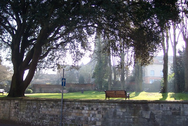
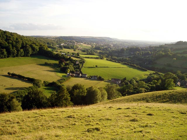
Conygre Wood is a picturesque woodland located in Gloucestershire, England. Covering an area of approximately 50 hectares, it is a popular destination for nature enthusiasts and those seeking tranquility amidst the beauty of nature. The wood is situated on the southern slopes of the Cotswold Hills, offering stunning views of the surrounding countryside.
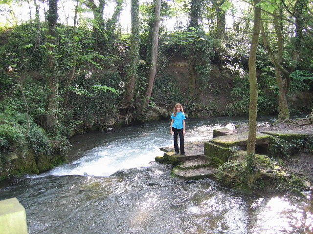
The wood is predominantly composed of native broadleaf trees such as oak, beech, and ash, which create a dense canopy that provides shade and shelter to a diverse range of flora and fauna. Bluebells carpet the forest floor in spring, creating a vibrant and enchanting display of colors.
Several walking trails wind their way through Conygre Wood, allowing visitors to explore its natural wonders. These paths are well-maintained and suitable for all levels of fitness. Along the way, visitors may encounter a variety of wildlife, including deer, squirrels, and a multitude of bird species.
Conygre Wood is a designated Site of Special Scientific Interest (SSSI) due to its exceptional biological importance. The wood is home to rare species of plants, insects, and fungi, making it an important conservation area.
The wood is easily accessible, with a car park located nearby, and is open to the public year-round. Its tranquil atmosphere, rich biodiversity, and scenic beauty make Conygre Wood a must-visit destination for nature lovers and those seeking a peaceful retreat.
If you have any feedback on the listing, please let us know in the comments section below.
Conygre Wood Images
Images are sourced within 2km of 51.74243/-2.1916658 or Grid Reference SO8604. Thanks to Geograph Open Source API. All images are credited.


Conygre Wood is located at Grid Ref: SO8604 (Lat: 51.74243, Lng: -2.1916658)
Administrative County: Gloucestershire
District: Stroud
Police Authority: Gloucestershire
What 3 Words
///budgeted.whizzed.teeth. Near Stroud, Gloucestershire
Nearby Locations
Related Wikis
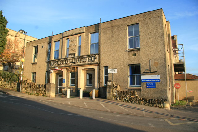
Stroud General Hospital
Stroud General Hospital is a health facility in Trinity Road in Stroud, Gloucestershire, England. It is managed by Gloucestershire Health and Care NHS...

Nether Lypiatt Manor
Nether Lypiatt Manor is a compact, neo-Classical manor house in the mainly rural parish of Thrupp, near Stroud in Gloucestershire. It was formerly the...

Bowbridge Crossing Halt railway station
Bowbridge Crossing Halt was opened on 1 May 1905 on what is now the Golden Valley Line between Kemble and Stroud. This line was opened in 1845 as the Cheltenham...

Church of All Saints, Stroud
The Church of All Saints is a Church of England parish church in the Uplands area of Stroud, Gloucestershire. The church is a Grade I listed building....

Blackboy Clock
The Blackboy Clock is a clock in Stroud, Gloucestershire, England. It is a jacquemart (Jack clock), with a Black boy figurine with a club that strikes...

Stroud
Stroud is a market town and civil parish in Gloucestershire, England. It is the main town in Stroud District. The town's population was 13,500 in 2021...
Rodborough
Rodborough is a large village and civil parish in the district of Stroud, Gloucestershire, in South West England. It is directly south of the town of Stroud...

Five Valleys
The Five Valleys are a group of valleys in Gloucestershire, England, which converge on the town of Stroud at the western edge of the Cotswolds. The Five...
Related Videos

🇬🇧 Stroud Strolls: Exploring the Heart of the Cotswolds on a Walking Adventure!
Welcome to Stroud Strolls: Exploring the Heart of the Cotswolds on a Walking Adventure!** Join us on a virtual journey through ...
![#walking in the #cotswolds Training day 2 in support of #healthcareworkers [EP:003]](https://i.ytimg.com/vi/gL-00Gn-U6k/hqdefault.jpg)
#walking in the #cotswolds Training day 2 in support of #healthcareworkers [EP:003]
Here we are training in the Cotswolds for the Cambrian Way Challenge, in support of Healthcare Workers' Foundation. We walk ...

Cotswold Weekend Away June 2023
7 of us (plus the dog Alfie) went away for the weekend and stayed in the Cotswolds. We explored Stroud, Gloucester and ...

Nearby Amenities
Located within 500m of 51.74243,-2.1916658Have you been to Conygre Wood?
Leave your review of Conygre Wood below (or comments, questions and feedback).