Cumberstone Wood

Wood, Forest in Staffordshire Stafford

England

Cumberstone Wood

St Luke's Church St Luke's church Tittensor.
St Luke's Church Credit: Andy and Hilary

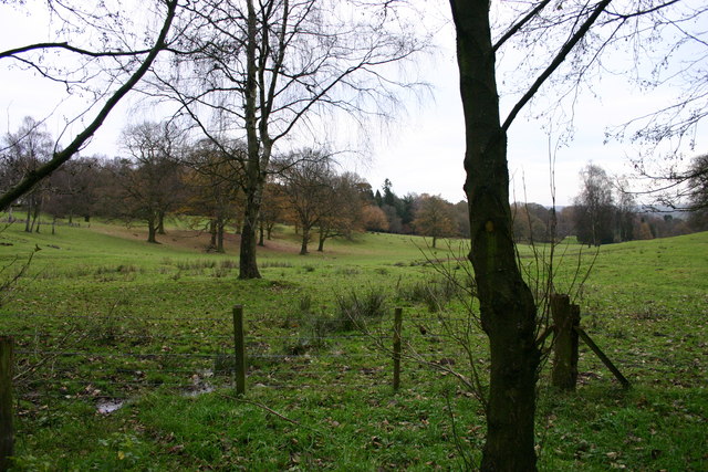
Cumberstone Wood is a picturesque forest located in Staffordshire, England. Covering an area of approximately 100 acres, it is a popular destination for nature lovers, hikers, and wildlife enthusiasts. The wood is situated on the outskirts of the village of Cumberstone, surrounded by rolling hills and beautiful landscapes.

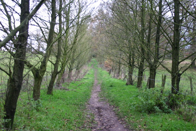
The wood is predominantly made up of native broadleaf trees, including oak, beech, ash, and birch, creating a diverse and vibrant ecosystem. The dense canopy provides a sheltered habitat for a variety of wildlife species, making it an ideal spot for birdwatching and wildlife spotting.

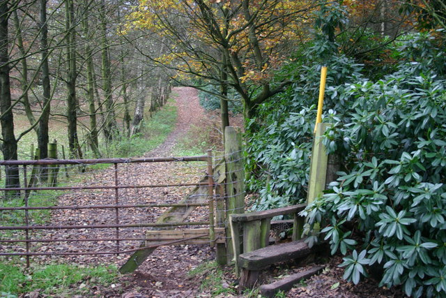
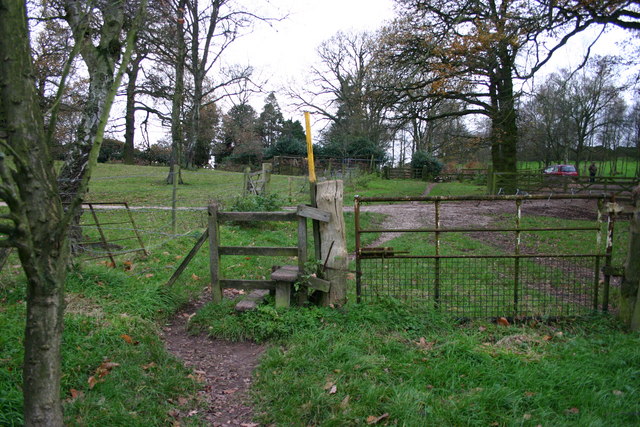
Traversing through Cumberstone Wood, visitors can explore numerous well-maintained trails and pathways, offering a chance to immerse themselves in nature's tranquility. The wood is known for its stunning bluebell displays in the spring, transforming the forest floor into a carpet of vibrant colors.

In addition to its natural beauty, Cumberstone Wood also holds historical significance. The area was once part of a medieval deer park and remnants of its past can still be seen, including the remains of an ancient boundary wall.

The wood is open to the public year-round and provides ample parking facilities for visitors. It is also equipped with picnic areas and benches, allowing visitors to enjoy a leisurely day amidst nature. Whether it's a peaceful stroll, wildlife spotting, or simply taking in the breathtaking views, Cumberstone Wood offers a delightful escape from the hustle and bustle of everyday life.

If you have any feedback on the listing, please let us know in the comments section below.

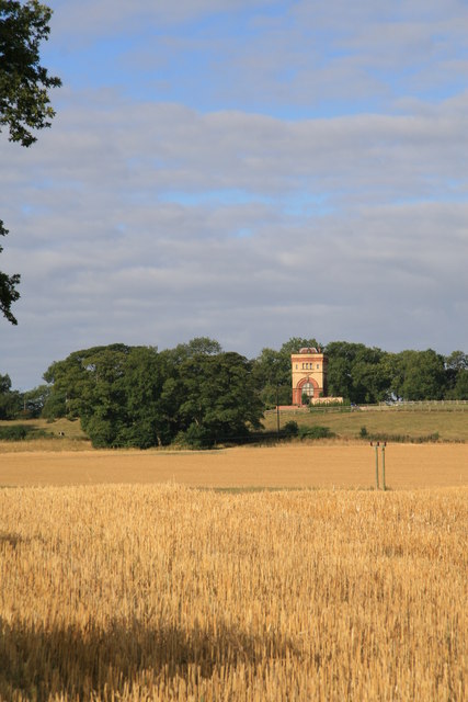
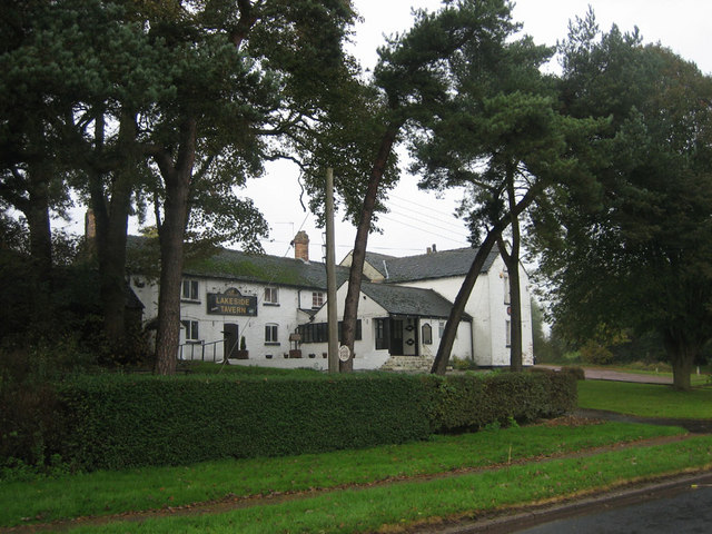
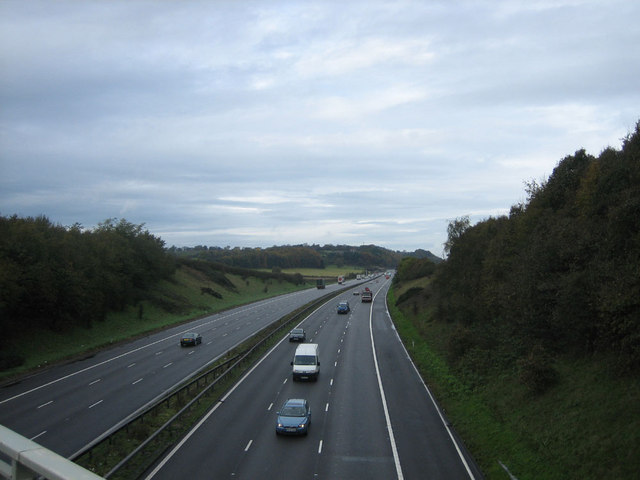
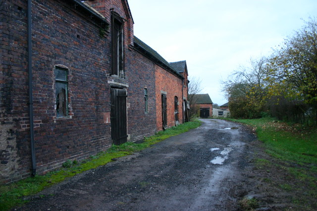
Cumberstone Wood Images

Images are sourced within 2km of 52.932824/-2.2007427 or Grid Reference SJ8637. Thanks to Geograph Open Source API. All images are credited.

St Luke's Church St Luke's church Tittensor.
St Luke's Church
St Luke's church Tittensor.
Water Tower, Swynnerton The north edge of the tower is bang on the grid line. The tower is now a dwelling but there is a reservoir adjoining it and it was associated with the italianate Hatton Pumping Station.
Water Tower, Swynnerton
The north edge of the tower is bang on the grid line. The tower is now a dwelling but there is a reservoir adjoining it and it was associated with the italianate Hatton Pumping Station.
Lakeside Tavern Lakeside Tavern on the road between Meaford and Barlaston adjacent to Barlaston Golf Course
Lakeside Tavern
Lakeside Tavern on the road between Meaford and Barlaston adjacent to Barlaston Golf Course
M6 Motorway Looking north along the M6 from the bridge on the A51, Stone to Nantwich road
M6 Motorway
Looking north along the M6 from the bridge on the A51, Stone to Nantwich road
Derelict Farm Buildings This is Blakelow Farm. These farm buildings appear to be derelict although I heard work in progress at the location.
Derelict Farm Buildings
This is Blakelow Farm. These farm buildings appear to be derelict although I heard work in progress at the location.
Saxon Lowe This is a view of Saxon Lowe on Tittensor Chase, from a public footpath.  Unfortunately this is on private land so a closer, circumnavigation of the hill is unable to be made... yet.
Saxon Lowe
This is a view of Saxon Lowe on Tittensor Chase, from a public footpath. Unfortunately this is on private land so a closer, circumnavigation of the hill is unable to be made... yet.
Track to Tittensor This track runs from Bury Bank on the A51 near to Stone and goes to Tittensor.
Track to Tittensor
This track runs from Bury Bank on the A51 near to Stone and goes to Tittensor.
An Off-Road Route to Bury Bank This path runs from Tittensor Chase to Bury Bank.
An Off-Road Route to Bury Bank
This path runs from Tittensor Chase to Bury Bank.
Footpath Across Fields This view is taken at the edge of Tittensor Chase and looking towards Bury Bank on the A51 near to Stone. The A51 can just be made out in the distance to the mid-left of the photo.
Footpath Across Fields
This view is taken at the edge of Tittensor Chase and looking towards Bury Bank on the A51 near to Stone. The A51 can just be made out in the distance to the mid-left of the photo.
Tittensor Chase A view of Tittensor Chase at the very edge of the woodland. Beyond the trees you can make out the mound of Saxon's Low in a clearing, another photo is submitted.
Tittensor Chase
A view of Tittensor Chase at the very edge of the woodland. Beyond the trees you can make out the mound of Saxon's Low in a clearing, another photo is submitted.
A Worn Out Stile A stile that is need of some TLC on a path from Tittensor Chase to Bury Bank, on the A51 near Stone. The A51 can just be made out in the distance.
A Worn Out Stile
A stile that is need of some TLC on a path from Tittensor Chase to Bury Bank, on the A51 near Stone. The A51 can just be made out in the distance.
A Forest Track A forest track through Tittensor Chase
A Forest Track
A forest track through Tittensor Chase
Track by Woodland Newly planted trees are sheltered by more mature trees on Tittensor Chase with this track running through the middle of the woodland.
Track by Woodland
Newly planted trees are sheltered by more mature trees on Tittensor Chase with this track running through the middle of the woodland.
A Walk in the Woods This pleasant woodland walk is through Tittensor Chase and leads to the A51 near Stone.
A Walk in the Woods
This pleasant woodland walk is through Tittensor Chase and leads to the A51 near Stone.
Tittensor Chase This woodland walk leads to Chase Lane, Tittensor.
Tittensor Chase
This woodland walk leads to Chase Lane, Tittensor.
Open Parkland This is a view of Tittensor Chase parkland from the public footpath.
Open Parkland
This is a view of Tittensor Chase parkland from the public footpath.
A Footpath and Stile A footpath and stile at the edge of Tittensor Chase. Chase Lane, Tittensor is at the end of this path where the red car is.
A Footpath and Stile
A footpath and stile at the edge of Tittensor Chase. Chase Lane, Tittensor is at the end of this path where the red car is.
Chase Lane, Tittensor This is Chase Lane looking towards Tittensor.
Chase Lane, Tittensor
This is Chase Lane looking towards Tittensor.
Show me another place!

Cumberstone Wood is located at Grid Ref: SJ8637 (Lat: 52.932824, Lng: -2.2007427)

Administrative County: Staffordshire

District: Stafford

Police Authority: Staffordshire

What 3 Words

///bright.crab.puts. Near Barlaston, Staffordshire

Nearby Locations

Cumberstone Wood

Related Wikis

Tittensor

Tittensor village is located in Staffordshire, England, between Newcastle-under-Lyme and Stone. The population as taken at the 2011 census can be found...

Beechcliff

Beechcliff is a village in Staffordshire, England. For population details at the 2011 census see Swynnerton

Trentham Boat Club

Trentham Boat Club is a rowing club based on Trentham Lake next to the River Trent, at Trentham Gardens Estate, Stone Road, Trentham, Stoke-on-Trent, Staffordshire...

Swynnerton

Swynnerton is a village and civil parish in Staffordshire, England. It lies in the Borough of Stafford, and at the 2001 census had a population of 4,233...

Bury Bank

Bury Bank is an Iron Age hillfort in Staffordshire, England, about 1.5 miles (2.4 km) north-west of Stone and near the village of Meaford. It is a scheduled...

Trentham Estate

The Trentham Estate, in the village of Trentham, is a visitor attraction located on the southern fringe of the city of Stoke-on-Trent in Staffordshire...

Swynnerton Hall

Swynnerton Hall is an 18th-century country mansion house, the home of Lord Stafford, situated at Swynnerton near Stone, Staffordshire. It is a Grade I...

Meaford Power Station

Meaford Power Station was a coal-fired power station situated on the River Trent at Meaford near Stone in Staffordshire. == History == === Meaford A... ===

Nearby Amenities

Located within 500m of 52.932824,-2.2007427
Bus Stop
Fieldrise Road
Bus: yes
Naptan AtcoCode: 3800C704300
Naptan Bearing: SW
Naptan CommonName: Fieldrise Road
Naptan Indicator: Opp
Naptan Landmark: Fieldrise Rd
Naptan Street: Winghouse Lane
Naptan Verified: no
Public Transport: platform
Source: naptan_import
Lat/Long: 52.9365792/-2.2003163
Barrier: stile
Lat/Long: 52.9298548/-2.1984885
Barrier: stile
Lat/Long: 52.930042/-2.1990055
Barrier: stile
Lat/Long: 52.9299887/-2.1988312
Barrier: stile
Lat/Long: 52.9325631/-2.2035314
Barrier: stile
Lat/Long: 52.932311/-2.2040696
Barrier: stile
Lat/Long: 52.9298089/-2.1983475
Power: pole
Lat/Long: 52.9370144/-2.1982526
Power: pole
Lat/Long: 52.9360441/-2.1986903
Power: pole
Lat/Long: 52.9350629/-2.1991469
Power: pole
Lat/Long: 52.9335867/-2.2006263
Power: pole
Lat/Long: 52.9342822/-2.1959581
Power: pole
Lat/Long: 52.9338726/-2.1953493
Power: pole
Lat/Long: 52.9332881/-2.1944893
Power: pole
Lat/Long: 52.9347728/-2.1967296
Cumberstone
Brand: National Grid
Brand Wikidata: Q1465461
Operator: National Grid Electricity Distribution
Operator Old: Western Power Distribution
Operator Wikidata: Q7988183
Owner: National Grid Electricity Distribution (West Midlands) Plc
Owner Wikidata: Q114397791
Power: pole
Ref: 86/0062
Transformer: distribution
Lat/Long: 52.9335738/-2.1934905
Power: pole
Lat/Long: 52.9317783/-2.2025007
Power: pole
Lat/Long: 52.9310372/-2.2027872
Power: pole
Lat/Long: 52.9300325/-2.2031539
Power: pole
Lat/Long: 52.9307178/-2.2014685
Power: pole
Lat/Long: 52.9303464/-2.1999465
The data included in this document is from www.openstreetmap.org. The data is made available under ODbL.

Have you been to Cumberstone Wood?

Leave your review of Cumberstone Wood below (or comments, questions and feedback).