Alkrington Wood

Wood, Forest in Lancashire

England

Alkrington Wood

Alkrington Hall
Alkrington Hall Credit: Peter McDermott

Alkrington Wood is a beautiful woodland area located in Lancashire, England. It covers an area of approximately 40 acres and is known for its diverse range of flora and fauna. The wood is situated near the town of Middleton and is easily accessible by both car and public transport.

The wood is predominantly made up of native deciduous trees such as oak, beech, and birch, creating a rich and vibrant canopy throughout the year. The forest floor is carpeted with a variety of wildflowers, including bluebells, wood anemones, and primroses, which bloom in spring and add a burst of color to the woodland.

Alkrington Wood is home to a wide range of wildlife, making it a popular spot for nature enthusiasts and birdwatchers. Visitors can expect to see a variety of bird species, including woodpeckers, tits, and finches, as well as small mammals such as squirrels and rabbits. The woodland also provides a habitat for numerous insects and butterflies, adding to its ecological significance.

There are well-maintained walking trails throughout the wood, allowing visitors to explore the area and enjoy its natural beauty. The paths wind through the trees, offering glimpses of the surrounding countryside and providing a peaceful and tranquil atmosphere.

Alkrington Wood is a cherished natural resource in Lancashire, providing a haven for wildlife and a recreational space for the local community. Its picturesque setting, diverse ecosystem, and accessibility make it a must-visit destination for those seeking a connection with nature in the area.

If you have any feedback on the listing, please let us know in the comments section below.

Alkrington Wood Images

Images are sourced within 2km of 53.541909/-2.2095619 or Grid Reference SD8605. Thanks to Geograph Open Source API. All images are credited.

Alkrington Hall
Alkrington Hall
River Irk
River Irk
Edgar Wood The former Dusty Miller <a href="https://www.geograph.org.uk/photo/2666576">SD8605 : Dusty Miller</a> is now the Edgar Wood. A Craft Union pub.  It is named after the world acclaimed Middleton architect, Edgar Wood <span class="nowrap"><a title="http://middletonheritage.co.uk/arts-and-crafts-trail/" rel="nofollow ugc noopener" href="http://middletonheritage.co.uk/arts-and-crafts-trail/">Link</a><img style="margin-left:2px;" alt="External link" title="External link - shift click to open in new window" src="https://s1.geograph.org.uk/img/external.png" width="10" height="10"/></span>  

<a href="https://www.geograph.org.uk/photo/6992739">SD8605 : Sign of the Edgar Wood</a>.
Edgar Wood
The former Dusty Miller SD8605 : Dusty Miller is now the Edgar Wood. A Craft Union pub. It is named after the world acclaimed Middleton architect, Edgar Wood LinkExternal link SD8605 : Sign of the Edgar Wood.
Sign of the Edgar Wood Sign for the Edgar Wood <a href="https://www.geograph.org.uk/photo/6992736">SD8605 : Edgar Wood</a>.
Sign of the Edgar Wood
Sign for the Edgar Wood SD8605 : Edgar Wood.
Tesco Extra 
The filling station at the superstore which was built on the site of the former Middleton civic buildings. In the background is the now derelict Grade II listed <span class="nowrap"><a title="https://historicengland.org.uk/listing/the-list/list-entry/1356232" rel="nofollow ugc noopener" href="https://historicengland.org.uk/listing/the-list/list-entry/1356232">Link</a><img style="margin-left:2px;" alt="External link" title="External link - shift click to open in new window" src="https://s1.geograph.org.uk/img/external.png" width="10" height="10"/></span> Warwick Mill.
Tesco Extra
The filling station at the superstore which was built on the site of the former Middleton civic buildings. In the background is the now derelict Grade II listed LinkExternal link Warwick Mill.
Warwick Mill 
The  Grade II listed <span class="nowrap"><a title="https://historicengland.org.uk/listing/the-list/list-entry/1356232" rel="nofollow ugc noopener" href="https://historicengland.org.uk/listing/the-list/list-entry/1356232">Link</a><img style="margin-left:2px;" alt="External link" title="External link - shift click to open in new window" src="https://s1.geograph.org.uk/img/external.png" width="10" height="10"/></span> Warwick Mill is presently in somewhat derelict state.
Warwick Mill
The Grade II listed LinkExternal link Warwick Mill is presently in somewhat derelict state.
Warwick House 
The property dated 1990 appears to be the offices for a large number of companies with addresses divided between Conway House, Balmoral House and Windsor House.

Note: Photograph is for record purposes only. The photographer has no personal connection with any of the businesses depicted.
Warwick House
The property dated 1990 appears to be the offices for a large number of companies with addresses divided between Conway House, Balmoral House and Windsor House. Note: Photograph is for record purposes only. The photographer has no personal connection with any of the businesses depicted.
Middleton Arena 
Construction of the Middleton Arena was completed in December 2008 and the Arena officially opened for business on 4th January 2009.

It was built on Corporation Street (since renamed LCpl Joel Halliwell VC Way) on the site formerly occupied by the Hippodrome Nightclub (previously The Empire Cinema) and the old civic amenity site. To make way for construction the Hippodrome was levelled in August 2007.

Operated by yourtrust (formerly Link4Life) the arena comprises a gymnasium, swimming pools, sauna and steam rooms, sports hall & squash and a cafe. <span class="nowrap"><a title="https://www.yourtrustrochdale.co.uk/venues/middleton-arena/" rel="nofollow ugc noopener" href="https://www.yourtrustrochdale.co.uk/venues/middleton-arena/">Link</a><img style="margin-left:2px;" alt="External link" title="External link - shift click to open in new window" src="https://s1.geograph.org.uk/img/external.png" width="10" height="10"/></span>
Middleton Arena
Construction of the Middleton Arena was completed in December 2008 and the Arena officially opened for business on 4th January 2009. It was built on Corporation Street (since renamed LCpl Joel Halliwell VC Way) on the site formerly occupied by the Hippodrome Nightclub (previously The Empire Cinema) and the old civic amenity site. To make way for construction the Hippodrome was levelled in August 2007. Operated by yourtrust (formerly Link4Life) the arena comprises a gymnasium, swimming pools, sauna and steam rooms, sports hall & squash and a cafe. LinkExternal link
Middleton Arena Construction of the Middleton Arena was completed in December 2008 and the Arena officially opened for business on 4th January 2009.

It was built on Corporation Street (since renamed LCpl Joel Halliwell VC Way) on the site formerly occupied by the Hippodrome Nightclub (previously The Empire Cinema) and the old civic amenity site. To make way for construction, the Hippodrome was levelled in August 2007.

Operated by yourtrust (formerly Link4Life) the arena comprises a gymnasium, swimming pools, sauna and steam rooms, sports hall & squash and a cafe. <span class="nowrap"><a title="https://www.yourtrustrochdale.co.uk/venues/middleton-arena/" rel="nofollow ugc noopener" href="https://www.yourtrustrochdale.co.uk/venues/middleton-arena/">Link</a><img style="margin-left:2px;" alt="External link" title="External link - shift click to open in new window" src="https://s1.geograph.org.uk/img/external.png" width="10" height="10"/></span>
Middleton Arena
Construction of the Middleton Arena was completed in December 2008 and the Arena officially opened for business on 4th January 2009. It was built on Corporation Street (since renamed LCpl Joel Halliwell VC Way) on the site formerly occupied by the Hippodrome Nightclub (previously The Empire Cinema) and the old civic amenity site. To make way for construction, the Hippodrome was levelled in August 2007. Operated by yourtrust (formerly Link4Life) the arena comprises a gymnasium, swimming pools, sauna and steam rooms, sports hall & squash and a cafe. LinkExternal link
Middleton Market Place At the junction of the A664 Assheton Way and the B6189 Market Place.

#1 on the left is the Assheton Arms. Originally a J.W.Lees pub it now only operates as a B&B <a href="https://www.geograph.org.uk/photo/7026148">SD8706 : Sign of the Assheton Arms Hotel</a>.

#3 in the middle is the Grade II listed <span class="nowrap"><a title="https://historicengland.org.uk/listing/the-list/list-entry/1068505" rel="nofollow ugc noopener" href="https://historicengland.org.uk/listing/the-list/list-entry/1068505">Link</a><img style="margin-left:2px;" alt="External link" title="External link - shift click to open in new window" src="https://s1.geograph.org.uk/img/external.png" width="10" height="10"/></span> building  built in 1892 for the Manchester and Salford Bank. The local architect Edgar Wood was responsible for its design  comprising buff-coloured terracotta with a clay tile roof, 3 bays and 3 storeys. There is a panelled round-arched door between bays 2 and 3 with blocked archivolt and coat of arms above. Three 3-light mullion and transom basket-arched windows within segmental recesses on the ground floor. Secondary doors to extreme left and right. Similar 4-light windows on the first and second floor the latter within bold gabled dormers. All windows have leaded lights. The gabled dormers are only narrowly divided by the plane of the roof which continues down to a deep eaves projection. Elaborate rainwater heads with rosette motifs and downpipes with flamboyant brackets convey the rainwater to a trough at first floor sill level. The trough has bead-and-reel enrichment and channels water to an internal drain. Bold ridge chimney stacks. It became a Williams Deacon bank and subsequently the Royal Bank of Scotland. Having stood empty for many years plans to turn it into a nightclub were rejected. It has recently opened as the Lekki Lounge <span class="nowrap"><a title="https://www.lekkiloungemanchester.co.uk/" rel="nofollow ugc noopener" href="https://www.lekkiloungemanchester.co.uk/">Link</a><img style="margin-left:2px;" alt="External link" title="External link - shift click to open in new window" src="https://s1.geograph.org.uk/img/external.png" width="10" height="10"/></span> describing itself as having the best Afro Caribbean cuisine in Manchester.

#5 on the right has for many years been a branch of the Royal Bank of Scotland but that too has now closed.
Middleton Market Place
At the junction of the A664 Assheton Way and the B6189 Market Place. #1 on the left is the Assheton Arms. Originally a J.W.Lees pub it now only operates as a B&B SD8706 : Sign of the Assheton Arms Hotel. #3 in the middle is the Grade II listed LinkExternal link building built in 1892 for the Manchester and Salford Bank. The local architect Edgar Wood was responsible for its design comprising buff-coloured terracotta with a clay tile roof, 3 bays and 3 storeys. There is a panelled round-arched door between bays 2 and 3 with blocked archivolt and coat of arms above. Three 3-light mullion and transom basket-arched windows within segmental recesses on the ground floor. Secondary doors to extreme left and right. Similar 4-light windows on the first and second floor the latter within bold gabled dormers. All windows have leaded lights. The gabled dormers are only narrowly divided by the plane of the roof which continues down to a deep eaves projection. Elaborate rainwater heads with rosette motifs and downpipes with flamboyant brackets convey the rainwater to a trough at first floor sill level. The trough has bead-and-reel enrichment and channels water to an internal drain. Bold ridge chimney stacks. It became a Williams Deacon bank and subsequently the Royal Bank of Scotland. Having stood empty for many years plans to turn it into a nightclub were rejected. It has recently opened as the Lekki Lounge LinkExternal link describing itself as having the best Afro Caribbean cuisine in Manchester. #5 on the right has for many years been a branch of the Royal Bank of Scotland but that too has now closed.
Lekki Lounge #3 Market Place, Middleton is the Grade II listed <span class="nowrap"><a title="https://historicengland.org.uk/listing/the-list/list-entry/1068505" rel="nofollow ugc noopener" href="https://historicengland.org.uk/listing/the-list/list-entry/1068505">Link</a><img style="margin-left:2px;" alt="External link" title="External link - shift click to open in new window" src="https://s1.geograph.org.uk/img/external.png" width="10" height="10"/></span> building  built in 1892 for the Manchester and Salford Bank. The local architect Edgar Wood <a href="https://www.geograph.org.uk/photo/7026144">SD8706 : Edgar Wood (1860 - 1935)</a> was responsible for its design  comprising buff-coloured terracotta with a clay tile roof, 3 bays and 3 storeys. There is a panelled round-arched door between bays 2 and 3 with blocked archivolt and coat of arms above. Three 3-light mullion and transom basket-arched windows within segmental recesses on the ground floor. Secondary doors to extreme left and right. Similar 4-light windows on the first and second floor the latter within bold gabled dormers. All windows have leaded lights. The gabled dormers are only narrowly divided by the plane of the roof which continues down to a deep eaves projection. Elaborate rainwater heads with rosette motifs and downpipes with flamboyant brackets convey the rainwater to a trough at first floor sill level. The trough has bead-and-reel enrichment and channels water to an internal drain. Bold ridge chimney stacks. It became a Williams Deacon bank and subsequently the Royal Bank of Scotland. Having stood empty for many years plans to turn it into a nightclub were rejected. It has recently opened as the Lekki Lounge <span class="nowrap"><a title="https://www.lekkiloungemanchester.co.uk/" rel="nofollow ugc noopener" href="https://www.lekkiloungemanchester.co.uk/">Link</a><img style="margin-left:2px;" alt="External link" title="External link - shift click to open in new window" src="https://s1.geograph.org.uk/img/external.png" width="10" height="10"/></span> describing itself as having the best Afro Caribbean cuisine in Manchester.
Lekki Lounge
#3 Market Place, Middleton is the Grade II listed LinkExternal link building built in 1892 for the Manchester and Salford Bank. The local architect Edgar Wood SD8706 : Edgar Wood (1860 - 1935) was responsible for its design comprising buff-coloured terracotta with a clay tile roof, 3 bays and 3 storeys. There is a panelled round-arched door between bays 2 and 3 with blocked archivolt and coat of arms above. Three 3-light mullion and transom basket-arched windows within segmental recesses on the ground floor. Secondary doors to extreme left and right. Similar 4-light windows on the first and second floor the latter within bold gabled dormers. All windows have leaded lights. The gabled dormers are only narrowly divided by the plane of the roof which continues down to a deep eaves projection. Elaborate rainwater heads with rosette motifs and downpipes with flamboyant brackets convey the rainwater to a trough at first floor sill level. The trough has bead-and-reel enrichment and channels water to an internal drain. Bold ridge chimney stacks. It became a Williams Deacon bank and subsequently the Royal Bank of Scotland. Having stood empty for many years plans to turn it into a nightclub were rejected. It has recently opened as the Lekki Lounge LinkExternal link describing itself as having the best Afro Caribbean cuisine in Manchester.
Former Bricklayers Arms Former Gartside's pub now Domino's Pizza.
Former Bricklayers Arms
Former Gartside's pub now Domino's Pizza.
Edgar Wood (1860 - 1935) 
The plaque on what is now the Lekki Lounge <a href="https://www.geograph.org.uk/photo/7026044">SD8706 : Lekki Lounge</a> reads:

MIDDLETON CIVIC
ASSOCIATION

EDGAR
WOOD
ARCHITECT
(1860 - 1935)

MANCHESTER
AND SALFORD BANK
1892
GRADE II LISTED BUILDING

ROCHDALE METROPOLITAN
BOROUGH COUNCIL
Edgar Wood (1860 - 1935)
The plaque on what is now the Lekki Lounge SD8706 : Lekki Lounge reads: MIDDLETON CIVIC ASSOCIATION EDGAR WOOD ARCHITECT (1860 - 1935) MANCHESTER AND SALFORD BANK 1892 GRADE II LISTED BUILDING ROCHDALE METROPOLITAN BOROUGH COUNCIL
Sign of the Assheton Arms Hotel Sign for the Assheton Arms Hotel <a href="https://www.geograph.org.uk/photo/7026018">SD8706 : Middleton Market Place</a>.
Sign of the Assheton Arms Hotel
Sign for the Assheton Arms Hotel SD8706 : Middleton Market Place.
Sign of the New Inn Sign for the New Inn <a href="https://www.geograph.org.uk/photo/7026249">SD8706 : New Inn and D Igoe optometrist</a>.
Sign of the New Inn
New Inn and D Igoe optometrist Long Street, Middleton.

<a href="https://www.geograph.org.uk/photo/7026222">SD8706 : Sign of the New Inn</a>.
New Inn and D Igoe optometrist
Long Street, Middleton. SD8706 : Sign of the New Inn.
St Andrew's Church
St Andrew's Church
Middleton Church - St Michael
Show me another place!

Alkrington Wood is located at Grid Ref: SD8605 (Lat: 53.541909, Lng: -2.2095619)

Unitary Authority: Rochdale

Police Authority: Greater Manchester

What 3 Words

///probe.laptop.reap. Near Middleton, Manchester

Related Wikis

Our Lady's Roman Catholic High School, Manchester

Our Lady's Roman Catholic High School, also known as Our Lady's RC High School, is a coeducational Roman Catholic secondary school located in the Higher...

Middleton bus station

Middleton bus station is a bus station located in the town of Middleton in Greater Manchester. The bus station is found next to the Middleton Shopping...

Municipal Borough of Middleton

The Municipal Borough of Middleton was, from 1886 to 1974, a municipal borough in the administrative county of Lancashire, England, coterminous with the...

Rhodes, Greater Manchester

Rhodes is a suburb of the town of Middleton, in the Rochdale district of Greater Manchester, England. In 2018 it had an estimated population of 2917....

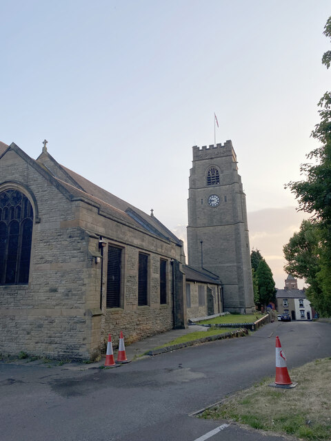
St Michael's Church, Middleton

St Michael's Church is in Townley Street, Middleton, Greater Manchester, England. It is an active Anglican parish church in the deanery of Heywood and...

Middleton railway station (England)

Middleton Railway station served the town of Middleton. The station opened on 5 January 1857 when the Lancashire and Yorkshire Railway (L&YR) opened a...

Alkrington

Alkrington Garden Village is a suburban area of Middleton, in the Metropolitan Borough of Rochdale, Greater Manchester, England.Historically a part of...

Langley, Greater Manchester

Langley is an suburb near Middleton, Greater Manchester, England, 4.4 miles (7.1 km) southwest of Rochdale and 5.5 miles (8.9 km) northeast of Manchester...

Related Videos

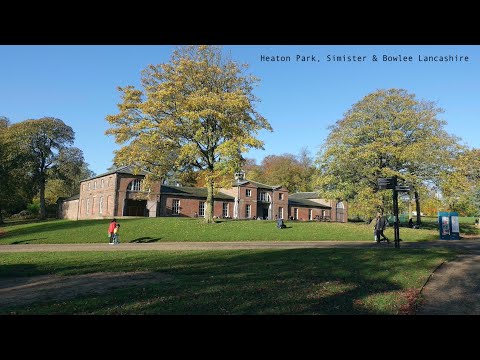
Heaton Park, Simister & Bowlee, Lancashire

Heaton Park in Prestwich, is in the North West of Manchester. The park is familiar for most people locally including ourselves.

Relaxing music. Walking in Park near Boggart hole clough in Manchester.

Created by InShot:https://inshotapp.com/share/youtube.html https://b1a1ey94xiqlts1ioo1litfudn.hop.clickbank.net/

Walking The Dog VLOG / SJCAM C300 #2 Boarshaw Clough With My English Springer Spaniel

sjcamc300 #flexigiant #walkingthedog Hi - Ive got a new action camera & i have to correct myself its a SJCAM C300 not a SJCAM ...

Nearby Amenities

Located within 500m of 53.541909,-2.2095619
Turning Circle
Lat/Long: 53.5411109/-2.2064821
Turning Circle
Lat/Long: 53.5392696/-2.2077008
Turning Circle
Lat/Long: 53.5401775/-2.2059413
Turning Circle
Lat/Long: 53.5388648/-2.2044009
Bus Stop
Rhodes, Manchester Old Road / near Kings Drive
Bus: yes
Naptan AtcoCode: 1800NE48441
Naptan Bearing: E
Naptan CommonName: Manchester Old Road/Kings Drive
Naptan Indicator: Golf Club
Naptan Landmark: HOUSE 364
Naptan NaptanCode: mangdtmg
Naptan PlusbusZoneRef: MNCRPIC
Naptan ShortCommonName: Kings Drive
Naptan Street: M/CR OLD ROAD
Naptan Verified: no
Network: TfGM
Operator: TfGM
Public Transport: platform
Source: naptan_import
Lat/Long: 53.5456229/-2.2117374
Bus Stop
Rhodes, Manchester Old Road / opposite Kings Drive
Bus: yes
Naptan AtcoCode: 1800NE48451
Naptan Bearing: W
Naptan CommonName: Manchester Old Road/Kings Drive
Naptan Indicator: Op Texaco
Naptan Landmark: HOUSE 352
Naptan NaptanCode: mangdtmj
Naptan PlusbusZoneRef: MNCRPIC
Naptan ShortCommonName: Kings Drive
Naptan Street: M/CR OLD ROAD
Naptan Verified: no
Network: TfGM
Operator: TfGM
Public Transport: platform
Source: naptan_import
Lat/Long: 53.5456339/-2.2105754
Source: Bing
Waterway: weir
Lat/Long: 53.5428627/-2.2144194
Source: Bing
Waterway: weir
Lat/Long: 53.5443749/-2.2073939
Source: Bing
Waterway: weir
Lat/Long: 53.5444126/-2.2065793
Source: Bing
Waterway: weir
Lat/Long: 53.5443972/-2.2069916
Power: tower
Source: Bing
Lat/Long: 53.5398113/-2.2151747
Power: tower
Source: Bing
Lat/Long: 53.5413689/-2.2156497
Garden of Remembrance
Historic: memorial
Lat/Long: 53.5461661/-2.2094434
Generator Method: photovoltaic
Generator Output Electricity: yes
Generator Source: solar
Generator Type: solar_photovoltaic_panel
Location: roof
Power: generator
Lat/Long: 53.5400573/-2.2058028
Generator Method: photovoltaic
Generator Output Electricity: yes
Generator Source: solar
Generator Type: solar_photovoltaic_panel
Location: roof
Power: generator
Lat/Long: 53.5405857/-2.2035458
The data included in this document is from www.openstreetmap.org. The data is made available under ODbL.

Have you been to Alkrington Wood?

Leave your review of Alkrington Wood below (or comments, questions and feedback).