Simon's Wood
Wood, Forest in Cheshire
England
Simon's Wood

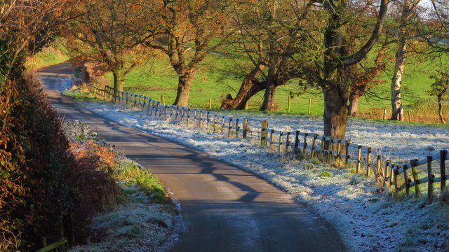
Simon's Wood is a picturesque woodland located in the county of Cheshire, England. Nestled in the village of Offerton, it covers an area of approximately 200 acres and is a popular destination for nature enthusiasts and walkers alike.
The woodland is predominantly made up of broadleaved trees such as oak, beech, and birch, creating a diverse and enchanting landscape. The trees provide a habitat for a variety of wildlife, including birds, mammals, and insects, making it a haven for nature lovers.
There are several well-maintained walking trails throughout the wood, offering visitors the opportunity to explore its beauty at their own pace. These trails vary in difficulty, catering to both casual strollers and more experienced hikers. Along the way, walkers can discover hidden streams, peaceful picnic spots, and breathtaking views of the surrounding countryside.
Simon's Wood is also home to a rich history, with evidence of human settlement dating back to the Iron Age. Archaeological finds, such as pottery and tools, have been unearthed within the woodland, providing a glimpse into the lives of those who once called this area home.
Today, the wood is managed by a local conservation group, ensuring its preservation and protection for future generations to enjoy. Whether it's a leisurely stroll, a bird-watching expedition, or a peaceful escape into nature, Simon's Wood provides a tranquil retreat for all who visit.
If you have any feedback on the listing, please let us know in the comments section below.
Simon's Wood Images
Images are sourced within 2km of 53.236123/-2.216244 or Grid Reference SJ8571. Thanks to Geograph Open Source API. All images are credited.
Simon's Wood is located at Grid Ref: SJ8571 (Lat: 53.236123, Lng: -2.216244)
Unitary Authority: Cheshire East
Police Authority: Cheshire
What 3 Words
///kilts.squashes.skimmers. Near Siddington, Cheshire
Nearby Locations
Related Wikis
All Saints Church, Siddington
All Saints Church is in the village of Siddington, Cheshire, England. The church is recorded in the National Heritage List for England as a designated...
Siddington, Cheshire
Siddington is a civil parish in Cheshire, England. It consists of farms; a picnic site; Redesmere, a half-mile long lake; and the Capesthorne Estate. The...
Henbury Hall, Cheshire
Henbury Hall is a country house about 1 mile (1.6 km) southwest of the village of Henbury in Cheshire, England. The present house was built during the...
Holy Trinity Chapel, Capesthorne
Holy Trinity Chapel is a private chapel adjacent to Capesthorne Hall, near the village of Siddington, Cheshire, England. It is recorded in the National...
Capesthorne Hall
Capesthorne Hall is a country house near the village of Siddington, Cheshire, England. The house and its private chapel were built in the early 18th century...
Marton, Cheshire
Marton, Cheshire is a small village and civil parish in the unitary authority of Cheshire East and the ceremonial county of Cheshire, England on the A34...
St James' and St Paul's Church, Marton
The Church of St James and St Paul, south of the village of Marton, Cheshire, England, is recorded in the National Heritage List for England as a designated...
Warren, Cheshire
Warren is the traditional name for the largest settlement in the civil parish of Gawsworth in Cheshire, England. It is situated just to the north west...
Nearby Amenities
Located within 500m of 53.236123,-2.216244Have you been to Simon's Wood?
Leave your review of Simon's Wood below (or comments, questions and feedback).


