Bamford Wood

Wood, Forest in Lancashire

England

Bamford Wood

WWII Lancashire: Ghost Signs of the Home Front  (12) -
Emergency Rendezvous Point, Peel Street, at junction with  Bury Street, Heywood, Bury 

"ERP ---?"

Emergency Rendezvous Points (ERP) were designated places in the locality for the coordination of ARP and emergency services during civil emergencies, particularly for those services arriving from outside the area. The signs appear in a variety of designs, but most are diamond shapes framing the ERP locality number.

<a href="https://www.geograph.org.uk/photo/6945275">SD8410 : WWII Lancashire: Ghost Signs of the Home Front  (13)</a>
WWII Lancashire: Ghost Signs of the Home Front (12) Credit: Mike Searle

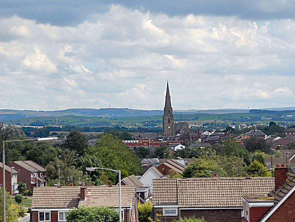
Bamford Wood is a picturesque woodland located in the county of Lancashire, England. Covering an area of approximately 50 hectares, this serene forest is a popular destination for nature enthusiasts and hikers alike. The wood is situated in the rural village of Bamford, nestled in the heart of the Lancashire countryside.

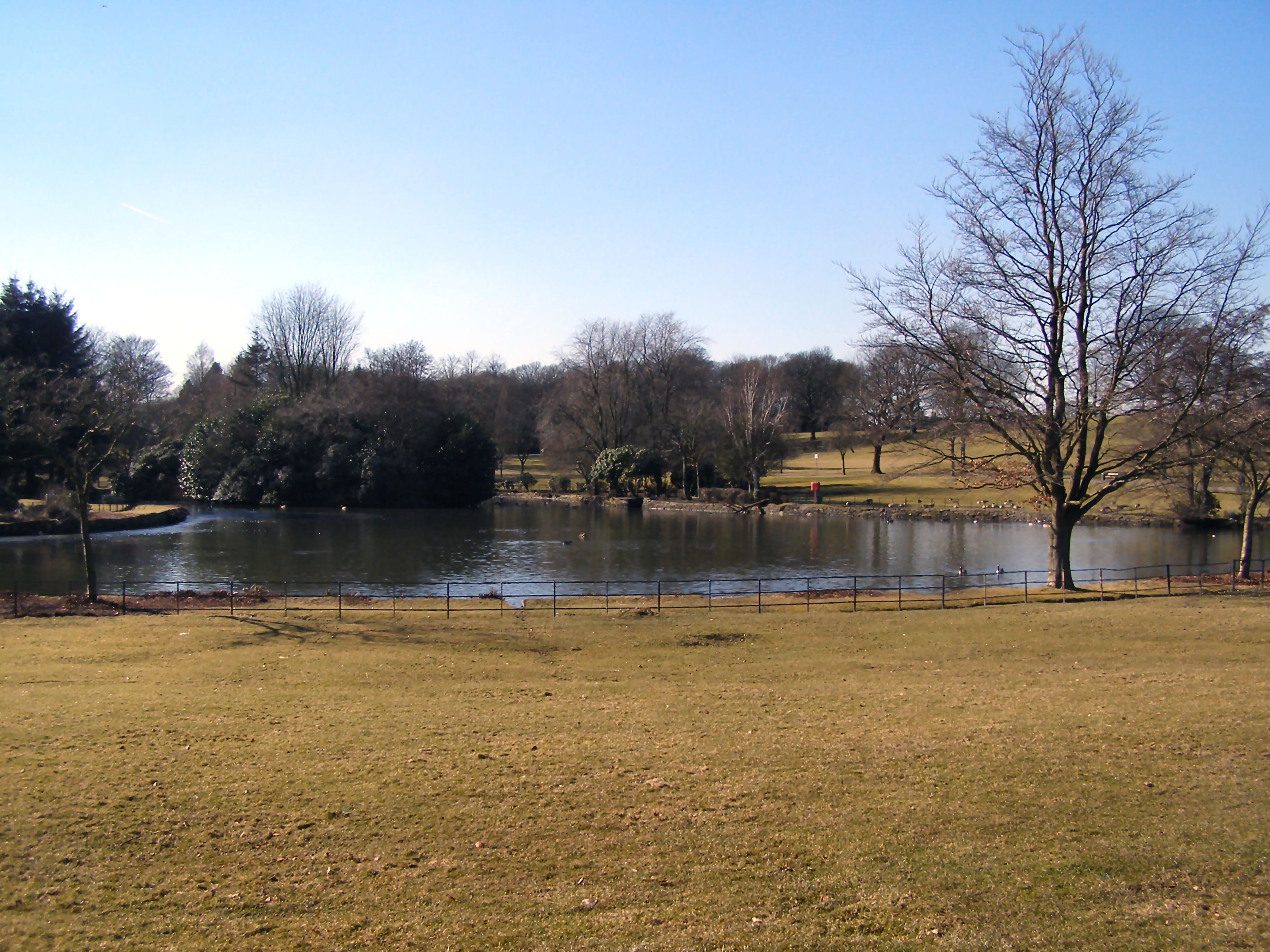
Bamford Wood is characterized by its diverse range of tree species, including oak, beech, birch, and conifers. The dense canopy created by these towering trees provides a haven for a variety of wildlife, making it an ideal spot for birdwatching and wildlife observation. Visitors may be fortunate enough to spot woodpeckers, owls, and various small mammals during their explorations.

The woodland is crisscrossed by a network of well-maintained footpaths and trails, allowing visitors to easily navigate the area and take in its natural beauty. These pathways wind through the forest, leading to hidden clearings and tranquil spots, perfect for picnicking or simply enjoying the peaceful ambiance.

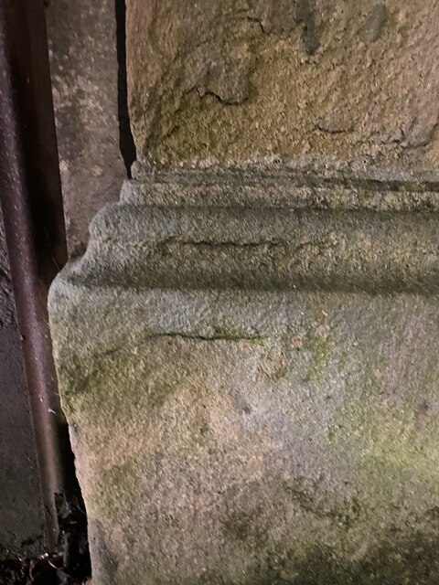
Bamford Wood is also home to a number of ancient archaeological sites, adding a historical element to its natural charm. The remains of a medieval settlement, including a moat and a small chapel, can still be seen within the wood, providing a glimpse into the area's rich past.

Overall, Bamford Wood is a captivating destination where visitors can immerse themselves in the beauty of nature, explore its trails, and discover the remnants of its fascinating history.

If you have any feedback on the listing, please let us know in the comments section below.

Bamford Wood Images

Images are sourced within 2km of 53.607394/-2.2217353 or Grid Reference SD8512. Thanks to Geograph Open Source API. All images are credited.

WWII Lancashire: Ghost Signs of the Home Front  (12) -
Emergency Rendezvous Point, Peel Street, at junction with  Bury Street, Heywood, Bury 

"ERP ---?"

Emergency Rendezvous Points (ERP) were designated places in the locality for the coordination of ARP and emergency services during civil emergencies, particularly for those services arriving from outside the area. The signs appear in a variety of designs, but most are diamond shapes framing the ERP locality number.

<a href="https://www.geograph.org.uk/photo/6945275">SD8410 : WWII Lancashire: Ghost Signs of the Home Front  (13)</a>
WWII Lancashire: Ghost Signs of the Home Front (12)
- Emergency Rendezvous Point, Peel Street, at junction with Bury Street, Heywood, Bury "ERP ---?" Emergency Rendezvous Points (ERP) were designated places in the locality for the coordination of ARP and emergency services during civil emergencies, particularly for those services arriving from outside the area. The signs appear in a variety of designs, but most are diamond shapes framing the ERP locality number. SD8410 : WWII Lancashire: Ghost Signs of the Home Front (13)
WWII Lancashire: Ghost Signs of the Home Front  (13) -
Emergency Rendezvous Point, Peel Street, at junction with  Bury Street, Heywood, Bury 

"ERP ---?"

Emergency Rendezvous Points (ERP) were designated places in the locality for the coordination of ARP and emergency services during civil emergencies, particularly for those services arriving from outside the area. The signs appear in a variety of designs, but most are diamond shapes framing the ERP locality number.

<a href="https://www.geograph.org.uk/photo/6945286">SD8609 : WWII Lancashire: Ghost Signs of the Home Front (14)</a>
WWII Lancashire: Ghost Signs of the Home Front (13)
- Emergency Rendezvous Point, Peel Street, at junction with Bury Street, Heywood, Bury "ERP ---?" Emergency Rendezvous Points (ERP) were designated places in the locality for the coordination of ARP and emergency services during civil emergencies, particularly for those services arriving from outside the area. The signs appear in a variety of designs, but most are diamond shapes framing the ERP locality number. SD8609 : WWII Lancashire: Ghost Signs of the Home Front (14)
Heywood Church Spire - St Lukes
OS Cut Mark: Heywood - Number 6 Hind Hill Street <span class="nowrap"><a title="https://www.bench-marks.org.uk/bm109138" rel="nofollow ugc noopener" href="https://www.bench-marks.org.uk/bm109138">Link</a><img style="margin-left:2px;" alt="External link" title="External link - shift click to open in new window" src="https://s1.geograph.org.uk/img/external.png" width="10" height="10"/></span>
OS Cut Mark: Heywood - Number 6 Hind Hill Street
Mutual Mills, Heywood – 1 The tower of Mill No.1
Mutual Mills, Heywood – 1
The tower of Mill No.1
Mutual Mills, Heywood – 2 Office block of 1900 at Mill No.1, looking down Buckley Street.
Mutual Mills, Heywood – 2
Office block of 1900 at Mill No.1, looking down Buckley Street.
Mutual Mills, Heywood – 3 Aspinall Street facade of Mill No.1 and tower of Mill No.2
Mutual Mills, Heywood – 3
Aspinall Street facade of Mill No.1 and tower of Mill No.2
Mutual Mills, Heywood – 4 Razor wire tangle along Buckley Street.
Mutual Mills, Heywood – 4
Razor wire tangle along Buckley Street.
Mutual Mills, Heywood – 5 View from the entrance off Aspinall Street; Mill No.2 near left, Mills Nos.3 and 4 in the distance.
Mutual Mills, Heywood – 5
View from the entrance off Aspinall Street; Mill No.2 near left, Mills Nos.3 and 4 in the distance.
Mutual Mills, Heywood – 6 Warehouse and connecting corridor between Mills 2 and 3.
Mutual Mills, Heywood – 6
Warehouse and connecting corridor between Mills 2 and 3.
Mutual Mills, Heywood – 7 View across the lodge to Mill No.3; corner of Mill No.2 on left, and Mill No.4 on the right.
Mutual Mills, Heywood – 7
View across the lodge to Mill No.3; corner of Mill No.2 on left, and Mill No.4 on the right.
Mutual Mills, Heywood – 8 The south side of Mill No.1 with its tower.
Mutual Mills, Heywood – 8
The south side of Mill No.1 with its tower.
Mutual Mills, Heywood – 9 Tower reflection, Mill No.3.
Mutual Mills, Heywood – 9
Tower reflection, Mill No.3.
Mutual Mills, Heywood – 10 Mills 1 (left) and 2 (centre left) and connecting link seen across the lodge.
Mutual Mills, Heywood – 10
Mills 1 (left) and 2 (centre left) and connecting link seen across the lodge.
Mutual Mills, Heywood – 11 Tower of Mill No.3 and connecting link seen across the lodge.
Mutual Mills, Heywood – 11
Tower of Mill No.3 and connecting link seen across the lodge.
Mutual Mills, Heywood – 12 The east face of Mill No.1 showing engine house and later carding shed, the latter in red engineering brick.
Mutual Mills, Heywood – 12
The east face of Mill No.1 showing engine house and later carding shed, the latter in red engineering brick.
Mutual Mills, Heywood – 13 View across the lodge to Mills 1 and 2.
Mutual Mills, Heywood – 13
View across the lodge to Mills 1 and 2.
Mutual Mills, Heywood – 14 Mill No.1 engine house with boiler house to the left.
Mutual Mills, Heywood – 14
Mill No.1 engine house with boiler house to the left.
Show me another place!

Bamford Wood is located at Grid Ref: SD8512 (Lat: 53.607394, Lng: -2.2217353)

Unitary Authority: Rochdale

Police Authority: Greater Manchester

What 3 Words

///pirate.damp.cracks. Near Heywood, Manchester

Related Wikis

Naden Brook

Naden Brook is a watercourse in northwest England. It rises in the hills above Norden, near the boundary of Lancashire and Greater Manchester. From here...

Tack Lee Brook

Tack Lee Brook is a watercourse in Greater Manchester and a tributary of the River Roch. Birtle Brook is one of its tributaries.

Millers Brook

Millers Brook is a watercourse in Greater Manchester and tributary of the River Roch. It originates in Heywood and flows through Queens Park to join the...

Wrigley Brook

Wrigley Brook is a culverted watercourse in Greater Manchester which flows through Heywood and is a tributary of the River Roch. Originating in the Hareshill...

Municipal Borough of Heywood

The Municipal Borough of Heywood was, from 1881 to 1974, a local government district in the administrative county of Lancashire, England, with borough...

Heywood, Greater Manchester

Heywood is a town in the Metropolitan Borough of Rochdale, Greater Manchester, England, in the historic county of Lancashire. It had a population of 28...

Springfield Park (Rochdale)

Springfield Park is a large public park located between Rochdale and Heywood in Greater Manchester. Completed in 1927 on the former site of a 13th-century...

Heap, Bury

Heap was a district of Bury, England until it was abolished in 1894 to become parts of the parishes of Heywood, Bury, Bircle and Unsworth.The district...

Nearby Amenities

Located within 500m of 53.607394,-2.2217353
Hooley Bridge
Is In: Heywood, Rochdale, Greater Manchester, England, UK
Place: suburb
Source: npe
Lat/Long: 53.6030715/-2.2228986
Bus Stop
Bury and Rochdale Old Road/Ashworth Road
Bus: yes
Naptan AtcoCode: 1800NE44241
Naptan Bearing: E
Naptan CommonName: Bury and Rochdale Old Road/Ashworth Road
Naptan Indicator: Nr Open Land
Naptan Landmark: NR OPEN LAND
Naptan NaptanCode: mangdpjm
Naptan PlusbusZoneRef: MNCRPIC
Naptan ShortCommonName: Ashworth Road
Naptan Street: Bury And Rochdale Old Road
Naptan Verified: no
Network: TfGM
Public Transport: platform
Source: naptan_import
Lat/Long: 53.6048866/-2.2253482
Bus Stop
Bury and Rochdale Old Road/Bamford Road
Bus: yes
Naptan AtcoCode: 1800NE44251
Naptan Bearing: W
Naptan CommonName: Bury and Rochdale Old Road/Bamford Road
Naptan Indicator: Nr House 164
Naptan Landmark: PARK
Naptan NaptanCode: mangdpjp
Naptan Notes: INDICATOR AMENDED
Naptan PlusbusZoneRef: MNCRPIC
Naptan ShortCommonName: Bamford Road
Naptan Street: Bury And Rochdale Old Road
Naptan Verified: no
Network: TfGM
Public Transport: platform
Source: naptan_import
Lat/Long: 53.6045122/-2.2236989
Bus Stop
Bury & Rochdale Old Rd/Bamford Rd
Bus: yes
Naptan AtcoCode: 1800NE44261
Naptan Bearing: E
Naptan CommonName: Bury & Rochdale Old Rd/Bamford Rd
Naptan Indicator: Nr Open Land
Naptan Landmark: NR OPEN LAND
Naptan NaptanCode: mangdpjt
Naptan PlusbusZoneRef: MNCRPIC
Naptan ShortCommonName: Bamford Rd
Naptan Street: Bury And Rochdale Old Road
Naptan Verified: no
Network: TfGM
Public Transport: platform
Source: naptan_import
Lat/Long: 53.6045848/-2.2233517
Bus Stop
Bury & Rochdale Old Rd/Queens Park Rd
Bus: yes
Naptan AtcoCode: 1800NE44271
Naptan Bearing: W
Naptan CommonName: Bury & Rochdale Old Rd/Queens Park Rd
Naptan Indicator: School
Naptan Landmark: SCHOOL
Naptan NaptanCode: mangdpjw
Naptan PlusbusZoneRef: MNCRPIC
Naptan ShortCommonName: Queens Park Rd
Naptan Street: Bury And Rochdale Old Road
Naptan Verified: no
Network: TfGM
Public Transport: platform
Source: naptan_import
Lat/Long: 53.6049273/-2.2179431
Bus Stop
Bury & Rochdale Old Rd/Queens Park Rd
Bus: yes
Naptan AtcoCode: 1800NE44281
Naptan Bearing: E
Naptan CommonName: Bury & Rochdale Old Rd/Queens Park Rd
Naptan Indicator: Church
Naptan Landmark: CHURCH
Naptan NaptanCode: mangdpma
Naptan PlusbusZoneRef: MNCRPIC
Naptan ShortCommonName: Queens Park Rd
Naptan Street: Bury And Rochdale Old Road
Naptan Verified: no
Network: TfGM
Public Transport: platform
Source: naptan_import
Lat/Long: 53.6050891/-2.2179288
Bus Stop
Bamford Road/Bury and Rochdale Old Road
Bus: yes
Naptan AtcoCode: 1800NE32221
Naptan Bearing: N
Naptan CommonName: Bamford Road/Bury and Rochdale Old Road
Naptan Indicator: Nr Open Land
Naptan Landmark: NR OPEN LAND
Naptan NaptanCode: mangdgaw
Naptan PlusbusZoneRef: MNCRPIC
Naptan ShortCommonName: Bury and Rochdale
Naptan Street: BAMFORD ROAD
Naptan Verified: no
Network: TfGM
Public Transport: platform
Source: naptan_import
Lat/Long: 53.6042706/-2.2231233
Bus Stop
Bamford Road/Bury and Rochdale Old Road
Bus: yes
Naptan AtcoCode: 1800NE32241
Naptan Bearing: S
Naptan CommonName: Bamford Road/Bury and Rochdale Old Road
Naptan Indicator: Opp House 203
Naptan Landmark: OPP HOUSE
Naptan NaptanCode: mangdgdg
Naptan Notes: INDICATOR AMENDED
Naptan PlusbusZoneRef: MNCRPIC
Naptan ShortCommonName: Bury and Rochdale
Naptan Street: BAMFORD ROAD
Naptan Verified: no
Network: TfGM
Public Transport: platform
Source: naptan_import
Lat/Long: 53.6042169/-2.2230173
Bamford Hall
Place: isolated_dwelling
Lat/Long: 53.6084366/-2.2196813
Generator Method: photovoltaic
Generator Output Electricity: yes
Generator Source: solar
Generator Type: solar_photovoltaic_panel
Location: roof
Power: generator
Lat/Long: 53.6032461/-2.2189334
Bench
Material: wood
Lat/Long: 53.6089456/-2.2251181
Crossing
Crossing: marked
Lat/Long: 53.6060124/-2.2152238
Crossing
Crossing: marked
Lat/Long: 53.6060745/-2.2149796
The data included in this document is from www.openstreetmap.org. The data is made available under ODbL.

Have you been to Bamford Wood?

Leave your review of Bamford Wood below (or comments, questions and feedback).