Knap Coppice
Wood, Forest in Dorset
England
Knap Coppice
Knap Coppice is a picturesque woodland located in the county of Dorset, England. Situated near the village of Bere Regis, the coppice covers an area of approximately 100 acres, making it a significant woodland in the region.
The forest is primarily composed of oak and ash trees, which dominate the landscape and create a dense canopy, providing a haven for a diverse range of flora and fauna. The woodland floor is adorned with a rich carpet of bluebells, wild garlic, and other wildflowers during the spring, adding to its natural beauty.
Knap Coppice is a popular destination for nature enthusiasts and walkers, who are drawn to its tranquil atmosphere and scenic trails. The woodland is crisscrossed with a network of footpaths, allowing visitors to explore its various nooks and crannies. These paths lead to hidden glades and small streams, providing opportunities for peaceful picnics or simply immersing oneself in nature.
The forest also serves as an important habitat for a variety of wildlife. It is home to several species of birds, including woodpeckers and tawny owls, which can often be heard or spotted among the trees. On occasion, visitors may also be lucky enough to catch a glimpse of deer or foxes that roam the woodland.
Overall, Knap Coppice offers a peaceful retreat from the hustle and bustle of everyday life. Its natural beauty and diverse ecosystem make it a cherished woodland in Dorset, attracting visitors who seek solace and a connection with nature.
If you have any feedback on the listing, please let us know in the comments section below.
Knap Coppice Images
Images are sourced within 2km of 50.665416/-2.2100782 or Grid Reference SY8585. Thanks to Geograph Open Source API. All images are credited.
![Wool Buildings [1] The Roman Catholic church of St Joseph, The Square, was built between 1969 and 1971. Constructed with a space-frame roof of aluminium and of exposed brickwork, a mineral render and vertical glazing. Listed, grade II*, with details at: <span class="nowrap"><a title="https://historicengland.org.uk/listing/the-list/list-entry/1416504" rel="nofollow ugc noopener" href="https://historicengland.org.uk/listing/the-list/list-entry/1416504">Link</a><img style="margin-left:2px;" alt="External link" title="External link - shift click to open in new window" src="https://s1.geograph.org.uk/img/external.png" width="10" height="10"/></span>
Wool is a large village in Dorset, midway between Dorchester and Poole, both about 10 miles distant. Set on the south bank of the River Frome, the village includes Bovington Camp army base to the north. The place-name &#039;Wool&#039; is first recorded in Anglo-Saxon Writs in the first years of the 11th century. The ruins of Bindon Abbey are nearby, demolished in 1539, the stone was used to build castles in Portland, Lulworth and Sandsfoot.](https://s3.geograph.org.uk/geophotos/07/25/80/7258063_3d71e82c.jpg)
![Wool features [1] Wool railway station is on the South Western main line. The station was opened in 1847 by the Southampton and Dorchester Railway. Here the 13:45 service to London, Waterloo is taking on passengers.
Wool is a large village in Dorset, midway between Dorchester and Poole, both about 10 miles distant. Set on the south bank of the River Frome, the village includes Bovington Camp army base to the north. The place-name &#039;Wool&#039; is first recorded in Anglo-Saxon Writs in the first years of the 11th century. The ruins of Bindon Abbey are nearby, demolished in 1539, the stone was used to build castles in Portland, Lulworth and Sandsfoot.](https://s0.geograph.org.uk/geophotos/07/25/80/7258064_de3d5884.jpg)
![Wool features [2] Wool railway station is on the South Western main line. The station was opened in 1847 by the Southampton and Dorchester Railway. Here the 13:45 service to London, Waterloo has just departed.
Wool is a large village in Dorset, midway between Dorchester and Poole, both about 10 miles distant. Set on the south bank of the River Frome, the village includes Bovington Camp army base to the north. The place-name &#039;Wool&#039; is first recorded in Anglo-Saxon Writs in the first years of the 11th century. The ruins of Bindon Abbey are nearby, demolished in 1539, the stone was used to build castles in Portland, Lulworth and Sandsfoot.](https://s1.geograph.org.uk/geophotos/07/25/80/7258065_7a71a763.jpg)
![Wool houses [1] Cowslip Cottage, Station Road, was probably built in the 18th century. Constructed of stuccoed rubble stone under a thatch roof. There is a later rear extension. At one time the cottage and the adjoining weatherboarded building operated as tearooms and later as a restaurant. Listed, grade II, with details at: <span class="nowrap"><a title="https://historicengland.org.uk/listing/the-list/list-entry/1120336" rel="nofollow ugc noopener" href="https://historicengland.org.uk/listing/the-list/list-entry/1120336">Link</a><img style="margin-left:2px;" alt="External link" title="External link - shift click to open in new window" src="https://s1.geograph.org.uk/img/external.png" width="10" height="10"/></span>
Wool is a large village in Dorset, midway between Dorchester and Poole, both about 10 miles distant. Set on the south bank of the River Frome, the village includes Bovington Camp army base to the north. The place-name &#039;Wool&#039; is first recorded in Anglo-Saxon Writs in the first years of the 11th century. The ruins of Bindon Abbey are nearby, demolished in 1539, the stone was used to build castles in Portland, Lulworth and Sandsfoot.](https://s3.geograph.org.uk/geophotos/07/25/80/7258067_4a8180ea.jpg)
![Wool Buildings [2] Wool Methodist church, Station Road, was built in 1893. Constructed of red brick with ashlar dressings under a slate roof.
Wool is a large village in Dorset, midway between Dorchester and Poole, both about 10 miles distant. Set on the south bank of the River Frome, the village includes Bovington Camp army base to the north. The place-name &#039;Wool&#039; is first recorded in Anglo-Saxon Writs in the first years of the 11th century. The ruins of Bindon Abbey are nearby, demolished in 1539, the stone was used to build castles in Portland, Lulworth and Sandsfoot.](https://s0.geograph.org.uk/geophotos/07/25/80/7258068_4922fff6.jpg)
![Wool features [4] The village pound in Bindon Lane. The square enclosure of brick was probably built in the 19th century. Listed, grade II, with details at: <span class="nowrap"><a title="https://historicengland.org.uk/listing/the-list/list-entry/1120398" rel="nofollow ugc noopener" href="https://historicengland.org.uk/listing/the-list/list-entry/1120398">Link</a><img style="margin-left:2px;" alt="External link" title="External link - shift click to open in new window" src="https://s1.geograph.org.uk/img/external.png" width="10" height="10"/></span>
Wool is a large village in Dorset, midway between Dorchester and Poole, both about 10 miles distant. Set on the south bank of the River Frome, the village includes Bovington Camp army base to the north. The place-name &#039;Wool&#039; is first recorded in Anglo-Saxon Writs in the first years of the 11th century. The ruins of Bindon Abbey are nearby, demolished in 1539, the stone was used to build castles in Portland, Lulworth and Sandsfoot.](https://s1.geograph.org.uk/geophotos/07/25/80/7258069_4400a5f0.jpg)
![Wool houses [2] Springfield Cottage, High Street, was originally two cottages. Possibly built in the late 17th century and altered in the late 18th century and in the 19th century. Constructed of plastered rubble stone under a thatch roof. A former stable attached to the house has is of similar construction. Listed, grade II, with details at: <span class="nowrap"><a title="https://historicengland.org.uk/listing/the-list/list-entry/1120370" rel="nofollow ugc noopener" href="https://historicengland.org.uk/listing/the-list/list-entry/1120370">Link</a><img style="margin-left:2px;" alt="External link" title="External link - shift click to open in new window" src="https://s1.geograph.org.uk/img/external.png" width="10" height="10"/></span>
Wool is a large village in Dorset, midway between Dorchester and Poole, both about 10 miles distant. Set on the south bank of the River Frome, the village includes Bovington Camp army base to the north. The place-name &#039;Wool&#039; is first recorded in Anglo-Saxon Writs in the first years of the 11th century. The ruins of Bindon Abbey are nearby, demolished in 1539, the stone was used to build castles in Portland, Lulworth and Sandsfoot.](https://s3.geograph.org.uk/geophotos/07/25/80/7258071_d9520149.jpg)
![Wool houses [3] Tumbledown Cottage, number 8 High Street, was probably built in the 18th century. Constructed of plastered rubble stone under a thatch roof. There is a large outbuilding at the rear. Listed, grade II, with details at: <span class="nowrap"><a title="https://historicengland.org.uk/listing/the-list/list-entry/1152923" rel="nofollow ugc noopener" href="https://historicengland.org.uk/listing/the-list/list-entry/1152923">Link</a><img style="margin-left:2px;" alt="External link" title="External link - shift click to open in new window" src="https://s1.geograph.org.uk/img/external.png" width="10" height="10"/></span>
Wool is a large village in Dorset, midway between Dorchester and Poole, both about 10 miles distant. Set on the south bank of the River Frome, the village includes Bovington Camp army base to the north. The place-name &#039;Wool&#039; is first recorded in Anglo-Saxon Writs in the first years of the 11th century. The ruins of Bindon Abbey are nearby, demolished in 1539, the stone was used to build castles in Portland, Lulworth and Sandsfoot.](https://s0.geograph.org.uk/geophotos/07/25/80/7258072_4e8c84e6.jpg)
![Wool houses [4] Jumpers Cottage, number 9 High Street, was formerly two cottages. Probably built in the 18th century. Constructed of plastered rubble stone under a thatch roof. The windows are all horizontally sliding sash windows. A former outbuilding at the rear is now incorporated into the cottage. Listed, grade II, with details at: <span class="nowrap"><a title="https://historicengland.org.uk/listing/the-list/list-entry/1120371" rel="nofollow ugc noopener" href="https://historicengland.org.uk/listing/the-list/list-entry/1120371">Link</a><img style="margin-left:2px;" alt="External link" title="External link - shift click to open in new window" src="https://s1.geograph.org.uk/img/external.png" width="10" height="10"/></span>
Wool is a large village in Dorset, midway between Dorchester and Poole, both about 10 miles distant. Set on the south bank of the River Frome, the village includes Bovington Camp army base to the north. The place-name &#039;Wool&#039; is first recorded in Anglo-Saxon Writs in the first years of the 11th century. The ruins of Bindon Abbey are nearby, demolished in 1539, the stone was used to build castles in Portland, Lulworth and Sandsfoot.](https://s1.geograph.org.uk/geophotos/07/25/80/7258073_04afad14.jpg)
![Wool houses [5] This pair of cottages, numbers 16 and 17 High Street, were built in the late 18th or early 19th century. Constructed of rubble stone with brick dressings under a tile roof. The windows are horizontally sliding sash. Listed, for group value, grade II, with details at: <span class="nowrap"><a title="https://historicengland.org.uk/listing/the-list/list-entry/1152925" rel="nofollow ugc noopener" href="https://historicengland.org.uk/listing/the-list/list-entry/1152925">Link</a><img style="margin-left:2px;" alt="External link" title="External link - shift click to open in new window" src="https://s1.geograph.org.uk/img/external.png" width="10" height="10"/></span>
Wool is a large village in Dorset, midway between Dorchester and Poole, both about 10 miles distant. Set on the south bank of the River Frome, the village includes Bovington Camp army base to the north. The place-name &#039;Wool&#039; is first recorded in Anglo-Saxon Writs in the first years of the 11th century. The ruins of Bindon Abbey are nearby, demolished in 1539, the stone was used to build castles in Portland, Lulworth and Sandsfoot.](https://s2.geograph.org.uk/geophotos/07/25/80/7258074_8a3c549a.jpg)
![Wool houses [6] Burvan House, number 24 High Street (nearer the camera) and April Cottage, number 23 High Street were originally one house and later a house and shop. Number 23 was built in the 18th century, number 24 was built, probably, in the early 19th century. Number 23 is constructed of painted brick, Number 24 of plastered rubble stone, both under a thatch roof. Listed, grade II, with details at: <span class="nowrap"><a title="https://historicengland.org.uk/listing/the-list/list-entry/1120372" rel="nofollow ugc noopener" href="https://historicengland.org.uk/listing/the-list/list-entry/1120372">Link</a><img style="margin-left:2px;" alt="External link" title="External link - shift click to open in new window" src="https://s1.geograph.org.uk/img/external.png" width="10" height="10"/></span>
Wool is a large village in Dorset, midway between Dorchester and Poole, both about 10 miles distant. Set on the south bank of the River Frome, the village includes Bovington Camp army base to the north. The place-name &#039;Wool&#039; is first recorded in Anglo-Saxon Writs in the first years of the 11th century. The ruins of Bindon Abbey are nearby, demolished in 1539, the stone was used to build castles in Portland, Lulworth and Sandsfoot.](https://s2.geograph.org.uk/geophotos/07/25/80/7258082_3df8bb43.jpg)
![Wool features [5] In High Street is this K6 telephone box, designed in 1935 by Sir Giles Gilbert Scott. Listed, grade II, with details at: <span class="nowrap"><a title="https://historicengland.org.uk/listing/the-list/list-entry/1454418" rel="nofollow ugc noopener" href="https://historicengland.org.uk/listing/the-list/list-entry/1454418">Link</a><img style="margin-left:2px;" alt="External link" title="External link - shift click to open in new window" src="https://s1.geograph.org.uk/img/external.png" width="10" height="10"/></span>
Wool is a large village in Dorset, midway between Dorchester and Poole, both about 10 miles distant. Set on the south bank of the River Frome, the village includes Bovington Camp army base to the north. The place-name &#039;Wool&#039; is first recorded in Anglo-Saxon Writs in the first years of the 11th century. The ruins of Bindon Abbey are nearby, demolished in 1539, the stone was used to build castles in Portland, Lulworth and Sandsfoot.](https://s2.geograph.org.uk/geophotos/07/25/80/7258086_5b91a884.jpg)
![Wool houses [7] Colliers Barn, High Street, has been converted into two houses. Probably originally built in the 18th century. Constructed partly of brick, partly of plastered rubble stone, all under a tile roof. Listed, grade II, with details at: <span class="nowrap"><a title="https://historicengland.org.uk/listing/the-list/list-entry/1152927" rel="nofollow ugc noopener" href="https://historicengland.org.uk/listing/the-list/list-entry/1152927">Link</a><img style="margin-left:2px;" alt="External link" title="External link - shift click to open in new window" src="https://s1.geograph.org.uk/img/external.png" width="10" height="10"/></span>
Wool is a large village in Dorset, midway between Dorchester and Poole, both about 10 miles distant. Set on the south bank of the River Frome, the village includes Bovington Camp army base to the north. The place-name &#039;Wool&#039; is first recorded in Anglo-Saxon Writs in the first years of the 11th century. The ruins of Bindon Abbey are nearby, demolished in 1539, the stone was used to build castles in Portland, Lulworth and Sandsfoot.](https://s0.geograph.org.uk/geophotos/07/25/80/7258092_f357b803.jpg)
![Wool houses [8] Part of a terrace, peppercorn Cottage, number 44 Spring Street, was probably built in the 18th century. Constructed of brick under a thatch roof. There is a modern rear wing. There are three horizontally sliding sash windows. Some original internal features remain. Listed, grade II, with details at: <span class="nowrap"><a title="https://historicengland.org.uk/listing/the-list/list-entry/1152946" rel="nofollow ugc noopener" href="https://historicengland.org.uk/listing/the-list/list-entry/1152946">Link</a><img style="margin-left:2px;" alt="External link" title="External link - shift click to open in new window" src="https://s1.geograph.org.uk/img/external.png" width="10" height="10"/></span>
Wool is a large village in Dorset, midway between Dorchester and Poole, both about 10 miles distant. Set on the south bank of the River Frome, the village includes Bovington Camp army base to the north. The place-name &#039;Wool&#039; is first recorded in Anglo-Saxon Writs in the first years of the 11th century. The ruins of Bindon Abbey are nearby, demolished in 1539, the stone was used to build castles in Portland, Lulworth and Sandsfoot.](https://s1.geograph.org.uk/geophotos/07/25/81/7258101_6a538cef.jpg)
![Wool houses [9] The Poplars, Spring Street, probably a former farmhouse, is dated 1823 but incorporating an earlier structure. Constructed of squared, coursed rubble stone with brick dressings under a tile roof. Listed, grade II, with details at: <span class="nowrap"><a title="https://historicengland.org.uk/listing/the-list/list-entry/1120374" rel="nofollow ugc noopener" href="https://historicengland.org.uk/listing/the-list/list-entry/1120374">Link</a><img style="margin-left:2px;" alt="External link" title="External link - shift click to open in new window" src="https://s1.geograph.org.uk/img/external.png" width="10" height="10"/></span>
Wool is a large village in Dorset, midway between Dorchester and Poole, both about 10 miles distant. Set on the south bank of the River Frome, the village includes Bovington Camp army base to the north. The place-name &#039;Wool&#039; is first recorded in Anglo-Saxon Writs in the first years of the 11th century. The ruins of Bindon Abbey are nearby, demolished in 1539, the stone was used to build castles in Portland, Lulworth and Sandsfoot.](https://s3.geograph.org.uk/geophotos/07/25/81/7258115_d119b7aa.jpg)
![Wool houses [10] Numbers 46A and 46B Spring Street are part of a terrace and were formerly one house. Probably built in the 18th century of roughcast rubble stone under a thatch roof. There is a common entrance and the windows are horizontally sliding sashes. Listed, grade II, with details at: <span class="nowrap"><a title="https://historicengland.org.uk/listing/the-list/list-entry/1323396" rel="nofollow ugc noopener" href="https://historicengland.org.uk/listing/the-list/list-entry/1323396">Link</a><img style="margin-left:2px;" alt="External link" title="External link - shift click to open in new window" src="https://s1.geograph.org.uk/img/external.png" width="10" height="10"/></span>
Wool is a large village in Dorset, midway between Dorchester and Poole, both about 10 miles distant. Set on the south bank of the River Frome, the village includes Bovington Camp army base to the north. The place-name &#039;Wool&#039; is first recorded in Anglo-Saxon Writs in the first years of the 11th century. The ruins of Bindon Abbey are nearby, demolished in 1539, the stone was used to build castles in Portland, Lulworth and Sandsfoot.](https://s1.geograph.org.uk/geophotos/07/25/81/7258121_c4b19406.jpg)
![Wool houses [11] This terraced cottage, The Old Bakehouse, number 47 Spring Street, was probably built in the 18th century. Constructed of rubble stone with brick dressings under a tile roof. The windows are horizontally sliding sash. The former bakery was a wing at the rear. Listed, grade II, with details at: <span class="nowrap"><a title="https://historicengland.org.uk/listing/the-list/list-entry/1304509" rel="nofollow ugc noopener" href="https://historicengland.org.uk/listing/the-list/list-entry/1304509">Link</a><img style="margin-left:2px;" alt="External link" title="External link - shift click to open in new window" src="https://s1.geograph.org.uk/img/external.png" width="10" height="10"/></span>
Wool is a large village in Dorset, midway between Dorchester and Poole, both about 10 miles distant. Set on the south bank of the River Frome, the village includes Bovington Camp army base to the north. The place-name &#039;Wool&#039; is first recorded in Anglo-Saxon Writs in the first years of the 11th century. The ruins of Bindon Abbey are nearby, demolished in 1539, the stone was used to build castles in Portland, Lulworth and Sandsfoot.](https://s2.geograph.org.uk/geophotos/07/25/81/7258178_f642cd34.jpg)
Knap Coppice is located at Grid Ref: SY8585 (Lat: 50.665416, Lng: -2.2100782)
Unitary Authority: Dorset
Police Authority: Dorset
What 3 Words
///wiping.ignore.amounting. Near Wool, Dorset
Nearby Locations
Related Wikis

Coombe Keynes
Coombe Keynes is a hamlet, civil parish and depopulated village in the Purbeck district of Dorset, England. The village is about 2 miles (3 km) south of...
Holy Rood Church, Coombe Keynes
Holy Rood Church is a former Church of England church in Coombe Keynes, Dorset, England. Most of the church dates to a rebuild of 1860–61, but the tower...
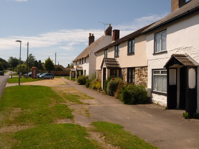
Wool, Dorset
Wool is a large village, civil parish and electoral ward in south Dorset, England. In the 2011 census the parish – which includes Bovington Camp army base...

Bindon Abbey
Bindon Abbey (Bindonium) was a Cistercian monastery, of which only ruins remain, on the River Frome about half a mile east of Wool in the Purbeck District...

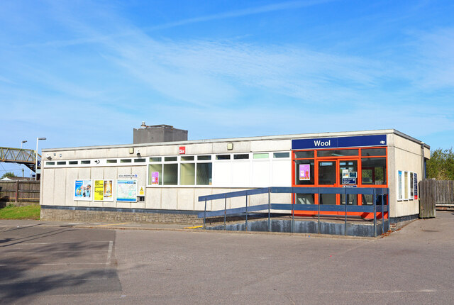
Wool railway station
Wool railway station serves the village of Wool in Dorset, England. It is on the South West Main Line, 125 miles 69 chains (202.6 km) down the line from...

Woolbridge Manor House
Woolbridge Manor is a 17th-century manor house just outside the village of Wool, in Dorset, England. English Heritage have designated it a Grade II* listed...

East Stoke, Dorset
East Stoke is a village in the English county of Dorset. It lies three miles west of the small town of Wareham and two miles east of Wool. In 2013 the...

East Lulworth
East Lulworth is a village and civil parish nine miles east of Dorchester, near Lulworth Cove, in the county of Dorset, South West England. It consists...
Nearby Amenities
Located within 500m of 50.665416,-2.2100782Have you been to Knap Coppice?
Leave your review of Knap Coppice below (or comments, questions and feedback).