Birch Wood
Wood, Forest in Dorset
England
Birch Wood
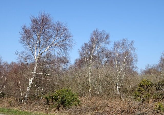
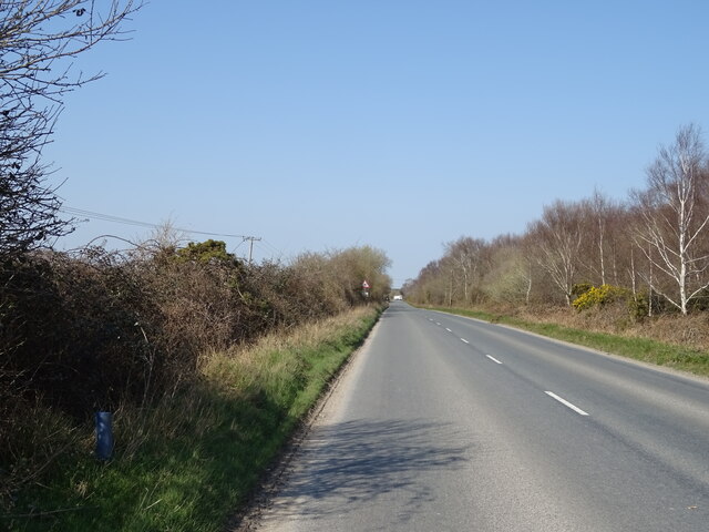
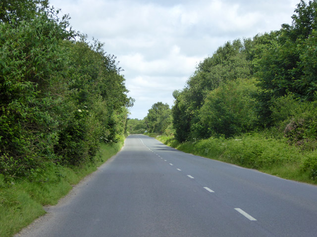
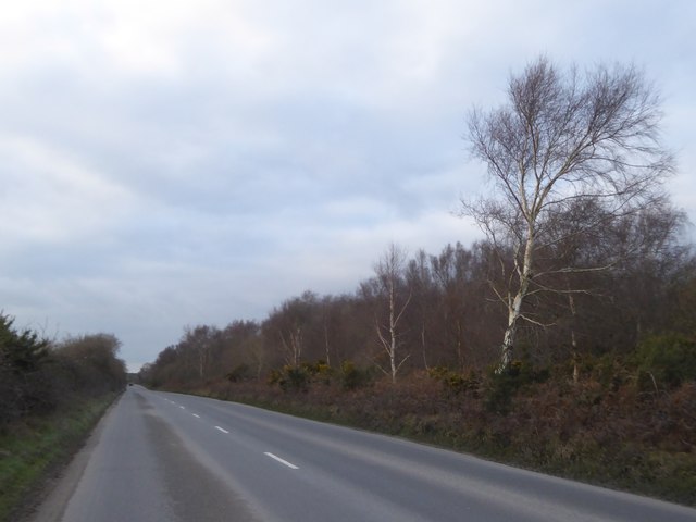
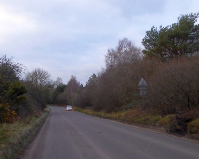
Birch Wood is a picturesque forest located in the county of Dorset, England. Spread over an area of approximately 100 hectares, this wood is known for its abundant birch trees, which lend it its name. Situated in the heart of the Dorset countryside, Birch Wood offers visitors a tranquil and serene environment, perfect for walking, hiking, or simply enjoying the beauty of nature.
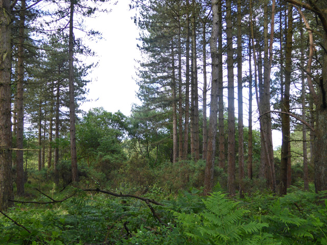
The wood is characterized by its dense canopy of birch trees, which provide shade and shelter to a variety of flora and fauna. The trees stand tall and slender, with their distinctive white bark adding a touch of elegance to the surroundings. In spring, the wood comes alive with a burst of vibrant colors as wildflowers bloom under the sunlight filtering through the canopy.
The forest floor is covered in a lush carpet of moss and ferns, creating a soft and inviting path for walkers. The air is filled with the sweet scent of wildflowers and the melodic chirping of birds, making it a haven for nature enthusiasts and birdwatchers alike. Visitors may catch a glimpse of various bird species, including woodpeckers, thrushes, and owls.
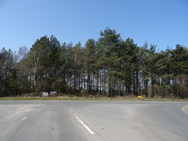
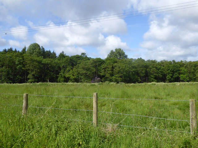
Birch Wood also boasts a diverse range of wildlife, with rabbits, squirrels, and deer often spotted roaming freely among the trees. The forest is well-maintained, with designated paths and trails for visitors to explore. Interpretative boards along the way provide information about the wood's history, flora, and fauna, making it an educational experience for all.
Located in a rural area, Birch Wood offers a peaceful escape from the hustle and bustle of daily life. Its natural beauty, abundant wildlife, and serene atmosphere make it a popular destination for nature lovers and those seeking a moment of tranquility in the heart of Dorset.
If you have any feedback on the listing, please let us know in the comments section below.
Birch Wood Images
Images are sourced within 2km of 50.700451/-2.2107588 or Grid Reference SY8589. Thanks to Geograph Open Source API. All images are credited.

![Woolbridge Manor [1] On the north bank of the River Frome, adjacent to Wool Bridge, stands Woolbridge Manor House and a cluster of farming outbuildings. The house was built in the 12th century and restored in the 17th century. One of the barns was a Saxon chapel, and later the manor was part of the monastery of Bindon Abbey. The house, some cottages and most of the outbuildings are listed.
The detached early 17th century manor house was a restoration of a 12th century building with a wing added circa 1660. The main front is of brick with stone quoins and details, the other walls are of rubble stone, all under a tile roof with lower courses of stone slates. The interior has been greatly altered, but two wall paintings survive. The house features in Thomas Hardy&#039;s book, &#039;Tess of the Durbervilles&#039;. Listed, grade II*, with details at: <span class="nowrap"><a title="https://historicengland.org.uk/listing/the-list/list-entry/1323300" rel="nofollow ugc noopener" href="https://historicengland.org.uk/listing/the-list/list-entry/1323300">Link</a><img style="margin-left:2px;" alt="External link" title="External link - shift click to open in new window" src="https://s1.geograph.org.uk/img/external.png" width="10" height="10"/></span>](https://s0.geograph.org.uk/geophotos/07/25/69/7256908_8db82229.jpg)
![Woolbridge Manor [2] On the north bank of the River Frome, adjacent to Wool Bridge, stands Woolbridge Manor House and a cluster of farming outbuildings. The house was built in the 12th century and restored in the 17th century. One of the barns was a Saxon chapel, and later the manor was part of the monastery of Bindon Abbey. The house, some cottages and most of the outbuildings are listed.
Chapel Barn contains some herringbone stone work, fragments of a Saxon chapel, and in common with many other chapels was built near a bridge to further the interests of an ancient monastery. Walls mainly of rubble stone, partly rebuilt in brick under a tiled roof with stone eaves courses. Listed, grade II, with details at: <span class="nowrap"><a title="https://historicengland.org.uk/listing/the-list/list-entry/1323301" rel="nofollow ugc noopener" href="https://historicengland.org.uk/listing/the-list/list-entry/1323301">Link</a><img style="margin-left:2px;" alt="External link" title="External link - shift click to open in new window" src="https://s1.geograph.org.uk/img/external.png" width="10" height="10"/></span>](https://s1.geograph.org.uk/geophotos/07/25/69/7256909_d8081e34.jpg)
![Woolbridge Manor [3] On the north bank of the River Frome, adjacent to Wool Bridge, stands Woolbridge Manor House and a cluster of farming outbuildings. The house was built in the 12th century and restored in the 17th century. One of the barns was a Saxon chapel, and later the manor was part of the monastery of Bindon Abbey. The house, some cottages and most of the outbuildings are listed.
This barn, with a projecting porch, was probably built in the 18th century. Constructed of brick on a stone plinth under a tile roof with stone eaves courses. Listed, grade II, with details at: <span class="nowrap"><a title="https://historicengland.org.uk/listing/the-list/list-entry/1120579" rel="nofollow ugc noopener" href="https://historicengland.org.uk/listing/the-list/list-entry/1120579">Link</a><img style="margin-left:2px;" alt="External link" title="External link - shift click to open in new window" src="https://s1.geograph.org.uk/img/external.png" width="10" height="10"/></span>](https://s2.geograph.org.uk/geophotos/07/25/69/7256910_869552b4.jpg)
![Woolbridge Manor [4] On the north bank of the River Frome, adjacent to Wool Bridge, stands Woolbridge Manor House and a cluster of farming outbuildings. The house was built in the 12th century and restored in the 17th century. One of the barns was a Saxon chapel, and later the manor was part of the monastery of Bindon Abbey. The house, some cottages and most of the outbuildings are listed.
This dovecote and the attached garden walls were probably built in the 18th century. Constructed of brick with a tile roof to the dovecote. Listed, for group value, grade II, with details at: <span class="nowrap"><a title="https://historicengland.org.uk/listing/the-list/list-entry/1171252" rel="nofollow ugc noopener" href="https://historicengland.org.uk/listing/the-list/list-entry/1171252">Link</a><img style="margin-left:2px;" alt="External link" title="External link - shift click to open in new window" src="https://s1.geograph.org.uk/img/external.png" width="10" height="10"/></span>](https://s3.geograph.org.uk/geophotos/07/25/69/7256911_78b9c159.jpg)
![Woolbridge Manor [5] On the north bank of the River Frome, adjacent to Wool Bridge, stands Woolbridge Manor House and a cluster of farming outbuildings. The house was built in the 12th century and restored in the 17th century. One of the barns was a Saxon chapel, and later the manor was part of the monastery of Bindon Abbey. The house, some cottages and most of the outbuildings are listed.
This detached stable range was probably built in the 18th century. Constructed of brick on a stone base under a tile roof with stone eaves courses. Listed, for group value, grade II, with details at: <span class="nowrap"><a title="https://historicengland.org.uk/listing/the-list/list-entry/1171262" rel="nofollow ugc noopener" href="https://historicengland.org.uk/listing/the-list/list-entry/1171262">Link</a><img style="margin-left:2px;" alt="External link" title="External link - shift click to open in new window" src="https://s1.geograph.org.uk/img/external.png" width="10" height="10"/></span>](https://s0.geograph.org.uk/geophotos/07/25/69/7256912_16897531.jpg)
![Wool Bridge [1] A bridge over the River Frome is recorded at this point in 1343, but the current Wool Bridge is probably 16th century. Repairs are documented in 1607, 1688, 1742 and 1806. An additional flood arch, was built in, probably, the late 19th century. During the Second World War, the bridge was widened and the parapets removed to allow tanks from nearby Bovingdon Camp to cross. The parapets were later rebuilt using the same stone. The bridge is now only passable to horse riders, cyclists and pedestrians. Listed, grade II*, with details at: <span class="nowrap"><a title="https://historicengland.org.uk/listing/the-list/list-entry/1171233" rel="nofollow ugc noopener" href="https://historicengland.org.uk/listing/the-list/list-entry/1171233">Link</a><img style="margin-left:2px;" alt="External link" title="External link - shift click to open in new window" src="https://s1.geograph.org.uk/img/external.png" width="10" height="10"/></span>](https://s2.geograph.org.uk/geophotos/07/25/69/7256914_3248aeb1.jpg)
![Wool Bridge [2] A bridge over the River Frome is recorded at this point in 1343, but the current Wool Bridge is probably 16th century. Repairs are documented in 1607, 1688, 1742 and 1806. An additional flood arch, was built in, probably, the late 19th century. During the Second World War, the bridge was widened and the parapets removed to allow tanks from nearby Bovingdon Camp to cross. The parapets were later rebuilt using the same stone. The bridge is now only passable to horse riders, cyclists and pedestrians. Listed, grade II*, with details at: <span class="nowrap"><a title="https://historicengland.org.uk/listing/the-list/list-entry/1171233" rel="nofollow ugc noopener" href="https://historicengland.org.uk/listing/the-list/list-entry/1171233">Link</a><img style="margin-left:2px;" alt="External link" title="External link - shift click to open in new window" src="https://s1.geograph.org.uk/img/external.png" width="10" height="10"/></span>](https://s3.geograph.org.uk/geophotos/07/25/69/7256915_21104063.jpg)
![Wool Bridge [3] A plaque on the bridge.
A bridge over the River Frome is recorded at this point in 1343, but the current Wool Bridge is probably 16th century. Repairs are documented in 1607, 1688, 1742 and 1806. An additional flood arch, was built in, probably, the late 19th century. During the Second World War, the bridge was widened and the parapets removed to allow tanks from nearby Bovingdon Camp to cross. The parapets were later rebuilt using the same stone. The bridge is now only passable to horse riders, cyclists and pedestrians. Listed, grade II*, with details at: <span class="nowrap"><a title="https://historicengland.org.uk/listing/the-list/list-entry/1171233" rel="nofollow ugc noopener" href="https://historicengland.org.uk/listing/the-list/list-entry/1171233">Link</a><img style="margin-left:2px;" alt="External link" title="External link - shift click to open in new window" src="https://s1.geograph.org.uk/img/external.png" width="10" height="10"/></span>](https://s0.geograph.org.uk/geophotos/07/25/69/7256916_97178f70.jpg)
![Wool Bridge [4] The River Frome, looking downstream from the bridge.
A bridge over the River Frome is recorded at this point in 1343, but the current Wool Bridge is probably 16th century. Repairs are documented in 1607, 1688, 1742 and 1806. An additional flood arch, was built in, probably, the late 19th century. During the Second World War, the bridge was widened and the parapets removed to allow tanks from nearby Bovingdon Camp to cross. The parapets were later rebuilt using the same stone. The bridge is now only passable to horse riders, cyclists and pedestrians. Listed, grade II*, with details at: <span class="nowrap"><a title="https://historicengland.org.uk/listing/the-list/list-entry/1171233" rel="nofollow ugc noopener" href="https://historicengland.org.uk/listing/the-list/list-entry/1171233">Link</a><img style="margin-left:2px;" alt="External link" title="External link - shift click to open in new window" src="https://s1.geograph.org.uk/img/external.png" width="10" height="10"/></span>](https://s1.geograph.org.uk/geophotos/07/25/69/7256917_60452eb9.jpg)
Birch Wood is located at Grid Ref: SY8589 (Lat: 50.700451, Lng: -2.2107588)
Unitary Authority: Dorset
Police Authority: Dorset
What 3 Words
///origin.deflated.mint. Near Bovington Camp, Dorset
Nearby Locations
Related Wikis

Monkey World
The Monkey World Ape Rescue Centre is a 65-acre (26.3 ha) ape and monkey sanctuary and rescue centre near Wool, Dorset, England. == History == Set up in...
Winfrith Hundred
Winfrith Hundred was a hundred in the county of Dorset, England, containing the following parishes: Coombe Keynes East Lulworth East Stoke Moreton (part...

Woolbridge Manor House
Woolbridge Manor is a 17th-century manor house just outside the village of Wool, in Dorset, England. English Heritage have designated it a Grade II* listed...

Bovington Camp
Bovington Camp () is a British Army military base in Dorset, England. Together with Lulworth Camp it forms part of Bovington Garrison. The garrison is...
Nearby Amenities
Located within 500m of 50.700451,-2.2107588Have you been to Birch Wood?
Leave your review of Birch Wood below (or comments, questions and feedback).