Bawden Plantation
Wood, Forest in Yorkshire Pendle
England
Bawden Plantation

Bawden Plantation is a picturesque woodland located in the county of Yorkshire, England. Nestled amidst the beautiful countryside, this forested area spans over 500 acres and is a haven for nature enthusiasts and outdoor adventurers alike.
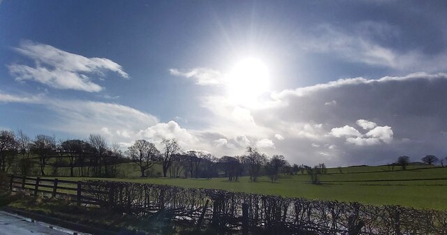
The plantation is predominantly made up of native broadleaf trees, such as oak, beech, and birch, which create a diverse and vibrant landscape throughout the year. These trees provide a rich habitat for a variety of wildlife, including deer, foxes, and numerous bird species, making it a popular spot for birdwatchers and wildlife photographers.
Visitors to Bawden Plantation can explore the numerous walking trails that wind their way through the forest, offering breathtaking views and a chance to immerse oneself in the tranquility of nature. The trails are well-marked and suit all levels of fitness, from leisurely strolls to more challenging hikes.
In addition to its natural beauty, Bawden Plantation also holds historical significance. It is believed that the area was once part of a medieval hunting ground and evidence of this can still be seen in the form of ancient boundary walls and earthworks dotted throughout the woodland.
The plantation is managed by the local forestry commission, ensuring its preservation and the sustainable management of its resources. Facilities at Bawden Plantation include car parking, picnic areas, and information boards providing educational insights into the flora, fauna, and history of the area.
Overall, Bawden Plantation offers a peaceful and enchanting escape where visitors can connect with nature, explore its rich history, and indulge in the beauty of the Yorkshire countryside.
If you have any feedback on the listing, please let us know in the comments section below.
Bawden Plantation Images
Images are sourced within 2km of 53.926502/-2.2276433 or Grid Reference SD8547. Thanks to Geograph Open Source API. All images are credited.
Bawden Plantation is located at Grid Ref: SD8547 (Lat: 53.926502, Lng: -2.2276433)
Division: West Riding
Administrative County: Lancashire
District: Pendle
Police Authority: Lancashire
What 3 Words
///ideas.hiker.attention. Near Barnoldswick, Lancashire
Nearby Locations
Related Wikis
Bracewell and Brogden
Bracewell and Brogden is a civil parish in the West Craven area of the Borough of Pendle in Lancashire, England. According to the 2001 census it had a...
St Michael's Church, Bracewell
St Michael's Church is in Bracewell Lane, Bracewell, Lancashire, England. It is an active Anglican parish church in the deanery of Skipton, the archdeaconry...
A59 road
The A59 is a major road in England which is around 109 miles (175 km) long and runs from Wallasey, Merseyside to York, North Yorkshire. The alignment formed...
Horton, Lancashire
Horton, historically known as Horton-in-Craven, is a village and a civil parish in the Ribble Valley district of the English county of Lancashire (historically...
Nearby Amenities
Located within 500m of 53.926502,-2.2276433Have you been to Bawden Plantation?
Leave your review of Bawden Plantation below (or comments, questions and feedback).


