Kempsey Grove

Wood, Forest in Worcestershire Malvern Hills

England

Kempsey Grove

B4424 passing through Callow End
B4424 passing through Callow End Credit: Rob Purvis

Kempsey Grove is a small village located in the county of Worcestershire, England. Situated near the town of Worcester, it is nestled within a wooded area known as the Kempsey Forest. This picturesque village is renowned for its natural beauty and tranquil atmosphere.

The village of Kempsey Grove is characterized by its idyllic setting, surrounded by lush greenery and a variety of trees, including oak, beech, and ash. The forest provides a haven for wildlife, and visitors can often spot deer, foxes, and numerous species of birds in the area. The peacefulness of the surroundings attracts nature enthusiasts and those seeking a respite from the busy city life.

The village itself consists of a cluster of charming cottages, many of which date back several centuries, showcasing traditional Worcestershire architecture. The community is close-knit and friendly, with a population of around 500 residents. Local amenities include a village hall, a primary school, and a quaint pub where locals gather to socialize.

Kempsey Grove offers a range of outdoor activities for residents and visitors alike. The forest provides ample opportunities for walking, hiking, and cycling along its well-maintained trails. There are also picnic spots and designated areas for camping, allowing visitors to fully immerse themselves in the natural surroundings.

Overall, Kempsey Grove is a hidden gem in Worcestershire, offering a peaceful retreat and a chance to connect with nature. Its picturesque forest, charming village, and friendly community make it a desirable place to visit or call home.

If you have any feedback on the listing, please let us know in the comments section below.

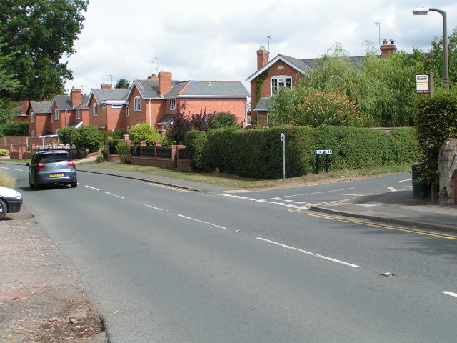
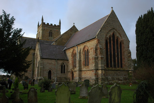
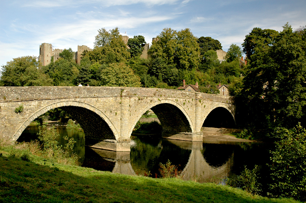
Kempsey Grove Images

Images are sourced within 2km of 52.153782/-2.219169 or Grid Reference SO8550. Thanks to Geograph Open Source API. All images are credited.

B4424 passing through Callow End
Kempsey church Kempsey church is dedicated to St Mary the Virgin, at the time of the picture work was taking place on the tower.
Kempsey church
Kempsey church is dedicated to St Mary the Virgin, at the time of the picture work was taking place on the tower.
Flood defence work, Kempsey Work has begun on creation of flood defences in Kempsey, here work is being carried out to the south of the church.
Flood defence work, Kempsey
Work has begun on creation of flood defences in Kempsey, here work is being carried out to the south of the church.
Ford in Kempsey Ford on Hatfield Brook in Kempsey.
Ford in Kempsey
Ford on Hatfield Brook in Kempsey.
Bridge over Hatfield Brook Bridge over Hatfield Brook beside a ford in Kempsey.
Bridge over Hatfield Brook
Bridge over Hatfield Brook beside a ford in Kempsey.
Kempsey Ford
Kempsey Ford
Kempsey Hatfield Brook Ford
Up on stilts - caravans on the floodplain
Flood defences at Kempsey One month ago on the 25 November, Kempsey made national headlines when this newly built flood defence and in particular this pumping station failed.  The flood bank effectively became a dam trapping the water of the swollen Hatfield Brook and resulting in the unexpected flooding of a number of homes in the village.  A month on and another flood, but fortunately this time it is working.  The tower of Kempsey church is to the right.
Flood defences at Kempsey
One month ago on the 25 November, Kempsey made national headlines when this newly built flood defence and in particular this pumping station failed. The flood bank effectively became a dam trapping the water of the swollen Hatfield Brook and resulting in the unexpected flooding of a number of homes in the village. A month on and another flood, but fortunately this time it is working. The tower of Kempsey church is to the right.
The Severn and the Malverns
Walking on the Severn Way, Upper Ham, Kempsey
Kempsey - St Mary's Church
Kempsey: Squire's Walk and water level gaugeboard On the right is a water level gaugeboard, which shows the depth of water at the ford across Hatfield Brook, which itself is just around the corner to the left. Some indication of the depth of water that was expected at the ford in historic times can be gleaned from the fact that the base of the gaugeboard is at 7 feet. Philip's <a href="https://www.geograph.org.uk/photo/2642421">SO8449 : Ford in Kempsey</a> taken round the corner shows the "lower half" of the gaugeboard. Hopefully, with the completion in September 2012 of Kempsey's flood protection embankment, that keeps floodwater from the River Severn out of the village, and pumps that take excess water from the brook into the river, there will be no more need for such a gauge. However the pumps failed to operate as planned in a flood event in November 2012, and some properties in the village were flooded again.
Kempsey: Squire's Walk and water level gaugeboard
On the right is a water level gaugeboard, which shows the depth of water at the ford across Hatfield Brook, which itself is just around the corner to the left. Some indication of the depth of water that was expected at the ford in historic times can be gleaned from the fact that the base of the gaugeboard is at 7 feet. Philip's SO8449 : Ford in Kempsey taken round the corner shows the "lower half" of the gaugeboard. Hopefully, with the completion in September 2012 of Kempsey's flood protection embankment, that keeps floodwater from the River Severn out of the village, and pumps that take excess water from the brook into the river, there will be no more need for such a gauge. However the pumps failed to operate as planned in a flood event in November 2012, and some properties in the village were flooded again.
Kempsey: River Severn floodplain These fields will get a periodic inundation of floodwater from the neraby River Severn.
Kempsey: River Severn floodplain
These fields will get a periodic inundation of floodwater from the neraby River Severn.
Kempsey: Flood protection bund After numerous flood events the village of Kempsey finally got its protection from the River Severn with the construction of this bund, completed in 2012. This is the south-eastern end of the bund showing how it merges into the naturally rising agricultural land beyond. The function of the large wooden posts on both the upstream and downstream sides is unknown. Perhaps they are boundary markers indicating the extents of the land taken out of the original field.
Kempsey: Flood protection bund
After numerous flood events the village of Kempsey finally got its protection from the River Severn with the construction of this bund, completed in 2012. This is the south-eastern end of the bund showing how it merges into the naturally rising agricultural land beyond. The function of the large wooden posts on both the upstream and downstream sides is unknown. Perhaps they are boundary markers indicating the extents of the land taken out of the original field.
Kempsey Ford This ford on the Hatfield Brook is found on Squire's Walk beside the church in Kempsey.
The ford can be seen in normal conditions at:
<a title="https://www.geograph.org.uk/photo/22068" href="https://www.geograph.org.uk/photo/22068">Link</a>
Kempsey Ford
This ford on the Hatfield Brook is found on Squire's Walk beside the church in Kempsey. The ford can be seen in normal conditions at: Link
Georgian House in Kempsey Georgian House in Kempsey on the corner of the junction of Church Street with the A38.
Georgian House in Kempsey
Georgian House in Kempsey on the corner of the junction of Church Street with the A38.
The Original Stores/Spar In recent months this store has been extended and refurbished.  The Original Stores on the left is now closed and a new Spar supermarket has been built on the back, to the right.
The Original Stores/Spar
In recent months this store has been extended and refurbished. The Original Stores on the left is now closed and a new Spar supermarket has been built on the back, to the right.
Show me another place!

Kempsey Grove is located at Grid Ref: SO8550 (Lat: 52.153782, Lng: -2.219169)

Administrative County: Worcestershire

District: Malvern Hills

Police Authority: West Mercia

What 3 Words

///harmony.jokes.geologist. Near Kempsey, Worcestershire

Nearby Locations

Kempsey Grove

Related Wikis

Kempsey, Worcestershire

Kempsey is a village and civil parish in the Malvern Hills District in the county of Worcestershire, England. It is bounded by the River Severn on the...

St Peter the Great, Worcester

St Peter's is a suburb in the civil parish of St. Peters, in the city of Worcester, in the county of Worcestershire, England. It lies south of the city...

Callow End

Callow End is a constituent village of the civil parish of Powick in the Malvern Hills District of Worcestershire, England. It is located on the B4424...

Powick

Powick is a village and civil parish in the Malvern Hills district of Worcestershire, England, located two miles south of the city of Worcester and four...
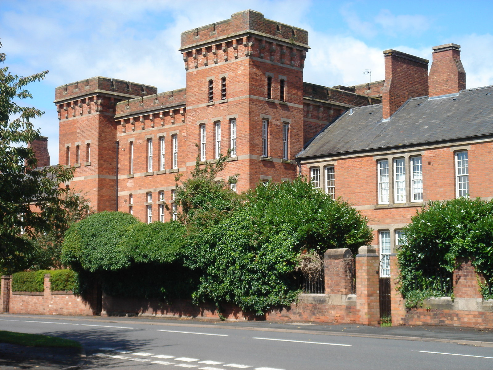
Norton Barracks

Norton Barracks is a military installation in Norton, Worcestershire. The keep is a Grade II listed building. == History == The barracks were built in...

River Teme

The River Teme (pronounced ; Welsh: Afon Tefeidiad) rises in Mid Wales, south of Newtown, and flows southeast roughly forming the border between England...

Norton, Worcestershire

Norton is a village in the Wychavon district of Worcestershire, 0.8 miles (1.3 km) from the boundary of the City of Worcester, England. The village sits...

Lower Wick, Worcester

Lower Wick is a suburb of Worcester situated to the south-west of the city. Lower Wick is located to the south of St. John's and to the west of the River...

Nearby Amenities

Located within 500m of 52.153782,-2.219169
Source: Landsat photo
Lat/Long: 52.1574523/-2.2202438
Source: Landsat photo
Lat/Long: 52.1563435/-2.2207746
Source: Landsat photo
Lat/Long: 52.1551653/-2.2213585
Source: Landsat photo
Lat/Long: 52.15414/-2.2219844
Source: Landsat photo
Lat/Long: 52.153398/-2.2224151
Source: Landsat photo
Lat/Long: 52.1524986/-2.2227554
Source: Landsat photo
Lat/Long: 52.1504927/-2.2236118
Bus Stop
Hatfield Turn
Bus: yes
Naptan AtcoCode: 2000G500668
Naptan Bearing: S
Naptan CommonName: Hatfield Turn
Naptan Indicator: adj
Naptan Landmark: Hatfield Turn
Naptan NaptanCode: wocdpgtp
Naptan PlusbusZoneRef: WORCSFS
Naptan Street: Worcester Road
Naptan Verified: no
Public Transport: platform
Source: naptan_import
Lat/Long: 52.1554634/-2.2154138
Bus Stop
Hatfield Turn
Bus: yes
Naptan AtcoCode: 2000G500669
Naptan Bearing: N
Naptan CommonName: Hatfield Turn
Naptan Indicator: Opp
Naptan Landmark: Hatfield Turn
Naptan NaptanCode: wocdpgtw
Naptan PlusbusZoneRef: WORCSFS
Naptan Street: Worcester Road
Naptan Verified: no
Public Transport: platform
Source: naptan_import
Lat/Long: 52.1560476/-2.2154897
Post Box
Collection Times: Mo-Fr 17:30; Sa 09:45
Post Box Type: lamp
Ref: WR5 144
Royal Cypher: EIIR
Royal Cypher Wikidata: Q33102113
Lat/Long: 52.1556065/-2.2153747
Barrier: stile
Foot: yes
Lat/Long: 52.1560425/-2.2187743
Barrier: stile
Foot: yes
Lat/Long: 52.1576635/-2.2185506
Barrier: kissing_gate
Foot: yes
Lat/Long: 52.1525329/-2.2252231
Power: pole
Switch: mechanical
Lat/Long: 52.1506913/-2.2153802
Power: pole
Lat/Long: 52.1539205/-2.2119292
Power: pole
Lat/Long: 52.154894/-2.2152397
Power: pole
Lat/Long: 52.1552168/-2.2132603
Open Barn
Location Transition: yes
Power: pole
Transformer: distribution
Voltage Primary: 11000
Lat/Long: 52.1502289/-2.2189556
Location Transition: yes
Power: pole
Lat/Long: 52.1505465/-2.2170036
Location Transition: yes
Power: pole
Lat/Long: 52.1544723/-2.2154403
Power: pole
Lat/Long: 52.1553589/-2.2150051
Broomhall
Power: pole
Transformer: distribution
Voltage Primary: 11000
Lat/Long: 52.1555946/-2.2148515
Marker: aerial
Operator: CLH
Operator Old: GPSS
Ref: CP 2288
Ref GPSS: 18231
Utility: oil
Lat/Long: 52.150595/-2.2184913
Marker: pedestal
Operator: CLH
Operator Old: GPSS
Ref: CP 2289
Utility: oil
Lat/Long: 52.1577437/-2.2178978
Marker: aerial
Operator: CLH
Operator Old: GPSS
Ref: MP 5517
Ref GPSS: 18079
Utility: oil
Lat/Long: 52.1577472/-2.2178982
Marker: aerial
Operator: CLH
Operator Old: GPSS
Ref: MP 5534
Utility: oil
Lat/Long: 52.1554814/-2.218619
The data included in this document is from www.openstreetmap.org. The data is made available under ODbL.

Have you been to Kempsey Grove?

Leave your review of Kempsey Grove below (or comments, questions and feedback).