Morgan's Wood

Wood, Forest in Dorset

England

Morgan's Wood

Approaching Winterborne Stickland from Jubilee Trail
Approaching Winterborne Stickland from Jubilee Trail Credit: Becky Williamson

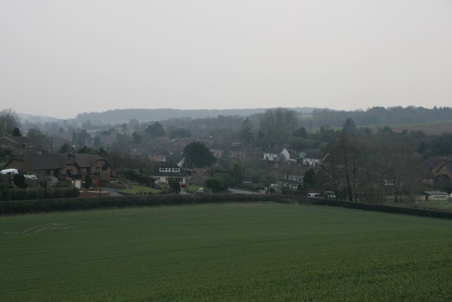
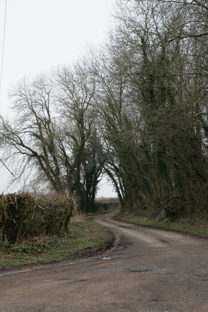
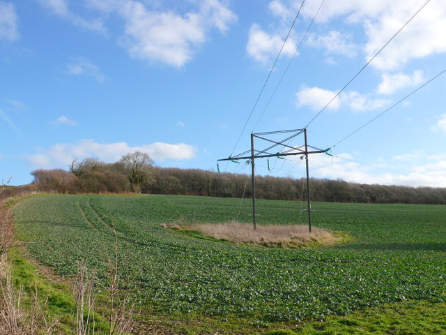
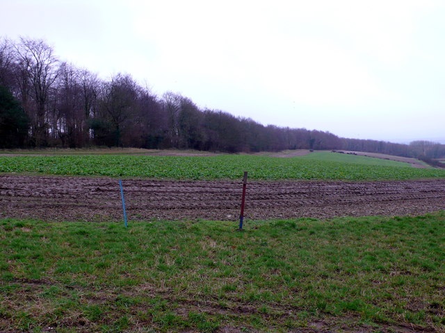
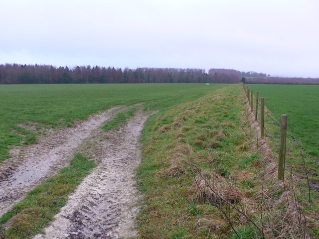
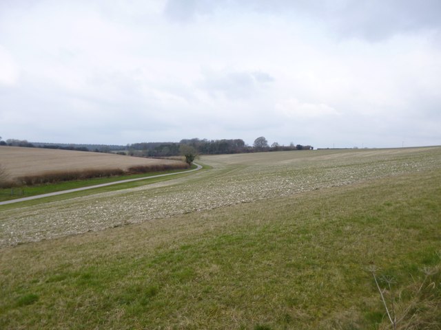
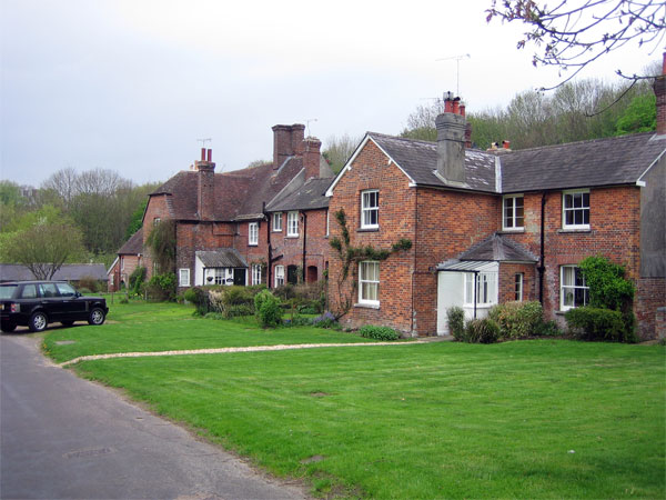
Morgan's Wood is a picturesque forest located in the county of Dorset, England. Covering an area of approximately 100 acres, this woodland is a haven for nature enthusiasts and outdoor adventurers alike.

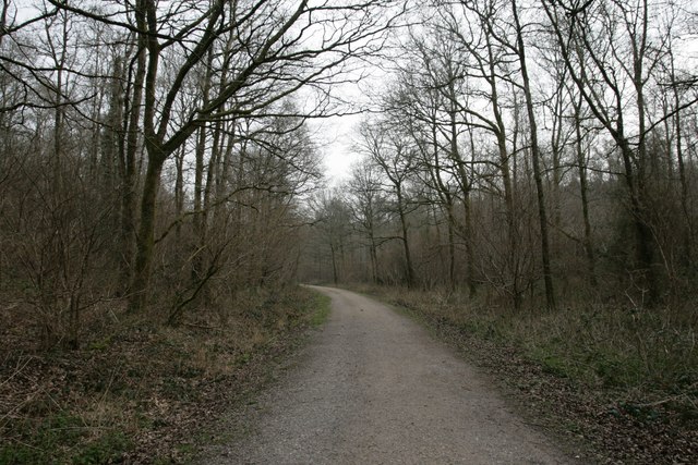
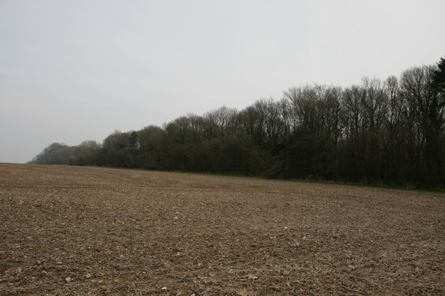
The wood is characterized by its diverse range of tree species, including oak, beech, and birch, which create a vibrant and lush canopy. The forest floor is carpeted with a variety of wildflowers and ferns, adding to the natural beauty of the area. The dense vegetation provides a habitat for a plethora of wildlife, making it a popular spot for birdwatching and animal spotting.

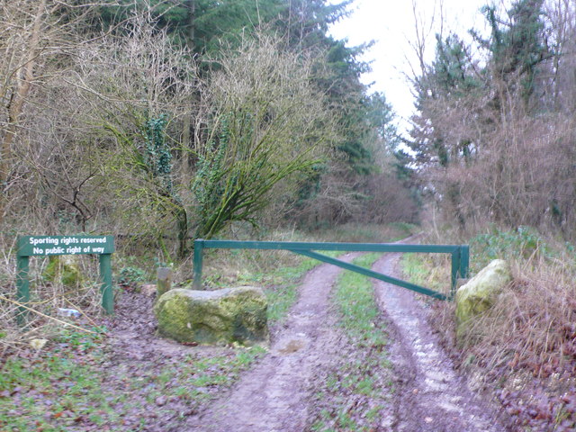
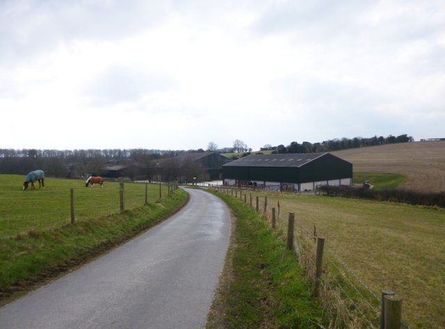
Trails and footpaths wind their way through the woodland, offering visitors the opportunity to explore and immerse themselves in the tranquil surroundings. These paths cater to all levels of fitness, making it accessible for families and individuals of all ages.

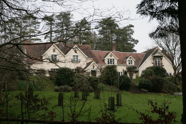
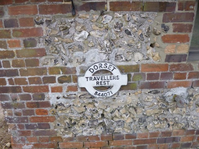
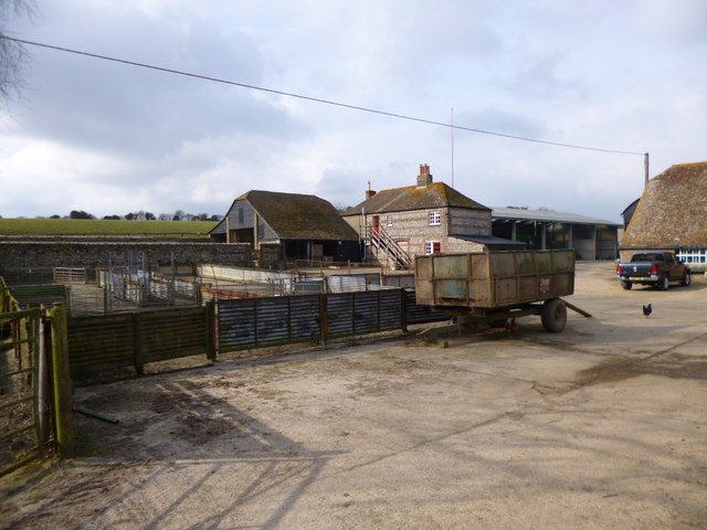
Morgan's Wood has a rich history, dating back several centuries. It was once part of a larger estate owned by the Morgan family, who were prominent landowners in the region. Today, remnants of the estate can still be seen, including an old stone wall and the ruins of a historic building.

The wood is managed by a local conservation group, who work tirelessly to preserve its natural beauty and protect the delicate ecosystem within. Regular maintenance and tree planting initiatives ensure the sustainability of the wood for future generations to enjoy.

Overall, Morgan's Wood offers a serene and enchanting escape from the hustle and bustle of everyday life. With its stunning scenery, abundant wildlife, and historical significance, it is a must-visit destination for anyone seeking a peaceful retreat in the heart of Dorset.

If you have any feedback on the listing, please let us know in the comments section below.

Morgan's Wood Images

Images are sourced within 2km of 50.858494/-2.2163871 or Grid Reference ST8406. Thanks to Geograph Open Source API. All images are credited.

Approaching Winterborne Stickland from Jubilee Trail
Jubilee Trail through Field Grove
Free Down Border
Free Down Border
Field Grove House
Field Grove House
New Road near Winterborne Stickland
Winterborne Stickland: downhill from Normandy Lodge Looking down the road which has come from Bryanston and Blandford, as it heads down into the village of Winterborne Stickland.

The finger-post has in recent years been fitted with a traditional style Dorset roundel giving location and grid reference. See <a href="https://www.geograph.org.uk/photo/5710890">ST8406 : Winterborne Stickland: detail of Normandy Lodge finger-post</a> for a close-up.
Winterborne Stickland: downhill from Normandy Lodge
Looking down the road which has come from Bryanston and Blandford, as it heads down into the village of Winterborne Stickland. The finger-post has in recent years been fitted with a traditional style Dorset roundel giving location and grid reference. See ST8406 : Winterborne Stickland: detail of Normandy Lodge finger-post for a close-up.
Winterborne Stickland: detail of Normandy Lodge finger-post A closer look at the traditional Dorset roundel on the signpost at this junction between Winterborne Stickland and Blandford. The six digits at the bottom are the grid reference.


See <a href="https://www.geograph.org.uk/photo/5710885">ST8406 : Winterborne Stickland: downhill from Normandy Lodge</a> for the wider view.
Winterborne Stickland: detail of Normandy Lodge finger-post
A closer look at the traditional Dorset roundel on the signpost at this junction between Winterborne Stickland and Blandford. The six digits at the bottom are the grid reference. See ST8406 : Winterborne Stickland: downhill from Normandy Lodge for the wider view.
Old Direction Sign - Signpost by Milton Lane, Traveller's Rest, Durweston parish Annulus finial - 2 arms; Dorset halo without NGR by the UC road, in parish of Durweston (North Dorset District), Traveller's Rest, on verge North of farm at Milton Lane junction with farm track, Norton Lane.

Surveyed

Milestone Society National ID: DO_ST8407A
Old Direction Sign - Signpost by Milton Lane, Traveller's Rest, Durweston parish
Annulus finial - 2 arms; Dorset halo without NGR by the UC road, in parish of Durweston (North Dorset District), Traveller's Rest, on verge North of farm at Milton Lane junction with farm track, Norton Lane. Surveyed Milestone Society National ID: DO_ST8407A
Old Direction Sign - Signpost by Traveller's Rest, Milton Lane, Durweston parish Finial only - no arms; Dorset halo with NGR by the UC road, in parish of Durweston (North Dorset District), Traveller's Rest, Milton Lane, attached to wall of long barn facing road.

Surveyed

Milestone Society National ID: DO_ST8407B
Old Direction Sign - Signpost by Traveller's Rest, Milton Lane, Durweston parish
Finial only - no arms; Dorset halo with NGR by the UC road, in parish of Durweston (North Dorset District), Traveller's Rest, Milton Lane, attached to wall of long barn facing road. Surveyed Milestone Society National ID: DO_ST8407B
Power Line at Hedge End These power lines are relatively small and carry power from Yeovil to Lytchett Matravers through the small villages of Dorset. The woods in the background is Field Grove mainly in ST8306.
Power Line at Hedge End
These power lines are relatively small and carry power from Yeovil to Lytchett Matravers through the small villages of Dorset. The woods in the background is Field Grove mainly in ST8306.
Field next to Suttcombe Wood. Most of the woods are hidden in the deep valley behind. The arable field are limited to the tops of the chalk downs away from the steep sided valleys. The wheat had recently sprouted in this very stony field.
Field next to Suttcombe Wood.
Most of the woods are hidden in the deep valley behind. The arable field are limited to the tops of the chalk downs away from the steep sided valleys. The wheat had recently sprouted in this very stony field.
Fields at Milton Lane View north across a recently sprouted field of wheat next to the minor road from Durweston to Winterbourne Stickland. The tops of the trees in Suttcombe Wood can just be seen on the horizon.
Fields at Milton Lane
View north across a recently sprouted field of wheat next to the minor road from Durweston to Winterbourne Stickland. The tops of the trees in Suttcombe Wood can just be seen on the horizon.
Fodder Field at Blackfern Plantation This field of growing rootcrops was being used to feed cattle just visible at the far end of the field. This crop appears to be stubble turnips which are grazed in situ. One narrow strip of the crop is exposed each day and the herd works its way across the field.
Fodder Field at Blackfern Plantation
This field of growing rootcrops was being used to feed cattle just visible at the far end of the field. This crop appears to be stubble turnips which are grazed in situ. One narrow strip of the crop is exposed each day and the herd works its way across the field.
Track into Broadley Wood Although this is a well used vehicle track into the woods there is a metal gate barring the way and a sign saying

Sporting rights reserved
No Public Right of Way
Track into Broadley Wood
Although this is a well used vehicle track into the woods there is a metal gate barring the way and a sign saying Sporting rights reserved No Public Right of Way
Pasture Land at Quarleston Down These large pasture fields are on New Road a country lane that runs from Bryanston to Winterborne Stickland. In the background are the trees of Old Warren Plantation part of which is in <a href="https://www.geograph.org.uk/gridref/ST8605">ST8605</a>.
Pasture Land at Quarleston Down
These large pasture fields are on New Road a country lane that runs from Bryanston to Winterborne Stickland. In the background are the trees of Old Warren Plantation part of which is in ST8605.
Durweston, farmyard At Traveller's Rest.
Durweston, farmyard
At Traveller's Rest.
Durweston, farmland With the road to Shepherd's Corner Farm to the left.
Durweston, farmland
With the road to Shepherd's Corner Farm to the left.
Durweston, Traveller's Rest Farm Seen From Milton Lane.
Durweston, Traveller's Rest Farm
Seen From Milton Lane.
Show me another place!

Morgan's Wood is located at Grid Ref: ST8406 (Lat: 50.858494, Lng: -2.2163871)

Unitary Authority: Dorset

Police Authority: Dorset

What 3 Words

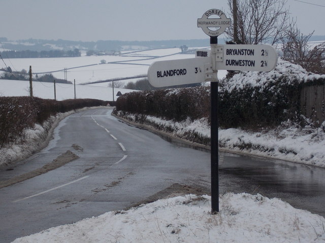
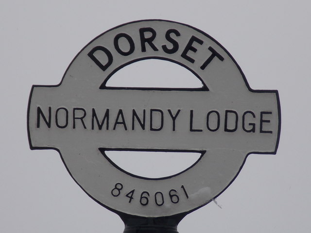
///donates.resources.heckler. Near Blandford Forum, Dorset

Related Wikis

Blandford Forest

Blandford Forest is a scattered area of woodland centred to the northwest of the town of Blandford Forum in North Dorset, England. == Location == According...

Durweston

Durweston ( dər-WES-tən) is a village and civil parish in the English county of Dorset. It lies two miles (three kilometres) northwest of the town of Blandford...

The Coade Hall

The Coade Hall is a brick-built theatre and concert hall at Bryanston School, near Blandford Forum in Dorset, England. == History == It was opened on...

Bryanston School

Bryanston School is a public school (English private boarding and day school for pupils aged 13–18) located next to the village of Bryanston, and near...
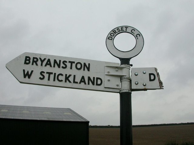
Bryanston

Bryanston is a village and civil parish in north Dorset, England, situated on the River Stour 1 mile (1.5 kilometres) west of Blandford Forum. In the...

Winterborne Stickland

Winterborne Stickland is a village and civil parish in the county of Dorset in southern England. It lies about four miles (six kilometres) west of the...

Stourpaine and Durweston railway station

Stourpaine & Durweston Halt was a railway station in the English county of Dorset. It was located between Shillingstone and Blandford Forum on the Somerset...

Turnworth

Turnworth is a small village and civil parish in north Dorset, England, situated on the Dorset Downs five miles (eight kilometres) west of Blandford Forum...

Nearby Amenities

Located within 500m of 50.858494,-2.2163871
Material: wood
Power: pole
Source: bing
Lat/Long: 50.8559313/-2.2109321
Material: wood
Power: pole
Source: bing
Lat/Long: 50.8560887/-2.212028
Material: wood
Power: pole
Source: bing
Transformer: distribution
Lat/Long: 50.8563797/-2.2117106
Material: wood
Power: pole
Source: bing
Lat/Long: 50.8566849/-2.2113593
Material: wood
Power: pole
Source: bing
Lat/Long: 50.8570145/-2.2110331
Material: wood
Power: pole
Source: bing
Lat/Long: 50.8568452/-2.2125114
Material: wood
Power: pole
Source: bing
Lat/Long: 50.8573777/-2.2106527
Material: wood
Power: pole
Source: bing
Lat/Long: 50.8573147/-2.213321
Material: wood
Power: pole
Source: bing
Lat/Long: 50.85779/-2.2141443
Material: wood
Power: pole
Source: bing
Lat/Long: 50.858423/-2.2145971
Post Box
Post Box Type: lamp
Ref: DT11 157
Ref GB Uprn: 10015333199
Royal Cypher: EIIR
Royal Cypher Wikidata: Q33102113
Lat/Long: 50.85567/-2.2124884
Material: wood
Power: pole
Source: bing
Lat/Long: 50.8625564/-2.2180876
Material: wood
Power: pole
Source: bing
Lat/Long: 50.8619977/-2.2175056
Material: wood
Power: pole
Source: bing
Lat/Long: 50.8614458/-2.216953
Material: wood
Power: pole
Source: bing
Lat/Long: 50.8603166/-2.2160009
Material: wood
Power: pole
Source: bing
Lat/Long: 50.8596935/-2.2155315
Material: wood
Power: pole
Source: bing
Lat/Long: 50.8590501/-2.2150594
Material: wood
Power: pole
Source: bing
Lat/Long: 50.8593261/-2.2152337
Material: wood
Power: pole
Source: bing
Lat/Long: 50.8552532/-2.2200845
Material: wood
Power: pole
Source: bing
Lat/Long: 50.8559026/-2.2193201
Material: wood
Power: pole
Source: bing
Lat/Long: 50.8565494/-2.218557
Material: wood
Power: pole
Source: bing
Lat/Long: 50.8572004/-2.2177818
Power: pole
Source: bing
Lat/Long: 50.8585591/-2.2161658
Power: pole
Source: bing
Lat/Long: 50.8578444/-2.2170097
Man Made: mast
Source: bing
Tower Type: communication
Lat/Long: 50.8617408/-2.2155838
Power: pole
Source: bing
Lat/Long: 50.8610056/-2.2164542
Power: pole
Source: bing
Lat/Long: 50.8557976/-2.2123691
The data included in this document is from www.openstreetmap.org. The data is made available under ODbL.

Have you been to Morgan's Wood?

Leave your review of Morgan's Wood below (or comments, questions and feedback).