Bradwell Wood

Wood, Forest in Staffordshire Newcastle-under-Lyme

England

Bradwell Wood

Longport Wharf the site of Stoke on Trent Boatbuilding Services
Longport Wharf Credit: Andrew Longton

Bradwell Wood is a picturesque woodland located in Staffordshire, England. Covering an area of approximately 136 hectares, it is a popular destination for nature enthusiasts and outdoor enthusiasts alike. The wood is situated near the village of Bradwell, providing easy access for visitors from nearby towns and cities.

This ancient woodland is known for its diverse range of flora and fauna, making it an ideal habitat for a variety of wildlife. The wood boasts a mixture of mature trees, including oak, birch, and beech, which create a dense canopy, providing shade and shelter for the woodland floor below. The undergrowth is abundant with wildflowers, ferns, and mosses, adding to the natural beauty of the area.

Bradwell Wood is crisscrossed by a network of well-maintained footpaths, allowing visitors to explore the wood at their own pace. The paths lead visitors through the heart of the woodland, offering opportunities to spot a range of wildlife, such as deer, foxes, and a variety of bird species. The wood is also home to several species of butterflies and insects, making it a haven for nature lovers and photographers.

In addition to its natural beauty, Bradwell Wood also has historical significance. The wood has evidence of human activity dating back to the Bronze Age, with the discovery of several burial mounds and ancient earthworks. These remnants provide insight into the wood's rich history and add an extra layer of intrigue to visitors exploring the area.

Overall, Bradwell Wood is a captivating woodland that offers a tranquil escape from the hustle and bustle of everyday life. Its natural beauty, diverse wildlife, and historical significance make it a must-visit destination for anyone seeking to connect with nature and explore the rich heritage of Staffordshire.

If you have any feedback on the listing, please let us know in the comments section below.

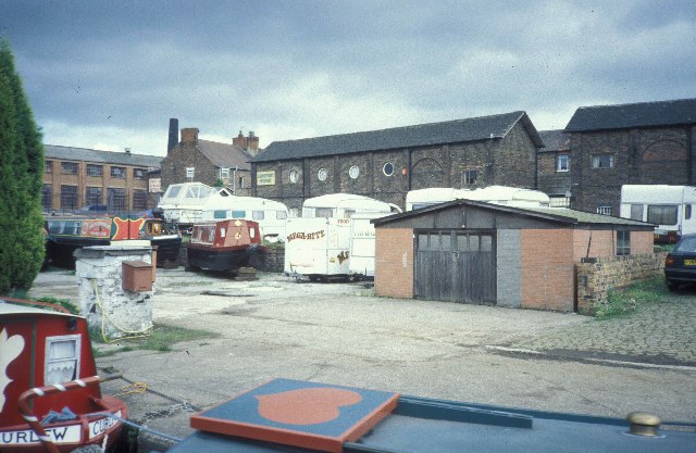
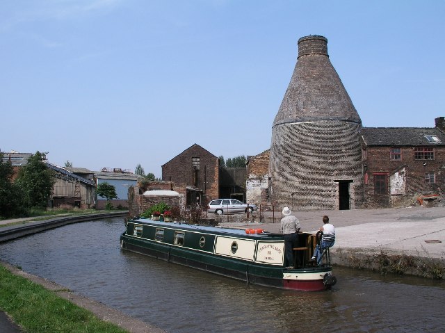
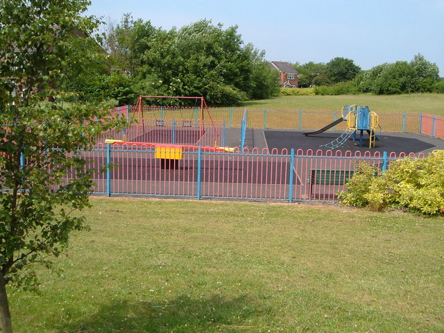
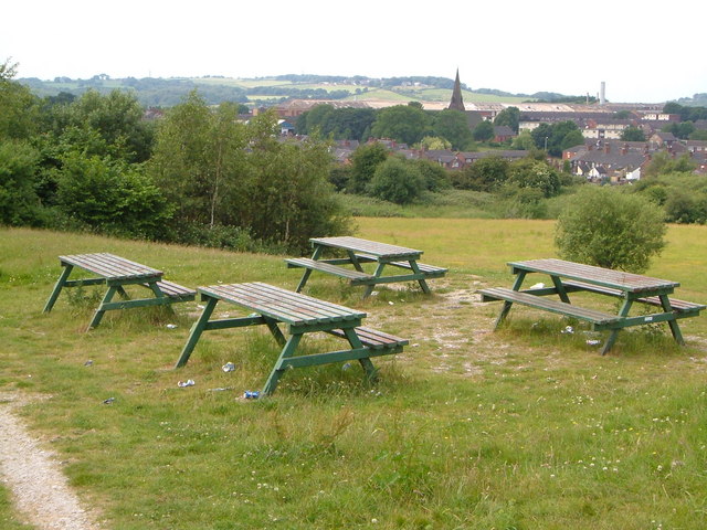
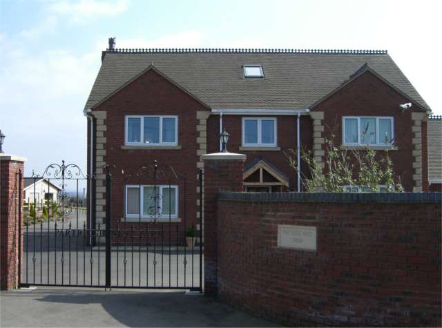
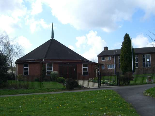
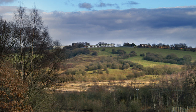
Bradwell Wood Images

Images are sourced within 2km of 53.050618/-2.2352733 or Grid Reference SJ8450. Thanks to Geograph Open Source API. All images are credited.

Longport Wharf the site of Stoke on Trent Boatbuilding Services
Longport Wharf
the site of Stoke on Trent Boatbuilding Services
Longport Bottle Oven Bottle Ovens were once a very common sight in The Potteries, but now very few remain. This one is by the Trent and Mersey Canal at Price & Kensington Factory, Newcastle Street, Longport - <a href="https://www.geograph.org.uk/gridref/SJ857496">SJ857496</a>.  It is a Grade II* listed building.
Longport Bottle Oven
Bottle Ovens were once a very common sight in The Potteries, but now very few remain. This one is by the Trent and Mersey Canal at Price & Kensington Factory, Newcastle Street, Longport - SJ857496. It is a Grade II* listed building.
Playground off Cheswardine Road, Bradwell On the edge of the Bradwell estate between Newcastle and Kidsgrove, by a footpath to Bradwell Wood.
Playground off Cheswardine Road, Bradwell
On the edge of the Bradwell estate between Newcastle and Kidsgrove, by a footpath to Bradwell Wood.
Picnic site near Chesterton Holy Trinity church in Chesterton is a landmark from this picnic site on open land between the Parkouse Industrial Estate and Beasley, north of Newcastle.
Picnic site near Chesterton
Holy Trinity church in Chesterton is a landmark from this picnic site on open land between the Parkouse Industrial Estate and Beasley, north of Newcastle.
Dalehall works, Burslem Was Steelite International when I visited although the earlier name was over the gateway. There was still a working stationary steam engine here then, although it's long been stopped now. The company majored in crockery for hotels and the NHS etc.
Dalehall works, Burslem
Was Steelite International when I visited although the earlier name was over the gateway. There was still a working stationary steam engine here then, although it's long been stopped now. The company majored in crockery for hotels and the NHS etc.
Partridge Nest Farm No longer a working farm, there are still stables for a few horses.
Partridge Nest Farm
No longer a working farm, there are still stables for a few horses.
St John the Evangelist, Broad Meadow A rather small Catholic Church of unusual shape with, to the right, the much larger Parish Hall.
St John the Evangelist, Broad Meadow
A rather small Catholic Church of unusual shape with, to the right, the much larger Parish Hall.
Something Nasty on the Towpath, Longport, Staffordshire North of bridge No. 127 on the Trent and Mersey Canal a substantial area of land around a former clubhouse has become infested with Japanese Knotweed. This is spreading very quickly, and was halfway across the towpath walkway in some places today. Total blockage could happen in another two weeks, if allowed. This needs to be dealt with.
Something Nasty on the Towpath, Longport, Staffordshire
North of bridge No. 127 on the Trent and Mersey Canal a substantial area of land around a former clubhouse has become infested with Japanese Knotweed. This is spreading very quickly, and was halfway across the towpath walkway in some places today. Total blockage could happen in another two weeks, if allowed. This needs to be dealt with.
Japanese Knotweed, Trent and Mersey Canal, Longport, Staffordshire Spreading rapidly across the towpath here, and there are many invasive clumps in various places along this canal. See DEFRA's comments here: <span class="nowrap"><a title="http://www.defra.gov.uk/wildlife-countryside/non-native/knotweed.htm" rel="nofollow ugc noopener" href="http://www.defra.gov.uk/wildlife-countryside/non-native/knotweed.htm">Link</a><img style="margin-left:2px;" alt="External link" title="External link - shift click to open in new window" src="https://s1.geograph.org.uk/img/external.png" width="10" height="10"/></span> .
Japanese Knotweed, Trent and Mersey Canal, Longport, Staffordshire
Spreading rapidly across the towpath here, and there are many invasive clumps in various places along this canal. See DEFRA's comments here: LinkExternal link .
Industry by the Trent and Mersey Canal, Longport, Staffordshire
Chesterton School From Apedale Country Park
Price and Kensington, Longport Also known as the National Teapot Works.
Price and Kensington, Longport
Also known as the National Teapot Works.
The Duke of Bridgewater, Longport Currently closed, this pub stands near the canal bridge.
The Duke of Bridgewater, Longport
Currently closed, this pub stands near the canal bridge.
Price & Kensington, The National Teapot Works A very photogenic pot bank although this is the first one to be posted from this angle.
Price & Kensington, The National Teapot Works
A very photogenic pot bank although this is the first one to be posted from this angle.
Steelite International Longport wharf is on the left but the rest of the building, on both sides of the canal, are part of Steelite International. This was formerly Dunn, Bennett & Co, Dalehall Works and there has obviously been significant recent investment in this large site.
Steelite International
Longport wharf is on the left but the rest of the building, on both sides of the canal, are part of Steelite International. This was formerly Dunn, Bennett & Co, Dalehall Works and there has obviously been significant recent investment in this large site.
Longport Railway Station Built in 1848 this listed structure is looking for a new occupier. The windows and doors are all boarded up but painted to look like windows! There is a strong Dutch influence. More can be found at <span class="nowrap"><a title="http://www.thepotteries.org/listed/76a.html" rel="nofollow ugc noopener" href="http://www.thepotteries.org/listed/76a.html">Link</a><img style="margin-left:2px;" alt="External link" title="External link - shift click to open in new window" src="https://s1.geograph.org.uk/img/external.png" width="10" height="10"/></span>.
Longport Railway Station
Built in 1848 this listed structure is looking for a new occupier. The windows and doors are all boarded up but painted to look like windows! There is a strong Dutch influence. More can be found at LinkExternal link.
Longport Railway Station View from Station Road. The tiling on the roof is nice. Sadly looking for a new occupier though the structure is listed. More can be found here <span class="nowrap"><a title="http://www.thepotteries.org/listed/76a.html" rel="nofollow ugc noopener" href="http://www.thepotteries.org/listed/76a.html">Link</a><img style="margin-left:2px;" alt="External link" title="External link - shift click to open in new window" src="https://s1.geograph.org.uk/img/external.png" width="10" height="10"/></span>.
Longport Railway Station
View from Station Road. The tiling on the roof is nice. Sadly looking for a new occupier though the structure is listed. More can be found here LinkExternal link.
The Duke of Bridgewater Pub, Longport, Stoke on Trent Station Street, Longport STOKE ON TRENT ST6 4NB on The Trent and Mersey Canal
The Duke of Bridgewater Pub, Longport, Stoke on Trent
Station Street, Longport STOKE ON TRENT ST6 4NB on The Trent and Mersey Canal
Show me another place!

Bradwell Wood is located at Grid Ref: SJ8450 (Lat: 53.050618, Lng: -2.2352733)

Administrative County: Staffordshire

District: Newcastle-under-Lyme

Police Authority: Staffordshire

What 3 Words

///tame.oval.cover. Near Tunstall, Staffordshire

Nearby Locations

Bradwell Wood

Related Wikis

Bradwell, Staffordshire

Bradwell is a suburb and council ward in the Borough of Newcastle-under-Lyme in Staffordshire. According to the 2001 Census, it had a population of 6...

Wolstanton United Urban District

Wolstanton United Urban District was an urban district in the county of Staffordshire. It was formed in 1904 with the civil parishes of Chesterton, Silverdale...

Red Street

Red Street is a small, semi-rural village in the borough of Newcastle-under-Lyme, Staffordshire 6 miles (9.7 km) north west of Stoke-on-Trent, 2 miles...

Crackley

Crackley is an estate in the Borough of Newcastle-under-Lyme, Staffordshire. It is a former National Coal Board estate and lies on the edge of the larger...

Chesterton, Staffordshire

Chesterton is a former mining village on the edge of Newcastle-under-Lyme, in the Newcastle-under-Lyme district, in Staffordshire, England. Chesterton...

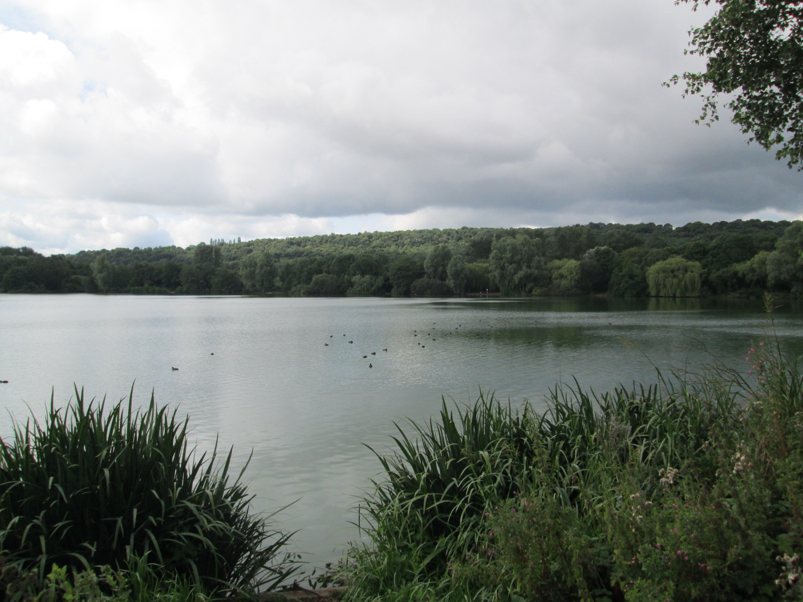
Westport Lake, Stoke-on-Trent

Westport Lake is a lake and local nature reserve in Stoke-on-Trent, in Staffordshire, England, about 0.8 miles (1.3 km) south of Tunstall. It is alongside...

Sandyford, Staffordshire

Sandyfordis a former village in Stoke-on-Trent near to Goldenhill and Tunstall. Churchill China has its large factory based in Sandyford. == References... ==

Chatterley railway station

Chatterley railway station is a former railway station in Staffordshire, England. Situated in the main North Staffordshire Railway (NSR) between Stoke...

Nearby Amenities

Located within 500m of 53.050618,-2.2352733
Bus Stop
Fearns Avenue
Bus: yes
Naptan AtcoCode: 3800C500700
Naptan Bearing: E
Naptan CommonName: Fearns Avenue
Naptan Indicator: Adj
Naptan Landmark: Fearns Avenue
Naptan PlusbusZoneRef: STOKEOT
Naptan Street: Riceyman Road
Naptan Verified: no
Public Transport: platform
Source: naptan_import
Lat/Long: 53.0498377/-2.2298864
Bus Stop
Toft End Road
Bus: yes
Naptan AtcoCode: 3800C531701
Naptan Bearing: N
Naptan CommonName: Toft End Road
Naptan Indicator: Opp
Naptan Landmark: The Cavalier PH
Naptan PlusbusZoneRef: STOKEOT
Naptan Street: Riceyman Road
Naptan Verified: no
Public Transport: platform
Source: naptan_import
Lat/Long: 53.0475605/-2.231366
Bus Stop
Toft End Road
Bus: yes
Naptan AtcoCode: 3800C531901
Naptan Bearing: S
Naptan CommonName: Toft End Road
Naptan Indicator: Opp
Naptan Landmark: Toft End Rd
Naptan PlusbusZoneRef: STOKEOT
Naptan Street: Fearns Avenue
Naptan Verified: no
Public Transport: platform
Source: naptan_import
Lat/Long: 53.0482662/-2.2290128
Barrier: cycle_barrier
Lat/Long: 53.0482413/-2.2397715
Barrier: cycle_barrier
Lat/Long: 53.0510696/-2.2367485
Barrier: cycle_barrier
Lat/Long: 53.0539416/-2.232028
Barrier: cycle_barrier
Lat/Long: 53.0539433/-2.2317634
Noexit: yes
Lat/Long: 53.0489858/-2.2328712
Source: Bing
Lat/Long: 53.0534897/-2.2407664
Source: Bing
Lat/Long: 53.053619/-2.2407669
Source: Bing
Lat/Long: 53.0534084/-2.2404961
Source: Bing
Lat/Long: 53.0534462/-2.2407149
Pub
The Cavalier
Lat/Long: 53.0479622/-2.230853
Riceyman News, Food & Booze
Addr Housenumber: 62
Addr Postcode: ST5 8LG
Addr Street: Riceyman Road
Fhrs Id: 1137164
Shop: convenience
Source Addr: FHRS Open Data
Lat/Long: 53.047693/-2.2309254
Natural: peak
Lat/Long: 53.051353/-2.23398
Crossing
Crossing: unmarked
Lat/Long: 53.0539461/-2.2314962
The data included in this document is from www.openstreetmap.org. The data is made available under ODbL.

Have you been to Bradwell Wood?

Leave your review of Bradwell Wood below (or comments, questions and feedback).