Creeton

Settlement in Lincolnshire South Kesteven

England

Creeton

Countryside at dusk
Countryside at dusk Credit: Bob Harvey

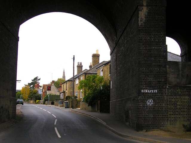
Creeton is a quaint village located in the South Kesteven district of Lincolnshire, England. Situated approximately 8 miles south of Grantham, it is a small yet charming community with a population of around 250 people. The village lies on the A151 road, which connects it to nearby towns and provides convenient access for residents and visitors.

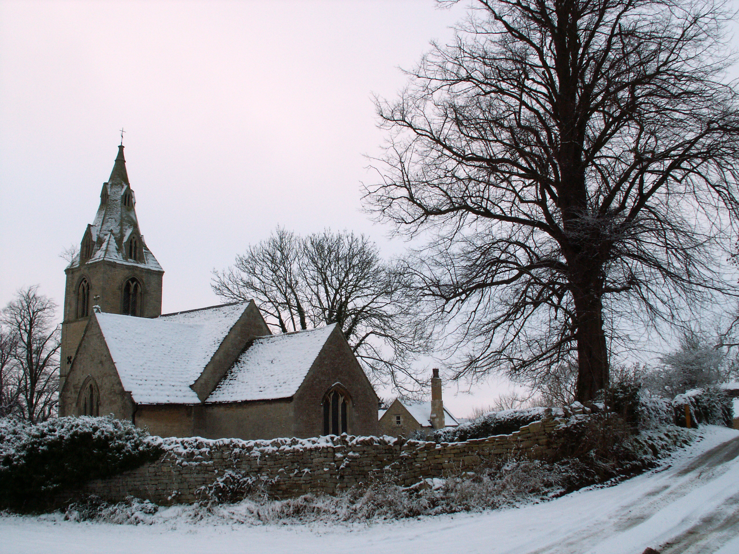
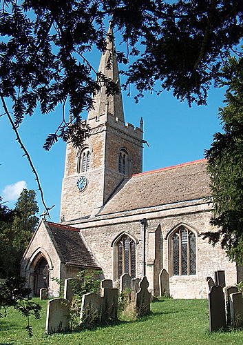
Creeton boasts a rich history dating back to medieval times, with the impressive St. Peter's Church standing as a testament to its past. This Grade I listed building features a striking 14th-century tower and beautiful stained glass windows, attracting architecture enthusiasts and history buffs.

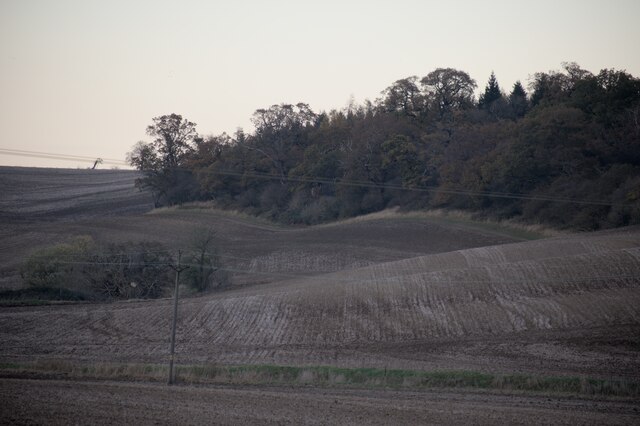
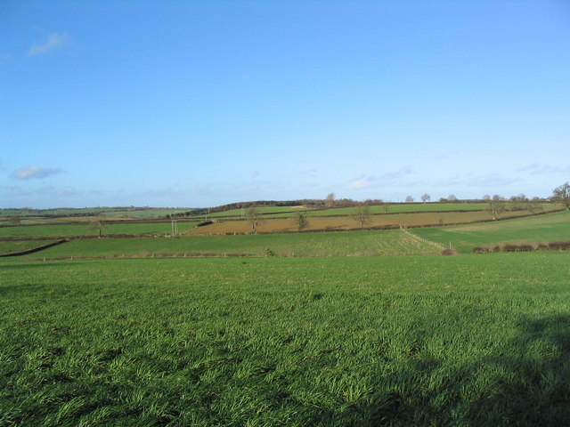
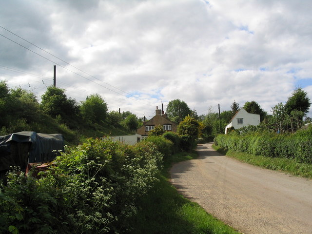
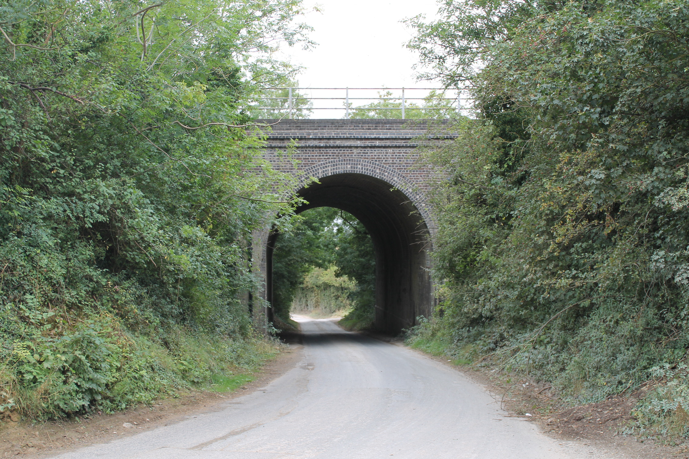
The village is surrounded by picturesque countryside, offering stunning views and ample opportunities for outdoor activities. The nearby Creeton Quarry Nature Reserve is a popular spot for nature lovers, providing a habitat for a variety of flora and fauna. The surrounding fields and footpaths also offer pleasant walks and cycling routes for those looking to explore the idyllic countryside.

Despite its small size, Creeton is a vibrant community that hosts several events throughout the year, including a summer fete and a Christmas fair. The village pub, The Green Man, serves as a social hub, offering a cozy atmosphere and traditional pub food.

Overall, Creeton presents a tranquil and welcoming atmosphere, making it an attractive place to live for those seeking a peaceful rural lifestyle. Its proximity to larger towns and natural beauty make it a hidden gem in Lincolnshire.

If you have any feedback on the listing, please let us know in the comments section below.

Creeton Images

Images are sourced within 2km of 52.767562/-0.50246 or Grid Reference TF0119. Thanks to Geograph Open Source API. All images are credited.

Countryside at dusk
Countryside at dusk
Viaduct, Little Bytham The giant Great Northern Railway viaduct looms large in this small village, and still carries the main East Coast line. It appears to be built of blue engineering brick. I haven't found a date beyond that it is Victorian.
Viaduct, Little Bytham
The giant Great Northern Railway viaduct looms large in this small village, and still carries the main East Coast line. It appears to be built of blue engineering brick. I haven't found a date beyond that it is Victorian.
Getting ready For the last 4 months "works entrance" signs have been appearing in field entrances all over the area, wherever the 400kV lines cross a lane, road, or track.  Now they have started to erect these scaffolds.
Getting ready
For the last 4 months "works entrance" signs have been appearing in field entrances all over the area, wherever the 400kV lines cross a lane, road, or track. Now they have started to erect these scaffolds.
Little Bytham High Street Looking through the road arch of the magnificent Victorian railway viaduct that carries the 4-track East Coast Main Line over the village <a href="https://www.geograph.org.uk/photo/1622243">TF0118 : Railway Viaduct, Little Bytham</a>. The spire of the Church of St. Medard and St. Gildard is in the distance.
Little Bytham High Street
Looking through the road arch of the magnificent Victorian railway viaduct that carries the 4-track East Coast Main Line over the village TF0118 : Railway Viaduct, Little Bytham. The spire of the Church of St. Medard and St. Gildard is in the distance.
High Street, Little Bytham
The Spinney, Little Bytham Looking towards Foxholes Corner Plantation.
The Spinney, Little Bytham
Looking towards Foxholes Corner Plantation.
Counthorpe The name 'Mallard Cottage' for the white building has nothing to do with birds. The East Coast Main Line runs along the embankment immediately opposite
Counthorpe
The name 'Mallard Cottage' for the white building has nothing to do with birds. The East Coast Main Line runs along the embankment immediately opposite
Counthorpe House
Counthorpe House
'The Drift', north of Creeton View north of this attractive lane, which runs parallel to the West Glen River (to right)
'The Drift', north of Creeton
View north of this attractive lane, which runs parallel to the West Glen River (to right)
Footbridge over the West Glen River View north, with Croakhill Plantation on the right. The footpath runs from The Drift (left) to Creeton Farm on the Creeton-Swinstead road (right)
Footbridge over the West Glen River
View north, with Croakhill Plantation on the right. The footpath runs from The Drift (left) to Creeton Farm on the Creeton-Swinstead road (right)
Creeton Farm
Creeton Farm
View north-west of TF0120 Showing most of square TF0120, with Croakhill Plantation in the distance. Taken from the footpath running east from Creeton toward Grimsthorpe Park, which cuts across the south-east corner of the square.
View north-west of TF0120
Showing most of square TF0120, with Croakhill Plantation in the distance. Taken from the footpath running east from Creeton toward Grimsthorpe Park, which cuts across the south-east corner of the square.
Swinstead Road, north of Creeton 'Spring Buildings Plantation' to the left of the road at the top of the hill.
Swinstead Road, north of Creeton
'Spring Buildings Plantation' to the left of the road at the top of the hill.
Mistletoe in lime trees; Steel's Riding, Grimsthorpe Park The track running west-east through the southern part of Grimsthorpe Park is lined with lime trees, heavily infested with mistletoe. The trees look rather sick - but I've only seen them in their leaf-free, winter months.
Mistletoe in lime trees; Steel's Riding, Grimsthorpe Park
The track running west-east through the southern part of Grimsthorpe Park is lined with lime trees, heavily infested with mistletoe. The trees look rather sick - but I've only seen them in their leaf-free, winter months.
Western end of 'Steel's Riding', Grimsthorpe Park With one of the many mistletoe-infested lime trees.
Western end of 'Steel's Riding', Grimsthorpe Park
With one of the many mistletoe-infested lime trees.
View north towards Park House, Grimsthorpe Park
Farm buildings, Grimsthorpe Park The track runs north-west towards Swinstead.
Farm buildings, Grimsthorpe Park
The track runs north-west towards Swinstead.
Road running east into Grimsthorpe Park Much of the central part of this large Park estate is farmed, but the remainder is attractive woodland.
Road running east into Grimsthorpe Park
Much of the central part of this large Park estate is farmed, but the remainder is attractive woodland.
Show me another place!

Creeton is located at Grid Ref: TF0119 (Lat: 52.767562, Lng: -0.50246)

Division: Parts of Kesteven

Administrative County: Lincolnshire

District: South Kesteven

Police Authority: Lincolnshire

What 3 Words

///rebounder.flux.agreeable. Near Corby Glen, Lincolnshire

Related Wikis

Creeton

Creeton is a village in the civil parish of Counthorpe and Creeton in the South Kesteven district of Lincolnshire, England. It is situated 3 miles (5 km...

Counthorpe

Counthorpe is a hamlet in the civil parish of Counthorpe and Creeton in the South Kesteven district of Lincolnshire, England. It adjoins the hamlet of...

Counthorpe and Creeton

Counthorpe and Creeton is a civil parish in the South Kesteven district of Lincolnshire, England. According to the 2001 census it had a population of...

St Medardus and St Gildardus Church, Little Bytham

The church of St Medardus and St Gildardus in Little Bytham, Lincolnshire, England, is a Grade I listed building. It is dedicated to two 6th-century French...

Nearby Amenities

Located within 500m of 52.767562,-0.50246
Creeton
Place: village
Lat/Long: 52.7676647/-0.5024833
Passing Place
Lat/Long: 52.768187/-0.5062594
Bus Stop
Counthorpe Road
Naptan AtcoCode: 2700LCC02204
Naptan Bearing: SW
Naptan CommonName: Counthorpe Road
Naptan Indicator: opp
Naptan Landmark: Counthorpe Road
Naptan NaptanCode: linapjpm
Naptan Street: Glen Road
Naptan Verified: no
Source: naptan_import
Lat/Long: 52.7666364/-0.503417
Bus Stop
Counthorpe Road
Naptan AtcoCode: 2700LCCH3259
Naptan Bearing: NE
Naptan CommonName: Counthorpe Road
Naptan Indicator: adj
Naptan Landmark: Counthorpe Road
Naptan NaptanCode: linawtdj
Naptan Street: Glen Road
Naptan Verified: no
Source: naptan_import
Lat/Long: 52.7666645/-0.5035049
Parking
Ele: 27.7635498
Lat/Long: 52.7658939/-0.5036271
Ele: 37.0000000
Removed Amenity: telephone
Lat/Long: 52.7662141/-0.5038112
Parking
Ele: 45.0000000
Lat/Long: 52.7675774/-0.5054849
Passing Place
Lat/Long: 52.7687968/-0.5067953
Brownlow Farm
Place: farm
Source: Bing
Lat/Long: 52.7679641/-0.501034
Manor Farm
Place: farm
Source: Bing
Lat/Long: 52.7665653/-0.4968465
Millington's Farm
Place: farm
Source: Bing
Lat/Long: 52.7689521/-0.5019394
Building: yes
Lat/Long: 52.7664497/-0.5045775
Post Box
Note: wall box hasbeen replaced by lamp box nearer the road
Post Box Type: lamp
Lat/Long: 52.7664275/-0.5039307
The data included in this document is from www.openstreetmap.org. The data is made available under ODbL.

Have you been to Creeton?

Leave your review of Creeton below (or comments, questions and feedback).