Ennox Wood

Wood, Forest in Wiltshire

England

Ennox Wood

Folly Farm
Folly Farm Credit: Doug Lee

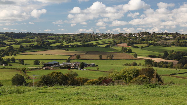
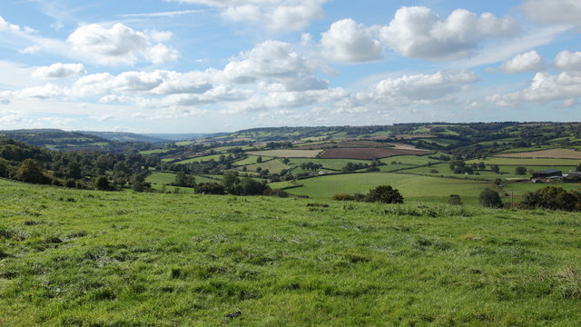
Ennox Wood is a dense forest located in the county of Wiltshire, England. Covering an expansive area of approximately 500 acres, the wood is situated in the southern part of the county, near the town of Trowbridge. Ennox Wood is primarily composed of deciduous trees, including oak, beech, and ash, which create a breathtaking canopy throughout the forest.

The wood is renowned for its diverse wildlife and is designated as a Site of Special Scientific Interest (SSSI), highlighting its ecological importance. Visitors to Ennox Wood can expect to encounter a variety of bird species, such as woodpeckers, tawny owls, and warblers, as well as small mammals like foxes, deer, and squirrels. The forest also boasts a rich variety of plant life, including bluebells, wild garlic, and ferns, creating a picturesque landscape throughout the seasons.

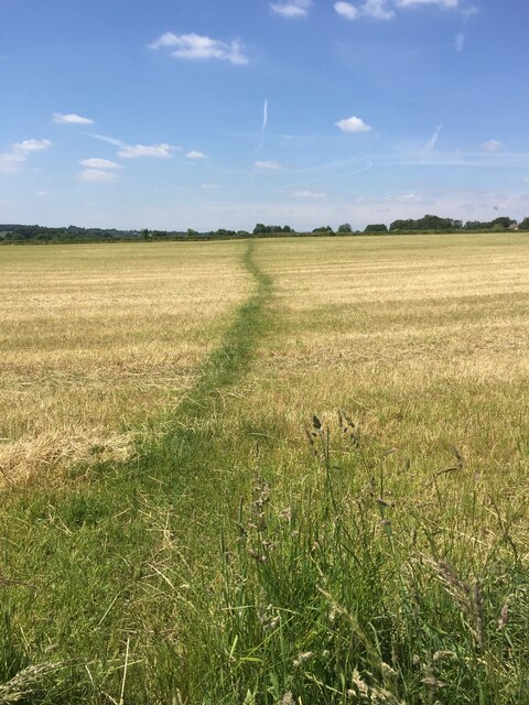
Ennox Wood provides an idyllic setting for nature enthusiasts, hikers, and photographers. The forest offers several well-maintained trails, allowing visitors to explore its beauty and discover hidden gems along the way. These trails wind through ancient woodland, crossing small streams and meandering past tranquil ponds. The wood's diverse terrain, with its gentle slopes and undulating pathways, adds to the allure of the area.

Managed by local authorities, Ennox Wood is carefully protected and preserved, ensuring its natural beauty remains intact for generations to come. The forest offers a peaceful and serene environment, providing a welcome escape from the bustling city life. Whether one seeks a leisurely stroll, a chance to reconnect with nature, or an opportunity to capture stunning photographs, Ennox Wood is a destination that offers something for everyone.

If you have any feedback on the listing, please let us know in the comments section below.
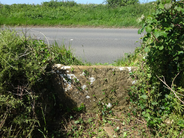
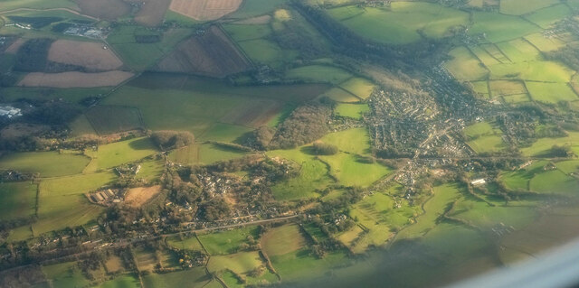
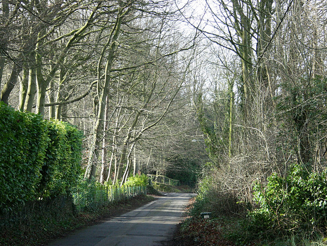
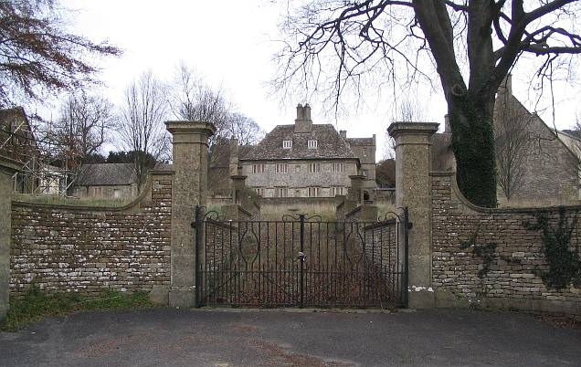
Ennox Wood Images

Images are sourced within 2km of 51.420596/-2.2300501 or Grid Reference ST8469. Thanks to Geograph Open Source API. All images are credited.

Folly Farm
Folly Farm
View Towards Colerne Folly Farm is in the mid-distance with Colerne on the top of the hill.  The tower of the Parish Church of St John the Baptist is visible towards the eastern (right) side of Colerne.  The Water Tower at Colerne Airfield can be seen on the horizon in the centre of the image.
View Towards Colerne
Folly Farm is in the mid-distance with Colerne on the top of the hill. The tower of the Parish Church of St John the Baptist is visible towards the eastern (right) side of Colerne. The Water Tower at Colerne Airfield can be seen on the horizon in the centre of the image.
View Southwest from Rudloe Batheaston lies in the valley to the left of the image in the mid-distance below the horizon.
View Southwest from Rudloe
Batheaston lies in the valley to the left of the image in the mid-distance below the horizon.
Wadswick Trig Point Flush Bracket S2486
A well worn path
A well worn path
St Thomas a Becket church, Box, from SE Parish church of Box, Wiltshire. Grade I listed.
<span class="nowrap"><a title="https://historicengland.org.uk/listing/the-list/list-entry/1180500" rel="nofollow ugc noopener" href="https://historicengland.org.uk/listing/the-list/list-entry/1180500">Link</a><img style="margin-left:2px;" alt="External link" title="External link - shift click to open in new window" src="https://s1.geograph.org.uk/img/external.png" width="10" height="10"/></span>
St Thomas a Becket church, Box, from SE
Parish church of Box, Wiltshire. Grade I listed. LinkExternal link
Stone Stile, Lower Wadswick On the north side of the A365, on Wiltshire footpath Box58. Looking from the road, the view looking South is <a href="https://www.geograph.org.uk/photo/7188519">ST8467 : Stone Stile, Lower Wadswick</a>.
Stone Stile, Lower Wadswick
On the north side of the A365, on Wiltshire footpath Box58. Looking from the road, the view looking South is ST8467 : Stone Stile, Lower Wadswick.
Stone Stile, Lower Wadswick On the north side of the A365, on Wiltshire footpath Box58. Looking to the road, the view looking North is <a href="https://www.geograph.org.uk/photo/7188517">ST8467 : Stone Stile, Lower Wadswick</a>.
Stone Stile, Lower Wadswick
On the north side of the A365, on Wiltshire footpath Box58. Looking to the road, the view looking North is ST8467 : Stone Stile, Lower Wadswick.
Stone Stile, Lower Wadswick On Wiltshire footpath BOX58, looking North to the A365. The view from the road is <a href="https://www.geograph.org.uk/photo/7188529">ST8467 : Stone Stile, Lower Wadswick</a>.
Stone Stile, Lower Wadswick
On Wiltshire footpath BOX58, looking North to the A365. The view from the road is ST8467 : Stone Stile, Lower Wadswick.
Stone Stile, Lower Wadswick On Wiltshire footpath BOX58, looking South from the A365. The view looking to the road is <a href="https://www.geograph.org.uk/photo/7188528">ST8467 : Stone Stile, Lower Wadswick</a>.
Stone Stile, Lower Wadswick
On Wiltshire footpath BOX58, looking South from the A365. The view looking to the road is ST8467 : Stone Stile, Lower Wadswick.
Box from the air The main railway line crosses the right side of the image horizontally and then abruptly disappears into the Box Tunnel before reaching the central wood. Below is the A4.
Box from the air
The main railway line crosses the right side of the image horizontally and then abruptly disappears into the Box Tunnel before reaching the central wood. Below is the A4.
Valley north of Box Hill
Rudloe Manor Until about ten years ago this was RAF Rudloe Manor, although part of the camp is in private hands the house is still disused.
Rudloe Manor
Until about ten years ago this was RAF Rudloe Manor, although part of the camp is in private hands the house is still disused.
Drewett's Mill In the By Brook valley, north of Box.
Drewett's Mill
In the By Brook valley, north of Box.
Brewers Yard Quarry This photo shows some blocks of stone that were never removed from this quarry.
Owned by a Mr Brewer who was a contractor on the Box Tunnel construction is unusual as it is on two levels.
Brewers Yard Quarry
This photo shows some blocks of stone that were never removed from this quarry. Owned by a Mr Brewer who was a contractor on the Box Tunnel construction is unusual as it is on two levels.
Copenacre Copenacre Quarry was converted into a Naval Stores Depot (part of Spring Quarry Naval Stores Depot) and was in use from the 1940's to the mid 1990's. Here we see a telephone box and a Stores Manager's office in the background. It has now become a dumping ground for the adjoining Hartham Quarry.
Copenacre
Copenacre Quarry was converted into a Naval Stores Depot (part of Spring Quarry Naval Stores Depot) and was in use from the 1940's to the mid 1990's. Here we see a telephone box and a Stores Manager's office in the background. It has now become a dumping ground for the adjoining Hartham Quarry.
View from Widdenham Farm Showing a dammed area of the By Brook providing a small pond.  The field boundary in the middle distance is also in this square, but Rudloe Wood on the horizon is in the next square east.
View from Widdenham Farm
Showing a dammed area of the By Brook providing a small pond. The field boundary in the middle distance is also in this square, but Rudloe Wood on the horizon is in the next square east.
Activity at Widdenham Farm This is at the end of the field so the shapes are caused by the tractor driver swinging round at the end of each row and continuing to cut as he does so.
Activity at Widdenham Farm
This is at the end of the field so the shapes are caused by the tractor driver swinging round at the end of each row and continuing to cut as he does so.
Show me another place!

Ennox Wood is located at Grid Ref: ST8469 (Lat: 51.420596, Lng: -2.2300501)

Unitary Authority: Wiltshire

Police Authority: Wiltshire

What 3 Words

///donor.pollution.shipped. Near Box, Wiltshire

Nearby Locations

Ennox Wood

Related Wikis

Box Tunnel

Box Tunnel passes through Box Hill on the Great Western Main Line (GWML) between Bath and Chippenham. The 1.83-mile (2.95 km) tunnel was the world's longest...

Box Mine

Box Mine (grid reference ST838690) is a 56.6 ha (139.9 acres) biological Site of Special Scientific Interest, near the village of Box in Wiltshire, England...

Box Hill, Wiltshire

Box Hill is a small village in Wiltshire, England, most notable for its position above Brunel's famous Box Tunnel. It is located on the A4 road just northeast...

Central Government War Headquarters

The Central Government War Headquarters (CGWHQ) is a 35-acre (14 ha) complex built 120 feet (37 m) underground as the United Kingdom's emergency government...

MOD Corsham

MOD Corsham (formerly Basil Hill Barracks) is a Ministry of Defence establishment located between the towns of Corsham and Box in Wiltshire, England....

RAF Rudloe Manor

RAF Rudloe Manor, formerly RAF Box, was a Royal Air Force station north-east of Bath, England, between the settlements of Box and Corsham, in Wiltshire...

Hazelbury, Wiltshire

Hazelbury is a former village in the civil parish of Box, Wiltshire, England. It was about 0.5 miles (0.8 km) southeast of the present-day village of Box...

Hazelbury Manor

Hazelbury Manor is a Grade I listed manor house, parts of which date back to the 15th century, in the hamlet of Hazelbury in the parish of Box, Wiltshire...

Nearby Amenities

Located within 500m of 51.420596,-2.2300501
Mini Roundabout
Direction: clockwise
Lat/Long: 51.4234398/-2.2249668
Crossing
Crossing: unmarked
Crossing Island: yes
Crossing Markings: no
Kerb: lowered
Tactile Paving: no
Lat/Long: 51.4233771/-2.2250122
Parking
Access: yes
Fee: no
Parking: street_side
Lat/Long: 51.4200307/-2.2362731
Barrier: stile
Lat/Long: 51.4232965/-2.2288796
Toilets
Access: customers
Fee: no
Toilets Disposal: pitlatrine
Unisex: yes
Lat/Long: 51.4201998/-2.2353042
Toilets
Access: customers
Fee: no
Toilets Disposal: pitlatrine
Unisex: yes
Lat/Long: 51.4197911/-2.235062
Power: pole
Lat/Long: 51.4190965/-2.223476
Power: pole
Lat/Long: 51.4190028/-2.2244632
Power: pole
Lat/Long: 51.4175626/-2.2253779
BT Fiveways Mast
Communication Microwave: yes
Communication Mobile Phone: yes
Communication Radio: yes
Man Made: tower
Tower Construction: lattice
Tower Type: communication
Lat/Long: 51.4222823/-2.2248219
Power: pole
Lat/Long: 51.4231893/-2.2270381
Power: pole
Lat/Long: 51.4222928/-2.2277892
Power: pole
Lat/Long: 51.4212876/-2.2286126
Power: pole
Lat/Long: 51.4201134/-2.2289211
Power: pole
Lat/Long: 51.419334/-2.2287494
Power: pole
Lat/Long: 51.4185127/-2.2285321
Power: pole
Lat/Long: 51.4175843/-2.2283337
Historic: milestone
Lat/Long: 51.4185436/-2.2277382
Power: transformer
Lat/Long: 51.4173365/-2.2257964
Power: transformer
Lat/Long: 51.417306/-2.2255737
The data included in this document is from www.openstreetmap.org. The data is made available under ODbL.

Have you been to Ennox Wood?

Leave your review of Ennox Wood below (or comments, questions and feedback).