Forest Covert

Wood, Forest in Staffordshire South Staffordshire

England

Forest Covert

Highgate Path The view from near White House Lane of the footpath on Highgate Common Country Park.
Highgate Path Credit: Gordon Griffiths

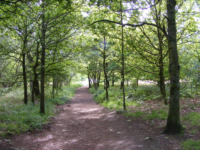
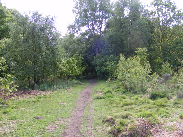
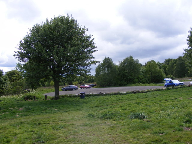
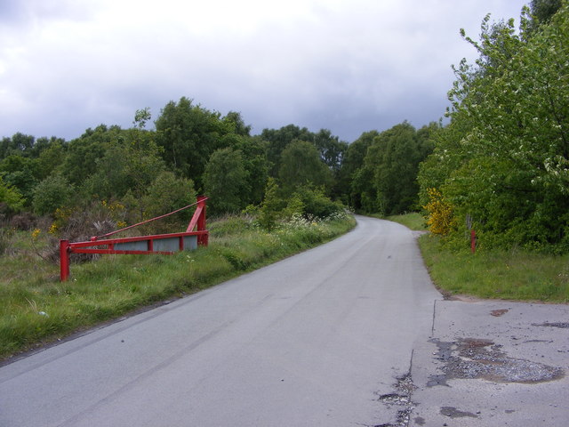
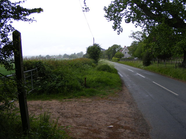
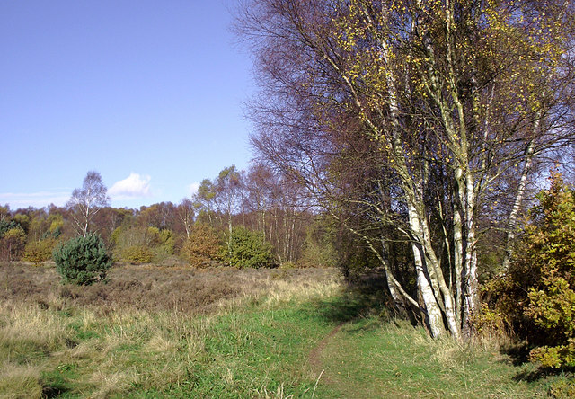
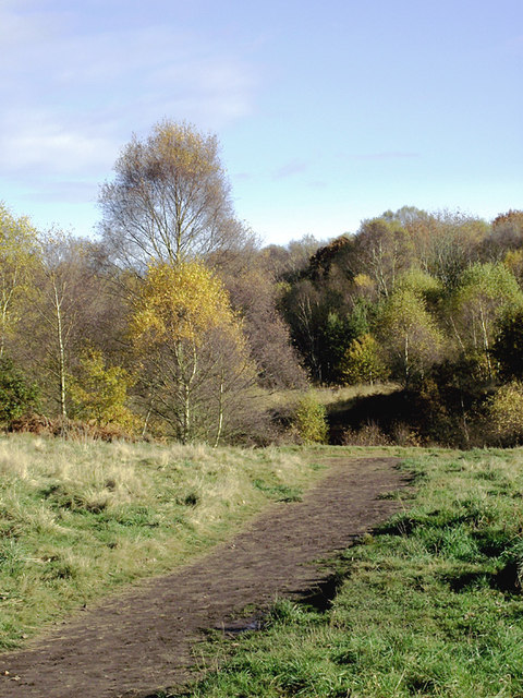
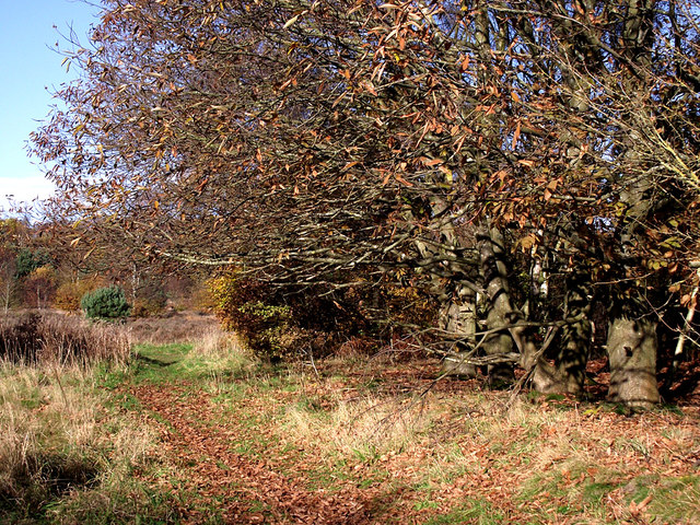
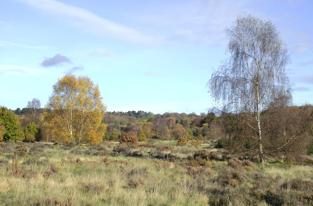
Forest Covert is a picturesque woodland located in Staffordshire, England. Spanning over a vast area, it is renowned for its natural beauty and rich biodiversity. The woodland is primarily composed of a dense canopy of trees, creating an enchanting and tranquil atmosphere.

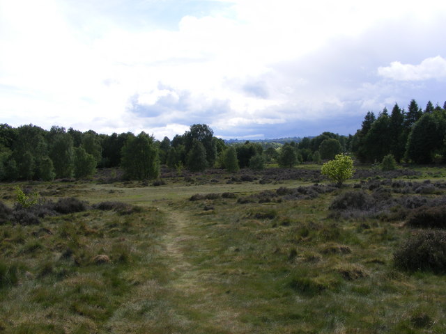
The forest boasts a diverse range of tree species, including oak, beech, birch, and pine, lending the woodland a vibrant and ever-changing landscape throughout the seasons. The forest floor is covered with a tapestry of ferns, wildflowers, and moss, adding to its allure.

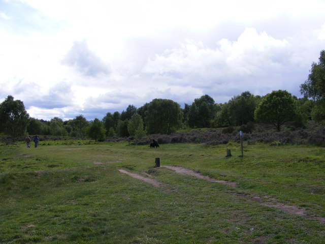
Visitors to Forest Covert can enjoy a variety of recreational activities. The well-maintained trails provide opportunities for hiking, jogging, and cycling, allowing visitors to immerse themselves in the beauty of nature. The woodland also offers a designated picnic area, providing a perfect spot for a leisurely lunch amidst the stunning surroundings.

Wildlife enthusiasts will be thrilled by the abundance of fauna in Forest Covert. The forest is home to a wide array of bird species, including woodpeckers, owls, and various songbirds. Squirrels, rabbits, and deer can also be spotted roaming freely within the woodland.

Forest Covert is not only a haven for nature lovers but also plays a vital ecological role. The forest acts as a carbon sink, absorbing carbon dioxide from the atmosphere and helping to mitigate climate change. It also serves as a habitat for numerous endangered and protected species, contributing to their conservation efforts.

In conclusion, Forest Covert in Staffordshire is a breathtaking woodland that offers visitors a chance to reconnect with nature. With its stunning scenery, diverse flora and fauna, and recreational opportunities, it is a destination that appeals to individuals seeking tranquility and an escape from the hustle and bustle of everyday life.

If you have any feedback on the listing, please let us know in the comments section below.

Forest Covert Images

Images are sourced within 2km of 52.512523/-2.2398713 or Grid Reference SO8390. Thanks to Geograph Open Source API. All images are credited.

Highgate Path The view from near White House Lane of the footpath on Highgate Common Country Park.
Highgate Path
The view from near White House Lane of the footpath on Highgate Common Country Park.
Highgate Clearing The view of the footpath on Highgate Common Country Park.
Highgate Clearing
The view of the footpath on Highgate Common Country Park.
Highgate View The view from Birches Coppice Car Park off White House Lane over Highgate Common Country Park.
Highgate View
The view from Birches Coppice Car Park off White House Lane over Highgate Common Country Park.
Highgate Common View The view over Highgate Common Country Park.
Highgate Common View
The view over Highgate Common Country Park.
Highgate Car Park View The view of the car park off Camp Hill Road from Highgate Common Country Park.
Highgate Car Park View
The view of the car park off Camp Hill Road from Highgate Common Country Park.
Highgate Road Gate The view of Camp Hill Road on Highgate Common Country Park.
Highgate Road Gate
The view of Camp Hill Road on Highgate Common Country Park.
Highgate Road Junction The view of Camp Hill Road and Highgate Road junction on Highgate Common Country Park.
Highgate Road Junction
The view of Camp Hill Road and Highgate Road junction on Highgate Common Country Park.
Staffordshire Way View The view of Crab Lane near Highgate Common Country Park.
Staffordshire Way View
The view of Crab Lane near Highgate Common Country Park.
Chasepool Lodge trig in evening sunshine Looking NNE across the autumn fields, with Chasepool Farm in the middle distance.
Chasepool Lodge trig in evening sunshine
Looking NNE across the autumn fields, with Chasepool Farm in the middle distance.
Farmland south-west of Swindon, Staffordshire This is a telephoto assisted image cropped top and bottom to show Chasepool Farm and fields nearby. Beyond the farm is the village of Swindon.
Farmland south-west of Swindon, Staffordshire
This is a telephoto assisted image cropped top and bottom to show Chasepool Farm and fields nearby. Beyond the farm is the village of Swindon.
Farmland south-west of Swindon, Staffordshire Chasepool Lane is behind the hedge.
Farmland south-west of Swindon, Staffordshire
Chasepool Lane is behind the hedge.
Camp Hill Road near Swindon, Staffordshire Off to the left is Enville Common Road. Ahead is the way to Highgate Common.
Camp Hill Road near Swindon, Staffordshire
Off to the left is Enville Common Road. Ahead is the way to Highgate Common.
Enville Common Road south-west of Swindon, Staffordshire Looking south-west from near the junction with Chasepool Road and Camp Hill Road.
Enville Common Road south-west of Swindon, Staffordshire
Looking south-west from near the junction with Chasepool Road and Camp Hill Road.
Highgate Common south-west of Wombourne, Staffordshire Highgate Common is a Staffordshire Wildlife Trust reserve containing a mix of heathland and woodland. It is about 129 hectares or 320 acres in size and is a Site of Special Scientific Interest. (Wikipedia)

This is a very popular area for walkers (including dog-walkers) at any time of the year.

<span class="nowrap"><a title="http://en.wikipedia.org/wiki/Highgate_Common" rel="nofollow ugc noopener" href="http://en.wikipedia.org/wiki/Highgate_Common">Link</a><img style="margin-left:2px;" alt="External link" title="External link - shift click to open in new window" src="https://s1.geograph.org.uk/img/external.png" width="10" height="10"/></span>
Highgate Common south-west of Wombourne, Staffordshire
Highgate Common is a Staffordshire Wildlife Trust reserve containing a mix of heathland and woodland. It is about 129 hectares or 320 acres in size and is a Site of Special Scientific Interest. (Wikipedia) This is a very popular area for walkers (including dog-walkers) at any time of the year. LinkExternal link
Track on Highgate Common, Staffordshire Highgate Common is a Staffordshire Wildlife Trust reserve containing a mix of heathland and woodland. It is about 129 hectares or 320 acres in size and is a Site of Special Scientific Interest. (Wikipedia)

This is a very popular area for walkers (including dog-walkers) at any time of the year.

<span class="nowrap"><a title="http://en.wikipedia.org/wiki/Highgate_Common" rel="nofollow ugc noopener" href="http://en.wikipedia.org/wiki/Highgate_Common">Link</a><img style="margin-left:2px;" alt="External link" title="External link - shift click to open in new window" src="https://s1.geograph.org.uk/img/external.png" width="10" height="10"/></span>
Track on Highgate Common, Staffordshire
Highgate Common is a Staffordshire Wildlife Trust reserve containing a mix of heathland and woodland. It is about 129 hectares or 320 acres in size and is a Site of Special Scientific Interest. (Wikipedia) This is a very popular area for walkers (including dog-walkers) at any time of the year. LinkExternal link
Highgate Common south-west of Wombourne, Staffordshire A group of Spanish Chestnut trees has shed most of its leaves.

Highgate Common is a Staffordshire Wildlife Trust reserve containing a mix of heathland and woodland. It is about 129 hectares or 320 acres in size and is a Site of Special Scientific Interest. (Wikipedia)

This is a very popular area for walkers (including dog-walkers) at any time of the year.

<span class="nowrap"><a title="http://en.wikipedia.org/wiki/Highgate_Common" rel="nofollow ugc noopener" href="http://en.wikipedia.org/wiki/Highgate_Common">Link</a><img style="margin-left:2px;" alt="External link" title="External link - shift click to open in new window" src="https://s1.geograph.org.uk/img/external.png" width="10" height="10"/></span>
Highgate Common south-west of Wombourne, Staffordshire
A group of Spanish Chestnut trees has shed most of its leaves. Highgate Common is a Staffordshire Wildlife Trust reserve containing a mix of heathland and woodland. It is about 129 hectares or 320 acres in size and is a Site of Special Scientific Interest. (Wikipedia) This is a very popular area for walkers (including dog-walkers) at any time of the year. LinkExternal link
Highgate Common south-west of Wombourne, Staffordshire Highgate Common is a Staffordshire Wildlife Trust reserve containing a mix of heathland and woodland. It is about 129 hectares or 320 acres in size and is a Site of Special Scientific Interest. (Wikipedia)

This is a very popular area for walkers (including dog-walkers) at any time of the year.

<span class="nowrap"><a title="http://en.wikipedia.org/wiki/Highgate_Common" rel="nofollow ugc noopener" href="http://en.wikipedia.org/wiki/Highgate_Common">Link</a><img style="margin-left:2px;" alt="External link" title="External link - shift click to open in new window" src="https://s1.geograph.org.uk/img/external.png" width="10" height="10"/></span>
Highgate Common south-west of Wombourne, Staffordshire
Highgate Common is a Staffordshire Wildlife Trust reserve containing a mix of heathland and woodland. It is about 129 hectares or 320 acres in size and is a Site of Special Scientific Interest. (Wikipedia) This is a very popular area for walkers (including dog-walkers) at any time of the year. LinkExternal link
Show me another place!

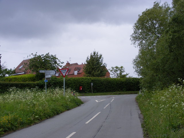
Forest Covert is located at Grid Ref: SO8390 (Lat: 52.512523, Lng: -2.2398713)

Administrative County: Staffordshire

District: South Staffordshire

Police Authority: Staffordshire

What 3 Words

///causes.bounded.clincher. Near Wombourn, Staffordshire

Nearby Locations

Forest Covert

Related Wikis

Highgate Common

Highgate Common is a Staffordshire Wildlife Trust reserve containing a mix of heathland and woodland. It is about 129 hectares or 320 acres in size. The...

Wolverhampton Airport

Wolverhampton Halfpenny Green Airport (ICAO: EGBO), formerly Halfpenny Green Airport and Wolverhampton Business Airport, locally Bobbington Airport, is...

Swindon, Staffordshire

Swindon is a village and civil parish located in the West Midlands. The nearest major town is Dudley, approximately five miles eastwards. It stands halfway...

Greensforge

Greensforge is a scattered hamlet on the boundary of Kinver and Swindon parishes, in South Staffordshire, England. It is noted for its Roman associations...

Bobbington

Bobbington is a village and civil parish in the South Staffordshire district of Staffordshire, England, about 5 miles (8.0 km) west of Wombourne. According...

Himley railway station

Himley was a station on the Wombourne Branch Line. Unlike other stops along the route, it was deemed worthy of full station status. It was opened by the...

Ashwood, Staffordshire

Ashwood is a small area of Staffordshire, England. It is situated in the South Staffordshire district, approximately two miles west of the West Midlands...

Himley

Himley is a small village and civil parish in Staffordshire, England, 4 miles (6.4 km) west of Dudley and 5 mi (8.0 km) southwest of Wolverhampton. At...

Nearby Amenities

Located within 500m of 52.512523,-2.2398713
Barrier: cycle_barrier
Horse: no
Material: wood
Lat/Long: 52.5142089/-2.2413717
Hiking: yes
Information: guidepost
Material: wood
Tourism: information
Lat/Long: 52.5131481/-2.2404284
Bench
Colour: green
Material: metal
Lat/Long: 52.5093046/-2.239898
Bench
Material: wood
Lat/Long: 52.5095601/-2.2395895
Bench
Colour: green
Material: metal
Lat/Long: 52.5138239/-2.2356132
Barrier: cycle_barrier
Bicycle: no
Horse: no
Material: wood
Lat/Long: 52.5110268/-2.2384644
The data included in this document is from www.openstreetmap.org. The data is made available under ODbL.

Have you been to Forest Covert?

Leave your review of Forest Covert below (or comments, questions and feedback).