Brindley's Heath

Wood, Forest in Staffordshire South Staffordshire

England

Brindley's Heath

Enville Hall Grade II listed 16C&17C hall built by the Grey family, Earls of Stamford and Warrington. The extensive estate comprises 6500acres at Enville.
Enville Hall Credit: John M

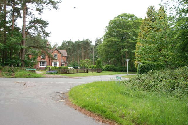
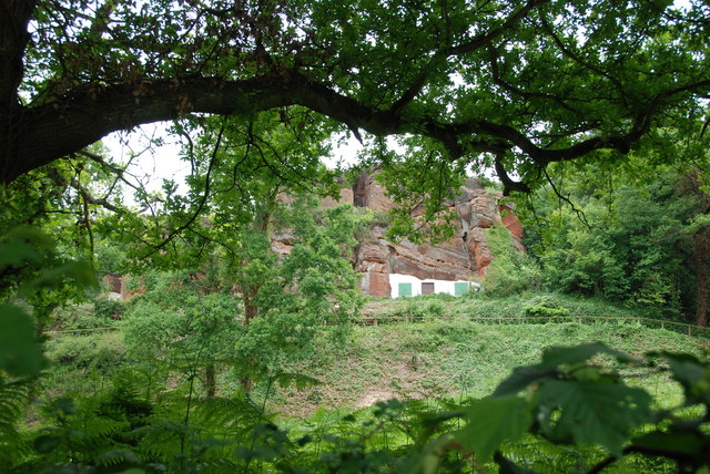
Brindley's Heath, located in Staffordshire, England, is a picturesque woodland area renowned for its natural beauty and rich biodiversity. Spanning over several acres, this enchanting forest is a haven for outdoor enthusiasts and nature lovers alike.

The woodland of Brindley's Heath is characterized by a diverse range of tree species, including oak, birch, beech, and pine, which create a lush and verdant canopy overhead. The forest floor is covered in a thick carpet of moss, ferns, and wildflowers, adding to its ethereal charm. The gentle rustling of leaves, the chirping of birds, and the occasional scurrying of woodland creatures provide a soothing soundtrack to visitors' exploration of the area.

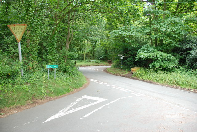
Brindley's Heath is a haven for wildlife, providing a habitat for a wide array of fauna. Visitors may catch glimpses of deer, foxes, rabbits, and various bird species, including woodpeckers and owls. The forest also boasts a small stream that meanders through the woodland, creating a serene and tranquil atmosphere.

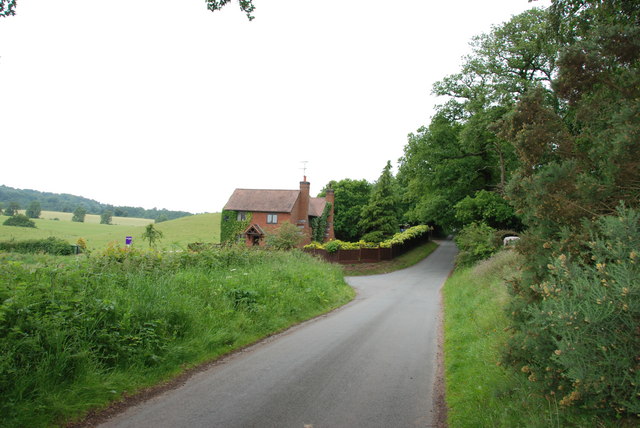
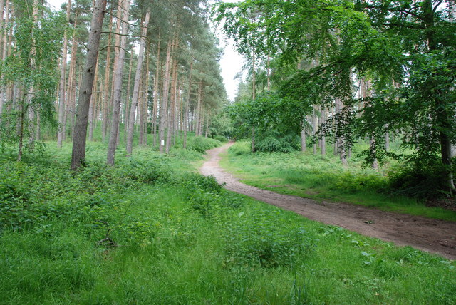
The forest is crisscrossed by a network of well-maintained trails, allowing visitors to explore the area and immerse themselves in its natural wonders. These trails cater to all levels of fitness and offer opportunities for walking, jogging, or cycling. Along the way, visitors may encounter picnic areas and benches, providing the perfect spot to rest and appreciate the tranquil surroundings.

Brindley's Heath offers a welcome respite from the hustle and bustle of everyday life, providing an idyllic setting for outdoor recreation, relaxation, and connecting with nature. Whether it's a leisurely stroll through the trees, a family picnic, or birdwatching, Brindley's Heath is sure to captivate visitors with its timeless beauty and abundant wildlife.

If you have any feedback on the listing, please let us know in the comments section below.

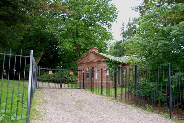
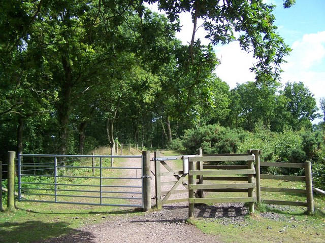
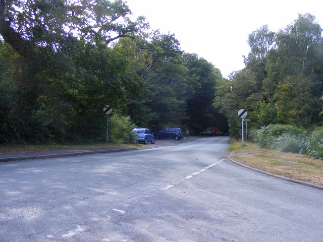
Brindley's Heath Images

Images are sourced within 2km of 52.460832/-2.2438139 or Grid Reference SO8384. Thanks to Geograph Open Source API. All images are credited.

Enville Hall Grade II listed 16C&17C hall built by the Grey family, Earls of Stamford and Warrington. The extensive estate comprises 6500acres at Enville.
Enville Hall
Grade II listed 16C&17C hall built by the Grey family, Earls of Stamford and Warrington. The extensive estate comprises 6500acres at Enville.
Gateway at Enville Hall The gate in the brick wall surrounding the hall leads into the landscaped gardens.
Gateway at Enville Hall
The gate in the brick wall surrounding the hall leads into the landscaped gardens.
Enville Cricket Club In the grounds of Enville Hall.
Enville Cricket Club
In the grounds of Enville Hall.
Scoreboard at Enville Cricket Club Built onto the wall surrounding Enville Hall.
Scoreboard at Enville Cricket Club
Built onto the wall surrounding Enville Hall.
Ha-ha at Enville Hall The Ha-ha or sunken wall feature separates the house and gardens from the grazing in the landscaped parkland.
Ha-ha at Enville Hall
The Ha-ha or sunken wall feature separates the house and gardens from the grazing in the landscaped parkland.
Gamekeepers Cottages. These Cottages are on the Enville Road, Compton Road crossroads. Just outside Kinver.
Gamekeepers Cottages.
These Cottages are on the Enville Road, Compton Road crossroads. Just outside Kinver.
House On The Outskirts Of Kinver. This house replaced an old Cottage, around 1990
House On The Outskirts Of Kinver.
This house replaced an old Cottage, around 1990
Crossroads Near Holy Austin Rock, Kinver. These Crossroads are at the Kinver end of Kingsford Lane.
Crossroads Near Holy Austin Rock, Kinver.
These Crossroads are at the Kinver end of Kingsford Lane.
Holy Austin Rock, Kinver. One of the Rock houses has been restored, and is open to the public at certain times.The others have been closed off, as is evident from the Photo, for Health & Safety reasons.
Holy Austin Rock, Kinver.
One of the Rock houses has been restored, and is open to the public at certain times.The others have been closed off, as is evident from the Photo, for Health & Safety reasons.
Entrance To Huntsmans Drive, Kinver
A Track Into The Million.
Falcon Farm, Enville. Falcon Farm is part of the Enville Estate.
Falcon Farm, Enville.
Falcon Farm is part of the Enville Estate.
Brindley Hall, Compton, Kinver This house was once owned by James Brindley, the man who played such a big part in the building of the Canals. Up until recent years it was owned by the Enville Estate and fell into disrepair, squatters moved in for a while, then it was sold to Developers, but when they came to renovate it, Bats were found in the roof and work had to stop. If anyone lives in it now I don't know, but with iron fence and Doberman dogs I will leave that to someone else to find out. The farm nextdoor is Union Hall Farm named after The Grand Union Canal.
Brindley Hall, Compton, Kinver
This house was once owned by James Brindley, the man who played such a big part in the building of the Canals. Up until recent years it was owned by the Enville Estate and fell into disrepair, squatters moved in for a while, then it was sold to Developers, but when they came to renovate it, Bats were found in the roof and work had to stop. If anyone lives in it now I don't know, but with iron fence and Doberman dogs I will leave that to someone else to find out. The farm nextdoor is Union Hall Farm named after The Grand Union Canal.
Gate House, Brindley Hall, Compton, Kinver High security, note one of the dogs in right hand corner.
Gate House, Brindley Hall, Compton, Kinver
High security, note one of the dogs in right hand corner.
Staffordshire Way Nearing Kinver
Public bridleway through Million Wood, near Enville The public bridleway which runs through the heart of this large wood, is the only route which the public can use. There are no other public rights of way, nor is it access land. Forestry operations are undertaken in the wood, so it is probably safest to stick to the correct route!
Public bridleway through Million Wood, near Enville
The public bridleway which runs through the heart of this large wood, is the only route which the public can use. There are no other public rights of way, nor is it access land. Forestry operations are undertaken in the wood, so it is probably safest to stick to the correct route!
Million Wood near Enville A typical scene in the wood, taken from the public bridleway. Although there appears to be a path here, there is no public right of way other than on the bridleway. The trees here are mainly pine. In April 2011, another part of the wood suffered a bad fire, which took some days to extinguish.
Million Wood near Enville
A typical scene in the wood, taken from the public bridleway. Although there appears to be a path here, there is no public right of way other than on the bridleway. The trees here are mainly pine. In April 2011, another part of the wood suffered a bad fire, which took some days to extinguish.
Kinver Lane Junction The view along Compton Road from Meddings Lane, next to Kinver Edge National Trust woodland.
Kinver Lane Junction
The view along Compton Road from Meddings Lane, next to Kinver Edge National Trust woodland.
Show me another place!

Brindley's Heath is located at Grid Ref: SO8384 (Lat: 52.460832, Lng: -2.2438139)

Administrative County: Staffordshire

District: South Staffordshire

Police Authority: Staffordshire

What 3 Words

///bulbs.sobbed.unrated. Near Kinvere, Staffordshire

Related Wikis

Kinver Edge

Kinver Edge is a high heath and woodland escarpment just west of Kinver, about four miles west of Stourbridge, and four miles north of Kidderminster, and...

Kinver High School

Kinver High School (formerly Edgecliff High School) is a mixed secondary school and sixth form located in Kinver in the English county of Staffordshire...

Kinver Edge Hillfort

Kinver Edge Hillfort, is a univallate Iron Age hillfort with a massive rampart and outer ditch along the south-west and south-east sides, with natural...

Kinver

Kinver is a large village in the District of South Staffordshire in Staffordshire, England. It is in the far south-west of the county, at the end of the...
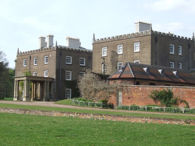
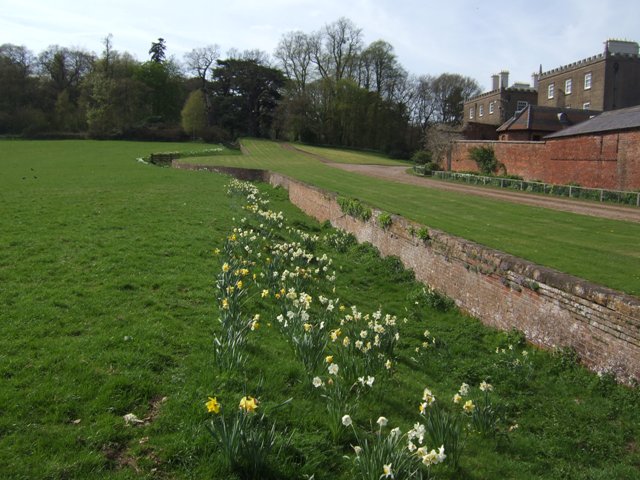
Enville Hall

Enville Hall is an English Tudor country house in the village of Enville, Staffordshire. It is a Grade II listed building.The house has a 16th and 17th...

Dunsley, Staffordshire

Dunsley is a hamlet in Kinver, Staffordshire, England. The settled part of the hamlet is the part of the village of Kinver, lying east of the River Stour...

Great Fountain, Enville

The Great Fountain, Enville, was a fountain created in the mid-19th century by the Earl of Stamford in the middle of a lake on his Enville Hall estate...

Enville, Staffordshire

Enville is a village and civil parish in rural Staffordshire, England, on the A458 road between Stourbridge and Bridgnorth. Enville is in the South Staffordshire...

Nearby Amenities

Located within 500m of 52.460832,-2.2438139
Bus Stop
Edge View Close
Bus: yes
Naptan AtcoCode: 3800C606300
Naptan Bearing: SW
Naptan CommonName: Edge View Close
Naptan Indicator: Opp
Naptan Landmark: Edge View Close
Naptan Street: Edge View Walk
Naptan Verified: no
Public Transport: platform
Source: naptan_import
Lat/Long: 52.4573411/-2.2413141
Bus Stop
Elm Tree
Bus: yes
Naptan AtcoCode: 3800C606500
Naptan Bearing: NW
Naptan CommonName: Elm Tree
Naptan Indicator: Adj
Naptan Landmark: Elm Tree
Naptan Street: Enville Rd
Naptan Verified: no
Public Transport: platform
Source: naptan_import
Lat/Long: 52.4616219/-2.2406457
Bus Stop
Chester Road
Bus: yes
Naptan AtcoCode: 3800C606501
Naptan Bearing: SE
Naptan CommonName: Chester Road
Naptan Indicator: Adj
Naptan Landmark: Chester Road
Naptan Street: Enville Road
Naptan Verified: no
Public Transport: platform
Source: naptan_import
Lat/Long: 52.4615954/-2.2403954
Bus Stop
Elm Tree Inn PH
Bus: yes
Naptan AtcoCode: 3800C611800
Naptan Bearing: NW
Naptan CommonName: Elm Tree Inn PH
Naptan Indicator: Adj
Naptan Landmark: Elm Tree Inn PH
Naptan Street: Enville Road
Naptan Verified: no
Public Transport: platform
Source: naptan_import
Lat/Long: 52.4591894/-2.2387045
Power: tower
Lat/Long: 52.4630549/-2.2498982
Power: tower
Lat/Long: 52.4644695/-2.2465843
Power: tower
Lat/Long: 52.4651384/-2.2456804
Power: pole
Lat/Long: 52.4628003/-2.2478667
Power: pole
Lat/Long: 52.4631206/-2.2472364
Power: pole
Lat/Long: 52.460604/-2.250659
Power: pole
Lat/Long: 52.4610974/-2.2500046
Power: pole
Lat/Long: 52.4619913/-2.2487949
Power: pole
Lat/Long: 52.4616074/-2.2493233
Power: pole
Lat/Long: 52.4634573/-2.2466141
Power: pole
Lat/Long: 52.4624571/-2.2484809
Telephone
Booth: K6
Covered: booth
Operator: BT
Phone: +44 1384 872504
Lat/Long: 52.458233/-2.2402799
The data included in this document is from www.openstreetmap.org. The data is made available under ODbL.

Have you been to Brindley's Heath?

Leave your review of Brindley's Heath below (or comments, questions and feedback).