Burned Hey Wood

Wood, Forest in Cheshire

England

Burned Hey Wood

Footpath adjacent to railway line, North of Wilmslow Footpath as it enters woodland area near Alveston Drive
Footpath adjacent to railway line, North of Wilmslow Credit: Philip Cornwall

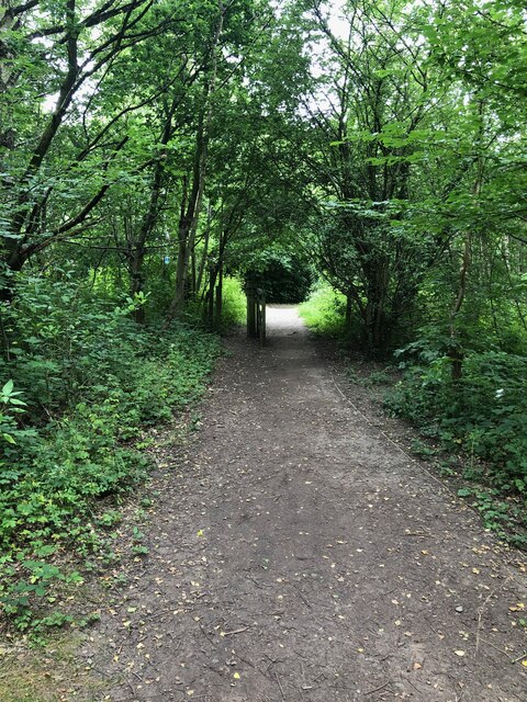
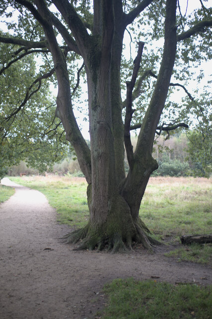
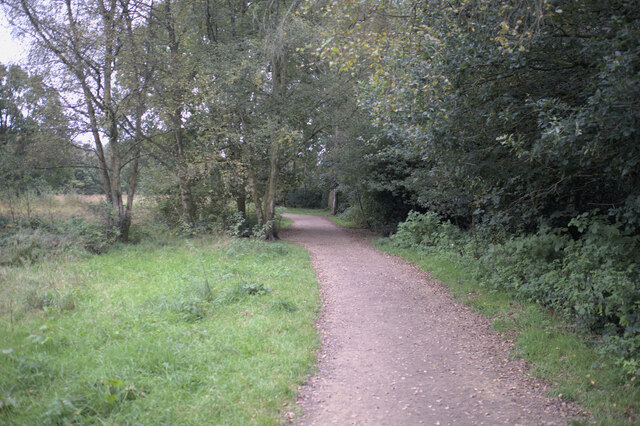
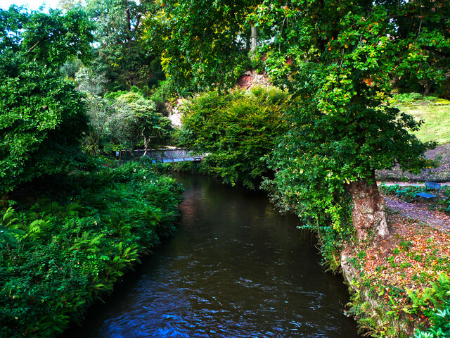
Burned Hey Wood, located in Cheshire, England, is a picturesque forest that covers an area of approximately 50 acres. It is known for its natural beauty and diverse ecosystem, attracting nature enthusiasts and hikers alike.

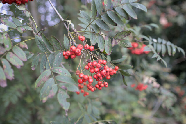
The wood is predominantly made up of deciduous trees, including oak, birch, and beech, which create a stunning canopy in the summer months. The forest floor is adorned with an array of wildflowers, ferns, and mosses, adding to its overall charm. Additionally, a small stream meanders through the wood, providing a tranquil atmosphere and attracting various wildlife.

The wood has a rich history, dating back centuries. It was once part of a larger estate and was used for timber production. However, in recent years, it has been preserved as a nature reserve, managed by the local authorities. This has led to the establishment of walking trails and picnic areas, allowing visitors to explore the beauty of the wood at their own pace.

Burned Hey Wood is a haven for birdwatchers, as it is home to a variety of bird species, including woodpeckers, owls, and various songbirds. The wood is also a habitat for small mammals such as squirrels, foxes, and badgers, which can often be spotted by observant visitors.

Overall, Burned Hey Wood offers a peaceful and idyllic escape from the hustle and bustle of everyday life. Its natural beauty, diverse flora and fauna, and historical significance make it a popular destination for nature lovers and those seeking a tranquil retreat in the heart of Cheshire.

If you have any feedback on the listing, please let us know in the comments section below.

Burned Hey Wood Images

Images are sourced within 2km of 53.336056/-2.2502233 or Grid Reference SJ8382. Thanks to Geograph Open Source API. All images are credited.

Footpath adjacent to railway line, North of Wilmslow Footpath as it enters woodland area near Alveston Drive
Footpath adjacent to railway line, North of Wilmslow
Footpath as it enters woodland area near Alveston Drive
Woodland between railway line and the A34 north of Wilmslow
Path through woodland, north of Wilmslow
View across Church Street to St Bartholomew Church Link to Wilmslow parish website that includes a virtual tour of this church. <span class="nowrap"><a title="http://wilmslowparish.co.uk" rel="nofollow ugc noopener" href="http://wilmslowparish.co.uk">Link</a><img style="margin-left:2px;" alt="External link" title="External link - shift click to open in new window" src="https://s1.geograph.org.uk/img/external.png" width="10" height="10"/></span>
View across Church Street to St Bartholomew Church
Link to Wilmslow parish website that includes a virtual tour of this church. LinkExternal link
Lindow Common sign Lindow Common is a Site of Special Scientific Interest (SSSI citation <span class="nowrap"><a title="http://www.sssi.naturalengland.org.uk/citation/citation_photo/1002734.pdf" rel="nofollow ugc noopener" href="http://www.sssi.naturalengland.org.uk/citation/citation_photo/1002734.pdf">Link</a><img style="margin-left:2px;" alt="External link" title="External link - shift click to open in new window" src="https://s1.geograph.org.uk/img/external.png" width="10" height="10"/></span>  ) on the western edge of Wilmslow, it is also designated a Local Nature Reserve (<span class="nowrap"><a title="http://www.lnr.naturalengland.org.uk/Special/lnr/lnr_details.asp?C=0&N=lindow&ID=264" rel="nofollow ugc noopener" href="http://www.lnr.naturalengland.org.uk/Special/lnr/lnr_details.asp?C=0&N=lindow&ID=264">Link</a><img style="margin-left:2px;" alt="External link" title="External link - shift click to open in new window" src="https://s1.geograph.org.uk/img/external.png" width="10" height="10"/></span>  Natural England)

The Common was once an area of heathland, where villagers could graze their cattle, but birch trees have overrun many areas, so that much of the Common is now under tree cover.

It is believed that this is the name Lindow which is also used for one of the historic parishes of Wilmslow and the adjacent Lindow Moss, is derived from Black Lake which lies in the middle of Lindow Common. The Welsh for Black Lake is llyn ddu.

Lindow Common is now managed by Cheshire East Council.

(adapted from <span class="nowrap"><a title="http://en.wikipedia.org/wiki/Lindow_Common" rel="nofollow ugc noopener" href="http://en.wikipedia.org/wiki/Lindow_Common">Link</a><img style="margin-left:2px;" alt="External link" title="External link - shift click to open in new window" src="https://s1.geograph.org.uk/img/external.png" width="10" height="10"/></span>  Wikipedia)
Lindow Common sign
Lindow Common is a Site of Special Scientific Interest (SSSI citation LinkExternal link ) on the western edge of Wilmslow, it is also designated a Local Nature Reserve (LinkExternal link Natural England) The Common was once an area of heathland, where villagers could graze their cattle, but birch trees have overrun many areas, so that much of the Common is now under tree cover. It is believed that this is the name Lindow which is also used for one of the historic parishes of Wilmslow and the adjacent Lindow Moss, is derived from Black Lake which lies in the middle of Lindow Common. The Welsh for Black Lake is llyn ddu. Lindow Common is now managed by Cheshire East Council. (adapted from LinkExternal link Wikipedia)
On Lindow Common Lindow Common is a Site of Special Scientific Interest (SSSI citation <span class="nowrap"><a title="http://www.sssi.naturalengland.org.uk/citation/citation_photo/1002734.pdf" rel="nofollow ugc noopener" href="http://www.sssi.naturalengland.org.uk/citation/citation_photo/1002734.pdf">Link</a><img style="margin-left:2px;" alt="External link" title="External link - shift click to open in new window" src="https://s1.geograph.org.uk/img/external.png" width="10" height="10"/></span>  ) on the western edge of Wilmslow, it is also designated a Local Nature Reserve (<span class="nowrap"><a title="http://www.lnr.naturalengland.org.uk/Special/lnr/lnr_details.asp?C=0&N=lindow&ID=264" rel="nofollow ugc noopener" href="http://www.lnr.naturalengland.org.uk/Special/lnr/lnr_details.asp?C=0&N=lindow&ID=264">Link</a><img style="margin-left:2px;" alt="External link" title="External link - shift click to open in new window" src="https://s1.geograph.org.uk/img/external.png" width="10" height="10"/></span>  Natural England)

The Common was once an area of heathland, where villagers could graze their cattle, but birch trees have overrun many areas, so that much of the Common is now under tree cover.

It is believed that this is the name Lindow which is also used for one of the historic parishes of Wilmslow and the adjacent Lindow Moss, is derived from Black Lake which lies in the middle of Lindow Common. The Welsh for Black Lake is llyn ddu.

Lindow Common is now managed by Cheshire East Council.

(adapted from <span class="nowrap"><a title="http://en.wikipedia.org/wiki/Lindow_Common" rel="nofollow ugc noopener" href="http://en.wikipedia.org/wiki/Lindow_Common">Link</a><img style="margin-left:2px;" alt="External link" title="External link - shift click to open in new window" src="https://s1.geograph.org.uk/img/external.png" width="10" height="10"/></span>  Wikipedia)
On Lindow Common
Lindow Common is a Site of Special Scientific Interest (SSSI citation LinkExternal link ) on the western edge of Wilmslow, it is also designated a Local Nature Reserve (LinkExternal link Natural England) The Common was once an area of heathland, where villagers could graze their cattle, but birch trees have overrun many areas, so that much of the Common is now under tree cover. It is believed that this is the name Lindow which is also used for one of the historic parishes of Wilmslow and the adjacent Lindow Moss, is derived from Black Lake which lies in the middle of Lindow Common. The Welsh for Black Lake is llyn ddu. Lindow Common is now managed by Cheshire East Council. (adapted from LinkExternal link Wikipedia)
The Black Lake Lindow Common is a Site of Special Scientific Interest (SSSI citation <span class="nowrap"><a title="http://www.sssi.naturalengland.org.uk/citation/citation_photo/1002734.pdf" rel="nofollow ugc noopener" href="http://www.sssi.naturalengland.org.uk/citation/citation_photo/1002734.pdf">Link</a><img style="margin-left:2px;" alt="External link" title="External link - shift click to open in new window" src="https://s1.geograph.org.uk/img/external.png" width="10" height="10"/></span>  ) on the western edge of Wilmslow, it is also designated a Local Nature Reserve (<span class="nowrap"><a title="http://www.lnr.naturalengland.org.uk/Special/lnr/lnr_details.asp?C=0&N=lindow&ID=264" rel="nofollow ugc noopener" href="http://www.lnr.naturalengland.org.uk/Special/lnr/lnr_details.asp?C=0&N=lindow&ID=264">Link</a><img style="margin-left:2px;" alt="External link" title="External link - shift click to open in new window" src="https://s1.geograph.org.uk/img/external.png" width="10" height="10"/></span>  Natural England)

The Common was once an area of heathland, where villagers could graze their cattle, but birch trees have overrun many areas, so that much of the Common is now under tree cover.

It is believed that this is the name Lindow which is also used for one of the historic parishes of Wilmslow and the adjacent Lindow Moss, is derived from Black Lake which lies in the middle of Lindow Common. The Welsh for Black Lake is llyn ddu.

Lindow Common is now managed by Cheshire East Council.

(adapted from <span class="nowrap"><a title="http://en.wikipedia.org/wiki/Lindow_Common" rel="nofollow ugc noopener" href="http://en.wikipedia.org/wiki/Lindow_Common">Link</a><img style="margin-left:2px;" alt="External link" title="External link - shift click to open in new window" src="https://s1.geograph.org.uk/img/external.png" width="10" height="10"/></span>  Wikipedia)
The Black Lake
Lindow Common is a Site of Special Scientific Interest (SSSI citation LinkExternal link ) on the western edge of Wilmslow, it is also designated a Local Nature Reserve (LinkExternal link Natural England) The Common was once an area of heathland, where villagers could graze their cattle, but birch trees have overrun many areas, so that much of the Common is now under tree cover. It is believed that this is the name Lindow which is also used for one of the historic parishes of Wilmslow and the adjacent Lindow Moss, is derived from Black Lake which lies in the middle of Lindow Common. The Welsh for Black Lake is llyn ddu. Lindow Common is now managed by Cheshire East Council. (adapted from LinkExternal link Wikipedia)
Multi-stemmed oak Lindow Common is a Site of Special Scientific Interest (SSSI citation <span class="nowrap"><a title="http://www.sssi.naturalengland.org.uk/citation/citation_photo/1002734.pdf" rel="nofollow ugc noopener" href="http://www.sssi.naturalengland.org.uk/citation/citation_photo/1002734.pdf">Link</a><img style="margin-left:2px;" alt="External link" title="External link - shift click to open in new window" src="https://s1.geograph.org.uk/img/external.png" width="10" height="10"/></span>  ) on the western edge of Wilmslow, it is also designated a Local Nature Reserve (<span class="nowrap"><a title="http://www.lnr.naturalengland.org.uk/Special/lnr/lnr_details.asp?C=0&N=lindow&ID=264" rel="nofollow ugc noopener" href="http://www.lnr.naturalengland.org.uk/Special/lnr/lnr_details.asp?C=0&N=lindow&ID=264">Link</a><img style="margin-left:2px;" alt="External link" title="External link - shift click to open in new window" src="https://s1.geograph.org.uk/img/external.png" width="10" height="10"/></span>  Natural England)

The Common was once an area of heathland, where villagers could graze their cattle, but birch trees have overrun many areas, so that much of the Common is now under tree cover.

It is believed that this is the name Lindow which is also used for one of the historic parishes of Wilmslow and the adjacent Lindow Moss, is derived from Black Lake which lies in the middle of Lindow Common. The Welsh for Black Lake is llyn ddu.

Lindow Common is now managed by Cheshire East Council.

(adapted from <span class="nowrap"><a title="http://en.wikipedia.org/wiki/Lindow_Common" rel="nofollow ugc noopener" href="http://en.wikipedia.org/wiki/Lindow_Common">Link</a><img style="margin-left:2px;" alt="External link" title="External link - shift click to open in new window" src="https://s1.geograph.org.uk/img/external.png" width="10" height="10"/></span>  Wikipedia)
Multi-stemmed oak
Lindow Common is a Site of Special Scientific Interest (SSSI citation LinkExternal link ) on the western edge of Wilmslow, it is also designated a Local Nature Reserve (LinkExternal link Natural England) The Common was once an area of heathland, where villagers could graze their cattle, but birch trees have overrun many areas, so that much of the Common is now under tree cover. It is believed that this is the name Lindow which is also used for one of the historic parishes of Wilmslow and the adjacent Lindow Moss, is derived from Black Lake which lies in the middle of Lindow Common. The Welsh for Black Lake is llyn ddu. Lindow Common is now managed by Cheshire East Council. (adapted from LinkExternal link Wikipedia)
Entering the common Lindow Common is a Site of Special Scientific Interest (SSSI citation <span class="nowrap"><a title="http://www.sssi.naturalengland.org.uk/citation/citation_photo/1002734.pdf" rel="nofollow ugc noopener" href="http://www.sssi.naturalengland.org.uk/citation/citation_photo/1002734.pdf">Link</a><img style="margin-left:2px;" alt="External link" title="External link - shift click to open in new window" src="https://s1.geograph.org.uk/img/external.png" width="10" height="10"/></span>  ) on the western edge of Wilmslow, it is also designated a Local Nature Reserve (<span class="nowrap"><a title="http://www.lnr.naturalengland.org.uk/Special/lnr/lnr_details.asp?C=0&N=lindow&ID=264" rel="nofollow ugc noopener" href="http://www.lnr.naturalengland.org.uk/Special/lnr/lnr_details.asp?C=0&N=lindow&ID=264">Link</a><img style="margin-left:2px;" alt="External link" title="External link - shift click to open in new window" src="https://s1.geograph.org.uk/img/external.png" width="10" height="10"/></span>  Natural England)

The Common was once an area of heathland, where villagers could graze their cattle, but birch trees have overrun many areas, so that much of the Common is now under tree cover.

It is believed that this is the name Lindow which is also used for one of the historic parishes of Wilmslow and the adjacent Lindow Moss, is derived from Black Lake which lies in the middle of Lindow Common. The Welsh for Black Lake is llyn ddu.

Lindow Common is now managed by Cheshire East Council.

(adapted from <span class="nowrap"><a title="http://en.wikipedia.org/wiki/Lindow_Common" rel="nofollow ugc noopener" href="http://en.wikipedia.org/wiki/Lindow_Common">Link</a><img style="margin-left:2px;" alt="External link" title="External link - shift click to open in new window" src="https://s1.geograph.org.uk/img/external.png" width="10" height="10"/></span>  Wikipedia)
Entering the common
Lindow Common is a Site of Special Scientific Interest (SSSI citation LinkExternal link ) on the western edge of Wilmslow, it is also designated a Local Nature Reserve (LinkExternal link Natural England) The Common was once an area of heathland, where villagers could graze their cattle, but birch trees have overrun many areas, so that much of the Common is now under tree cover. It is believed that this is the name Lindow which is also used for one of the historic parishes of Wilmslow and the adjacent Lindow Moss, is derived from Black Lake which lies in the middle of Lindow Common. The Welsh for Black Lake is llyn ddu. Lindow Common is now managed by Cheshire East Council. (adapted from LinkExternal link Wikipedia)
Berries on a Rowan Lindow Common is a Site of Special Scientific Interest (SSSI citation <span class="nowrap"><a title="http://www.sssi.naturalengland.org.uk/citation/citation_photo/1002734.pdf" rel="nofollow ugc noopener" href="http://www.sssi.naturalengland.org.uk/citation/citation_photo/1002734.pdf">Link</a><img style="margin-left:2px;" alt="External link" title="External link - shift click to open in new window" src="https://s1.geograph.org.uk/img/external.png" width="10" height="10"/></span>  ) on the western edge of Wilmslow, it is also designated a Local Nature Reserve (<span class="nowrap"><a title="http://www.lnr.naturalengland.org.uk/Special/lnr/lnr_details.asp?C=0&N=lindow&ID=264" rel="nofollow ugc noopener" href="http://www.lnr.naturalengland.org.uk/Special/lnr/lnr_details.asp?C=0&N=lindow&ID=264">Link</a><img style="margin-left:2px;" alt="External link" title="External link - shift click to open in new window" src="https://s1.geograph.org.uk/img/external.png" width="10" height="10"/></span>  Natural England)

The Common was once an area of heathland, where villagers could graze their cattle, but birch trees have overrun many areas, so that much of the Common is now under tree cover.

It is believed that this is the name Lindow which is also used for one of the historic parishes of Wilmslow and the adjacent Lindow Moss, is derived from Black Lake which lies in the middle of Lindow Common. The Welsh for Black Lake is llyn ddu.

Lindow Common is now managed by Cheshire East Council.

(adapted from <span class="nowrap"><a title="http://en.wikipedia.org/wiki/Lindow_Common" rel="nofollow ugc noopener" href="http://en.wikipedia.org/wiki/Lindow_Common">Link</a><img style="margin-left:2px;" alt="External link" title="External link - shift click to open in new window" src="https://s1.geograph.org.uk/img/external.png" width="10" height="10"/></span>  Wikipedia)
Berries on a Rowan
Lindow Common is a Site of Special Scientific Interest (SSSI citation LinkExternal link ) on the western edge of Wilmslow, it is also designated a Local Nature Reserve (LinkExternal link Natural England) The Common was once an area of heathland, where villagers could graze their cattle, but birch trees have overrun many areas, so that much of the Common is now under tree cover. It is believed that this is the name Lindow which is also used for one of the historic parishes of Wilmslow and the adjacent Lindow Moss, is derived from Black Lake which lies in the middle of Lindow Common. The Welsh for Black Lake is llyn ddu. Lindow Common is now managed by Cheshire East Council. (adapted from LinkExternal link Wikipedia)
Cottages on Racecourse road
Semidetached houses Houses in racecourse road.
Semidetached houses
Houses in racecourse road.
The entrance yard to Quarry Bank Mill, Styal Although now a National Trust property much of the machinery is still in use, and some of it is amazingly complicated, the result of years of 'brain-work' in the 19C.
The entrance yard to Quarry Bank Mill, Styal
Although now a National Trust property much of the machinery is still in use, and some of it is amazingly complicated, the result of years of 'brain-work' in the 19C.
The River Bollin at Quarry Bank Mill, Styal This is the river upstream of the packhorse bridge.
The River Bollin at Quarry Bank Mill, Styal
This is the river upstream of the packhorse bridge.
Inside the water wheel, Quarry Bank Mill, Styal This wheel is very wide, said to be the biggest in Europe. See <a href="https://www.geograph.org.uk/photo/2176475">SJ8382 : Waterwheel, Quarry Bank Mill</a> for more information.
Inside the water wheel, Quarry Bank Mill, Styal
This wheel is very wide, said to be the biggest in Europe. See SJ8382 : Waterwheel, Quarry Bank Mill for more information.
Warehouse and shop, Oak Cottages, Styal The shop is just a shop-front now, with a house behind. The same probably applies to the warehouse; perhaps the door leads to a garage now.
Warehouse and shop, Oak Cottages, Styal
The shop is just a shop-front now, with a house behind. The same probably applies to the warehouse; perhaps the door leads to a garage now.
Show me another place!

Burned Hey Wood is located at Grid Ref: SJ8382 (Lat: 53.336056, Lng: -2.2502233)

Unitary Authority: Cheshire East

Police Authority: Cheshire

What 3 Words

///grants.telephone.narrate. Near Wilmslow, Cheshire

Related Wikis

Pownall Hall

Pownall Hall is a former country house in Wilmslow, Cheshire, England. It was remodelled in 1830 as "a red sandstone Georgian house dressed up in the...
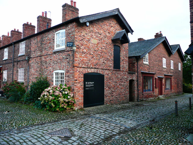
Styal Cottage Homes

Styal Cottage Homes were open from October 1898 to 1956 and housed destitute children from the Manchester area. They were established in Styal by the...

HM Prison Styal

HM Prison Styal is a Closed Category prison for female adults and young offenders in Styal, Cheshire, England. The prison is operated by His Majesty's...
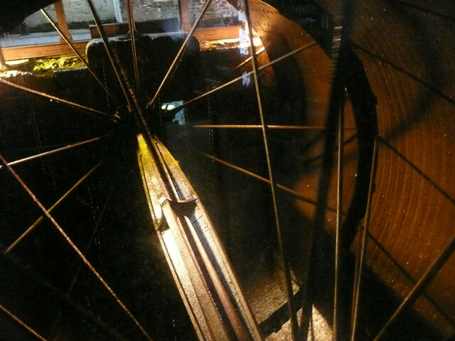
Quarry Bank Mill

Quarry Bank Mill (also known as Styal Mill) in Styal, Cheshire, England, is one of the best preserved textile factories of the Industrial Revolution....
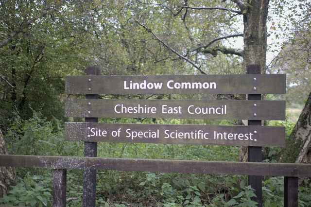
Lindow Common

Lindow Common is a Site of Special Scientific Interest (SSSI) on the western edge of the town of Wilmslow, Cheshire, in the northwest of England. It is...

The Carrs Park

The Carrs Park is a park in Wilmslow, Cheshire, England. The park was gifted to the town by Henry Boddington and follows the path of the River Bollin....

Hawthorn Hall

Hawthorn Hall is a former country house in Hall Road, Wilmslow, Cheshire, England. It originated in about 1610 as a timber-framed yeoman house for John...

Lacey Green, Cheshire

Lacey Green is a council estate in the upmarket area of Wilmslow in the English county of Cheshire. The population at the 2011 Census was 4,718. It lies...

Nearby Amenities

Located within 500m of 53.336056,-2.2502233
Traffic Calming: cushion
Lat/Long: 53.3327705/-2.2488014
Post Box
Check Date: 2021-01-30
Collection Times: Mo-Fr 09:00, Sa 07:00
Postal Code: SK9
Ref: SK9 642
Lat/Long: 53.3332534/-2.250342
Post Box
Postal Code: SK9
Ref: SK9 70
Lat/Long: 53.3320708/-2.2536018
Addr Housenumber: 44
Addr Postcode: SK9 5PW
Addr Street: Kings Road
Source Post Code: ONS
Lat/Long: 53.3332217/-2.2505727
Addr Housenumber: 64
Addr Postcode: SK9 5PW
Addr Street: Kings Road
Source Post Code: ONS
Lat/Long: 53.3321018/-2.2520711
Addr Housenumber: 42
Addr Postcode: SK9 5PZ
Addr Street: Kings Road
Source Post Code: ONS
Lat/Long: 53.3333402/-2.2504173
Addr Housenumber: 38
Addr Postcode: SK9 5PZ
Addr Street: Kings Road
Source Post Code: ONS
Lat/Long: 53.3335526/-2.2501261
Addr Housenumber: 30
Addr Postcode: SK9 5PZ
Addr Street: Kings Road
Source Post Code: ONS
Lat/Long: 53.3339395/-2.2494331
Addr Housenumber: 28
Addr Postcode: SK9 5PZ
Addr Street: Kings Road
Source Post Code: ONS
Lat/Long: 53.3341974/-2.2490143
Addr Housenumber: 6
Addr Postcode: SK9 5PZ
Addr Street: Kings Road
Source Post Code: ONS
Lat/Long: 53.3353202/-2.2475746
Addr Housenumber: 4
Addr Postcode: SK9 5PZ
Addr Street: Kings Road
Source Post Code: ONS
Lat/Long: 53.3355886/-2.2472342
Addr Housenumber: 2
Addr Postcode: SK9 5PZ
Addr Street: Kings Road
Source Post Code: ONS
Lat/Long: 53.3357045/-2.2468983
Addr Housenumber: 1
Addr Postcode: SK9 5QA
Addr Street: Vale Road
Source Post Code: ONS
Lat/Long: 53.3340677/-2.2498296
Addr Housenumber: 17
Addr Postcode: SK9 5QA
Addr Street: Vale Road
Source Post Code: ONS
Lat/Long: 53.3352142/-2.2494523
Addr Housenumber: 19
Addr Postcode: SK9 5QA
Addr Street: Vale Road
Source Post Code: ONS
Lat/Long: 53.3353832/-2.2493708
Addr Housenumber: 21
Addr Postcode: SK9 5QA
Addr Street: Vale Road
Source Post Code: ONS
Lat/Long: 53.3355108/-2.2491818
Addr Housenumber: 20
Addr Postcode: SK9 5QA
Addr Street: Vale Road
Source Post Code: ONS
Lat/Long: 53.3353933/-2.2488616
Addr Housenumber: 18
Addr Postcode: SK9 5QA
Addr Street: Vale Road
Source Post Code: ONS
Lat/Long: 53.3352495/-2.2488479
Addr Housenumber: 16
Addr Postcode: SK9 5QA
Addr Street: Vale Road
Source Post Code: ONS
Lat/Long: 53.3351104/-2.2489274
Addr Housenumber: 4
Addr Postcode: SK9 5QA
Addr Street: Vale Road
Source Post Code: ONS
Lat/Long: 53.3344649/-2.2493537
Addr Housenumber: 2
Addr Postcode: SK9 5QA
Addr Street: Vale Road
Source Post Code: ONS
Lat/Long: 53.3343294/-2.2494131
Addr Housenumber: 1
Addr Postcode: SK9 5QB
Addr Street: Woodlands Road
Source Post Code: ONS
Lat/Long: 53.3354125/-2.2478355
Addr Housenumber: 15
Addr Postcode: SK9 5QB
Addr Street: Woodlands Road
Source Post Code: ONS
Lat/Long: 53.3358996/-2.2493918
Addr Housenumber: 2
Addr Postcode: SK9 5QB
Addr Street: Woodlands Road
Source Post Code: ONS
Lat/Long: 53.3357973/-2.2474083
Addr Housenumber: 16
Addr Postcode: SK9 5QB
Addr Street: Woodlands Road
Source Post Code: ONS
Lat/Long: 53.3362235/-2.2491136
Addr Housenumber: 17
Addr Postcode: SK9 5QB
Addr Street: Woodlands Road
Source Post Code: ONS
Lat/Long: 53.3359568/-2.2496991
Addr Housenumber: 18
Addr Postcode: SK9 5QB
Addr Street: Woodlands Road
Source Post Code: ONS
Lat/Long: 53.3362539/-2.2494173
Addr Housenumber: 1
Addr Postcode: SK9 5PZ
Addr Street: Kings Road
Source Post Code: ONS
Lat/Long: 53.3353563/-2.2458198
Addr Housenumber: 7
Addr Postcode: SK9 5PZ
Addr Street: Kings Road
Source Post Code: ONS
Lat/Long: 53.3352678/-2.2467875
Addr Housenumber: 25
Addr Postcode: SK9 5PZ
Addr Street: Kings Road
Source Post Code: ONS
Lat/Long: 53.3341386/-2.248182
Addr Housenumber: 27
Addr Postcode: SK9 5PZ
Addr Street: Kings Road
Source Post Code: ONS
Lat/Long: 53.3340464/-2.2484398
Addr Housenumber: 31
Addr Postcode: SK9 5PZ
Addr Street: Kings Road
Source Post Code: ONS
Lat/Long: 53.3338443/-2.2487427
Addr Housenumber: 41
Addr Postcode: SK9 5PZ
Addr Street: Kings Road
Source Post Code: ONS
Lat/Long: 53.3333488/-2.2495431
Bus Stop
Pownall Park, Altrincham Road / Sandy Lane
Bus: yes
Naptan AtcoCode: 0600MA0598
Naptan Bearing: SE
Naptan CommonName: Sandy Lane
Naptan Crossing: Sandy Lane
Naptan Indicator: opp
Naptan Landmark: Sandy Lane
Naptan LocalityName: Pownall Park
Naptan NaptanCode: chepgjw
Naptan ShortCommonName: Sandy Lane
Naptan Street: Water Lane
Naptan Verified: no
Network: Cheshire East Council
Operator: Ansa Transport
Public Transport: platform
Source: naptan_import
Lat/Long: 53.332195/-2.2534004
Entrance: main
Lat/Long: 53.3321324/-2.2532072
Entrance: main
Lat/Long: 53.3323015/-2.25333
Entrance: main
Lat/Long: 53.3318444/-2.2521074
Addr Housenumber: 10
Addr Street: Wallworth Terrace
Lat/Long: 53.3322376/-2.2538632
Traffic Calming: cushion
Lat/Long: 53.3321639/-2.2476221
Traffic Calming: cushion
Lat/Long: 53.3337078/-2.2494168
Traffic Calming: cushion
Lat/Long: 53.3344423/-2.2482665
Street Lamp
Associated Street: Priory Road
Ref: 11
Lat/Long: 53.331674/-2.2516238
Street Lamp
Associated Street: Friars Close
Ref: 2
Lat/Long: 53.3317374/-2.2507543
Street Lamp
Associated Street: Manor Close
Ref: 4
Lat/Long: 53.3318519/-2.2488528
Street Lamp
Associated Street: Friars Close
Ref: 3
Lat/Long: 53.3319288/-2.2504531
Street Lamp
Associated Street: Manor Close
Ref: 1
Lat/Long: 53.331579/-2.2500927
Street Lamp
Associated Street: Manor Close
Ref: 3
Lat/Long: 53.3322909/-2.2495762
Street Lamp
Associated Street: Manor Close
Ref: 2
Lat/Long: 53.3324716/-2.2499482
Street Lamp
Ref: 1
Lat/Long: 53.3340381/-2.2493385
Street Lamp
Ref: 2
Lat/Long: 53.3341921/-2.2497574
Street Lamp
Ref: 3
Lat/Long: 53.3344577/-2.2495579
Street Lamp
Ref: 4
Lat/Long: 53.3347767/-2.2495186
Street Lamp
Ref: 5
Lat/Long: 53.3350349/-2.2492219
Street Lamp
Ref: 6
Lat/Long: 53.3353578/-2.2491144
Street Lamp
Ref: 1
Lat/Long: 53.3354033/-2.2474386
Street Lamp
Ref: 2
Lat/Long: 53.3356192/-2.2478112
Street Lamp
Ref: 3
Lat/Long: 53.3356829/-2.2483073
Street Lamp
Ref: 4
Lat/Long: 53.3359047/-2.2487269
Street Lamp
Ref: 5
Lat/Long: 53.3359648/-2.2491801
Pownall Park
Place: suburb
Lat/Long: 53.3331263/-2.2488503
Bench
Material: wood
Lat/Long: 53.3384222/-2.250303
Bench
Material: wood
Lat/Long: 53.3402881/-2.2520015
Bench
Material: wood
Lat/Long: 53.3386634/-2.2511016
Barrier: kissing_gate
Lat/Long: 53.3373728/-2.2436557
KLNIK
Addr City: Wilmslow, Cheshire
Addr Housename: KLNIK
Addr Postcode: SK9 4LY
Addr Street: The Colony
Lat/Long: 53.3372958/-2.2574172
Waste Basket
Lat/Long: 53.3359715/-2.2427019
Waste Basket
Lat/Long: 53.3357597/-2.2455779
Crossing
Button Operated: yes
Crossing: traffic_signals
Crossing Island: no
Tactile Paving: yes
Lat/Long: 53.3338698/-2.2546395
Crossing
Lat/Long: 53.3319559/-2.2531839
Crossing
Lat/Long: 53.3324665/-2.2535461
Bus Stop
Morley Green, Altrincham Road / Waters
Bus: yes
Naptan AtcoCode: 0600MA19168
Naptan Bearing: SE
Naptan CommonName: Waters
Naptan Indicator: o/s
Naptan Landmark: Waters
Naptan LocalityName: Morley Green
Naptan NaptanCode: cheagagm
Naptan ShortCommonName: Waters
Naptan Street: Altrincham Road
Network: Cheshire East Council
Operator: Ansa Transport
Public Transport: platform
Source: naptan_import
Lat/Long: 53.3356792/-2.2555794
Bus Stop
Morley Green, Altrincham Road / Mobberley Road
Bus: yes
Naptan AtcoCode: 0600MA19167
Naptan Bearing: N
Naptan BusStopType: CUS
Naptan CommonName: Mobberley Road
Naptan Crossing: Mobberley Road
Naptan Indicator: nr
Naptan Landmark: Mobberley Road
Naptan LocalityName: Morley Green
Naptan NaptanCode: cheagadw
Naptan ShortCommonName: Mobberley Road
Naptan Street: Altrincham Road
Network: Cheshire East Council
Operator: Ansa Transport
Public Transport: platform
Source: naptan_import
Lat/Long: 53.3342048/-2.2549709
Bus Stop
Morley Green, Mobberley Road / Altrincham Road
Bus: yes
Naptan AtcoCode: 0600MA19166
Naptan Bearing: SE
Naptan CommonName: Water Lane
Naptan Crossing: Water Lane
Naptan Indicator: nr
Naptan Landmark: Water Lane
Naptan LocalityName: Morley Green
Naptan NaptanCode: cheagagp
Naptan ShortCommonName: Water Lane
Naptan Street: Mobberley Road
Network: Cheshire East Council
Operator: Ansa Transport
Public Transport: platform
Source: naptan_import
Lat/Long: 53.3336536/-2.2549229
Wilmslow Running Club
Club: sport
Sport: running
Website: https://wilmslowrunningclub.co.uk/
Lat/Long: 53.3368605/-2.2452563
Leisure: picnic_table
Tourism: picnic_site
Lat/Long: 53.3356838/-2.2427881
Leisure: picnic_table
Tourism: picnic_site
Lat/Long: 53.3356075/-2.2428507
Leisure: picnic_table
Tourism: picnic_site
Lat/Long: 53.3353995/-2.2428142
The data included in this document is from www.openstreetmap.org. The data is made available under ODbL.

Have you been to Burned Hey Wood?

Leave your review of Burned Hey Wood below (or comments, questions and feedback).