Standish Wood

Wood, Forest in Gloucestershire Stroud

England

Standish Wood

Topograph on Haresfield Beacon The Severn Estuary can be seen in the distance.
Topograph on Haresfield Beacon Credit: Philip Halling

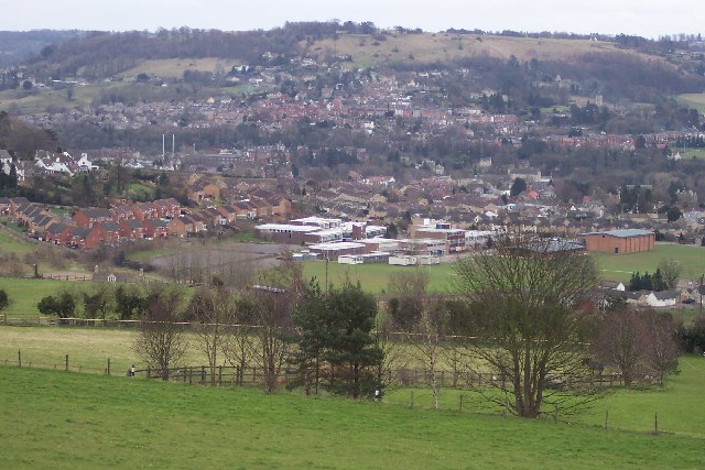
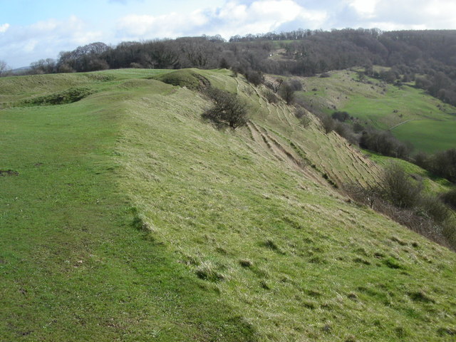
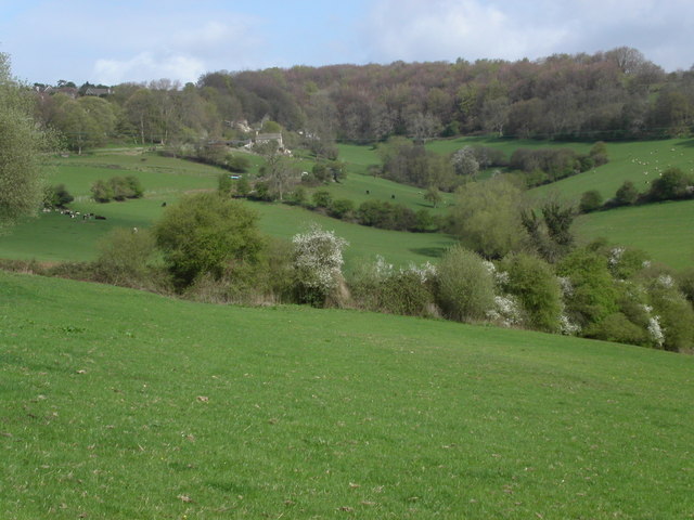
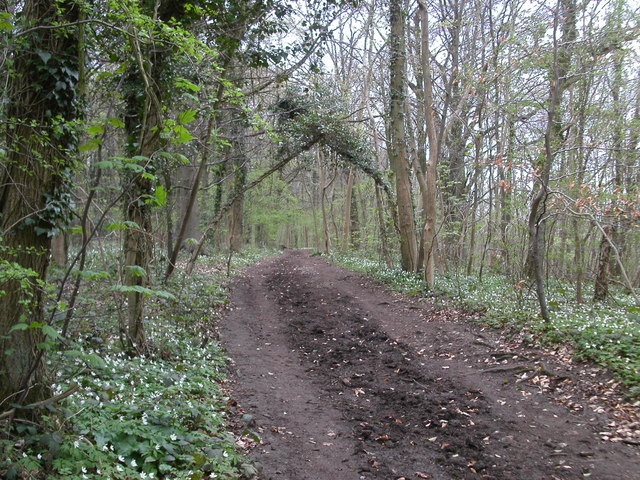
Standish Wood is a picturesque forest located in Gloucestershire, England. Covering an area of approximately 103 acres, this woodland is a haven for nature enthusiasts and provides a tranquil escape from the hustle and bustle of everyday life.

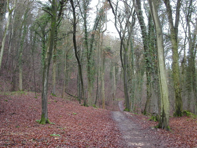
With its diverse range of tree species, including oak, birch, and beech, Standish Wood offers a stunning display of colors throughout the year. In spring, the forest floor comes alive with vibrant bluebells and delicate wildflowers, creating a carpet of beauty. During the summer months, the canopy provides much-needed shade, while the leaves rustle in the gentle breeze. Autumn transforms the woodland into a breathtaking palette of reds, oranges, and yellows as the foliage prepares for winter.

The forest is home to a variety of wildlife, making it a popular spot for birdwatchers and nature lovers. Visitors may have the opportunity to see species such as woodpeckers, owls, and various songbirds. Additionally, the woodland is inhabited by small mammals like squirrels, rabbits, and badgers, as well as an assortment of insects and butterflies.

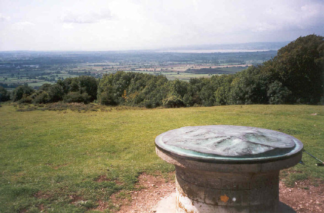
Standish Wood offers several well-maintained walking trails, allowing visitors to explore its beauty at their own pace. These paths meander through the forest, providing glimpses of serene ponds and babbling brooks along the way. The forest also features picnic areas, where visitors can relax and enjoy a packed lunch amidst the natural surroundings.

Overall, Standish Wood in Gloucestershire is a captivating destination, offering visitors a chance to immerse themselves in the beauty of nature while enjoying the tranquility of this picturesque woodland.

If you have any feedback on the listing, please let us know in the comments section below.

Standish Wood Images

Images are sourced within 2km of 51.766321/-2.2481363 or Grid Reference SO8207. Thanks to Geograph Open Source API. All images are credited.
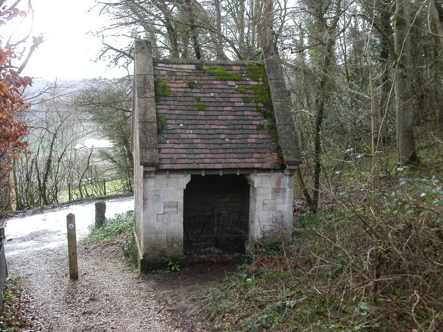
Topograph on Haresfield Beacon The Severn Estuary can be seen in the distance.
Topograph on Haresfield Beacon
The Severn Estuary can be seen in the distance.
Stroud view General view of Stroud. The clump of buildings in the centre of the picture belong to Archway School. The pair of white lines looking like a giant rugby goal are chimney stacks belonging to the Millikan factory, a wool cloth mill. The hill in the background is Rodborough Hill.
Stroud view
General view of Stroud. The clump of buildings in the centre of the picture belong to Archway School. The pair of white lines looking like a giant rugby goal are chimney stacks belonging to the Millikan factory, a wool cloth mill. The hill in the background is Rodborough Hill.
Cliff  Well on the Cotswold Way path Standing beside the Cotswold Way path on Haresfield Hill is Cliff Well. The entrance is on the other side. The building still contains a winch although the well is capped.
Cliff Well on the Cotswold Way path
Standing beside the Cotswold Way path on Haresfield Hill is Cliff Well. The entrance is on the other side. The building still contains a winch although the well is capped.
Cotswold Way path at Ring Hill The Cotswold Way path runs along Ring Hill as you walk from Haresfield Beacon.
Cotswold Way path at Ring Hill
The Cotswold Way path runs along Ring Hill as you walk from Haresfield Beacon.
Cotswold Way path woodland The Cotswold Way path as it runs between Maitlands Wood and Hallidays Wood not far from Edge village.
Cotswold Way path woodland
The Cotswold Way path as it runs between Maitlands Wood and Hallidays Wood not far from Edge village.
Road to Haresfield Beacon The road forks left to Haresfield Beacon. A popular walking area with views of the river Severn. The Cotswold Way path lies close to the road.
Road to Haresfield Beacon
The road forks left to Haresfield Beacon. A popular walking area with views of the river Severn. The Cotswold Way path lies close to the road.
Farmland below Standish Woods The farmland past Standish village starts to rise towards Standish woods. The Cotswold Way path runs through the woods.
Farmland below Standish Woods
The farmland past Standish village starts to rise towards Standish woods. The Cotswold Way path runs through the woods.
Vinegar Hill Vinegar hill lies on the lower slopes of Haresfield Beacon where the Cotswold Way path travels by.
Vinegar Hill
Vinegar hill lies on the lower slopes of Haresfield Beacon where the Cotswold Way path travels by.
Cliff Well This photo shows the entrance to access the winding winch of the well.
Cliff Well
This photo shows the entrance to access the winding winch of the well.
Stone monument close to the Cotswold Way path Unknown stone monument along the Cotswold Way path just west from Cliff Well in Cliff wood.

[Update: this is Cromwell or Cromwell's Stone, commemorating the relief of the Royalist siege of Gloucester by Parliamentary forces in September 1643. <span class="nowrap"><a title="http://www.heritagegateway.org.uk/Gateway/Results_Single.aspx?uid=7879&resourceID=108" rel="nofollow ugc noopener" href="http://www.heritagegateway.org.uk/Gateway/Results_Single.aspx?uid=7879&resourceID=108">Link</a><img style="margin-left:2px;" alt="External link" title="External link - shift click to open in new window" src="https://s1.geograph.org.uk/img/external.png" width="10" height="10"/></span> ]
Stone monument close to the Cotswold Way path
Unknown stone monument along the Cotswold Way path just west from Cliff Well in Cliff wood. [Update: this is Cromwell or Cromwell's Stone, commemorating the relief of the Royalist siege of Gloucester by Parliamentary forces in September 1643. LinkExternal link ]
Cotswold Way path at Haresfield Beacon The Cotswold Way path runs east along the ridge at Haresfield Beacon from the triangulation pillar towards Bunkers Bank.
Cotswold Way path at Haresfield Beacon
The Cotswold Way path runs east along the ridge at Haresfield Beacon from the triangulation pillar towards Bunkers Bank.
Whiteshill Church Whiteshill church is situated at the southern end of Whiteshill and just north of Stroud. The church was opened in 1840.
Whiteshill Church
Whiteshill church is situated at the southern end of Whiteshill and just north of Stroud. The church was opened in 1840.
Farmland below Whiteshill Cotswold farmland to the east and below Whiteshill village. 2Km north of Stroud.
Farmland below Whiteshill
Cotswold farmland to the east and below Whiteshill village. 2Km north of Stroud.
Whiteshill village Whiteshill village is 2Km north of Stroud. The Cotswold Way path is 1Km to the west in Standish woods.
Whiteshill village
Whiteshill village is 2Km north of Stroud. The Cotswold Way path is 1Km to the west in Standish woods.
Randwick church Randwick parish church lies just below Standish wood and is 1Km north of Stroud.
Randwick church
Randwick parish church lies just below Standish wood and is 1Km north of Stroud.
Cotswold Way path in Standish woods The Cotswold Way path as it runs south-west through Standish woods. Taken in late April with a late spring the floor of the wood was covered in Wild Garlic and Bluebells.
Cotswold Way path in Standish woods
The Cotswold Way path as it runs south-west through Standish woods. Taken in late April with a late spring the floor of the wood was covered in Wild Garlic and Bluebells.
Ocker Hill phone box An original red phonebox stands by the footpath marker at Ocker Hill, Randwick.
Ocker Hill phone box
An original red phonebox stands by the footpath marker at Ocker Hill, Randwick.
Ruscombe Tucked into a narrow valley in the Cotswolds just north of Stroud. A view from the Congregational church.
Ruscombe
Tucked into a narrow valley in the Cotswolds just north of Stroud. A view from the Congregational church.
Show me another place!

Standish Wood is located at Grid Ref: SO8207 (Lat: 51.766321, Lng: -2.2481363)

Administrative County: Gloucestershire

District: Stroud

Police Authority: Gloucestershire

What 3 Words

///mentioned.lawn.defender. Near Stonehouse, Gloucestershire

Nearby Locations

Standish Wood

Related Wikis

Randwick, Gloucestershire

Randwick is a village bordering the market town of Stroud in Gloucestershire, England, the United Kingdom. It is known locally for its folk traditions...

Whiteshill, Stroud

Whiteshill is a village in the Cotswolds, situated between Stroud and Gloucester, in Gloucestershire, England and forms part of the Stroud urban area....
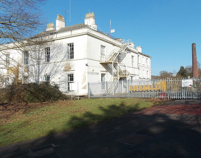
Standish Hospital

Standish Hospital was a specialist orthopaedics, rheumatology and respiratory care National Health Service (NHS) hospital, located in the hamlet of Standish...

Arlebrook

Arlebrook is a village in Gloucestershire, England. A timber framed house known as the Thatched Cottage was built in the 16th century. Next to it is an...

Haresfield Beacon

Haresfield Beacon (grid reference SO819088) is a 0.73-hectare (1.8-acre) geological Site of Special Scientific Interest in Gloucestershire, notified in...

Archway School

Archway School is a comprehensive co-educational school for pupils aged 11 to 18 in Stroud, Gloucestershire, England. The headteacher is Kieron Smith....

Cashes Green

Cashes Green is a substantial residential area in the civil parish of Cainscross on the outskirts of Stroud, in Gloucestershire, England. Although the...

Pitchcombe

Pitchcombe is a village and civil parish 6 miles (9.7 km) south of Gloucester, in the Stroud district, in the county of Gloucestershire, England. In 2011...

Nearby Amenities

Located within 500m of 51.766321,-2.2481363
Ele: 222.6694336
Lat/Long: 51.7640335/-2.247506
Marker: stone
Lat/Long: 51.7650906/-2.2462614
Marker: stone
Lat/Long: 51.7661052/-2.2454031
Marker: stone
Lat/Long: 51.7687485/-2.2434243
Marker: stone
Lat/Long: 51.7681236/-2.2474802
Marker: stone
Lat/Long: 51.7664717/-2.249008
Bus Stop
Lightwood Lane
Naptan AtcoCode: 1600GLS243
Naptan Bearing: NE
Naptan CommonName: Lightwood Lane
Naptan Indicator: Opp
Naptan NaptanCode: gloawtjp
Naptan PlusbusZoneRef: STRUD
Naptan Street: Church Rd
Naptan Verified: no
Source: naptan_import
Lat/Long: 51.7621349/-2.2464433
Bus Stop
Lightwood Lane
Naptan AtcoCode: 1600GLS244
Naptan Bearing: SW
Naptan CommonName: Lightwood Lane
Naptan NaptanCode: gloawtjt
Naptan PlusbusZoneRef: STRUD
Naptan Street: Church Rd
Naptan Verified: no
Source: naptan_import
Lat/Long: 51.762099/-2.2463852
Power: pole
Lat/Long: 51.766756/-2.2430083
Post Box
Collection Times: Mo-Fr 09:00; Sa 07:00; Su off
Drive Through: no
Operator: Royal Mail
Post Box Type: lamp
Ref: GL6 237D
Royal Cypher: EIIR
Royal Cypher Wikidata: Q33102113
Source: survey
Lat/Long: 51.7621313/-2.2463127
Give Way
Direction: backward
Lat/Long: 51.7621905/-2.2462749
Bus Stop
Ele: 221.7081299
Lat/Long: 51.7640654/-2.2457636
The data included in this document is from www.openstreetmap.org. The data is made available under ODbL.

Have you been to Standish Wood?

Leave your review of Standish Wood below (or comments, questions and feedback).