Flagstaff Plantation

Wood, Forest in Staffordshire Newcastle-under-Lyme

England

Flagstaff Plantation

All Bowls A pleasant afternoon bowling in Newcastle under Lyme
All Bowls Credit: Andy and Hilary

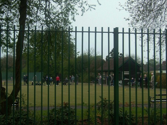
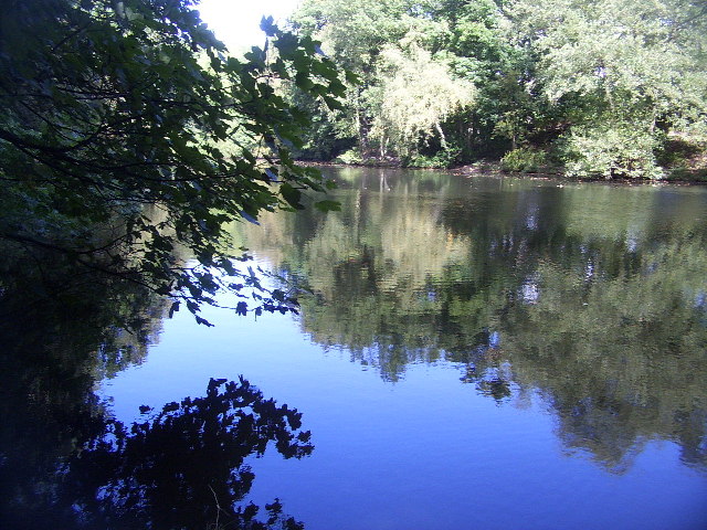
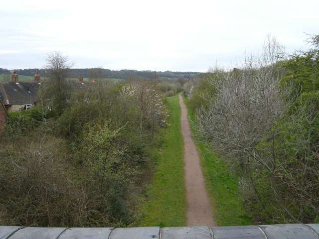
Flagstaff Plantation is a picturesque woodland located in Staffordshire, England. Situated in the heart of the county, it covers an area of approximately 100 acres and is renowned for its natural beauty and diverse range of flora and fauna. The plantation is named after the distinctive flagstaff that can be found at its entrance, which historically served as a navigation aid for passing ships on the nearby canal.

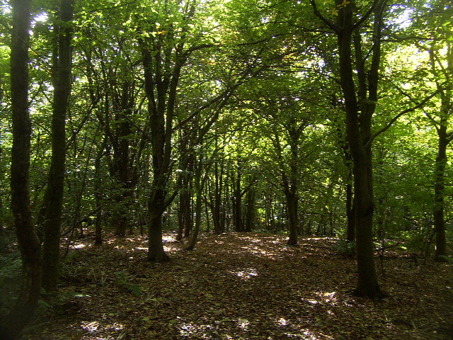
The woodland is characterized by its dense canopy of mature trees, predominantly consisting of native species such as oak, beech, and birch. These towering trees provide a haven for a variety of wildlife, including squirrels, deer, and a wide array of bird species. The undergrowth is rich with wildflowers, ferns, and mosses, creating a vibrant and enchanting atmosphere.

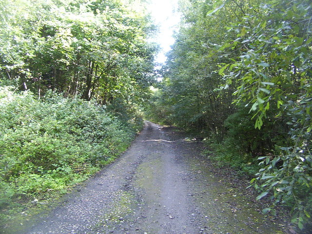
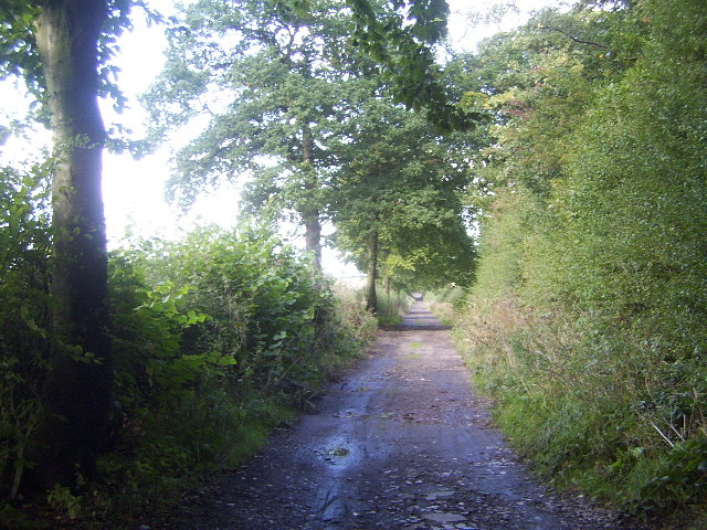
Flagstaff Plantation offers visitors a tranquil and immersive experience in nature. The woodland is crisscrossed with a network of well-maintained trails, making it a popular spot for walkers, joggers, and nature enthusiasts. The paths wind through the trees, offering glimpses of sunlight filtering through the leaves and allowing visitors to appreciate the changing seasons.

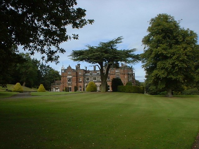
In addition to its natural beauty, Flagstaff Plantation also holds historical significance. It was once part of an extensive estate owned by a prominent local family, and remnants of an old mansion can still be found within the woodland. These historic relics add an element of intrigue and provide a glimpse into the area's past.

Overall, Flagstaff Plantation is a hidden gem within Staffordshire, offering a serene and captivating escape from the hustle and bustle of everyday life. Whether one seeks solace in nature, enjoys a leisurely stroll, or simply wants to explore the historical remnants, this woodland provides an enchanting experience for all who visit.

If you have any feedback on the listing, please let us know in the comments section below.

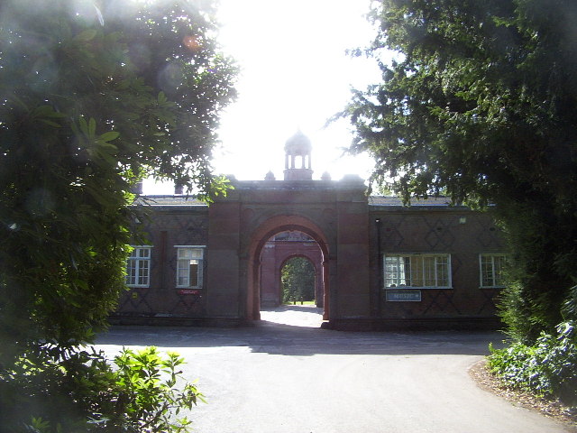
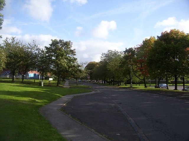
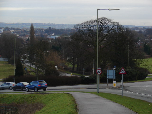
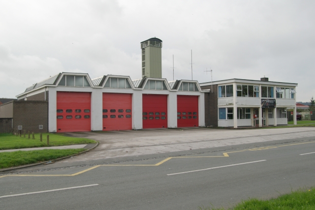
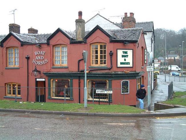
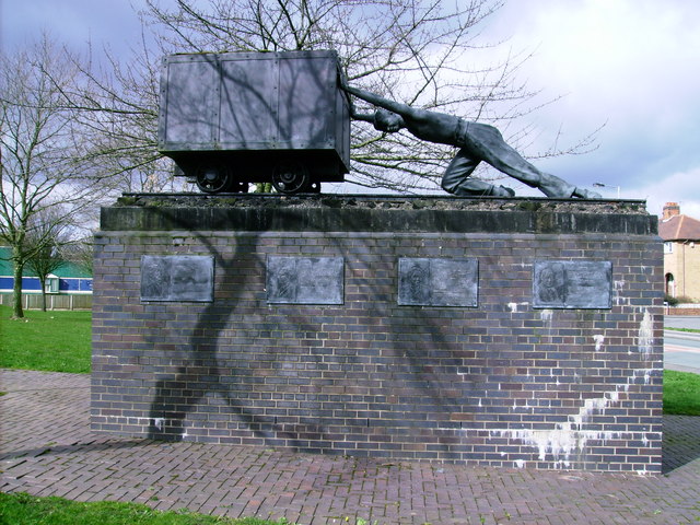
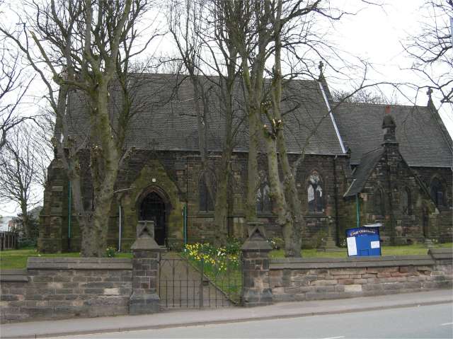
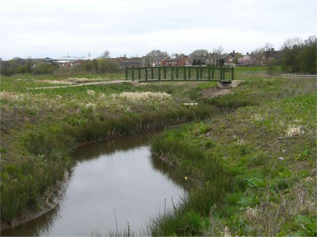
Flagstaff Plantation Images

Images are sourced within 2km of 53.001972/-2.2551249 or Grid Reference SJ8244. Thanks to Geograph Open Source API. All images are credited.

All Bowls A pleasant afternoon bowling in Newcastle under Lyme
All Bowls
A pleasant afternoon bowling in Newcastle under Lyme
St. Andrew's Church in the Westlands Situated at the top of Pilkington Avenue on the north side of the square
St. Andrew's Church in the Westlands
Situated at the top of Pilkington Avenue on the north side of the square
Keele Hall, Keele This historic house now forms part of the campus of the University of Keele. Some of the grounds of the house still also survive.
Keele Hall, Keele
This historic house now forms part of the campus of the University of Keele. Some of the grounds of the house still also survive.
Keele University Observatory The University observatory houses a 60cm telescope. Here a mount for another telescope can be seen in the foreground.
Keele University Observatory
The University observatory houses a 60cm telescope. Here a mount for another telescope can be seen in the foreground.
Woods near Keele University An early autumn day in the woods near Keele University. A lot of this square is open woodland that used to form the grounds of Keele Hall. Since the University took over the Hall and its 617 acre grounds, this area is now public access, with many footpaths among the trees and ponds.
Woods near Keele University
An early autumn day in the woods near Keele University. A lot of this square is open woodland that used to form the grounds of Keele Hall. Since the University took over the Hall and its 617 acre grounds, this area is now public access, with many footpaths among the trees and ponds.
Pool near Keele Hall This is the lowermost of the ponds that extend south-east from Keele Hall <a href="https://www.geograph.org.uk/photo/14295">SJ8144 : Keele Hall, Keele</a> towards Springpool Wood. There are many possible walks around the area.
Pool near Keele Hall
This is the lowermost of the ponds that extend south-east from Keele Hall SJ8144 : Keele Hall, Keele towards Springpool Wood. There are many possible walks around the area.
The Lymes Road According to the 1940s map, this was originally a B-road, leading down to The Lymes, also in this square. Now it is only a loose-cobbled track running between Keele village and The Lymes. It also serves as a bridleway. Here is it seen just before it passes underneath the M6, which it now runs next to.
The Lymes Road
According to the 1940s map, this was originally a B-road, leading down to The Lymes, also in this square. Now it is only a loose-cobbled track running between Keele village and The Lymes. It also serves as a bridleway. Here is it seen just before it passes underneath the M6, which it now runs next to.
The Lymes Road More of The Lymes Road (see <a href="https://www.geograph.org.uk/gridref/SJ8243">SJ8243</a>), which runs between Keele village and The Lymes farm.
The Lymes Road
More of The Lymes Road (see SJ8243), which runs between Keele village and The Lymes farm.
The Clock House The Clock House, part of Keele University. It also houses the Music Department and has an attractive rock-cutting entrance.
The Clock House
The Clock House, part of Keele University. It also houses the Music Department and has an attractive rock-cutting entrance.
Keele University Campus Part of Keele University Campus, near Barnes Hall. This is effectively the "main street" of Keele Campus, which continues east into the next square.
Keele University Campus
Part of Keele University Campus, near Barnes Hall. This is effectively the "main street" of Keele Campus, which continues east into the next square.
Chapel, Silverdale Cemetery
Roundabout on the A525 Not very many interesting things in this square, in my opinion! I figured this view down the A525 towards Newcastle-under-Lyme and Stoke is worth showing, though.
Roundabout on the A525
Not very many interesting things in this square, in my opinion! I figured this view down the A525 towards Newcastle-under-Lyme and Stoke is worth showing, though.
Newcastle fire station Newcastle fire station, Knutton Lane, Newcastle Under Lyme, Staffordshire.
Newcastle fire station
Newcastle fire station, Knutton Lane, Newcastle Under Lyme, Staffordshire.
Boat and Horses pub in Stubbs Lane, Newcastle The Newcastle-under-Lyme to Stoke canal was a 4 mile level canal from the Trent & Mersey Canal at Stoke to Newcastle-under-Lyme.
It was authorised by an Act of 1795 and completed in about 1800, part closed in 1921 and abandoned in 1935 - subsequently filled in.

The canal left the town centre heading south east on the west side of London Road (A34). Where Occupation Street leaves London Road is the spot which would have been the bottom of the inclined plane (had it been built). Near here is the newly developed Lyme Valley Park - Lyme Brook runs to the west of the canal line.
Boat and Horses pub in Stubbs Lane, Newcastle
The Newcastle-under-Lyme to Stoke canal was a 4 mile level canal from the Trent & Mersey Canal at Stoke to Newcastle-under-Lyme. It was authorised by an Act of 1795 and completed in about 1800, part closed in 1921 and abandoned in 1935 - subsequently filled in. The canal left the town centre heading south east on the west side of London Road (A34). Where Occupation Street leaves London Road is the spot which would have been the bottom of the inclined plane (had it been built). Near here is the newly developed Lyme Valley Park - Lyme Brook runs to the west of the canal line.
One for the workers! Statue to commemorate the miners, Silverdale, Staffordshire
One for the workers!
Statue to commemorate the miners, Silverdale, Staffordshire
St Mary's Church, Knutton
Footbridge over Lyme Brook There are quite a number of small streams round this area, all known locally as Lyme Brook. Most of them disappear underground fairly often so I suppose it is just possible that they are all the same stream.
Footbridge over Lyme Brook
There are quite a number of small streams round this area, all known locally as Lyme Brook. Most of them disappear underground fairly often so I suppose it is just possible that they are all the same stream.
Footpath at Knutton One of many disused railway tracks in this area now recycled as footpaths.
Footpath at Knutton
One of many disused railway tracks in this area now recycled as footpaths.
Show me another place!

Flagstaff Plantation is located at Grid Ref: SJ8244 (Lat: 53.001972, Lng: -2.2551249)

Administrative County: Staffordshire

District: Newcastle-under-Lyme

Police Authority: Staffordshire

What 3 Words

///gentle.leaps.oils. Near Newcastle under Lyme, Staffordshire

Related Wikis

Newcastle Academy

Newcastle Academy is a mixed secondary school located in Newcastle-under-Lyme in the English county of Staffordshire.Previously known as Sneyd High School...

Thistleberry (ward)

Thistleberry is a ward of the Borough of Newcastle-under-Lyme, located west of Newcastle town centre, in the county of Staffordshire, England. In 2021...

Keele University School of Medicine

Keele University School of Medicine is a medical school located in Newcastle-under-Lyme and Shrewsbury. The first two years of the school's MBChB degree...

Keele Hall

Keele Hall is a 19th-century mansion house at Keele, Staffordshire, England, now standing on the campus of Keele University and serving as the university...

Keele University Science & Business Park

Keele University Science and Innovation Park is a science and business development facility located on the campus of Keele University in North Staffordshire...

Keele University

Keele University, officially known as the University of Keele, is a public research university in Keele, approximately three miles (five kilometres) from...

Keele (ward)

Keele Ward is a local council ward in the borough of Newcastle-under-Lyme. It covers the village of Keele and the neighbouring University of Keele's campus...

Westlands, Staffordshire

Westlands is a suburban area and ward in Newcastle-under-Lyme, Staffordshire. == Religion == The Church in the Westlands is a local ecumenical partnership...

Nearby Amenities

Located within 500m of 53.001972,-2.2551249
Source: gps_tracks
Lat/Long: 53.0045348/-2.2505535
Source: gps_tracks
Lat/Long: 53.0042585/-2.249739
Source: gps_tracks
Lat/Long: 53.0019376/-2.2482584
Source: gps_tracks
Lat/Long: 53.0020722/-2.2503492
Source: gps_tracks
Lat/Long: 53.002114/-2.2508147
Source: gps_tracks
Lat/Long: 53.0024037/-2.2512202
Source: gps_tracks
Lat/Long: 53.0027972/-2.2511022
Source: gps_tracks
Lat/Long: 53.0043616/-2.2501999
Source: gps_tracks
Lat/Long: 53.0042922/-2.2499134
Source: gps_tracks
Lat/Long: 53.0047439/-2.2509073
Source: gps_tracks
Lat/Long: 53.0001595/-2.2525833
Source: gps_tracks
Lat/Long: 53.0000784/-2.2525086
Source: gps_tracks
Lat/Long: 53.0000215/-2.2523649
Source: gps_tracks
Lat/Long: 53.0013636/-2.2526217
Source: gps_tracks
Lat/Long: 53.0012497/-2.2526636
Source: gps_tracks
Lat/Long: 53.0013202/-2.2526547
Source: gps_tracks
Lat/Long: 53.0014149/-2.2525137
Source: gps_tracks
Lat/Long: 53.0005972/-2.2494584
Source: gps_tracks
Lat/Long: 53.0006529/-2.2506476
Source: gps_tracks
Lat/Long: 53.0007619/-2.2506426
Source: gps_tracks
Lat/Long: 53.0006381/-2.2505105
Source: gps_tracks
Lat/Long: 53.000647/-2.2506011
Source: gps_tracks
Lat/Long: 53.0007241/-2.2494426
Source: gps_tracks
Lat/Long: 53.0007603/-2.2502064
Source: gps_tracks
Lat/Long: 53.0006183/-2.250207
Source: gps_tracks
Lat/Long: 52.9999485/-2.2503416
Source: gps_tracks
Lat/Long: 52.9999966/-2.2515801
Source: gps_tracks
Lat/Long: 53.0000203/-2.2520431
Source: gps_tracks
Lat/Long: 53.0001619/-2.2515941
Source: gps_tracks
Lat/Long: 53.0007186/-2.2492335
Source: gps_tracks
Lat/Long: 53.0005893/-2.249189
Source: gps_tracks
Lat/Long: 53.0004079/-2.2489306
Source: gps_tracks
Lat/Long: 53.0014524/-2.2497999
Source: gps_tracks
Lat/Long: 53.0011092/-2.2515409
Source: gps_tracks
Lat/Long: 53.0014202/-2.2515387
Source: gps_tracks
Lat/Long: 53.0014063/-2.2506111
Source: gps_tracks
Lat/Long: 53.0011111/-2.250629
Source: gps_tracks
Lat/Long: 53.0015046/-2.2504103
Source: gps_tracks
Lat/Long: 53.0014741/-2.2505343
Source: gps_tracks
Lat/Long: 53.0020887/-2.25143
Source: gps_tracks
Lat/Long: 53.0021903/-2.2513077
Source: gps_tracks
Lat/Long: 53.0022717/-2.2511272
Source: gps_tracks
Lat/Long: 53.0028855/-2.2498084
Source: gps_tracks
Lat/Long: 53.0032324/-2.2508661
Source: gps_tracks
Lat/Long: 53.0031388/-2.250921
Source: gps_tracks
Lat/Long: 53.0009434/-2.2486924
Source: gps_tracks
Lat/Long: 53.0011865/-2.2486464
Source: gps_tracks
Lat/Long: 53.0031788/-2.249299
Source: gps_tracks
Lat/Long: 53.0033953/-2.2492886
Source: gps_tracks
Lat/Long: 53.0034253/-2.2491718
Source: gps_tracks
Lat/Long: 53.0031908/-2.2494998
Source: gps_tracks
Lat/Long: 53.0030901/-2.2483793
Source: gps_tracks
Lat/Long: 53.0041054/-2.2507012
Source: gps_tracks
Lat/Long: 53.0043183/-2.2506318
Source: gps_tracks
Lat/Long: 53.0036546/-2.2490247
Source: gps_tracks
Lat/Long: 53.0040625/-2.2503942
Source: gps_tracks
Lat/Long: 53.0036615/-2.2506078
Lodeys Supermarket
Addr Housenumber: 72-76
Addr Postcode: ST5 2QX
Addr Street: Paris Avenue
Fhrs Id: 94042
Shop: supermarket
Source: gps_tracks
Source Addr: FHRS Open Data
Lat/Long: 53.0017668/-2.2484834
Check Date: 2011-10-16
Shop: alcohol
Lat/Long: 53.0021242/-2.2485268
Check Date: 2011-10-16
Shop: newsagent
Lat/Long: 53.0021277/-2.2488004
Power: tower
Lat/Long: 53.0014436/-2.2573797
Power: tower
Lat/Long: 52.9992048/-2.2574602
Power: tower
Lat/Long: 53.0036065/-2.2573207
Power: tower
Lat/Long: 53.0057096/-2.2572349
Source: gps_tracks
Lat/Long: 53.0030408/-2.2495468
Bus Stop
Bus: yes
Public Transport: platform
Lat/Long: 53.00193/-2.2487113
The data included in this document is from www.openstreetmap.org. The data is made available under ODbL.

Have you been to Flagstaff Plantation?

Leave your review of Flagstaff Plantation below (or comments, questions and feedback).