Nockatt Coppice
Wood, Forest in Wiltshire
England
Nockatt Coppice

Nockatt Coppice is a charming woodland located in the county of Wiltshire, England. Situated near the village of Nockatt, the coppice covers an area of approximately 50 acres and is a prominent natural attraction in the region. The woodland is characterized by its dense canopy of trees, predominantly consisting of oak, beech, and birch, which have flourished over many years.
As a well-preserved forest, Nockatt Coppice offers a haven for wildlife and a diverse range of plant species. The forest floor is adorned with a carpet of bluebells during the spring months, creating a picturesque scene that attracts nature enthusiasts and photographers alike. The native flora also includes wood anemones, wild garlic, and foxgloves, adding to the beauty and biodiversity of the woodland.
Nockatt Coppice is not only stunning but also holds historical significance. It is believed to have been used as a source of timber and charcoal during ancient times. Remnants of charcoal hearths can still be found in certain areas, providing a glimpse into the past uses of the forest.
The woodland is a popular destination for outdoor activities such as hiking, birdwatching, and nature walks. There are well-maintained footpaths and trails that allow visitors to explore the forest's natural wonders and discover its hidden gems. The peaceful and serene atmosphere of Nockatt Coppice makes it an ideal place for relaxation and contemplation, away from the hustle and bustle of everyday life.
In summary, Nockatt Coppice in Wiltshire is a picturesque and historically significant woodland that offers a diverse range of flora and fauna. It provides a tranquil escape for nature enthusiasts and offers a glimpse into the region's past.
If you have any feedback on the listing, please let us know in the comments section below.
Nockatt Coppice Images
Images are sourced within 2km of 51.178675/-2.2461383 or Grid Reference ST8242. Thanks to Geograph Open Source API. All images are credited.


Nockatt Coppice is located at Grid Ref: ST8242 (Lat: 51.178675, Lng: -2.2461383)
Unitary Authority: Wiltshire
Police Authority: Wiltshire
What 3 Words
///forgiving.tiptoes.deflate. Near Corsley, Wiltshire
Nearby Locations
Related Wikis
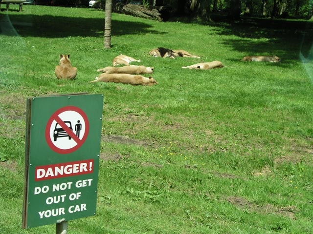
Longleat Safari and Adventure Park
Longleat Safari and Adventure Park in Wiltshire, England, was opened in 1966 as the world's first drive-through safari park outside Africa. == History... ==

Horningsham
Horningsham is a small village and civil parish in Wiltshire, England, on the county border with Somerset. The village lies about 4 miles (6 km) southwest...

Dunkerton Colliery Halt railway station
Dunkerton Colliery Halt railway station served the colliery near the village of Dunkerton, Somerset, England from 1911 to 1925 on the Bristol and North...
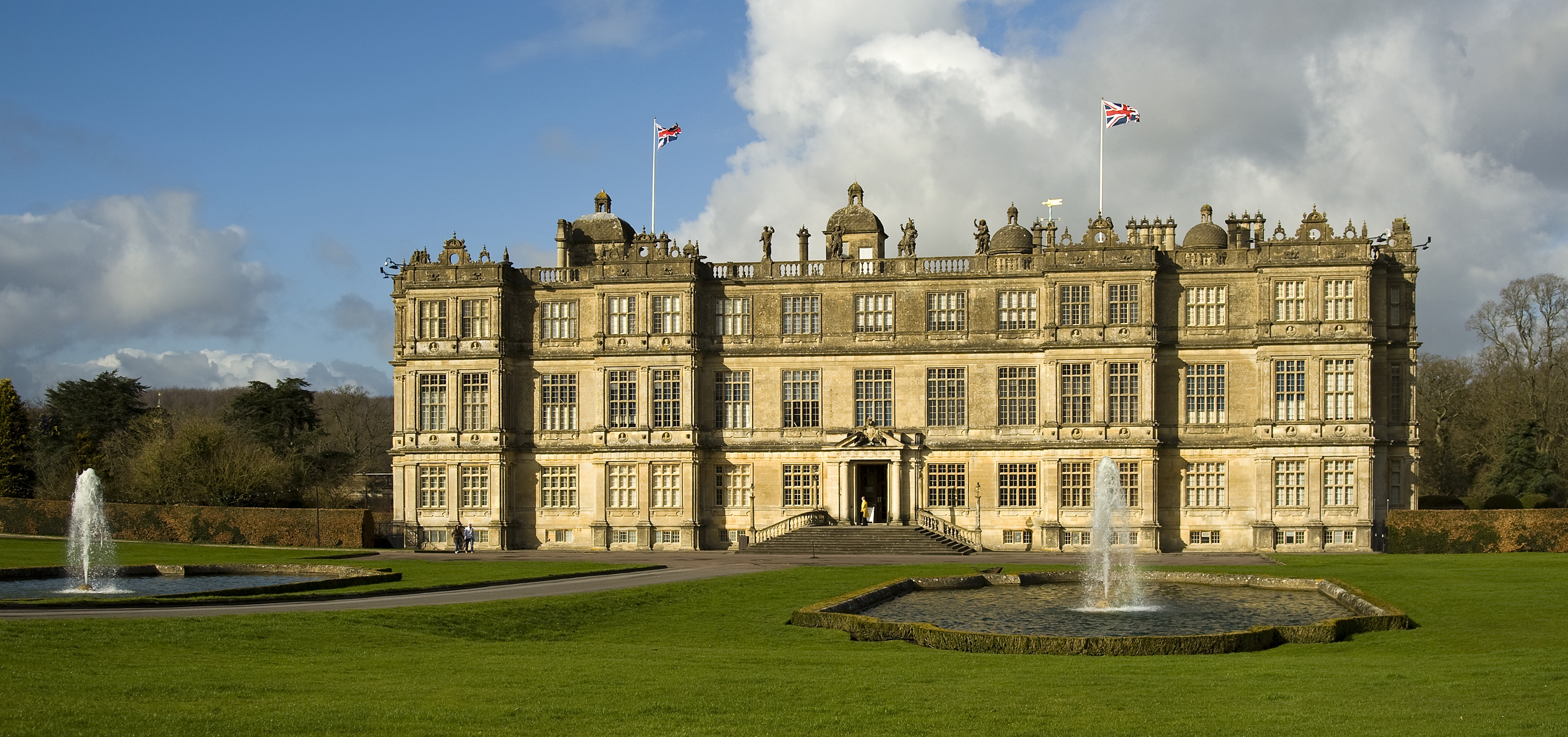
Longleat
Longleat is a stately home about 4 miles (7 km) west of Warminster in Wiltshire, England. A leading and early example of the Elizabethan prodigy house...
Longleat Priory
Longleat Priory was a priory near Warminster, Wiltshire, in the south of England. A short-lived priory was established and dissolved near to Longleat in...

Shearwater (lake)
Shearwater (or Shear Water) is a man-made freshwater lake near Crockerton village, about 2+1⁄4 miles (3.6 km) southwest of the town of Warminster in Wiltshire...

St Mary's Church, Temple, Corsley
The Church of St Mary at Temple, Corsley, Wiltshire, England is a chapel-of-ease dating from the very early 20th century. It was commissioned and paid...
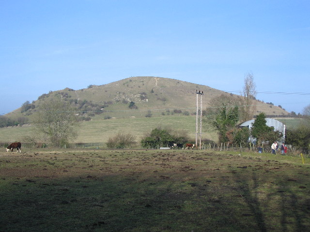
Cley Hill
Cley Hill (grid reference ST838449) is a prominent hill to the west of Warminster in Wiltshire, England. Its summit has a commanding view of the Wiltshire...
Nearby Amenities
Located within 500m of 51.178675,-2.2461383Have you been to Nockatt Coppice?
Leave your review of Nockatt Coppice below (or comments, questions and feedback).