Chicken Hill Wood

Wood, Forest in Lancashire Burnley

England

Chicken Hill Wood

WWII Lancashire: Ghost Signs of the Home Front  (22) -
Emergency Water Supply, Hand Bridge, Todmorden Road, Burnley

"EWS Hatch"

A rare EWS sign of metal on the bridge over the River Calder. "EWS Hatch" may refer to a facility to obtain an emergency supply of water from the river (below the bridge).

<a href="https://www.geograph.org.uk/photo/6945367">SD8432 : WWII Lancashire: Ghost Signs of the Home Front  (23)</a>
WWII Lancashire: Ghost Signs of the Home Front (22) Credit: Mike Searle

Chicken Hill Wood is a small, picturesque woodland located in the county of Lancashire, England. Nestled in the rolling hills of the region, this serene forest covers an area of approximately 10 acres. It is situated near the village of Chicken Hill, from which it derives its name.

The wood is predominantly composed of mature deciduous trees, including oak, beech, and ash, creating a rich and diverse ecosystem. The dense canopy provides a haven for a wide range of flora and fauna, making it a popular spot for nature enthusiasts. Bluebells, primroses, and wild garlic carpet the forest floor during the spring months, adding a vibrant splash of color to the landscape.

Several well-maintained trails wind their way through the wood, enabling visitors to explore its beauty at their own pace. These paths lead to various points of interest, such as a small pond teeming with aquatic life and a clearing that offers breathtaking views of the surrounding countryside.

Birdwatchers will be delighted by the abundance of avian species that call Chicken Hill Wood their home. From woodpeckers and robins to thrushes and finches, the forest is alive with the melodious sounds of songbirds throughout the year.

Chicken Hill Wood is a tranquil oasis away from the hustle and bustle of everyday life, providing a peaceful retreat for those seeking solace in nature. Its accessibility, stunning scenery, and diverse wildlife make it a must-visit destination for nature lovers and outdoor enthusiasts alike.

If you have any feedback on the listing, please let us know in the comments section below.

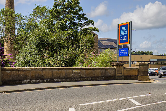
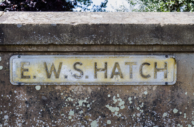
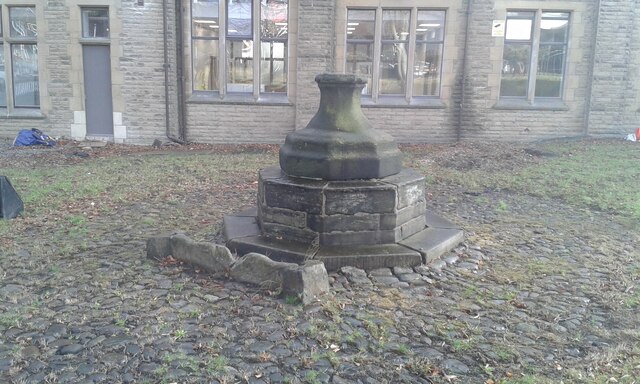
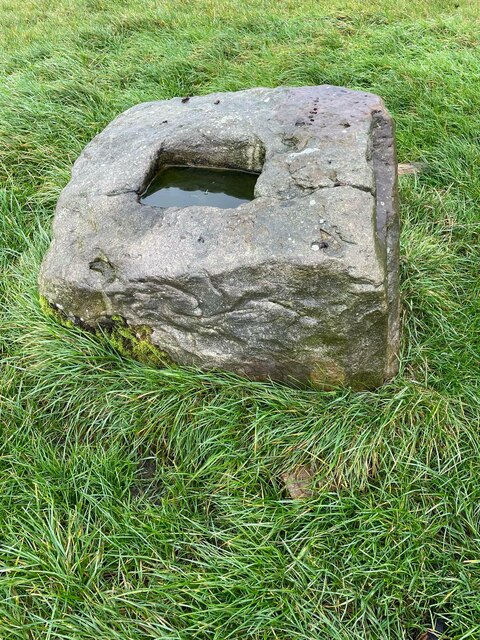
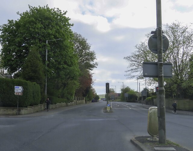
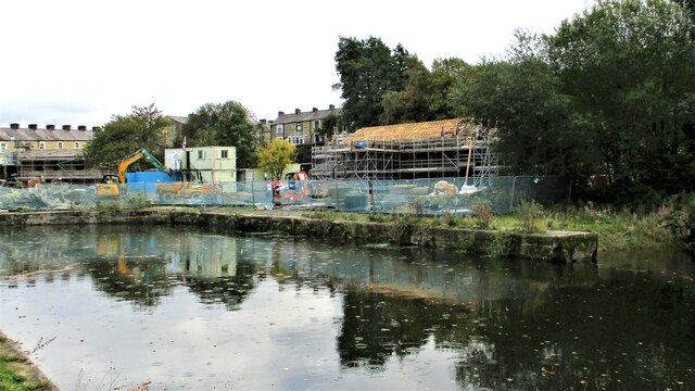
Chicken Hill Wood Images

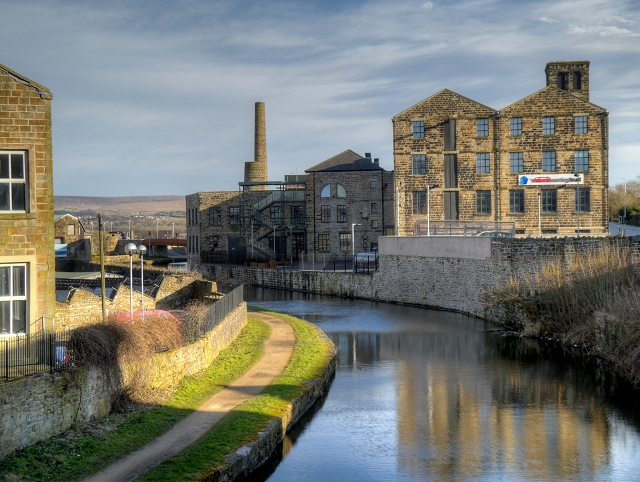
Images are sourced within 2km of 53.783778/-2.2611837 or Grid Reference SD8231. Thanks to Geograph Open Source API. All images are credited.

WWII Lancashire: Ghost Signs of the Home Front  (22) -
Emergency Water Supply, Hand Bridge, Todmorden Road, Burnley

"EWS Hatch"

A rare EWS sign of metal on the bridge over the River Calder. "EWS Hatch" may refer to a facility to obtain an emergency supply of water from the river (below the bridge).

<a href="https://www.geograph.org.uk/photo/6945367">SD8432 : WWII Lancashire: Ghost Signs of the Home Front  (23)</a>
WWII Lancashire: Ghost Signs of the Home Front (22)
- Emergency Water Supply, Hand Bridge, Todmorden Road, Burnley "EWS Hatch" A rare EWS sign of metal on the bridge over the River Calder. "EWS Hatch" may refer to a facility to obtain an emergency supply of water from the river (below the bridge). SD8432 : WWII Lancashire: Ghost Signs of the Home Front (23)
WWII Lancashire: Ghost Signs of the Home Front  (23) -
Emergency Water Supply,  Hand Bridge, Todmorden Road, Burnley

"EWS Hatch"

<a href="https://www.geograph.org.uk/photo/6945359">SD8432 : WWII Lancashire: Ghost Signs of the Home Front  (24)</a>
WWII Lancashire: Ghost Signs of the Home Front (23)
- Emergency Water Supply, Hand Bridge, Todmorden Road, Burnley "EWS Hatch" SD8432 : WWII Lancashire: Ghost Signs of the Home Front (24)
Old Central Cross in the garden of Burnley College Adult Education Centre on Bank Parade Cross of St Paulinus, a central cross with an old shaft and base. Moved to the garden of Burnley College Adult Education Centre on Bank Parade in Burnley. Probably erected in the former market place east of St Peter's church; moved to Godley Lane c1617, and moved to this site in 1881. Grade II Listed <span class="nowrap"><a title="https://historicengland.org.uk/listing/the-list/list-entry/1022617" rel="nofollow ugc noopener" href="https://historicengland.org.uk/listing/the-list/list-entry/1022617">Link</a><img style="margin-left:2px;" alt="External link" title="External link - shift click to open in new window" src="https://s1.geograph.org.uk/img/external.png" width="10" height="10"/></span>. See also <span class="nowrap"><a title="https://commons.wikimedia.org/wiki/File:Cross_of_St_Paulinus_(Market_Cross),_Burnley.jpg" rel="nofollow ugc noopener" href="https://commons.wikimedia.org/wiki/File:Cross_of_St_Paulinus_(Market_Cross),_Burnley.jpg">Link</a><img style="margin-left:2px;" alt="External link" title="External link - shift click to open in new window" src="https://s1.geograph.org.uk/img/external.png" width="10" height="10"/></span>.

Milestone Society National ID: LABU_BUR01
Old Central Cross in the garden of Burnley College Adult Education Centre on Bank Parade
Cross of St Paulinus, a central cross with an old shaft and base. Moved to the garden of Burnley College Adult Education Centre on Bank Parade in Burnley. Probably erected in the former market place east of St Peter's church; moved to Godley Lane c1617, and moved to this site in 1881. Grade II Listed LinkExternal link. See also LinkExternal link. Milestone Society National ID: LABU_BUR01
Old Central Cross in the garden of Burnley College Adult Education Centre on Bank Parade The Market Cross, a central cross with an old base. Moved to in the garden of Burnley College Adult Education Centre on Bank Parade in Burnley. Erected in the former market place east of St Peter's church in 1617 and moved to this site in 1881. Grade II Listed <span class="nowrap"><a title="https://historicengland.org.uk/listing/the-list/list-entry/1022618" rel="nofollow ugc noopener" href="https://historicengland.org.uk/listing/the-list/list-entry/1022618">Link</a><img style="margin-left:2px;" alt="External link" title="External link - shift click to open in new window" src="https://s1.geograph.org.uk/img/external.png" width="10" height="10"/></span>.

Milestone Society National ID: LABU_BUR02
Old Central Cross in the garden of Burnley College Adult Education Centre on Bank Parade
The Market Cross, a central cross with an old base. Moved to in the garden of Burnley College Adult Education Centre on Bank Parade in Burnley. Erected in the former market place east of St Peter's church in 1617 and moved to this site in 1881. Grade II Listed LinkExternal link. Milestone Society National ID: LABU_BUR02
Old Wayside Cross in Habergham Eaves parish The Butter Cross, the base of a wayside cross. South of a public footpath in the middle of a field southwest of houses at the junction of the A646 and the A682 in Habergham Eaves parish. Grade II Listed <span class="nowrap"><a title="https://historicengland.org.uk/listing/the-list/list-entry/1274582" rel="nofollow ugc noopener" href="https://historicengland.org.uk/listing/the-list/list-entry/1274582">Link</a><img style="margin-left:2px;" alt="External link" title="External link - shift click to open in new window" src="https://s1.geograph.org.uk/img/external.png" width="10" height="10"/></span>.

Milestone Society National ID: LABU_HAB
Old Wayside Cross in Habergham Eaves parish
The Butter Cross, the base of a wayside cross. South of a public footpath in the middle of a field southwest of houses at the junction of the A646 and the A682 in Habergham Eaves parish. Grade II Listed LinkExternal link. Milestone Society National ID: LABU_HAB
The junction of Manchester Road and Rossendale Road
Rosegrove Lane in Burnley
Entrance to Burnley Bus Station
Bootleggers' sign Sign for the Bootleggers <a href="https://www.geograph.org.uk/photo/7258620">SD8432 : Bootleggers and Roy's Jewellers</a>.
Bootleggers' sign
Sign for the Bootleggers SD8432 : Bootleggers and Roy's Jewellers.
Boot Inn The Grade II listed <span class="nowrap"><a title="https://historicengland.org.uk/listing/the-list/list-entry/1244972?section=official-list-entry" rel="nofollow ugc noopener" href="https://historicengland.org.uk/listing/the-list/list-entry/1244972?section=official-list-entry">Link</a><img style="margin-left:2px;" alt="External link" title="External link - shift click to open in new window" src="https://s1.geograph.org.uk/img/external.png" width="10" height="10"/></span> Boot Inn dates from 1911. For a time it was a Yates Wine Lodge but is now a Wetherspoon's <a href="https://www.geograph.org.uk/photo/7256758">SD8432 : Sign of The Boot Inn</a>.
Boot Inn
The Grade II listed LinkExternal link Boot Inn dates from 1911. For a time it was a Yates Wine Lodge but is now a Wetherspoon's SD8432 : Sign of The Boot Inn.
Sign of The Boot Inn Sign for The Boot Inn.
Sign of The Boot Inn
Sign for The Boot Inn.
Yorkshire Street Aqueduct The west portal of the aqueduct for the Leeds and Liverpool Canal on its straight mile of embankment above the streets of Burnley
Yorkshire Street Aqueduct
The west portal of the aqueduct for the Leeds and Liverpool Canal on its straight mile of embankment above the streets of Burnley
Finsley Gate Wharf Renovations underway on the old depot buildings. A former dockyard on the Leeds and Liverpool Canal
Finsley Gate Wharf
Renovations underway on the old depot buildings. A former dockyard on the Leeds and Liverpool Canal
Manchester Road Canal Wharf View of the canopies of the central and north warehouses on the Leeds and Liverpool Canal
Manchester Road Canal Wharf
View of the canopies of the central and north warehouses on the Leeds and Liverpool Canal
White Lion The Grade II listed <span class="nowrap"><a title="https://historicengland.org.uk/listing/the-list/list-entry/1244973?section=official-list-entry" rel="nofollow ugc noopener" href="https://historicengland.org.uk/listing/the-list/list-entry/1244973?section=official-list-entry">Link</a><img style="margin-left:2px;" alt="External link" title="External link - shift click to open in new window" src="https://s1.geograph.org.uk/img/external.png" width="10" height="10"/></span> White Lion dates from 1910.

<a href="https://www.geograph.org.uk/photo/7257690">SD8432 : White Lion signage</a>.
White Lion
The Grade II listed LinkExternal link White Lion dates from 1910. SD8432 : White Lion signage.
White Lion signage Signage on the White Lion <a href="https://www.geograph.org.uk/photo/7257658">SD8432 : White Lion</a>.
White Lion signage
Signage on the White Lion SD8432 : White Lion.
Thwaites' The Swan Sign for the Swan Inn <a href="https://www.geograph.org.uk/photo/7258471">SD8432 : Swan Inn</a>.
Thwaites' The Swan
Sign for the Swan Inn SD8432 : Swan Inn.
P. Eastwood: Ghost sign On the gable end of the Swan Inn <a href="https://www.geograph.org.uk/photo/7258471">SD8432 : Swan Inn</a> is a preserved ghost sign for P. Eastwood. 

"P. EASTWOOD
(BURNLEY) LTD.
COACH & MOTOR
PROPRIETORS,
TOUR &
PRIVATE TRIPS
Etc."
P. Eastwood: Ghost sign
On the gable end of the Swan Inn SD8432 : Swan Inn is a preserved ghost sign for P. Eastwood. "P. EASTWOOD (BURNLEY) LTD. COACH & MOTOR PROPRIETORS, TOUR & PRIVATE TRIPS Etc."
Show me another place!

Chicken Hill Wood is located at Grid Ref: SD8231 (Lat: 53.783778, Lng: -2.2611837)

Administrative County: Lancashire

District: Burnley

Police Authority: Lancashire

What 3 Words

///listed.chain.topped. Near Burnley, Lancashire

Nearby Locations

Chicken Hill Wood

Related Wikis

Scott Park

Scott Park is a public park in Burnley, Lancashire. It covers 7.9 hectares (20 acres) and was opened in 1895. Located south of the town centre, attractions...

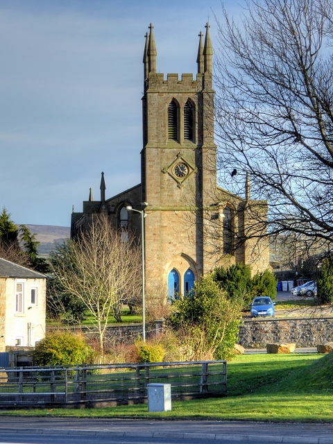
St Matthew's Church, Burnley

St Matthew's Church is in St Matthew's Street, Burnley, Lancashire, England. It is an active Anglican parish church in the diocese of Blackburn. The...

Hameldon Community College

Hameldon Community College was a mixed 11–16 comprehensive school located in Burnley, Lancashire, England. == History == The school opened in September...
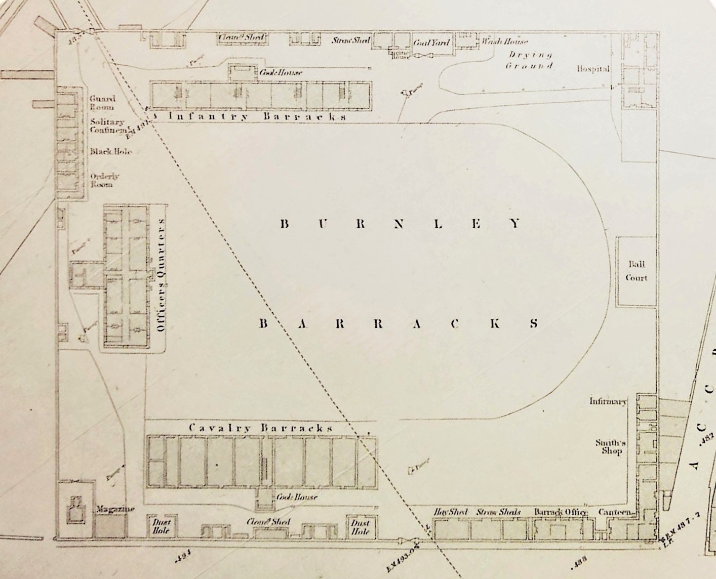
Burnley Barracks

Burnley Barracks was a military installation at Burnley in Lancashire, England. Built for cavalry, but later used for infantry and storage, military activities...
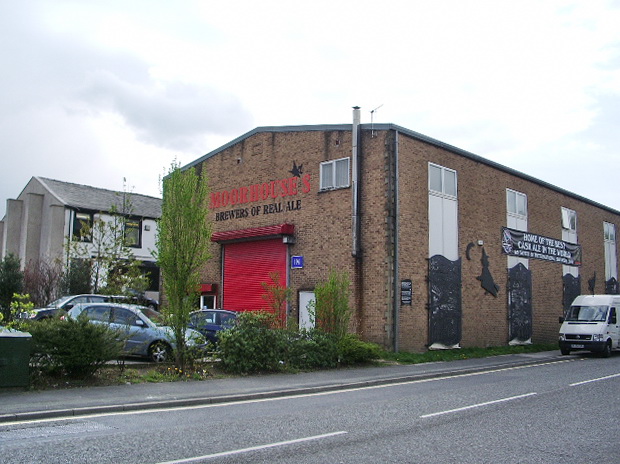
Moorhouse's Brewery

Moorhouse's is an independent brewery founded in 1865, by William Moorhouse in Burnley Lancashire, England, as a producer of mineral waters and low-alcohol...

Holy Trinity Church, Burnley

Holy Trinity Church is in Accrington Road, Burnley, Lancashire, England. It is a redundant Anglican parish church, and is recorded in the National Heritage...

University Technical College Lancashire

University Technical College Lancashire (or UTC Lancashire) was a university technical college (UTC) that opened in Burnley, Lancashire, England in August...

Burnley Manchester Road railway station

Burnley Manchester Road is the main railway station in Burnley, Lancashire, England. It is situated on the Calder Valley Line 24+1⁄2 miles (39.4 km) east...

Nearby Amenities

Located within 500m of 53.783778,-2.2611837
Created By: YahooApplet 1.0
Lat/Long: 53.7805699/-2.2644534
Created By: YahooApplet 1.0
Lat/Long: 53.7811912/-2.2649362
Created By: YahooApplet 1.0
Lat/Long: 53.7813465/-2.2650918
Created By: YahooApplet 1.0
Lat/Long: 53.7823892/-2.2659832
Created By: YahooApplet 1.0
Lat/Long: 53.7828172/-2.2662719
Created By: YahooApplet 1.0
Lat/Long: 53.7833243/-2.2666206
Created By: YahooApplet 1.0
Lat/Long: 53.7848393/-2.2673556
Created By: YahooApplet 1.0
Lat/Long: 53.7858087/-2.2672286
Created By: YahooApplet 1.0
Lat/Long: 53.7862235/-2.2671677
Created By: YahooApplet 1.0
Lat/Long: 53.7879227/-2.258798
Created By: YahooApplet 1.0
Lat/Long: 53.7880162/-2.2587966
Mini Roundabout
Direction: clockwise
Lat/Long: 53.7838513/-2.2581828
Turning Circle
Lat/Long: 53.7804319/-2.2633257
Post Office
Source: OS StreetView
Lat/Long: 53.7870507/-2.2653511
Barrier: entrance
Lat/Long: 53.7808302/-2.2651985
Barrier: bollard
Lat/Long: 53.7873984/-2.2600057
Barrier: bollard
Bicycle: yes
Foot: yes
Motor Vehicle: no
Lat/Long: 53.787451/-2.2600274
Barrier: bollard
Lat/Long: 53.7874245/-2.2600165
Barrier: bollard
Lat/Long: 53.7874373/-2.2600219
Barrier: bollard
Lat/Long: 53.7874111/-2.2600108
Noexit: yes
Lat/Long: 53.7843891/-2.2649604
Noexit: yes
Lat/Long: 53.7843201/-2.2656611
Noexit: yes
Lat/Long: 53.7876831/-2.2606364
Noexit: yes
Lat/Long: 53.787633/-2.2599061
Noexit: yes
Lat/Long: 53.7875963/-2.2599973
Noexit: yes
Lat/Long: 53.7878522/-2.2608909
Bus Stop
Hargher Street
Public Transport: platform
Lat/Long: 53.7874611/-2.2646123
Bus Stop
Hargher Street
Naptan AtcoCode: 2500IMG2824
Naptan NaptanCode: langjata
Public Transport: platform
Lat/Long: 53.7873266/-2.2649437
Bus Stop
Laburnum Close
Bus: yes
Naptan AtcoCode: 2500IMG2839
Naptan NaptanCode: langjdag
Public Transport: platform
Lat/Long: 53.7797483/-2.2632957
Bus Stop
Laburnum Close
Bus: yes
Naptan AtcoCode: 2500IMG2838
Naptan NaptanCode: langjdad
Public Transport: platform
Lat/Long: 53.7798865/-2.2625628
Bus Stop
Melrose Avenue
Bus: yes
Naptan AtcoCode: 2500IMG2836
Naptan NaptanCode: langjawp
Public Transport: platform
Lat/Long: 53.7817867/-2.2597337
Bus Stop
Melrose Avenue
Bus: yes
Naptan AtcoCode: 2500IMG2837
Naptan NaptanCode: langjawt
Public Transport: platform
Lat/Long: 53.7810782/-2.2602586
Bus Stop
Scott Park Road
Bus: yes
Public Transport: platform
Lat/Long: 53.7832195/-2.2584437
Bus Stop
Scott Park Road
Bus: yes
Naptan AtcoCode: 250010921
Naptan NaptanCode: lanadtag
Public Transport: platform
Lat/Long: 53.7835939/-2.2581814
Bus Stop
St Matthew Street
Bus: yes
Naptan AtcoCode: 2500IMG2834
Naptan NaptanCode: langjawj
Public Transport: platform
Lat/Long: 53.7847746/-2.2581452
Bus Stop
St Matthew Street
Bus: yes
Naptan AtcoCode: 2500IMG2833
Naptan NaptanCode: langjawg
Public Transport: platform
Lat/Long: 53.7851029/-2.2583589
Bus Stop
Coal Clough Bridge
Bus: yes
Naptan AtcoCode: 2500IMG2831
Naptan NaptanCode: langjawa
Public Transport: platform
Lat/Long: 53.7877128/-2.2589726
Bus Stop
Coal Clough Bridge
Bus: yes
Naptan AtcoCode: 2500IMG2832
Naptan NaptanCode: langjawd
Public Transport: platform
Lat/Long: 53.7876579/-2.2587975
Bus Stop
Cog Lane Stores
Bus: yes
Naptan AtcoCode: 250010858
Naptan NaptanCode: lanadpmd
Public Transport: platform
Lat/Long: 53.7810131/-2.2647389
Bus Stop
Venice Avenue
Bus: yes
Naptan AtcoCode: 2500LAA07231
Naptan NaptanCode: lanjagwd
Public Transport: platform
Lat/Long: 53.7816338/-2.2663682
Bus Stop
Hameldon Approach
Bus: yes
Naptan AtcoCode: 2500IMG2826
Naptan NaptanCode: langjatg
Public Transport: platform
Shelter: yes
Lat/Long: 53.7877076/-2.2632776
Bus Stop
Albion Street
Bus: yes
Naptan AtcoCode: 2500LA00414
Naptan NaptanCode: langpwdg
Public Transport: platform
Lat/Long: 53.7838913/-2.2553582
Crossing
Crossing: traffic_signals
Crossing Ref: pelican
Kerb: lowered
Tactile Paving: yes
Lat/Long: 53.7872666/-2.2654669
DEPHER CIC
Craft: plumber
Description: https://www.depher.co.uk
Source: https://www.bbc.com/news/uk-49729211
Website: https://www.gasengineerinburnley.co.uk
Lat/Long: 53.7817046/-2.259395
Barrier: yes
Foot: yes
Lat/Long: 53.7816118/-2.2674032
Speed Camera
Lat/Long: 53.7875479/-2.2636769
The data included in this document is from www.openstreetmap.org. The data is made available under ODbL.

Have you been to Chicken Hill Wood?

Leave your review of Chicken Hill Wood below (or comments, questions and feedback).