Heys Lane Plantation

Wood, Forest in Lancashire Pendle

England

Heys Lane Plantation

Pendle Inn Inn in the very popular village of Barley.
Pendle Inn Credit: Oliver Dixon

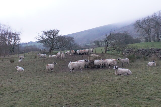
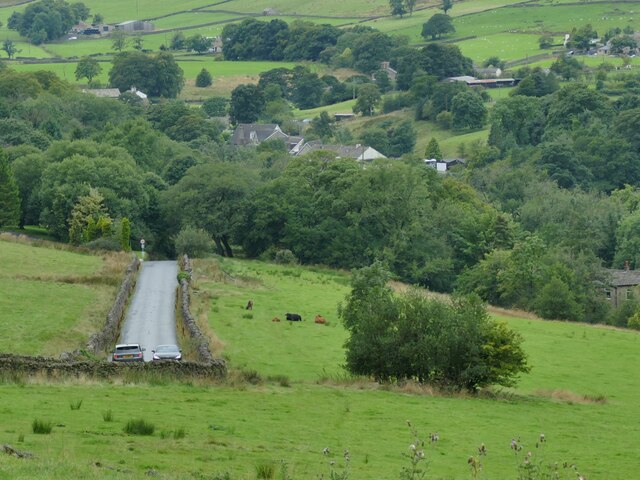
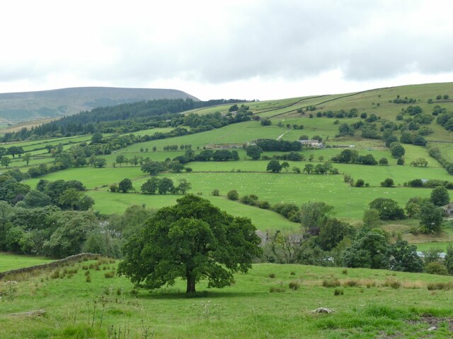
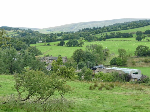
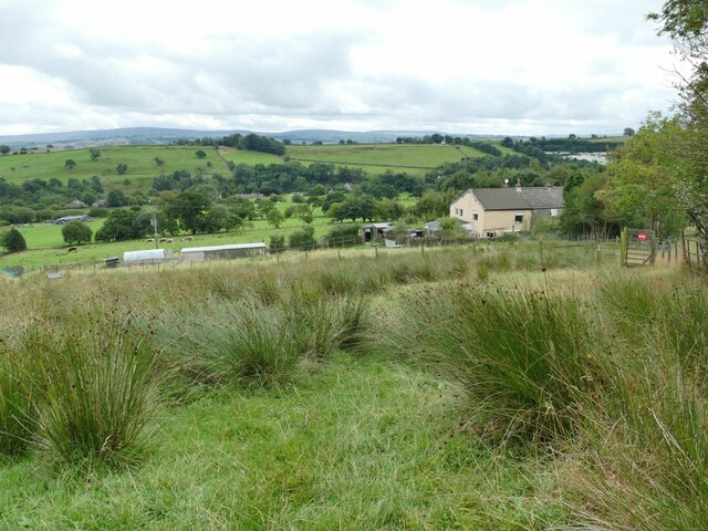
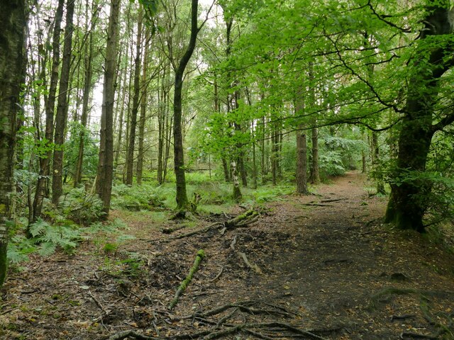
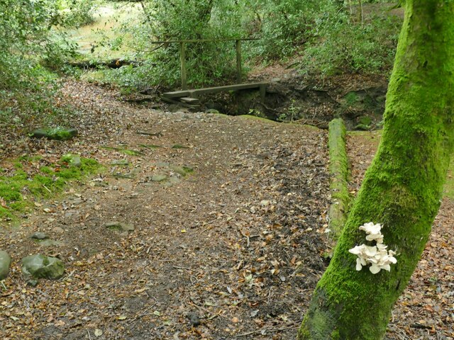
Heys Lane Plantation is a picturesque woodland located in Lancashire, England. Spanning over several acres, it is a significant natural asset of the local community. The plantation is characterized by its dense and diverse assortment of trees, creating a serene and enchanting forest setting.

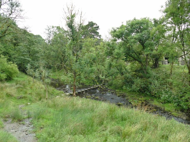
The woodland is primarily composed of deciduous trees such as oak, beech, and birch, which provide a vibrant display of colors throughout the year. The forest floor is covered in a lush carpet of ferns, mosses, and wildflowers, adding to the beauty and biodiversity of the area. The canopy formed by the tall trees creates a cool and shaded environment, making it an ideal refuge during hot summer days.

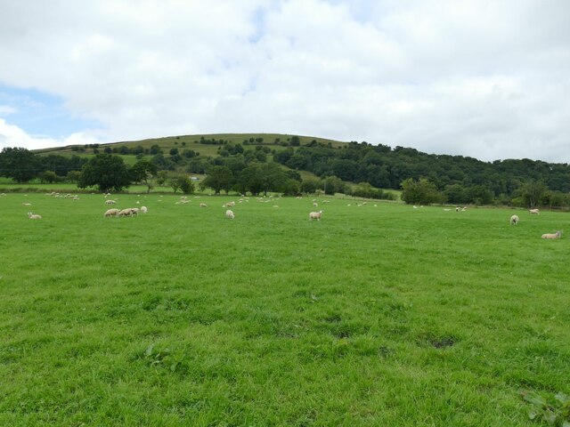
Heys Lane Plantation is not only a haven for nature enthusiasts but also supports a variety of wildlife. Numerous bird species can be spotted, including woodpeckers, owls, and songbirds, making it a haven for birdwatchers. Squirrels, foxes, and rabbits are commonly seen darting among the trees, adding a touch of wildlife charm.

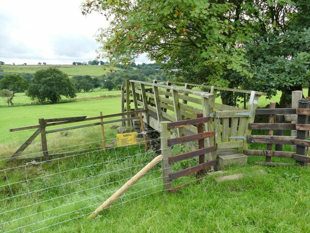
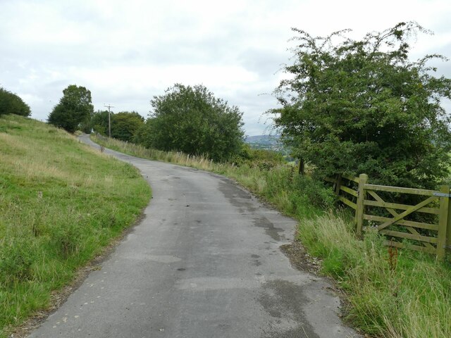
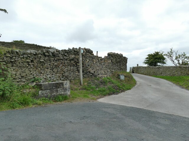
The plantation offers several well-maintained walking trails, allowing visitors to explore the woodland's beauty at their own pace. These paths wind through the forest, leading to hidden nooks and peaceful clearings. The tranquility and peacefulness of the woodland make it a popular spot for locals to enjoy picnics or engage in outdoor activities such as yoga or meditation.

Heys Lane Plantation is a true natural gem, providing a much-needed respite from the hustle and bustle of everyday life. It serves as a reminder of the importance of preserving and appreciating the wonders of nature.

If you have any feedback on the listing, please let us know in the comments section below.

Heys Lane Plantation Images

Images are sourced within 2km of 53.855949/-2.2622566 or Grid Reference SD8240. Thanks to Geograph Open Source API. All images are credited.

Pendle Inn Inn in the very popular village of Barley.
Pendle Inn
Inn in the very popular village of Barley.
Feeding sheep at dusk Low cloud is resting on Pendle Hill behind.
Feeding sheep at dusk
Low cloud is resting on Pendle Hill behind.
Back of Alice Nutter Statue The commemorative statue by David Palmer, to mark the 400th anniversary of the Pendle Witch Trials. Alice Nutter is in chains but this cloak on her back looks like an instrument of torture
Back of Alice Nutter Statue
The commemorative statue by David Palmer, to mark the 400th anniversary of the Pendle Witch Trials. Alice Nutter is in chains but this cloak on her back looks like an instrument of torture
Passing cars on Pasture Lane The hill has some steep sections and tight bends; these two cars met and passed slowly just below the upper steep section.
Passing cars on Pasture Lane
The hill has some steep sections and tight bends; these two cars met and passed slowly just below the upper steep section.
View towards Pendle from the top of Pasture Lane
Roughlee Old Hall and Farm For a closer view of the grade II listed Old Hall itself see <a href="https://www.geograph.org.uk/photo/67348">SD8440 : Roughlee - Old Hall Farm</a>.
Roughlee Old Hall and Farm
For a closer view of the grade II listed Old Hall itself see SD8440 : Roughlee - Old Hall Farm.
Roughlee stepping stones The stones are on the Pendle Way. An easy crossing in a dry summer, but Pendle Water can easily run in spate in wet weather.
Roughlee stepping stones
The stones are on the Pendle Way. An easy crossing in a dry summer, but Pendle Water can easily run in spate in wet weather.
Half a field of sheep A large field (nearly four hectares), quite densely and randomly populated with sheep. This is just part of one side. The Pendle Way passes through the field.
Half a field of sheep
A large field (nearly four hectares), quite densely and randomly populated with sheep. This is just part of one side. The Pendle Way passes through the field.
Footbridge on the Pendle Way below Croft House  It crosses a ditch between two fields, possibly the boundary between Croft House and Hollin Farm, rather than a stream.
Footbridge on the Pendle Way below Croft House
It crosses a ditch between two fields, possibly the boundary between Croft House and Hollin Farm, rather than a stream.
Wet field above Croft House  This only slightly sloping field is just below the steep side of Brown Hill, which probably explains why it is wet.
Wet field above Croft House
This only slightly sloping field is just below the steep side of Brown Hill, which probably explains why it is wet.
The road to Hollin Top A farm access road rather than a public route. The Pendle Way turns right through the gate here and down the hill.
The road to Hollin Top
A farm access road rather than a public route. The Pendle Way turns right through the gate here and down the hill.
Mounting block and signpost on Stang Top Road The signpost indicates the Pendle Way that at this point uses the road to Hollin Top farm.
Mounting block and signpost on Stang Top Road
The signpost indicates the Pendle Way that at this point uses the road to Hollin Top farm.
Pendle Way through White Hough Plantation The Pendle Way is a footpath in the South Pennines which encircles the borough of Pendle. It was officially opened in 1987. The circuit is 45 miles. Its attractions include historical associations with the seventeenth century Pendle Witches, connections with the Brontës, stonebuilt villages in the traditional style of East Lancashire and the South Pennines, relics of the weaving and lead mining industry, and limestone meadows and millstone grit moorland culminating in the ascent of Pendle Hill.
The logo is a witch on a broomstick <a href="https://www.geograph.org.uk/photo/4622234">SD8848 : Every Witch Way</a>
Pendle Way through White Hough Plantation
The Pendle Way is a footpath in the South Pennines which encircles the borough of Pendle. It was officially opened in 1987. The circuit is 45 miles. Its attractions include historical associations with the seventeenth century Pendle Witches, connections with the Brontës, stonebuilt villages in the traditional style of East Lancashire and the South Pennines, relics of the weaving and lead mining industry, and limestone meadows and millstone grit moorland culminating in the ascent of Pendle Hill. The logo is a witch on a broomstick SD8848 : Every Witch Way
Bracket fungus in White Hough Plantation Location approximate; there is a simple plank footbridge in the background but there were at least three of these through the woods.
Bracket fungus in White Hough Plantation
Location approximate; there is a simple plank footbridge in the background but there were at least three of these through the woods.
White Hough Outdoor Centre A camp school opened in 1938, now run on behalf of Burnley Football Club.
White Hough Outdoor Centre
A camp school opened in 1938, now run on behalf of Burnley Football Club.
Converted barn at White Hough One of the few buildings in this complex that is not listed.
Converted barn at White Hough
One of the few buildings in this complex that is not listed.
White Hough Cottages Grade II listed (list entry 1361676).
White Hough Cottages
Grade II listed (list entry 1361676).
White Hough Farm The main building is grade II listed (list entry 1073458), dating from 1593 but rebuilt and altered since then.
White Hough Farm
The main building is grade II listed (list entry 1073458), dating from 1593 but rebuilt and altered since then.
Show me another place!

Heys Lane Plantation is located at Grid Ref: SD8240 (Lat: 53.855949, Lng: -2.2622566)

Administrative County: Lancashire

District: Pendle

Police Authority: Lancashire

What 3 Words

///smarting.commented.filer. Near Barrowford, Lancashire

Related Wikis

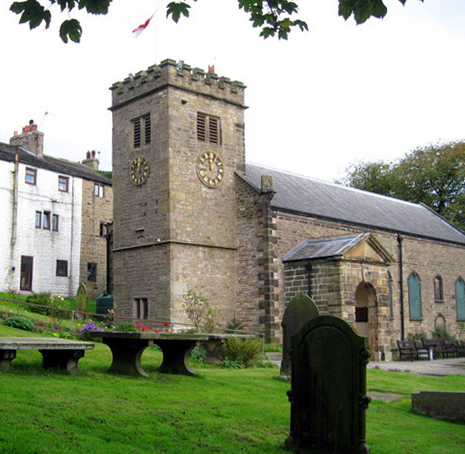
St Mary's Church, Newchurch in Pendle

St Mary's Church is in the village of Newchurch in Pendle, Lancashire, England. The church is recorded in the National Heritage List for England as a...

Barley, Lancashire

Barley is a village in the borough of Pendle, in Lancashire, England. It is in the civil parish of Barley-with-Wheatley Booth. The village lies between...

Goldshaw Booth

Goldshaw Booth is a civil parish in the Pendle district of Lancashire, England. It has a population of 248, and contains the village of Newchurch in Pendle...

Newchurch in Pendle

Newchurch in Pendle is a village in the civil parish of Goldshaw Booth, Pendle, Lancashire, England, adjacent to Barley, to the south of Pendle Hill. It...

Nearby Amenities

Located within 500m of 53.855949,-2.2622566
Barrier: stile
Lat/Long: 53.8561701/-2.2599213
Barrier: stile
Lat/Long: 53.8534937/-2.2653744
Barrier: stile
Lat/Long: 53.8572547/-2.2572397
Barrier: stile
Lat/Long: 53.8572904/-2.2571596
Access: customers
Entrance: main
Lat/Long: 53.8523056/-2.2578351
Leisure: picnic_table
Lat/Long: 53.8523292/-2.2577857
Narrow Gates
Place: locality
Lat/Long: 53.8591196/-2.2673973
Bench
Source: survey;gps
Lat/Long: 53.8587503/-2.2629127
Barrier: stile
Material: metal
Source: survey;gps
Stile: stepover
Lat/Long: 53.8589259/-2.2658048
Barrier: stile
Material: stone
Source: survey;gps
Stile: stepover
Lat/Long: 53.859182/-2.258435
The data included in this document is from www.openstreetmap.org. The data is made available under ODbL.

Have you been to Heys Lane Plantation?

Leave your review of Heys Lane Plantation below (or comments, questions and feedback).