Cow Close Plantation

Wood, Forest in Yorkshire Craven

England

Cow Close Plantation

Settle, Holy Ascension church The bolt and benchmark is cut into the tower of the church and is to the left of the main church access door.
Settle, Holy Ascension church Credit: Mel Towler

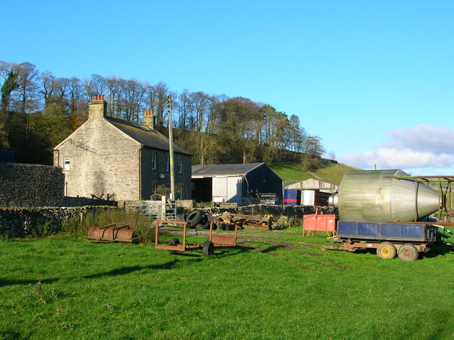
Cow Close Plantation is a picturesque woodland located in the county of Yorkshire, England. Situated in the heart of the countryside, it covers an area of approximately 100 acres and is known for its stunning natural beauty and diverse ecosystem.

The woodland consists mainly of deciduous trees, such as oak, ash, and beech, which provide a dense canopy and create a serene and tranquil environment. The plantation is also home to a variety of wildlife, including deer, foxes, and numerous bird species, making it a popular destination for nature enthusiasts and birdwatchers.

Cow Close Plantation offers several walking trails that wind their way through the woodland, allowing visitors to explore its enchanting surroundings. The pathways are well-maintained and suitable for all ages and fitness levels, providing a peaceful retreat for walkers and hikers alike.

In addition to its natural attractions, the plantation also boasts a rich history. It is believed that the woodland has been in existence for centuries and was once used for timber production. Today, remnants of the past can still be seen in the form of old boundary walls and the remains of a former sawmill.

Visitors to Cow Close Plantation can enjoy a range of activities, including picnicking, wildlife spotting, and simply immersing themselves in the tranquility of nature. With its breathtaking landscapes and abundant wildlife, Cow Close Plantation is truly a hidden gem in Yorkshire's natural heritage.

If you have any feedback on the listing, please let us know in the comments section below.

Cow Close Plantation Images

Images are sourced within 2km of 54.081406/-2.2665509 or Grid Reference SD8265. Thanks to Geograph Open Source API. All images are credited.

Settle, Holy Ascension church The bolt and benchmark is cut into the tower of the church and is to the left of the main church access door.
Settle, Holy Ascension church
The bolt and benchmark is cut into the tower of the church and is to the left of the main church access door.
Settle, Holy Ascension church A wider angle showing the main access door to the church. There is a bolt and benchmark cut into the stone just above the wooden seats, to the left of the main church access door.
Settle, Holy Ascension church
A wider angle showing the main access door to the church. There is a bolt and benchmark cut into the stone just above the wooden seats, to the left of the main church access door.
Settle Bridge This parapet is on the west side of the road. Flush Bracket 1479 is on the north-east facing parapet, and is fixed into the 2nd course of stone of the bridge.
Settle Bridge
This parapet is on the west side of the road. Flush Bracket 1479 is on the north-east facing parapet, and is fixed into the 2nd course of stone of the bridge.
Settle Bridge A wider angle showing both parapets of the busy road bridge through Settle, and looking towards Giggleswick. The parapet on the west side of the road has a Flush Bracket 1479 fixed into the 2nd course of stone of the bridge.
Settle Bridge
A wider angle showing both parapets of the busy road bridge through Settle, and looking towards Giggleswick. The parapet on the west side of the road has a Flush Bracket 1479 fixed into the 2nd course of stone of the bridge.
Settle, Town Hall This is the south facing wall of the Town Hall. The local Tourist Information bureau is currently resident in this area of the building. There is a fine benchmark cut into the 2nd course of stone at the corner.
Settle, Town Hall
This is the south facing wall of the Town Hall. The local Tourist Information bureau is currently resident in this area of the building. There is a fine benchmark cut into the 2nd course of stone at the corner.
Settle, Town Hall A wider angle showing the complete Town Hall. On the right angled corner of the building, to the right of the drainpipe is a benchmark cut into 2nd course of stone.
Settle, Town Hall
A wider angle showing the complete Town Hall. On the right angled corner of the building, to the right of the drainpipe is a benchmark cut into 2nd course of stone.
Settle, Victoria Street This is number 7 Victoria Street, and the wall faces north-east. There is a benchmark cut into the corner stone of the 2nd course, just above the airbrick.
Settle, Victoria Street
This is number 7 Victoria Street, and the wall faces north-east. There is a benchmark cut into the corner stone of the 2nd course, just above the airbrick.
Settle, Victoria Street A wider angle showing the front facia of number 7 Victoria Street. This wall faces north-east, and there is a benchmark cut into the corner stone of the 2nd course, just above the airbrick.
Settle, Victoria Street
A wider angle showing the front facia of number 7 Victoria Street. This wall faces north-east, and there is a benchmark cut into the corner stone of the 2nd course, just above the airbrick.
Settle, Albert Hill This is a north -east facing wall of a property on Albert Hill. There is an indistinct benchmark cut into a right-hand cornerstone. It looks as if the front facia may have been painted white previously, and the paint still remains in the cut depressions on the stonework.
Settle, Albert Hill
This is a north -east facing wall of a property on Albert Hill. There is an indistinct benchmark cut into a right-hand cornerstone. It looks as if the front facia may have been painted white previously, and the paint still remains in the cut depressions on the stonework.
Settle, Albert Hill A wider angle showing the north -east facing wall of a property on Albert Hill. There is an indistinct benchmark cut into a right-hand cornerstone, to the right of the road sign. It looks as if the front facia may have been painted white previously, and the paint still remains in the cut depressions on the stonework.
Settle, Albert Hill
A wider angle showing the north -east facing wall of a property on Albert Hill. There is an indistinct benchmark cut into a right-hand cornerstone, to the right of the road sign. It looks as if the front facia may have been painted white previously, and the paint still remains in the cut depressions on the stonework.
Cross-platform bridge at Settle 
The platforms at Settle are linked by an ex-North British Railway footbridge that was formerly located at Drem station in East Lothian until electrification of the ECML made it redundant. It was then dismantled and re-erected here in 1993.
Cross-platform bridge at Settle
The platforms at Settle are linked by an ex-North British Railway footbridge that was formerly located at Drem station in East Lothian until electrification of the ECML made it redundant. It was then dismantled and re-erected here in 1993.
Settle Station 
The previous train to Carlisle has long gone as have the passengers who disembarked here. The next is not due for some time so the platform is temporarily deserted but that situation won't last for long. The station buildings are Grade II listed <span class="nowrap"><a title="https://historicengland.org.uk/listing/the-list/list-entry/1132349" rel="nofollow ugc noopener" href="https://historicengland.org.uk/listing/the-list/list-entry/1132349">Link</a><img style="margin-left:2px;" alt="External link" title="External link - shift click to open in new window" src="https://s1.geograph.org.uk/img/external.png" width="10" height="10"/></span>
Settle Station
The previous train to Carlisle has long gone as have the passengers who disembarked here. The next is not due for some time so the platform is temporarily deserted but that situation won't last for long. The station buildings are Grade II listed LinkExternal link
Settle & District Conservative Club 
The club on Station Road dates from 1901. The front ground floor units are occupied by the iprint shop.
Settle & District Conservative Club
The club on Station Road dates from 1901. The front ground floor units are occupied by the iprint shop.
Station Road, Settle
Moneypennys & Lavender Lounge 
Beauty & Skincare shop on Station Road <a href="https://www.geograph.org.uk/photo/6963985">SD8163 : Station Road, Settle</a>.
Moneypennys & Lavender Lounge
Beauty & Skincare shop on Station Road SD8163 : Station Road, Settle.
Settle Post Office, Duke Street Duke Street was originally part of the A65 but after the bypass was built it became part of the B6480.
Settle Post Office, Duke Street
Duke Street was originally part of the A65 but after the bypass was built it became part of the B6480.
Settle Social Club Castleberg Settle Working Men's Club and Institute was founded in 1932, previously being situated at Bank Buildings, High Street. It moved premises in 1973/74 to 10 Duke Street Settle, which was formerly the Ashfield Hotel, an imposing Grade II listed <span class="nowrap"><a title="https://historicengland.org.uk/listing/the-list/list-entry/1166701" rel="nofollow ugc noopener" href="https://historicengland.org.uk/listing/the-list/list-entry/1166701">Link</a><img style="margin-left:2px;" alt="External link" title="External link - shift click to open in new window" src="https://s1.geograph.org.uk/img/external.png" width="10" height="10"/></span> building on the junction of Duke Street and Chapel Street.  Many local sports teams use the club as their HQ.
Settle Social Club
Castleberg Settle Working Men's Club and Institute was founded in 1932, previously being situated at Bank Buildings, High Street. It moved premises in 1973/74 to 10 Duke Street Settle, which was formerly the Ashfield Hotel, an imposing Grade II listed LinkExternal link building on the junction of Duke Street and Chapel Street. Many local sports teams use the club as their HQ.
Barclays Bank, Settle
Show me another place!

Cow Close Plantation is located at Grid Ref: SD8265 (Lat: 54.081406, Lng: -2.2665509)

Division: West Riding

Administrative County: North Yorkshire

District: Craven

Police Authority: North Yorkshire

What 3 Words

///maddening.rash.dial. Near Settle, North Yorkshire

Related Wikis

Nearby Amenities

Located within 500m of 54.081406,-2.2665509
Langcliffe
Place: village
Wikidata: Q6485765
Wikipedia: en:Langcliffe
Lat/Long: 54.0809672/-2.273792
The Green
Bus: yes
Public Transport: stop_position
Lat/Long: 54.0807034/-2.2738288
Barrier: cattle_grid
Lat/Long: 54.082671/-2.268027
Post Box
Post Box Type: wall
Ref: BD24 74
Source: survey
Lat/Long: 54.0808253/-2.2738998
Barrier: stile
Material: stone
Source: survey;gps
Stile: stepover
Lat/Long: 54.08377/-2.2722087
Barrier: stile
Material: wood
Source: survey;gps
Stile: ladder
Lat/Long: 54.0841824/-2.2724521
Maureen's Garden Plant Sale
Shop: garden_centre
Lat/Long: 54.0812826/-2.2721696
Man Made: flagpole
Lat/Long: 54.0810599/-2.2731588
Defibrillator
Defibrillator Location: outside Langcliffe Institute building - to right of the entrance
Emergency: defibrillator
Indoor: no
Lat/Long: 54.0812452/-2.2723406
Bench
Lat/Long: 54.0810387/-2.2735263
Bench
Lat/Long: 54.0810214/-2.273419
Bus Stop
The Green
Bus: yes
Naptan AtcoCode: 3200YNE04715
Naptan Bearing: SW
Naptan BusStopType: MKD
Naptan CommonName: The Green
Naptan Indicator: SW-bound
Naptan Landmark: Playground
Naptan LocalityCode: E0048912
Naptan NaptanCode: 32004715
Naptan Street: Main Street
Naptan Verified: no
Public Transport: platform
Ref: 32004715
Lat/Long: 54.0806188/-2.2738744
The Green
Bus: yes
Public Transport: stop_position
Lat/Long: 54.0806324/-2.2739114
Bus Stop
The Green
Bus: yes
Naptan AtcoCode: 3200YNE04716
Naptan Bearing: NE
Naptan BusStopType: MKD
Naptan CommonName: The Green
Naptan Indicator: NE-bound
Naptan Landmark: Playground
Naptan LocalityCode: E0048912
Naptan NaptanCode: 32004716
Naptan Street: Main Street
Naptan Verified: no
Public Transport: platform
Ref: 32004716
Lat/Long: 54.0807333/-2.273868
Generator Method: photovoltaic
Generator Orientation: west
Generator Output Electricity: yes
Generator Solar Modules: 8
Generator Source: solar
Generator Type: solar_photovoltaic_panel
Location: roof
Power: generator
Lat/Long: 54.0804725/-2.27251
Generator Method: photovoltaic
Generator Orientation: west
Generator Output Electricity: yes
Generator Solar Modules: 8
Generator Source: solar
Generator Type: solar_photovoltaic_panel
Location: roof
Power: generator
Lat/Long: 54.082164/-2.2728935
Historic: memorial
Image: https://www.geograph.org.uk/photo/3970636
Memorial: war_memorial
Wikidata: Q26425352
Lat/Long: 54.0808831/-2.2737636
Board Type: notice
Information: board
Tourism: information
Lat/Long: 54.0810289/-2.273383
Langcliffe
Information: board
Tourism: information
Lat/Long: 54.0810385/-2.2734692
Image: https://www.geograph.org.uk/photo/5576964
Information: guidepost
Tourism: information
Lat/Long: 54.083342/-2.2620021
The data included in this document is from www.openstreetmap.org. The data is made available under ODbL.

Have you been to Cow Close Plantation?

Leave your review of Cow Close Plantation below (or comments, questions and feedback).