Crawley

Settlement in Oxfordshire West Oxfordshire

England

Crawley

Poffley End Lane Road junction near Witney.
Poffley End Lane Credit: Wayland Smith

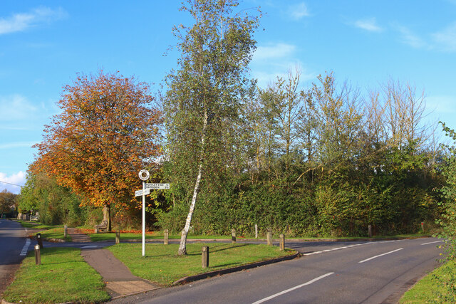
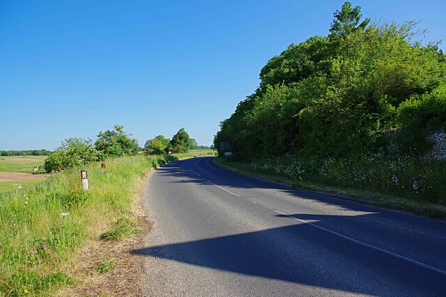
Crawley is a small village located in Oxfordshire, England. Situated approximately 6 miles west of Witney, it is nestled amongst the picturesque rolling hills of the Cotswolds. The village is surrounded by lush green fields and farmland, offering a tranquil and idyllic setting for its residents.

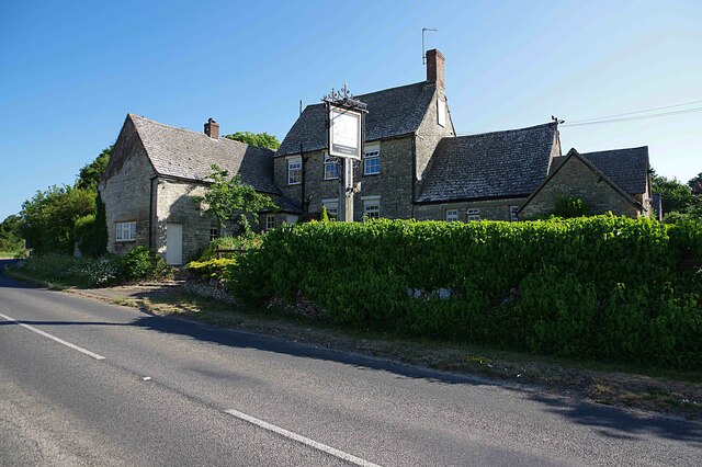
Crawley has a rich history, dating back to the medieval period. The village is known for its charming traditional stone cottages, which give it a quintessentially English character. The 12th-century St. Mary's Church stands at the heart of the village, showcasing beautiful architectural features and serving as a reminder of Crawley's heritage.

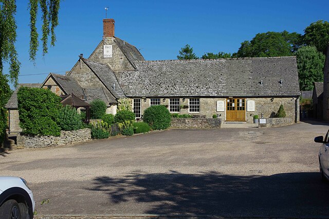
Despite its small size, Crawley offers a range of amenities for its residents. The village has a primary school, providing education for the local children. Additionally, there is a village hall that hosts various community events and activities, fostering a strong sense of community spirit.

Nature enthusiasts are drawn to Crawley due to its proximity to the countryside. The village is surrounded by scenic walking trails and bridleways, allowing residents to explore the natural beauty of the area. The nearby Wychwood Forest and Crawley Woods offer opportunities for outdoor activities, such as hiking and cycling.

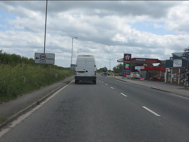
While Crawley may be a peaceful and rural village, it benefits from its close proximity to larger towns and cities. The town of Witney is a short drive away, offering a wider range of amenities, including shops, restaurants, and leisure facilities.

In summary, Crawley is a charming and historic village in Oxfordshire, offering a peaceful and picturesque setting for its residents. With its rich history, natural beauty, and community spirit, it is a desirable place to call home.

If you have any feedback on the listing, please let us know in the comments section below.

Crawley Images

Images are sourced within 2km of 51.805552/-1.5068813 or Grid Reference SP3411. Thanks to Geograph Open Source API. All images are credited.

Poffley End Lane Road junction near Witney.
Poffley End Lane
Road junction near Witney.
Bird in Hand (1), Whiteoak Green, Oxon A few miles from the town of Witney and on the B4022 road. This inn serves food, drinks and has accommodation in 16 bedrooms. The building is believed to date from the 17th century.

<a href="https://www.geograph.org.uk/photo/7418831">SP3413 : Bird in Hand (2), Whiteoak Green, Oxon</a>.
<a href="https://www.geograph.org.uk/photo/7418850">SP3413 : B4022 road heading north towards Finstock, Oxon</a>.
Bird in Hand (1), Whiteoak Green, Oxon
A few miles from the town of Witney and on the B4022 road. This inn serves food, drinks and has accommodation in 16 bedrooms. The building is believed to date from the 17th century. SP3413 : Bird in Hand (2), Whiteoak Green, Oxon. SP3413 : B4022 road heading north towards Finstock, Oxon.
Bird in Hand (2), Whiteoak Green, Oxon Photographed from the car park.

See also:- <a href="https://www.geograph.org.uk/photo/7418821">SP3413 : Bird in Hand (1), Whiteoak Green, Oxon</a>; <a href="https://www.geograph.org.uk/photo/7418836">SP3413 : Bird in Hand (3) - sign, Whiteoak Green, Oxon</a>.
Bird in Hand (2), Whiteoak Green, Oxon
Bird in Hand (3) - sign, Whiteoak Green, Oxon The sign is on a pole adjacent to the B4022 road. Since this photograph was taken, the sign has been replaced by a different design incorporating a white bird on a sky blue background.

<a href="https://www.geograph.org.uk/photo/7418821">SP3413 : Bird in Hand (1), Whiteoak Green, Oxon</a>.
<a href="https://www.geograph.org.uk/photo/7418831">SP3413 : Bird in Hand (2), Whiteoak Green, Oxon</a>.
Bird in Hand (3) - sign, Whiteoak Green, Oxon
The sign is on a pole adjacent to the B4022 road. Since this photograph was taken, the sign has been replaced by a different design incorporating a white bird on a sky blue background. SP3413 : Bird in Hand (1), Whiteoak Green, Oxon. SP3413 : Bird in Hand (2), Whiteoak Green, Oxon.
B4022 road heading north towards Finstock, Oxon The road here is just passing the Bird in Hand inn.

<a href="https://www.geograph.org.uk/photo/7418821">SP3413 : Bird in Hand (1), Whiteoak Green, Oxon</a>.
B4022 road heading north towards Finstock, Oxon
The road here is just passing the Bird in Hand inn. SP3413 : Bird in Hand (1), Whiteoak Green, Oxon.
Benchmark on #81 Hailey Road Ordnance Survey cut mark benchmark described on the Bench Mark Database at <span class="nowrap"><a title="http://www.bench-marks.org.uk/bm37230" rel="nofollow ugc noopener" href="http://www.bench-marks.org.uk/bm37230">Link</a><img style="margin-left:2px;" alt="External link" title="External link - shift click to open in new window" src="https://s1.geograph.org.uk/img/external.png" width="10" height="10"/></span>
Benchmark on #81 Hailey Road
Ordnance Survey cut mark benchmark described on the Bench Mark Database at LinkExternal link
Benchmark on #41 Hailey Road Ordnance Survey cut mark benchmark described on the Bench Mark Database at <span class="nowrap"><a title="http://www.bench-marks.org.uk/bm37231" rel="nofollow ugc noopener" href="http://www.bench-marks.org.uk/bm37231">Link</a><img style="margin-left:2px;" alt="External link" title="External link - shift click to open in new window" src="https://s1.geograph.org.uk/img/external.png" width="10" height="10"/></span>
Benchmark on #41 Hailey Road
Ordnance Survey cut mark benchmark described on the Bench Mark Database at LinkExternal link
Benchmark on #18 Burford Road Ordnance Survey cut mark benchmark described on the Bench Mark Database at <span class="nowrap"><a title="http://www.bench-marks.org.uk/bm37235" rel="nofollow ugc noopener" href="http://www.bench-marks.org.uk/bm37235">Link</a><img style="margin-left:2px;" alt="External link" title="External link - shift click to open in new window" src="https://s1.geograph.org.uk/img/external.png" width="10" height="10"/></span>
Benchmark on #18 Burford Road
Ordnance Survey cut mark benchmark described on the Bench Mark Database at LinkExternal link
Benchmark on #55 Burford Road Ordnance Survey cut mark benchmark described on the Bench Mark Database at <span class="nowrap"><a title="http://www.bench-marks.org.uk/bm37236" rel="nofollow ugc noopener" href="http://www.bench-marks.org.uk/bm37236">Link</a><img style="margin-left:2px;" alt="External link" title="External link - shift click to open in new window" src="https://s1.geograph.org.uk/img/external.png" width="10" height="10"/></span>
Benchmark on #55 Burford Road
Ordnance Survey cut mark benchmark described on the Bench Mark Database at LinkExternal link
Benchmark on the garage of #103 Burford Road Ordnanace Survey cut mark benchmark described on the Bench Mark Database at <span class="nowrap"><a title="http://www.bench-marks.org.uk/bm37238" rel="nofollow ugc noopener" href="http://www.bench-marks.org.uk/bm37238">Link</a><img style="margin-left:2px;" alt="External link" title="External link - shift click to open in new window" src="https://s1.geograph.org.uk/img/external.png" width="10" height="10"/></span>
Benchmark on the garage of #103 Burford Road
Ordnanace Survey cut mark benchmark described on the Bench Mark Database at LinkExternal link
Benchmark on #32 Tower Hill Ordnance Survey cut mark benchmark described on the Bench Mark Database at <span class="nowrap"><a title="http://www.bench-marks.org.uk/bm37239" rel="nofollow ugc noopener" href="http://www.bench-marks.org.uk/bm37239">Link</a><img style="margin-left:2px;" alt="External link" title="External link - shift click to open in new window" src="https://s1.geograph.org.uk/img/external.png" width="10" height="10"/></span>
Benchmark on #32 Tower Hill
Ordnance Survey cut mark benchmark described on the Bench Mark Database at LinkExternal link
Filling station on Burford Road
Entrance to Witney on the B4047
Burford Road (B4047) at Deer Park Road traffic lights
Witney - Burford Road (B4047) about to meet the A4095
Burford Road (A4095)
Minster Lovell Church St Kenelm, 15th century church adjacent to the ruins of Minster Lovell Hall.
<span class="nowrap"><a title="http://www.english-heritage.org.uk/daysout/properties/minster-lovell-hall-and-dovecote/" rel="nofollow ugc noopener" href="http://www.english-heritage.org.uk/daysout/properties/minster-lovell-hall-and-dovecote/">Link</a><img style="margin-left:2px;" alt="External link" title="External link - shift click to open in new window" src="https://s1.geograph.org.uk/img/external.png" width="10" height="10"/></span>
Minster Lovell Church
St Kenelm, 15th century church adjacent to the ruins of Minster Lovell Hall. LinkExternal link
St Kenelm 15th century, Cotswold stone, parish church of Minster Lovell.
<span class="nowrap"><a title="http://www.english-heritage.org.uk/daysout/properties/minster-lovell-hall-and-dovecote/" rel="nofollow ugc noopener" href="http://www.english-heritage.org.uk/daysout/properties/minster-lovell-hall-and-dovecote/">Link</a><img style="margin-left:2px;" alt="External link" title="External link - shift click to open in new window" src="https://s1.geograph.org.uk/img/external.png" width="10" height="10"/></span>
St Kenelm
15th century, Cotswold stone, parish church of Minster Lovell. LinkExternal link
Show me another place!

Crawley is located at Grid Ref: SP3411 (Lat: 51.805552, Lng: -1.5068813)

Administrative County: Oxfordshire

District: West Oxfordshire

Police Authority: Thames Valley

What 3 Words

///unsigned.hungry.cage. Near Witney, Oxfordshire

Nearby Locations

Crawley The Horseshoe

Related Wikis

Crawley, Oxfordshire

Crawley is a village and civil parish beside the River Windrush about 2+1⁄2 miles (4 km) north of Witney, Oxfordshire. The parish extends from the Windrush...

Witney (UK Parliament constituency)

Witney is a county constituency in Oxfordshire represented in the House of Commons of the Parliament of the United Kingdom since 2016 by Robert Courts...

Hailey, Oxfordshire

Hailey is a village and civil parish about 2 miles (3 km) north of Witney, Oxfordshire. The village comprises three neighbourhoods: Middletown on the main...

Minster Lovell Hall

Minster Lovell Hall is a ruin in Minster Lovell, an English village in the Oxfordshire Cotswolds. The ruins are situated by the River Windrush. == History... ==

Minster Lovell Priory

Minster Lovell Priory was a priory in Minster Lovell, Oxfordshire, England. Its current site is lost, though it is thought to have been west of St Kenelm...

West Oxfordshire

West Oxfordshire is a local government district in northwest Oxfordshire, England, including towns such as Woodstock, Burford, Chipping Norton, Charlbury...

Witney Rural District

Witney Rural District was a rural district in Oxfordshire, England from 1894 to 1974. It surrounded but did not include the town of Witney. == History... ==

Holy Trinity Church, Wood Green

Holy Trinity Church, Wood Green, is a Grade II listed Victorian church in Witney, Oxfordshire.The Church was built in 1848–9, on land given by the bishop...

Nearby Amenities

Located within 500m of 51.805552,-1.5068813
Passing Place
Lat/Long: 51.806938/-1.5003417
Traffic Calming: choker
Lat/Long: 51.8078494/-1.506982
Crawley Inn
Addr City: Crawley
Addr Housenumber: 1
Addr Postcode: OX29 9UN
Addr Street: Foxburrow Lane
Disused Amenity: pub
Fhrs Id: 870797
Lat/Long: 51.8063148/-1.5036035
Crawley
Is In: Oxfordshire, England, UK
Place: village
Lat/Long: 51.8062564/-1.5066056
Traffic Signals
Lat/Long: 51.8036231/-1.5087649
Traffic Signals
Lat/Long: 51.8034559/-1.5088949
Crawley Mill Industrial Estate
Lat/Long: 51.8027281/-1.5098296
Crawley Mill
Man Made: works
Lat/Long: 51.8032204/-1.5104888
Barrier: bollard
Lat/Long: 51.8072613/-1.5102635
Barrier: stile
Foot: yes
Lat/Long: 51.8054412/-1.5121636
Barrier: stile
Foot: yes
Lat/Long: 51.8057729/-1.5122573
The Lamb PH
Naptan AtcoCode: 340000236T
Naptan Bearing: S
Naptan BusStopType: CUS
Naptan CommonName: The Lamb PH
Naptan Indicator: Opposite
Naptan Landmark: Triangle
Naptan NaptanCode: oxfajtpd
Naptan Street: Leafield Road
Naptan Verified: no
Source: naptan_import
Lat/Long: 51.8060634/-1.5067494
Traffic Calming: choker
Lat/Long: 51.804257/-1.5061954
Waterway: weir
Lat/Long: 51.8032505/-1.5108574
Power: pole
Lat/Long: 51.8017436/-1.5088347
Power: pole
Lat/Long: 51.804702/-1.5118073
Power: pole
Lat/Long: 51.8051853/-1.5129291
Power: pole
Lat/Long: 51.8029794/-1.5078185
Power: pole
Lat/Long: 51.8043391/-1.5109663
Power: pole
Lat/Long: 51.805497/-1.5136738
Power: pole
Lat/Long: 51.8017637/-1.5099631
Power: pole
Lat/Long: 51.802482/-1.5065232
Power: pole
Lat/Long: 51.8038897/-1.5099065
Barrier: stile
Foot: yes
Material: wood
Source: gps_survey;photographic_survey
Stile: stepover
Lat/Long: 51.8098588/-1.5079052
Barrier: stile
Foot: yes
Material: wood
Note: Style broken down and partially obstructed. Probably illegally.
Stile: stepover
Lat/Long: 51.8072831/-1.510199
Traffic Calming: choker
Lat/Long: 51.8072002/-1.5072258
Historic: memorial
Memorial: war_memorial
Lat/Long: 51.8059662/-1.5067162
Power: pole
Lat/Long: 51.8016067/-1.5085113
Power: pole
Lat/Long: 51.8018194/-1.5080337
Power: pole
Lat/Long: 51.8021495/-1.5072613
Power: pole
Lat/Long: 51.8029901/-1.5077518
Power: pole
Lat/Long: 51.8030189/-1.5076846
Power: pole
Lat/Long: 51.8041121/-1.5072705
Power: pole
Lat/Long: 51.8035716/-1.5071237
Power: pole
Lat/Long: 51.8041452/-1.5065041
Power: pole
Lat/Long: 51.8046864/-1.5059422
Power: pole
Lat/Long: 51.8052014/-1.5053961
Power: pole
Lat/Long: 51.8055614/-1.5060141
Power: pole
Lat/Long: 51.8058104/-1.5054
Power: pole
Lat/Long: 51.801977/-1.5053299
Power: pole
Lat/Long: 51.8013569/-1.5049856
The data included in this document is from www.openstreetmap.org. The data is made available under ODbL.

Have you been to Crawley?

Leave your review of Crawley below (or comments, questions and feedback).