Bishopfield Wood

Wood, Forest in Northumberland

England

Bishopfield Wood

River East Allen downstream The river flowing away from Allendale Town in the vicinity of Bishopfield Haugh.
River East Allen downstream Credit: Trevor Littlewood

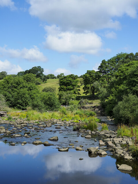
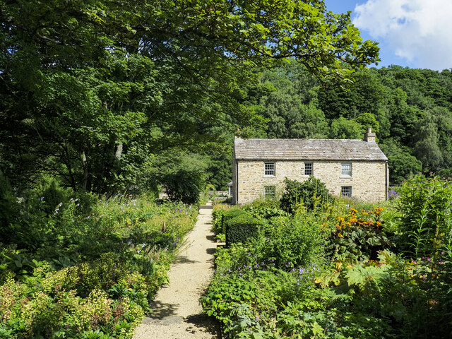
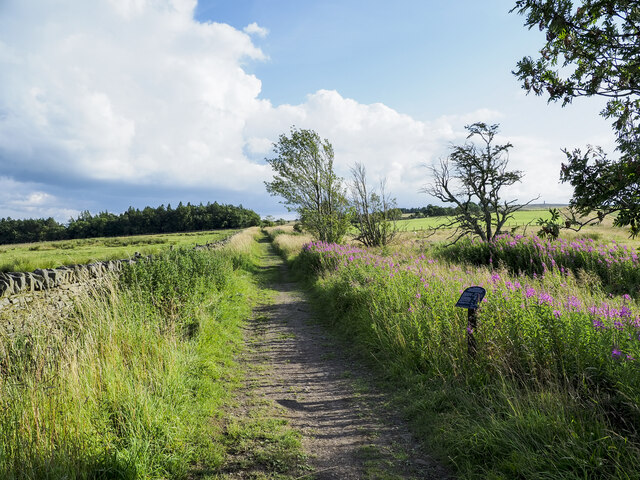
Bishopfield Wood is a charming woodland area located in Northumberland, England. Covering an area of approximately 100 acres, this forested landscape offers visitors a tranquil and picturesque retreat from the hustle and bustle of everyday life.

The wood is predominantly composed of broad-leaved trees, such as oak, beech, and birch, which create a diverse and vibrant canopy overhead. Underneath, a rich undergrowth of ferns, bluebells, and wildflowers adds to the woodland's natural beauty. The forest floor is carpeted with a thick layer of fallen leaves, creating a peaceful and inviting atmosphere.

Bishopfield Wood is home to a wide variety of wildlife, making it a popular spot for nature enthusiasts and birdwatchers. Visitors may catch a glimpse of woodland birds such as the great spotted woodpecker, tawny owl, or the elusive red squirrel. The wood also provides a habitat for small mammals like foxes, badgers, and voles.

A network of well-maintained footpaths and trails winds its way through Bishopfield Wood, offering visitors the opportunity to explore its hidden corners and enjoy its natural splendor. The wood is also home to a small picnic area, providing a perfect spot for visitors to relax and enjoy a packed lunch amidst the peaceful surroundings.

Bishopfield Wood is open to the public year-round, with no admission fees. It is managed by a local conservation organization dedicated to preserving its natural beauty and protecting its wildlife. Whether you are seeking a peaceful escape or an opportunity to connect with nature, Bishopfield Wood is a must-visit destination in Northumberland.

If you have any feedback on the listing, please let us know in the comments section below.

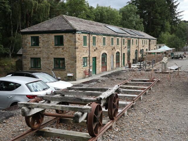
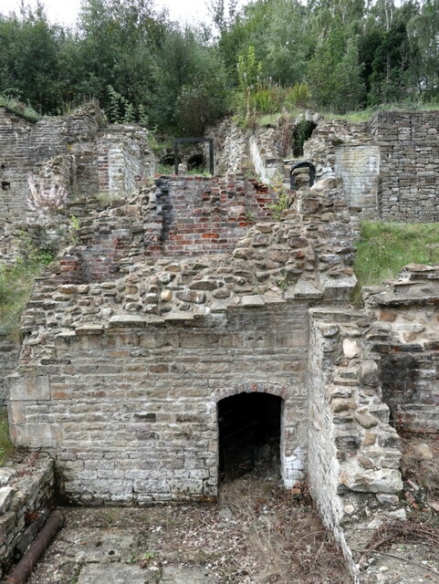
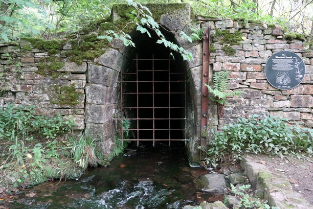
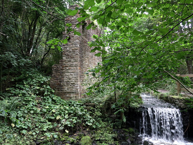
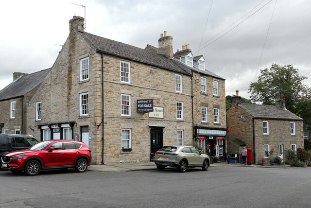
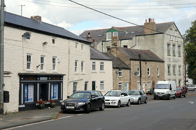
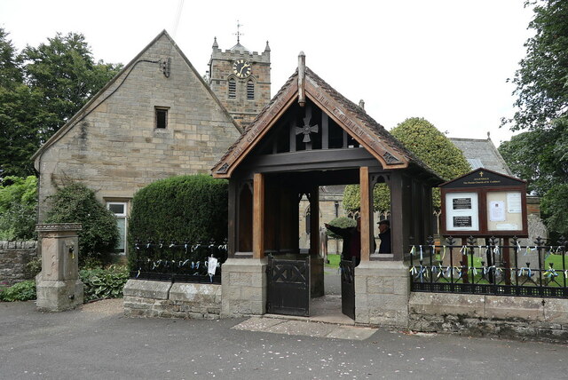
Bishopfield Wood Images

Images are sourced within 2km of 54.907499/-2.2766178 or Grid Reference NY8257. Thanks to Geograph Open Source API. All images are credited.

River East Allen downstream The river flowing away from Allendale Town in the vicinity of Bishopfield Haugh.
River East Allen downstream
The river flowing away from Allendale Town in the vicinity of Bishopfield Haugh.
House at Bridge Eal The house lies to the south of the River East Allen: It's unclear whether the name Bridge Eal applies specifically to the house or the general location. The property has a public footpath running along the garden path. Attached to the entrance was a notice asking that due to current Covid 19 situation, would walkers consider taking an alternative route than the one passing through the garden. The request was made most politely and didn't seek to deny access. A detour involved a change of route to be measured only in tens of metres and so we were content to make it.
House at Bridge Eal
The house lies to the south of the River East Allen: It's unclear whether the name Bridge Eal applies specifically to the house or the general location. The property has a public footpath running along the garden path. Attached to the entrance was a notice asking that due to current Covid 19 situation, would walkers consider taking an alternative route than the one passing through the garden. The request was made most politely and didn't seek to deny access. A detour involved a change of route to be measured only in tens of metres and so we were content to make it.
Access road for Chapel House Chapel House is behind the camera position. The image was recorded from a path which crosses the road, and is now part of the route of the Isaac Tea Trail. Use of the road by walkers is obviously unwelcome!
Access road for Chapel House
Chapel House is behind the camera position. The image was recorded from a path which crosses the road, and is now part of the route of the Isaac Tea Trail. Use of the road by walkers is obviously unwelcome!
Minor road at Burn Tongues passing war memorial The war memorial is to the men of Keenley and Broadside where the small population is dispersed and there is no focal point of a settlement; that explains the isolated location of the memorial beside the road at Burn Tongues.
Minor road at Burn Tongues passing war memorial
The war memorial is to the men of Keenley and Broadside where the small population is dispersed and there is no focal point of a settlement; that explains the isolated location of the memorial beside the road at Burn Tongues.
Farm buildings at Frolar Meadows The farm at Frolar Meadows lies to the south of a minor road west of Allendale Town. These are the outbuildings of the farm.
Farm buildings at Frolar Meadows
The farm at Frolar Meadows lies to the south of a minor road west of Allendale Town. These are the outbuildings of the farm.
Byway heading south close to Oakeydean Burn The Oakeydean Burn lies to the right, out of the image. The notice at the side of the lane gives information about the Allendale smelt mill flues which crossed at about this location.
Byway heading south close to Oakeydean Burn
The Oakeydean Burn lies to the right, out of the image. The notice at the side of the lane gives information about the Allendale smelt mill flues which crossed at about this location.
Catton village On the road from Hexham to Allendale town. Sturdy stone cottages with substantial front gardens.
Catton village
On the road from Hexham to Allendale town. Sturdy stone cottages with substantial front gardens.
Sculpture of St Cuthbert, St Cuthbert's Church, Allendale Town Sculpture of St Cuthbert by former Allendale resident, Charles Sansbury (1916-1989) given to the church by his family in 2014.
Sculpture of St Cuthbert, St Cuthbert's Church, Allendale Town
Sculpture of St Cuthbert by former Allendale resident, Charles Sansbury (1916-1989) given to the church by his family in 2014.
Interpretation board, Allen Lead Smelt Mill The design and manufacture of this information board (and others installed in Allenheads) are described here:
Differentia: <span class="nowrap"><a title="https://www.differentia.co.uk/news/2018/3/22/allen-valleys-interpretation-industrial-heritage-realised" rel="nofollow ugc noopener" href="https://www.differentia.co.uk/news/2018/3/22/allen-valleys-interpretation-industrial-heritage-realised">Link</a><img style="margin-left:2px;" alt="External link" title="External link - shift click to open in new window" src="https://s1.geograph.org.uk/img/external.png" width="10" height="10"/></span> <span class="nowrap"><a title="https://web.archive.org/web/20220919075532/https://www.differentia.co.uk/news/2018/3/22/allen-valleys-interpretation-industrial-heritage-realised" rel="nofollow ugc noopener" href="https://web.archive.org/web/20220919075532/https://www.differentia.co.uk/news/2018/3/22/allen-valleys-interpretation-industrial-heritage-realised">Archive Link</a><img style="margin-left:2px;" alt="External link" title="External link - shift click to open in new window" src="https://s1.geograph.org.uk/img/external.png" width="10" height="10"/></span>
Bob Marshall 3D Illustrator: <span class="nowrap"><a title="http://www.bob-marshall.co.uk/2018/01/reconstructing-our-industrial-past.html" rel="nofollow ugc noopener" href="http://www.bob-marshall.co.uk/2018/01/reconstructing-our-industrial-past.html">Link</a><img style="margin-left:2px;" alt="External link" title="External link - shift click to open in new window" src="https://s1.geograph.org.uk/img/external.png" width="10" height="10"/></span> <span class="nowrap"><a title="https://web.archive.org/web/20220919080606/http://www.bob-marshall.co.uk/2018/01/reconstructing-our-industrial-past.html" rel="nofollow ugc noopener" href="https://web.archive.org/web/20220919080606/http://www.bob-marshall.co.uk/2018/01/reconstructing-our-industrial-past.html">Archive Link</a><img style="margin-left:2px;" alt="External link" title="External link - shift click to open in new window" src="https://s1.geograph.org.uk/img/external.png" width="10" height="10"/></span>
Interpretation board, Allen Lead Smelt Mill
The design and manufacture of this information board (and others installed in Allenheads) are described here: Differentia: LinkExternal link Archive LinkExternal link Bob Marshall 3D Illustrator: LinkExternal link Archive LinkExternal link
Excavation of wheel-pit, Allen Lead Smelt Mill Water-Wheel Pit

"This is the pit for the over-shot water-wheel used here at Allen Mill. The weight and force of moving water cause a wheel to move, which in turn moves machinery by means of belts or gears. The water for the wheel at Allen Mill came from as far away as Weardale. The water was collected in reservoirs and underground systems to finally enter the smelt mill from the south, just above where the current 'SAM' is located. The water for an over-shot water-wheel arrives in-line with and passes over the top of the wheel. The mechanical efficiency of an over-shot water-wheel is estimated to be 68% compared with that of an under-shot water-wheel (where the water passes under the wheel) which is thought to be only 35%. The water-wheel at Allen Mill was used to drive the machinery to crush the ore and provide the air blast for the furnaces."
<span class="nowrap"><a title="http://www.allenmill.co.uk/heritage" rel="nofollow ugc noopener" href="http://www.allenmill.co.uk/heritage">Link</a><img style="margin-left:2px;" alt="External link" title="External link - shift click to open in new window" src="https://s1.geograph.org.uk/img/external.png" width="10" height="10"/></span> <span class="nowrap"><a title="https://web.archive.org/web/20220917132443/http://www.allenmill.co.uk/heritage" rel="nofollow ugc noopener" href="https://web.archive.org/web/20220917132443/http://www.allenmill.co.uk/heritage">Archive Link</a><img style="margin-left:2px;" alt="External link" title="External link - shift click to open in new window" src="https://s1.geograph.org.uk/img/external.png" width="10" height="10"/></span>
Excavation of wheel-pit, Allen Lead Smelt Mill
Water-Wheel Pit "This is the pit for the over-shot water-wheel used here at Allen Mill. The weight and force of moving water cause a wheel to move, which in turn moves machinery by means of belts or gears. The water for the wheel at Allen Mill came from as far away as Weardale. The water was collected in reservoirs and underground systems to finally enter the smelt mill from the south, just above where the current 'SAM' is located. The water for an over-shot water-wheel arrives in-line with and passes over the top of the wheel. The mechanical efficiency of an over-shot water-wheel is estimated to be 68% compared with that of an under-shot water-wheel (where the water passes under the wheel) which is thought to be only 35%. The water-wheel at Allen Mill was used to drive the machinery to crush the ore and provide the air blast for the furnaces." LinkExternal link Archive LinkExternal link
Archaeology excavation at Allen Lead Smelt Mill The remains of a ore hearth smelt mill and a reverberatory smelt mill, as well as an extensive system of flues. Much of the smelt mill has been levelled, but a broad retaining bank at the rear of the smelt mill site contains the remains of several stone structures revetted into the slope. Some of these structures are interpreted as a series of bouse teams and the remains of a condensing chamber and a flue opening. A building on the north side of the smelt mill complex, was constructed partly on the site of the original Pattison building, a retains its roof form. This was a 19th century silver smelter. Horizontal flues, which run between the smelt mill furnaces and their chimneys, were constructed during the 19th century.

The first flue, which was begun in 1808, runs from the south end of the smelt mill and follows the south side of the B6295 before turning west towards Cleugh Head where it originally terminated. On construction of the second flue in 1853 it is thought that the first was extended south and then south-west to Flow Moss. The second flue emerges from the south-western side of the smelt mill and crossed over the adjacent road on what is thought to have been a bridge. The flue continued south-west on a more direct route to the chimneys on Flow Moss.

There are two chimneys on Flow Moss. The most southerly chimney, into which both flues pass, has undergone consolidation, and is visible as a well preserved structure 7 metres in diameter. The most northerly chimney, 40 metres north of the first, stands 25 metres high and 4 metres in diameter.

The smelt mill was closed in 1896.

Historic England List Entry 1016817: <span class="nowrap"><a title="https://historicengland.org.uk/listing/the-list/list-entry/1016817" rel="nofollow ugc noopener" href="https://historicengland.org.uk/listing/the-list/list-entry/1016817">Link</a><img style="margin-left:2px;" alt="External link" title="External link - shift click to open in new window" src="https://s1.geograph.org.uk/img/external.png" width="10" height="10"/></span>
Allen Lead Smelt Mill on Pastscape: <span class="nowrap"><a title="http://www.pastscape.org.uk/hob.aspx?hob_id=16248" rel="nofollow ugc noopener" href="http://www.pastscape.org.uk/hob.aspx?hob_id=16248">Link</a><img style="margin-left:2px;" alt="External link" title="External link - shift click to open in new window" src="https://s1.geograph.org.uk/img/external.png" width="10" height="10"/></span> <span class="nowrap"><a title="https://web.archive.org/web/20190923181831/https://www.pastscape.org.uk/hob.aspx?hob_id=16248" rel="nofollow ugc noopener" href="https://web.archive.org/web/20190923181831/https://www.pastscape.org.uk/hob.aspx?hob_id=16248">Archive Link</a><img style="margin-left:2px;" alt="External link" title="External link - shift click to open in new window" src="https://s1.geograph.org.uk/img/external.png" width="10" height="10"/></span>
Allen Smelt Mill, flue system and chimneys: <span class="nowrap"><a title="http://ads.ahds.ac.uk/catalogue/collections/nsmr03abstracts/7293.html" rel="nofollow ugc noopener" href="http://ads.ahds.ac.uk/catalogue/collections/nsmr03abstracts/7293.html">Link</a><img style="margin-left:2px;" alt="External link" title="External link - shift click to open in new window" src="https://s1.geograph.org.uk/img/external.png" width="10" height="10"/></span>
Hexham Courant - 24 October 2016: <span class="nowrap"><a title="http://www.hexham-courant.co.uk/news/allendale/Centuries-of-history-uncovered-at-Allendale-smelt-mill-3dc5b0ed-90e1-43f2-893b-b8eb6e4096d2-ds" rel="nofollow ugc noopener" href="http://www.hexham-courant.co.uk/news/allendale/Centuries-of-history-uncovered-at-Allendale-smelt-mill-3dc5b0ed-90e1-43f2-893b-b8eb6e4096d2-ds">Link</a><img style="margin-left:2px;" alt="External link" title="External link - shift click to open in new window" src="https://s1.geograph.org.uk/img/external.png" width="10" height="10"/></span>
3D reconstruction: <span class="nowrap"><a title="http://www.bob-marshall.co.uk/2018/01/reconstructing-our-industrial-past.html" rel="nofollow ugc noopener" href="http://www.bob-marshall.co.uk/2018/01/reconstructing-our-industrial-past.html">Link</a><img style="margin-left:2px;" alt="External link" title="External link - shift click to open in new window" src="https://s1.geograph.org.uk/img/external.png" width="10" height="10"/></span> <span class="nowrap"><a title="https://web.archive.org/web/20220917133103/http://www.bob-marshall.co.uk/2018/01/reconstructing-our-industrial-past.html" rel="nofollow ugc noopener" href="https://web.archive.org/web/20220917133103/http://www.bob-marshall.co.uk/2018/01/reconstructing-our-industrial-past.html">Archive Link</a><img style="margin-left:2px;" alt="External link" title="External link - shift click to open in new window" src="https://s1.geograph.org.uk/img/external.png" width="10" height="10"/></span>
ChronicleLive (2018): <span class="nowrap"><a title="https://www.chroniclelive.co.uk/news/north-east-news/beautiful-northumberland-landscape-once-powerhouse-15439815" rel="nofollow ugc noopener" href="https://www.chroniclelive.co.uk/news/north-east-news/beautiful-northumberland-landscape-once-powerhouse-15439815">Link</a><img style="margin-left:2px;" alt="External link" title="External link - shift click to open in new window" src="https://s1.geograph.org.uk/img/external.png" width="10" height="10"/></span> <span class="nowrap"><a title="https://web.archive.org/web/20181121170314/https://www.chroniclelive.co.uk/news/north-east-news/beautiful-northumberland-landscape-once-powerhouse-15439815" rel="nofollow ugc noopener" href="https://web.archive.org/web/20181121170314/https://www.chroniclelive.co.uk/news/north-east-news/beautiful-northumberland-landscape-once-powerhouse-15439815">Archive Link</a><img style="margin-left:2px;" alt="External link" title="External link - shift click to open in new window" src="https://s1.geograph.org.uk/img/external.png" width="10" height="10"/></span>
Archaeology excavation at Allen Lead Smelt Mill
The remains of a ore hearth smelt mill and a reverberatory smelt mill, as well as an extensive system of flues. Much of the smelt mill has been levelled, but a broad retaining bank at the rear of the smelt mill site contains the remains of several stone structures revetted into the slope. Some of these structures are interpreted as a series of bouse teams and the remains of a condensing chamber and a flue opening. A building on the north side of the smelt mill complex, was constructed partly on the site of the original Pattison building, a retains its roof form. This was a 19th century silver smelter. Horizontal flues, which run between the smelt mill furnaces and their chimneys, were constructed during the 19th century. The first flue, which was begun in 1808, runs from the south end of the smelt mill and follows the south side of the B6295 before turning west towards Cleugh Head where it originally terminated. On construction of the second flue in 1853 it is thought that the first was extended south and then south-west to Flow Moss. The second flue emerges from the south-western side of the smelt mill and crossed over the adjacent road on what is thought to have been a bridge. The flue continued south-west on a more direct route to the chimneys on Flow Moss. There are two chimneys on Flow Moss. The most southerly chimney, into which both flues pass, has undergone consolidation, and is visible as a well preserved structure 7 metres in diameter. The most northerly chimney, 40 metres north of the first, stands 25 metres high and 4 metres in diameter. The smelt mill was closed in 1896. Historic England List Entry 1016817: LinkExternal link Allen Lead Smelt Mill on Pastscape: LinkExternal link Archive LinkExternal link Allen Smelt Mill, flue system and chimneys: LinkExternal link Hexham Courant - 24 October 2016: LinkExternal link 3D reconstruction: LinkExternal link Archive LinkExternal link ChronicleLive (2018): LinkExternal link Archive LinkExternal link
Business Units at Allen Mill The remains of a ore hearth smelt mill and a reverberatory smelt mill, as well as an extensive system of flues. Much of the smelt mill has been levelled, but a broad retaining bank at the rear of the smelt mill site contains the remains of several stone structures revetted into the slope. Some of these structures are interpreted as a series of bouse teams and the remains of a condensing chamber and a flue opening. A building on the north side of the smelt mill complex, was constructed partly on the site of the original Pattison building, a retains its roof form. This was a 19th century silver smelter. Horizontal flues, which run between the smelt mill furnaces and their chimneys, were constructed during the 19th century.

The first flue, which was begun in 1808, runs from the south end of the smelt mill and follows the south side of the B6295 before turning west towards Cleugh Head where it originally terminated. On construction of the second flue in 1853 it is thought that the first was extended south and then south-west to Flow Moss. The second flue emerges from the south-western side of the smelt mill and crossed over the adjacent road on what is thought to have been a bridge. The flue continued south-west on a more direct route to the chimneys on Flow Moss.

There are two chimneys on Flow Moss. The most southerly chimney, into which both flues pass, has undergone consolidation, and is visible as a well preserved structure 7 metres in diameter. The most northerly chimney, 40 metres north of the first, stands 25 metres high and 4 metres in diameter.

The smelt mill was closed in 1896.

Historic England List Entry 1016817: <span class="nowrap"><a title="https://historicengland.org.uk/listing/the-list/list-entry/1016817" rel="nofollow ugc noopener" href="https://historicengland.org.uk/listing/the-list/list-entry/1016817">Link</a><img style="margin-left:2px;" alt="External link" title="External link - shift click to open in new window" src="https://s1.geograph.org.uk/img/external.png" width="10" height="10"/></span>
Allen Lead Smelt Mill on Pastscape: <span class="nowrap"><a title="http://www.pastscape.org.uk/hob.aspx?hob_id=16248" rel="nofollow ugc noopener" href="http://www.pastscape.org.uk/hob.aspx?hob_id=16248">Link</a><img style="margin-left:2px;" alt="External link" title="External link - shift click to open in new window" src="https://s1.geograph.org.uk/img/external.png" width="10" height="10"/></span> <span class="nowrap"><a title="https://web.archive.org/web/20190923181831/https://www.pastscape.org.uk/hob.aspx?hob_id=16248" rel="nofollow ugc noopener" href="https://web.archive.org/web/20190923181831/https://www.pastscape.org.uk/hob.aspx?hob_id=16248">Archive Link</a><img style="margin-left:2px;" alt="External link" title="External link - shift click to open in new window" src="https://s1.geograph.org.uk/img/external.png" width="10" height="10"/></span>
Allen Smelt Mill, flue system and chimneys: <span class="nowrap"><a title="http://ads.ahds.ac.uk/catalogue/collections/nsmr03abstracts/7293.html" rel="nofollow ugc noopener" href="http://ads.ahds.ac.uk/catalogue/collections/nsmr03abstracts/7293.html">Link</a><img style="margin-left:2px;" alt="External link" title="External link - shift click to open in new window" src="https://s1.geograph.org.uk/img/external.png" width="10" height="10"/></span>
Hexham Courant - 24 October 2016: <span class="nowrap"><a title="http://www.hexham-courant.co.uk/news/allendale/Centuries-of-history-uncovered-at-Allendale-smelt-mill-3dc5b0ed-90e1-43f2-893b-b8eb6e4096d2-ds" rel="nofollow ugc noopener" href="http://www.hexham-courant.co.uk/news/allendale/Centuries-of-history-uncovered-at-Allendale-smelt-mill-3dc5b0ed-90e1-43f2-893b-b8eb6e4096d2-ds">Link</a><img style="margin-left:2px;" alt="External link" title="External link - shift click to open in new window" src="https://s1.geograph.org.uk/img/external.png" width="10" height="10"/></span>
3D reconstruction: <span class="nowrap"><a title="http://www.bob-marshall.co.uk/2018/01/reconstructing-our-industrial-past.html" rel="nofollow ugc noopener" href="http://www.bob-marshall.co.uk/2018/01/reconstructing-our-industrial-past.html">Link</a><img style="margin-left:2px;" alt="External link" title="External link - shift click to open in new window" src="https://s1.geograph.org.uk/img/external.png" width="10" height="10"/></span> <span class="nowrap"><a title="https://web.archive.org/web/20220917133103/http://www.bob-marshall.co.uk/2018/01/reconstructing-our-industrial-past.html" rel="nofollow ugc noopener" href="https://web.archive.org/web/20220917133103/http://www.bob-marshall.co.uk/2018/01/reconstructing-our-industrial-past.html">Archive Link</a><img style="margin-left:2px;" alt="External link" title="External link - shift click to open in new window" src="https://s1.geograph.org.uk/img/external.png" width="10" height="10"/></span>
ChronicleLive (2018): <span class="nowrap"><a title="https://www.chroniclelive.co.uk/news/north-east-news/beautiful-northumberland-landscape-once-powerhouse-15439815" rel="nofollow ugc noopener" href="https://www.chroniclelive.co.uk/news/north-east-news/beautiful-northumberland-landscape-once-powerhouse-15439815">Link</a><img style="margin-left:2px;" alt="External link" title="External link - shift click to open in new window" src="https://s1.geograph.org.uk/img/external.png" width="10" height="10"/></span> <span class="nowrap"><a title="https://web.archive.org/web/20181121170314/https://www.chroniclelive.co.uk/news/north-east-news/beautiful-northumberland-landscape-once-powerhouse-15439815" rel="nofollow ugc noopener" href="https://web.archive.org/web/20181121170314/https://www.chroniclelive.co.uk/news/north-east-news/beautiful-northumberland-landscape-once-powerhouse-15439815">Archive Link</a><img style="margin-left:2px;" alt="External link" title="External link - shift click to open in new window" src="https://s1.geograph.org.uk/img/external.png" width="10" height="10"/></span>
Business Units at Allen Mill
The remains of a ore hearth smelt mill and a reverberatory smelt mill, as well as an extensive system of flues. Much of the smelt mill has been levelled, but a broad retaining bank at the rear of the smelt mill site contains the remains of several stone structures revetted into the slope. Some of these structures are interpreted as a series of bouse teams and the remains of a condensing chamber and a flue opening. A building on the north side of the smelt mill complex, was constructed partly on the site of the original Pattison building, a retains its roof form. This was a 19th century silver smelter. Horizontal flues, which run between the smelt mill furnaces and their chimneys, were constructed during the 19th century. The first flue, which was begun in 1808, runs from the south end of the smelt mill and follows the south side of the B6295 before turning west towards Cleugh Head where it originally terminated. On construction of the second flue in 1853 it is thought that the first was extended south and then south-west to Flow Moss. The second flue emerges from the south-western side of the smelt mill and crossed over the adjacent road on what is thought to have been a bridge. The flue continued south-west on a more direct route to the chimneys on Flow Moss. There are two chimneys on Flow Moss. The most southerly chimney, into which both flues pass, has undergone consolidation, and is visible as a well preserved structure 7 metres in diameter. The most northerly chimney, 40 metres north of the first, stands 25 metres high and 4 metres in diameter. The smelt mill was closed in 1896. Historic England List Entry 1016817: LinkExternal link Allen Lead Smelt Mill on Pastscape: LinkExternal link Archive LinkExternal link Allen Smelt Mill, flue system and chimneys: LinkExternal link Hexham Courant - 24 October 2016: LinkExternal link 3D reconstruction: LinkExternal link Archive LinkExternal link ChronicleLive (2018): LinkExternal link Archive LinkExternal link
Archaeology restoration at Allen Lead Smelt Mill The remains of a ore hearth smelt mill and a reverberatory smelt mill, as well as an extensive system of flues. Much of the smelt mill has been levelled, but a broad retaining bank at the rear of the smelt mill site contains the remains of several stone structures revetted into the slope. Some of these structures are interpreted as a series of bouse teams and the remains of a condensing chamber and a flue opening. A building on the north side of the smelt mill complex, was constructed partly on the site of the original Pattison building, a retains its roof form. This was a 19th century silver smelter. Horizontal flues, which run between the smelt mill furnaces and their chimneys, were constructed during the 19th century.

The first flue, which was begun in 1808, runs from the south end of the smelt mill and follows the south side of the B6295 before turning west towards Cleugh Head where it originally terminated. On construction of the second flue in 1853 it is thought that the first was extended south and then south-west to Flow Moss. The second flue emerges from the south-western side of the smelt mill and crossed over the adjacent road on what is thought to have been a bridge. The flue continued south-west on a more direct route to the chimneys on Flow Moss.

There are two chimneys on Flow Moss. The most southerly chimney, into which both flues pass, has undergone consolidation, and is visible as a well preserved structure 7 metres in diameter. The most northerly chimney, 40 metres north of the first, stands 25 metres high and 4 metres in diameter.

The smelt mill was closed in 1896.

Historic England List Entry 1016817: <span class="nowrap"><a title="https://historicengland.org.uk/listing/the-list/list-entry/1016817" rel="nofollow ugc noopener" href="https://historicengland.org.uk/listing/the-list/list-entry/1016817">Link</a><img style="margin-left:2px;" alt="External link" title="External link - shift click to open in new window" src="https://s1.geograph.org.uk/img/external.png" width="10" height="10"/></span>
Allen Lead Smelt Mill on Pastscape: <span class="nowrap"><a title="http://www.pastscape.org.uk/hob.aspx?hob_id=16248" rel="nofollow ugc noopener" href="http://www.pastscape.org.uk/hob.aspx?hob_id=16248">Link</a><img style="margin-left:2px;" alt="External link" title="External link - shift click to open in new window" src="https://s1.geograph.org.uk/img/external.png" width="10" height="10"/></span> <span class="nowrap"><a title="https://web.archive.org/web/20190923181831/https://www.pastscape.org.uk/hob.aspx?hob_id=16248" rel="nofollow ugc noopener" href="https://web.archive.org/web/20190923181831/https://www.pastscape.org.uk/hob.aspx?hob_id=16248">Archive Link</a><img style="margin-left:2px;" alt="External link" title="External link - shift click to open in new window" src="https://s1.geograph.org.uk/img/external.png" width="10" height="10"/></span>
Allen Smelt Mill, flue system and chimneys: <span class="nowrap"><a title="http://ads.ahds.ac.uk/catalogue/collections/nsmr03abstracts/7293.html" rel="nofollow ugc noopener" href="http://ads.ahds.ac.uk/catalogue/collections/nsmr03abstracts/7293.html">Link</a><img style="margin-left:2px;" alt="External link" title="External link - shift click to open in new window" src="https://s1.geograph.org.uk/img/external.png" width="10" height="10"/></span>
Hexham Courant - 24 October 2016: <span class="nowrap"><a title="http://www.hexham-courant.co.uk/news/allendale/Centuries-of-history-uncovered-at-Allendale-smelt-mill-3dc5b0ed-90e1-43f2-893b-b8eb6e4096d2-ds" rel="nofollow ugc noopener" href="http://www.hexham-courant.co.uk/news/allendale/Centuries-of-history-uncovered-at-Allendale-smelt-mill-3dc5b0ed-90e1-43f2-893b-b8eb6e4096d2-ds">Link</a><img style="margin-left:2px;" alt="External link" title="External link - shift click to open in new window" src="https://s1.geograph.org.uk/img/external.png" width="10" height="10"/></span>
3D reconstruction: <span class="nowrap"><a title="http://www.bob-marshall.co.uk/2018/01/reconstructing-our-industrial-past.html" rel="nofollow ugc noopener" href="http://www.bob-marshall.co.uk/2018/01/reconstructing-our-industrial-past.html">Link</a><img style="margin-left:2px;" alt="External link" title="External link - shift click to open in new window" src="https://s1.geograph.org.uk/img/external.png" width="10" height="10"/></span> <span class="nowrap"><a title="https://web.archive.org/web/20220917133103/http://www.bob-marshall.co.uk/2018/01/reconstructing-our-industrial-past.html" rel="nofollow ugc noopener" href="https://web.archive.org/web/20220917133103/http://www.bob-marshall.co.uk/2018/01/reconstructing-our-industrial-past.html">Archive Link</a><img style="margin-left:2px;" alt="External link" title="External link - shift click to open in new window" src="https://s1.geograph.org.uk/img/external.png" width="10" height="10"/></span>
ChronicleLive (2018): <span class="nowrap"><a title="https://www.chroniclelive.co.uk/news/north-east-news/beautiful-northumberland-landscape-once-powerhouse-15439815" rel="nofollow ugc noopener" href="https://www.chroniclelive.co.uk/news/north-east-news/beautiful-northumberland-landscape-once-powerhouse-15439815">Link</a><img style="margin-left:2px;" alt="External link" title="External link - shift click to open in new window" src="https://s1.geograph.org.uk/img/external.png" width="10" height="10"/></span> <span class="nowrap"><a title="https://web.archive.org/web/20181121170314/https://www.chroniclelive.co.uk/news/north-east-news/beautiful-northumberland-landscape-once-powerhouse-15439815" rel="nofollow ugc noopener" href="https://web.archive.org/web/20181121170314/https://www.chroniclelive.co.uk/news/north-east-news/beautiful-northumberland-landscape-once-powerhouse-15439815">Archive Link</a><img style="margin-left:2px;" alt="External link" title="External link - shift click to open in new window" src="https://s1.geograph.org.uk/img/external.png" width="10" height="10"/></span>
Archaeology restoration at Allen Lead Smelt Mill
The remains of a ore hearth smelt mill and a reverberatory smelt mill, as well as an extensive system of flues. Much of the smelt mill has been levelled, but a broad retaining bank at the rear of the smelt mill site contains the remains of several stone structures revetted into the slope. Some of these structures are interpreted as a series of bouse teams and the remains of a condensing chamber and a flue opening. A building on the north side of the smelt mill complex, was constructed partly on the site of the original Pattison building, a retains its roof form. This was a 19th century silver smelter. Horizontal flues, which run between the smelt mill furnaces and their chimneys, were constructed during the 19th century. The first flue, which was begun in 1808, runs from the south end of the smelt mill and follows the south side of the B6295 before turning west towards Cleugh Head where it originally terminated. On construction of the second flue in 1853 it is thought that the first was extended south and then south-west to Flow Moss. The second flue emerges from the south-western side of the smelt mill and crossed over the adjacent road on what is thought to have been a bridge. The flue continued south-west on a more direct route to the chimneys on Flow Moss. There are two chimneys on Flow Moss. The most southerly chimney, into which both flues pass, has undergone consolidation, and is visible as a well preserved structure 7 metres in diameter. The most northerly chimney, 40 metres north of the first, stands 25 metres high and 4 metres in diameter. The smelt mill was closed in 1896. Historic England List Entry 1016817: LinkExternal link Allen Lead Smelt Mill on Pastscape: LinkExternal link Archive LinkExternal link Allen Smelt Mill, flue system and chimneys: LinkExternal link Hexham Courant - 24 October 2016: LinkExternal link 3D reconstruction: LinkExternal link Archive LinkExternal link ChronicleLive (2018): LinkExternal link Archive LinkExternal link
Blackett Level Portal The plaque to the right of the entrance is shown here: <a href="https://www.geograph.org.uk/photo/5863976">NY8356 : Plaque re the Blackett Level</a>.
Blackett Level Portal
The plaque to the right of the entrance is shown here: NY8356 : Plaque re the Blackett Level.
Waterfall from Blackett Level Portal into Philp Burn WB Lead's Blackett Level Project was designed to explore lead veins along the East Allen valley and also to provide drainage of the mines at Allenheads. From its entrance in Allendale, shafts along its proposed course were opened at Studdon, Holms Linn, Sipton and Bracken Holm. Sinking of the shaft at Holms Linn at the hands of its chief engineer, Thomas Sopwith, commenced in 1855. The portal at Allendale was constructed four years later, in 1859. The accuracy of planning of the level was demonstrated as a pin-hole of light from the entrance could be seen near Holms Linn, two miles distant. The project eventually proved to be a failure as the level never reached Allenheads, and apart from an area at Sipton, few profitable deposits of lead-ore were discovered. In addition, cheap sources of lead from overseas in the late 19th century made home production of lead relatively uneconomic.

Blackett Level in Allendale: <span class="nowrap"><a title="http://www.allenmill.co.uk/blacket-level" rel="nofollow ugc noopener" href="http://www.allenmill.co.uk/blacket-level">Link</a><img style="margin-left:2px;" alt="External link" title="External link - shift click to open in new window" src="https://s1.geograph.org.uk/img/external.png" width="10" height="10"/></span> <span class="nowrap"><a title="https://web.archive.org/web/20201011151048/http://www.allenmill.co.uk/blacket-level" rel="nofollow ugc noopener" href="https://web.archive.org/web/20201011151048/http://www.allenmill.co.uk/blacket-level">Archive Link</a><img style="margin-left:2px;" alt="External link" title="External link - shift click to open in new window" src="https://s1.geograph.org.uk/img/external.png" width="10" height="10"/></span>
Waterfall from Blackett Level Portal into Philp Burn
WB Lead's Blackett Level Project was designed to explore lead veins along the East Allen valley and also to provide drainage of the mines at Allenheads. From its entrance in Allendale, shafts along its proposed course were opened at Studdon, Holms Linn, Sipton and Bracken Holm. Sinking of the shaft at Holms Linn at the hands of its chief engineer, Thomas Sopwith, commenced in 1855. The portal at Allendale was constructed four years later, in 1859. The accuracy of planning of the level was demonstrated as a pin-hole of light from the entrance could be seen near Holms Linn, two miles distant. The project eventually proved to be a failure as the level never reached Allenheads, and apart from an area at Sipton, few profitable deposits of lead-ore were discovered. In addition, cheap sources of lead from overseas in the late 19th century made home production of lead relatively uneconomic. Blackett Level in Allendale: LinkExternal link Archive LinkExternal link
Tea Rooms, Market Place, Allendale Town The Tea Rooms, a 5-bedroom town-house, is currently for sale at a guide price of £325,000 (2022).
Tea Rooms, Market Place, Allendale Town
The Tea Rooms, a 5-bedroom town-house, is currently for sale at a guide price of £325,000 (2022).
Shield Street, Allendale Town
St Cuthbert's Church, Allendale Town
Show me another place!

Bishopfield Wood is located at Grid Ref: NY8257 (Lat: 54.907499, Lng: -2.2766178)

Unitary Authority: Northumberland

Police Authority: Northumbria

What 3 Words

///walks.window.growl. Near Haydon Bridge, Northumberland

Related Wikis

Catton, Northumberland

Catton is a village in Northumberland, England. It is about 7 miles (11 km) to the southwest of Hexham and is located on the outskirts of Allendale �...

Allendale railway station

Allendale railway station was the terminus of the single track branch of the Hexham and Allendale Railway, in north east England. The line connected villages...

Museum of Classic Sci-Fi

The Museum of Classic Sci-Fi is in Allendale, Northumberland in England. The museum opened in 2018 and houses a collection of more than 200 props, costumes...

Allendale, Northumberland

Allendale, often marked on maps as Allendale Town, is a village and civil parish in south west Northumberland, England. It is located within the North...

Allendale Co-operative Society

Allendale Co-operative Society is a small consumer co-operative in the village of Allendale, Northumberland, England. Founded in 1874 as the Allendale...

Allen Confluence Gravels

The Allen Confluence Gravels is the name given to a Site of Special Scientific Interest (SSSI) in Northumberland, England. The site, listed since 1968...

Staward Halt railway station

Staward Halt is a closed stone built railway station situated on a single track branch railway line in Northumberland, England, that ran from Allendale...

Bearsbridge

Bearsbridge is a village in Northumberland, in England. It is situated to the west of Hexham, on the A686. == Governance == Bearsbridge is in the parliamentary...

Nearby Amenities

Located within 500m of 54.907499,-2.2766178
Bishopfield Haugh
Place: locality
Lat/Long: 54.9081465/-2.2757338
Jackson's Cleugh
Place: locality
Lat/Long: 54.9106814/-2.2757685
Woody Close
Place: locality
Lat/Long: 54.9109309/-2.2791364
Power: pole
Lat/Long: 54.9084834/-2.2692011
The data included in this document is from www.openstreetmap.org. The data is made available under ODbL.

Have you been to Bishopfield Wood?

Leave your review of Bishopfield Wood below (or comments, questions and feedback).