Crathes

Settlement in Kincardineshire

Scotland

Crathes

Mill Wheel at Milton This is one of two water wheels that drove mill machinery at Milton of Crathes. It is an undershot wheel.
Mill Wheel at Milton Credit: Anne Burgess

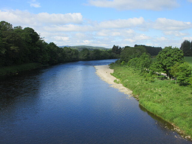
Crathes is a small village located in the county of Kincardineshire, Scotland. Situated on the banks of the River Dee, it is approximately 15 miles west of Aberdeen. The village is renowned for its picturesque landscapes, historic sites, and close proximity to the stunning Crathes Castle.

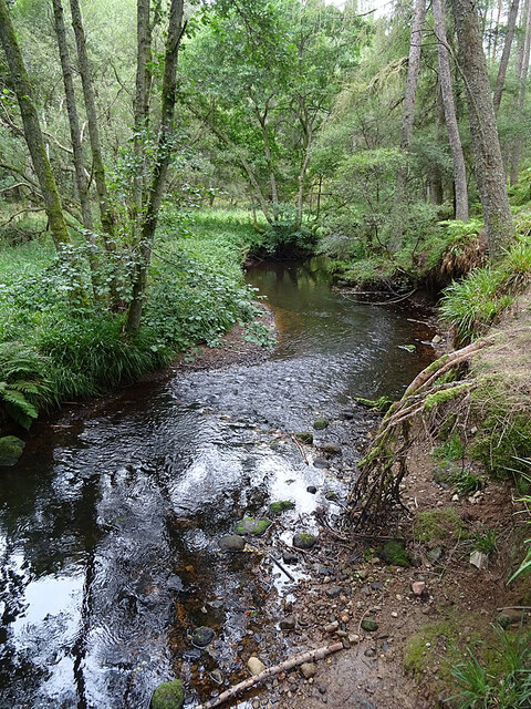
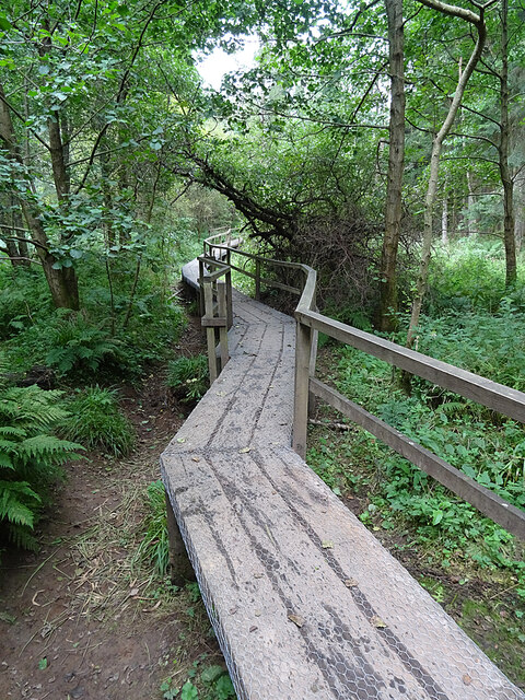
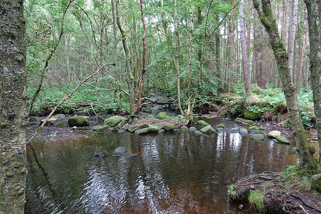
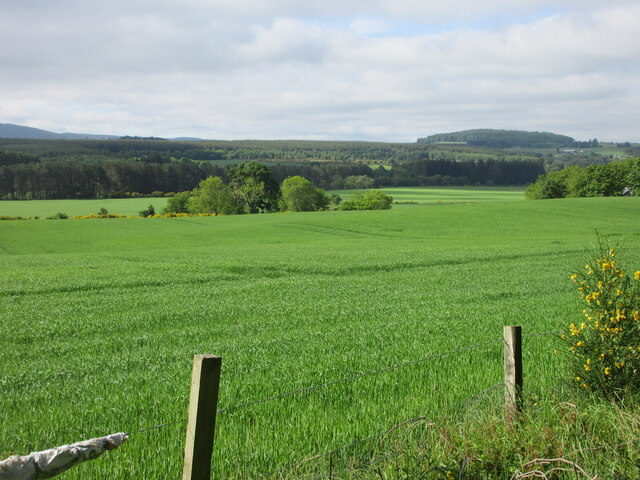
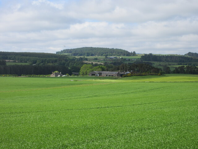
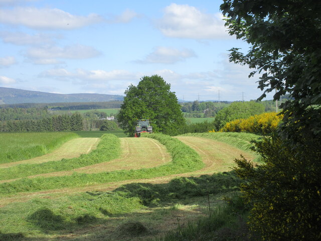
Crathes is a charming rural community with a population of around 1,500 residents. The village is surrounded by lush green fields, rolling hills, and dense forests, making it an ideal destination for nature lovers and outdoor enthusiasts. The River Dee adds to the beauty of the area, offering opportunities for fishing, boating, and scenic walks along its banks.

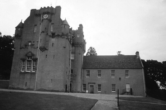
The main attraction in Crathes is undoubtedly Crathes Castle, a magnificent 16th-century tower house. This grand castle is surrounded by beautifully manicured gardens and boasts a rich history that dates back to the Burnett family, who owned the estate for over 350 years. Visitors can explore the castle's opulent interiors, including its impressive oak-panelled Great Hall and the intricately painted ceilings of the Queen's Bedroom.

In addition to Crathes Castle, the village offers a range of amenities for both residents and visitors. These include a primary school, a village hall, a post office, and a few local shops and cafes. The village also hosts various events throughout the year, such as the Crathes Vintage Car and Motorcycle Rally, which attracts enthusiasts from all over Scotland.

Overall, Crathes is a delightful village where history, natural beauty, and a strong sense of community converge. Its idyllic location, combined with the charm of Crathes Castle, make it a must-visit destination in Kincardineshire.

If you have any feedback on the listing, please let us know in the comments section below.
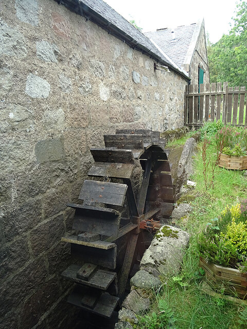
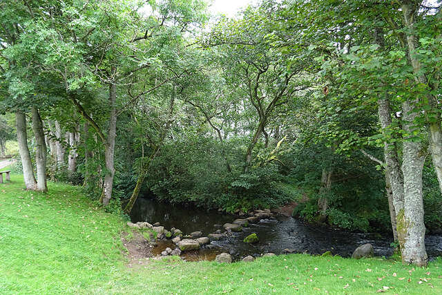
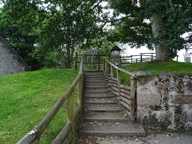
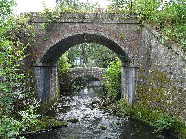
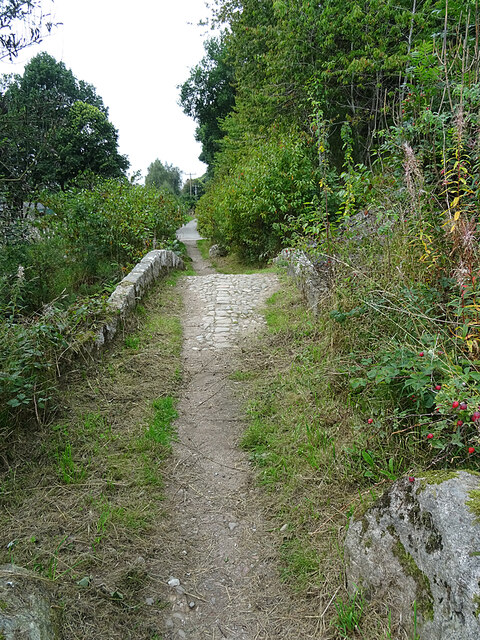
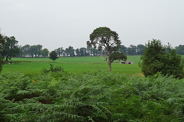
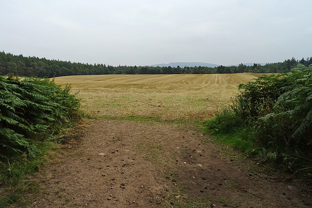
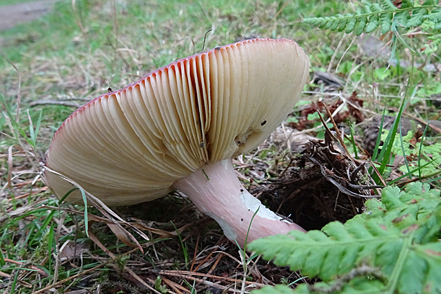
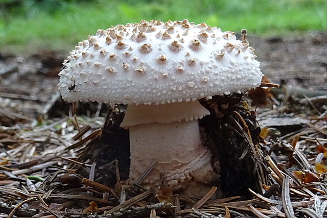
Crathes Images

Images are sourced within 2km of 57.05926/-2.415831 or Grid Reference NO7496. Thanks to Geograph Open Source API. All images are credited.

Mill Wheel at Milton This is one of two water wheels that drove mill machinery at Milton of Crathes. It is an undershot wheel.
Mill Wheel at Milton
This is one of two water wheels that drove mill machinery at Milton of Crathes. It is an undershot wheel.
Ford on the Coy Burn Until the bridge was built a little distance upstream, this was the only way across the Coy Burn.
Ford on the Coy Burn
Until the bridge was built a little distance upstream, this was the only way across the Coy Burn.
Steps at Milton of Crathes The steps lead up to a field where customers can try out fishing rods and casting techniques.
Steps at Milton of Crathes
The steps lead up to a field where customers can try out fishing rods and casting techniques.
Bridges over the Coy Burn The lower bridge is an old packhorse bridge built to allow travellers to avoid having to use the ford. The higher one was built to carry the railway line over the burn. I'm standing on a third one, which is a tatty-looking concrete effort, and behind me are the pillars and arches of the modern A93 road bridge. It was, sadly, impossible to photograph the arch of the old bridge without getting the railway bridge, or the tatty concrete bridge, or the ugly blue-and-white portable building on the nearby sports field, in the picture. Maybe another time I will go wading and see if it is possible.
Bridges over the Coy Burn
The lower bridge is an old packhorse bridge built to allow travellers to avoid having to use the ford. The higher one was built to carry the railway line over the burn. I'm standing on a third one, which is a tatty-looking concrete effort, and behind me are the pillars and arches of the modern A93 road bridge. It was, sadly, impossible to photograph the arch of the old bridge without getting the railway bridge, or the tatty concrete bridge, or the ugly blue-and-white portable building on the nearby sports field, in the picture. Maybe another time I will go wading and see if it is possible.
Pack Horse Bridge The slightly humped bridge was built in the 18th century. It retains the old cobbled surface. It is part of a trio of bridges that are Category B Listed because of how they illustrate the history of crossings of the Coy Burn. A fourth bridge is mentioned briefly as being of insufficient merit to list.
Pack Horse Bridge
The slightly humped bridge was built in the 18th century. It retains the old cobbled surface. It is part of a trio of bridges that are Category B Listed because of how they illustrate the history of crossings of the Coy Burn. A fourth bridge is mentioned briefly as being of insufficient merit to list.
Grounds of Crathes Castle Looking pretty dreary on a dreich day, these fields are east of the castle itself.
Grounds of Crathes Castle
Looking pretty dreary on a dreich day, these fields are east of the castle itself.
Stubble Field This field next to Crathes Castle has already been harvested and the straw baled and removed.
Stubble Field
This field next to Crathes Castle has already been harvested and the straw baled and removed.
Burn of Coy Looking downstream from the point where the 'blue' waymarked walk from the car park reaches the bank of the burn.
Burn of Coy
Looking downstream from the point where the 'blue' waymarked walk from the car park reaches the bank of the burn.
Fungus This is a fairly common fungus with a dark red cap, but I don't know what sort it is.
Fungus
This is a fairly common fungus with a dark red cap, but I don't know what sort it is.
Boardwalk The boardwalk is evidently necessary so that visitors can follow the path alongside the Burn of Coy without plowtering through mud. Today, however, it was dry enough to climb down and look more closely at the plants if one wished to do so.
Boardwalk
The boardwalk is evidently necessary so that visitors can follow the path alongside the Burn of Coy without plowtering through mud. Today, however, it was dry enough to climb down and look more closely at the plants if one wished to do so.
Fungus Recently emerged and still undamaged by whatewver it is that eats holes in the caps of fungi.
Fungus
Recently emerged and still undamaged by whatewver it is that eats holes in the caps of fungi.
Coy Burn A pool formed in a bend of the burn, looking downstream.
Coy Burn
A pool formed in a bend of the burn, looking downstream.
Crathes Castle <span class="nowrap"><a title="https://canmore.org.uk/site/36693/crathes-castle" rel="nofollow ugc noopener" href="https://canmore.org.uk/site/36693/crathes-castle">Link</a><img style="margin-left:2px;" alt="External link" title="External link - shift click to open in new window" src="https://s1.geograph.org.uk/img/external.png" width="10" height="10"/></span>
Crathes Castle
Field near Mills of Drum Looking south-west from the Deeside Way over a field near Mills of Drum on the north side of the River Dee.
Field near Mills of Drum
Looking south-west from the Deeside Way over a field near Mills of Drum on the north side of the River Dee.
Nether Mills of Crathes A distant view of the Nether Mills of Crathes from the Deeside Way to the north-east.
Nether Mills of Crathes
A distant view of the Nether Mills of Crathes from the Deeside Way to the north-east.
River Dee from Durris Bridge Looking upstream of the River Dee from the A957 Durris Bridge.
River Dee from Durris Bridge
Looking upstream of the River Dee from the A957 Durris Bridge.
Grass cutting near Durris A field being shorn of grass near Funach Wood at Durris.
Grass cutting near Durris
A field being shorn of grass near Funach Wood at Durris.
Crathes village hall Geocaching is a type of global treasure hunt of people looking for caches, or hidden stashes of objects. Geocaching may also be described as a series of hide-and-seek games, where hiders provide online clues for seekers. Seekers use global positioning system (GPS) devices to find hidden caches
Crathes village hall
Geocaching is a type of global treasure hunt of people looking for caches, or hidden stashes of objects. Geocaching may also be described as a series of hide-and-seek games, where hiders provide online clues for seekers. Seekers use global positioning system (GPS) devices to find hidden caches
Show me another place!

Crathes is located at Grid Ref: NO7496 (Lat: 57.05926, Lng: -2.415831)

Unitary Authority: Aberdeenshire

Police Authority: North East

What 3 Words

///oiled.excavate.jaundice. Near Banchory, Aberdeenshire

Nearby Locations

Station Wood Crathes

Related Wikis

Banchory St Ternan F.C.

Banchory St. Ternan Football Club are a Scottish Junior football club based in Crathes, two miles outside the town of Banchory, Aberdeenshire. The club...

Milton of Crathes

Milton of Crathes is a complex of restored 17th-century stone buildings, associated with, and previously an outlier of, Crathes Castle in Aberdeenshire...

Coy Burn

Coy Burn is a stream that rises in the hills north of Banchory in Aberdeenshire, Scotland. Coy Burn discharges to the River Dee at Milton of Crathes....

Royal Deeside Railway

The Royal Deeside Railway is a Scottish heritage railway located at Milton of Crathes railway station on a part of the original Deeside Railway. ��2�...

Nearby Amenities

Located within 500m of 57.05926,-2.415831
Crathes
Name Gd: Creicheis
Place: village
Lat/Long: 57.0580342/-2.4144871
Bicycle Parking
Capacity: 10
Covered: yes
Lat/Long: 57.0583004/-2.4180022
Bus Stop
Station Wood
Bench: yes
Bin: no
Bus: yes
Naptan AtcoCode: 630040072
Naptan Bearing: W
Naptan CommonName: Station Wood
Naptan Indicator: adj
Naptan NaptanCode: 23624895
Naptan Street: A93
Naptan Verified: no
Public Transport: platform
Shelter: yes
Source: naptan;bing;naptan_compare_tool
Tactile Paving: no
Lat/Long: 57.0588571/-2.4162983
Man Made: tower
Tower Construction: lattice
Tower Type: communication
Lat/Long: 57.0592769/-2.4155727
Bus Stop
Station Wood
Bench: yes
Bin: no
Bus: yes
Naptan AtcoCode: 630040071
Naptan Bearing: E
Naptan CommonName: Station Wood
Naptan Indicator: opp
Naptan NaptanCode: 23624894
Naptan Street: A93
Naptan Verified: no
Public Transport: platform
Shelter: yes
Source: naptan;bing;naptan_compare_tool
Tactile Paving: no
Lat/Long: 57.0590132/-2.4161696
Crathes
Historic Railway: station
Wikidata: Q124322651
Lat/Long: 57.0574694/-2.4162131
Power: pole
Lat/Long: 57.0573636/-2.4088783
Power: pole
Lat/Long: 57.0578457/-2.4093413
Material: wood
Power: pole
Lat/Long: 57.0582818/-2.4097505
Material: wood
Power: pole
Lat/Long: 57.0588803/-2.4103378
Material: wood
Power: pole
Lat/Long: 57.0591965/-2.4106164
Material: wood
Power: pole
Lat/Long: 57.0597056/-2.4110793
Power: pole
Lat/Long: 57.060163/-2.4115113
Power: pole
Lat/Long: 57.0582695/-2.4110795
Power: pole
Lat/Long: 57.0576328/-2.4118857
Power: pole
Lat/Long: 57.0571086/-2.4125392
Power: pole
Lat/Long: 57.0615462/-2.4095792
Power: pole
Lat/Long: 57.0608745/-2.4105092
Power: pole
Lat/Long: 57.060651/-2.4108398
Power: pole
Lat/Long: 57.0596471/-2.4121876
Power: pole
Lat/Long: 57.0598345/-2.4135866
Power: pole
Lat/Long: 57.0600153/-2.4149546
Power: pole
Lat/Long: 57.0601851/-2.4162472
Power: pole
Lat/Long: 57.060381/-2.4176809
Power: pole
Lat/Long: 57.0605735/-2.418645
Power: pole
Lat/Long: 57.0606013/-2.4191704
Power: pole
Lat/Long: 57.0602787/-2.4204662
Power: pole
Lat/Long: 57.0599804/-2.4216416
Material: wood
Power: pole
Lat/Long: 57.0596351/-2.422856
Power: pole
Lat/Long: 57.0599519/-2.423677
Power: pole
Lat/Long: 57.0597971/-2.4233773
Material: wood
Power: pole
Lat/Long: 57.0591763/-2.4222203
Material: wood
Power: pole
Lat/Long: 57.0587118/-2.4215452
Material: wood
Power: pole
Lat/Long: 57.0582723/-2.4208953
Power: pole
Lat/Long: 57.057518/-2.4204292
Power: pole
Lat/Long: 57.0569112/-2.4200342
Power: pole
Lat/Long: 57.0566851/-2.4198896
Power: pole
Lat/Long: 57.0560183/-2.4207369
Power: pole
Lat/Long: 57.0563143/-2.4208862
Power: pole
Lat/Long: 57.0568762/-2.4184913
Power: pole
Lat/Long: 57.0570136/-2.4172672
Post Box
Brand: Royal Mail
Brand Wikidata: Q638098
Check Date: 2021-12-12
Collection Times: Mo-Fr 16:15; Sa 10:30; Su off
Manufacturer: Carron Company
Operator: Royal Mail
Operator Wikidata: Q638098
Post Box Type: lamp
Ref: AB31 469
Royal Cypher: scottish_crown
Source: survey
Lat/Long: 57.0575587/-2.4146405
Crossing
Crossing: unmarked
Crossing Island: yes
Tactile Paving: no
Lat/Long: 57.0581673/-2.4141316
Waste Basket
Lat/Long: 57.0570551/-2.412985
Power: pole
Lat/Long: 57.0602891/-2.4169923
Noexit: yes
Lat/Long: 57.0564633/-2.4163125
Noexit: yes
Lat/Long: 57.0566179/-2.4156763
Crossing
Crossing: unmarked
Crossing Island: yes
Tactile Paving: yes
Lat/Long: 57.0570805/-2.4128385
Entrance: yes
Lat/Long: 57.0583595/-2.4177763
Defibrillator
Access: yes
Defibrillator Location: outside Crathes Hall - to left of entrance
Emergency: defibrillator
Indoor: no
Ref GB The Circuit: ECBAD913-9C6F-4580-9FB1-1C6DD407CA11
Lat/Long: 57.0583729/-2.4177837
The data included in this document is from www.openstreetmap.org. The data is made available under ODbL.

Have you been to Crathes?

Leave your review of Crathes below (or comments, questions and feedback).