Hamley Park

Wood, Forest in Staffordshire South Staffordshire

England

Hamley Park

Gun Dog Training Dogs in the field alongside the Meadleys Farm, Pattingham.
Gun Dog Training Credit: Gordon Griffiths

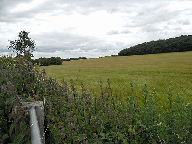
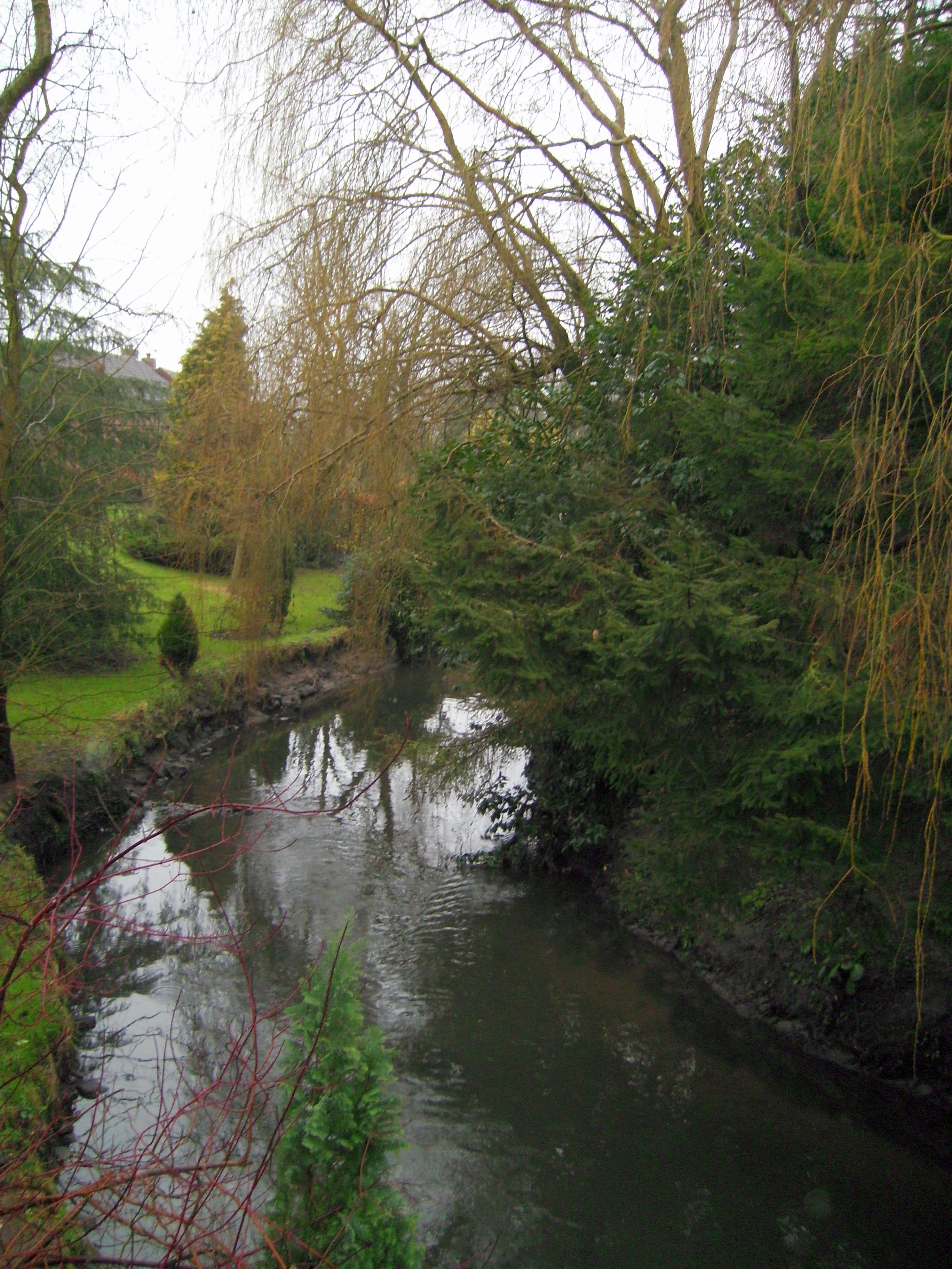
Hamley Park is a picturesque woodland located in Staffordshire, England. Spanning over a vast area, it is renowned for its serene ambiance and lush greenery, making it a popular destination for nature lovers and outdoor enthusiasts.

The park is predominantly covered by dense woodland, comprising a variety of tree species such as oak, beech, and birch. These trees provide a haven for numerous wildlife species, including birds, squirrels, and deer, making it a haven for wildlife enthusiasts and birdwatchers.

Traversing through the park, visitors will find well-maintained walking trails that wind through the forest, offering stunning views of the surrounding landscape. These trails are suitable for all ages and fitness levels, making it an ideal destination for families and individuals alike.

Within the park, there are several picnic areas and benches where visitors can relax and enjoy a meal amidst the tranquil surroundings. Additionally, there are designated areas for barbecues, allowing visitors to indulge in a traditional outdoor cooking experience.

Hamley Park also offers various recreational activities, including cycling and horseback riding. Cyclists can explore the park through designated cycling paths, while horse riders can enjoy the equestrian trails that meander through the woodland.

Overall, Hamley Park in Staffordshire provides a serene escape from the bustling city life, offering a peaceful sanctuary where visitors can immerse themselves in nature's beauty. Whether it's a leisurely stroll, a family picnic, or an adventurous bike ride, Hamley Park caters to the diverse needs and interests of its visitors.

If you have any feedback on the listing, please let us know in the comments section below.

Hamley Park Images

Images are sourced within 2km of 52.581938/-2.2750504 or Grid Reference SO8198. Thanks to Geograph Open Source API. All images are credited.

Gun Dog Training Dogs in the field alongside the Meadleys Farm, Pattingham.
Gun Dog Training
Dogs in the field alongside the Meadleys Farm, Pattingham.
Cereal crop field with oak trees near Chesterton in Staffordshire The cereal crop is growing well. The picture is taken from the bridleway which runs from Chesterton to Rudge.
Cereal crop field with oak trees near Chesterton in Staffordshire
The cereal crop is growing well. The picture is taken from the bridleway which runs from Chesterton to Rudge.
Cereal crop and bridleway, towards Rudge, Shropshire Cereal crops to the north, woodland (Black Coppice) to the south. The bridleway (seen on the right) leads through the fields from Chesterton to Rudge (about 3km; 2 miles).
Cereal crop and bridleway, towards Rudge, Shropshire
Cereal crops to the north, woodland (Black Coppice) to the south. The bridleway (seen on the right) leads through the fields from Chesterton to Rudge (about 3km; 2 miles).
Beside Black Coppice
Bridleway to Rudge, Shropshire The bridleway is not always this wide between Chesterton and Rudge. The riders are passing alongside Black Coppice which is on the right.
Bridleway to Rudge, Shropshire
The bridleway is not always this wide between Chesterton and Rudge. The riders are passing alongside Black Coppice which is on the right.
Bridleway to Rudge, Shropshire The bridleway is not always this wide between Chesterton and Rudge.
Bridleway to Rudge, Shropshire
The bridleway is not always this wide between Chesterton and Rudge.
Lane near Kingslow, Shropshire The lane comes from Ludstone in the south, and continues past Kingslow to nowhere in particular.
Lane near Kingslow, Shropshire
The lane comes from Ludstone in the south, and continues past Kingslow to nowhere in particular.
Bridleway to Rudge, Shropshire The bridleway is not always this wide between Chesterton and Rudge. Here the girl on the pony is approaching the crossing of this lane: <a href="https://www.geograph.org.uk/photo/1302513">SO7997 : Lane near Kingslow, Shropshire</a> "Wild flower of the day" - some say weed! - is cow parsley, the white flowers on both sides of the track here.
Bridleway to Rudge, Shropshire
The bridleway is not always this wide between Chesterton and Rudge. Here the girl on the pony is approaching the crossing of this lane: SO7997 : Lane near Kingslow, Shropshire "Wild flower of the day" - some say weed! - is cow parsley, the white flowers on both sides of the track here.
Lane near Kingslow, Shropshire The lane from Ludstone (to the south) by-passes Kingslow on its way towards Pattingham.
Lane near Kingslow, Shropshire
The lane from Ludstone (to the south) by-passes Kingslow on its way towards Pattingham.
Bridleway to Rudge, Shropshire A pleasant track for a quiet late spring stroll - arable fields and woodland, and the occasional stream to cross - and nothing much at each end.
Bridleway to Rudge, Shropshire
A pleasant track for a quiet late spring stroll - arable fields and woodland, and the occasional stream to cross - and nothing much at each end.
Gap in the hedge near Kingslow, Shropshire Looking towards Hamley Park and Pattingham.
Gap in the hedge near Kingslow, Shropshire
Looking towards Hamley Park and Pattingham.
Cereals waving in the breeze
Milepost at Pasford
Milepost at Pasford
Crossroads at Pasford
Wheat stubble and straw in fields south of Pattingham
Farmland off Moor Lane, Great Moor Cropped fields on the eastern side of Pattingham
Farmland off Moor Lane, Great Moor
Cropped fields on the eastern side of Pattingham
Bridleway below Little Moor A bridleway across fields below Little Moor farm.
Bridleway below Little Moor
A bridleway across fields below Little Moor farm.
Back towards Great Moor Along the bridleway between Bennett's Lane and The Clive
Back towards Great Moor
Along the bridleway between Bennett's Lane and The Clive
Show me another place!

Hamley Park is located at Grid Ref: SO8198 (Lat: 52.581938, Lng: -2.2750504)

Administrative County: Staffordshire

District: South Staffordshire

Police Authority: Staffordshire

What 3 Words

///scope.strongman.wager. Near Pattingham, Staffordshire

Related Wikis

Rudge, Shropshire

Rudge is a settlement and civil parish about 6 miles east of Bridgnorth, in the Shropshire district, in the ceremonial county of Shropshire, England. In...

Pattingham

Pattingham is a village and former civil parish, now in the parish of Pattingham and Patshull, in the South Staffordshire district, in the county of Staffordshire...

Nurton

Nurton is a hamlet in the South Staffordshire District, in the English county of Staffordshire. Nearby settlements include the city of Wolverhampton and...

St Mary's Church, Patshull

St Mary's Church, Patshull, is a redundant Anglican church in the parish of Pattingham and Patshull, Staffordshire, England, and is situated near Patshull...

Patshull

Patshull is a former civil parish, now in the parish of Pattingham and Patshull, in the South Staffordshire district, in the county of Staffordshire, England...

Patshull Hall

Patshull Hall is a substantial Georgian mansion house situated near Pattingham in Staffordshire, England. It is a Grade I listed building and by repute...

Burnhill Green

Burnhill Green is a small hamlet near Pattingham, situated in Staffordshire, England, in the former parish of Patshull. The hamlet is on the edge of the...

Seisdon

Seisdon is a rural village in the parish of Trysull and Seisdon, Staffordshire approximately six miles west of Wolverhampton and the name of one of the...

Nearby Amenities

Located within 500m of 52.581938,-2.2750504
Power: tower
Lat/Long: 52.58577/-2.2771067
Power: tower
Lat/Long: 52.5827388/-2.2687004
Addr Postcode: WV6 7BS
Communication Mobile Phone: yes
Designation: STA0027
Man Made: mast
Note: orange gsm transmitter STA0027
Operator: EE
Tower Type: communication
Lat/Long: 52.5818738/-2.2744779
Power: tower
Source: bing
Lat/Long: 52.5841893/-2.272779
Bench
Lat/Long: 52.5830031/-2.2736255
The data included in this document is from www.openstreetmap.org. The data is made available under ODbL.

Have you been to Hamley Park?

Leave your review of Hamley Park below (or comments, questions and feedback).