Gorse Covert

Wood, Forest in Worcestershire Wyre Forest

England

Gorse Covert

Elephant Enclosure, West Midlands Safari Park Viewed from the railway line beside the Safari Park, this is the elephant enclosure.
Elephant Enclosure, West Midlands Safari Park Credit: Rob Newman

Gorse Covert is a picturesque woodland area located in Worcestershire, England. Covering an area of approximately 200 acres, it is a popular destination for nature enthusiasts and outdoor lovers. The woodland is characterized by its dense and diverse vegetation, consisting mainly of various species of trees such as oak, birch, and beech.

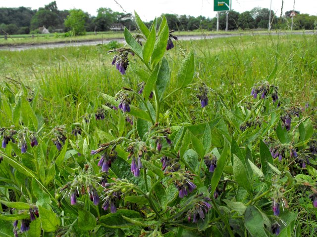
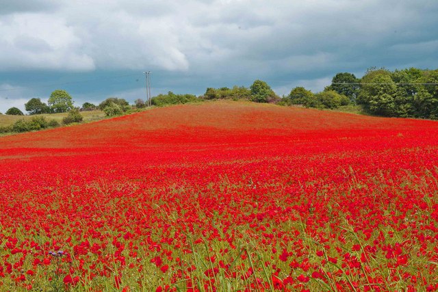
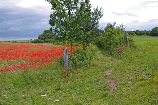
The forest floor is covered with a lush carpet of wildflowers, ferns, and moss, providing a vibrant and colorful display during the spring and summer months. The dense canopy above provides shade and shelter for a variety of woodland creatures, including squirrels, rabbits, and numerous species of birds.

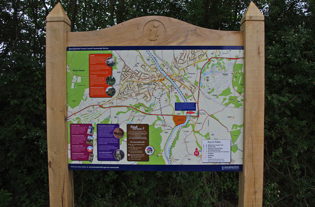
The woodland is crisscrossed by a network of well-maintained walking paths and trails, making it an ideal location for hiking, jogging, and dog walking. These trails offer visitors the opportunity to explore the forest and immerse themselves in its natural beauty. There are also designated picnic areas and benches scattered throughout the woodland, providing the perfect spots for visitors to relax and enjoy a picnic amidst the tranquil surroundings.

Gorse Covert is not only a haven for wildlife but also a site of historical importance. The forest has a rich history dating back several centuries, and remnants of ancient settlements and archaeological artifacts have been discovered within its boundaries.

Overall, Gorse Covert is a captivating woodland oasis that offers visitors a chance to escape the hustle and bustle of everyday life and connect with the beauty of nature.

If you have any feedback on the listing, please let us know in the comments section below.
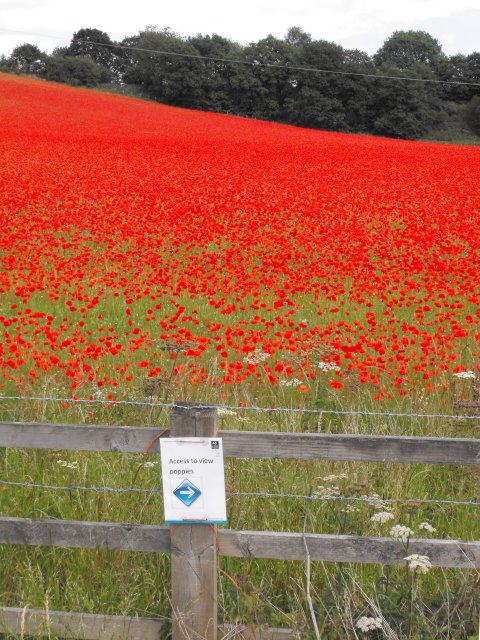
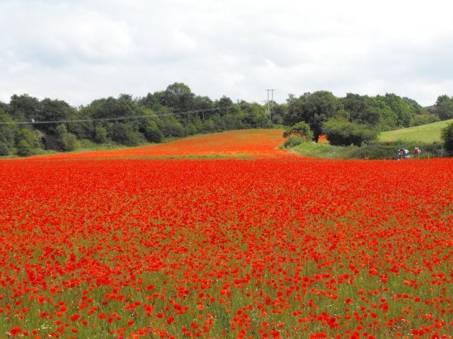
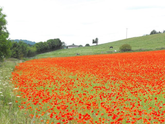
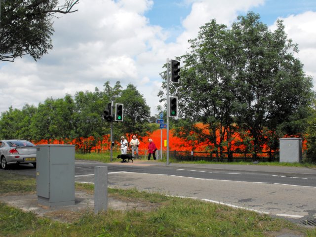
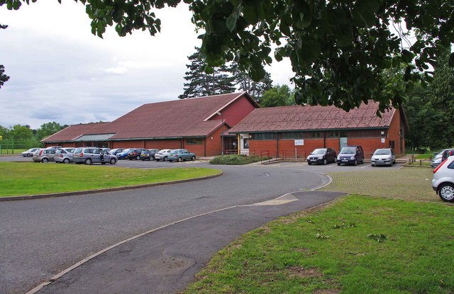
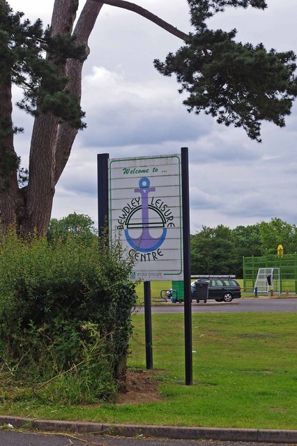
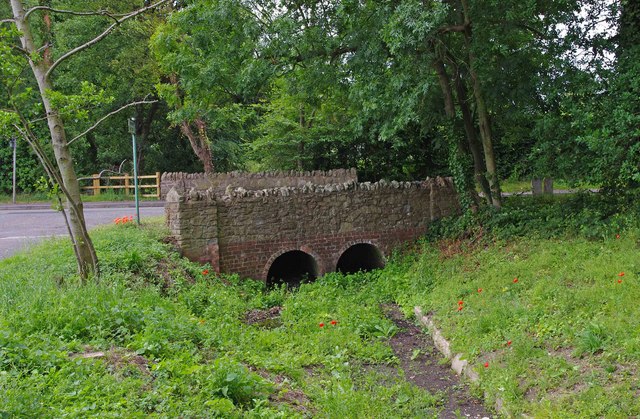
Gorse Covert Images

Images are sourced within 2km of 52.372687/-2.2750694 or Grid Reference SO8174. Thanks to Geograph Open Source API. All images are credited.

Elephant Enclosure, West Midlands Safari Park Viewed from the railway line beside the Safari Park, this is the elephant enclosure.
Elephant Enclosure, West Midlands Safari Park
Viewed from the railway line beside the Safari Park, this is the elephant enclosure.
Poppies at Blackstone, Worcestershire I was not alone in finding the sight of this field bright red with poppies difficult to drive past, the Blackstone car park opposite was full.

A poster on the fence says,
"This is one of three fields owned by Worcestershire Wildlife Trust. This year it is being left fallow.
Its diverse and colourful weeds are indicative of low input agriculture. By using minimal herbicides we get this beautiful flush of annual wildflowers such as the poppy. We'll leave the field fallow in rotation to help reduce the nutrient levels in the soil. This will allow the land to gradually become heathland, a very threatened habitat in the county.
Several rare arable plants have been recorded in these fields and insects are abundant."
A report on this site from the Worcestershire Wildlife Trust website <span class="nowrap"><a title="https://web.archive.org/web/20110614140450/http://www.worcswildlifetrust.co.uk/index.php?section=news&id=3740" rel="nofollow ugc noopener" href="https://web.archive.org/web/20110614140450/http://www.worcswildlifetrust.co.uk/index.php?section=news&id=3740">Archive Link</a><img style="margin-left:2px;" alt="External link" title="External link - shift click to open in new window" src="https://s1.geograph.org.uk/img/external.png" width="10" height="10"/></span>
Poppies at Blackstone, Worcestershire
I was not alone in finding the sight of this field bright red with poppies difficult to drive past, the Blackstone car park opposite was full. A poster on the fence says, "This is one of three fields owned by Worcestershire Wildlife Trust. This year it is being left fallow. Its diverse and colourful weeds are indicative of low input agriculture. By using minimal herbicides we get this beautiful flush of annual wildflowers such as the poppy. We'll leave the field fallow in rotation to help reduce the nutrient levels in the soil. This will allow the land to gradually become heathland, a very threatened habitat in the county. Several rare arable plants have been recorded in these fields and insects are abundant." A report on this site from the Worcestershire Wildlife Trust website Archive LinkExternal link
Poppies at Blackstone, Worcestershire An area on one side of the field has been roped off for use by visitors so they can feel they are surrounded by the poppies.
Poppies at Blackstone, Worcestershire
An area on one side of the field has been roped off for use by visitors so they can feel they are surrounded by the poppies.
Poppies at Blackstone, Worcestershire I was not alone in finding the sight of this field bright red with poppies difficult to drive past, the Blackstone car park opposite was full.

A poster on the fence says,
"This is one of three fields owned by Worcestershire Wildlife Trust. This year it is being left fallow.
Its diverse and colourful weeds are indicative of low input agriculture. By using minimal herbicides we get this beautiful flush of annual wildflowers such as the poppy. We'll leave the field fallow in rotation to help reduce the nutrient levels in the soil. This will allow the land to gradually become heathland, a very threatened habitat in the county.
Several rare arable plants have been recorded in these fields and insects are abundant."
A report on this site from the Worcestershire Wildlife Trust website <span class="nowrap"><a title="https://web.archive.org/web/20110614140450/http://www.worcswildlifetrust.co.uk/index.php?section=news&id=3740" rel="nofollow ugc noopener" href="https://web.archive.org/web/20110614140450/http://www.worcswildlifetrust.co.uk/index.php?section=news&id=3740">Archive Link</a><img style="margin-left:2px;" alt="External link" title="External link - shift click to open in new window" src="https://s1.geograph.org.uk/img/external.png" width="10" height="10"/></span>
Poppies at Blackstone, Worcestershire
I was not alone in finding the sight of this field bright red with poppies difficult to drive past, the Blackstone car park opposite was full. A poster on the fence says, "This is one of three fields owned by Worcestershire Wildlife Trust. This year it is being left fallow. Its diverse and colourful weeds are indicative of low input agriculture. By using minimal herbicides we get this beautiful flush of annual wildflowers such as the poppy. We'll leave the field fallow in rotation to help reduce the nutrient levels in the soil. This will allow the land to gradually become heathland, a very threatened habitat in the county. Several rare arable plants have been recorded in these fields and insects are abundant." A report on this site from the Worcestershire Wildlife Trust website Archive LinkExternal link
Comfrey by the A456 at Blackstone It wasn't just the poppies <a title="https://www.geograph.org.uk/snippet/5338" href="https://www.geograph.org.uk/snippet/5338">Link</a> which caught my eye.
Comfrey by the A456 at Blackstone
It wasn't just the poppies Link which caught my eye.
I can see them quite well from here... I was not alone in finding the sight of this field bright red with poppies difficult to drive past, the Blackstone car park opposite was full.

A poster on the fence says,
"This is one of three fields owned by Worcestershire Wildlife Trust. This year it is being left fallow.
Its diverse and colourful weeds are indicative of low input agriculture. By using minimal herbicides we get this beautiful flush of annual wildflowers such as the poppy. We'll leave the field fallow in rotation to help reduce the nutrient levels in the soil. This will allow the land to gradually become heathland, a very threatened habitat in the county.
Several rare arable plants have been recorded in these fields and insects are abundant."
A report on this site from the Worcestershire Wildlife Trust website <span class="nowrap"><a title="https://web.archive.org/web/20110614140450/http://www.worcswildlifetrust.co.uk/index.php?section=news&id=3740" rel="nofollow ugc noopener" href="https://web.archive.org/web/20110614140450/http://www.worcswildlifetrust.co.uk/index.php?section=news&id=3740">Archive Link</a><img style="margin-left:2px;" alt="External link" title="External link - shift click to open in new window" src="https://s1.geograph.org.uk/img/external.png" width="10" height="10"/></span>
I can see them quite well from here...
I was not alone in finding the sight of this field bright red with poppies difficult to drive past, the Blackstone car park opposite was full. A poster on the fence says, "This is one of three fields owned by Worcestershire Wildlife Trust. This year it is being left fallow. Its diverse and colourful weeds are indicative of low input agriculture. By using minimal herbicides we get this beautiful flush of annual wildflowers such as the poppy. We'll leave the field fallow in rotation to help reduce the nutrient levels in the soil. This will allow the land to gradually become heathland, a very threatened habitat in the county. Several rare arable plants have been recorded in these fields and insects are abundant." A report on this site from the Worcestershire Wildlife Trust website Archive LinkExternal link
Poppies at Blackstone, Worcestershire
Poppies at Blackstone, Worcestershire The horses in the next field seem unimpressed.
Poppies at Blackstone, Worcestershire
The horses in the next field seem unimpressed.
Pedestrian crossing on A456 at Blackstone The crossing (a fairly recent development for National Cycle Route 45 I think) was getting a lot of use as people parked in the Blackstone Country Park car park and crossed the road to view the poppies.
Pedestrian crossing on A456 at Blackstone
The crossing (a fairly recent development for National Cycle Route 45 I think) was getting a lot of use as people parked in the Blackstone Country Park car park and crossed the road to view the poppies.
Bewdley Leisure Centre, Stourport Road, Bewdley Bewdley Leisure Centre is on the edge of Bewdley. It is owned by Wyre Forest District Council, but the facilities are managed for them by a firm called D C Leisure. At this centre facilities include badminton, five-a-side football, group exercise classes, basketball, volleyball, martial arts, and much else. There are also two football pitches, a rugby pitch and an artificial cricket wicket.

D C Leisure's contract to manage this centre, and other centres in Kidderminster and Stourport-on-Severn expires in 2013. Because of rising management and maintenance costs, the District Council are looking at other arrangements. They seem minded to hand over the Bewdley Leisure Centre to community groups or organisations. This presumably is what the current Government's "Big Society" is all about. It will be interesting to see if any groups come forward to run what is in effect a business, and running a facility this size would surely require some paid staff, or maybe volunteers will do everything. Although how a community group can cope with increasing management and maintenance costs, when the council can't, isn't immediately obvious.

<a href="https://www.geograph.org.uk/photo/2465462">SO7974 : Bewdley Leisure Centre sign, Stourport Road, Bewdley</a>.
Bewdley Leisure Centre, Stourport Road, Bewdley
Bewdley Leisure Centre is on the edge of Bewdley. It is owned by Wyre Forest District Council, but the facilities are managed for them by a firm called D C Leisure. At this centre facilities include badminton, five-a-side football, group exercise classes, basketball, volleyball, martial arts, and much else. There are also two football pitches, a rugby pitch and an artificial cricket wicket. D C Leisure's contract to manage this centre, and other centres in Kidderminster and Stourport-on-Severn expires in 2013. Because of rising management and maintenance costs, the District Council are looking at other arrangements. They seem minded to hand over the Bewdley Leisure Centre to community groups or organisations. This presumably is what the current Government's "Big Society" is all about. It will be interesting to see if any groups come forward to run what is in effect a business, and running a facility this size would surely require some paid staff, or maybe volunteers will do everything. Although how a community group can cope with increasing management and maintenance costs, when the council can't, isn't immediately obvious. SO7974 : Bewdley Leisure Centre sign, Stourport Road, Bewdley.
Bewdley Leisure Centre sign, Stourport Road, Bewdley The sign is by the entrance to the centre.

<a href="https://www.geograph.org.uk/photo/2465449">SO7974 : Bewdley Leisure Centre, Stourport Road, Bewdley</a>.
Bewdley Leisure Centre sign, Stourport Road, Bewdley
The sign is by the entrance to the centre. SO7974 : Bewdley Leisure Centre, Stourport Road, Bewdley.
Bridge carrying Stourport Road over a stream, Bewdley This bridge carries Stourport Road over a very small stream, which was virtually dry when photographed. The stream is culverted in places, and discharges into the nearby River Severn.
Bridge carrying Stourport Road over a stream, Bewdley
This bridge carries Stourport Road over a very small stream, which was virtually dry when photographed. The stream is culverted in places, and discharges into the nearby River Severn.
Lane off Stourport Road, Bewdley On the outskirts of Bewdley, this appears to be a private road, terminating by a viaduct carrying the Severn Valley Railway. The sign on the corner indicates there is a public footpath running along the lane, which doesn't seem to have any name.
Lane off Stourport Road, Bewdley
On the outskirts of Bewdley, this appears to be a private road, terminating by a viaduct carrying the Severn Valley Railway. The sign on the corner indicates there is a public footpath running along the lane, which doesn't seem to have any name.
Stourport Road (B4195), Bewdley The road shortly terminates at a traffic light controlled junction, with the A456 road. The building seen on the right is Bewdley Leisure Centre.
Stourport Road (B4195), Bewdley
The road shortly terminates at a traffic light controlled junction, with the A456 road. The building seen on the right is Bewdley Leisure Centre.
Poppy display by A456 in June 2011, Blackstone The poppy display in this field was as spectacular as last year, with an intensity of colour that it is difficult to do justice to in a photograph. It was again attracting many visitors. This year the poppies had also spread to other nearby fields, although with less density than in this field. The field is owned by Worcestershire Wildlife Trust, whose agricultural practices have allowed the poppies to flower naturally.
Poppy display by A456 in June 2011, Blackstone
The poppy display in this field was as spectacular as last year, with an intensity of colour that it is difficult to do justice to in a photograph. It was again attracting many visitors. This year the poppies had also spread to other nearby fields, although with less density than in this field. The field is owned by Worcestershire Wildlife Trust, whose agricultural practices have allowed the poppies to flower naturally.
Information board in Blackstone Picnic Area, Blackstone This board is fairly recent and is located in the picnic area, which basically is a large car park, off the A456, with a few picnic tables on the adjacent grassed area. The board, which gives useful information about the many points of interest in the area, has been provided by Worcestershire County Council Countryside Service.
Information board in Blackstone Picnic Area, Blackstone
This board is fairly recent and is located in the picnic area, which basically is a large car park, off the A456, with a few picnic tables on the adjacent grassed area. The board, which gives useful information about the many points of interest in the area, has been provided by Worcestershire County Council Countryside Service.
Public bridleway, Blackstone The bridleway runs straight ahead. The field, on the left, is one of those in this area where poppies have flowered this year.
Public bridleway, Blackstone
The bridleway runs straight ahead. The field, on the left, is one of those in this area where poppies have flowered this year.
Show me another place!

Gorse Covert is located at Grid Ref: SO8174 (Lat: 52.372687, Lng: -2.2750694)

Administrative County: Worcestershire

District: Wyre Forest

Police Authority: West Mercia

What 3 Words

///secure.lodge.ample. Near Kidderminster, Worcestershire

Related Wikis

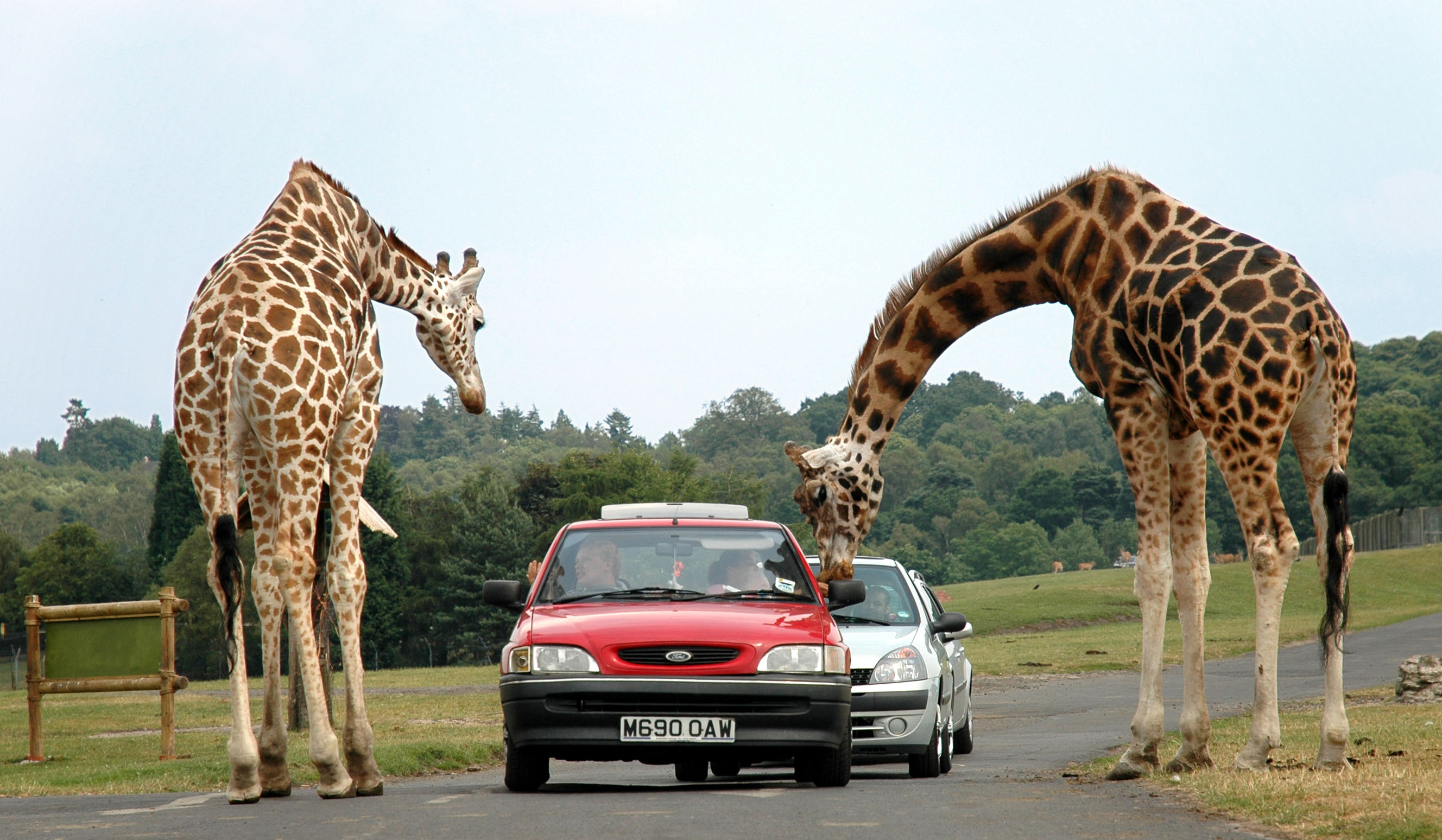
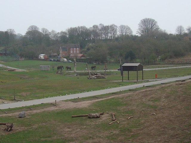
West Midland Safari Park

West Midland Safari and Leisure Park is a safari park located in Bewdley in Worcestershire, England. It was opened under the name of West Midland Safari...

Rifle Range Halt railway station

Rifle Range Halt was a short-lived unstaffed request stop on the GWR Kidderminster to Bewdley loop line which now forms part of the Severn Valley Railway...

Foley Park Halt railway station

Foley Park Halt was the first stop on the GWR Kidderminster to Bewdley loop line which now forms part of the Severn Valley Railway. It was located in the...

Chain Wire Club Ground

The Chain Wire Club Ground in Stourport-on-Severn, Worcestershire was used for first-class cricket by Worcestershire County Cricket Club on a single occasion...

Nearby Amenities

Located within 500m of 52.372687,-2.2750694
Bus Stop
Whittall Drive East
Bus: yes
Naptan AtcoCode: 2000G045595
Naptan Bearing: NE
Naptan CommonName: Whittall Drive East
Naptan Crossing: Whittall Drive East
Naptan Indicator: opp
Naptan NaptanCode: wocgmjdg
Naptan PlusbusZoneRef: KDRMNST
Naptan Street: Walter Nash Drive East
Naptan Verified: no
Public Transport: platform
Source: naptan_import
Lat/Long: 52.3685929/-2.2724083
Bus Stop
Shrawley Avenue
Bus: yes
Naptan AtcoCode: 2000G100600
Naptan Bearing: N
Naptan CommonName: Shrawley Avenue
Naptan Indicator: Adj
Naptan NaptanCode: wocgjwja
Naptan PlusbusZoneRef: KDRMNST
Naptan Street: Shrawley Avenue
Naptan Verified: no
Public Transport: platform
Source: naptan_import
Lat/Long: 52.3734673/-2.2717038
Bus Stop
Jubilee Drive North
Bus: yes
Naptan AtcoCode: 2000G100699
Naptan Bearing: NE
Naptan CommonName: Jubilee Drive North
Naptan Indicator: adj
Naptan NaptanCode: wocgjwjt
Naptan PlusbusZoneRef: KDRMNST
Naptan Street: Jubilee Drive North
Public Transport: platform
Route Ref: 1
Source: naptan_import; survey
Lat/Long: 52.3730018/-2.2685142
Bus Stop
Kidderminster- Shawley Avenue
Bus: yes
Naptan AtcoCode: 2000G502504
Naptan Bearing: N
Naptan CommonName: Kidderminster- Shawley Avenue
Naptan Indicator: Adj
Naptan Landmark: Teme Avenue
Naptan NaptanCode: wocgmgpw
Naptan PlusbusZoneRef: KDRMNST
Naptan Street: Emley Close
Naptan Verified: no
Public Transport: platform
Source: naptan_import
Lat/Long: 52.3738713/-2.2719413
Bus Stop
Rifle Range Road
Bus: yes
Naptan AtcoCode: 2000G581511
Naptan Bearing: SW
Naptan CommonName: Rifle Range Road
Naptan Indicator: adj
Naptan NaptanCode: wocdpajm
Naptan PlusbusZoneRef: KDRMNST
Naptan Street: Rifle Range Road
Public Transport: platform
Route Ref: 1
Source: naptan_import; survey
Lat/Long: 52.3751949/-2.2700072
Power: substation
Lat/Long: 52.373908/-2.2709325
Turning Circle
Lat/Long: 52.3745028/-2.2710954
Post Box
Ref: DY11 243
Lat/Long: 52.3736691/-2.271816
Pub
Note: Could also be a social club
Opening Hours: closed
Lat/Long: 52.3728449/-2.2696252
Woodlands Intermediate Care Scheme
Operator: Wyre Forest NHS Primary Care Trust
Lat/Long: 52.3740058/-2.273288
Grit Bin
Lat/Long: 52.3727533/-2.2714766
Rifle Range
Place: village
Source: NPTG
Lat/Long: 52.3742073/-2.2698259
Barrier: rails
Lat/Long: 52.3694289/-2.2720762
The data included in this document is from www.openstreetmap.org. The data is made available under ODbL.

Have you been to Gorse Covert?

Leave your review of Gorse Covert below (or comments, questions and feedback).