Cranhill

Settlement in Lanarkshire

Scotland

Cranhill

Limestone outcrop Outcrop of carboniferous limestone between Riddrie Knowes and Gogar Street.
Limestone outcrop Credit: Rosalind Mitchell

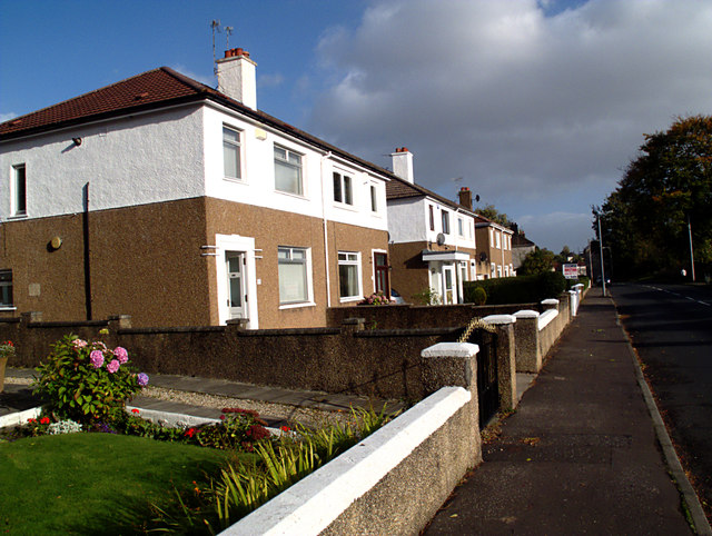
Cranhill is a residential area located in the eastern part of Glasgow, Scotland, within the historic county of Lanarkshire. It is situated approximately 5 miles east of the city center and is bordered by the neighborhoods of Ruchazie, Carntyne, and Queenslie. Cranhill primarily consists of public housing estates, built during the post-war period to accommodate the growing population.

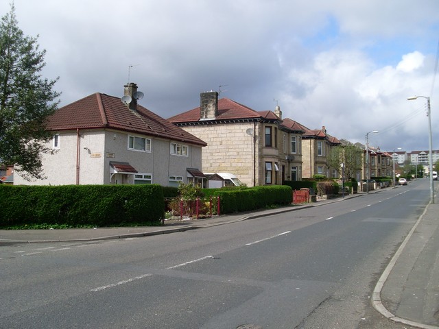
The area has a population of around 8,000 residents and is characterized by its distinctive layout of low-rise flats and maisonettes. The housing estates are interspersed with green spaces and playgrounds, providing recreational areas for families and children. Cranhill also benefits from several local amenities, including a community center, a library, and a health center, catering to the needs of the residents.

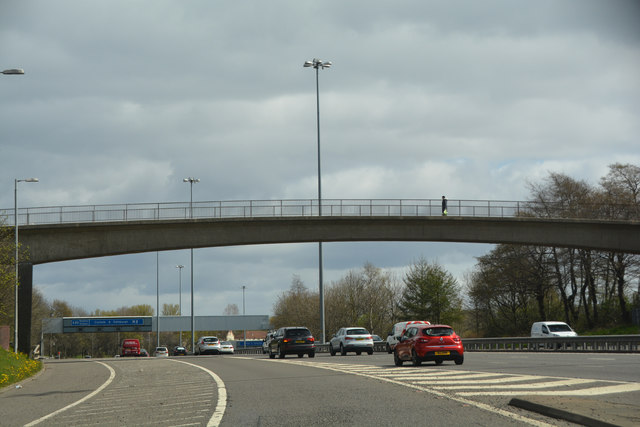
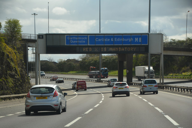
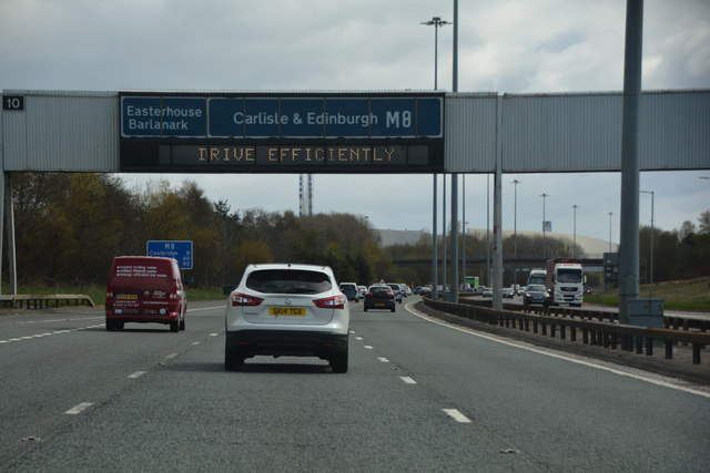
Transportation in Cranhill is facilitated by numerous bus routes connecting the area to the city center and surrounding neighborhoods. The nearby M8 motorway offers easy access to the wider region and beyond. Additionally, there are several primary and secondary schools in the vicinity, ensuring education opportunities for the local children.

While Cranhill has faced its share of socio-economic challenges, community initiatives and local organizations have worked collaboratively to improve the area's infrastructure, facilities, and social cohesion. The residents actively participate in various community events and projects, fostering a sense of pride and togetherness.

Overall, Cranhill is a residential neighborhood in Lanarkshire, known for its public housing estates, green spaces, and community-oriented atmosphere.

If you have any feedback on the listing, please let us know in the comments section below.
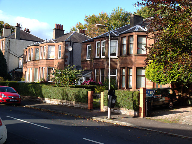
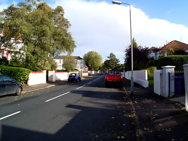
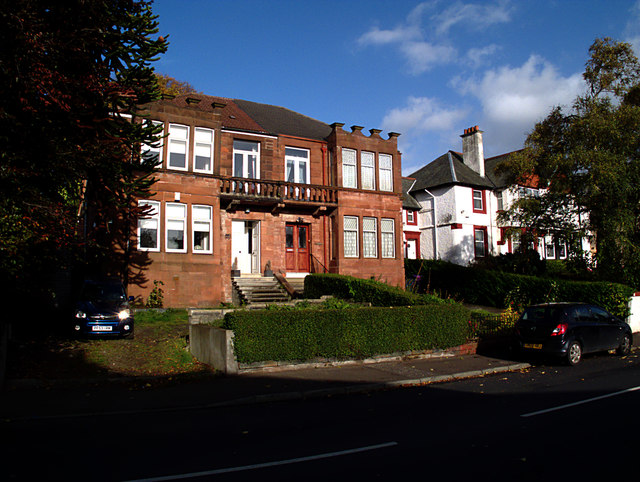
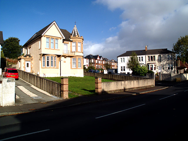
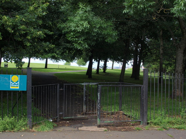
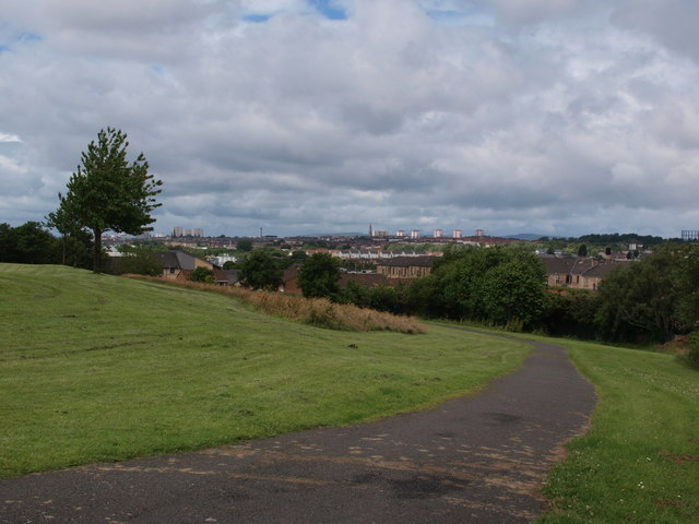
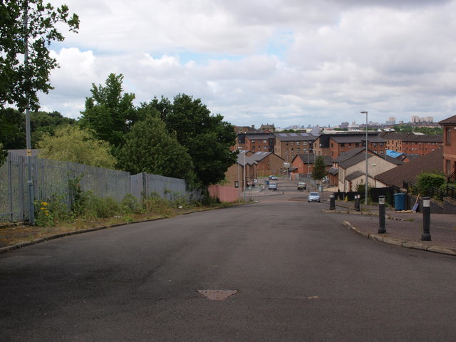
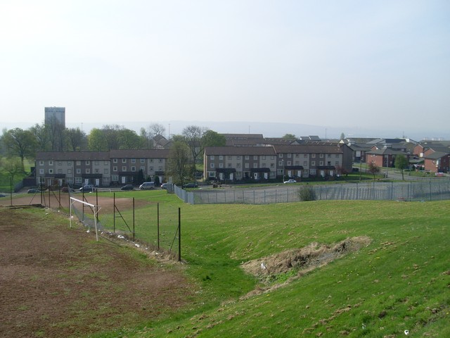
Cranhill Images

Images are sourced within 2km of 55.866085/-4.16651 or Grid Reference NS6465. Thanks to Geograph Open Source API. All images are credited.

Limestone outcrop Outcrop of carboniferous limestone between Riddrie Knowes and Gogar Street.
Limestone outcrop
Outcrop of carboniferous limestone between Riddrie Knowes and Gogar Street.
Riddrie Knowes Sandstone villas.
Riddrie Knowes
Sandstone villas.
Riddrie Knowes Looking eastwards
Riddrie Knowes
Looking eastwards
Riddrie Knowes Although the square is dominated by twentieth-century social housing, Riddrie Knowes is an enclave of older and more afflent private development, exhibiting a variety of styles.
Riddrie Knowes
Although the square is dominated by twentieth-century social housing, Riddrie Knowes is an enclave of older and more afflent private development, exhibiting a variety of styles.
Riddrie Knowes And round the corner into Riddrie Crescent.
Riddrie Knowes
And round the corner into Riddrie Crescent.
Riddrie Knowes Bungalows.
Riddrie Knowes
Bungalows.
Riddrie Knowes More typical housing further east on Riddrie Knowes.
Riddrie Knowes
More typical housing further east on Riddrie Knowes.
Hogganfield Park Local Nature Reserve Hogganfield Park was declared a Local Nature Reserve in 1998. Small ponds and marsh have been created on the eastern side of the Reserve. They are particularly attractive in summer with the flag iris, reedmace (seen here) and rushes. A wide variety of birds and other wildlife can be seen within the LNR.

Hogganfield Loch can be seen in the distance, as can the Red Road Flats beyond.
Hogganfield Park Local Nature Reserve
Hogganfield Park was declared a Local Nature Reserve in 1998. Small ponds and marsh have been created on the eastern side of the Reserve. They are particularly attractive in summer with the flag iris, reedmace (seen here) and rushes. A wide variety of birds and other wildlife can be seen within the LNR. Hogganfield Loch can be seen in the distance, as can the Red Road Flats beyond.
Mute Swan, Hogganfield Park Local Nature Reserve
Glasgow City : The M8 Motorway The M8 seen after joining at junction 13.
Glasgow City : The M8 Motorway
The M8 seen after joining at junction 13.
Glasgow City : The M8 Motorway The M8 heading through Glasgow.
Glasgow City : The M8 Motorway
The M8 heading through Glasgow.
Glasgow City : The M8 Motorway The M8 is the busiest motorway in Scotland and one of the busiest in the United Kingdom.
Glasgow City : The M8 Motorway
The M8 is the busiest motorway in Scotland and one of the busiest in the United Kingdom.
Glasgow City : The M8 Motorway Heading along the M8 with some tower blocks on the right.
Glasgow City : The M8 Motorway
Heading along the M8 with some tower blocks on the right.
Glasgow City : The M8 Motorway Heading out from Glasgow on the M8 motorway.
Glasgow City : The M8 Motorway
Heading out from Glasgow on the M8 motorway.
Glasgow City : The M8 Motorway Heading along the M8 motorway out from Glasgow.
Glasgow City : The M8 Motorway
Heading along the M8 motorway out from Glasgow.
Anstruther Street entrance to Tollcross Park
North edge of Tollcross Park The picture looks west along the path at the very north edge of Tollcross Park.
North edge of Tollcross Park
The picture looks west along the path at the very north edge of Tollcross Park.
Looking down St Mark Street The picture was taken from just inside Tollcross Park. It looks west, downhill.
Looking down St Mark Street
The picture was taken from just inside Tollcross Park. It looks west, downhill.
Show me another place!

Cranhill is located at Grid Ref: NS6465 (Lat: 55.866085, Lng: -4.16651)

Unitary Authority: City of Glasgow

Police Authority: Greater Glasgow

What 3 Words

///bells.sparks.treat. Near Stepps, North Lanarkshire

Nearby Locations

Lightburn Cranhill

Related Wikis

Cranhill

Cranhill is an inner city district and housing scheme in the north east of Glasgow, Scotland. Cranhill was developed from public funding in the early...

Ruchazie

Ruchazie ( rukh-HAY-zee) is a neighbourhood in the Scottish city of Glasgow. It is situated to the north-east of the city, bordered by Craigend and Garthamlock...

St Andrew's Secondary School, Glasgow

St Andrew's Secondary School is an 11–18 mixed, Roman Catholic comprehensive secondary school in Glasgow, Scotland. Its catchment area includes much of...
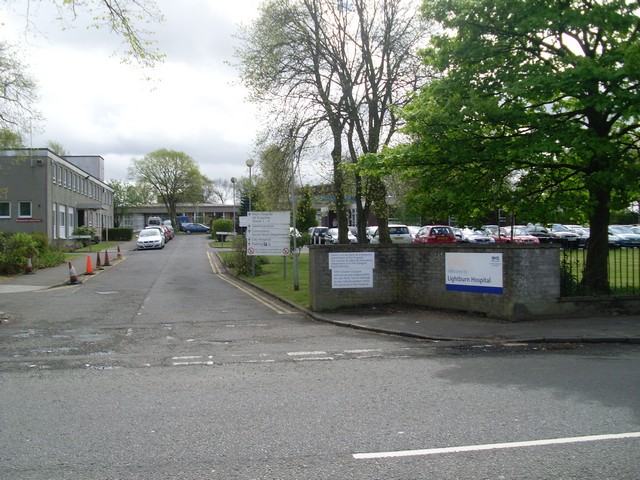
Lightburn Hospital

Lightburn Hospital is a health facility in Carntyne Road, Glasgow, Scotland. It is managed by NHS Greater Glasgow and Clyde. == History == The facility...

Lightburn, Glasgow

Lightburn is a district in the Scottish city of Glasgow. It is situated north of the River Clyde. It takes its name from the Light Burn which flows through...

HM Prison Barlinnie

HM Prison Barlinnie is the largest prison in Scotland. It is operated by the Scottish Prison Service and is located in the residential suburb of Riddrie...

Craigend, Glasgow

Craigend is a neighbourhood in the Scottish city of Glasgow. It is situated north of the River Clyde, immediately west of Garthamlock, east of Hogganfield...

Springboig

Springboig is a neighbourhood in the east end of the Scottish city of Glasgow, situated north of the River Clyde. Administratively, it has been within...

Nearby Amenities

Located within 500m of 55.866085,-4.16651
Motorway Junction
Stepps Road
Ref: 11
Lat/Long: 55.8683649/-4.1641745
Mini Roundabout
Direction: clockwise
Lat/Long: 55.8659534/-4.164563
Traffic Calming: cushion
Lat/Long: 55.8655133/-4.1709747
Traffic Calming: cushion
Lat/Long: 55.8656393/-4.1724928
Traffic Calming: cushion
Lat/Long: 55.8657647/-4.1732517
Traffic Calming: cushion
Lat/Long: 55.8660741/-4.1744911
Mini Roundabout
Direction: clockwise
Lat/Long: 55.8659756/-4.1590836
Mini Roundabout
Lat/Long: 55.8654721/-4.1619945
Traffic Calming: table
Lat/Long: 55.8640944/-4.1728532
Traffic Calming: table
Lat/Long: 55.8646603/-4.1740119
Traffic Calming: table
Lat/Long: 55.8651241/-4.1737905
Crossing
Crossing: traffic_signals
Crossing Ref: pelican
Lat/Long: 55.862615/-4.1691881
Crossing
Crossing: traffic_signals
Crossing Ref: pelican
Lat/Long: 55.8624477/-4.169088
Turning Circle
Lat/Long: 55.8620951/-4.1648808
Cranhill
Place: suburb
Wikidata: Q5182117
Wikipedia: en:Cranhill
Lat/Long: 55.8651064/-4.1659371
Turning Circle
Lat/Long: 55.8653156/-4.1633803
Post Office
Cranhill Post Office
Addr City: Glasgow
Addr Postcode: G33 3LQ
Addr Street: Lamlash Crescent
Branch: Cranhill
Brand: Post Office
Brand Wikidata: Q1783168
Check Date: 2020-02-20
Ref Pol Id: 11704
Lat/Long: 55.8662855/-4.1633916
Fast Food
Cranhill Tandoori
Cuisine: indian
Phone: +44 141 774 4496
Lat/Long: 55.8661821/-4.1634707
Fast Food
Foong Yik
Cuisine: chinese
Phone: +44 141 774 0985
Lat/Long: 55.8661375/-4.163511
Hair Kaylee
Shop: hairdresser
Lat/Long: 55.8662283/-4.163431
Jan Superstore
Shop: convenience
Lat/Long: 55.866352/-4.1633215
Bus Stop
Queenslie, Bellrock Street/ Newhaven Road
Bench: no
Naptan AtcoCode: 60901982
Naptan Bearing: NE
Naptan CommonName: Newhaven Road
Naptan Indicator: before
Naptan Landmark: Newhaven Road
Naptan NaptanCode: 45243274
Naptan Street: Bellrock Street
Nat Ref: 60901982
Ref: 60901982
Shelter: yes
Lat/Long: 55.8658996/-4.1595321
Bus Stop
Queenslie, Bellrock Street/ Newhaven Road
Bench: no
Naptan AtcoCode: 60901983
Naptan Bearing: SW
Naptan CommonName: Newhaven Road
Naptan Indicator: Opp
Naptan Landmark: Newhaven Road
Naptan NaptanCode: 45236549
Naptan Street: Bellrock Street
Nat Ref: 60901983
Ref: 60901983
Shelter: no
Lat/Long: 55.8660404/-4.1585145
Bus Stop
Queenslie, Bellrock Street/ Skerryvore Place
Bench: no
Naptan AtcoCode: 60901981
Naptan Bearing: NW
Naptan CommonName: Skerryvore Place
Naptan Indicator: after
Naptan Landmark: Skerryvore Place
Naptan NaptanCode: 45235472
Naptan Street: Bellrock Street
Nat Ref: 60901981
Ref: 60901981
Shelter: yes
Lat/Long: 55.8656384/-4.1634203
Bus Stop
Queenslie, Bellrock Street/ Skerryvore Place
Bench: no
Naptan AtcoCode: 60901980
Naptan Bearing: SE
Naptan CommonName: Skerryvore Place
Naptan Indicator: opp
Naptan Landmark: Skerryvore Place
Naptan NaptanCode: 45238492
Naptan Street: Bellrock Street
Nat Ref: 60901980
Ref: 60901980
Shelter: no
Lat/Long: 55.865654/-4.1629555
Bicycle Parking
Bicycle Parking: stands
Capacity: 16
Covered: no
Lat/Long: 55.8657209/-4.1658057
Recycling
Recycling Glass: yes
Recycling Type: container
Lat/Long: 55.8659832/-4.1637191
Post Box
Brand: Royal Mail
Brand Wikidata: Q638098
Brand Wikipedia: en:Royal Mail
Operator: Royal Mail
Operator Wikidata: Q638098
Post Box Design: type_b
Post Box Type: pillar
Ref: G33 1194
Royal Cypher: scottish_crown
Lat/Long: 55.8660628/-4.1590514
Post Box
Operator: Royal Mail
Post Box Design: type_b
Post Box Type: pillar
Ref: G33 1263
Lat/Long: 55.8663154/-4.1634904
Bus Stop
Ruchazie, Milncroft Road/ Milncroft Place
Bench: no
Naptan AtcoCode: 60901998
Naptan Bearing: SE
Naptan CommonName: Milncroft Place
Naptan Indicator: after
Naptan Landmark: Milncroft Place
Naptan NaptanCode: 45235976
Naptan Street: Milncroft Road
Nat Ref: 60901998
Ref: 60901998
Shelter: no
Lat/Long: 55.8689876/-4.1715042
Bus Stop
Ruchazie, Elibank Street/ Craighouse Street
Bench: no
Naptan AtcoCode: 60903809
Naptan Bearing: S
Naptan CommonName: Milncroft Road
Naptan Indicator: before
Naptan Landmark: Craighouse Street
Naptan NaptanCode: 45246438
Naptan Street: Elibank Street
Nat Ref: 60903809
Ref: 60903809
Shelter: no
Lat/Long: 55.8691684/-4.1708406
Bus Stop
Cranhill, Bellrock Street/ Soutra Place
Bench: no
Naptan AtcoCode: 60901979
Naptan Bearing: E
Naptan CommonName: Soutra Place
Naptan Indicator: before
Naptan Landmark: Soutra Place
Naptan NaptanCode: 45234967
Naptan Street: Bellrock Street
Nat Ref: 60901979
Ref: 60901979
Shelter: no
Lat/Long: 55.8660982/-4.16672
Bus Stop
Carntyne, Edinburgh Road/ Cardowan Road
Naptan AtcoCode: 60901762
Naptan Bearing: W
Naptan CommonName: Cranhill Park
Naptan Indicator: opp
Naptan Landmark: Cardowan Road
Naptan NaptanCode: 45239584
Naptan Street: Edinburgh Road
Ref: 60901762
Shelter: yes
Lat/Long: 55.86235/-4.16803
Bus Stop
Carntyne, Edinburgh Road/ Cardowan Road
Naptan AtcoCode: 60901763
Naptan Bearing: E
Naptan CommonName: Cranhill Park
Naptan Indicator: at
Naptan Landmark: Cardowan Road
Naptan NaptanCode: 45239495
Naptan Street: Edinburgh Road
Ref: 60901763
Shelter: yes
Lat/Long: 55.86264/-4.16869
Bus Stop
Queenslie, Edinburgh Road/ Gantock Crescent
Naptan AtcoCode: 60901765
Naptan Bearing: E
Naptan CommonName: Gantock Crescent
Naptan Indicator: at
Naptan Landmark: Gantock Crescent
Naptan NaptanCode: 45236476
Naptan Street: Edinburgh Road
Ref: 60901765
Shelter: yes
Lat/Long: 55.86237/-4.16246
Bus Stop
Cranhill, Bellrock Street/ Bellrock Crescent
Naptan AtcoCode: 60901978
Naptan Bearing: SW
Naptan CommonName: Bellrock Crescent
Naptan Indicator: opp
Naptan Landmark: Bellrock Crescent
Naptan NaptanCode: 45237836
Naptan Street: Bellrock Street
Ref: 60901978
Lat/Long: 55.86577/-4.16784
Bus Stop
Cranhill, Bellrock Street/ Bellrock Crescent
Naptan AtcoCode: 60901973
Naptan Bearing: SE
Naptan CommonName: Bellrock Crescent
Naptan Indicator: after
Naptan Landmark: Bellrock Crescent
Naptan NaptanCode: 45235386
Naptan Street: Bellrock Street
Ref: 60901973
Lat/Long: 55.86602/-4.17409
Bus Stop
Cranhill, Bellrock Street/ No 100
Naptan AtcoCode: 60901974
Naptan Bearing: NW
Naptan CommonName: Bellrock Street
Naptan Indicator: at 100
Naptan Landmark: No 100
Naptan NaptanCode: 45237967
Naptan Street: Bellrock Street
Ref: 60901974
Lat/Long: 55.86557/-4.17251
Bus Stop
Cranhill, Bellrock Street/ No 122
Naptan AtcoCode: 60901975
Naptan Bearing: E
Naptan CommonName: Bellrock Street
Naptan Indicator: opp 122
Naptan Landmark: No 122
Naptan NaptanCode: 45236387
Naptan Street: Bellrock Street
Ref: 60901975
Lat/Long: 55.86557/-4.17127
Bus Stop
Cranhill, Bellrock Street/ No 146
Naptan AtcoCode: 60901976
Naptan Bearing: W
Naptan CommonName: 146 Bellrock Street
Naptan Indicator: at
Naptan Landmark: No 146
Naptan NaptanCode: 45238259
Naptan Street: Bellrock Street
Ref: 60901976
Lat/Long: 55.86548/-4.17011
Bus Stop
Cranhill, Bellrock Street/ Startpoint Street
Naptan AtcoCode: 60901977
Naptan Bearing: NE
Naptan CommonName: Bellrock Crescent
Naptan Indicator: before
Naptan Landmark: Startpoint Street
Naptan NaptanCode: 45239834
Naptan Street: Bellrock Street
Ref: 60901977
Lat/Long: 55.86573/-4.16859
Bus Stop
Carntyne, Carntyne Road/ Lightburn Place
Naptan AtcoCode: 60901901
Naptan Bearing: W
Naptan CommonName: Lightburn Place
Naptan Indicator: after
Naptan Landmark: Lightburn Place
Naptan NaptanCode: 45236735
Naptan Street: Carntyne Road
Ref: 60901901
Lat/Long: 55.86169/-4.1652
Bus Stop
Carntyne, Carntyne Road/ Lightburn Place
Naptan AtcoCode: 60901902
Naptan Bearing: E
Naptan CommonName: Lightburn Place
Naptan Indicator: opp
Naptan Landmark: Lightburn Place
Naptan NaptanCode: 45235797
Naptan Street: Carntyne Road
Ref: 60901902
Lat/Long: 55.86184/-4.16706
Crossing
Crossing: uncontrolled
Lat/Long: 55.8630925/-4.1723005
Traffic Calming: cushion
Lat/Long: 55.8655153/-4.1702632
Traffic Calming: cushion
Lat/Long: 55.8655519/-4.1717356
Traffic Calming: cushion
Lat/Long: 55.8659089/-4.1738862
Crossing
Crossing: traffic_signals
Lat/Long: 55.8618414/-4.1679237
Crossing
Crossing: traffic_signals
Lat/Long: 55.8623375/-4.1632523
Crossing
Crossing: traffic_signals
Lat/Long: 55.8621666/-4.1631457
Farmfoods
Brand: Farmfoods
Brand Wikidata: Q5435841
Brand Wikipedia: en:Farmfoods
Contact Website: https://www.farmfoods.co.uk/store-finder.php?branch_code=183
Opening Hours Url: https://www.farmfoods.co.uk/store-finder.php?branch_code=183
Shop: frozen_food
Source: bing
Lat/Long: 55.8634816/-4.1725165
Scotmid
Addr City: Glasgow
Addr Housenumber: 111
Addr Postcode: G33 3QE
Addr Street: Edinburgh Road
Brand: Scotmid
Brand Wikidata: Q7435719
Brand Wikipedia: en:Scotmid
Shop: supermarket
Lat/Long: 55.8633078/-4.1725382
Generator Method: photovoltaic
Generator Output Electricity: yes
Generator Source: solar
Generator Type: solar_photovoltaic_panel
Power: generator
Lat/Long: 55.8651376/-4.163366
Generator Method: photovoltaic
Generator Output Electricity: yes
Generator Source: solar
Generator Type: solar_photovoltaic_panel
Power: generator
Lat/Long: 55.8650734/-4.1630111
Generator Method: photovoltaic
Generator Output Electricity: yes
Generator Source: solar
Generator Type: solar_photovoltaic_panel
Power: generator
Lat/Long: 55.865021/-4.1628313
Generator Method: photovoltaic
Generator Output Electricity: yes
Generator Source: solar
Generator Type: solar_photovoltaic_panel
Power: generator
Lat/Long: 55.8704549/-4.1684206
Generator Method: photovoltaic
Generator Output Electricity: yes
Generator Source: solar
Generator Type: solar_photovoltaic_panel
Power: generator
Lat/Long: 55.8704504/-4.1683413
Generator Method: photovoltaic
Generator Output Electricity: yes
Generator Source: solar
Generator Type: solar_photovoltaic_panel
Power: generator
Lat/Long: 55.870415/-4.1677213
Generator Method: photovoltaic
Generator Output Electricity: yes
Generator Source: solar
Generator Type: solar_photovoltaic_panel
Power: generator
Lat/Long: 55.8704162/-4.1674713
Generator Method: photovoltaic
Generator Output Electricity: yes
Generator Source: solar
Generator Type: solar_photovoltaic_panel
Power: generator
Lat/Long: 55.8704025/-4.1673676
Addr Housenumber: 4
Addr Street: Milncroft Road
Entrance: home
Lat/Long: 55.8689349/-4.1726212
Addr Housenumber: 2
Addr Street: Milncroft Road
Entrance: home
Lat/Long: 55.8689381/-4.1726538
Addr Housenumber: 8
Addr Street: Milncroft Road
Entrance: home
Lat/Long: 55.8688968/-4.1723477
Addr Housenumber: 6
Addr Street: Milncroft Road
Entrance: home
Lat/Long: 55.8689003/-4.1723831
Addr Housenumber: 12
Addr Street: Milncroft Road
Entrance: home
Lat/Long: 55.8688779/-4.1720627
Addr Housenumber: 10
Addr Street: Milncroft Road
Entrance: home
Lat/Long: 55.8688817/-4.1721017
Addr Housenumber: 16
Addr Street: Milncroft Road
Entrance: home
Lat/Long: 55.8688421/-4.1717894
Addr Housenumber: 14
Addr Street: Milncroft Road
Entrance: home
Lat/Long: 55.8688455/-4.1718234
Addr Housenumber: 18
Addr Street: Milncroft Road
Entrance: home
Lat/Long: 55.868819/-4.1715472
Addr Housenumber: 20
Addr Street: Milncroft Road
Entrance: home
Lat/Long: 55.8688149/-4.1715061
Addr Housenumber: 24
Addr Street: Milncroft Road
Entrance: home
Lat/Long: 55.8688005/-4.1712195
Addr Housenumber: 22
Addr Street: Milncroft Road
Entrance: home
Lat/Long: 55.8688044/-4.1712581
Addr Housenumber: 28
Addr Street: Milncroft Road
Entrance: home
Lat/Long: 55.8687694/-4.1709376
Addr Housenumber: 26
Addr Street: Milncroft Road
Entrance: home
Lat/Long: 55.868773/-4.170974
Addr Housenumber: 30
Addr Street: Milncroft Road
Entrance: home
Lat/Long: 55.8687511/-4.1706768
Addr Housenumber: 32
Addr Street: Milncroft Road
Entrance: home
Lat/Long: 55.8687474/-4.1706397
Addr Housenumber: 34
Addr Street: Milncroft Road
Entrance: home
Lat/Long: 55.8687136/-4.1702473
Addr Housenumber: 36
Addr Street: Milncroft Road
Entrance: home
Lat/Long: 55.8687109/-4.1702174
Addr Housenumber: 38
Addr Street: Milncroft Road
Entrance: home
Lat/Long: 55.8687024/-4.1701223
Addr Housenumber: 40
Addr Street: Milncroft Road
Entrance: home
Lat/Long: 55.8686749/-4.1698804
Addr Housenumber: 42
Addr Street: Milncroft Road
Entrance: home
Lat/Long: 55.8686663/-4.169785
Addr Housenumber: 44
Addr Street: Milncroft Road
Entrance: home
Lat/Long: 55.8686632/-4.1697502
Addr Housenumber: 46
Addr Street: Milncroft Road
Entrance: home
Lat/Long: 55.8686155/-4.1692936
Addr Housenumber: 48
Addr Street: Milncroft Road
Entrance: home
Lat/Long: 55.8686131/-4.1692653
Addr Housenumber: 50
Addr Street: Milncroft Road
Entrance: home
Lat/Long: 55.8685989/-4.1690964
Addr Housenumber: 52
Addr Street: Milncroft Road
Entrance: home
Lat/Long: 55.8685963/-4.1690655
Addr Housenumber: 56
Addr Street: Milncroft Road
Entrance: home
Lat/Long: 55.8685377/-4.1683896
Addr Housenumber: 58
Addr Street: Milncroft Road
Entrance: home
Lat/Long: 55.8685349/-4.1683617
Addr Housenumber: 54
Addr Street: Milncroft Road
Entrance: main
Lat/Long: 55.868575/-4.1687485
Addr Housenumber: 71
Addr Street: Longstone Road
Lat/Long: 55.8678027/-4.1593678
Addr Housenumber: 6
Addr Street: Longstone Road
Lat/Long: 55.8675889/-4.1634002
Addr Housenumber: 55
Addr Street: Longstone Road
Lat/Long: 55.8677049/-4.1604334
Addr Housenumber: 5
Addr Street: Longstone Road
Lat/Long: 55.8678418/-4.163358
Addr Housenumber: 33
Addr Street: Newhaven Road
Lat/Long: 55.86673/-4.162313
Addr Housenumber: 67
Addr Street: Longstone Road
Lat/Long: 55.8677506/-4.1596653
Addr Housenumber: 4
Addr Street: Longstone Road
Lat/Long: 55.8676049/-4.1635316
Addr Housenumber: 2
Addr Street: Newhaven Road
Lat/Long: 55.866332/-4.1591054
Addr Housenumber: 5
Addr Street: Newhaven Road
Lat/Long: 55.8661229/-4.1607114
Addr Housenumber: 29
Addr Street: Newhaven Road
Lat/Long: 55.8664774/-4.1622984
Addr Housenumber: 65
Addr Street: Longstone Road
Lat/Long: 55.8677248/-4.1597669
Addr Housenumber: 31
Addr Street: Newhaven Road
Lat/Long: 55.8665408/-4.1622972
Addr Housenumber: 69
Addr Street: Longstone Road
Lat/Long: 55.8677531/-4.1594533
Addr Housenumber: 50
Addr Street: Lamlash Crescent
Lat/Long: 55.8666539/-4.1585609
Addr Housenumber: 64
Addr Street: Longstone Road
Lat/Long: 55.8674503/-4.1597825
Addr Housenumber: 19
Addr Street: Newhaven Road
Lat/Long: 55.866169/-4.1616267
Addr Housenumber: 23
Addr Street: Newhaven Road
Lat/Long: 55.8661754/-4.1619323
Addr Housenumber: 271
Addr Street: Bellrock Street
Lat/Long: 55.866146/-4.158965
Addr Housenumber: 70
Addr Street: Longstone Road
Lat/Long: 55.8675243/-4.1593469
Addr Housenumber: 68
Addr Street: Longstone Road
Lat/Long: 55.8674956/-4.1594671
Addr Housenumber: 3
Addr Street: Newhaven Road
Lat/Long: 55.8661175/-4.1605909
Addr Housenumber: 3
Addr Street: Longstone Road
Lat/Long: 55.8678555/-4.1634834
Addr Housenumber: 1
Addr Street: Newhaven Road
Lat/Long: 55.8661155/-4.1604788
Addr Housenumber: 35
Addr Street: Longstone Road
Lat/Long: 55.867743/-4.1616545
Addr Housenumber: 33
Addr Street: Longstone Road
Lat/Long: 55.8677495/-4.1617606
Addr Housenumber: 15
Addr Street: Newhaven Road
Lat/Long: 55.8661439/-4.1614121
Addr Housenumber: 46
Addr Street: Lamlash Crescent
Lat/Long: 55.8666861/-4.1593617
Addr Housenumber: 273
Addr Street: Bellrock Street
Lat/Long: 55.8662119/-4.1586897
Addr Housenumber: 44
Addr Street: Lamlash Crescent
Lat/Long: 55.8666937/-4.1596424
Addr Housenumber: 66
Addr Street: Longstone Road
Lat/Long: 55.8674686/-4.1596839
Addr Housenumber: 21
Addr Street: Newhaven Road
Lat/Long: 55.8661829/-4.1618176
Addr Housenumber: 53
Addr Street: Longstone Road
Lat/Long: 55.8677101/-4.1605314
Addr Housenumber: 69
Addr Street: Lamlash Crescent
Lat/Long: 55.8672191/-4.1593111
Addr Housenumber: 67
Addr Street: Lamlash Crescent
Lat/Long: 55.8671175/-4.1592604
Addr Housenumber: 25
Addr Street: Newhaven Road
Lat/Long: 55.8661779/-4.1620377
Addr Housenumber: 17
Addr Street: Newhaven Road
Lat/Long: 55.8661597/-4.161531
Addr Housenumber: 48
Addr Street: Lamlash Crescent
Lat/Long: 55.8665897/-4.158859
Addr Housenumber: 27
Addr Street: Newhaven Road
Lat/Long: 55.8664179/-4.1622892
The data included in this document is from www.openstreetmap.org. The data is made available under ODbL.

Have you been to Cranhill?

Leave your review of Cranhill below (or comments, questions and feedback).