Langham Brake

Wood, Forest in Wiltshire

England

Langham Brake

The Red Lion at Woolverton
The Red Lion at Woolverton Credit: Anthony Parkes

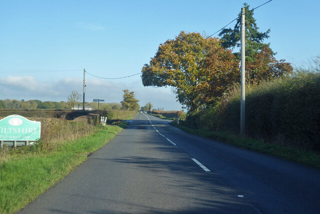
Langham Brake is a picturesque woodland area located in Wiltshire, England. It covers an approximate area of 100 acres and is nestled within the larger expanse of Langham Estate. The brake primarily consists of dense, mature trees, creating a serene and secluded atmosphere for visitors.

The woodland is predominantly made up of native tree species such as oak, beech, and ash, which provide a diverse and vibrant habitat for various flora and fauna. The forest floor is covered in a thick carpet of ferns, bluebells, and wildflowers during the spring and summer months, adding bursts of color to the landscape.

Langham Brake offers a range of recreational activities for nature enthusiasts and outdoor adventurers. There are several well-maintained walking trails crisscrossing through the woodland, providing opportunities for leisurely strolls and more challenging hikes. The peaceful surroundings make it an ideal spot for birdwatching, with species such as great spotted woodpeckers, tawny owls, and buzzards commonly spotted.

The wood is also home to a diverse range of wildlife, including deer, foxes, and rabbits. Visitors may also come across smaller creatures such as squirrels, hedgehogs, and a variety of insects. Nature lovers and photographers will find plenty of opportunities to capture the beauty of the woodland and its inhabitants.

Overall, Langham Brake is a tranquil and enchanting woodland retreat that offers a chance to immerse oneself in nature and experience the beauty of the Wiltshire countryside.

If you have any feedback on the listing, please let us know in the comments section below.

Langham Brake Images

Images are sourced within 2km of 51.293525/-2.2760235 or Grid Reference ST8054. Thanks to Geograph Open Source API. All images are credited.

The Red Lion at Woolverton
New Entrance to Lower Chartley Farm & Training Centre
Old Milestone, A36, Woolverton The milestone is located in Woolverton village, south of the Red Lion, at the end of the low stone wall at the farmhouse, on the grass verge, on the west side of the road. Parish of Tellisford (Mendip district). Cast iron post, C&M Classical iron casting design, erected by the Black Dog turnpike trust in the 19th century. See also <a title="https://www.geograph.org.uk/photo/5789494" href="https://www.geograph.org.uk/photo/5789494">Link</a>

Inscription reads:-
BATH / 9 / MILES / WARMINSTER / 8 / FROME / 4 

Grade II Listed,  List entry number: 1058876 <span class="nowrap"><a title="https://historicengland.org.uk/listing/the-list/list-entry/1058876" rel="nofollow ugc noopener" href="https://historicengland.org.uk/listing/the-list/list-entry/1058876">Link</a><img style="margin-left:2px;" alt="External link" title="External link - shift click to open in new window" src="https://s1.geograph.org.uk/img/external.png" width="10" height="10"/></span>

Milestone Society National ID: SO_BAWM09
Old Milestone, A36, Woolverton
The milestone is located in Woolverton village, south of the Red Lion, at the end of the low stone wall at the farmhouse, on the grass verge, on the west side of the road. Parish of Tellisford (Mendip district). Cast iron post, C&M Classical iron casting design, erected by the Black Dog turnpike trust in the 19th century. See also Link Inscription reads:- BATH / 9 / MILES / WARMINSTER / 8 / FROME / 4 Grade II Listed, List entry number: 1058876 LinkExternal link Milestone Society National ID: SO_BAWM09
Lane and footpath sign
Sign for Rode Manor Nurseries
Lane heading north near Farleigh Wood
West Terrace A row of Grade II listed houses <span class="nowrap"><a title="https://historicengland.org.uk/listing/the-list/list-entry/1058873" rel="nofollow ugc noopener" href="https://historicengland.org.uk/listing/the-list/list-entry/1058873">Link</a><img style="margin-left:2px;" alt="External link" title="External link - shift click to open in new window" src="https://s1.geograph.org.uk/img/external.png" width="10" height="10"/></span>  & <span class="nowrap"><a title="https://historicengland.org.uk/listing/the-list/list-entry/1307981" rel="nofollow ugc noopener" href="https://historicengland.org.uk/listing/the-list/list-entry/1307981">Link</a><img style="margin-left:2px;" alt="External link" title="External link - shift click to open in new window" src="https://s1.geograph.org.uk/img/external.png" width="10" height="10"/></span>  and K6 telephone kiosk <span class="nowrap"><a title="https://historicengland.org.uk/listing/the-list/list-entry/1393245" rel="nofollow ugc noopener" href="https://historicengland.org.uk/listing/the-list/list-entry/1393245">Link</a><img style="margin-left:2px;" alt="External link" title="External link - shift click to open in new window" src="https://s1.geograph.org.uk/img/external.png" width="10" height="10"/></span>
West Terrace
A row of Grade II listed houses LinkExternal link & LinkExternal link and K6 telephone kiosk LinkExternal link
Woolverton: red telephone box A traditional phone box whose paintwork is peeling markedly.
Woolverton: red telephone box
A traditional phone box whose paintwork is peeling markedly.
Road Junction on the A36  north of Beckington Here is where the B class road takes you onward  to Midford on Avon
Road Junction on the A36 north of Beckington
Here is where the B class road takes you onward to Midford on Avon
Old Boundary Marker on Lower Street, Rode County Boundary Marker set in the road on Lower Street against the western corner of The Corner House, 21 High Street, a stone building at the junction of Lower Street and High Street. Until 1937 this was on the boundary of Rode, Somerset and Southwick, Wiltshire but is now entirely in Rode parish.

Milestone Society National ID: SO_RODE02cb
Old Boundary Marker on Lower Street, Rode
County Boundary Marker set in the road on Lower Street against the western corner of The Corner House, 21 High Street, a stone building at the junction of Lower Street and High Street. Until 1937 this was on the boundary of Rode, Somerset and Southwick, Wiltshire but is now entirely in Rode parish. Milestone Society National ID: SO_RODE02cb
Electricity Powerlines at Whittaker's Farm
Entering Rode
Entering Rode
Entrance to The Mill at Rode
Bend on A361 Frome Road, Rode Towards Trowbridge.
Bend on A361 Frome Road, Rode
Towards Trowbridge.
Junction of A361 and B3109, Rode
B3109 Bradford Road Towards Bradford-on-Avon, passing Flexham Farm on the right.
B3109 Bradford Road
Towards Bradford-on-Avon, passing Flexham Farm on the right.
B3109 Bradford Road towards Bradford-on-Avon Passing from Somerset into Wiltshire.
B3109 Bradford Road towards Bradford-on-Avon
Passing from Somerset into Wiltshire.
Bend on B3109 Bradford Road Towards Bradford-on-Avon, at the end of a very long (over 2 km) straight.
Bend on B3109 Bradford Road
Towards Bradford-on-Avon, at the end of a very long (over 2 km) straight.
Show me another place!

Langham Brake is located at Grid Ref: ST8054 (Lat: 51.293525, Lng: -2.2760235)

Unitary Authority: Wiltshire

Police Authority: Wiltshire

What 3 Words

///reply.dating.modern. Near Rode, Somerset

Related Wikis

Tellisford Mill

Tellisford Mill is a 55 kilowatts (74 hp) installed capacity micro hydro run-of-the-river power station on the site of a former watermill in the village...

Christ Church, Rode

The Anglican Church of St Peter in Rode, within the English county of Somerset, dates from 1824. It is a redundant church and a Grade II* listed building...

Tellisford

Tellisford is a village and civil parish 6 miles (10 km) north-east of Frome in the Mendip district of Somerset, England. The parish includes the village...

Rode, Somerset

Rode (formerly Road) is a village and civil parish in the ceremonial county of Somerset in England, 5 miles (8.0 km) north-east of Frome and 5 miles (8...

Ravenscroft School, Somerset

Ravenscroft School (founded 1931 at Yelverton, Devon, and until 1978 known as Ravenscroft Preparatory School) was an independent day and boarding school...

Wingfield, Wiltshire

Wingfield is a small village and civil parish in the county of Wiltshire, England, about 2.5 miles (4.0 km) south of Bradford-on-Avon and 2.2 miles (3...

Seymours Court Farmhouse, Beckington

Seymours Court Farmhouse in Beckington, Somerset, England, dates from the 15th century and is a Grade I listed building.It was the home of Thomas Seymour...

Church of St Leonard, Farleigh Hungerford

The Anglican Church of St Leonard in Farleigh Hungerford, within the English county of Somerset, was consecrated in 1443. It is a Grade II* listed building...

Nearby Amenities

Located within 500m of 51.293525,-2.2760235
Barrier: kissing_gate
Foot: yes
Lat/Long: 51.2969573/-2.2799079
Barrier: kissing_gate
Foot: yes
Lat/Long: 51.2970875/-2.2799079
Waterway: weir
Lat/Long: 51.2932126/-2.2797064
The data included in this document is from www.openstreetmap.org. The data is made available under ODbL.

Have you been to Langham Brake?

Leave your review of Langham Brake below (or comments, questions and feedback).