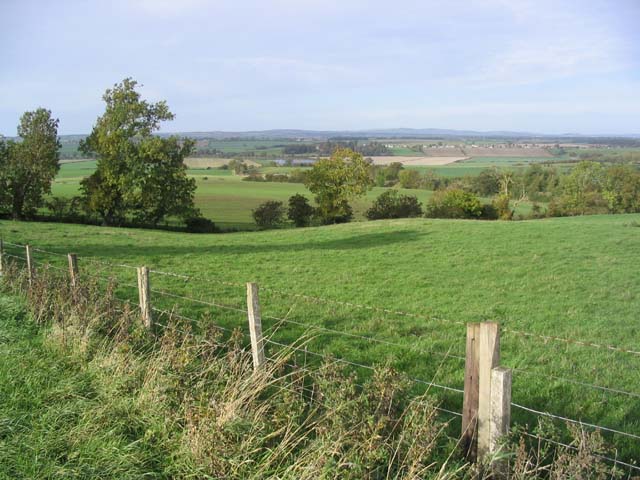
Bog Plantation

Wood, Forest in Northumberland

England

Bog Plantation

The River Tweed near Carham Hall A view looking upstream from near Carham Hall, just inside Northumberland.

This photograph was taken during the Coronavirus (COVID-19) pandemic of 2020/21/22.
The River Tweed near Carham Hall Credit: James T M Towill

The requested URL returned error: 429 Too Many Requests

If you have any feedback on the listing, please let us know in the comments section below.

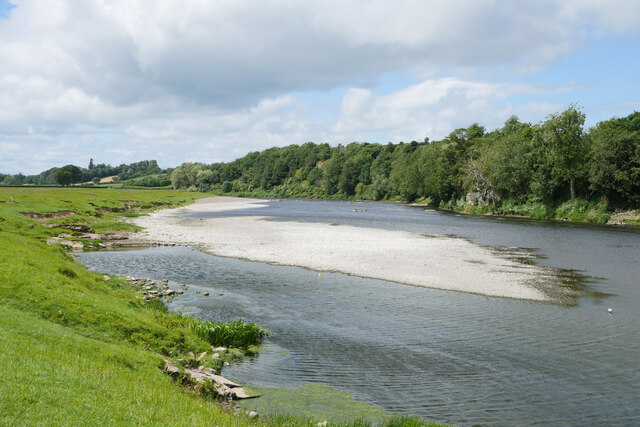
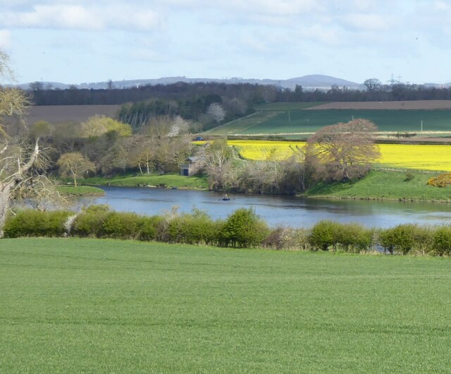
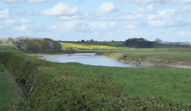
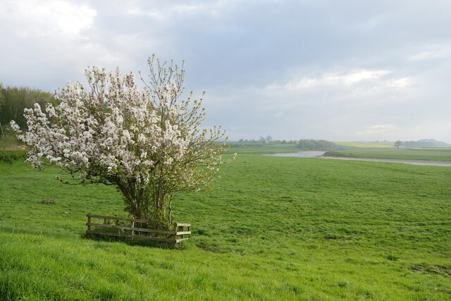
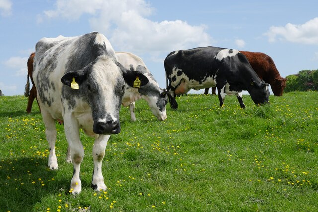
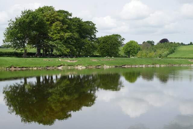
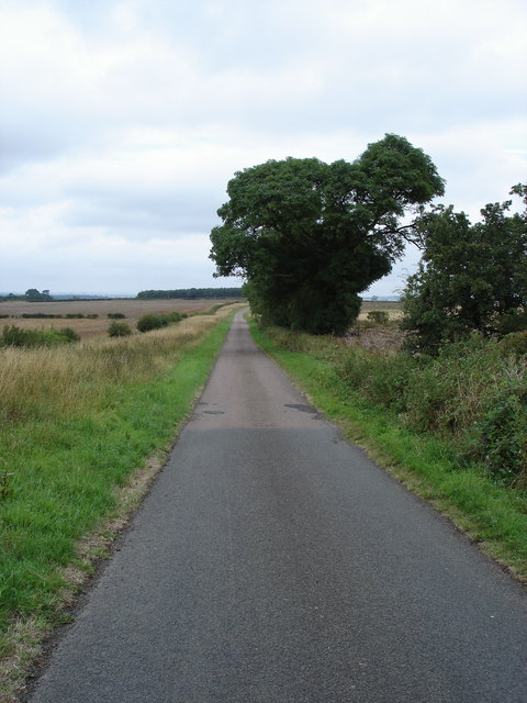
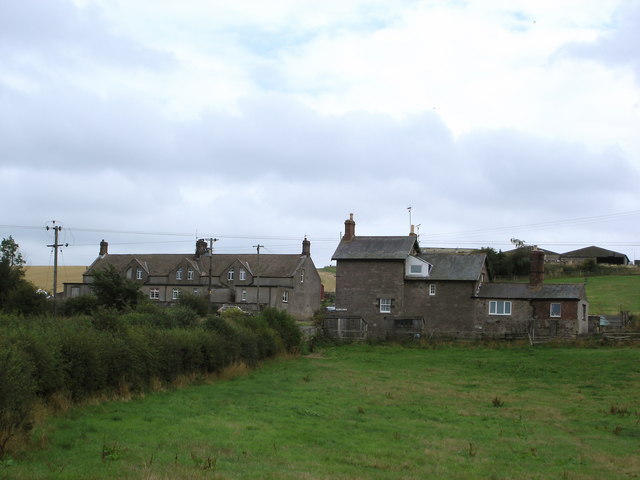
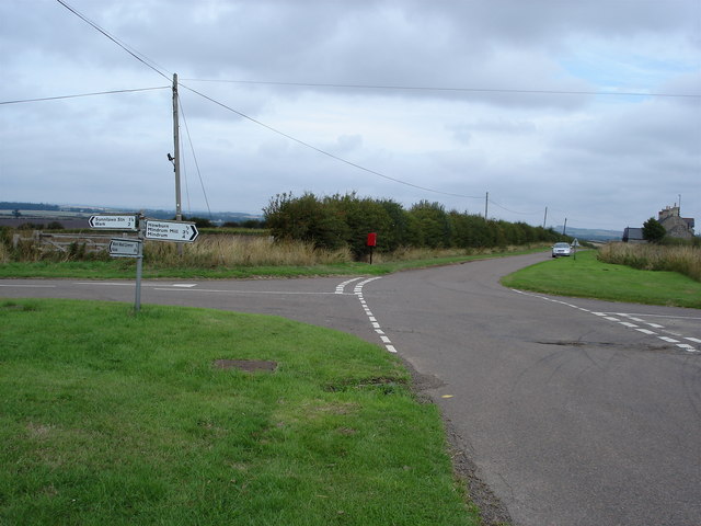
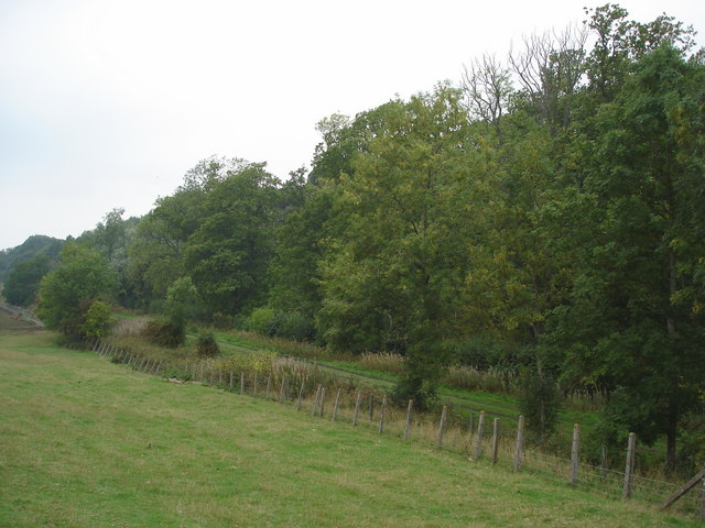
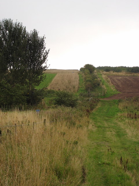
Bog Plantation Images

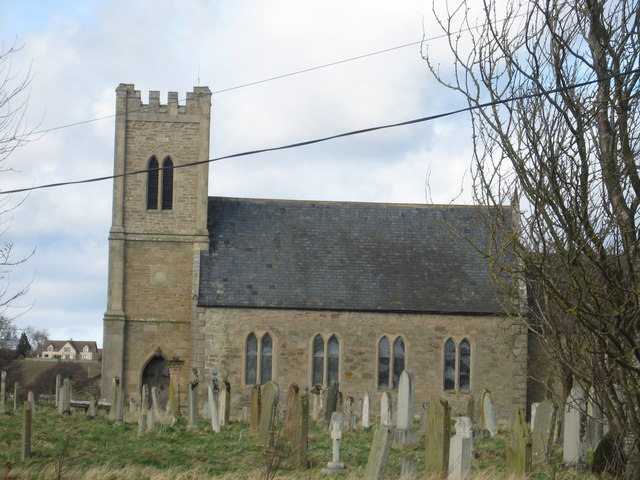
Images are sourced within 2km of 55.629517/-2.3100669 or Grid Reference NT8037. Thanks to Geograph Open Source API. All images are credited.

The River Tweed near Carham Hall A view looking upstream from near Carham Hall, just inside Northumberland.

This photograph was taken during the Coronavirus (COVID-19) pandemic of 2020/21/22.
The River Tweed near Carham Hall
A view looking upstream from near Carham Hall, just inside Northumberland. This photograph was taken during the Coronavirus (COVID-19) pandemic of 2020/21/22.
Carham Hall Carham Hall is a grade II listed building near Carham in Northumberland. The site, on the Scottish border, was previously occupied by a medieval tower house, built as a defence from border reivers.
Carham Hall
Carham Hall is a grade II listed building near Carham in Northumberland. The site, on the Scottish border, was previously occupied by a medieval tower house, built as a defence from border reivers.
The River Tweed Fertile arable land beside the river. 
A fisherman on the river and a fishing station on the far bank.
The River Tweed
Fertile arable land beside the river. A fisherman on the river and a fishing station on the far bank.
River Tweed at Carham Viewed from the B6350.
River Tweed at Carham
Viewed from the B6350.
In bloom at Carham A Wild Cherry (Prunus avium) in bloom on the Tweed floodplain at Carham.
In bloom at Carham
A Wild Cherry (Prunus avium) in bloom on the Tweed floodplain at Carham.
Riparian ruminants An inquisitive herd of cattle by the River Tweed at Carham.
Riparian ruminants
An inquisitive herd of cattle by the River Tweed at Carham.
A view across the River Tweed to Birgham Haugh The access track to Birgham Haugh runs alongside this avenue of trees.
A view across the River Tweed to Birgham Haugh
The access track to Birgham Haugh runs alongside this avenue of trees.
Serenity A lone Mute Swan on a shingle bar in the River Tweed west of Carham on a beautiful May afternoon.  The distinctive outline of Hume Castle can be noted atop the hill in the distance.
Serenity
A lone Mute Swan on a shingle bar in the River Tweed west of Carham on a beautiful May afternoon. The distinctive outline of Hume Castle can be noted atop the hill in the distance.
Home tweet home at Carham These decorative bird boxes for sale were in a front garden at Carham opposite the entrance to the churchyard.
Home tweet home at Carham
These decorative bird boxes for sale were in a front garden at Carham opposite the entrance to the churchyard.
England A mixed flock of Tufted drakes (Aythya fuligula) and Mallard drakes (Anas platyrhynchos) alongside the English bank of the Tweed. The layby just east of Birgham is a very good spot to watch river wildlife, swans (Cygnus olor) flying past, a gang of Goosander (Mergus merganser) on a rough section and leaping salmon (Salmo salar).
England
A mixed flock of Tufted drakes (Aythya fuligula) and Mallard drakes (Anas platyrhynchos) alongside the English bank of the Tweed. The layby just east of Birgham is a very good spot to watch river wildlife, swans (Cygnus olor) flying past, a gang of Goosander (Mergus merganser) on a rough section and leaping salmon (Salmo salar).
Looking into England The only clue that this is the National Border is that the road surface changes colour !
Looking into England
The only clue that this is the National Border is that the road surface changes colour !
Sunilaws Station Former Station on the LNER Kelso & Berwick railway
Sunilaws Station
Former Station on the LNER Kelso & Berwick railway
Crossroads at Wark Common The 1: 50000 OS Map indicates that there used to be a phone box beside the post box.
Crossroads at Wark Common
The 1: 50000 OS Map indicates that there used to be a phone box beside the post box.
Looking North to England The photograph was taken from Scotland looking towards the former LNER Kelso Berwick railway. One of the quirks of the Border line is that at this point England is actually north of Scotland.
Looking North to England
The photograph was taken from Scotland looking towards the former LNER Kelso Berwick railway. One of the quirks of the Border line is that at this point England is actually north of Scotland.
The Border This unassuming hedge marks another section of the Border between Scotland and England.
The Border
This unassuming hedge marks another section of the Border between Scotland and England.
Farmland near Nottylees This is an area of rich arable farmland. The River Tweed can be seen in the middle background with the village of Birgham behind to the right.
Farmland near Nottylees
This is an area of rich arable farmland. The River Tweed can be seen in the middle background with the village of Birgham behind to the right.
Disused railway This used to be the site of Carham Station on the Kelso to Coldstream branch railway line. The staggered platforms still exist on both sides of the level crossing which split the station site. The platform in this photo is to the East of the level crossing. All of the old buildings have been removed. Carham is a small village just inside England, but their former railway station was in Scotland. (Source: Borders Railway Rambles by Alasdair Wham)
Disused railway
This used to be the site of Carham Station on the Kelso to Coldstream branch railway line. The staggered platforms still exist on both sides of the level crossing which split the station site. The platform in this photo is to the East of the level crossing. All of the old buildings have been removed. Carham is a small village just inside England, but their former railway station was in Scotland. (Source: Borders Railway Rambles by Alasdair Wham)
Road junction on the B6350 This road junction is 1.5km Southwest of Carham. A signpost to Nottylees is to the right. The car is travelling on the B6350 towards Carham.
Road junction on the B6350
This road junction is 1.5km Southwest of Carham. A signpost to Nottylees is to the right. The car is travelling on the B6350 towards Carham.
Show me another place!

Bog Plantation is located at Grid Ref: NT8037 (Lat: 55.629517, Lng: -2.3100669)

Unitary Authority: Northumberland

Police Authority: Northumbria

What 3 Words

///speaking.cone.revealing. Near Coldstream, Scottish Borders

Nearby Locations

Bog Plantation

Related Wikis

Battle of Carham

The Battle of Carham was fought between the English ruler of Bamburgh and the king of Scotland in alliance with the Cumbrians. The encounter took place...

Carham

Carham or Carham on Tweed is a village in Northumberland, England. The village lies on the south side of the River Tweed about 3 miles (5 km) west of Coldstream...
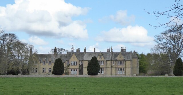
Carham Hall

Carham Hall is a grade II listed building near Carham in Northumberland, England. The site, on the Scottish border, was previously occupied by a medieval...

Carham railway station

Carham railway station was located in the historic county of Roxburghshire, Scotland, from 1849 to 1964 on the Kelso Branch. It served the village of Carham...

Nearby Amenities

Located within 500m of 55.629517,-2.3100669
The data included in this document is from www.openstreetmap.org. The data is made available under ODbL.

Have you been to Bog Plantation?

Leave your review of Bog Plantation below (or comments, questions and feedback).