Dead Wood

Wood, Forest in Northumberland

England

Dead Wood

The Pennine Way near Hanging Crag
The Pennine Way near Hanging Crag Credit: Dave Kelly

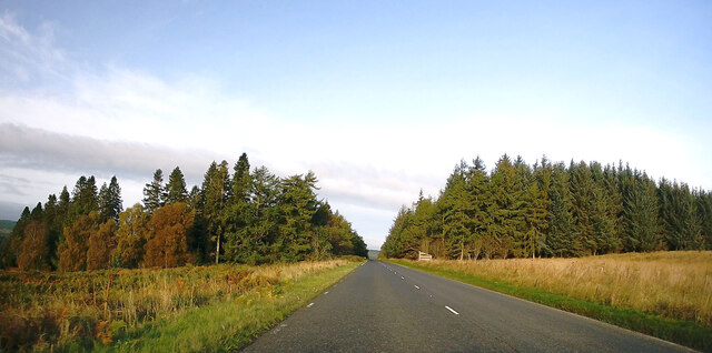
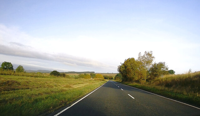
Dead Wood is a small forest located in the county of Northumberland, England. It covers an area of approximately 100 acres and is characterized by its dense vegetation and towering trees. The forest is situated in a remote and secluded area, surrounded by picturesque countryside and rolling hills.

The name "Dead Wood" is derived from the abundance of fallen trees and decaying wood that can be found throughout the forest. These fallen trees provide a rich habitat for various species of fungi, mosses, and insects, contributing to the overall biodiversity of the area. The forest floor is covered in a thick layer of decomposing leaves and vegetation, creating a fertile environment for plant growth.

The dominant tree species in Dead Wood include oak, beech, and birch, with some areas also populated by conifers such as pine and spruce. The forest is home to a wide variety of wildlife, including deer, badgers, foxes, and numerous bird species. It is a popular destination for nature enthusiasts and birdwatchers, who can explore the forest through a network of well-maintained trails and footpaths.

In addition to its natural beauty, Dead Wood also has historical significance. It is believed that the forest has been present for hundreds of years, and remnants of ancient settlements and structures can still be found within its boundaries. These archaeological sites provide a glimpse into the area's rich cultural heritage.

Overall, Dead Wood is a captivating destination for those seeking to immerse themselves in nature and explore the historical and ecological wonders of Northumberland.

If you have any feedback on the listing, please let us know in the comments section below.

Dead Wood Images

Images are sourced within 2km of 55.285378/-2.3076286 or Grid Reference NY8099. Thanks to Geograph Open Source API. All images are credited.

The Pennine Way near Hanging Crag
The Pennine Way near Peg's Height
Forest edge, Redesdale Some fierce looking tussocks as the huge conifer plantations take over.
Forest edge, Redesdale
Some fierce looking tussocks as the huge conifer plantations take over.
A68 approaching Redesdale Forest Towards Jedburgh.
A68 approaching Redesdale Forest
Towards Jedburgh.
The Pennine Way at Deadwood Cleugh The Pennine Way here cuts off a bend on the forestry road. It looks to be rough going compared with the good walking surface of the road. Normally the Pennine Way is walked in the opposite direction from south to north.
The Pennine Way at Deadwood Cleugh
The Pennine Way here cuts off a bend on the forestry road. It looks to be rough going compared with the good walking surface of the road. Normally the Pennine Way is walked in the opposite direction from south to north.
Small clearing beside the Pennine Way
Ways diverge through Redesdale Forest The Pennine Way goes straight ahead along the old road, but the new forestry road takes a more roundabout course for 500 metres round the steep descent ahead.
Ways diverge through Redesdale Forest
The Pennine Way goes straight ahead along the old road, but the new forestry road takes a more roundabout course for 500 metres round the steep descent ahead.
Ethylene pipeline, Redesdale Forest Ethylene gas under very high pressure is transported through an underground pipeline along this firebreak through Redesdale Forest en route from Wilton on Teesside to Grangemouth on the Firth of Forth. The notice proclaims a broad no-dig zone to protect the integrity of the pipeline.
Ethylene pipeline, Redesdale Forest
Ethylene gas under very high pressure is transported through an underground pipeline along this firebreak through Redesdale Forest en route from Wilton on Teesside to Grangemouth on the Firth of Forth. The notice proclaims a broad no-dig zone to protect the integrity of the pipeline.
A68 towards Jedburgh
A68 leaving Redesdale Forest
Red flag, Otterburn Ranges Road from the A68 on to the range.
Red flag, Otterburn Ranges
Road from the A68 on to the range.
Military area on north side of A68 The MOD has a large training area, the Otterburn Range, to the north of the A68; the access through this gate comes with accompanying warning notices.
Military area on north side of A68
The MOD has a large training area, the Otterburn Range, to the north of the A68; the access through this gate comes with accompanying warning notices.
Forest road, Redesdale Logging road leaving the A68.
Forest road, Redesdale
Logging road leaving the A68.
Redesdale Grassland away from the forests, rough grazing and military training areas. A wet morning.
Redesdale
Grassland away from the forests, rough grazing and military training areas. A wet morning.
Looking north-west on the A68 from the roadside layby Below the cairn on Mally's Crag.
Looking north-west on the A68 from the roadside layby
Below the cairn on Mally's Crag.
Gate leading to a field of very rough grazing At Bellshiel Farm in Northumberland.
Gate leading to a field of very rough grazing
At Bellshiel Farm in Northumberland.
Lay-by at the side of the A68 At Belshiel in Northumberland.
Lay-by at the side of the A68
At Belshiel in Northumberland.
Show me another place!

Dead Wood is located at Grid Ref: NY8099 (Lat: 55.285378, Lng: -2.3076286)

Unitary Authority: Northumberland

Police Authority: Northumbria

What 3 Words

///postage.workshops.grad. Near Rochester, Northumberland

Nearby Locations

Dead Wood

Related Wikis

A68 road

The A68 is a major road in the United Kingdom, running from Darlington in England to the A720 in Edinburgh, the capital of Scotland. It crosses the Anglo...

Bremenium

Bremenium is an ancient Roman fort (castrum) located at Rochester, Northumberland, England. The fort is one of the defensive structures built along Dere...

Rochester, Northumberland

Rochester is a small village and civil parish in north Northumberland, England. It is 5 miles (8 km) north-west of Otterburn on the A68 road between Corbridge...

Cottonshopeburnfoot

Cottonshopeburnfoot is a hamlet in Redesdale in Northumberland, England. It lies on the A68 road, 2 miles south east of the village of Byrness. The hamlet...

Have you been to Dead Wood?

Leave your review of Dead Wood below (or comments, questions and feedback).