Hightrees Copse

Wood, Forest in Staffordshire Wyre Forest

England

Hightrees Copse

Coldridge Wood View to the west through the trees in Coldridge Wood.
Coldridge Wood Credit: Philip Halling

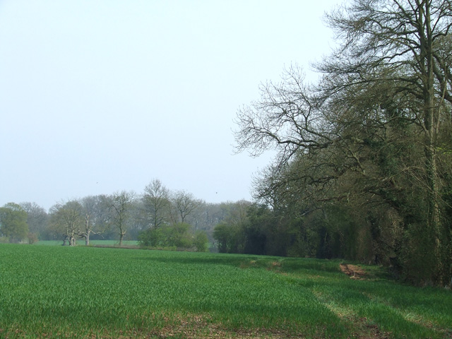
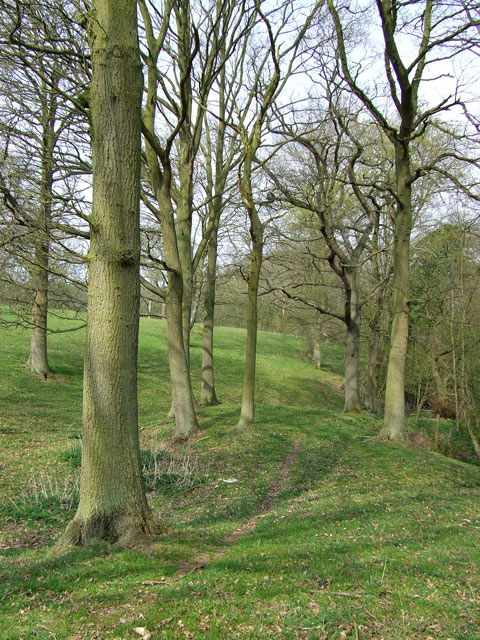
Hightrees Copse is a picturesque woodland located in Staffordshire, England. Situated on the outskirts of the town, this copse covers an expansive area of approximately 100 acres, making it an ideal destination for nature lovers and outdoor enthusiasts.

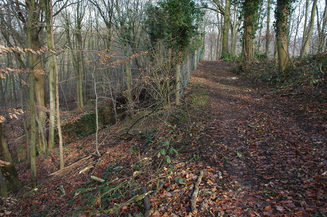
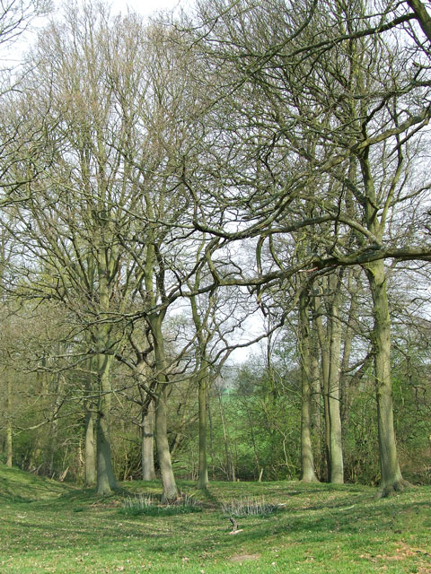
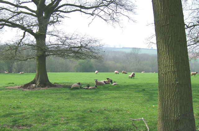
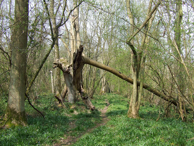
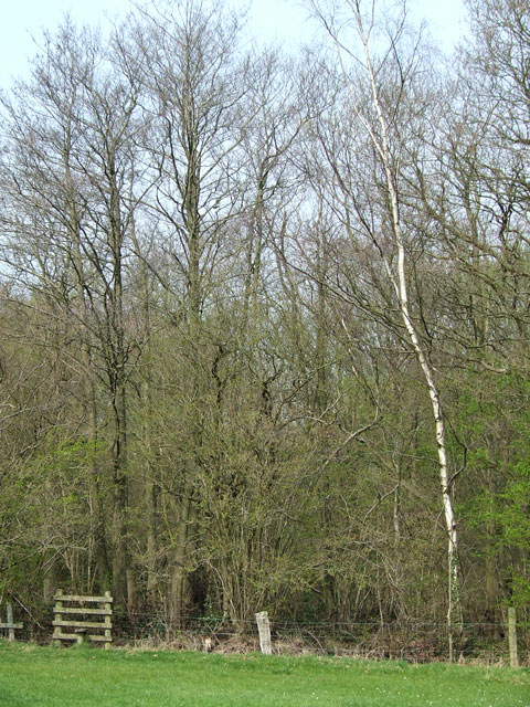
The copse is characterized by its diverse range of tree species, including oak, beech, and birch. These trees form a dense canopy, providing shade and shelter for a variety of wildlife. The forest floor is adorned with an array of wildflowers and ferns, creating a vibrant and colorful landscape during the spring and summer months.

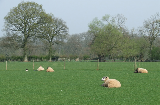
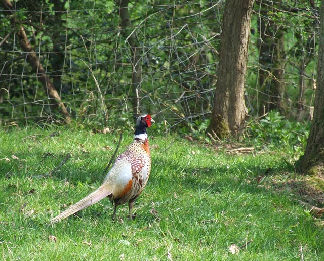
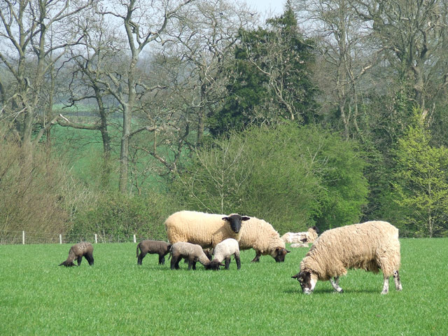
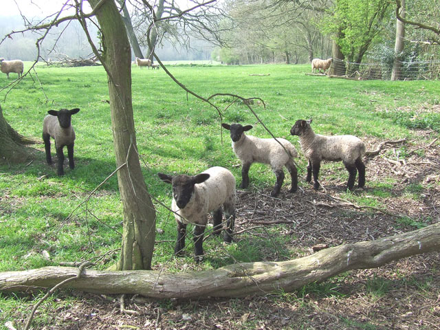
Hightrees Copse is a haven for birdwatchers, as it is home to a multitude of avian species. Visitors can spot woodpeckers, owls, and various songbirds throughout the year. The copse also attracts small mammals such as squirrels, rabbits, and hedgehogs, adding to its natural charm.

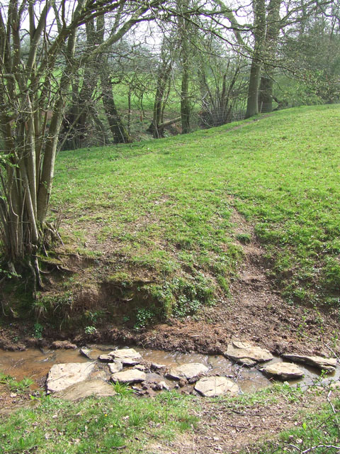
The woodland offers several walking trails, allowing visitors to explore its beauty at their own pace. These trails meander through the trees, offering glimpses of enchanting clearings and babbling brooks. There are also designated picnic areas, providing a perfect spot for a leisurely lunch amidst nature.

In addition to its natural beauty, Hightrees Copse holds historical significance. It is believed that the area was once used as a hunting ground by the local nobility during medieval times. Today, remnants of ancient stone walls can still be found, serving as a reminder of the copse's rich heritage.

Overall, Hightrees Copse in Staffordshire is a captivating woodland that offers visitors a chance to immerse themselves in nature's splendor while enjoying a tranquil and serene environment.

If you have any feedback on the listing, please let us know in the comments section below.

Hightrees Copse Images

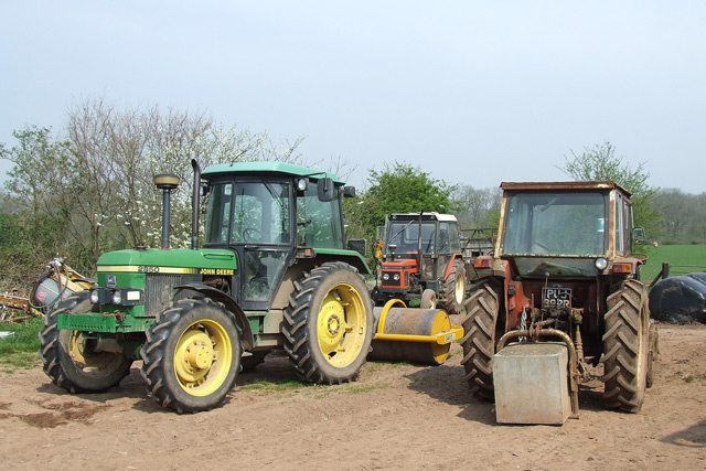
Images are sourced within 2km of 52.443852/-2.2904898 or Grid Reference SO8082. Thanks to Geograph Open Source API. All images are credited.

Coldridge Wood View to the west through the trees in Coldridge Wood.
Coldridge Wood
View to the west through the trees in Coldridge Wood.
Catkins in Coldridge Wood
Track through Coldridge Wood To the left of the track are a number of old quarries. The fence on the left provides protection from these quarries.
Track through Coldridge Wood
To the left of the track are a number of old quarries. The fence on the left provides protection from these quarries.
Sheep grazing near Hartsgreen in Shropshire Looking north-east from the bridleway by New Barns Farm. Land in the vicinity is shared between grazing and the growing of cereal crops.
Sheep grazing near Hartsgreen in Shropshire
Looking north-east from the bridleway by New Barns Farm. Land in the vicinity is shared between grazing and the growing of cereal crops.
Cereal crop and woodland near Hartsgreen in Shropshire Most land in the vicinity is dedicated to cereal crops or grazing, with small areas of woodland still remaining.
Cereal crop and woodland near Hartsgreen in Shropshire
Most land in the vicinity is dedicated to cereal crops or grazing, with small areas of woodland still remaining.
Pheasant, near Hartsgreen, Shropshire The whole area rings with the sound of these attractive birds.
Pheasant, near Hartsgreen, Shropshire
The whole area rings with the sound of these attractive birds.
Tractors, New Barns Farm, Hartsgreen, Shropshire
Ewes and Lambs, New Barns Farm, Hartsgreen, Shropshire The land this side of the dingle is dedicated mainly to grazing; the other side to cereal crops.
Ewes and Lambs, New Barns Farm, Hartsgreen, Shropshire
The land this side of the dingle is dedicated mainly to grazing; the other side to cereal crops.
A Woodland Walk, near Hartsgreen, Shropshire A beautiful footpath - and it's public! Enjoy woods and fields all the way to Birdsgreen (3km) and Alveley.
A Woodland Walk, near Hartsgreen, Shropshire
A beautiful footpath - and it's public! Enjoy woods and fields all the way to Birdsgreen (3km) and Alveley.
Sheep Grazing, near Hartsgreen, Shropshire
Inquisitive Lambs, near Hartsgreen, Shropshire This bunch came right up to me; the ewes didn't seem bothered.
Inquisitive Lambs, near Hartsgreen, Shropshire
This bunch came right up to me; the ewes didn't seem bothered.
Footpath to Bowhills Dingle, Shropshire The public footpath drops sharply into the dingle (slippery in poor weather) about 200 metres further on.
Footpath to Bowhills Dingle, Shropshire
The public footpath drops sharply into the dingle (slippery in poor weather) about 200 metres further on.
The Footpath to Bowhills Dingle, Shropshire The track leaves open grass fields and enters the woods at the stile, and after another well defined 200 metres turns right, down into the potentially very slippery stream bed.
The Footpath to Bowhills Dingle, Shropshire
The track leaves open grass fields and enters the woods at the stile, and after another well defined 200 metres turns right, down into the potentially very slippery stream bed.
Stepping Stones, Public Footpath near Hartsgreen, Shropshire Although rudimentary stepping stones have been laid, this public footpath will be difficult to negotiate after heavy rain!
Stepping Stones, Public Footpath near Hartsgreen, Shropshire
Although rudimentary stepping stones have been laid, this public footpath will be difficult to negotiate after heavy rain!
Footpath Through the Trees, Hartsgreen, Shropshire This very attractive public footpath leads through fields and woods, but there are places which could be difficult in wet weather.
Footpath Through the Trees, Hartsgreen, Shropshire
This very attractive public footpath leads through fields and woods, but there are places which could be difficult in wet weather.
Footpath at Witnells End
Lane past Brittles Cottage
It's easy to get lost down these lanes - especially when some bright spark turns a sign around!
Show me another place!

Hightrees Copse is located at Grid Ref: SO8082 (Lat: 52.443852, Lng: -2.2904898)

Administrative County: Worcestershire

District: Wyre Forest

Police Authority: West Mercia

What 3 Words

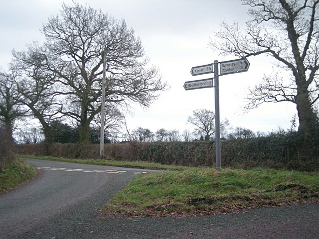
///showdown.mavericks.ivory. Near Romsley, Shropshire

Related Wikis

Castle Hill, Wolverley

Castle Hill or Baron Hill is about a mile from the hamlet of Kingsford in the civil parish of Wolverley and Cookley, Worcestershire. In 1912 the site consisted...

Shatterford

Shatterford is a village in the Wyre Forest District of Worcestershire, England, located north-west of Bewdley and lies less than a mile from the county...

Kingsford, Worcestershire

Kingsford is a large hamlet in Worcestershire, England. == Location == Kingsford is located one mile (1.6 km) north of the village of Wolverley, Worcestershire...

Romsley, Shropshire

Romsley (grid reference SO783826) is a hamlet and civil parish in southeast Shropshire, England. It is bounded on the north and west by Alveley and on...

Drakelow Tunnels

Drakelow Tunnels are a former underground military complex beneath the Blakeshall Estate north of Kidderminster, Worcestershire, covering 285,000 sq ft...

Drakelow Hillfort

Drakelow Hillfort, is a small multivallate Iron Age hillfort, located on a promontory (known as Drakelow Hill) at Drakelow at the southern end of Kinver...

Kingsford Country Park

Kingsford Country Park, officially Kingsford Forest Park, was in Worcestershire, England, U.K. and managed by Worcestershire County Council. It adjoined...

Drakelow, Worcestershire

Drakelow is a hamlet in Worcestershire, England. It is one of the ancient townships of the manor of Wolverley, whose extent was similar to that of the...

Nearby Amenities

Located within 500m of 52.443852,-2.2904898
Power: tower
Lat/Long: 52.4407878/-2.2936878
Power: tower
Lat/Long: 52.4409997/-2.2897692
Power: tower
Lat/Long: 52.4426765/-2.2860023
The data included in this document is from www.openstreetmap.org. The data is made available under ODbL.

Have you been to Hightrees Copse?

Leave your review of Hightrees Copse below (or comments, questions and feedback).