King Wanless Green

Wood, Forest in Northumberland

England

King Wanless Green

Boulder north of Sewingshields Crags The boulder located next to the earthwork remains of an Iron Age enclosed settlement has several possible prehistoric cup-marks and quarry wedges cut in a failed attempt (possibly as early as Roman times) to break it up.
Boulder north of Sewingshields Crags Credit: Andrew Curtis

King Wanless Green is a small village located in the county of Northumberland, England. Situated in the heart of a dense forest, it is renowned for its natural beauty and tranquil surroundings. The village is named after the prominent Wanless family, who once owned vast tracts of land in the area.

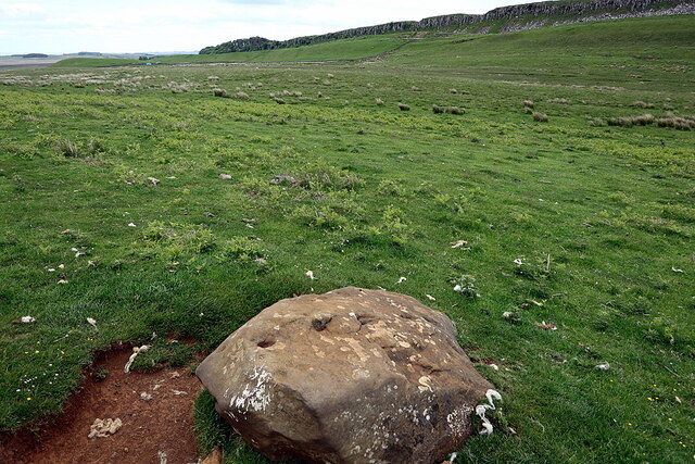
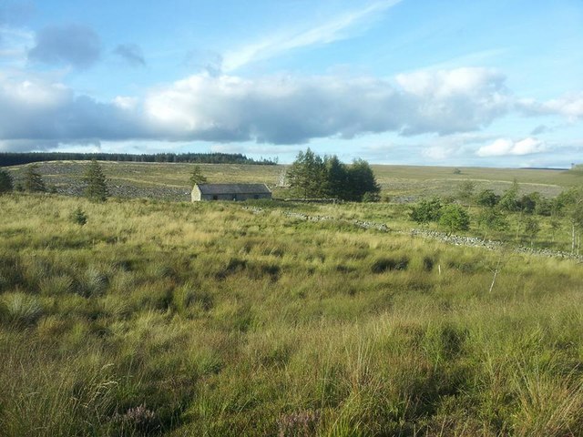
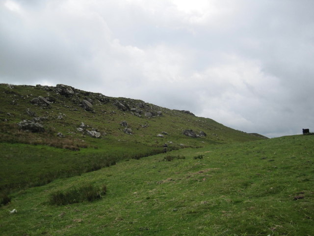
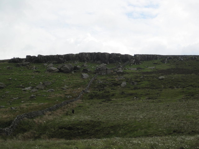
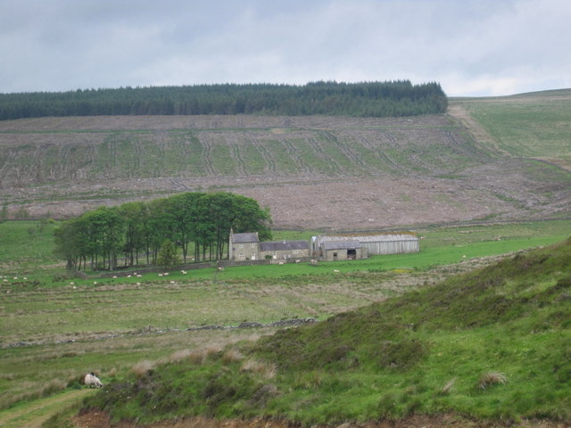
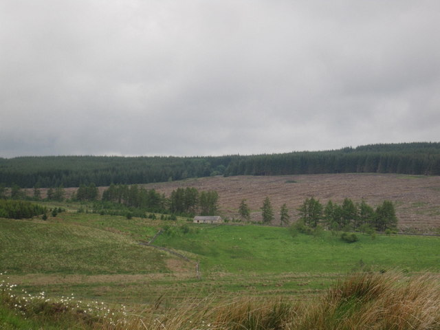
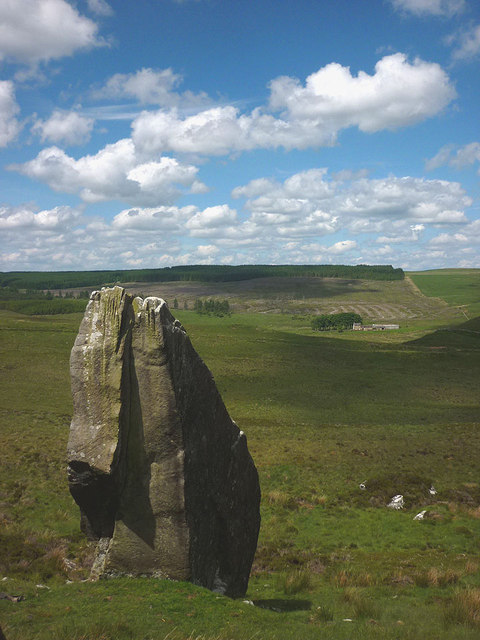
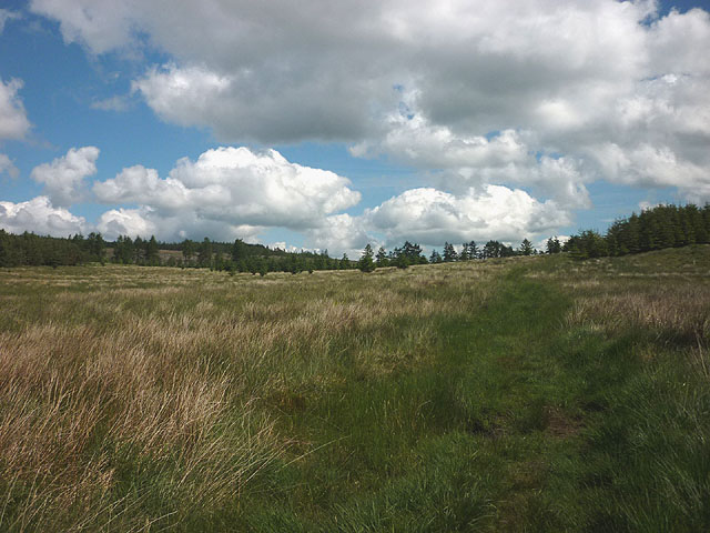
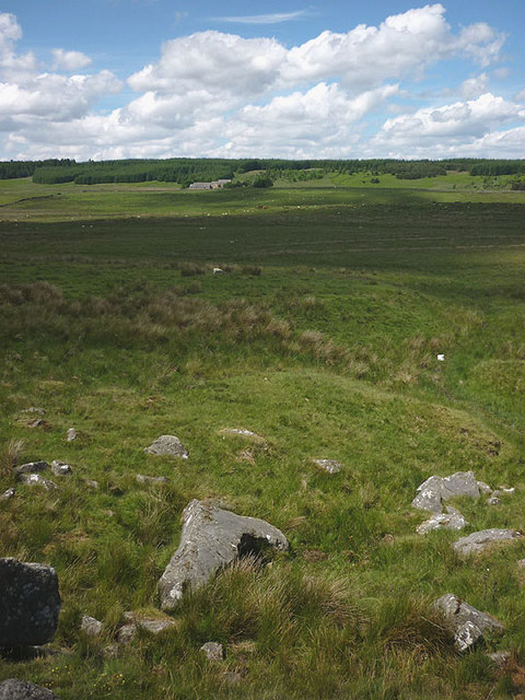
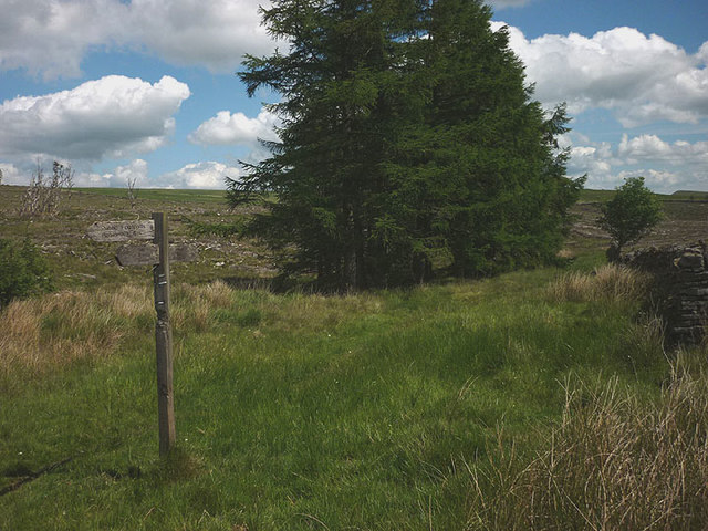
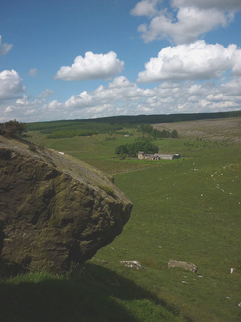
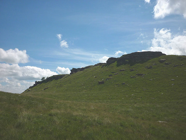
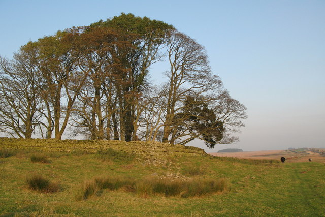
The landscape of King Wanless Green is characterized by dense woodlands and towering trees, creating a picturesque setting for nature enthusiasts and hikers. The forest is home to a diverse range of flora and fauna, including ancient oaks, beech trees, and a variety of wildflowers. It provides an idyllic habitat for numerous bird species, making it a popular spot for birdwatching.

The village itself is small and close-knit, with a population of around 300 residents. The community is known for its strong sense of community spirit and friendly atmosphere. The village pub, The Wanless Arms, serves as a social hub and gathering place for locals and visitors alike.

Despite its rural location, King Wanless Green is well-connected to nearby towns and cities. The village is only a short drive away from the market town of Hexham, where residents can find a range of amenities including shops, schools, and healthcare facilities.

Overall, King Wanless Green offers a peaceful retreat for those seeking a break from the hustle and bustle of city life. Its natural beauty, sense of community, and proximity to urban centers make it an attractive destination for both residents and visitors.

If you have any feedback on the listing, please let us know in the comments section below.

King Wanless Green Images

Images are sourced within 2km of 55.033225/-2.3139061 or Grid Reference NY8071. Thanks to Geograph Open Source API. All images are credited.

Boulder north of Sewingshields Crags The boulder located next to the earthwork remains of an Iron Age enclosed settlement has several possible prehistoric cup-marks and quarry wedges cut in a failed attempt (possibly as early as Roman times) to break it up.
Boulder north of Sewingshields Crags
The boulder located next to the earthwork remains of an Iron Age enclosed settlement has several possible prehistoric cup-marks and quarry wedges cut in a failed attempt (possibly as early as Roman times) to break it up.
Maintenance Work at Haughtongreen Haughtongreen is a basic shelter cared for by volunteers of the Mountain Bothies Association with permission of the landowner. On the weekend this photo was taken maintenance work was underway, with several MBA volunteers working on the interior and exterior.
Maintenance Work at Haughtongreen
Haughtongreen is a basic shelter cared for by volunteers of the Mountain Bothies Association with permission of the landowner. On the weekend this photo was taken maintenance work was underway, with several MBA volunteers working on the interior and exterior.
Path across moorland We have this path all to ourselves.
Path across moorland
We have this path all to ourselves.
Haughtongreen bothy Haughtongreen bothy in Wark Forest.
Haughtongreen bothy
Haughtongreen bothy in Wark Forest.
Haughtongreen bothy Haughtongreen bothy, Wark Forest; lovely little place to stay.
Haughtongreen bothy
Haughtongreen bothy, Wark Forest; lovely little place to stay.
King's Crags
King's Crags
Queen's Crags
Queen's Crags
East Hotbank Farm
East Hotbank Farm
Haughtongreen Mountain Bothy
By-way. Nanny's Hill
Natural "Rock Art"
Natural "Rock Art"
Rhododendrons on a Bield (sheepfold)
The 'Rabbit Stone', Queen's Crag This enormous boulder of Fell sandstone sits below the main edge of the crag and probably rolled down into its present location from there. It is big enough to host its own rock climbs - white patches are chalk from recent activity. Climbers originally came up with the name due to its resemblance to a gigantic sitting rabbit from some directions. Beyond, is the remote farm of East Hotbank with the southern edge of the vast Wark/Kielder Forest forming the skyline.
The 'Rabbit Stone', Queen's Crag
This enormous boulder of Fell sandstone sits below the main edge of the crag and probably rolled down into its present location from there. It is big enough to host its own rock climbs - white patches are chalk from recent activity. Climbers originally came up with the name due to its resemblance to a gigantic sitting rabbit from some directions. Beyond, is the remote farm of East Hotbank with the southern edge of the vast Wark/Kielder Forest forming the skyline.
Footpath to Haughtongreen A grassy path branches off the well-trodden Pennine Way forestry track and cuts through more open, boggy land.
Footpath to Haughtongreen
A grassy path branches off the well-trodden Pennine Way forestry track and cuts through more open, boggy land.
Jingling Well A spring just below the track. The rocks in view all appear to be Fell sandstone but there may be a band of limestone accounting for the resurgence - I do recall seeing limestone outcrops beside the nearby Broomlee Lough some years ago. In the background is the remote farmhouse of East Stonelands backed by the vast Wark/Kielder Forest.
Jingling Well
A spring just below the track. The rocks in view all appear to be Fell sandstone but there may be a band of limestone accounting for the resurgence - I do recall seeing limestone outcrops beside the nearby Broomlee Lough some years ago. In the background is the remote farmhouse of East Stonelands backed by the vast Wark/Kielder Forest.
Fingerpost, Haughtongreen A three-way path junction just north of the bothy. One finger points to Robinrock <a href="https://www.geograph.org.uk/photo/5009263">NY7370 : Forestry track, Robinrock Plantations</a> 4.25 miles away, where I had been three days earlier. Note the worn away post below the fingers - deer rubbing their antlers possibly?
Fingerpost, Haughtongreen
A three-way path junction just north of the bothy. One finger points to Robinrock NY7370 : Forestry track, Robinrock Plantations 4.25 miles away, where I had been three days earlier. Note the worn away post below the fingers - deer rubbing their antlers possibly?
King's Crags and East Hotbank The crag is a north-facing edge of large boulders and short outcrops of Fell sandstone. It overlooks the remote farmhouse of East Hotbank.
King's Crags and East Hotbank
The crag is a north-facing edge of large boulders and short outcrops of Fell sandstone. It overlooks the remote farmhouse of East Hotbank.
King's Crags A line of north-facing short outcrops and boulders of Fell sandstone.
King's Crags
A line of north-facing short outcrops and boulders of Fell sandstone.
Show me another place!

King Wanless Green is located at Grid Ref: NY8071 (Lat: 55.033225, Lng: -2.3139061)

Unitary Authority: Northumberland

Police Authority: Northumbria

What 3 Words

///shameless.curtail.shadows. Near Bardon Mill, Northumberland

Related Wikis

Milecastle 35

Milecastle 35 (Sewingshields) is one of the milecastles on Hadrian's Wall (grid reference NY80497018). The remains still exist as exposed masonry. ��2...

Halleypike Lough

Halleypike Lough is an inland lake on Haughton Common at the southern edge of Northumberland National Park, northeast of Bardon Mill, and 1 mile (1.6 km...

Broomlee Lough

Broomlee Lough is an inland lake in Northumberland, England at the southern edge of Northumberland National Park. The lough lies immediately north of the...

Milecastle 36

Milecastle 36 (King's Hill) was one of the milecastles on Hadrian's Wall (grid reference NY79726931). There is little to see on the ground as most of the...

Milecastle 34

Milecastle 34 (Grindon) was a milecastle of the Roman Hadrian's Wall. There are no visible remains, but the site is within a small, tree-filled, walled...

Knag Burn Gateway

The Knag Burn Gateway is a gateway which was built into Hadrian's Wall some time after construction of the wall itself, generally acknowledged to be during...

Housesteads Roman Fort

Housesteads Roman Fort is the remains of an auxiliary fort on Hadrian's Wall, at Housesteads, Northumberland, England, south of Broomlee Lough. The fort...
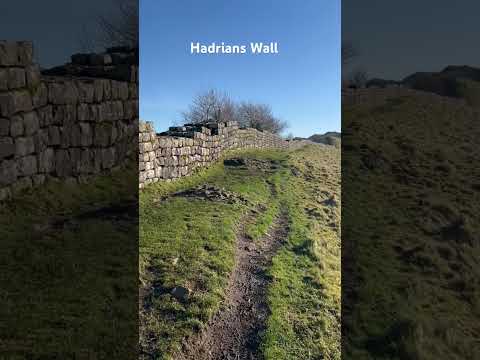
Hadrian's Wall

Hadrian's Wall (Latin: Vallum Hadriani, also known as the Roman Wall, Picts' Wall, or Vallum Aelium in Latin), is a former defensive fortification of the...

Related Videos

Hadrian's Wall Path: 3 Day Hike

A 3 day hike taking in 65 miles of the Hadrian's Wall Path. Starting in Carlisle and ending in Newcastle.

Hadrian's Wall | Walking The Wall At Housesteads Roman Fort

In this Vlog, Global Gumboots visit Hadrian's Wall stopping at Heddon On The Wall and Houseteads Roman Fort. It's then off to ...

HIKING HADRIANS WALL. Backpacking along Hadrians Wall in Northumberland.

As part of preparation for this years Fan Dance in Wales I am hiking. This mornings walk along Hadrians Wall in Northumberland ...

Nearby Amenities

Located within 500m of 55.033225,-2.3139061
The data included in this document is from www.openstreetmap.org. The data is made available under ODbL.

Have you been to King Wanless Green?

Leave your review of King Wanless Green below (or comments, questions and feedback).