Highrigg Wood
Wood, Forest in Yorkshire Craven
England
Highrigg Wood

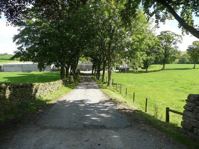
Highrigg Wood is a picturesque woodland located in the county of Yorkshire, England. Covering an area of approximately 50 hectares, this stunning forest is renowned for its natural beauty and rich biodiversity. It is situated near the village of Highrigg, nestled amidst the rolling hills and lush green valleys of the Yorkshire Dales.
The wood is predominantly composed of deciduous trees, including oak, beech, and ash, which create a dense canopy overhead. The forest floor is covered in a vibrant carpet of bluebells, wild garlic, and ferns, adding to the enchanting atmosphere of the woodland. The tranquil ambiance is further enhanced by the gentle sound of a nearby stream meandering through the trees.
Highrigg Wood is home to a diverse range of wildlife, with several species of birds, mammals, and insects inhabiting the area. Birdwatchers can often spot woodland birds such as great tits, woodpeckers, and tawny owls. Deer are also known to roam the forest, adding to the sense of wilderness.
The wood is a popular destination for nature enthusiasts, hikers, and photographers who appreciate its natural splendor. The many well-marked trails winding through the forest offer visitors the opportunity to explore its beauty, with occasional viewpoints providing panoramic vistas of the surrounding countryside.
Highrigg Wood is a true gem in the Yorkshire landscape, providing a serene retreat for those seeking solace in nature and an opportunity to immerse themselves in the beauty of the English countryside.
If you have any feedback on the listing, please let us know in the comments section below.
Highrigg Wood Images
Images are sourced within 2km of 54.079694/-2.3094128 or Grid Reference SD7964. Thanks to Geograph Open Source API. All images are credited.


Highrigg Wood is located at Grid Ref: SD7964 (Lat: 54.079694, Lng: -2.3094128)
Division: West Riding
Administrative County: North Yorkshire
District: Craven
Police Authority: North Yorkshire
What 3 Words
///nags.scans.hill. Near Settle, North Yorkshire
Nearby Locations
Related Wikis
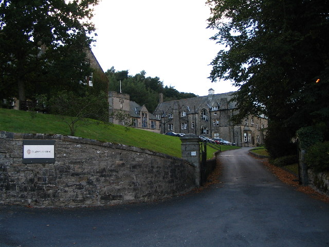
Giggleswick School
Giggleswick School is a public school (English private boarding and day school) in Giggleswick, near Settle, North Yorkshire, England. == Early school... ==

Giggleswick
Giggleswick, a village and civil parish in the Craven district of North Yorkshire, England, lies on the B6480 road, less than 1 mile (1.6 km) north-west...
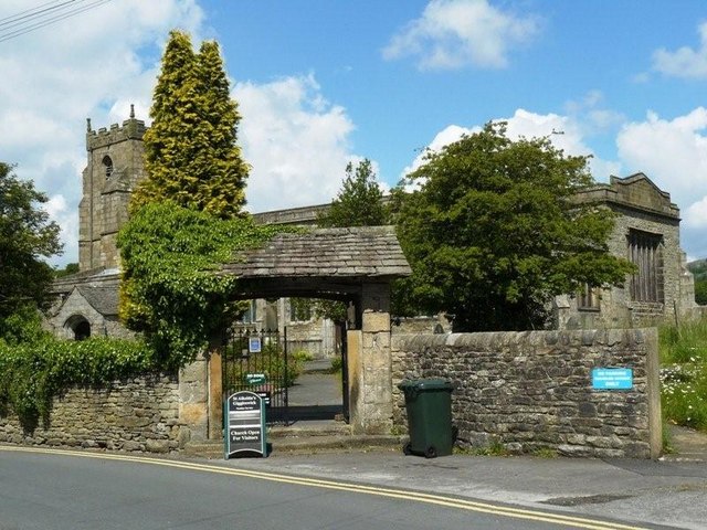
Church of St Alkelda, Giggleswick
The Church of St Alkelda, Giggleswick (historically St Alkald), is an Anglican church in the village of Giggleswick, North Yorkshire, England. St Alkelda...
Stackhouse, North Yorkshire
Stackhouse (sometimes written as Stack House), is a hamlet near to Giggleswick on the western bank of the River Ribble in North Yorkshire, England. �...

Settle College
Settle College (formerly Settle High School and Settle Girls' High School) is an 11–18 mixed, community secondary school and sixth form in Giggleswick...

Settle Rural District
Settle Rural District was an administrative district in the West Riding of Yorkshire, England. The rural district was named after the town of Settle and...

Settle Hydro
Settle Hydro is a micro hydroelectric scheme, owned by the community, in Settle, North Yorkshire, England. It is located on the River Ribble, at Settle...

Giggleswick railway station
Giggleswick is a railway station on the Bentham Line, which runs between Leeds and Morecambe via Skipton. The station, situated 41+1⁄4 miles (66 km) north...
Nearby Amenities
Located within 500m of 54.079694,-2.3094128Have you been to Highrigg Wood?
Leave your review of Highrigg Wood below (or comments, questions and feedback).