Moat Covert

Wood, Forest in Staffordshire Stafford

England

Moat Covert

Shropshire Union Canal In Shelmore Wood.
Shropshire Union Canal Credit: Andrew Abbott

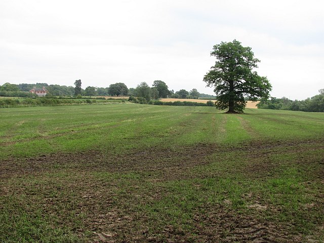
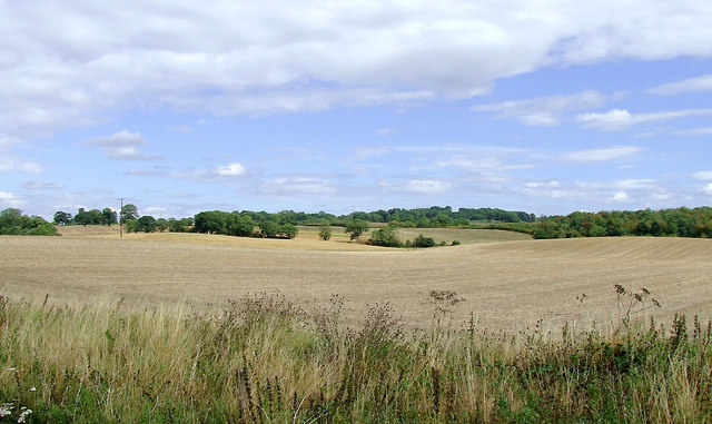
Moat Covert, located in Staffordshire, is a picturesque woodland area known for its natural beauty and rich historical significance. Covering an area of approximately 200 acres, this enchanting forest is a popular destination for nature lovers and history buffs alike.

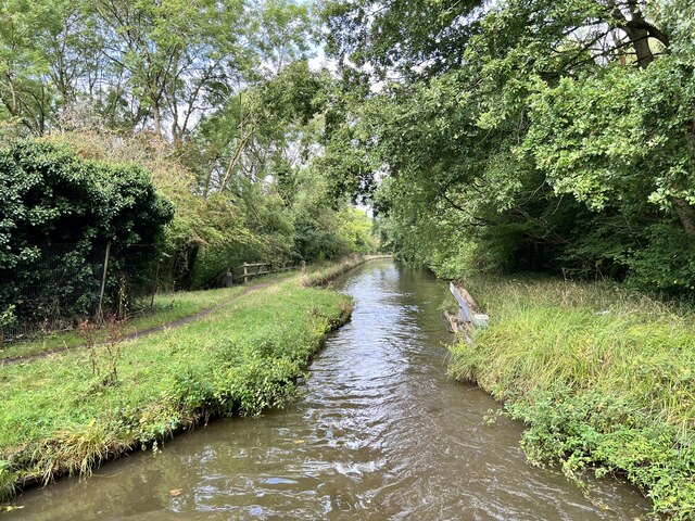
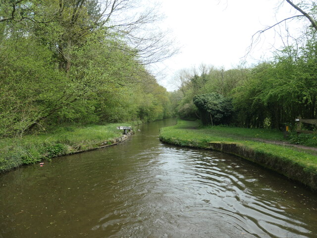
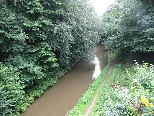
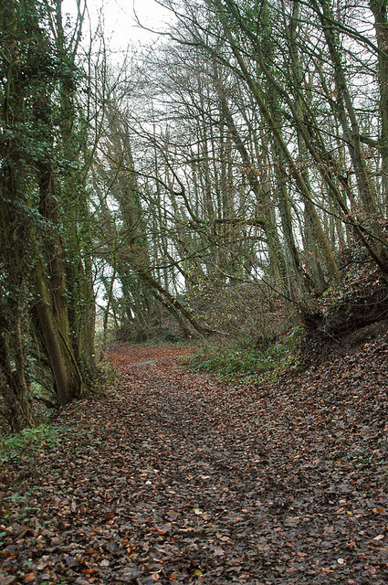
The woodland is characterized by its dense canopy of ancient oak, beech, and ash trees, creating a serene and peaceful atmosphere. The forest floor is adorned with an array of wildflowers, ferns, and mosses, making it a haven for various species of flora and fauna.

Moat Covert is also home to a diverse range of wildlife, including deer, foxes, badgers, and a variety of bird species. Nature enthusiasts can often be seen exploring the forest, observing and photographing the abundant wildlife.

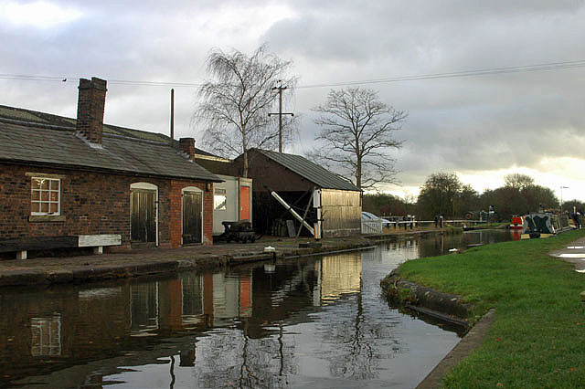
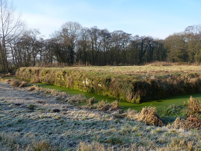
In addition to its natural beauty, Moat Covert holds significant historical importance. The name "Moat Covert" refers to the remains of a medieval moated manor house that once stood in the area. Visitors can still see the remnants of the moat, which add an intriguing element to the forest's charm.

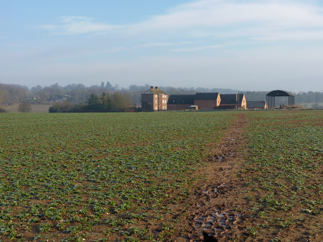
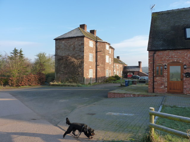
Throughout the centuries, the woodland has been used for various purposes, including timber production, hunting, and even as a hiding place during times of conflict. Today, Moat Covert is primarily a protected nature reserve, managed by local authorities to preserve its natural heritage.

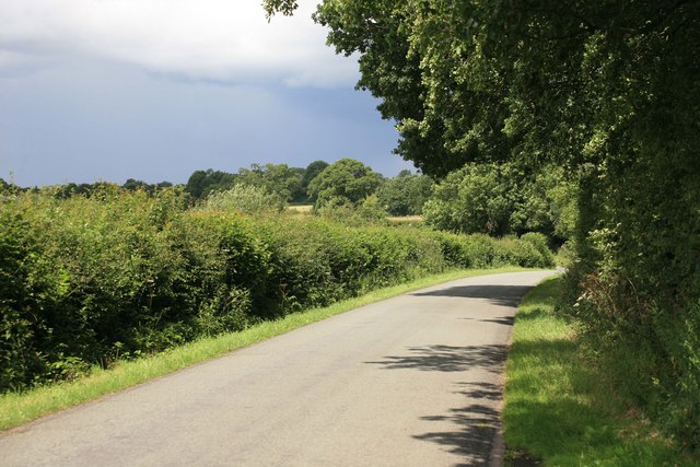
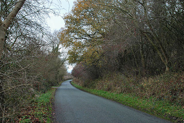
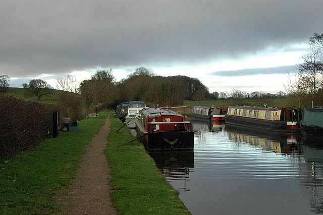
Visitors to Moat Covert can enjoy a range of activities, such as hiking, birdwatching, and picnicking. The forest is crisscrossed by well-maintained trails, allowing visitors to explore its beauty at their own pace.

Overall, Moat Covert in Staffordshire offers a magical escape into nature, where history and natural beauty seamlessly intertwine.

If you have any feedback on the listing, please let us know in the comments section below.
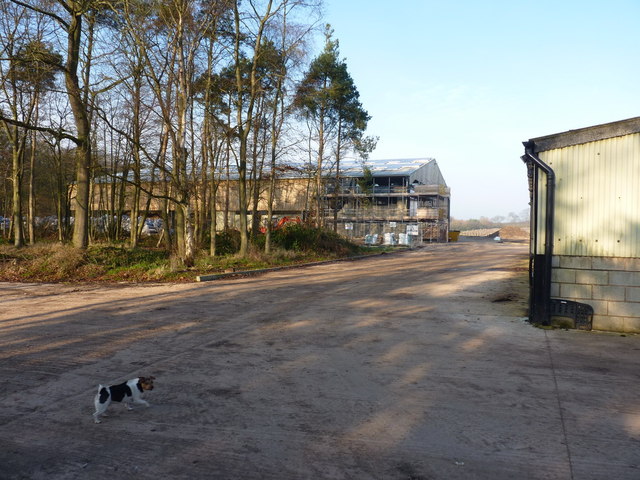
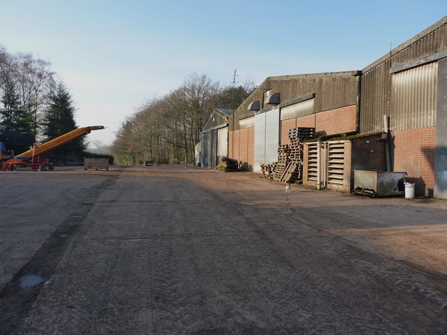
Moat Covert Images

Images are sourced within 2km of 52.806713/-2.3052911 or Grid Reference SJ7923. Thanks to Geograph Open Source API. All images are credited.

Shropshire Union Canal In Shelmore Wood.
Shropshire Union Canal
In Shelmore Wood.
Stop gate, south end of Shelmore embankment If the embankment was breached, the flow of water would pull the gate shut. This stops a much longer stretch of the canal from emptying and reduces the size of the flood below the breach.
Stop gate, south end of Shelmore embankment
If the embankment was breached, the flow of water would pull the gate shut. This stops a much longer stretch of the canal from emptying and reduces the size of the flood below the breach.
Norbury Road sunshine and cloud Sunlight highlights the hedge while black clouds beyond bring heavy showers to some.
Norbury Road sunshine and cloud
Sunlight highlights the hedge while black clouds beyond bring heavy showers to some.
Shropshire Union Canal View from the High Bridge.
Shropshire Union Canal
View from the High Bridge.
A muddy field Silage has just been taken off this field, and vehicle movements have made things muddy. A lone tree in the middle of a field is often a sign that there was once a hedge there.
A muddy field
Silage has just been taken off this field, and vehicle movements have made things muddy. A lone tree in the middle of a field is often a sign that there was once a hedge there.
Roadside 'greasy spoon' Look closely at the person in the 'cafe' and you will see him providing an unusual 'welcome' sign. I was going to purchase a buttie but not after that 'comment'.
Roadside 'greasy spoon'
Look closely at the person in the 'cafe' and you will see him providing an unusual 'welcome' sign. I was going to purchase a buttie but not after that 'comment'.
A 'Millennium Stone' on Grubb Street
Lane to Norbury
Lane to Norbury
Workshops at Norbury Junction
Shropshire Union Canal - just north of Norbury
Woodland near the Shropshire Union Canal
Arable fields east of Norbury, Staffordshire Seen from the Shropshire Union Canal, the woodland ahead is Little Campions; that by the right edge is Moat Covert.
Arable fields east of Norbury, Staffordshire
Seen from the Shropshire Union Canal, the woodland ahead is Little Campions; that by the right edge is Moat Covert.
Arable fields east of Norbury, Staffordshire Seen from the Shropshire Union Canal, the woodland at the right edge is known as Little Campions. Straight ahead and more distant are Gorsey Covert and Ball's Rough, on the skyline.
Arable fields east of Norbury, Staffordshire
Seen from the Shropshire Union Canal, the woodland at the right edge is known as Little Campions. Straight ahead and more distant are Gorsey Covert and Ball's Rough, on the skyline.
Across the fields to Norbury Manor The main manor house, and barn conversions, at Norbury.
Across the fields to Norbury Manor
The main manor house, and barn conversions, at Norbury.
Norbury Manor house A fine Georgian style manor house, built using much of the masonry from the ruined 14th century house that originally stood within the nearby moat.
Norbury Manor house
A fine Georgian style manor house, built using much of the masonry from the ruined 14th century house that originally stood within the nearby moat.
The original location of Norbury Manor The square platform within this moat was the base for the 14th century Norbury Manor. It was built by Ralph le Botiller in the early 1300s, and sold to one Thomas Skrymsher in 1521. In the 1700s, it changed hands again, passing to George Anson of Shugborough in Staffs, but was in a generally poor state of repair by that time, and fell into disuse soon after. Demolition followed in the 1800s, and much of the masonry was re-used to build the current house a couple of hundred yards away <a href="https://www.geograph.org.uk/photo/3295776">SJ7923 : Norbury Manor house</a>
(Info from the on-site signage by Natural England)
The original location of Norbury Manor
The square platform within this moat was the base for the 14th century Norbury Manor. It was built by Ralph le Botiller in the early 1300s, and sold to one Thomas Skrymsher in 1521. In the 1700s, it changed hands again, passing to George Anson of Shugborough in Staffs, but was in a generally poor state of repair by that time, and fell into disuse soon after. Demolition followed in the 1800s, and much of the masonry was re-used to build the current house a couple of hundred yards away SJ7923 : Norbury Manor house (Info from the on-site signage by Natural England)
New barn under construction A large new barn is currently being built at the back of the existing buildings on this farm.
New barn under construction
A large new barn is currently being built at the back of the existing buildings on this farm.
Barns, pallets and machinery An assortment of farming paraphernalia in the tidy yard.
Barns, pallets and machinery
An assortment of farming paraphernalia in the tidy yard.
Show me another place!

Moat Covert is located at Grid Ref: SJ7923 (Lat: 52.806713, Lng: -2.3052911)

Administrative County: Staffordshire

District: Stafford

Police Authority: Staffordshire

What 3 Words

///alerting.unicorns.brew. Near Gnosall, Staffordshire

Nearby Locations

Moat Covert

Related Wikis

Norbury Junction

Norbury Junction (grid reference SJ793228) is a hamlet and former canal junction which lies about 1 mile (1.6 km) to the south east of Norbury, in Staffordshire...

Gnosall Rural District

Gnosall was a rural district in Staffordshire, England from 1894 to 1934. It was formed under the Local Government Act 1894 from that part of the Newport...

Loynton

Loynton is a hamlet on the A519 near the villages of Norbury, and Woodseaves in Staffordshire, England. It lies in the civil parish of Norbury. Loynton...

Norbury, Staffordshire

Norbury is a village and civil parish in the Borough of Stafford, in west Staffordshire, England. The population as taken at the 2011 census was 371.It...

Loynton Moss

Loynton Moss is a nature reserve of the Staffordshire Wildlife Trust, near the village of Woodseaves, in Staffordshire, England. It is adjacent to the...

Woodseaves

Woodseaves is a village in Staffordshire, England. It lies in the civil parish of High Offley and is situated on the A519 (Newport-Newcastle-under-Lyme...

Knightley, Staffordshire

Knightley is a hamlet and former manor in Staffordshire, England. It is situated near the villages of Gnosall and Woodseaves, now on the B5405 road. There...

High Offley

High Offley is a small village and civil parish in Staffordshire, England. It lies 3 miles southwest of the small town of Eccleshall and about 1 mile west...

Nearby Amenities

Located within 500m of 52.806713,-2.3052911
Norbury Junction
Operator: Canal and River Trust
Operator Wikidata: Q5030960
Waterway: turning_point
Wikidata: Q7050455
Wikipedia: en:Norbury Junction
Lat/Long: 52.8025764/-2.3077156
Bus Stop
Junction Inn PH
Bus: yes
Naptan AtcoCode: 3800C707000
Naptan Bearing: W
Naptan CommonName: Junction Inn PH
Naptan Indicator: Adj
Naptan Landmark: Junction Inn PH
Naptan Street: Main Rd
Naptan Verified: no
Public Transport: platform
Source: naptan_import
Lat/Long: 52.8032022/-2.3083433
Cafe
Old Wharf Tea Rooms
Lat/Long: 52.8029796/-2.3074336
Leisure: slipway
Lat/Long: 52.8026919/-2.307241
Power: pole
Lat/Long: 52.8104421/-2.3043394
Power: pole
Lat/Long: 52.8083668/-2.3027033
Power: pole
Lat/Long: 52.8105458/-2.3044843
Power: pole
Lat/Long: 52.8093477/-2.3045754
Power: pole
Lat/Long: 52.8036306/-2.3052621
Power: pole
Lat/Long: 52.8040619/-2.3041275
Power: pole
Lat/Long: 52.8047202/-2.3024538
Power: pole
Lat/Long: 52.8050121/-2.3017001
Power: pole
Lat/Long: 52.8056266/-2.3007292
Power: pole
Lat/Long: 52.8078674/-2.3018181
Power: pole
Lat/Long: 52.8070972/-2.3005414
Power: pole
Lat/Long: 52.806383/-2.299545
Power: pole
Lat/Long: 52.8059096/-2.2987564
Power: pole
Lat/Long: 52.807715/-2.3017819
Power: pole
Lat/Long: 52.8070364/-2.3006567
Power: pole
Lat/Long: 52.8062565/-2.2991292
Power: pole
Lat/Long: 52.808448/-2.3030722
The data included in this document is from www.openstreetmap.org. The data is made available under ODbL.

Have you been to Moat Covert?

Leave your review of Moat Covert below (or comments, questions and feedback).