Holly Bushes

Wood, Forest in Somerset Mendip

England

Holly Bushes

Road to the Longleat Safari park
Road to the Longleat Safari park Credit: Helen Steed

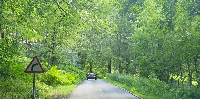
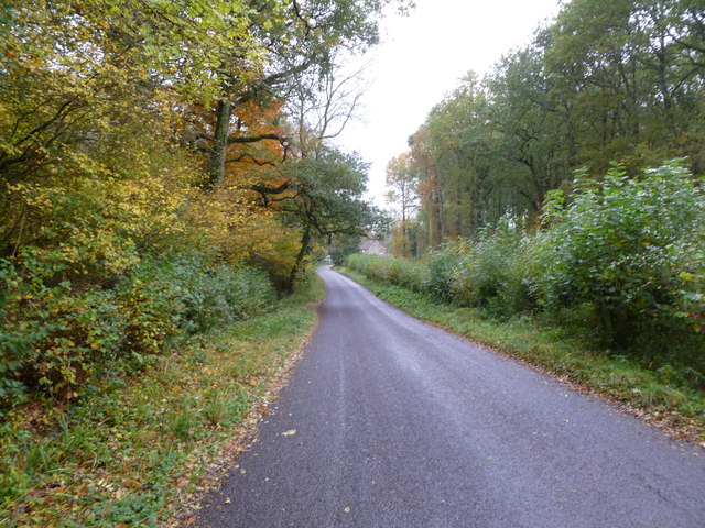
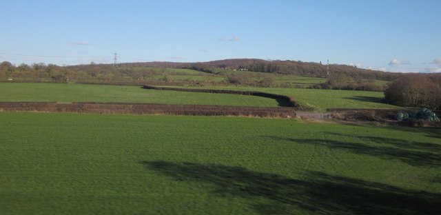
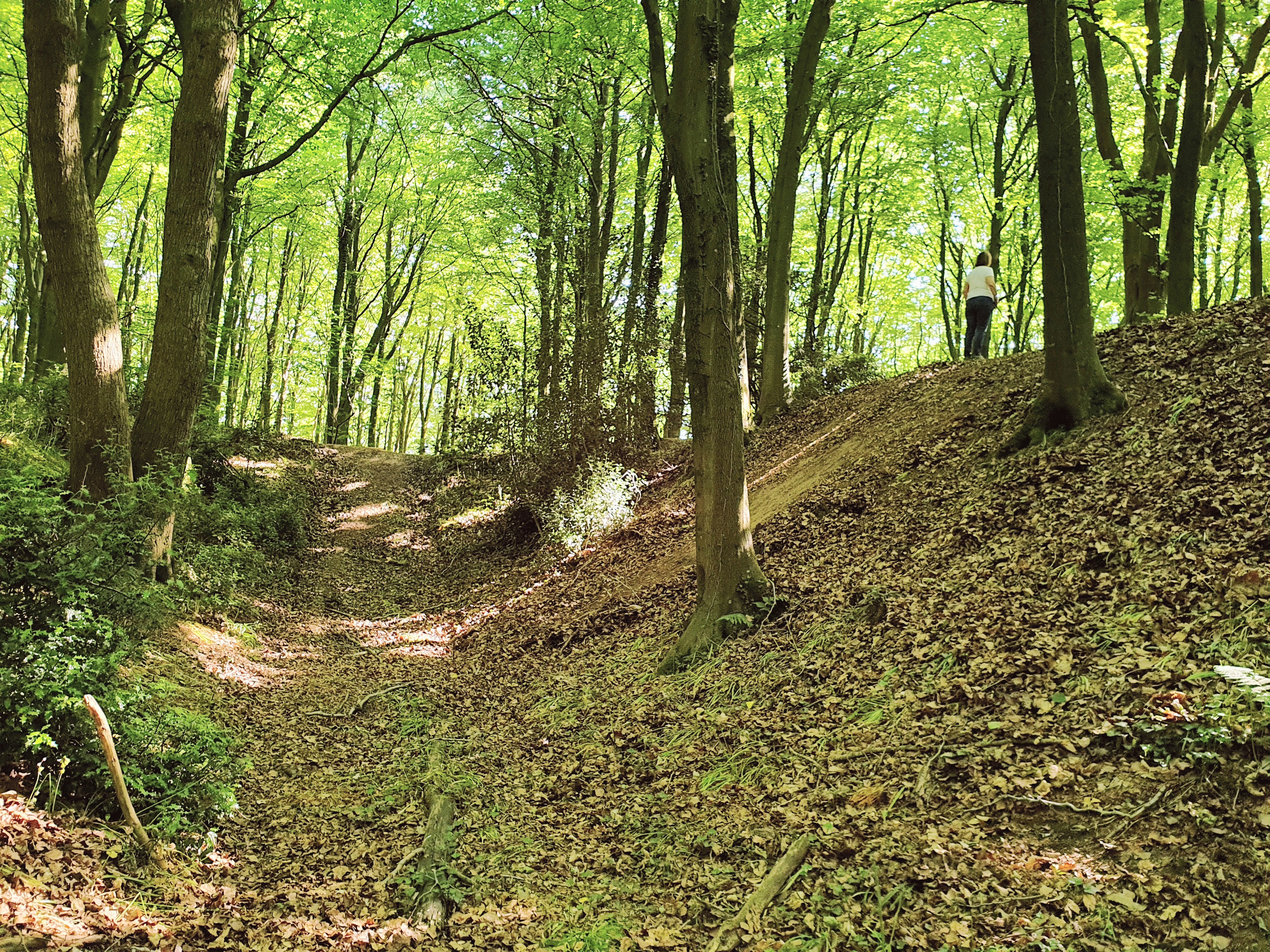
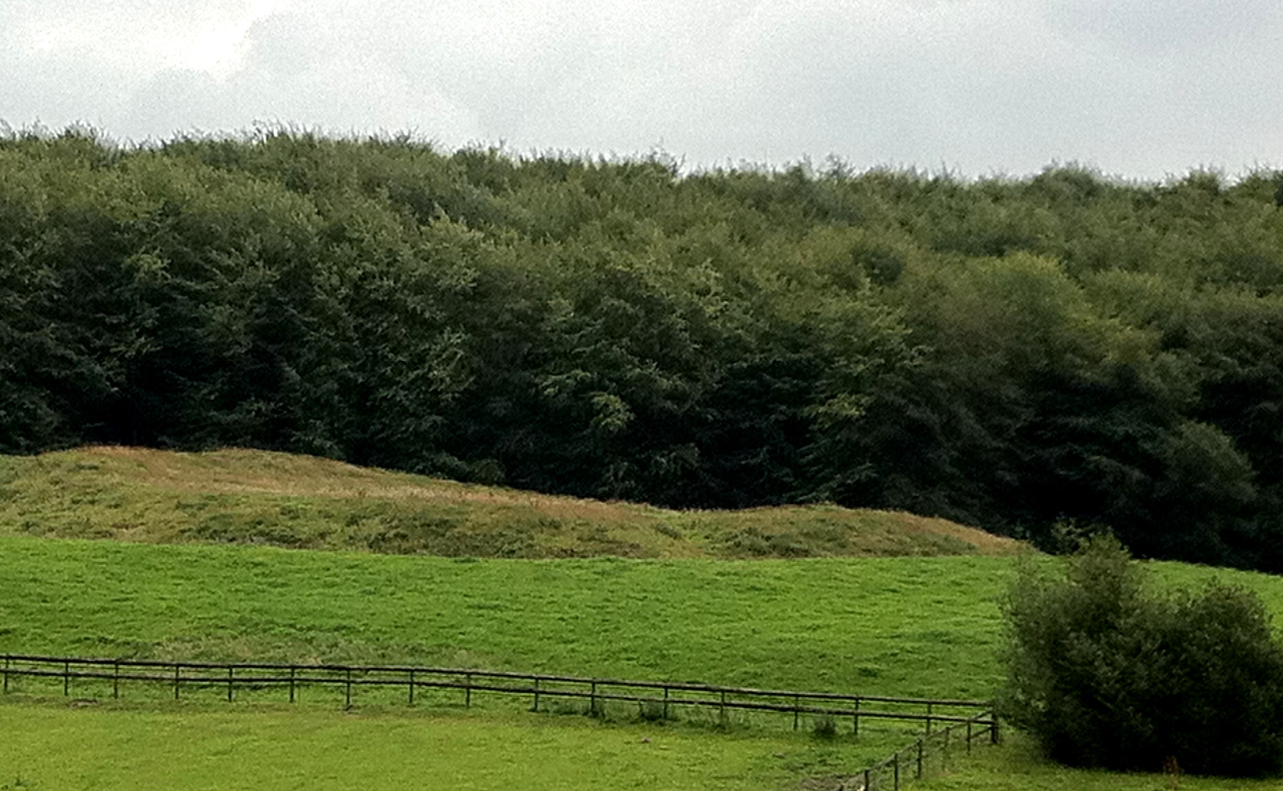
Holly Bushes, Somerset, also known as Wood or Forest, is a picturesque area located in the county of Somerset, England. This beautiful woodland is renowned for its abundant growth of holly bushes, which gives the area its name. The holly bushes thrive in this region due to the favorable climate and fertile soil, creating a dense and vibrant forest.

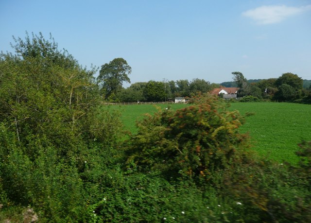
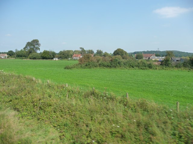
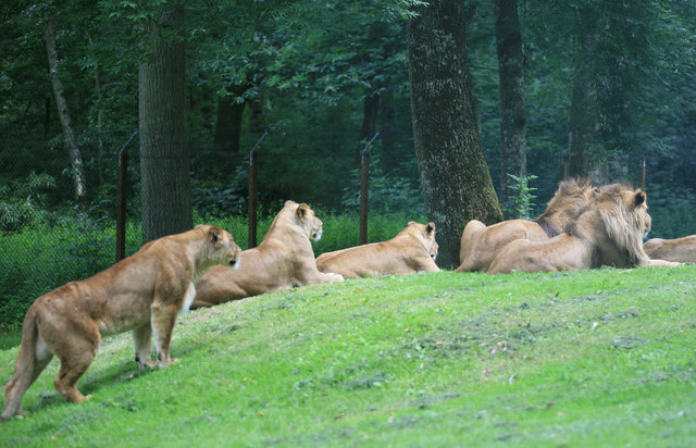
Stretching across several acres, Holly Bushes offers a tranquil and idyllic setting for nature enthusiasts and hikers alike. The forest is home to a diverse range of flora and fauna, providing a haven for various species of birds, mammals, and insects. Visitors can expect to see beautiful wildflowers, towering trees, and moss-covered rocks as they explore this enchanting woodland.

The woodland trails within Holly Bushes are well-maintained, allowing visitors to easily navigate their way through the forest. These paths wind through the dense foliage, offering stunning views of the surrounding landscape. The forest also features a small stream that meanders through the trees, adding to the serene atmosphere.

Holly Bushes, Somerset, is not only a popular destination for nature lovers but also for photographers and artists seeking inspiration from its natural beauty. The changing seasons bring a kaleidoscope of colors to the forest, with vibrant autumn leaves and delicate spring blossoms.

The area surrounding Holly Bushes is dotted with charming villages and is well-connected to nearby towns, making it easily accessible. Whether one seeks solitude in nature or an opportunity to explore the outdoors, Holly Bushes, Somerset, is a must-visit destination for those looking to immerse themselves in the tranquility of the English countryside.

If you have any feedback on the listing, please let us know in the comments section below.

Holly Bushes Images

Images are sourced within 2km of 51.192561/-2.2955393 or Grid Reference ST7943. Thanks to Geograph Open Source API. All images are credited.

Road to the Longleat Safari park
Half Mile Pond on the Longleat estate
Mendip : Bushes & Greenery Lots of greenery and bushes beside the railway here in Mendip.
Mendip : Bushes & Greenery
Lots of greenery and bushes beside the railway here in Mendip.
Mendip : Grassy Field A grassy field and bushes in the Mendips.
Mendip : Grassy Field
A grassy field and bushes in the Mendips.
Maiden Bradley, Forest Road From Horningsham to County Bridge (B3092); Little Bradley Wood to the left, Gully Copse, right.
Maiden Bradley, Forest Road
From Horningsham to County Bridge (B3092); Little Bradley Wood to the left, Gully Copse, right.
Fields by the B3092 The B road runs between hedges across the image, between Frome and Maiden Bradley. Silage bales are on the right. The pasture land rises towards New Church Farm at East Woodlands, in <a href="https://www.geograph.org.uk/gridref/ST7844">ST7844</a>, with Lower Woods clothing the hills west of Longleat. Taken from a train on the main railway line between Westbury and Bruton.
Fields by the B3092
The B road runs between hedges across the image, between Frome and Maiden Bradley. Silage bales are on the right. The pasture land rises towards New Church Farm at East Woodlands, in ST7844, with Lower Woods clothing the hills west of Longleat. Taken from a train on the main railway line between Westbury and Bruton.
West Woodlands: postbox № BA11 12 A Victorian postbox is set into the wall of the cottage on the corner of Bull's Quarries Road with the main B3092. The door is painted a matching red.
West Woodlands: postbox № BA11 12
A Victorian postbox is set into the wall of the cottage on the corner of Bull's Quarries Road with the main B3092. The door is painted a matching red.
Gardens between Orangery and Longleat House
Longleat House and gardens The view of the house from the Orangery , now a tea and coffee shop.
Longleat House and gardens
The view of the house from the Orangery , now a tea and coffee shop.
Waiting for Lunch The Lions have been at Longleat now since the 60s and this is what the majority of people come to see.At least they were not all asleep today.
Waiting for Lunch
The Lions have been at Longleat now since the 60s and this is what the majority of people come to see.At least they were not all asleep today.
Longleat Maze
Longleat Maze
Longleat - Safari Park Lion
Fountain at Longleat House
Lake outfall This artificial outfall keeps the main lake at Longleat at the required level.
Lake outfall
This artificial outfall keeps the main lake at Longleat at the required level.
Longleat House
Longleat House
Longleat House and gardens Longleat House <span class="nowrap"><a title="http://en.wikipedia.org/wiki/Longleat" rel="nofollow ugc noopener" href="http://en.wikipedia.org/wiki/Longleat">Link</a><img style="margin-left:2px;" alt="External link" title="External link - shift click to open in new window" src="https://s1.geograph.org.uk/img/external.png" width="10" height="10"/></span> and the magnificent secret garden as seen from the Orangery.
Longleat House and gardens
Longleat House LinkExternal link and the magnificent secret garden as seen from the Orangery.
Fire hydrant cover, Longleat One of several fire hydrant covers in the grounds of Longleat House marked "Shand Mason and Co. Engineers, London". The following information on the company is taken from <span class="nowrap"><a title="http://www.fire-engine-photos.com/manufacturers.asp?id=110" rel="nofollow ugc noopener" href="http://www.fire-engine-photos.com/manufacturers.asp?id=110">Link</a><img style="margin-left:2px;" alt="External link" title="External link - shift click to open in new window" src="https://s1.geograph.org.uk/img/external.png" width="10" height="10"/></span> "Shand-Mason and Co. of 75 Upper Ground Street, Blackfriars Road, London, SE were a manufacturer of fire pumps and engines. The company was founded by J. Shand and S. Mason in 1774." See also <a title="https://www.geograph.org.uk/search.php?i=43857974" href="https://www.geograph.org.uk/search.php?i=43857974">Link</a> for related images on Geograph.
Fire hydrant cover, Longleat
One of several fire hydrant covers in the grounds of Longleat House marked "Shand Mason and Co. Engineers, London". The following information on the company is taken from LinkExternal link "Shand-Mason and Co. of 75 Upper Ground Street, Blackfriars Road, London, SE were a manufacturer of fire pumps and engines. The company was founded by J. Shand and S. Mason in 1774." See also Link for related images on Geograph.
Bench Mark, Longleat Cut bench mark on the south-eastern tip of Longleat House. Further details on the Bench Mark database at <span class="nowrap"><a title="http://www.bench-marks.org.uk/bm47811" rel="nofollow ugc noopener" href="http://www.bench-marks.org.uk/bm47811">Link</a><img style="margin-left:2px;" alt="External link" title="External link - shift click to open in new window" src="https://s1.geograph.org.uk/img/external.png" width="10" height="10"/></span> .
Bench Mark, Longleat
Cut bench mark on the south-eastern tip of Longleat House. Further details on the Bench Mark database at LinkExternal link .
Show me another place!

Holly Bushes is located at Grid Ref: ST7943 (Lat: 51.192561, Lng: -2.2955393)

Administrative County: Somerset

District: Mendip

Police Authority: Avon and Somerset

What 3 Words

///store.disgraced.ships. Near Frome, Somerset

Related Wikis

Longleat Woods

Longleat Woods (grid reference ST795435) is a 249.9 hectare (617.4 acre) biological Site of Special Scientific Interest south of Frome in Somerset, notified...

Roddenbury Hillfort

Roddenbury Hillfort is a univallate Iron Age hillfort in the parish of Selwood, Somerset, England. It is a Scheduled Monument and it was on the Heritage...

Hales Castle

Hales Castle was a medieval castle that once stood overlooking the town of Frome in the Mendip district of Somerset, England. It has been scheduled as...

Church of St Katherine, East Woodlands

The Anglican Church of St Katherine in East Woodlands, Selwood, Somerset, England was built around 1712. It is a Grade II* listed building. == History... ==

Frome Clay

The Frome Clay is a geological formation in England. It preserves fossils dating back to the Bathonian stage of the Middle Jurassic period. == See also... ==
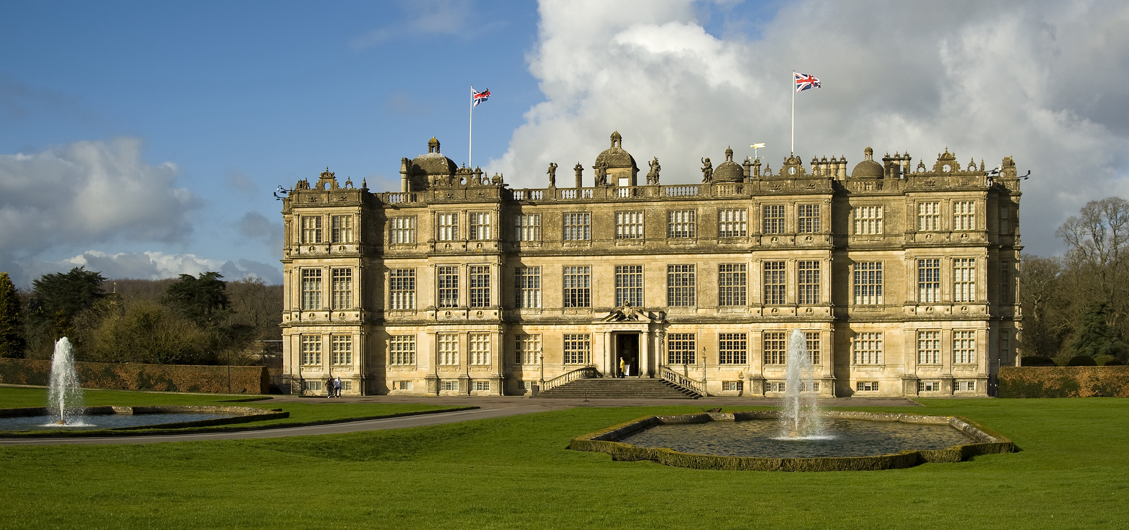
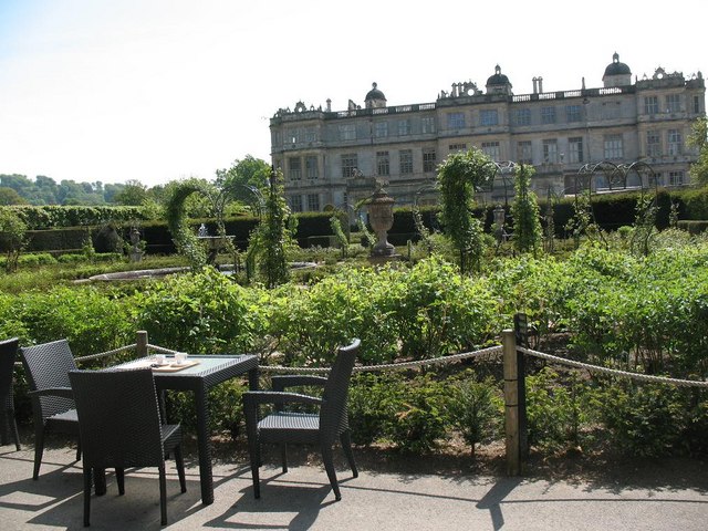
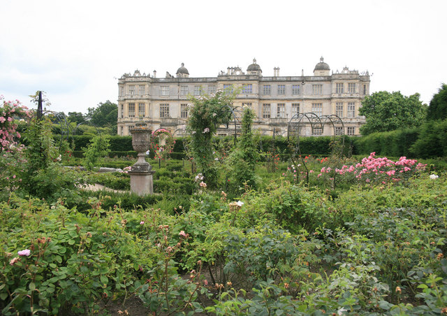
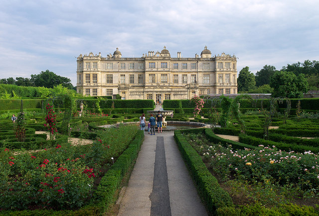
Longleat

Longleat is a stately home about 4 miles (7 km) west of Warminster in Wiltshire, England. A leading and early example of the Elizabethan prodigy house...

Longleat Priory

Longleat Priory was a priory near Warminster, Wiltshire, in the south of England. A short-lived priory was established and dissolved near to Longleat in...

Dunkerton Colliery Halt railway station

Dunkerton Colliery Halt railway station served the colliery near the village of Dunkerton, Somerset, England from 1911 to 1925 on the Bristol and North...

Nearby Amenities

Located within 500m of 51.192561,-2.2955393
The data included in this document is from www.openstreetmap.org. The data is made available under ODbL.

Have you been to Holly Bushes?

Leave your review of Holly Bushes below (or comments, questions and feedback).