Falshaw Wood
Wood, Forest in Yorkshire Ribble Valley
England
Falshaw Wood

Falshaw Wood is a picturesque woodland located in the county of Yorkshire, England. Spread over an area of approximately 50 acres, it is nestled amidst the scenic countryside, offering a tranquil and serene environment for visitors to explore.
The wood is primarily composed of native broadleaf trees, including oak, beech, and birch, which create a diverse and vibrant ecosystem. The dense canopy provides ample shade and shelter for a variety of wildlife, making it a haven for birds, small mammals, and insects.
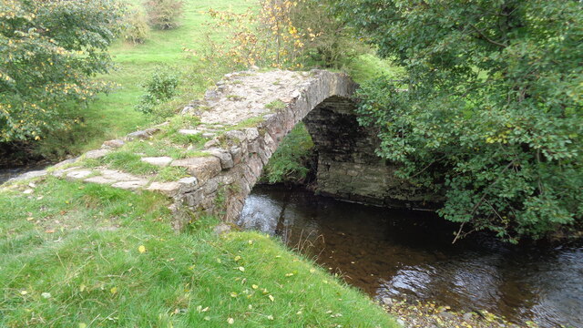
A network of well-maintained footpaths crisscrosses the wood, allowing visitors to easily navigate through its enchanting beauty. As one meanders along the winding trails, they will come across bubbling streams, charming meadows, and enchanting bluebells during the spring season.
Falshaw Wood is not only a place of natural beauty but also holds historical significance. The wood has remnants of ancient earthworks and is believed to have been inhabited by humans for thousands of years. Archaeological finds such as pottery shards and tools have been discovered, offering glimpses into the past.
Nature enthusiasts and outdoor lovers flock to Falshaw Wood to indulge in activities such as walking, birdwatching, and photography. The wood is also a popular spot for educational visits, where school children learn about the importance of conservation and the diverse flora and fauna found within.
Overall, Falshaw Wood is a captivating destination that offers a delightful escape from the hustle and bustle of everyday life, providing a perfect blend of natural beauty and historical significance.
If you have any feedback on the listing, please let us know in the comments section below.
Falshaw Wood Images
Images are sourced within 2km of 53.901921/-2.3184764 or Grid Reference SD7945. Thanks to Geograph Open Source API. All images are credited.
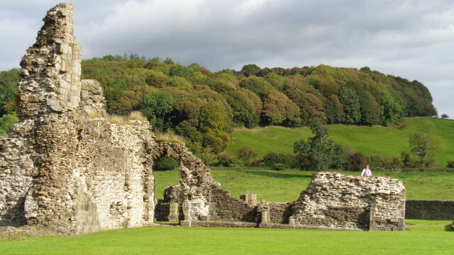
![Sawley village and abbey [4] The ruins of some of the monk's accommodation.
Sawley is a small village on the banks of the River Ribble, some 3½ miles northeast of Clitheroe. The village is dominated by the ruins of the Cistercian abbey founded in 1148. The abbey was dissolved in 1536 and mostly demolished, the stone taken and reused in neighbouring farms and cottages. The ruins are now in the care of English Heritage. The abbey remains are listed, grade I, with details at: <span class="nowrap"><a title="https://historicengland.org.uk/listing/the-list/list-entry/1072099" rel="nofollow ugc noopener" href="https://historicengland.org.uk/listing/the-list/list-entry/1072099">Link</a><img style="margin-left:2px;" alt="External link" title="External link - shift click to open in new window" src="https://s1.geograph.org.uk/img/external.png" width="10" height="10"/></span> The site is a Scheduled Ancient Monument with much detail at: <span class="nowrap"><a title="https://historicengland.org.uk/listing/the-list/list-entry/1015492" rel="nofollow ugc noopener" href="https://historicengland.org.uk/listing/the-list/list-entry/1015492">Link</a><img style="margin-left:2px;" alt="External link" title="External link - shift click to open in new window" src="https://s1.geograph.org.uk/img/external.png" width="10" height="10"/></span>](https://s0.geograph.org.uk/geophotos/07/02/65/7026516_b62c5d29.jpg)
![Sawley village and abbey [5] The remains of part of the floor of the abbey church.
Sawley is a small village on the banks of the River Ribble, some 3½ miles northeast of Clitheroe. The village is dominated by the ruins of the Cistercian abbey founded in 1148. The abbey was dissolved in 1536 and mostly demolished, the stone taken and reused in neighbouring farms and cottages. The ruins are now in the care of English Heritage. The abbey remains are listed, grade I, with details at: <span class="nowrap"><a title="https://historicengland.org.uk/listing/the-list/list-entry/1072099" rel="nofollow ugc noopener" href="https://historicengland.org.uk/listing/the-list/list-entry/1072099">Link</a><img style="margin-left:2px;" alt="External link" title="External link - shift click to open in new window" src="https://s1.geograph.org.uk/img/external.png" width="10" height="10"/></span> The site is a Scheduled Ancient Monument with much detail at: <span class="nowrap"><a title="https://historicengland.org.uk/listing/the-list/list-entry/1015492" rel="nofollow ugc noopener" href="https://historicengland.org.uk/listing/the-list/list-entry/1015492">Link</a><img style="margin-left:2px;" alt="External link" title="External link - shift click to open in new window" src="https://s1.geograph.org.uk/img/external.png" width="10" height="10"/></span>](https://s1.geograph.org.uk/geophotos/07/02/65/7026517_7643acc2.jpg)
![Sawley village and abbey [6] The remains of the abbey church.
Sawley is a small village on the banks of the River Ribble, some 3½ miles northeast of Clitheroe. The village is dominated by the ruins of the Cistercian abbey founded in 1148. The abbey was dissolved in 1536 and mostly demolished, the stone taken and reused in neighbouring farms and cottages. The ruins are now in the care of English Heritage. The abbey remains are listed, grade I, with details at: <span class="nowrap"><a title="https://historicengland.org.uk/listing/the-list/list-entry/1072099" rel="nofollow ugc noopener" href="https://historicengland.org.uk/listing/the-list/list-entry/1072099">Link</a><img style="margin-left:2px;" alt="External link" title="External link - shift click to open in new window" src="https://s1.geograph.org.uk/img/external.png" width="10" height="10"/></span> The site is a Scheduled Ancient Monument with much detail at: <span class="nowrap"><a title="https://historicengland.org.uk/listing/the-list/list-entry/1015492" rel="nofollow ugc noopener" href="https://historicengland.org.uk/listing/the-list/list-entry/1015492">Link</a><img style="margin-left:2px;" alt="External link" title="External link - shift click to open in new window" src="https://s1.geograph.org.uk/img/external.png" width="10" height="10"/></span>](https://s3.geograph.org.uk/geophotos/07/02/65/7026519_f683a7e7.jpg)
![Sawley village and abbey [8] This delightful former school, which closed in 1976, is now the village hall.
Sawley is a small village on the banks of the River Ribble, some 3½ miles northeast of Clitheroe. The village is dominated by the ruins of the Cistercian abbey founded in 1148. The abbey was dissolved in 1536 and mostly demolished, the stone taken and reused in neighbouring farms and cottages. The ruins are now in the care of English Heritage.](https://s3.geograph.org.uk/geophotos/07/02/65/7026539_8fb6ee9f.jpg)

![Sawley village and abbey [9] A row of houses in rubble stone under a stone slate roof.
Sawley is a small village on the banks of the River Ribble, some 3½ miles northeast of Clitheroe. The village is dominated by the ruins of the Cistercian abbey founded in 1148. The abbey was dissolved in 1536 and mostly demolished, the stone taken and reused in neighbouring farms and cottages. The ruins are now in the care of English Heritage.](https://s0.geograph.org.uk/geophotos/07/02/65/7026548_2fc290cc.jpg)


Falshaw Wood is located at Grid Ref: SD7945 (Lat: 53.901921, Lng: -2.3184764)
Division: West Riding
Administrative County: Lancashire
District: Ribble Valley
Police Authority: Lancashire
What 3 Words
///waistcoat.waiters.hello. Near Chatburn, Lancashire
Nearby Locations
Related Wikis
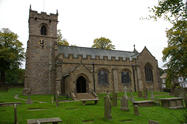
St Leonard's Church, Downham
St Leonard's Church is in the village of Downham, Lancashire, England. It is an active Anglican parish church in the diocese of Blackburn. The tower...
Downham, Lancashire
Downham is a village and civil parish in Lancashire, England. It is in the Ribble Valley district and at the United Kingdom 2001 census had a population...
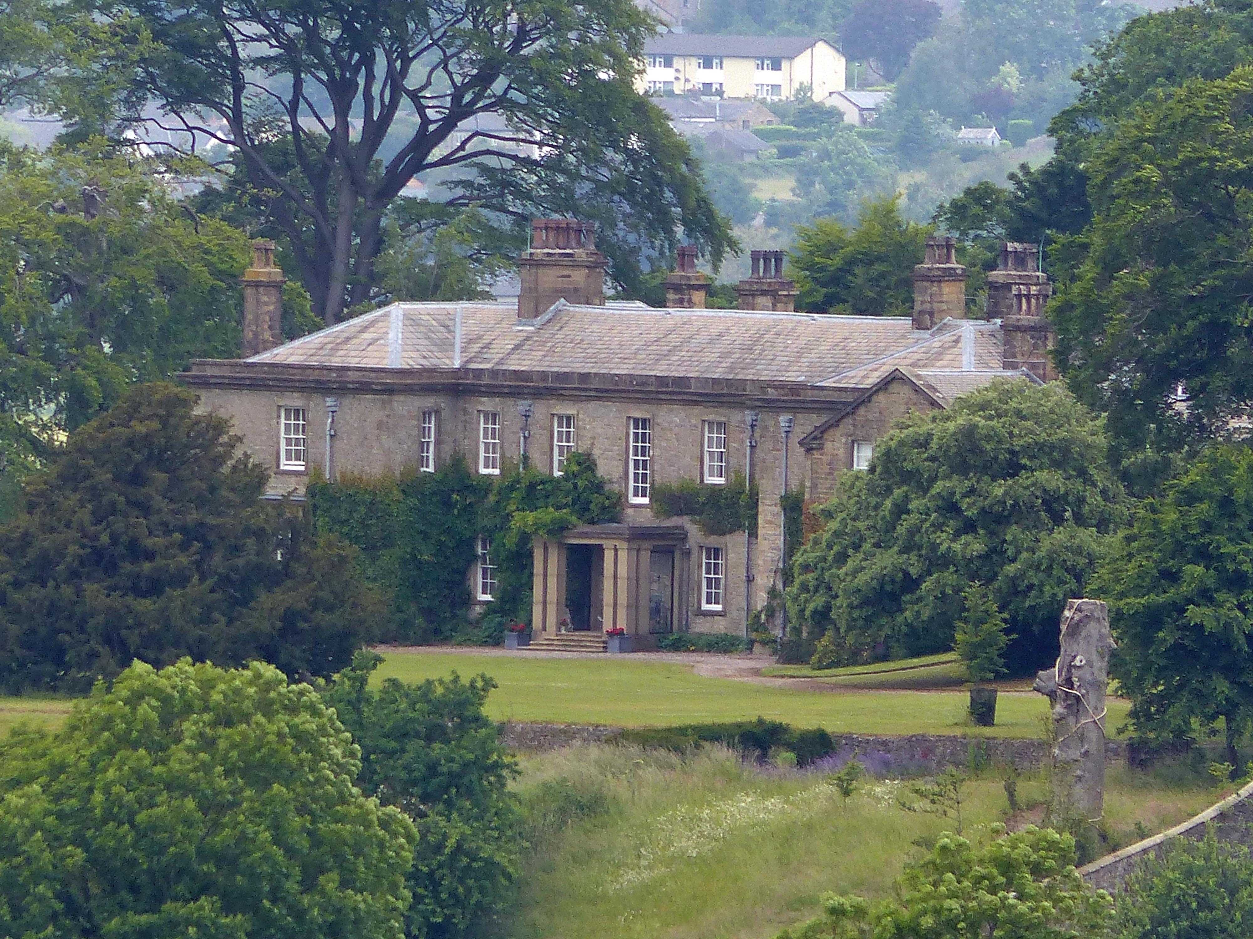
Downham Hall
Downham Hall is an English country house in Downham, Lancashire, England. == Overview == Downham Hall was designed by George Webster (1797–1864) in 1835...

Rimington railway station
Rimington railway station was a railway station that served the small village of Rimington in Lancashire. It was built by the Lancashire and Yorkshire...

Rimington
Rimington is a rural village and civil parish in the Ribble Valley, Lancashire, England. The population of the civil parish was 382 at the 2001 Census...
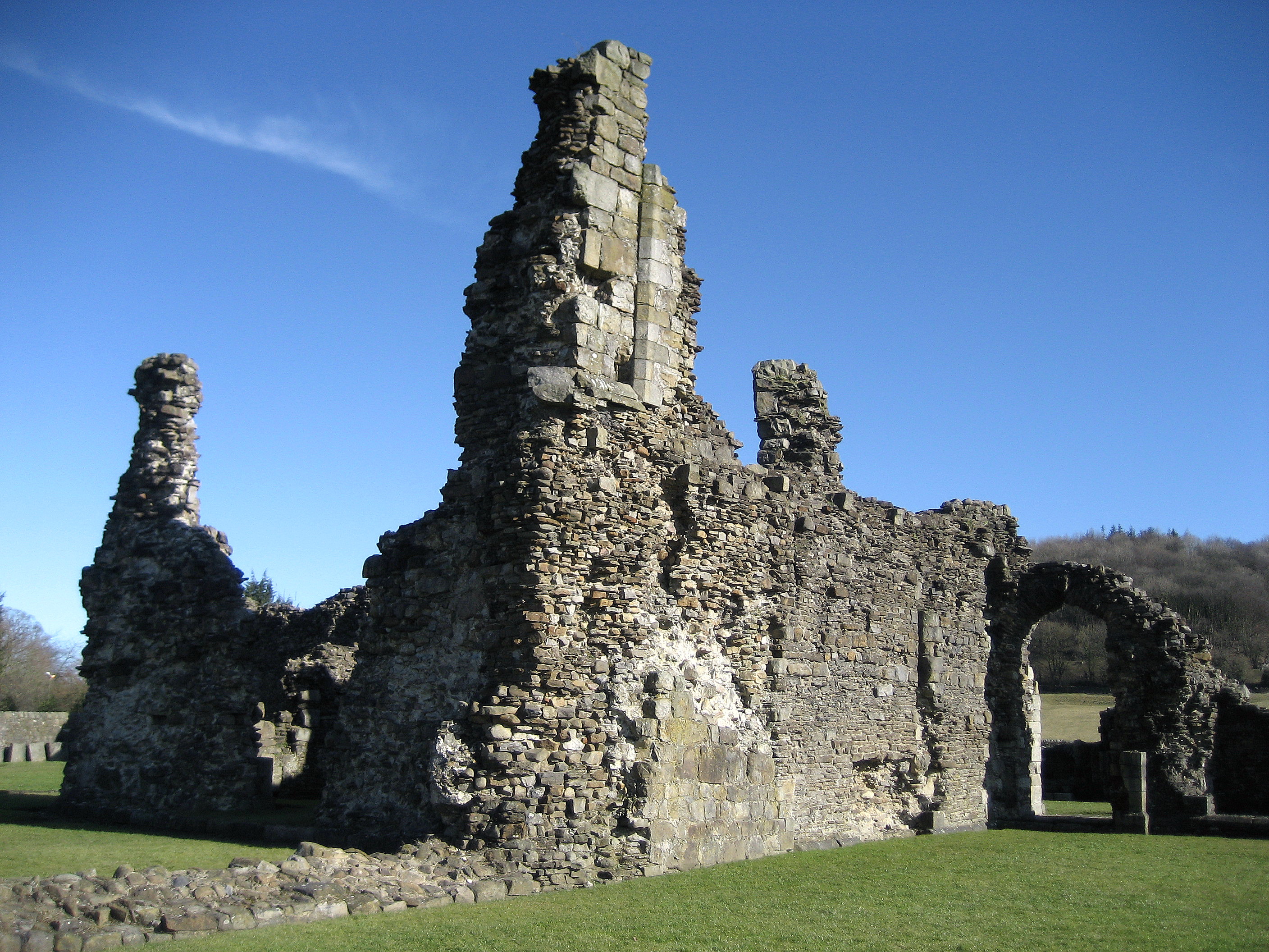
Sawley Abbey
Sawley Abbey was an abbey of Cistercian monks in the village of Sawley, Lancashire, in England (and historically in the West Riding of Yorkshire). Created...

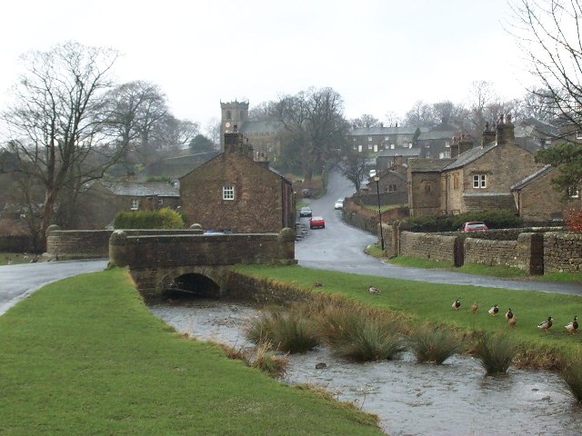
Sawley, Lancashire
Sawley is a village and civil parish in the Borough of Ribble Valley in Lancashire, England. The population of the civil parish was 305 at the 2001 Census...

Christ Church, Chatburn
Christ Church is in the village of Chatburn, Lancashire, England. It is an active Anglican parish church in the deanery of Whalley, the archdeaconry of...
Nearby Amenities
Located within 500m of 53.901921,-2.3184764Have you been to Falshaw Wood?
Leave your review of Falshaw Wood below (or comments, questions and feedback).