Green's Wood
Wood, Forest in Yorkshire Ribble Valley
England
Green's Wood
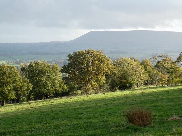
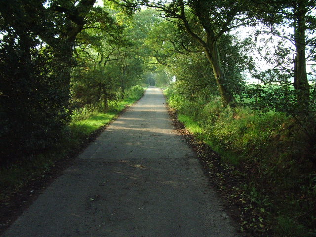
Green's Wood is a picturesque woodland located in the county of Yorkshire, England. Spanning over a vast area, it is considered one of the most enchanting forests in the region. The wood is situated on the outskirts of a small village, surrounded by rolling hills and verdant meadows, creating a tranquil and idyllic setting.
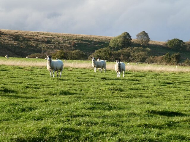
The lush vegetation of Green's Wood is primarily composed of a variety of deciduous and evergreen trees, including oak, birch, beech, and pine. These trees create a dense canopy that filters the sunlight, casting dappled shadows on the forest floor. The woodland is also home to a diverse array of flora and fauna, with wildflowers, ferns, and mosses carpeting the ground, providing a habitat for numerous species of birds, mammals, and insects.
Traversing through Green's Wood, visitors can explore a network of well-maintained walking trails that wind their way through the forest. The paths lead to scenic viewpoints, hidden glades, and bubbling streams, allowing visitors to immerse themselves in the natural beauty of the surroundings. The wood is a popular destination for nature lovers, hikers, and photographers, who come to capture the breathtaking vistas and capture the woodland's serene atmosphere.
Aside from its natural beauty, Green's Wood also holds cultural significance. It has been the inspiration for various works of art, including paintings, poems, and literature, due to its enchanting ambiance and timeless charm. The wood also holds historical importance, with remnants of an ancient settlement dating back centuries, offering a glimpse into the area's past.
Overall, Green's Wood is a captivating woodland, offering a haven of tranquility amidst the bustling modern world. Its diverse flora and fauna, scenic trails, and cultural significance make it a must-visit destination for anyone seeking solace in nature's embrace.
If you have any feedback on the listing, please let us know in the comments section below.
Green's Wood Images
Images are sourced within 2km of 53.966083/-2.3190267 or Grid Reference SD7952. Thanks to Geograph Open Source API. All images are credited.


Green's Wood is located at Grid Ref: SD7952 (Lat: 53.966083, Lng: -2.3190267)
Division: West Riding
Administrative County: Lancashire
District: Ribble Valley
Police Authority: Lancashire
What 3 Words
///widely.crank.simulations. Near Hellifield, North Yorkshire
Nearby Locations
Related Wikis

Manor House, Gisburn Forest
Manor House is an historic building in Gisburn Forest, Lancashire, England. It was built in the early 18th century, but contains a section that is believed...

Bolton-by-Bowland
Bolton-by-Bowland is a village and civil parish in the Ribble Valley district of Lancashire, England. Before 1974, the village was part of Bowland Rural...

St Peter and St Paul's Church, Bolton-by-Bowland
St Peter and St Paul's Church is in Gisburn Road, Bolton-by-Bowland, Lancashire, England. It is an active Anglican parish church in the deanery of Whalley...

Paythorne
Paythorne is a small village and civil parish in Ribble Valley, Lancashire, England. It is situated alongside the River Ribble, north-east of Clitheroe...

Gisburn Forest
Gisburn Forest is a civil parish in the Ribble Valley, in Lancashire, England. Mainly lying within the Forest of Bowland Area of Outstanding Natural Beauty...

Stock Beck
Stock Beck is a minor river in the West Craven area of Pendle, Lancashire (formerly in Yorkshire). It is 8.25 miles (13.27 km) long and has a catchment...

Tosside
Tosside is a small village on the modern border of North Yorkshire and Lancashire in Northern England. It lies within the Forest of Bowland, and is between...

Gisburne Park
Gisburne Park is an 18th-century country house and associated park in Gisburn, Lancashire, England, in the Ribble Valley some 6 miles (10 km) north-east...
Nearby Amenities
Located within 500m of 53.966083,-2.3190267Have you been to Green's Wood?
Leave your review of Green's Wood below (or comments, questions and feedback).