Edwin's Fell

Wood, Forest in Yorkshire South Lakeland

England

Edwin's Fell

View along Grisedale from moorland above Riggs
View along Grisedale from moorland above Riggs Credit: Luke Shaw

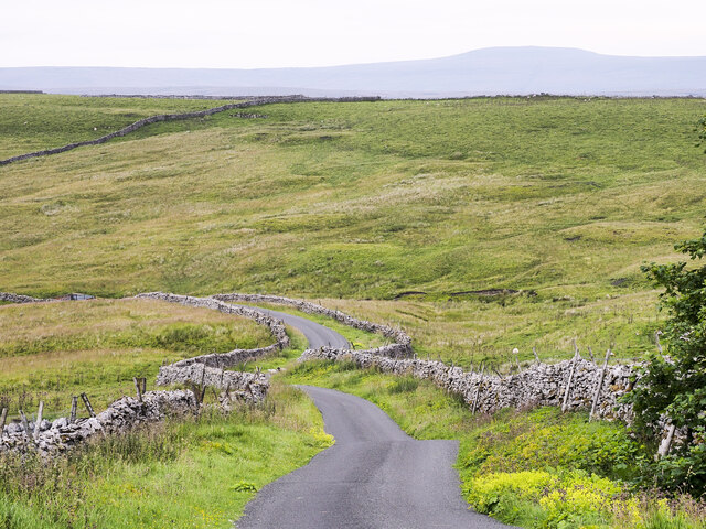
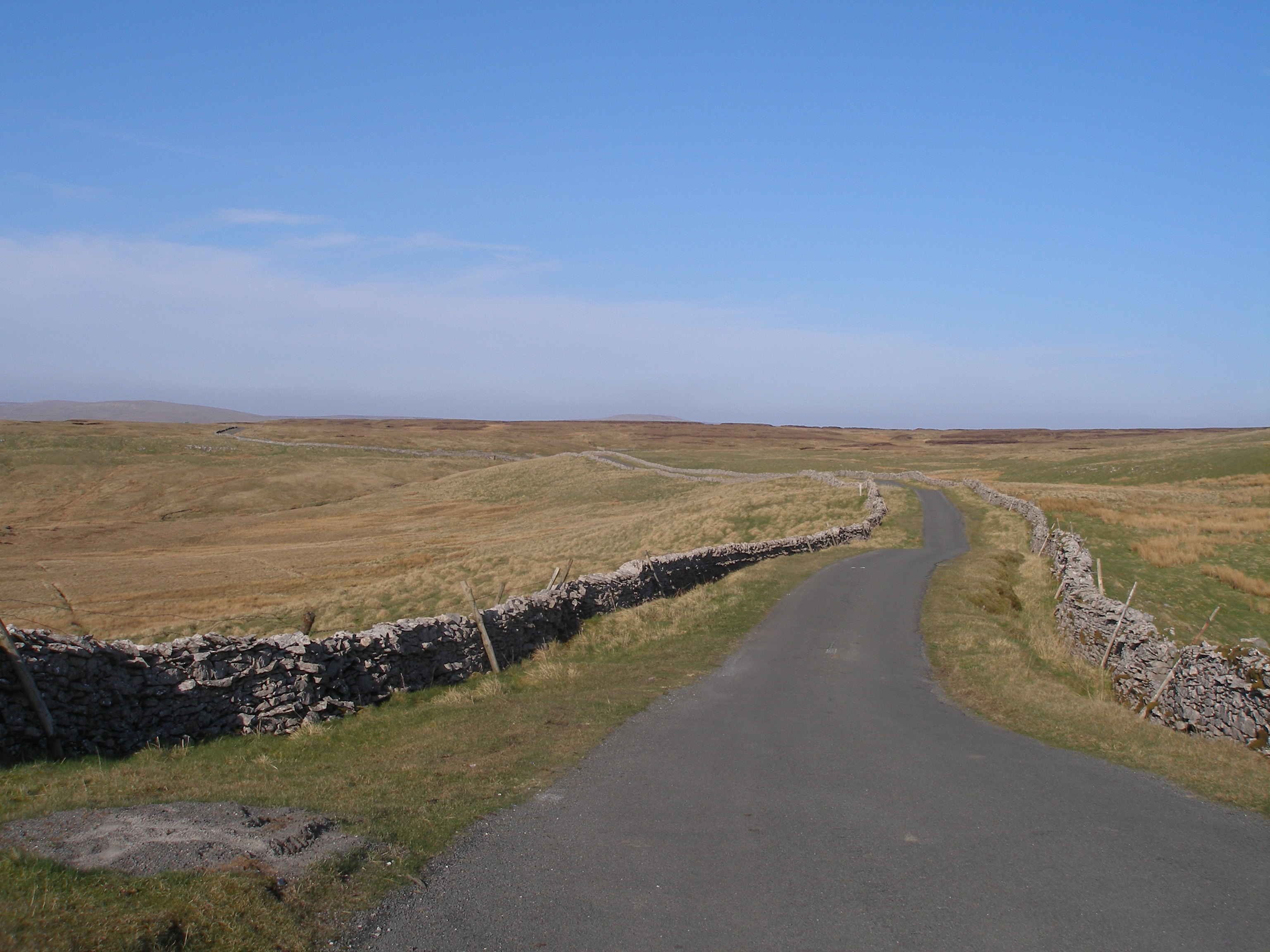
Edwin's Fell is a picturesque woodland area located in the heart of Yorkshire, England. Stretching across several hundred acres, this forested landscape offers a tranquil retreat for nature enthusiasts and outdoor adventurers alike.

The wood is named after Edwin, a prominent figure in the region's history, who was believed to have once owned the land. The fell, a term commonly used in northern England to describe a hill or mountain, aptly describes the undulating terrain of this woodland area.

Dominated by a diverse range of tree species, including oak, beech, and birch, Edwin's Fell boasts a vibrant and ever-changing color palette throughout the seasons. In spring, the forest floor is adorned with a carpet of bluebells and wildflowers, while autumn transforms the foliage into a breathtaking display of reds, oranges, and golds.

The woodland is crisscrossed by a network of well-maintained walking trails, offering visitors the opportunity to explore the forest at their own pace. These paths lead to various points of interest, such as secluded clearings, babbling brooks, and panoramic viewpoints, where one can admire the surrounding countryside.

The forest is also home to a variety of wildlife, including deer, foxes, and a multitude of bird species. Birdwatchers will be delighted by the chance to spot woodpeckers, owls, and other feathered inhabitants that call Edwin's Fell their home.

Whether it's a leisurely stroll through the woods, a picnic amidst the trees, or simply a moment of solitude and reflection, Edwin's Fell offers a serene escape from the hustle and bustle of everyday life. Its natural beauty and tranquil atmosphere make it a beloved destination for both locals and visitors seeking a connection with the great outdoors.

If you have any feedback on the listing, please let us know in the comments section below.

Edwin's Fell Images

Images are sourced within 2km of 54.319067/-2.325643 or Grid Reference SD7891. Thanks to Geograph Open Source API. All images are credited.

View along Grisedale from moorland above Riggs
Animal trap on log on top of dry stone wall at White Mea Apparently weasels have to be killed so that they do not predate grouse which have to be protected to be shot for sport.
Animal trap on log on top of dry stone wall at White Mea
Apparently weasels have to be killed so that they do not predate grouse which have to be protected to be shot for sport.
Descending from West Baugh Fell heading for Garsdale Head
The Staycation Express at Garsdale A Locomotive Services Limited service on the Settle-Carlisle Railway.
The Staycation Express at Garsdale
A Locomotive Services Limited service on the Settle-Carlisle Railway.
The 12.08 to Leeds at Garsdale Train 158901. Headcode 2H89. The 1058 Carlisle to Leeds service arrives at Garsdale.
The 12.08 to Leeds at Garsdale
Train 158901. Headcode 2H89. The 1058 Carlisle to Leeds service arrives at Garsdale.
Railhead Treatment Train in action south through Garsdale Station Two FEA wagons with RHTT modules between two Class 68 locomotives, 68005 at the head
Railhead Treatment Train in action south through Garsdale Station
Two FEA wagons with RHTT modules between two Class 68 locomotives, 68005 at the head
Class 66/7 diesel locomotive heads train through Garsdale Station Taking stone from Arcow Quarry to Mossend
Class 66/7 diesel locomotive heads train through Garsdale Station
Taking stone from Arcow Quarry to Mossend
Staycation Express southbound through Garsdale Station passing the refurbished signal box The charter train uses HST power cars (43058 and 43059) previously in service with East Midlands Trains and coaches from Great Western Railway.
Staycation Express southbound through Garsdale Station passing the refurbished signal box
The charter train uses HST power cars (43058 and 43059) previously in service with East Midlands Trains and coaches from Great Western Railway.
Sunset at Garsdale Head viewed from Railway Cottages
Hard Ing Barn
Hard Ing Barn
Low Scale
Low Scale
Dandrymire Viaduct
Dandrymire Viaduct
School House at Beck Rigg
Minor road descending towards Garsdale The winding, undulating road crosses high moorland north-west of Widdale Fell. As it rises from Garsdale it also acts for over four kilometres as the route of the long distance trail, 'Pennine Bridleway'.
Minor road descending towards Garsdale
The winding, undulating road crosses high moorland north-west of Widdale Fell. As it rises from Garsdale it also acts for over four kilometres as the route of the long distance trail, 'Pennine Bridleway'.
Barn at Low House viewed across the Clough
Royal Scotsman clagging through Garsdale Station Passing the station flower bed which has the statue to Ruswarp
Royal Scotsman clagging through Garsdale Station
Passing the station flower bed which has the statue to Ruswarp
Swimming in the pool below Clough Force
Benchmark at base of wall (at wall junction) on east side of Coal Road Ordnance Survey pivot benchmark shown as levelled at 1058.3 feet above Liverpool Datum on 1888-1913 6" Map
Benchmark at base of wall (at wall junction) on east side of Coal Road
Ordnance Survey pivot benchmark shown as levelled at 1058.3 feet above Liverpool Datum on 1888-1913 6" Map
Show me another place!

Edwin's Fell is located at Grid Ref: SD7891 (Lat: 54.319067, Lng: -2.325643)

Division: West Riding

Administrative County: Cumbria

District: South Lakeland

Police Authority: Cumbria

What 3 Words

///sprinkler.following.train. Near Sedbergh, Cumbria

Nearby Locations

Garsdale Head Edwin's Fell

Related Wikis

Garsdale railway station

Garsdale is a railway station in Cumbria, England (historically in the West Riding of Yorkshire), on the Settle and Carlisle Line, which runs between Carlisle...

Garsdale Head

Garsdale Head is a hamlet mainly within the South Lakeland district of Cumbria, England. Historically part of the West Riding of Yorkshire, the hamlet...
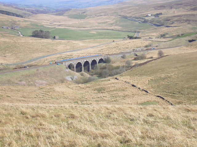
Dandry Mire Viaduct

Dandry Mire Viaduct, (or Dandrymire Viaduct), is a railway viaduct on the Settle & Carlisle line in Cumbria, England. It is just north of Garsdale station...
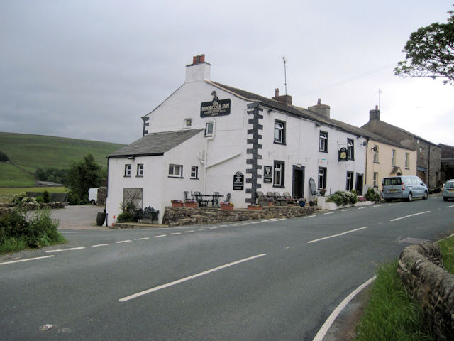
Moorcock Inn

The Moorcock Inn is a public house at the watershed of the Eden, Clough and Ure rivers, in Upper Wensleydale, North Yorkshire, England. It is adjacent...

Grisedale

Grisedale (sometimes Grisdale, or Grizedale [archaic]) is a south east facing Dale in Cumbria, England, 8 miles (13 km) east of Sedbergh, and 7 miles...

Hawes Junction rail crash

The Hawes Junction rail crash occurred at 5.49 am on 24 December 1910, just north of Lunds Viaduct between Hawes Junction (now known as Garsdale station...

Coal Road

The Coal Road (also known as the Galloway Gate Road) is an unclassified highway which connects the railway stations at Garsdale and Dent in Cumbria, England...

Lunds, North Yorkshire

Lunds is a hamlet in North Yorkshire, England, near to the watershed of the Eden and Ure rivers. It is on the border between Cumbria and North Yorkshire...

Related Videos

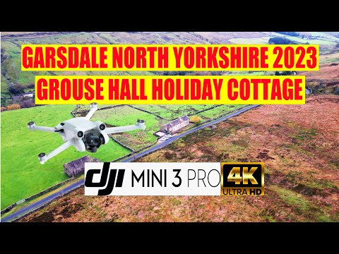
Grouse Hall remote holiday home Garsdale Head by DJI Mini 3 Pro 2023

Grouse Hall Yorkshire Dales Old Road Garsdale, Sedbergh. Wow! Such a lovely cottage in the Yorkshire National Park.

Just Missed this Tunnel Collapse! Hawes Abandoned Railway Line

This junction known as Hawes Jn still features a live railway viaduct called Morecock. Along the way a disused Hawes Branch line ...

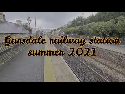
Garsdale Railway Station Explore.

I hope you will like the explore of Garsdale railway Station that I filmed in of summer 2021. Thanks to all my supporter's ...

Walked up Red Grouse shooting

Walked up red grouse shooting at HKG training.

Nearby Amenities

Located within 500m of 54.319067,-2.325643
Garsdale
Image: https://www.geograph.org.uk/photo/6076039
Naptan AtcoCode: 9100GARSDLE
Network: National Rail
Network Website: https://www.nationalrail.co.uk/stations/gsd/
Network Wikidata: Q26334
Operator: Northern Rail
Operator Website: https://www.northernrailway.co.uk/stations/garsdale
Operator Wikidata: Q85789775
Public Transport: station
Railway: station
Ref Crs: GSD
Source: NPE
Wikidata: Q2145153
Wikipedia: en:Garsdale railway station
Lat/Long: 54.3214617/-2.3263682
Bus Stop
Garsdale Station Road End
Local Ref: AT
Naptan AtcoCode: 090079241599
Naptan Bearing: N
Naptan CommonName: Station Road End
Naptan Indicator: at
Naptan Landmark: Garsdale Station Road End
Naptan NaptanCode: cumdjada
Naptan Street: No name
Naptan Verified: no
Public Transport: platform
Source: naptan_import
Lat/Long: 54.3211261/-2.3285279
Source: Bing
Lat/Long: 54.3215076/-2.3284067
Telephone
Booth: K6
Covered: booth
Source: survey
Lat/Long: 54.3226066/-2.3292686
Post Box
Post Box Type: lamp
Ref: LA10 55
Source: survey
Lat/Long: 54.3226586/-2.3293182
Barrier: entrance
Lat/Long: 54.3192237/-2.3316596
Garsdale
Public Transport: stop_position
Railway: stop
Train: yes
Lat/Long: 54.3214501/-2.3263553
Railway: switch
Lat/Long: 54.3223979/-2.3241779
Garsdale
Public Transport: stop_position
Railway: stop
Train: yes
Lat/Long: 54.3214736/-2.3263868
Ruswarp
Artist Name: JOEL Walker
Artwork Type: statue
Source: survey
Tourism: artwork
Wikimedia Commons: File:Ruswarp - geograph.org.uk - 1259798.jpg
Lat/Long: 54.3215196/-2.3260607
Bench
Backrest: yes
Material: wood
Source: survey
Lat/Long: 54.3212257/-2.3267562
Bench
Backrest: yes
Material: wood
Source: survey
Lat/Long: 54.3212966/-2.3265938
Bench
Source: survey
Source Position: gps
Lat/Long: 54.3213468/-2.3267787
Bench
Backrest: yes
Material: wood
Source: survey
Source Position: gps
Lat/Long: 54.3214118/-2.3266316
Bench
Backrest: yes
Material: wood
Source: survey
Source Position: gps
Lat/Long: 54.3215897/-2.3263061
Bench
Backrest: yes
Material: wood
Source: survey
Source Position: gps
Lat/Long: 54.3217234/-2.3259426
Railway: switch
Lat/Long: 54.3227461/-2.3233214
Railway: switch
Lat/Long: 54.3227918/-2.3232097
Male / Female
Entrance: main
Female: yes
Male: yes
Lat/Long: 54.3216211/-2.3258345
Baby change
Entrance: yes
Lat/Long: 54.3215605/-2.3259242
Edwins Fell
Place: locality
Lat/Long: 54.3178902/-2.3254819
Hawes Junction
Railway: junction
Lat/Long: 54.3225362/-2.3238628
Baugh Fell View
Tourism: chalet
Website: https://www.baughfellview.co.uk/
Lat/Long: 54.3225776/-2.3294301
Power: pole
Lat/Long: 54.3216274/-2.327386
Power: pole
Lat/Long: 54.3223944/-2.3271656
Power: pole
Lat/Long: 54.3231475/-2.3269309
The data included in this document is from www.openstreetmap.org. The data is made available under ODbL.

Have you been to Edwin's Fell?

Leave your review of Edwin's Fell below (or comments, questions and feedback).