Bewdley Wood

Wood, Forest in Worcestershire Wyre Forest

England

Bewdley Wood

Bewdley, including Severn Valley Guest House Part of the town of Bewdley taken from 'Bewdley North' railway viaduct looking towards the river. In view is the Severn Valley Guest House and part of the 'Red Lion'
Bewdley, including Severn Valley Guest House Credit: Rob Newman

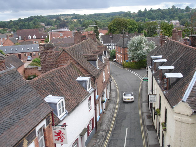
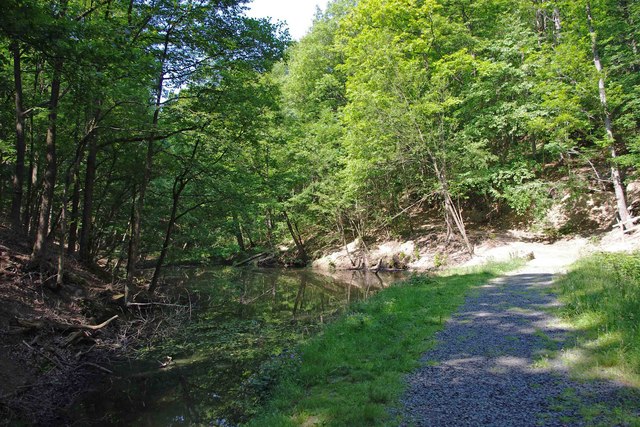
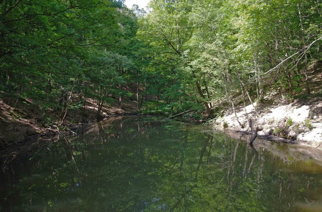
Bewdley Wood is a picturesque woodland located in Worcestershire, England. Covering an area of approximately 200 hectares, it is nestled on the western bank of the River Severn, just south of the town of Bewdley. As one of the largest ancient woodlands in the county, Bewdley Wood boasts a rich history and is renowned for its natural beauty.

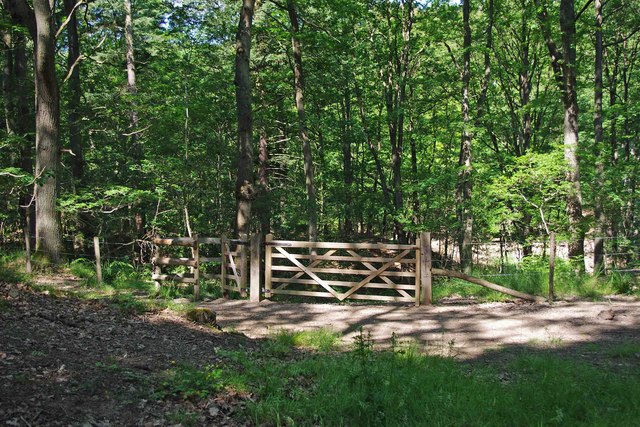
The woodland is predominantly made up of mixed deciduous trees, including oak, ash, beech, and birch. These trees provide a diverse habitat for a wide range of wildlife, making Bewdley Wood a haven for nature enthusiasts. Visitors can spot various bird species, such as woodpeckers, nuthatches, and tawny owls, as well as mammals like deer, foxes, and badgers.

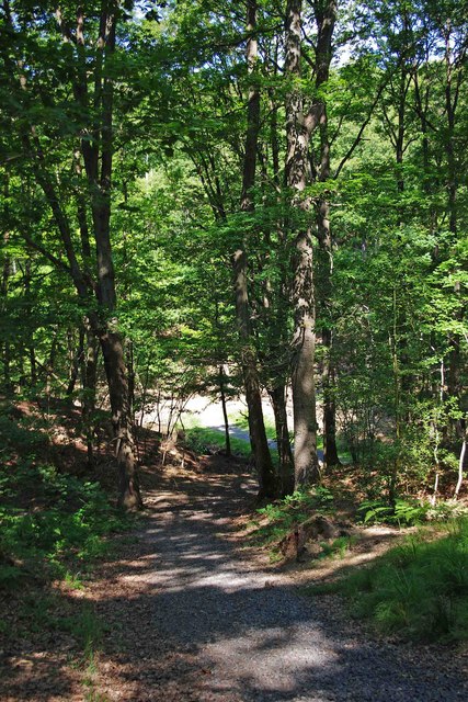
The wood is crisscrossed by a network of footpaths and trails, allowing visitors to explore its serene surroundings. The paths meander through the ancient woodland, providing breathtaking views of the River Severn and the surrounding countryside. During spring, the forest floor is carpeted with bluebells, creating a stunning display of vibrant colors.

Managed by the Forestry Commission, Bewdley Wood offers recreational activities for all ages. Families can enjoy picnics in designated areas, while adventurous individuals can try their hand at orienteering or geocaching. The woodland also serves as an educational resource, with informative signage providing insights into the flora and fauna found within the wood.

Bewdley Wood is a tranquil retreat for both locals and tourists alike, offering a peaceful escape from the hustle and bustle of everyday life. With its natural beauty, diverse wildlife, and recreational opportunities, it is a true gem nestled within the heart of Worcestershire.

If you have any feedback on the listing, please let us know in the comments section below.

Bewdley Wood Images

Images are sourced within 2km of 52.388708/-2.3146512 or Grid Reference SO7876. Thanks to Geograph Open Source API. All images are credited.
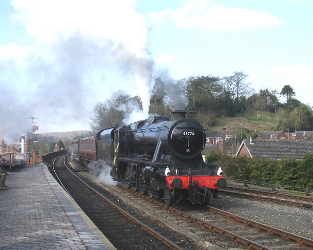
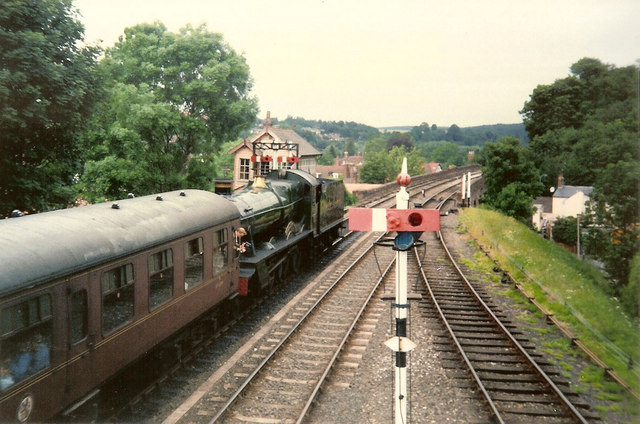
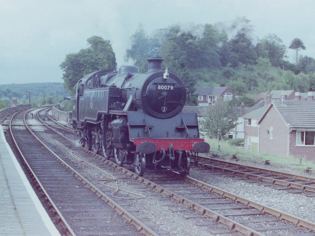
Bewdley, including Severn Valley Guest House Part of the town of Bewdley taken from 'Bewdley North' railway viaduct looking towards the river. In view is the Severn Valley Guest House and part of the 'Red Lion'
Bewdley, including Severn Valley Guest House
Part of the town of Bewdley taken from 'Bewdley North' railway viaduct looking towards the river. In view is the Severn Valley Guest House and part of the 'Red Lion'
48773 entering Bewdley Station, SVR Stanier 8F 2-8-0 No 48773, owned by the Stanier 8F Locomotive Society who bought the locomotive from British Railways in 1968, enters Bewdley Station with a Severn Valley Railway train from Bridgnorth to Kidderminster Town. The train is crossing Bewdley North Viaduct on its way into the station.
48773 entering Bewdley Station, SVR
Stanier 8F 2-8-0 No 48773, owned by the Stanier 8F Locomotive Society who bought the locomotive from British Railways in 1968, enters Bewdley Station with a Severn Valley Railway train from Bridgnorth to Kidderminster Town. The train is crossing Bewdley North Viaduct on its way into the station.
Rock Siding, Bewdley Station A diesel multiple unit occupies the track known as 'Rock Siding' at Bewdley Station, Severn Valley Railway
Rock Siding, Bewdley Station
A diesel multiple unit occupies the track known as 'Rock Siding' at Bewdley Station, Severn Valley Railway
Bewdley Bridge in 1987 The bridge carries the B4195 road over the River Severn. The large red brick house over the bridge on the left hand side stands in Severn Street South. The church tower is that of St Anne's.
Bewdley Bridge in 1987
The bridge carries the B4195 road over the River Severn. The large red brick house over the bridge on the left hand side stands in Severn Street South. The church tower is that of St Anne's.
Rock Outcrop, Bewdley This outcrop of sandstone rock forms the northern boundary of Bewdley station
Rock Outcrop, Bewdley
This outcrop of sandstone rock forms the northern boundary of Bewdley station
Trains Pass at Bewdley BR Standard Pacific No 71000 "Duke of Gloucester" [left] and 'Manor' class 4-6-0 No 7812 "Erlestoke Manor" pass at Bewdley station.
Trains Pass at Bewdley
BR Standard Pacific No 71000 "Duke of Gloucester" [left] and 'Manor' class 4-6-0 No 7812 "Erlestoke Manor" pass at Bewdley station.
Bewdley station on the Severn Valley Railway
2 new houses, Bewdley
Riverside Caravan Park, Bewdley
Car park off Dry Mill Lane This is a new car park for people walking in the Wyre Forest and is the recommended car park for visitors to Knowles Mill. A fellow collaborator has kindly confirmed my position and view direction.
Car park off Dry Mill Lane
This is a new car park for people walking in the Wyre Forest and is the recommended car park for visitors to Knowles Mill. A fellow collaborator has kindly confirmed my position and view direction.
Standard Tank at Bewdley, 1981 Standard 2-6-4T locomotive No 80079 at Bewdley Station, Severn Valley Railway
Standard Tank at Bewdley, 1981
Standard 2-6-4T locomotive No 80079 at Bewdley Station, Severn Valley Railway
Lane near railway viaduct, Bewdley The railway viaduct carries the Severn Valley Railway on its way to Bewdley Station, and to Kidderminster in the other direction. The public footpath along this lane passes under the viaduct, and continues mainly through the countryside, until it comes out on Kidderminster Road (the B4190), in the area of Bewdley usually known as Catchems End.

<a href="https://www.geograph.org.uk/photo/2465716">SO7974 : Lane off Stourport Road, Bewdley</a>.
<a href="https://www.geograph.org.uk/photo/2482730">SO7975 : View from the end of the lane off Stourport Road, Bewdley</a>.
Lane near railway viaduct, Bewdley
The railway viaduct carries the Severn Valley Railway on its way to Bewdley Station, and to Kidderminster in the other direction. The public footpath along this lane passes under the viaduct, and continues mainly through the countryside, until it comes out on Kidderminster Road (the B4190), in the area of Bewdley usually known as Catchems End. SO7974 : Lane off Stourport Road, Bewdley. SO7975 : View from the end of the lane off Stourport Road, Bewdley.
Arches of the railway viaduct near Bewdley Photographed from the end of the lane off Stourport Road. See:- <a href="https://www.geograph.org.uk/photo/2482683">SO7975 : Lane near railway viaduct, Bewdley</a>.
Arches of the railway viaduct near Bewdley
Photographed from the end of the lane off Stourport Road. See:- SO7975 : Lane near railway viaduct, Bewdley.
View from the end of the lane off Stourport Road, Bewdley Photographed from near the railway viaduct, looking in the direction of Stourport Road, which is not visible from this point.

<a href="https://www.geograph.org.uk/photo/2482683">SO7975 : Lane near railway viaduct, Bewdley</a>.
View from the end of the lane off Stourport Road, Bewdley
Photographed from near the railway viaduct, looking in the direction of Stourport Road, which is not visible from this point. SO7975 : Lane near railway viaduct, Bewdley.
Gated entrance to track in Wyre Forest near Bewdley There is both a kissing gate here, and a gate wide enough to let a vehicle pass through. On the other side is a track, with a rough stone surface, which makes a steep descent down to a pond and a steam.

<a href="https://www.geograph.org.uk/photo/2487006">SO7676 : Track to pond in Wyre Forest, near Bewdley</a>.
<a href="https://www.geograph.org.uk/photo/2487032">SO7676 : Pond and track in the Wyre Forest near Bewdley</a>.
Gated entrance to track in Wyre Forest near Bewdley
There is both a kissing gate here, and a gate wide enough to let a vehicle pass through. On the other side is a track, with a rough stone surface, which makes a steep descent down to a pond and a steam. SO7676 : Track to pond in Wyre Forest, near Bewdley. SO7676 : Pond and track in the Wyre Forest near Bewdley.
Track to pond in Wyre Forest, near Bewdley The pond is at the bottom of the track, but not visible in this photograph.

<a href="https://www.geograph.org.uk/photo/2486986">SO7676 : Gated entrance to track in Wyre Forest near Bewdley</a>.
<a href="https://www.geograph.org.uk/photo/2487032">SO7676 : Pond and track in the Wyre Forest near Bewdley</a>.
Track to pond in Wyre Forest, near Bewdley
The pond is at the bottom of the track, but not visible in this photograph. SO7676 : Gated entrance to track in Wyre Forest near Bewdley. SO7676 : Pond and track in the Wyre Forest near Bewdley.
Pond and track in the Wyre Forest near Bewdley The pond is on the left but difficult to see, as its surface is reflecting the trees which hang overhead. It is one of several which are linked by a small stream, and appears to be either artificial or enlarged from the original.

<a href="https://www.geograph.org.uk/photo/2486986">SO7676 : Gated entrance to track in Wyre Forest near Bewdley</a>.
<a href="https://www.geograph.org.uk/photo/2487006">SO7676 : Track to pond in Wyre Forest, near Bewdley</a>.
<a href="https://www.geograph.org.uk/photo/2487054">SO7676 : Pond in Wyre Forest near Bewdley</a>.
Pond and track in the Wyre Forest near Bewdley
The pond is on the left but difficult to see, as its surface is reflecting the trees which hang overhead. It is one of several which are linked by a small stream, and appears to be either artificial or enlarged from the original. SO7676 : Gated entrance to track in Wyre Forest near Bewdley. SO7676 : Track to pond in Wyre Forest, near Bewdley. SO7676 : Pond in Wyre Forest near Bewdley.
Pond in Wyre Forest near Bewdley The pond may be artificial or artificially enlarged. It lies on a stream which runs through the forest.

<a href="https://www.geograph.org.uk/photo/2487032">SO7676 : Pond and track in the Wyre Forest near Bewdley</a>.
Pond in Wyre Forest near Bewdley
The pond may be artificial or artificially enlarged. It lies on a stream which runs through the forest. SO7676 : Pond and track in the Wyre Forest near Bewdley.
Show me another place!

Bewdley Wood is located at Grid Ref: SO7876 (Lat: 52.388708, Lng: -2.3146512)

Administrative County: Worcestershire

District: Wyre Forest

Police Authority: West Mercia

What 3 Words

///amuses.unspoiled.secures. Near Bewdley, Worcestershire

Nearby Locations

Bewdley Wood

Related Wikis

Dowles Brook

Dowles Brook flows through the heart of the Wyre Forest, into the former civil parish of Dowles and into the River Severn. == History == In 1902, ornithologist...

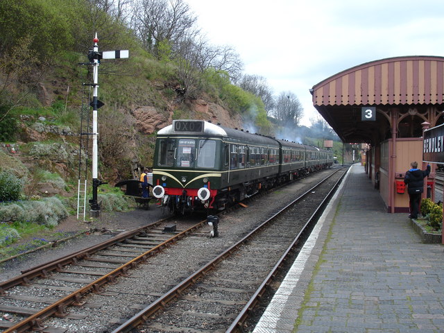
Northwood Halt railway station

Northwood Halt is an unstaffed request stop on the Severn Valley Railway in Worcestershire, situated a little to the north of Bewdley on the outskirts...

Dowles

Dowles is a hamlet in the civil parish of Upper Arley, in the Wyre Forest district, in the county of Worcestershire, England. It is about 3 miles from...

Bewdley Rowing Club

Bewdley Rowing Club is a rowing club on the River Severn, based at Riverside North, Wribbenhall, Bewdley, Wyre Forest District, West Midlands. == Club... ==
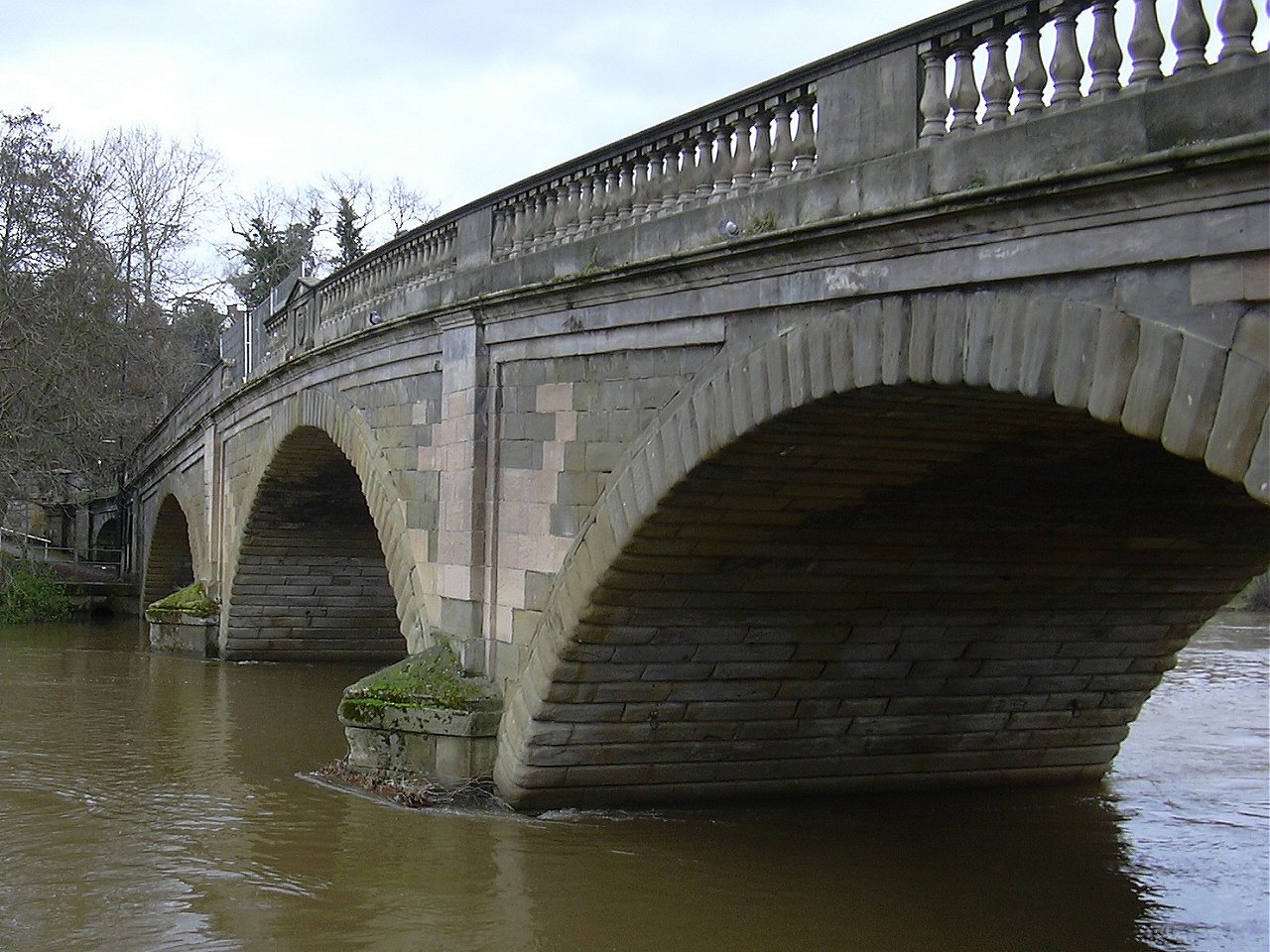
Bewdley Bridge

Bewdley Bridge is a three-span masonry arch bridge over the River Severn at Bewdley, Worcestershire, designed by civil engineer Thomas Telford. The two...

Bewdley

Bewdley ( pronunciation) is a town and civil parish in the Wyre Forest District in Worcestershire, England on the banks of the River Severn. It is in the...

Bewdley Museum

Bewdley Museum is a museum in the town of Bewdley in Worcestershire, England. It is managed by the Wyre Forest District Council. == History == The Bewdley...

Bewdley Guildhall

Bewdley Guildhall is a municipal building in Load Street in Bewdley, Worcestershire, England. The structure, which is the meeting place of Bewdley Town...

Nearby Amenities

Located within 500m of 52.388708,-2.3146512
H3G Cellsite Grey Green Farm
Power: pole
Transformer: distribution
Voltage Primary: 11000
Lat/Long: 52.3843607/-2.3149799
Power: pole
Lat/Long: 52.3844255/-2.3136109
Power: pole
Lat/Long: 52.3844637/-2.3126732
Power: tower
Lat/Long: 52.3866603/-2.3082583
Power: tower
Lat/Long: 52.3882588/-2.3086411
Power: tower
Lat/Long: 52.3901162/-2.309033
Power: tower
Lat/Long: 52.3917456/-2.3094065
Power: pole
Lat/Long: 52.3866827/-2.309204
Power: pole
Lat/Long: 52.3876516/-2.3099968
Power: pole
Lat/Long: 52.3884332/-2.3106351
Power: pole
Lat/Long: 52.3894132/-2.3103688
Power: pole
Lat/Long: 52.390232/-2.3101248
Power: pole
Lat/Long: 52.3908783/-2.3099704
Power: pole
Lat/Long: 52.3917132/-2.309263
Power: pole
Lat/Long: 52.3895396/-2.3108874
Power: pole
Lat/Long: 52.3862018/-2.311735
Power: pole
Lat/Long: 52.3863098/-2.3115043
Power: pole
Lat/Long: 52.386444/-2.3133711
Power: pole
Lat/Long: 52.3858138/-2.3100962
Power: pole
Lat/Long: 52.3865914/-2.3131753
The data included in this document is from www.openstreetmap.org. The data is made available under ODbL.

Have you been to Bewdley Wood?

Leave your review of Bewdley Wood below (or comments, questions and feedback).