Friary Wood

Wood, Forest in Somerset

England

Friary Wood

Direction Sign – Signpost on Green Lane in Hinton Charterhouse parish Located on the southeast side of a junction on Green Lane in Hinton Charterhouse parish. 1 arm and pyramid finial. See also <a title="https://www.geograph.org.uk/photo/4886057" href="https://www.geograph.org.uk/photo/4886057">Link</a>.

Milestone Society National ID: SO_ST7758A
Direction Sign – Signpost on Green Lane in Hinton Charterhouse parish Credit: D Philpott

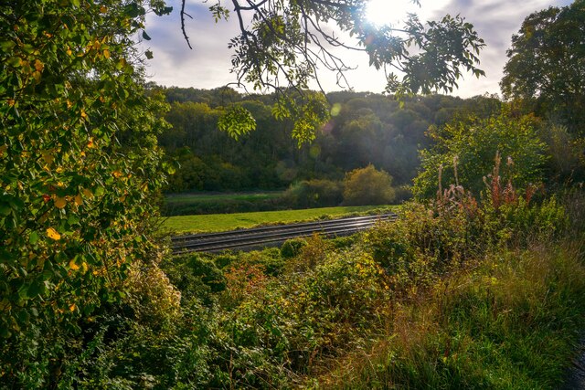
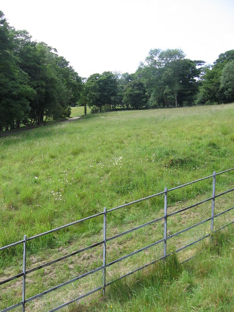
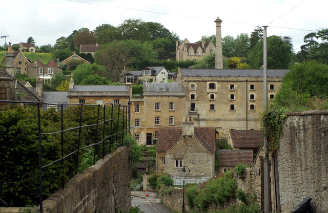
Friary Wood is a picturesque woodland located in Somerset, England. Covering an area of approximately 50 acres, it is a popular destination for nature enthusiasts and those seeking a tranquil escape from the bustling city life. The wood is situated near the town of Glastonbury, famous for its rich history and spiritual significance.

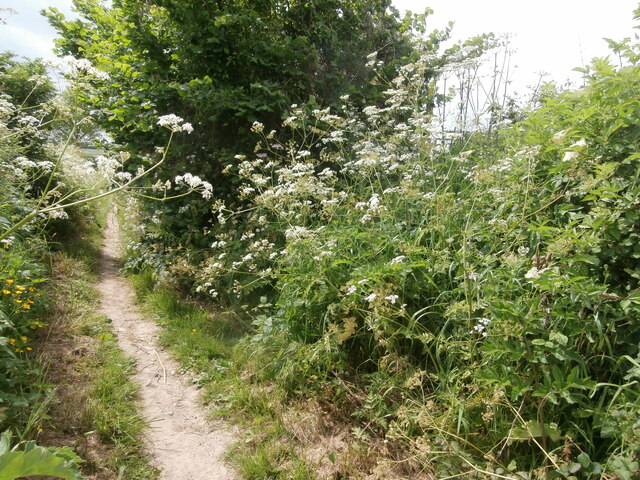
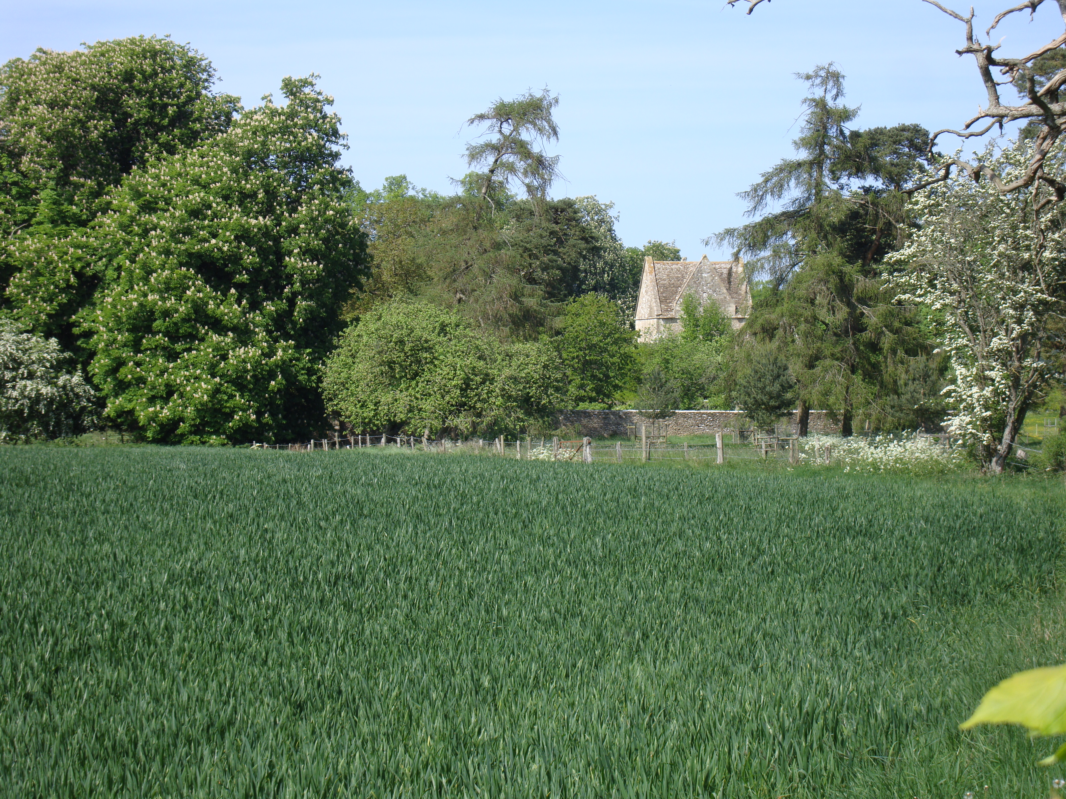
The woodland is characterized by a diverse range of tree species, including oak, beech, ash, and birch. These towering trees provide a dense canopy, creating a cool and shady atmosphere even on the hottest summer days. The forest floor is adorned with a vibrant carpet of wildflowers, adding to the beauty of the surroundings.

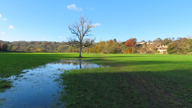
Friary Wood is home to a variety of wildlife, making it a haven for nature lovers. Visitors may encounter deer, foxes, badgers, and a multitude of bird species, including woodpeckers and owls. The wood is also home to several rare and protected species, highlighting its ecological importance.

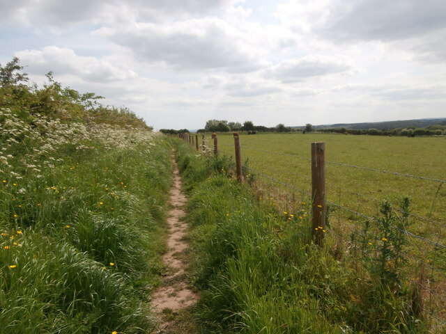
The wood offers a network of well-maintained footpaths, allowing visitors to explore its natural wonders at their own pace. The peaceful atmosphere and the soothing sounds of nature make it an ideal location for walking, picnicking, or simply enjoying a moment of solitude.

Managed by a local conservation group, Friary Wood is dedicated to preserving its natural beauty and protecting its wildlife. The wood plays a crucial role in the local ecosystem, acting as a carbon sink and providing a habitat for numerous species.

In summary, Friary Wood is a stunning woodland in Somerset, offering a serene and enchanting experience for those seeking the tranquility of nature.

If you have any feedback on the listing, please let us know in the comments section below.
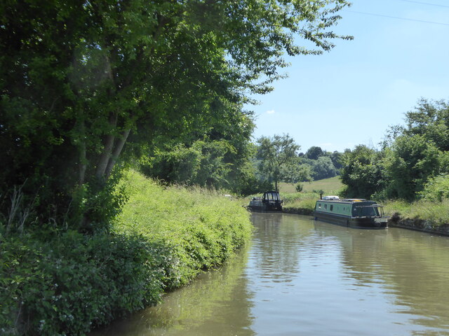
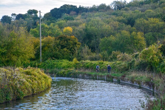
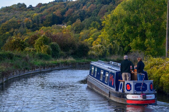
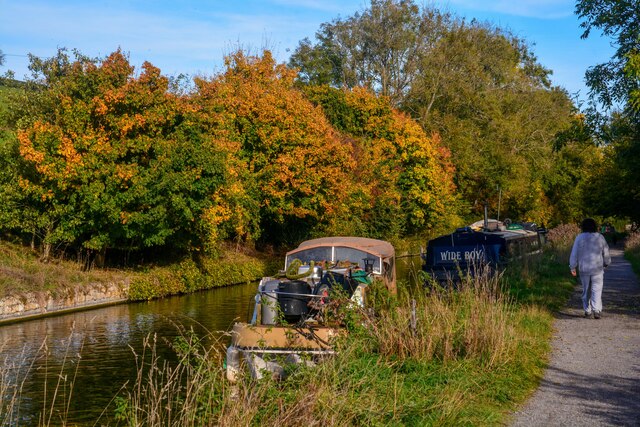
Friary Wood Images

Images are sourced within 2km of 51.330228/-2.3091553 or Grid Reference ST7859. Thanks to Geograph Open Source API. All images are credited.

Direction Sign – Signpost on Green Lane in Hinton Charterhouse parish Located on the southeast side of a junction on Green Lane in Hinton Charterhouse parish. 1 arm and pyramid finial. See also <a title="https://www.geograph.org.uk/photo/4886057" href="https://www.geograph.org.uk/photo/4886057">Link</a>.

Milestone Society National ID: SO_ST7758A
Direction Sign – Signpost on Green Lane in Hinton Charterhouse parish
Located on the southeast side of a junction on Green Lane in Hinton Charterhouse parish. 1 arm and pyramid finial. See also Link. Milestone Society National ID: SO_ST7758A
Bridge over the River Frome at Freshford
A sharp bend in the Kennet & Avon Canal below Avoncliff Wood
Avoncliff : Kennet & Avon Canal Looking along the Kennet & Avon Canal.
Avoncliff : Kennet & Avon Canal
Looking along the Kennet & Avon Canal.
Avoncliff : Kennet & Avon Canal Looking along the Kennet & Avon Canal.
Avoncliff : Kennet & Avon Canal
Looking along the Kennet & Avon Canal.
Avoncliff : Kennet & Avon Canal Looking along the Kennet & Avon Canal.
Avoncliff : Kennet & Avon Canal
Looking along the Kennet & Avon Canal.
Avoncliff : Railway The railway seen from the canal towpath.
Avoncliff : Railway
The railway seen from the canal towpath.
Farleigh Service Station This is the current incarnation of the former Esso station seen at <a href="https://www.geograph.org.uk/photo/190400">ST7857 : A36 filling station</a> and <a href="https://www.geograph.org.uk/photo/4886190">ST7857 : Cross roads on A36</a>.  Fairleigh Service Station <span class="nowrap"><a title="https://petrol-stations.co.uk/05682054/Farleigh_Service_Station" rel="nofollow ugc noopener" href="https://petrol-stations.co.uk/05682054/Farleigh_Service_Station">Link</a><img style="margin-left:2px;" alt="External link" title="External link - shift click to open in new window" src="https://s1.geograph.org.uk/img/external.png" width="10" height="10"/></span> is now run by Applegreen and on this day was charging 166.8p a litre for unleaded petrol and 189.8p a litre for diesel.
Farleigh Service Station
This is the current incarnation of the former Esso station seen at ST7857 : A36 filling station and ST7857 : Cross roads on A36. Fairleigh Service Station LinkExternal link is now run by Applegreen and on this day was charging 166.8p a litre for unleaded petrol and 189.8p a litre for diesel.
Pavilion, Hinton Charterhouse CC The new pavilion of Hinton Charterhouse Cricket Club <span class="nowrap"><a title="https://hccc.play-cricket.com/home" rel="nofollow ugc noopener" href="https://hccc.play-cricket.com/home">Link</a><img style="margin-left:2px;" alt="External link" title="External link - shift click to open in new window" src="https://s1.geograph.org.uk/img/external.png" width="10" height="10"/></span> , used for the first time in the 2023 season.  The spacious pavilion includes a bar, an indoor area for cricket teas, an open-sided but covered area for the scorer and other spectators to sit, and an electronic scoreboard which allows the par score according to the Duckworth-Lewis-Stern system to be displayed. The ground is on private land belonging to Hinton House.  A match is about to begin between Hinton Charterhouse CC Veterans XI and the Somerset Allsorts <span class="nowrap"><a title="https://hccc.play-cricket.com/match_details?id=5525607" rel="nofollow ugc noopener" href="https://hccc.play-cricket.com/match_details?id=5525607">Link</a><img style="margin-left:2px;" alt="External link" title="External link - shift click to open in new window" src="https://s1.geograph.org.uk/img/external.png" width="10" height="10"/></span> .
Pavilion, Hinton Charterhouse CC
The new pavilion of Hinton Charterhouse Cricket Club LinkExternal link , used for the first time in the 2023 season. The spacious pavilion includes a bar, an indoor area for cricket teas, an open-sided but covered area for the scorer and other spectators to sit, and an electronic scoreboard which allows the par score according to the Duckworth-Lewis-Stern system to be displayed. The ground is on private land belonging to Hinton House. A match is about to begin between Hinton Charterhouse CC Veterans XI and the Somerset Allsorts LinkExternal link .
Path towards Norton Barn A network of footpaths extends from the west of the village of Hinton Charterhouse, in varying states of upkeep.  This one is carefully fenced off from the adjacent field containing cattle and well trodden, though a little further on it becomes far less passable.
Path towards Norton Barn
A network of footpaths extends from the west of the village of Hinton Charterhouse, in varying states of upkeep. This one is carefully fenced off from the adjacent field containing cattle and well trodden, though a little further on it becomes far less passable.
A junction of two footpaths Barely visible in the hedge is a kissing gate which is where another footpath - in theory - branches off towards Wellow Lane from the well-marked one from the west side of Hinton Charterhouse across Hinton Farm.
A junction of two footpaths
Barely visible in the hedge is a kissing gate which is where another footpath - in theory - branches off towards Wellow Lane from the well-marked one from the west side of Hinton Charterhouse across Hinton Farm.
Field path leading west towards River Frome at Freshford
2011 : Kennet & Avon Canal west of Avoncliff A long straight stretch hidden by the wide variety of boats to be seen on the K&A. A mixture of craft, broad beam (up to 14 ft) and narrow, usually 6ft 10ins.
Privately owned craft rub cheek by jowl with hire boats. Anything from 8 ft length to 72 (yes 72) ft. Though the only horse drawn boat I know of is usually at Kintbury.
2011 : Kennet & Avon Canal west of Avoncliff
A long straight stretch hidden by the wide variety of boats to be seen on the K&A. A mixture of craft, broad beam (up to 14 ft) and narrow, usually 6ft 10ins. Privately owned craft rub cheek by jowl with hire boats. Anything from 8 ft length to 72 (yes 72) ft. Though the only horse drawn boat I know of is usually at Kintbury.
2011 : Kennet  & Avon Canal near Avoncliff This section of canal is concrete lined, the sloping sides underwater have caught many a steerer. Poor visibility round the bend tempts the steerer too close to the bank on the right. This gentleman is well experienced and has kept just far enough away from the side.
2011 : Kennet & Avon Canal near Avoncliff
This section of canal is concrete lined, the sloping sides underwater have caught many a steerer. Poor visibility round the bend tempts the steerer too close to the bank on the right. This gentleman is well experienced and has kept just far enough away from the side.
2011 : Kennet & Avon Canal approaching Winsley Bridge Between Avoncliff and Murhill.
The towpath is much used by joggers and cyclists as well as walkers, some with dogs.
A sewage treatment plant is close by to the left, it is only on rare occasions that passers by are aware of it.
2011 : Kennet & Avon Canal approaching Winsley Bridge
Between Avoncliff and Murhill. The towpath is much used by joggers and cyclists as well as walkers, some with dogs. A sewage treatment plant is close by to the left, it is only on rare occasions that passers by are aware of it.
The end of the grounds at Iford Manor This fence, which lies just beyond the orchard, is as far as visitors can go.
The end of the grounds at Iford Manor
This fence, which lies just beyond the orchard, is as far as visitors can go.
Avoncliff Sewage Works This shows the sewage works right next to the River Avon and tucked in between it and the railway from where this was taken.
Avoncliff Sewage Works
This shows the sewage works right next to the River Avon and tucked in between it and the railway from where this was taken.
Kennet and Avon Canal The Kennet and Avon Canal to the west of Avoncliff.
Kennet and Avon Canal
The Kennet and Avon Canal to the west of Avoncliff.
Show me another place!

Friary Wood is located at Grid Ref: ST7859 (Lat: 51.330228, Lng: -2.3091553)

Unitary Authority: Bath and North East Somerset

Police Authority: Avon and Somerset

What 3 Words

///sketching.quoted.coupler. Near Freshford, Somerset

Related Wikis

Friary, Somerset

The Friary is a small hamlet outside the English village of Freshford, about 6 miles (10 km) south of Bath, Somerset. Although closer to Freshford it lies...

Hinton Priory

Hinton Priory was a Carthusian monastery in northeast Somerset, England, from 1232 until 1539. == History == The priory was one of the ten medieval Carthusian...

Freshford, Somerset

Freshford is a village and civil parish in the Avon valley 6 miles (10 km) south-east of Bath, in the county of Somerset, England. The parish has a population...

Hinton Charterhouse

Hinton Charterhouse is a small village and civil parish in the Bath and North East Somerset unitary authority, Somerset, England. The parish, which includes...

Nearby Amenities

Located within 500m of 51.330228,-2.3091553
Barrier: kissing_gate
Foot: yes
Lat/Long: 51.3331488/-2.3136459
Barrier: stile
Lat/Long: 51.3314547/-2.3066081
Material: wood
Power: pole
Lat/Long: 51.3320793/-2.3075708
Material: wood
Power: pole
Lat/Long: 51.3345768/-2.3080678
Power: pole
Lat/Long: 51.3310902/-2.3056417
Power: pole
Lat/Long: 51.3311471/-2.305458
Material: wood
Power: pole
Lat/Long: 51.3333827/-2.308977
Power: pole
Lat/Long: 51.3308916/-2.3049068
Waterway: weir
Lat/Long: 51.3341806/-2.3073265
Material: wood
Power: pole
Lat/Long: 51.3341134/-2.3093377
Power: pole
Lat/Long: 51.3313822/-2.3047214
River House
Addr Postcode: BA2 7UE
Fhrs Id: 565700
Guest House: bed_and_breakfast
Tourism: guest_house
Website: https://www.riverhousebath.com/
Lat/Long: 51.3317588/-2.3044531
Barrier: kissing_gate
Foot: yes
Lat/Long: 51.3324354/-2.3139075
Bunker Type: pillbox
Military: bunker
Lat/Long: 51.3343283/-2.3092388
Bench
Backrest: yes
Material: wood
Lat/Long: 51.3312812/-2.3045379
The data included in this document is from www.openstreetmap.org. The data is made available under ODbL.

Have you been to Friary Wood?

Leave your review of Friary Wood below (or comments, questions and feedback).