North Wood

Wood, Forest in Worcestershire Wyre Forest

England

North Wood

Trimpley Reservoir, Severn Valley With the camera facing south, this is the view of Trimpley Reservoir from the adjacent railway line
Trimpley Reservoir, Severn Valley Credit: Rob Newman

North Wood is a small village located in the county of Worcestershire, England. Situated within the lush and picturesque region known as the Wood Forest, it is surrounded by an abundance of natural beauty and tranquility. The village is characterized by its idyllic rural setting, with rolling hills, verdant meadows, and dense woodlands enveloping the area.

Despite its small size, North Wood possesses a tight-knit and welcoming community. The village is home to approximately 300 residents, who take pride in their close relationships and strong sense of community spirit. The locals often gather for various social events and activities, fostering a warm and inclusive atmosphere.

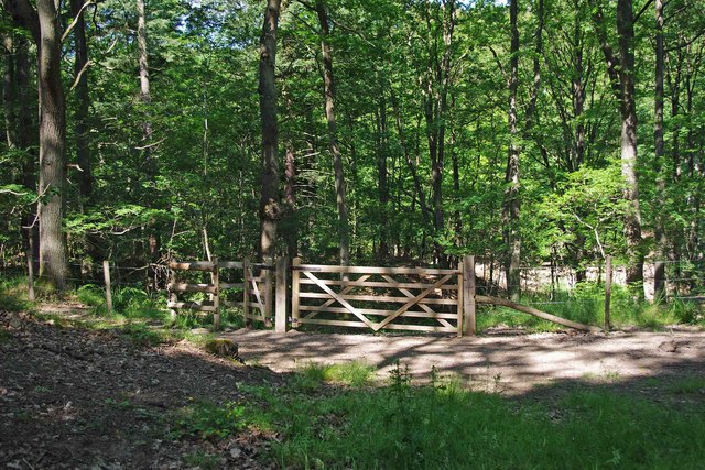
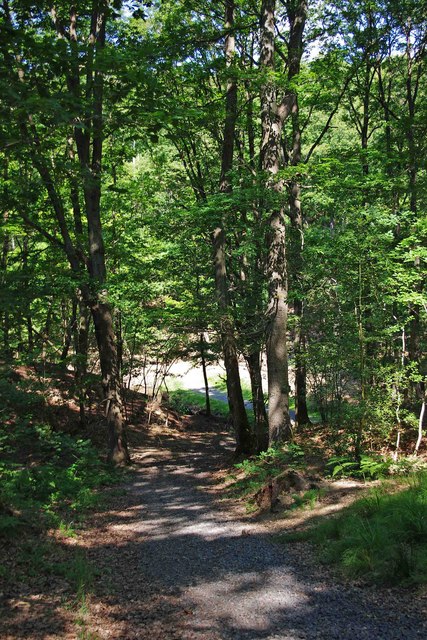
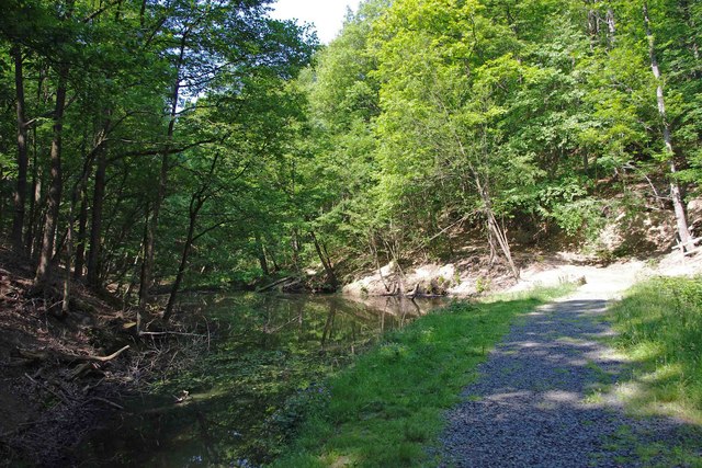
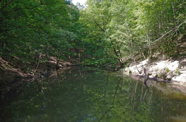
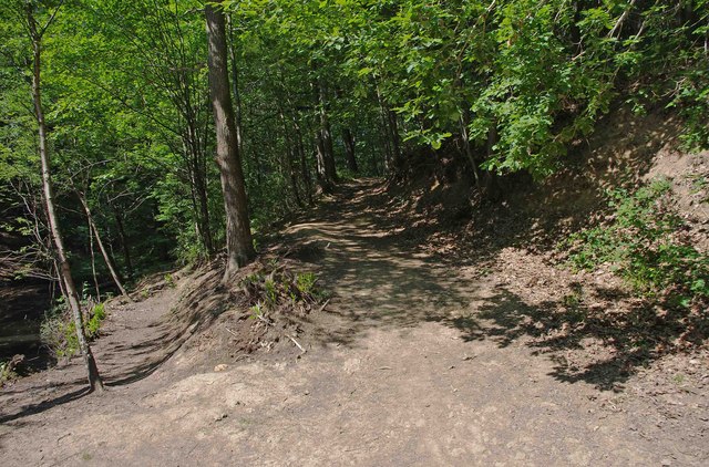
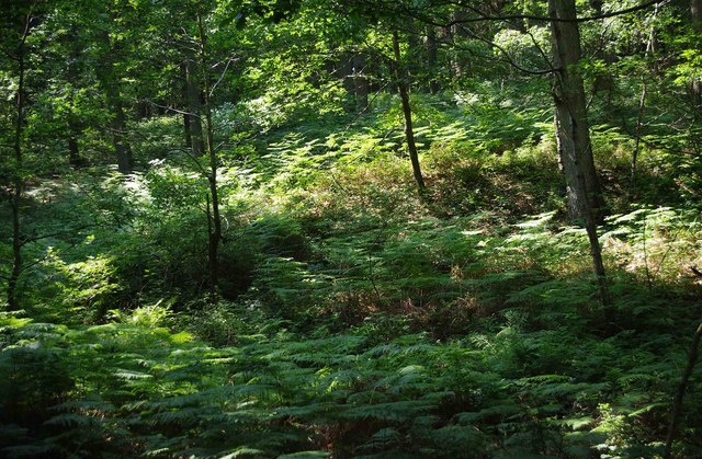
The landscape surrounding North Wood offers a haven for nature enthusiasts and outdoor adventurers. The Wood Forest provides ample opportunities for hiking, cycling, and horseback riding, with numerous trails meandering through the enchanting woodlands. The area is known for its rich biodiversity, with a diverse array of flora and fauna thriving within its boundaries.

Although primarily a residential area, North Wood is conveniently situated near several amenities. The nearby town of Worcestershire provides access to essential services such as schools, medical facilities, and shops. Additionally, the village benefits from good transportation links, with regular bus services connecting it to surrounding towns and cities.

North Wood, Worcestershire, is a charming village that offers a peaceful and picturesque lifestyle amidst the beauty of the Wood Forest. With its strong sense of community and abundant natural surroundings, it is an ideal destination for those seeking a tranquil retreat in the heart of the English countryside.

If you have any feedback on the listing, please let us know in the comments section below.

North Wood Images

Images are sourced within 2km of 52.390925/-2.3226314 or Grid Reference SO7877. Thanks to Geograph Open Source API. All images are credited.
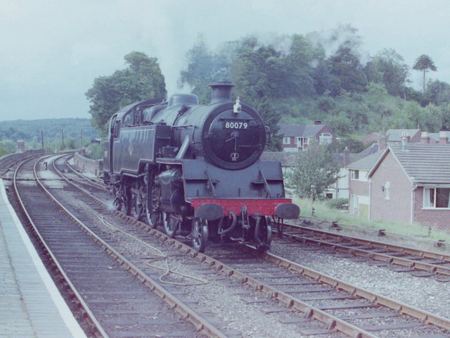
Trimpley Reservoir, Severn Valley With the camera facing south, this is the view of Trimpley Reservoir from the adjacent railway line
Trimpley Reservoir, Severn Valley
With the camera facing south, this is the view of Trimpley Reservoir from the adjacent railway line
Bewdley Bridge in 1987 The bridge carries the B4195 road over the River Severn. The large red brick house over the bridge on the left hand side stands in Severn Street South. The church tower is that of St Anne's.
Bewdley Bridge in 1987
The bridge carries the B4195 road over the River Severn. The large red brick house over the bridge on the left hand side stands in Severn Street South. The church tower is that of St Anne's.
Trains Pass at Bewdley BR Standard Pacific No 71000 "Duke of Gloucester" [left] and 'Manor' class 4-6-0 No 7812 "Erlestoke Manor" pass at Bewdley station.
Trains Pass at Bewdley
BR Standard Pacific No 71000 "Duke of Gloucester" [left] and 'Manor' class 4-6-0 No 7812 "Erlestoke Manor" pass at Bewdley station.
2 new houses, Bewdley
Riverside Caravan Park, Bewdley
Car park off Dry Mill Lane This is a new car park for people walking in the Wyre Forest and is the recommended car park for visitors to Knowles Mill. A fellow collaborator has kindly confirmed my position and view direction.
Car park off Dry Mill Lane
This is a new car park for people walking in the Wyre Forest and is the recommended car park for visitors to Knowles Mill. A fellow collaborator has kindly confirmed my position and view direction.
Knowles Mill Preserved derelict flour mill on the Dowles Brook in the Wyre Forest. The remains of the overshot waterwheel are behind the curved wall in the foreground and the tail race is in a tunnel.
Knowles Mill
Preserved derelict flour mill on the Dowles Brook in the Wyre Forest. The remains of the overshot waterwheel are behind the curved wall in the foreground and the tail race is in a tunnel.
Knowles Mill - the remains of the waterwheel This was an overshot waterwheel with the leat coming in at high level on the left and the portal of the tail race tunnel visible to the right.
Knowles Mill - the remains of the waterwheel
This was an overshot waterwheel with the leat coming in at high level on the left and the portal of the tail race tunnel visible to the right.
Knowles Mill - machinery A nineteenth century watermill that went out of use in 1891 when it was damaged by a flood following a big freeze. It is the only recognisable mill in the Wyre Forest.

This somewhat sharpened (really!) shot shows the pit wheel, wallower, great spur wheel and crown wheel. There is a surviving stone nut and quant on the right with a bed stone on the floor above. The other stone nut and the other stones have gone. There is a fragmented French burr stone on the ground inside.
Knowles Mill - machinery
A nineteenth century watermill that went out of use in 1891 when it was damaged by a flood following a big freeze. It is the only recognisable mill in the Wyre Forest. This somewhat sharpened (really!) shot shows the pit wheel, wallower, great spur wheel and crown wheel. There is a surviving stone nut and quant on the right with a bed stone on the floor above. The other stone nut and the other stones have gone. There is a fragmented French burr stone on the ground inside.
Knowles Mill Nineteenth century watermill that has been out of use since 1891 and is now preserved by the National Trust. The bridge in the foreground crosses the Dowles Brook.
Knowles Mill
Nineteenth century watermill that has been out of use since 1891 and is now preserved by the National Trust. The bridge in the foreground crosses the Dowles Brook.
Standard Tank at Bewdley, 1981 Standard 2-6-4T locomotive No 80079 at Bewdley Station, Severn Valley Railway
Standard Tank at Bewdley, 1981
Standard 2-6-4T locomotive No 80079 at Bewdley Station, Severn Valley Railway
Gated entrance to track in Wyre Forest near Bewdley There is both a kissing gate here, and a gate wide enough to let a vehicle pass through. On the other side is a track, with a rough stone surface, which makes a steep descent down to a pond and a steam.

<a href="https://www.geograph.org.uk/photo/2487006">SO7676 : Track to pond in Wyre Forest, near Bewdley</a>.
<a href="https://www.geograph.org.uk/photo/2487032">SO7676 : Pond and track in the Wyre Forest near Bewdley</a>.
Gated entrance to track in Wyre Forest near Bewdley
There is both a kissing gate here, and a gate wide enough to let a vehicle pass through. On the other side is a track, with a rough stone surface, which makes a steep descent down to a pond and a steam. SO7676 : Track to pond in Wyre Forest, near Bewdley. SO7676 : Pond and track in the Wyre Forest near Bewdley.
Track to pond in Wyre Forest, near Bewdley The pond is at the bottom of the track, but not visible in this photograph.

<a href="https://www.geograph.org.uk/photo/2486986">SO7676 : Gated entrance to track in Wyre Forest near Bewdley</a>.
<a href="https://www.geograph.org.uk/photo/2487032">SO7676 : Pond and track in the Wyre Forest near Bewdley</a>.
Track to pond in Wyre Forest, near Bewdley
The pond is at the bottom of the track, but not visible in this photograph. SO7676 : Gated entrance to track in Wyre Forest near Bewdley. SO7676 : Pond and track in the Wyre Forest near Bewdley.
Pond and track in the Wyre Forest near Bewdley The pond is on the left but difficult to see, as its surface is reflecting the trees which hang overhead. It is one of several which are linked by a small stream, and appears to be either artificial or enlarged from the original.

<a href="https://www.geograph.org.uk/photo/2486986">SO7676 : Gated entrance to track in Wyre Forest near Bewdley</a>.
<a href="https://www.geograph.org.uk/photo/2487006">SO7676 : Track to pond in Wyre Forest, near Bewdley</a>.
<a href="https://www.geograph.org.uk/photo/2487054">SO7676 : Pond in Wyre Forest near Bewdley</a>.
Pond and track in the Wyre Forest near Bewdley
The pond is on the left but difficult to see, as its surface is reflecting the trees which hang overhead. It is one of several which are linked by a small stream, and appears to be either artificial or enlarged from the original. SO7676 : Gated entrance to track in Wyre Forest near Bewdley. SO7676 : Track to pond in Wyre Forest, near Bewdley. SO7676 : Pond in Wyre Forest near Bewdley.
Pond in Wyre Forest near Bewdley The pond may be artificial or artificially enlarged. It lies on a stream which runs through the forest.

<a href="https://www.geograph.org.uk/photo/2487032">SO7676 : Pond and track in the Wyre Forest near Bewdley</a>.
Pond in Wyre Forest near Bewdley
The pond may be artificial or artificially enlarged. It lies on a stream which runs through the forest. SO7676 : Pond and track in the Wyre Forest near Bewdley.
Junction of two paths in the Wyre Forest near Bewdley The lower path runs alongside a pond. The other path climbs steeply.

<a href="https://www.geograph.org.uk/photo/2487054">SO7676 : Pond in Wyre Forest near Bewdley</a>.
Junction of two paths in the Wyre Forest near Bewdley
The lower path runs alongside a pond. The other path climbs steeply. SO7676 : Pond in Wyre Forest near Bewdley.
Ferns in the Wyre Forest near Bewdley Ferns were flourishing in this area.
Ferns in the Wyre Forest near Bewdley
Ferns were flourishing in this area.
Public convenience, Dog Lane Car Park, Bewdley This is one of the modern type of pay to enter public conveniences, where you have various buttons to press, and the fear that making the wrong choice will result in a minor disaster.
Public convenience, Dog Lane Car Park, Bewdley
This is one of the modern type of pay to enter public conveniences, where you have various buttons to press, and the fear that making the wrong choice will result in a minor disaster.
Show me another place!

North Wood is located at Grid Ref: SO7877 (Lat: 52.390925, Lng: -2.3226314)

Administrative County: Worcestershire

District: Wyre Forest

Police Authority: West Mercia

What 3 Words

///laptops.quaking.fixed. Near Bewdley, Worcestershire

Nearby Locations

North Wood

Related Wikis

Northwood Halt railway station

Northwood Halt is an unstaffed request stop on the Severn Valley Railway in Worcestershire, situated a little to the north of Bewdley on the outskirts...

Dowles Brook

Dowles Brook flows through the heart of the Wyre Forest, into the former civil parish of Dowles and into the River Severn. == History == In 1902, ornithologist...

Dowles

Dowles is a hamlet in the civil parish of Upper Arley, in the Wyre Forest district, in the county of Worcestershire, England. It is about 3 miles from...

Bewdley Rowing Club

Bewdley Rowing Club is a rowing club on the River Severn, based at Riverside North, Wribbenhall, Bewdley, Wyre Forest District, West Midlands. == Club... ==

Nearby Amenities

Located within 500m of 52.390925,-2.3226314
Barrier: kissing_gate
Lat/Long: 52.3875385/-2.32546
Barrier: kissing_gate
Lat/Long: 52.3886557/-2.3257225
Barrier: kissing_gate
Lat/Long: 52.3893893/-2.3258786
Barrier: kissing_gate
Lat/Long: 52.3902352/-2.3259901
Barrier: cattle_grid
Lat/Long: 52.3935407/-2.3272936
Telephone
Booth: K6
Covered: booth
Operator: BT
Phone: +44 1299 400093
Lat/Long: 52.3936976/-2.3269864
Post Box
Collection Times: Mo-Fr 12:00; Sa 08:45
Post Box Type: lamp
Ref: DY12 195
Royal Cypher: GVIR
Royal Cypher Wikidata: Q33102169
Lat/Long: 52.3937638/-2.32722
Northwood
Railway: level_crossing
Lat/Long: 52.3944193/-2.3272561
Railway: level_crossing
Lat/Long: 52.3882685/-2.3226791
The data included in this document is from www.openstreetmap.org. The data is made available under ODbL.

Have you been to North Wood?

Leave your review of North Wood below (or comments, questions and feedback).