Lower Dean Wood

Wood, Forest in Lancashire Burnley

England

Lower Dean Wood

Castle Clough Farm View from the Leeds & Liverpool Canal towpath of the complex which appears to be used for various businesses.
Castle Clough Farm Credit: Kevin Waterhouse

Lower Dean Wood is a picturesque woodland located in the county of Lancashire, England. Spanning over an area of approximately 200 acres, it is nestled within the beautiful landscape of the West Pennine Moors. The woodland is part of the larger Dean Wood, which is divided into upper and lower sections.

Lower Dean Wood is characterized by its diverse mix of trees, including oak, birch, beech, and coniferous species. The dense canopy provides a tranquil and shaded environment, perfect for leisurely walks and nature exploration. The woodland floor is covered with a rich carpet of wildflowers, ferns, and mosses, creating a vibrant and enchanting atmosphere.

The area is home to a variety of wildlife, making it a popular spot for nature enthusiasts and birdwatchers. Visitors may be lucky enough to spot woodland birds such as woodpeckers, nuthatches, and finches, as well as mammals like badgers, foxes, and deer.

Lower Dean Wood offers several well-maintained footpaths, allowing visitors to explore the area at their own pace. The paths wind through the woodland, leading to charming clearings and viewpoints where one can enjoy breathtaking views of the surrounding countryside.

The wood is managed by the Lancashire Wildlife Trust, which works to preserve and enhance the natural habitat. They organize educational events and activities throughout the year, providing an opportunity for visitors to learn more about the local flora and fauna.

Overall, Lower Dean Wood is a delightful destination for those seeking tranquility, natural beauty, and a chance to connect with the great outdoors.

If you have any feedback on the listing, please let us know in the comments section below.

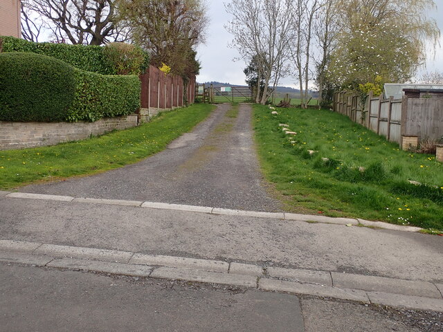
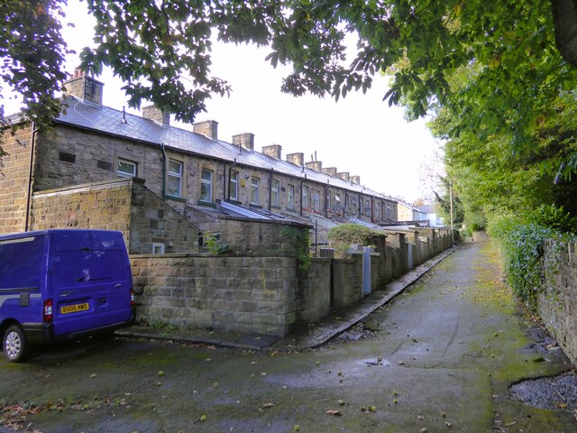
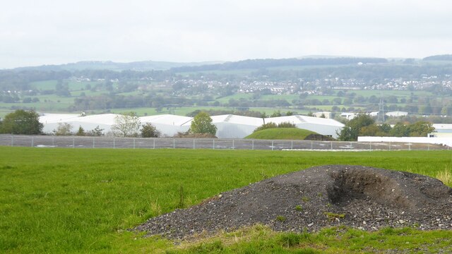
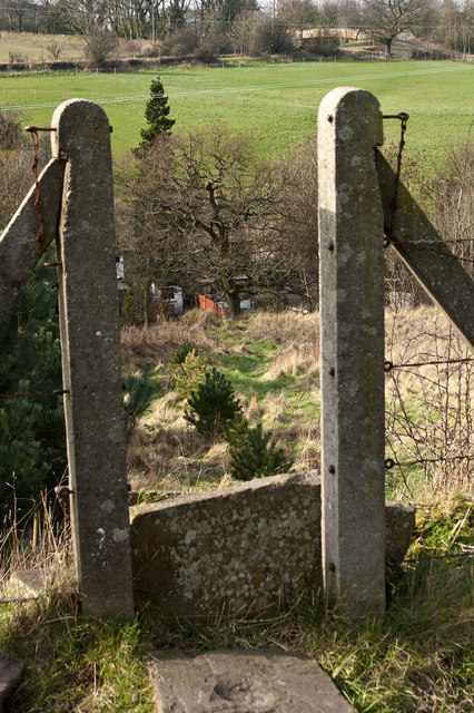
Lower Dean Wood Images

Images are sourced within 2km of 53.799588/-2.3337325 or Grid Reference SD7833. Thanks to Geograph Open Source API. All images are credited.

Castle Clough Farm View from the Leeds & Liverpool Canal towpath of the complex which appears to be used for various businesses.
Castle Clough Farm
View from the Leeds & Liverpool Canal towpath of the complex which appears to be used for various businesses.
Leeds and Liverpool Canal Following the contours around Castle Clough towards Shuttleworth Hall
Leeds and Liverpool Canal
Following the contours around Castle Clough towards Shuttleworth Hall
Higher Shuttleworth Bridge No.120 On the Leeds & Liverpool Canal, an iron bridge carrying the plate Dallam Forge, Warrington
Higher Shuttleworth Bridge No.120
On the Leeds & Liverpool Canal, an iron bridge carrying the plate Dallam Forge, Warrington
Footpath off Carleton Road The entrance leading to the footpath from Carleton road Simonstone.
Footpath off Carleton Road
The entrance leading to the footpath from Carleton road Simonstone.
Former railway bridge Spanning Green Brook and now used as a cycle route, the Padiham Greenway.
Former railway bridge
Spanning Green Brook and now used as a cycle route, the Padiham Greenway.
Cycle path following route of former railway The Padiham Greenway approaching the bridge across Park Road. Behind the camera is the fenced off viaduct that took the cycle path over the River Calder but is closed due to structural issues.
Cycle path following route of former railway
The Padiham Greenway approaching the bridge across Park Road. Behind the camera is the fenced off viaduct that took the cycle path over the River Calder but is closed due to structural issues.
Housing block On Moor Lane at the junction with Guy Street
Housing block
On Moor Lane at the junction with Guy Street
The back yards to terrace housing View of the rear of Bridge Street from a minor gateway to Memorial Park
The back yards to terrace housing
View of the rear of Bridge Street from a minor gateway to Memorial Park
Leeds & Liverpool Canal Approaching Altham Bridge that carries Altham Lane across the canal. The tree by the towpath ahead is in a small fenced enclosure that appears to contain a filled old mine shaft. Old OS maps do indicate an old mine in this area.
Leeds & Liverpool Canal
Approaching Altham Bridge that carries Altham Lane across the canal. The tree by the towpath ahead is in a small fenced enclosure that appears to contain a filled old mine shaft. Old OS maps do indicate an old mine in this area.
Groundworks at Altham Business Park There appears to be more ground cleared and fenced for possible further expansion of the business park along Altham Lane
Groundworks at Altham Business Park
There appears to be more ground cleared and fenced for possible further expansion of the business park along Altham Lane
That looks like a north light mill in the dip The fact that the north lights don't face north is fairly typical
That looks like a north light mill in the dip
The fact that the north lights don't face north is fairly typical
A footpath cuts across the loop in the canal
Bridge and walkers on the Leeds and Liverpool Canal Bridge No 120 manufactured by William Forge of Warrington
Bridge and walkers on the Leeds and Liverpool Canal
Bridge No 120 manufactured by William Forge of Warrington
The Leeds and Liverpool Canal
The Walton Arms
The Walton Arms
Two bridges 119a and 119 Since bridge 120 the good surface of the towpath has disappeared to be replaced by a muddy trough
Two bridges 119a and 119
Since bridge 120 the good surface of the towpath has disappeared to be replaced by a muddy trough
A noisy Canada Goose
The Leeds and Liverpool Canal
Show me another place!

Lower Dean Wood is located at Grid Ref: SD7833 (Lat: 53.799588, Lng: -2.3337325)

Administrative County: Lancashire

District: Burnley

Police Authority: Lancashire

What 3 Words

///ecologist.agree.motel. Near Padiham, Lancashire

Nearby Locations

Lower Dean Wood

Related Wikis

Padiham Power Station

Padiham Power Station was a coal-fired power station in Padiham, east Lancashire, England, which began operation in 1926 and generated power from 1927...

Simonstone railway station

Simonstone railway station was located on the east side of Simonstone Lane, 0.75 miles (1 km) south of Simonstone centre and near Padiham, Lancashire,...

Padiham F.C.

Padiham Football Club are an English football team based in Padiham, Lancashire. As of 2019–20, they play in the North West Counties League Premier Division...

Simonstone, Lancashire

Simonstone is a small village and civil parish in the Ribble Valley district of Lancashire, England. The population of the civil parish taken at the 2011...

Padiham railway station

Padiham railway station in Station Road, Padiham, Lancashire, England was on a branch line (usually known as the Great Harwood loop) of the East Lancashire...

St James' Church, Altham

St James' Church is in the village of Altham, Lancashire, England. It is an active Anglican parish church in the deanery of Accrington, the archdeaconry...

Padiham Town Hall

Padiham Town Hall is a municipal building in Burnley Road, Padiham, Lancashire, England. The town hall, which was the headquarters of Padiham Urban District...

Huntroyde Hall

Huntroyde Hall is a grade II listed, 16th-century house in the civil parish of Simonstone in the Borough of Ribble Valley, Lancashire, England. Its estate...

Nearby Amenities

Located within 500m of 53.799588,-2.3337325
Traffic Signals
Traffic Signals: signal
Lat/Long: 53.7967462/-2.3348858
Traffic Signals
Traffic Signals: signal
Lat/Long: 53.7971068/-2.3332648
Traffic Signals
Traffic Signals: signal
Lat/Long: 53.8013846/-2.3276975
Source: landsat
Lat/Long: 53.7976177/-2.3351864
Mini Roundabout
Lat/Long: 53.7963736/-2.3287122
Traffic Signals
Lat/Long: 53.8012982/-2.327999
Traffic Signals
Lat/Long: 53.8014602/-2.3273304
Traffic Signals
Fixme: Check traffic lights exist for this lane
Lat/Long: 53.8012321/-2.3274914
Give Way
Lat/Long: 53.8016392/-2.3275906
Bus Stop
Shuttleworth Mead
Bus: yes
Naptan AtcoCode: 250014403
Naptan NaptanCode: lanamtaw
Public Transport: platform
Lat/Long: 53.7969625/-2.3341405
Bus Stop
Shuttleworth Mead
Bus: yes
Naptan AtcoCode: 2500IMG2571
Naptan NaptanCode: langdjwa
Public Transport: platform
Lat/Long: 53.7972844/-2.3322992
Bus Stop
Sunnybank
Bus: yes
Naptan AtcoCode: 2500LAA16148
Naptan NaptanCode: lanwpdj
Public Transport: platform
Lat/Long: 53.7977187/-2.3302342
Bus Stop
Sunnybank
Bus: yes
Naptan AtcoCode: 2500IMG2572
Naptan NaptanCode: langdjwd
Public Transport: platform
Lat/Long: 53.7979657/-2.3294206
Post Box
Lat/Long: 53.7965436/-2.3315569
Bus Stop
Bus: yes
Public Transport: platform
Lat/Long: 53.7965339/-2.3313697
Waste Basket
Lat/Long: 53.7965327/-2.3313935
Edusentials
Addr City: Burnley
Addr Housename: Ribble Court
Addr Housenumber: 1
Addr Postcode: BB12 7NG
Addr Street: Meadway
Addr Suburb: Padiham
Email: mail@edusentials.co.uk
Fax: +44 844 854 8648
Office: school_supplies
Phone: +44 1282 682855
Website: https://www.edusentials.co.uk/
Lat/Long: 53.7969292/-2.3322817
The data included in this document is from www.openstreetmap.org. The data is made available under ODbL.

Have you been to Lower Dean Wood?

Leave your review of Lower Dean Wood below (or comments, questions and feedback).