Craig Llangiwg

Settlement in Glamorgan

Wales

Craig Llangiwg

Gellionnen Chapel
Gellionnen Chapel Credit: Sandy Gerrard

Craig Llangiwg is a small village located in the county borough of Glamorgan, Wales. Situated in the picturesque Neath Valley, it is known for its stunning natural beauty and rich historical heritage. The village is nestled at the foot of the imposing Craig Llangiwg Mountain, which dominates the skyline and offers breathtaking panoramic views of the surrounding countryside.

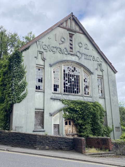
Historically, Craig Llangiwg was a hub of industrial activity during the 19th century, due to the presence of coal mines and ironworks in the area. The remnants of these industries can still be seen today, with old mining structures dotting the landscape. The village also played a significant role in the development of the Welsh language and culture, with many local residents being fluent Welsh speakers.

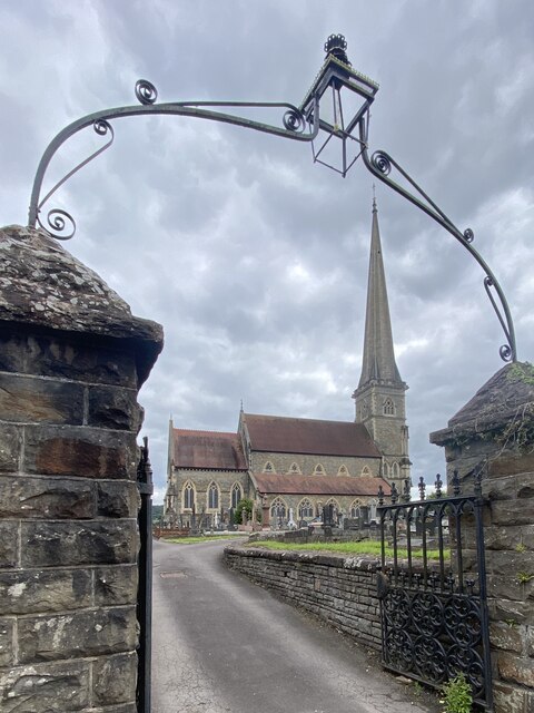
Despite its small size, Craig Llangiwg boasts a close-knit community that takes pride in its heritage. The village is home to a charming parish church, St. Cewydd's, which dates back to the 12th century. The church is a popular attraction for visitors, who come to admire its historic architecture and tranquil setting.

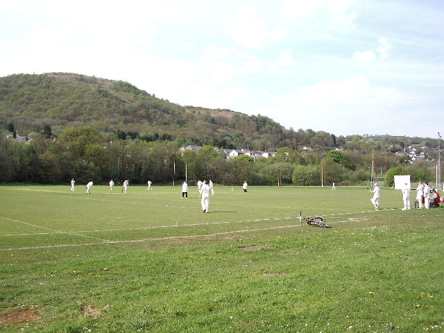
Outdoor enthusiasts are drawn to Craig Llangiwg for its ample opportunities for hiking, cycling, and exploring the nearby natural wonders. The nearby Afan Forest Park offers extensive woodland trails, while the picturesque Neath River provides the perfect setting for fishing or leisurely walks along its banks.

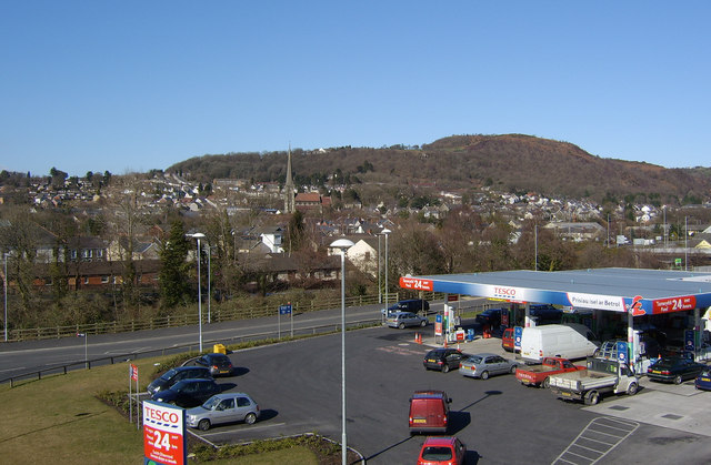
Craig Llangiwg is also conveniently located within easy reach of larger towns and cities, such as Neath and Swansea, offering a range of amenities and cultural attractions. Overall, Craig Llangiwg is a hidden gem, combining natural beauty, historical significance, and a warm community spirit.

If you have any feedback on the listing, please let us know in the comments section below.

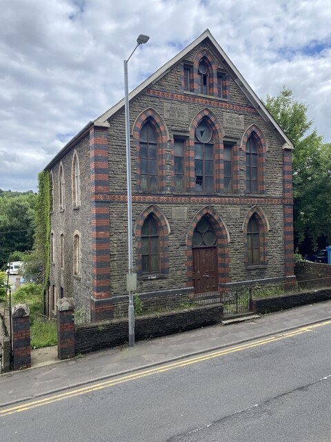
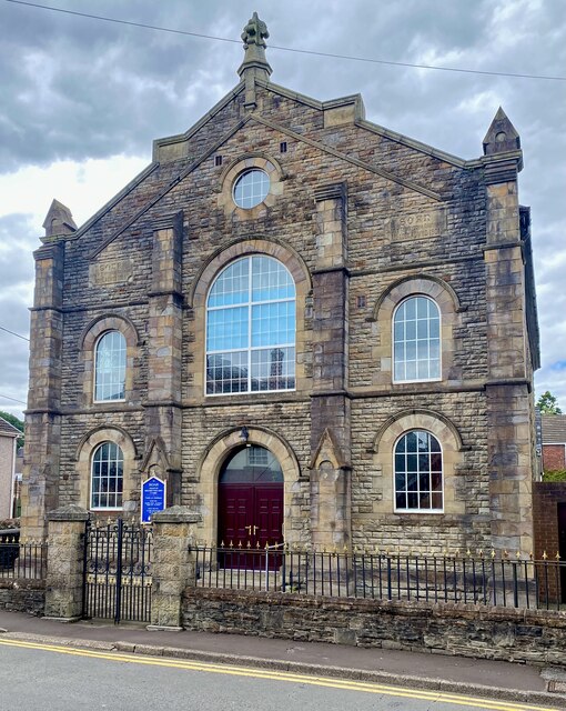
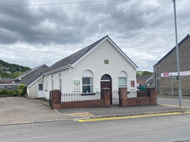
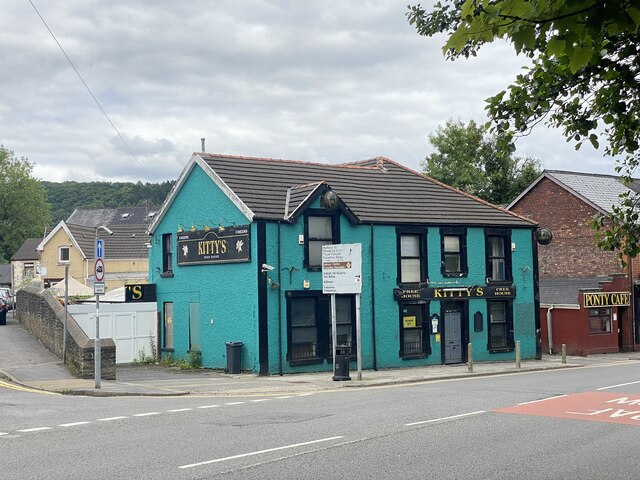
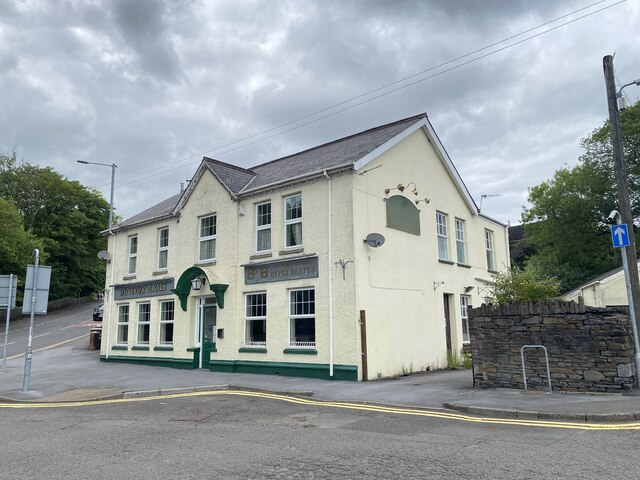
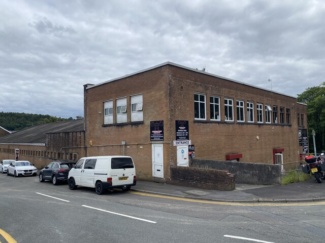
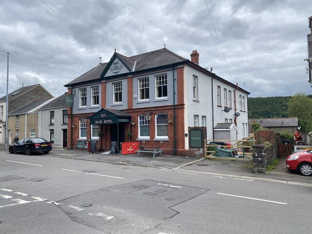
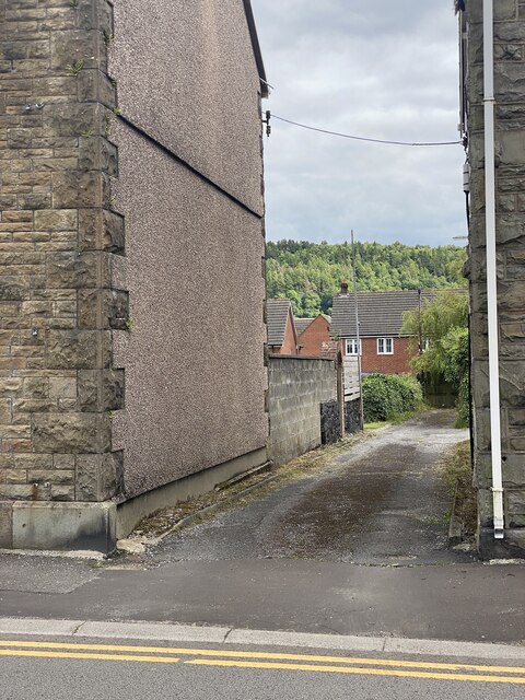
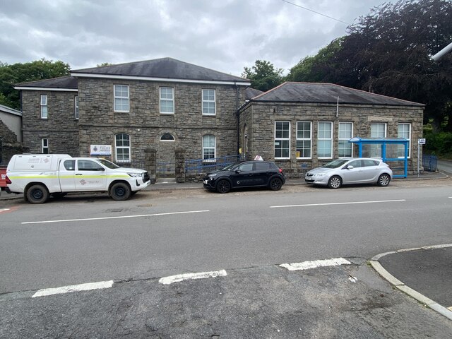
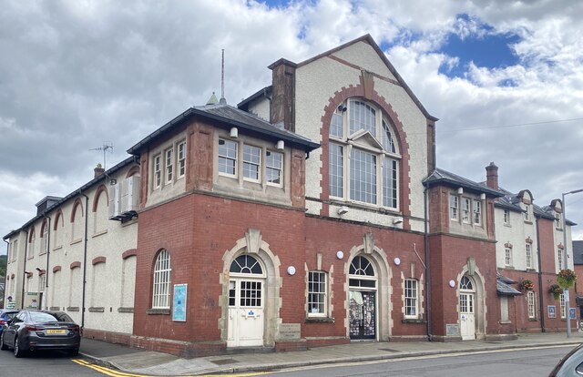
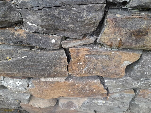
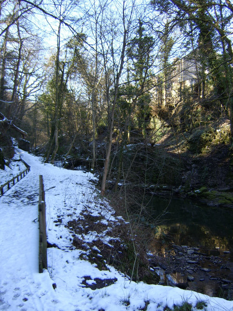
Craig Llangiwg Images

Images are sourced within 2km of 51.720073/-3.8544007 or Grid Reference SN7204. Thanks to Geograph Open Source API. All images are credited.

Gellionnen Chapel
Gellionnen Chapel
Adulam Baptist Chapel, Pontardawe Welsh Baptist Chapel built in 1845 and rebuilt in 1889 (1899?). Derelict since 2004 and subject to vandalism since then.

See <span class="nowrap"><a title="https://coflein.gov.uk/en/site/10119?term=Pontardawe%20&pg=2" rel="nofollow ugc noopener" href="https://coflein.gov.uk/en/site/10119?term=Pontardawe%20&pg=2">Link</a><img style="margin-left:2px;" alt="External link" title="External link - shift click to open in new window" src="https://s1.geograph.org.uk/img/external.png" width="10" height="10"/></span>
Adulam Baptist Chapel, Pontardawe
Welsh Baptist Chapel built in 1845 and rebuilt in 1889 (1899?). Derelict since 2004 and subject to vandalism since then. See LinkExternal link
Soar Welsh Presbyterian Church, Pontardawe Built in 1866 and restored in 1901. 

See <span class="nowrap"><a title="https://coflein.gov.uk/en/site/10100/" rel="nofollow ugc noopener" href="https://coflein.gov.uk/en/site/10100/">Link</a><img style="margin-left:2px;" alt="External link" title="External link - shift click to open in new window" src="https://s1.geograph.org.uk/img/external.png" width="10" height="10"/></span>
Soar Welsh Presbyterian Church, Pontardawe
Built in 1866 and restored in 1901. See LinkExternal link
Gosen Apostolic Church See <span class="nowrap"><a title="https://coflein.gov.uk/en/site/13414?term=Pontardawe%20&pg=2" rel="nofollow ugc noopener" href="https://coflein.gov.uk/en/site/13414?term=Pontardawe%20&pg=2">Link</a><img style="margin-left:2px;" alt="External link" title="External link - shift click to open in new window" src="https://s1.geograph.org.uk/img/external.png" width="10" height="10"/></span>
Gosen Apostolic Church
See LinkExternal link
Pontardawe Library The building also serves as the Pontardawe Hwb - a community facility.
Pontardawe Library
The building also serves as the Pontardawe Hwb - a community facility.
Kitty’s, Pontardawe Public house in Pontardawe.
Kitty’s, Pontardawe
Public house in Pontardawe.
Dynevor Arms Public House in Pontardawe.
Dynevor Arms
Public House in Pontardawe.
St Peter’s Church, Pontardawe
Bodybuilding Hardcore Gym Formerly the Pavilion Cinema.

See also <span class="nowrap"><a title="https://coflein.gov.uk/en/site/416827/?term=Pontardawe%20" rel="nofollow ugc noopener" href="https://coflein.gov.uk/en/site/416827/?term=Pontardawe%20">Link</a><img style="margin-left:2px;" alt="External link" title="External link - shift click to open in new window" src="https://s1.geograph.org.uk/img/external.png" width="10" height="10"/></span>
Bodybuilding Hardcore Gym
Formerly the Pavilion Cinema. See also LinkExternal link
Ivy Bush Hotel
Ivy Bush Hotel
School Lane, Pontardawe
Police Station, Pontardawe
Pontardawe Arts Centre Formerly Pontardawe Public Hall and Institute, built in 1908 and opened by Adelina Patti.

See <span class="nowrap"><a title="https://coflein.gov.uk/en/site/414794/?term=Pontardawe%20" rel="nofollow ugc noopener" href="https://coflein.gov.uk/en/site/414794/?term=Pontardawe%20">Link</a><img style="margin-left:2px;" alt="External link" title="External link - shift click to open in new window" src="https://s1.geograph.org.uk/img/external.png" width="10" height="10"/></span>
Pontardawe Arts Centre
Formerly Pontardawe Public Hall and Institute, built in 1908 and opened by Adelina Patti. See LinkExternal link
Wesleyaid Cymraeg Horeb Welsh Wesleyan Chapel.

The building was noted for its "spray of wild typography on the upper façade", marking out the words "1902 - Wesleyaid Cymraeg".
Wesleyaid Cymraeg
Horeb Welsh Wesleyan Chapel. The building was noted for its "spray of wild typography on the upper façade", marking out the words "1902 - Wesleyaid Cymraeg".
Ordnance Survey Cut Mark This OS cut mark can be found on the wall of No70 Gwyn Street. It marks a point 53.273m above mean sea level.
Ordnance Survey Cut Mark
This OS cut mark can be found on the wall of No70 Gwyn Street. It marks a point 53.273m above mean sea level.
Cricket on Pontardawe Recreation Ground Pontardawe Recreation Ground is on the flood plain of the River Tawe, which is behind the trees on the right of the photograph.  The Swansea Canal runs below the houses.
Cricket on Pontardawe Recreation Ground
Pontardawe Recreation Ground is on the flood plain of the River Tawe, which is behind the trees on the right of the photograph. The Swansea Canal runs below the houses.
Pontardawe A view of Pontardawe looking north from the footbridge over the A4067. The landmark spire of St Peter's is just left of centre.
Pontardawe
A view of Pontardawe looking north from the footbridge over the A4067. The landmark spire of St Peter's is just left of centre.
Cwmdu Glen, Pontardawe The footpath through Cwmdu (the Upper Clydach gorge) at Pontardawe.
Cwmdu Glen, Pontardawe
The footpath through Cwmdu (the Upper Clydach gorge) at Pontardawe.
Show me another place!

Craig Llangiwg is located at Grid Ref: SN7204 (Lat: 51.720073, Lng: -3.8544007)

Unitary Authority: Neath Port Talbot

Police Authority: South Wales

What 3 Words

///snips.backlog.backswing. Near Clydach, Swansea

Related Wikis

A474 road

The A474 is a suburban main route in south Wales. == Route == Settlements served by the A474 include: Briton Ferry Neath Neath Abbey Cadoxton Rhyddings...

Pontardawe Arts Centre

Pontardawe Arts Centre is a multi-purpose cultural venue in Pontardawe, Neath Port Talbot, Wales. The building is owned by Neath Port Talbot County Borough...

Pontardawe

Pontardawe (Welsh pronunciation: [pɔntarˈdawɛ]) is a town and a community in the lower Swansea Valley (Welsh: Cwmtawe). it had a population of approximately...

Alltwen television relay station

The Alltwen television relay station is sited on a hill to the southwest of Pontardawe in the Swansea Valley, at least a kilometre away from the village...

Nearby Amenities

Located within 500m of 51.720073,-3.8544007
Traffic Signals
Lat/Long: 51.7202668/-3.8534627
Pontardawe
Is In: Swansea
Name Cy: Pontardawe
Place: town
Population: 12333
Wikidata: Q2030641
Lat/Long: 51.7219859/-3.8488778
Barrier: bollard
Lat/Long: 51.7169312/-3.85064
Theatre
Pontardawe Arts Centre
Addr City: Pontardawe
Addr Postcode: SA8 4ED
Addr Street: Herbert Street
Operator: NPT Theatres
Wikidata: Q15267420
Lat/Long: 51.7198548/-3.8502485
Atm
Fee: no
Operator: Lloyds Bank
Lat/Long: 51.7195685/-3.8498957
Atm
Fee: no
Operator: Barclays Bank PLC
Lat/Long: 51.7209813/-3.8526759
Library
Pontardawe Library
Wikidata: Q47488075
Lat/Long: 51.7200334/-3.8494706
Bus Stop
Jubilee
Lat/Long: 51.7190115/-3.8494398
Bus Stop
Jubilee
Lat/Long: 51.7189371/-3.8491964
Information: board
Tourism: information
Lat/Long: 51.7203746/-3.8540563
Barrier: cycle_barrier
Bicycle: yes
Foot: yes
Lat/Long: 51.7187216/-3.8479457
Post Box
Collection Times: Mo-Fr 09:00; Sa 07:00
Post Box Type: wall
Ref: SA8 630D
Royal Cypher: GR
Royal Cypher Wikidata: Q33102273
Lat/Long: 51.7226611/-3.8496497
Post Box
Collection Times: Mo-Fr 17:30; Sa 12:15
Post Box Type: pillar
Ref: SA8 648
Royal Cypher: GR
Royal Cypher Wikidata: Q33102273
Lat/Long: 51.7196621/-3.8502079
Post Box
Collection Times: Mo-Fr 17:00; Sa 11:30
Post Box Type: pillar
Ref: SA8 653
Royal Cypher: EIIR
Royal Cypher Wikidata: Q33102113
Lat/Long: 51.7197047/-3.8539113
Atm
Lat/Long: 51.7211281/-3.8520284
Direction: 217
Generator Method: photovoltaic
Generator Output Electricity: yes
Generator Solar Modules: 8
Generator Source: solar
Generator Type: solar_photovoltaic_panel
Location: roof
Power: generator
Lat/Long: 51.7184509/-3.8503569
Crossing
Lat/Long: 51.7187809/-3.8479316
Community Centre
Tŷ'r Gwrhyd
Addr City: Pontardawe
Addr Housename: Tŷ'r Gwrhyd
Addr Postcode: SA8 4ET
Addr Street: Holly Street
Operator: Academi Hywel Teifi
Lat/Long: 51.7202159/-3.8494839
Menter Iaith Castell-nedd Port Talbot
Addr City: Pontardawe
Addr Housename: Tŷ'r Gwrhyd
Addr Postcode: SA8 4ET
Addr Street: Holly Street
Office: yes
Phone: +44 1639 763819
Lat/Long: 51.7201394/-3.8497025
Pontardawe RFC
Addr City: Swansea
Addr Postcode: SA8 4EG
Addr Street: Ynisderw Road
Club: sport
Name Cy: Clwb Rygbi Pontardawe
Name En: Pontardawe RFC
Phone: +44 1792 864 811
Rugby: union
Sport: rugby
Website: https://pontardawe.rfc.wales/
Wikidata: Q7228068
Wikipedia: en:Pontardawe RFC
Lat/Long: 51.716294/-3.8521846
Lidl
Addr City: Pontardawe
Addr Country: GB
Addr Postcode: SA8 4AG
Addr Street: Ffordd Parc Ynysderw
Addr Unit: 3
Brand: Lidl
Brand Wikidata: Q151954
Brand Wikipedia: en:Lidl
Fhrs Id: 948108
Opening Hours: Mo-Sa 08:00-22:00; Su 10:00-16:00
Phone: +44 8009 777 766
Shop: supermarket
Website: https://www.lidl.co.uk/s/en-GB/store-finder/pontardawe/ffordd-parc-ynysderw/
Lat/Long: 51.7176491/-3.851339
Argos
Addr City: Pontardawe
Addr Housename: Pontardawe Retail Park
Addr Housenumber: Unit 2
Addr Postcode: SA8 4AG
Addr Street: Ffordd Parc Ynysderw
Brand: Argos
Brand Wikidata: Q4789707
Brand Wikipedia: en:Argos (retailer)
Opening Hours: Mo-Fr 08:00-20:00; Sa 08:00-18:00; Su 10:00-16:00
Phone: +44 3456 564 136
Shop: catalogue
Website: https://www.argos.co.uk/stores/4136-pontardawe-argos
Lat/Long: 51.7180548/-3.8528764
Farmfoods
Addr City: Pontardawe
Addr Housename: Pontardawe Retail Park
Addr Postcode: SA8 4EG
Addr Street: Ffordd Parc Ynysderw
Addr Unit: 1
Brand: Farmfoods
Brand Wikidata: Q5435841
Brand Wikipedia: en:Farmfoods
Contact Website: https://www.farmfoods.co.uk/store-finder.php?branch_code=806
Opening Hours: Mo-Sa 08:00-20:00; Sa 08:00-19:00; Su 10:00-16:00
Opening Hours Url: https://www.farmfoods.co.uk/store-finder.php?branch_code=806
Shop: frozen_food
Lat/Long: 51.7187593/-3.8519215
Pub
The Other Place
Lat/Long: 51.7183472/-3.8494861
Power: pole
Lat/Long: 51.7194466/-3.8609192
Power: pole
Lat/Long: 51.7188567/-3.8592857
Power: pole
Lat/Long: 51.7184745/-3.8583925
Location Transition: yes
Power: pole
Lat/Long: 51.7186241/-3.8559598
Location Transition: yes
Power: pole
Lat/Long: 51.7187172/-3.855941
Power: pole
Lat/Long: 51.7187994/-3.8570125
Power: pole
Lat/Long: 51.7196543/-3.8581646
Power: pole
Lat/Long: 51.7201794/-3.8594037
Power: pole
Lat/Long: 51.7205782/-3.861182
Man Made: mast
Tower Type: communication
Lat/Long: 51.7192638/-3.8594332
Power: pole
Lat/Long: 51.716463/-3.8528846
Power: pole
Lat/Long: 51.717819/-3.8540849
Power: pole
Lat/Long: 51.7179602/-3.8540433
Direction: 125
Generator Method: photovoltaic
Generator Output Electricity: yes
Generator Solar Modules: 16
Generator Source: solar
Generator Type: solar_photovoltaic_panel
Location: roof
Power: generator
Lat/Long: 51.7234029/-3.8537657
Direction: S
Generator Method: photovoltaic
Generator Output Electricity: yes
Generator Solar Modules: 20
Generator Source: solar
Generator Type: solar_photovoltaic_panel
Location: roof
Power: generator
Lat/Long: 51.7228562/-3.8545483
Direction: 185
Generator Method: photovoltaic
Generator Output Electricity: yes
Generator Solar Modules: 8
Generator Source: solar
Generator Type: solar_photovoltaic_panel
Location: roof
Power: generator
Lat/Long: 51.7228658/-3.8536192
Direction: 235
Generator Method: photovoltaic
Generator Output Electricity: yes
Generator Solar Modules: 11
Generator Source: solar
Generator Type: solar_photovoltaic_panel
Location: roof
Power: generator
Lat/Long: 51.7223835/-3.8481975
Direction: 215
Generator Method: photovoltaic
Generator Output Electricity: yes
Generator Solar Modules: 10
Generator Source: solar
Generator Type: solar_photovoltaic_panel
Location: roof
Power: generator
Lat/Long: 51.7185925/-3.8500804
Direction: SSW
Generator Method: photovoltaic
Generator Output Electricity: yes
Generator Solar Modules: 10
Generator Source: solar
Generator Type: solar_photovoltaic_panel
Location: roof
Power: generator
Lat/Long: 51.7215519/-3.8528109
Direction: 195
Generator Method: photovoltaic
Generator Output Electricity: yes
Generator Solar Modules: 13
Generator Source: solar
Generator Type: solar_photovoltaic_panel
Location: roof
Power: generator
Lat/Long: 51.7217131/-3.8527036
Direction: 125
Generator Method: photovoltaic
Generator Output Electricity: yes
Generator Solar Modules: 16
Generator Source: solar
Generator Type: solar_photovoltaic_panel
Location: roof
Power: generator
Lat/Long: 51.7163521/-3.8579627
Direction: 125
Fixme: uncertain
Generator Method: photovoltaic
Generator Output Electricity: yes
Generator Solar Modules: 6
Generator Source: solar
Generator Type: solar_photovoltaic_panel
Location: roof
Power: generator
Lat/Long: 51.7163137/-3.8577884
Direction: 125
Fixme: uncertain
Generator Method: photovoltaic
Generator Output Electricity: yes
Generator Solar Modules: 8
Generator Source: solar
Generator Type: solar_photovoltaic_panel
Location: roof
Power: generator
Lat/Long: 51.7162765/-3.857842
Direction: 125
Generator Method: photovoltaic
Generator Output Electricity: yes
Generator Solar Modules: 3
Generator Source: solar
Generator Type: solar_photovoltaic_panel
Location: roof
Power: generator
Lat/Long: 51.7162495/-3.8576482
Direction: 215
Generator Method: photovoltaic
Generator Output Electricity: yes
Generator Solar Modules: 7
Generator Source: solar
Generator Type: solar_photovoltaic_panel
Location: roof
Power: generator
Lat/Long: 51.7162445/-3.8577009
Direction: 125
Generator Method: photovoltaic
Generator Output Electricity: yes
Generator Solar Modules: 16
Generator Source: solar
Generator Type: solar_photovoltaic_panel
Location: roof
Power: generator
Lat/Long: 51.7174509/-3.8566431
Direction: 145
Generator Method: photovoltaic
Generator Output Electricity: yes
Generator Solar Modules: 16
Generator Source: solar
Generator Type: solar_photovoltaic_panel
Location: roof
Power: generator
Lat/Long: 51.7228778/-3.8487889
Direction: 195
Generator Method: photovoltaic
Generator Output Electricity: yes
Generator Solar Modules: 10
Generator Source: solar
Generator Type: solar_photovoltaic_panel
Location: roof
Power: generator
Lat/Long: 51.722347/-3.8530563
Direction: 190
Generator Method: photovoltaic
Generator Output Electricity: yes
Generator Solar Modules: 12
Generator Source: solar
Generator Type: solar_photovoltaic_panel
Location: roof
Power: generator
Lat/Long: 51.7225306/-3.8538381
School
Godre'rgraig Primary School
Addr City: Pontardawe
Addr Postcode: SA8 4EG
Addr Street: Ffordd Parc Ynysderw
Email: godrergraigprimary@npt.school
Fixme: boundaries unclear from aerial imagery, needs adding
Phone: +441792860048
Website: https://godrergraig-primary-school.j2bloggy.com/
Wikidata: Q66169608
Lat/Long: 51.7166236/-3.854237
The data included in this document is from www.openstreetmap.org. The data is made available under ODbL.

Have you been to Craig Llangiwg?

Leave your review of Craig Llangiwg below (or comments, questions and feedback).